

National Park · Chiang Mai
Khun Khan National Park
อุทยานแห่งชาติขุนขาน
Where the Mountains Slow You Down
Samoeng, Chiang Mai · Northern Thailand
Where forested mountains, clear streams, pine ridges and highland communities come together in the quiet heart of Chiang Mai.
The Quiet Mountain Wilderness of Samoeng
Hidden in the mountain landscape of Samoeng, Khun Khan protects more than 208 square kilometres of forest, streams, waterfalls and highland ecosystems — a quieter side of Chiang Mai where the journey matters as much as the destination.
Khun Khan National Park is a mountainous protected area in Samoeng District, established in 2012 as Thailand’s 126th national park. Covering approximately 130,530 rai (208.85 km²), the park rises from around 500 metres to approximately 1,708 metres at Doi Pung Kia. Its landscape combines mixed deciduous, dry dipterocarp, dry evergreen, pine and higher-elevation forest, with waterfalls including Huai Mae Na Poe and Huai Tat and a 3.42-kilometre riverside nature trail.
Go beyond the city. Follow the forest. Find Samoeng.
Khun Khan at a Glance
- Official Name
- Khun Khan National Park
- Thai Name
- อุทยานแห่งชาติขุนขาน
- Province
- Chiang Mai
- District
- Samoeng
- Subdistricts
- Bo Kaeo, Mae Sap, Samoeng Nuea, Samoeng Tai
- Established
- 18 May 2012
- National Park Number
- 126th national park of Thailand
- Current Official Area
- 130,530.07 rai / approximately 208.85 km²
- Mountain System
- Thanon Thong Chai Range
- Elevation Range
- Approximately 500–1,708 m
- Highest Point
- Doi Pung Kia — approximately 1,708 m
- Signature Viewpoint
- Pha Sam Nar — approximately 1,253 m
- Major Waterfalls
- Huai Mae Na Poe (7 levels), Huai Tat (2 levels; one drop approx. 30 m)
- Nature Trail
- 3,420 m riverside trail · 14 interpretive stations
- Main Forest Types
- Mixed deciduous, dry dipterocarp, dry evergreen, hill evergreen, pine
- Watershed Role
- Headwater forests of the Mae Khan and Mae Chaem systems
- Nearest Major City
- Chiang Mai
- Thai Entrance Fee
- 20 THB adult / 10 THB child
- Foreign Entrance Fee
- 100 THB adult / 50 THB child
- Contact
- 052-000-410
The current Department of National Parks record states that Khun Khan was established on 18 May 2012 as Thailand’s 126th national park, covering approximately 130,530.07 rai, entirely within Samoeng District across four subdistricts.
The Mountain Behind Samoeng
There is another side to Chiang Mai. Beyond the temples. Beyond the old city. Beyond Nimman. Beyond the cafés and resorts. The road begins to climb. The valleys become narrower. Rice fields disappear behind forest. The mountains become darker. Mist begins to settle between the ridges.
And eventually you reach Samoeng — a mountain district surrounded by some of northern Thailand’s most characteristic highland landscapes. Hidden within this landscape is Khun Khan National Park: a relatively young national park protecting a compact but ecologically important section of Chiang Mai’s western mountain country.
Khun Khan is not Thailand’s largest national park. It does not have the country’s highest mountain. It does not have a world-famous waterfall. It does not have the tourist infrastructure of Doi Inthanon. And that is precisely its character.
Mountains. Forest. Streams. Waterfalls. Pine. Mist. Quiet. Local life.
It is a landscape to explore rather than a checklist of famous attractions.
The Legal Park — and a Landscape Still Evolving
Khun Khan was officially established on 18 May 2012 as Thailand’s 126th national park. The current DNP record gives an area of approximately 130,530.07 rai, or about 208.85 km². The park covers four subdistricts of Samoeng District: Bo Kaeo, Mae Sap, Samoeng Nuea and Samoeng Tai.
This is an important correction to older online descriptions that sometimes place parts of the park in Mae Chaem District. The current DNP announcement concerning the park’s boundaries and proposed expansion identifies the existing national park as being within Samoeng District.
Khun Khan is not a static landscape. In March 2025, DNP opened a public participation process concerning a proposal to expand the protected area — to investigate additional forest for possible incorporation into the conservation system. This matters because Khun Khan sits within a broader mountain ecosystem rather than functioning as an isolated island of forest. The surrounding landscape contains national forests, protected areas, community forests, agricultural valleys and mountain settlements. The ecological value of Khun Khan therefore extends beyond the legal boundary drawn on a map.
Where Is Khun Khan?
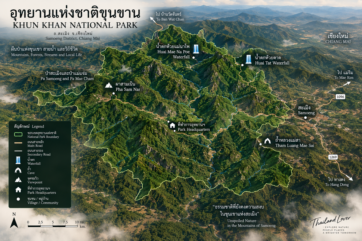
Khun Khan lies in Samoeng District, Chiang Mai Province, west of Chiang Mai city. The park is part of the mountainous interior of Chiang Mai and is reached through the winding roads connecting the city with Samoeng and surrounding highland communities.
Samoeng is famous for mountains, valleys, agricultural communities, strawberry farms, forests, a cool-season climate and winding mountain roads. The agricultural landscape is only one layer. Behind the cultivated valleys lies a much larger forest system. Khun Khan protects part of that forest.
The park lies within the Thanon Thong Chai Range, one of the major mountain systems of northern Thailand. The terrain is characterised by long ridges, steep slopes, narrow valleys, deeply incised streams and high forested summits. Elevation varies from approximately 500 metres to 1,708 metres. The highest point is Doi Pung Kia.
Doi Pung Kia — The High Point
Doi Pung Kia is not marketed with the same fame as Doi Inthanon or Doi Chiang Dao. But geographically, it is important. At approximately 1,708 metres, the mountain forms the highest point of Khun Khan National Park. The summit represents the upper elevation zone where the park’s forest structure changes substantially from the lower mountain landscape.
It is a mountain for people interested in altitude, forest and silence — rather than mass tourism.
The Vertical World of Khun Khan
One of the most interesting characteristics of Khun Khan is its vertical ecological gradient. At lower elevations: deciduous forest. Higher: dry dipterocarp and mixed forest. Higher again: evergreen forest. Then pine forest. And in the highest mountain zones: montane forest. This creates a remarkably diverse ecological sequence within a relatively compact protected area.
Current local government information describes four major forest types along the park’s educational trail. Other park descriptions also identify hill evergreen / montane evergreen forest in the higher elevations. The result is a mountain landscape that changes character as you climb.
- Mixed deciduous forest
- At lower and intermediate elevations, a strongly seasonal landscape. In the dry season, leaves fall, sunlight reaches the forest floor, grasses become more visible and the woodland opens. In the rainy season, the same forest becomes intensely green.
- Dry dipterocarp forest
- Adapted to pronounced dry seasons. Trees such as Shorea and Dipterocarpus species form an important component. These forests are ecologically valuable but particularly vulnerable to fire during the dry season.
- Dry evergreen forest
- Where moisture is retained for longer, evergreen vegetation becomes denser. The forest floor is darker, cooler and more humid. Streams often pass through these areas. Mosses, ferns and other moisture-loving plants become more noticeable.
- Pine forest
- One of Khun Khan’s most characteristic highland trees. Tall, relatively straight trunks rise above grasses, shrubs and leaf litter, creating an open forest structure very different from dense evergreen woodland — especially atmospheric in the cool season.
Above approximately 1,000 metres, the forest becomes increasingly important as a highland refuge. Historical DNP descriptions identify relatively intact forest at these elevations. Higher mountain environments also support plants and animals that are less common in heavily modified lowland landscapes.
The park is interesting because these forest communities exist in close geographical proximity. You can therefore see pine — open, highland and atmospheric; dipterocarp — seasonal, dry and sunlit; evergreen — dense, humid and shaded; mixed deciduous — seasonally changing. The park is effectively a natural lesson in northern Thai forest ecology.
A Headwater Landscape
Khun Khan is fundamentally a water tower. The mountains collect rainfall. The forest slows runoff. Roots stabilize slopes. Water enters the soil. Streams emerge. And those streams descend toward communities and larger river systems. The park is therefore not simply a scenic forest. It is a headwater landscape.
The park lies within the broader watershed associated with the Mae Khan, an important river of the Samoeng–Chiang Mai region. Forest in the upper catchment helps maintain water quality, stream flow, soil stability, downstream ecosystems and agricultural water supplies. The conservation value of Khun Khan therefore extends far beyond its visitor attractions.
Forest → water → agriculture → community.
This is particularly important in Samoeng, where mountain agriculture and settlements occupy valleys surrounded by forest. Protecting the forest protects the water system.
The Riverside Nature Trail
One of Khun Khan’s strongest visitor experiences is not a mountain summit. It is the riverside nature trail. Current Chiang Mai public-relations information describes a 3,420-metre nature-study trail running along the water. It includes 14 interpretive stations and passes through four major forest types. Along sections of the route, natural rock formations create places where visitors can stop beside the flowing water.
The trail allows visitors to experience the park without committing to a multi-day mountain expedition. It is a compact introduction to the ecosystem. In one walk, visitors can experience forest, water, rock, plants, birds, small wildlife and mountain atmosphere. This is arguably the best entry point for first-time visitors.
Huai Mae Na Poe — The Seven-Level Waterfall
One of Khun Khan’s major natural attractions is Huai Mae Na Poe Waterfall, described as having seven levels. The stream descends through the mountain forest in a series of natural cascades. Unlike a single vertical waterfall, its character comes from the progression of rock, water, forest, small cascades and larger drops.
Huai Mae Na Poe is particularly attractive during periods of good rainfall. Water moves through multiple levels of exposed rock. The forest surrounding the stream creates shade. Moss and moisture increase the sense of wilderness. The exact strength of the waterfall varies naturally according to rainfall and seasonal conditions.
Huai Tat — The Dramatic Drop
Huai Tat is described as a two-level waterfall, with one section reaching approximately 30 metres. That makes it visually different from the multi-tiered Huai Mae Na Poe. Instead of many small stages, Huai Tat emphasises a stronger vertical drop.
The waterfall is surrounded by forest and rock. During the rainy season, water volume can increase dramatically. During the dry season, the character becomes quieter. A waterfall is not a fixed photograph. It is a seasonal river.
Pha Sam Nar — The Three-Sided Cliff
One of Khun Khan’s most distinctive viewpoints is Pha Sam Nar. The name refers to its characteristic three-sided cliff / three-faced rock formation. The viewpoint sits at approximately 1,253 metres above sea level.
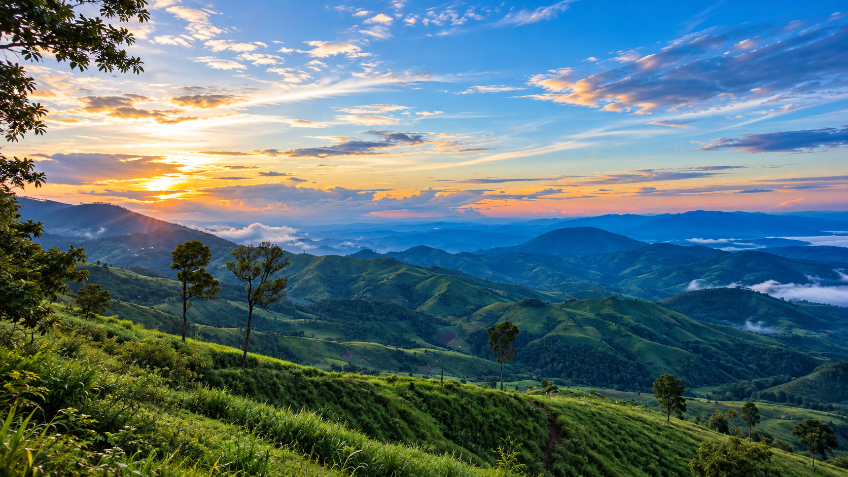
At this elevation, the landscape opens dramatically. Instead of looking at a single waterfall, visitors see mountain after mountain, ridge after ridge, valley after valley. The perspective reveals why Samoeng is fundamentally a mountain district. The horizon is not flat. It is layered.
On clear mornings, atmospheric perspective creates multiple layers of blue-green ridges. The nearest mountains appear dark. The distant mountains fade toward blue. Clouds may occupy the valleys. This is classic northern Thailand mountain scenery.
For photography, early morning is generally the most atmospheric: cool air, mist, soft light, long shadows, mountain layers. The chance of cloud sitting inside the valleys is highest when moisture and temperature conditions align. The sea of clouds is never guaranteed. Nature decides.
Forest, Plants and the Forest Floor
Khun Khan is not about one iconic tree. Its importance lies in the continuity of forest across the mountain landscape — habitat for trees, shrubs, vines, orchids, ferns, grasses, mosses and fungi. Many of these organisms are easy to overlook. Together they create the forest ecosystem.
Historical DNP information records trees and plants including three-needled pine, Malacca tree, Malabar ironwood, Baccaurea species, Siamese rosewood-related forest species, Shorea species, Dipterocarpus species, Xylia xylocarpa and Gmelina arborea. Exact species composition changes according to elevation, moisture and forest type.
Look down. The forest floor tells its own story: leaves, seeds, fallen branches, mushrooms, moss, animal tracks, insect activity, decaying wood. This layer is essential to nutrient cycling. A forest is not only what stands vertically. It is also what happens on the ground.
Wildlife and Bird Life
Khun Khan provides habitat for a range of northern Thai forest wildlife. Reported species include wild boar, barking deer, goral, porcupine, pangolin, masked palm civet, mongooses, Asian wild dog / dhole and gibbon. Historical DNP information also records other forest mammals.
Older descriptions sometimes list tiger among the wildlife associated with the park. This should be treated carefully. A historical species list does not mean that visitors should expect to encounter tigers, or that there is a currently confirmed resident tiger population. For ThailandLover, the scientifically responsible wording is: historical park records have listed tiger among the wildlife associated with the wider forest landscape. That avoids turning a historical record into a current wildlife promise.
The park’s forest habitat supports numerous bird species, including Red Junglefowl, Great Hornbill, forest barbets, woodland birds, raptors and passerines. The Great Hornbill is particularly significant as an indicator of mature forest, because large hornbills require substantial forest resources and nesting trees.
Khun Khan is better experienced by listening than by simply looking. Early morning is ideal. Stop. Wait. Listen. You may hear junglefowl, barbets, drongos, flycatchers and hornbills before you ever see them. For serious birdwatchers, the elevational transition between forest types adds another dimension.
The most frequently encountered animals may not be large mammals. Look for butterflies, dragonflies, frogs, lizards, squirrels, birds, insects, spiders and freshwater organisms. The park’s biodiversity exists at every scale.
Rock, Rain and Waterfalls
The mountain landscape is shaped by rock, rain, faults, weathering and erosion. Water finds weaknesses in rock. Over thousands and millions of years, fractures widen, streams deepen, valleys develop, waterfalls form and cliffs are exposed. The park’s waterfalls and cliffs are therefore geological landscapes as much as scenic ones.
A high mountain creates gradient. A gradient creates flow. Flow interacts with rock. Rock is eroded. The landscape becomes waterfalls, gorges, streams and valleys. This is the geological story behind Khun Khan.
Samoeng: Forest, Farm and Village
Khun Khan cannot be understood separately from Samoeng. The park exists beside agricultural valleys, villages, orchards, strawberry fields, community forests and mountain roads. The result is a classic northern Thai cultural landscape: forest + farm + village + mountain.
Samoeng is particularly known for strawberries. During the cool season, agricultural fields across the district become part of the wider travel experience. This is outside the legal national park boundary, but it is an important part of the destination surrounding Khun Khan. ThailandLover therefore distinguishes Khun Khan National Park from Samoeng District attractions.
Protected forests and local communities are not necessarily opposing concepts. The challenge is finding a sustainable balance between conservation, agriculture, tourism, water use and community livelihoods. This is particularly relevant in mountain districts such as Samoeng.
Samoeng is not empty wilderness. People have lived and farmed in these mountains for generations. The landscape therefore contains two simultaneous realities: the wild — forest, wildlife, water and mountains — and the lived — villages, farms, roads and communities. ThailandLover presents both.
Park Headquarters, Camping and Warm Water
The park headquarters is located in Mae Sap Subdistrict, Samoeng District. The headquarters landscape is itself surrounded by mountains and forest. It is therefore more than an administrative centre. It is an entry point into the mountain ecosystem.
Current Chiang Mai public-relations description highlights the headquarters as a place for camping, nature relaxation, riverside recreation, forest walks and hot-water bathing. The campground sits in a valley environment and has basic visitor facilities.
One of the more unusual experiences around the headquarters is natural warm water. Current local government information describes a natural warm-water bathing facility associated with the park’s campground. This gives Khun Khan an unusual combination: cool mountain air and warm natural water — particularly attractive during the northern winter.
In December 2025, Chiang Mai public-relations authorities promoted Khun Khan as a cool-season destination, reporting temperatures around 16°C at the campground. The combination of mountain air, mist, forest, campfire atmosphere and warm natural water makes the headquarters appealing for a quiet winter escape.
Khun Khan is well suited to low-key camping rather than large-scale camping tourism. The headquarters campground provides camping space, parking, bathrooms, a food-preparation area, a washing area and nearby natural surroundings. Current published local information lists the camping-area fee at 30 baht per person, and Thai entrance fees at 20 baht adult / 10 baht child, as reported in December 2025.
Entrance Fees and Visitor Information
Khun Khan belongs to Group 1 under the DNP national-park entrance fee structure.
- Thai visitors
- Adult 20 THB · Child 10 THB
- Foreign visitors
- Adult 100 THB · Child 50 THB
- Motorcycle
- 20 THB
- Four-wheel vehicle
- 30 THB
- Camping area
- 30 THB / person (December 2025 local government information)
- Park contact
- 052-000-410
These are official tariff rates; individual facilities or special activities may have separate charges. Current Chiang Mai public-relations information published in December 2025 describes the park as welcoming visitors for camping, riverside recreation, forest walks, nature study and warm-water bathing. Operational hours can vary by facility and seasonal management, so visitors should confirm before travelling.
Tham Luang Mae Sap — The Cave Beyond the Park
A particularly interesting nearby attraction is Tham Luang Mae Sap. It should not be presented as if it were necessarily inside the legal Khun Khan National Park boundary. Current Chiang Mai public-relations information places the cave approximately 15 km from the park and describes it as a nearby destination in the Mae Sap landscape.
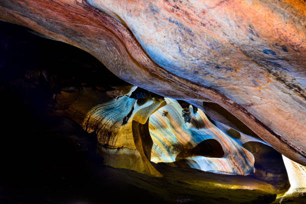
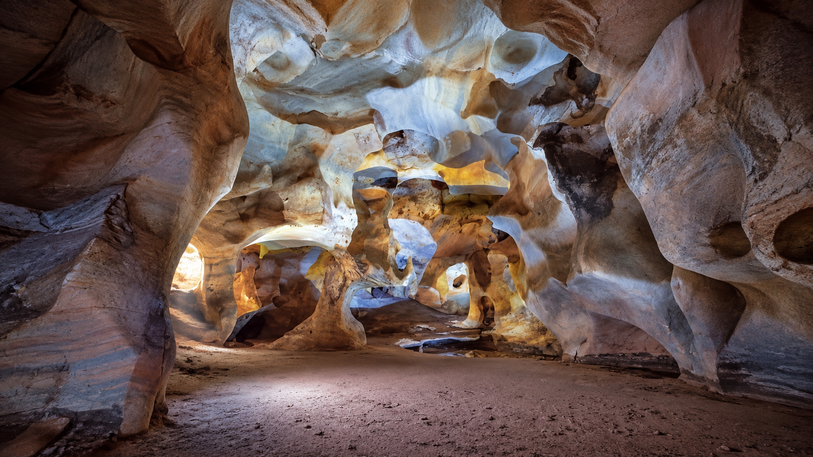
The main chamber is known as Tham Sai Rung, or Rainbow Cave — a limestone cave with striking grey, white and yellow banding on the walls. The cave contains stalactites, stalagmites and limestone columns. The main cave passage is approximately 144 metres long.
The Mae Sap cave system also includes chambers referred to as Tham Ubosot, Tham Morakot and Tham Phet. Together they create a small cave landscape rather than a single underground chamber. There is also a nature-study trail associated with the cave environment.
For ThailandLover, the correct presentation is: Khun Khan National Park provides the forest and mountain landscape; nearby Tham Luang Mae Sap adds a separate limestone-cave experience within the wider Samoeng destination. This distinction prevents the common mistake of placing every nearby attraction inside the national park.
The Road to Khun Khan
Khun Khan is connected to the broader Samoeng road network. Important regional routes include Highway 1096 — the famous Mae Rim–Samoeng mountain route — and Highway 1269, connecting the Samoeng area toward the southern side of the Chiang Mai mountain network. These roads are not merely transport infrastructure. They are part of the experience.
Highway 1096 is one of northern Thailand’s classic scenic mountain roads. It climbs through forest, agricultural valleys, mountain communities, viewpoints and orchards, and eventually reaches Samoeng. Khun Khan lies within this larger mountain travel landscape.
- From Chiang Mai
- Chiang Mai → Mae Rim → Highway 1096 → Samoeng → Mae Sap → Khun Khan National Park. The journey itself is part of the attraction.
- From Samoeng town
- Headquarters is approximately 16 km from central Samoeng, according to current Chiang Mai public-relations information. It is possible to combine Samoeng town with Khun Khan in a single day.
When to Go
- November–February
- The strongest general season for camping, cool weather, mountain photography, hiking, forest walks and morning mist. November moves into the cool season. December is the classic Khun Khan season: cool air, dry trails, mountain mist, clearer skies. January is usually the coldest-feeling period — ideal for camping, photography, sunrise, mountain walks and warm-water bathing. February remains attractive, but temperatures begin to rise and haze can affect visibility.
- March–April
- Hotter and drier. Forest-fire risk increases across northern Thailand. Approach the park with particular attention to air quality, fire conditions, official closures and trail safety.
- May–October
- The rainy season transforms Khun Khan. The forest becomes deep green. Streams strengthen. Waterfalls become more impressive. Mist becomes more frequent. Trails can become slippery, and heavy rainfall can make mountain roads and streams more hazardous.
If your priority is water, wetter months generally offer stronger waterfall conditions. If your priority is camping and clear mountain views, the cool season is generally better. There is no single “best month” for everything.
Northern Thailand’s dry season can bring serious wildfire and haze problems — not unique to Khun Khan, but affecting the entire mountain region. Do not judge the destination only by the calendar. Check actual air quality and park conditions before travelling.
How to Experience It
A perfect Khun Khan day
- 06:00
- Wake up in the mountain air
- 06:30
- Walk beside the stream. Listen to birds
- 08:00
- Breakfast
- 09:00
- Begin the 3.42 km riverside nature trail
- 12:00
- Lunch
- 13:00
- Explore the surrounding forest
- 15:00
- Relax beside the water
- 16:30
- Return to the campground
- 18:00
- Mountain sunset
- 20:00
- Stars. Silence. Cold air
A weekend from Chiang Mai
- Day 1
- Chiang Mai → Mae Rim → Samoeng. Mountain drive. Explore Samoeng. Continue to Khun Khan. Camp.
- Day 2
- Early morning forest walk. Waterfall / nature trail. Warm-water bathing. Lunch. Return through Samoeng to Chiang Mai.
The ThailandLover way: do not rush. Start from Chiang Mai. Drive into the mountains. Stop in Samoeng. Look at the agricultural landscape. Continue toward Mae Sap. Enter the forest. Follow the water. Listen. Then stay overnight. That is when Khun Khan begins to make sense.
Light, Sound and Slow Travel
Khun Khan is a slow-travel destination. It is not about how many places you can see today. It is about how long you can stay in one landscape. Sit beside the stream. Watch the clouds. Walk slowly. Listen to birds. Look at the forest. That is the Khun Khan experience.
- Best light
- Sunrise for mist and layered mountains. Morning for forest detail. Afternoon for waterfalls and side lighting. Golden hour for mountain ridges. Blue hour for atmospheric mountain landscapes.
- What to bring
- A wide-angle lens for mountain layers; a telephoto for distant ridges and birds; a macro lens for moss, insects, flowers, fungi and forest details; a tripod for early-morning and evening photography.
- The sound of Khun Khan
- Water in streams and waterfalls. Wind moving through pine and mountain forest. Birds calling from the canopy. Insects constantly active. At night the forest becomes almost completely dark. The absence of urban noise becomes part of the experience.
- The night sky
- Away from Chiang Mai’s urban lights, the mountain environment can offer much darker skies. Camping therefore adds another dimension: day is mountains; sunset is light; night is stars. The experience is fundamentally different from staying in a city hotel.
Khun Khan Among Chiang Mai’s Mountains
- Doi Inthanon
- Thailand’s highest mountain. Large tourism infrastructure. Very famous. Many established attractions. Khun Khan: lower maximum elevation, smaller protected area, less internationally known, quieter, more intimate. Its attraction is not the record. It is the atmosphere.
- Doi Chiang Dao
- Limestone massif. Extremely distinctive geology. High-altitude endemic ecosystem. Khun Khan is a forest-covered mountain landscape of pine and mixed forest, waterfalls, streams and highland communities. The visual language is completely different.
- Doi Suthep–Pui
- Immediately connected to Chiang Mai. Highly accessible. Major cultural attractions. Khun Khan is farther into the mountain landscape — quieter, more rural, more strongly associated with Samoeng’s agricultural and forest environment.
Why Khun Khan Matters
The greatest value of Khun Khan is not one attraction. It is connectivity: forest, water, mountain, community, agriculture, wildlife. Together they form a living landscape.
A national park is sometimes imagined as “a place with a waterfall.” Khun Khan demonstrates why that definition is too narrow. The waterfall exists because of the mountain. The mountain holds the forest. The forest captures the rain. The rain creates the stream. The stream creates the waterfall. And the whole system supports people downstream.
The DNP’s 2025 public participation process concerning expansion of the protected area indicates that the conservation story of Khun Khan is still developing. The objective is not simply to create more tourism space. It is to protect forests, watersheds, biodiversity, wildlife habitat and ecological connectivity while balancing the needs of local communities.
Khun Khan should be understood as one part of a much larger forest landscape. Around Samoeng are protected forests, wildlife habitat, agricultural valleys, community forests, national parks and wildlife sanctuaries. These areas collectively create an ecological mosaic.
Responsible Travel and Safety
Khun Khan is a protected ecosystem.
- Stay on designated trails — mountain terrain can be deceptive
- Do not pick wild plants — especially orchids and other slow-growing species
- Do not feed wildlife — wild animals must remain wild
- Take your rubbish out — especially food waste and plastic
- Never start unauthorised fires — northern forests are extremely vulnerable in the dry season
- Keep noise low — the forest is habitat, not an entertainment venue
- Do not enter closed areas — closures exist for safety and ecological protection
Never underestimate mountain streams. Rain may fall upstream even when the sky above you looks clear. Water levels can rise quickly. Avoid swimming during heavy rain, standing beneath unstable cliffs, crossing fast-flowing streams and climbing wet rock faces.
For nearby Tham Luang Mae Sap: never enter caves during heavy rain, without appropriate local guidance, when officially closed, or beyond permitted areas. Underground water can rise rapidly. A cave is a geological environment with real hazards.
If you see wildlife: do not chase it, call it, feed it, or photograph it from dangerously close. The best wildlife encounter is one where the animal behaves as if you were never there.
The Quiet Side of Chiang Mai
Most international visitors experience Chiang Mai through the Old City, temples, Nimman, Doi Suthep and elephant experiences. West of the city lies another Chiang Mai: the mountain Chiang Mai. Khun Khan belongs to that world.
The journey from Chiang Mai to Khun Khan is almost a transition between two worlds. City: traffic, cafés, buildings, people. Foothills: orchards, villages, roads. Mountains: forest, streams, mist. Then Khun Khan: silence.
Khun Khan is not trying to compete with Thailand’s biggest national parks. It does not need to. Its strength is intimacy. The mountains feel close. The forest feels accessible. The streams are part of everyday life. The communities remain visible. The tourism footprint is comparatively modest. It is a place where the landscape still feels bigger than the tourism.
- 01 — A real mountain park
- Elevation reaches approximately 1,708 metres.
- 02 — Water is central
- Streams and waterfalls define the landscape.
- 03 — Forest diversity is the story
- Deciduous, dipterocarp, evergreen and pine forests coexist across elevation.
- 04 — Samoeng is part of the experience
- The national park cannot be separated from its surrounding mountain communities.
- 05 — Quietness is the luxury
- Khun Khan’s greatest asset may be what it does not have: crowds.
Don’t Miss
- The 3.42 km riverside nature trail
- Huai Mae Na Poe Waterfall
- Huai Tat Waterfall
- Pha Sam Nar viewpoint
- Doi Pung Kia
- Camping at park headquarters
- Natural warm-water bathing
- Nearby Tham Luang Mae Sap
Best for: forest trails · waterfalls · mountain scenery · camping · highland nature · photography · slow travel.
Frequently Asked Questions
- What is Khun Khan National Park?
- Thailand’s 126th national park, established on 18 May 2012. Approximately 130,530.07 rai / 208.85 km² entirely within Samoeng District, Chiang Mai. Highest point: Doi Pung Kia at about 1,708 metres.
- Where is it?
- Samoeng District, Chiang Mai, west of the city. Headquarters is in Mae Sap. The park covers Bo Kaeo, Mae Sap, Samoeng Nuea and Samoeng Tai — not Mae Chaem, according to current DNP records.
- How do I get there from Chiang Mai?
- Chiang Mai → Mae Rim → Highway 1096 → Samoeng → Mae Sap → Khun Khan. Headquarters is approximately 16 km from central Samoeng.
- When is the best time to visit?
- November–February for camping, cool weather, photography and mist. Wetter months for stronger waterfalls. Check air quality and fire conditions in the dry season.
- Can I camp?
- Yes, at the Mae Sap headquarters campground. Local government information in December 2025 listed the camping-area fee at 30 baht per person. Natural warm-water bathing is associated with the campground.
- What are the entrance fees?
- Group 1 DNP tariff. Thai: 20 / 10 THB. Foreign: 100 / 50 THB. Motorcycle 20 THB; four-wheel vehicle 30 THB. Individual facilities may have separate charges.
- Is Tham Luang Mae Sap inside the park?
- No. Current information places the cave approximately 15 km from the park as a nearby Mae Sap destination, not necessarily inside the legal boundary.
Nearby Destinations
- Doi Suthep–Pui National Park
- The mountain immediately above Chiang Mai — temples, forest and the most accessible highland from the city.
- Doi Inthanon National Park
- Thailand’s highest mountain — a useful contrast if you want the famous highland, not the quiet one.
- Op Khan National Park
- Gorges, river and forest on the western side of Chiang Mai, another quieter mountain landscape.
- Mae Wang National Park
- Forest and mountain country southwest of Chiang Mai, in the same western highland belt.
- Doi Khun Tan National Park
- Pine forest and railway on the Khun Tan Range — another intimate northern mountain park.
- Khun Chae National Park
- The high-mountain wilderness of the Khun Tan Range, toward Chiang Rai along Highway 118.
Location
Find Khun Khan National Park
Mae Sap, Samoeng, Chiang Mai · approximately 16 km from Samoeng town