

National Park · Chiang Mai
Where Thailand Reaches the Clouds: Doi Inthanon National Park
อุทยานแห่งชาติดอยอินทนนท์
Chiang Mai · Northern Thailand
Thailand’s highest mountain is not just a number. At 2,565 metres, Doi Inthanon rises through waterfalls, cloud forest, highland wetlands, birdlife and living communities — a vertical journey into a cooler, wetter world.
Basic Information
- Name
- Doi Inthanon National Park
- Thai Name
- อุทยานแห่งชาติดอยอินทนนท์
- Province
- Chiang Mai, Northern Thailand
- Districts
- Chom Thong · Mae Chaem · Mae Wang · Doi Lo
- Established
- 2 October 1972
- National Park
- Thailand’s 6th National Park
- Area
- Approximately 481.89 km² (about 301,181 rai)
- Highest Point
- Doi Inthanon Summit — 2,565 metres above sea level
- Landscape
- High mountain forests · Cloud forest · Montane wetlands · Waterfalls · Streams · Agricultural landscapes · Highland communities
- Signature Landscapes
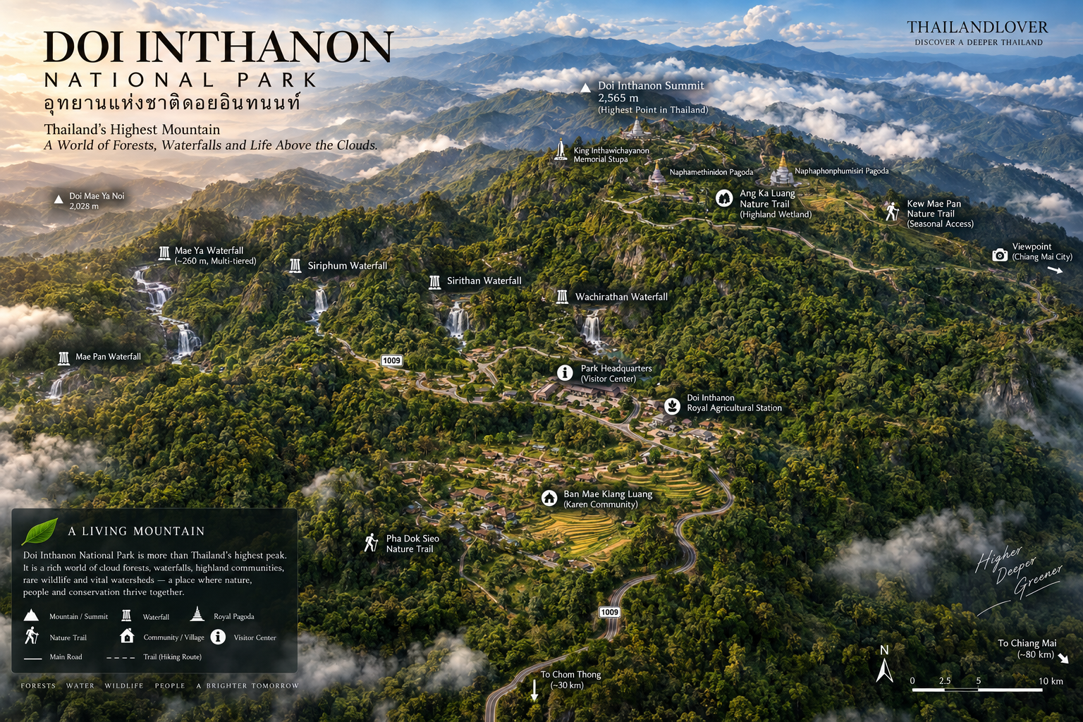
- Doi Inthanon Summit · Kew Mae Pan · Ang Ka Luang · Wachirathan · Mae Ya · Siriphum · Sirithan · Mae Klang · Mae Pan · Pha Dok Sieo · Inthanon Royal Agricultural Station · Ban Mae Klang Luang · Twin Royal Pagodas
- Management
- Department of National Parks, Wildlife and Plant Conservation (DNP)
Doi Inthanon reaches 2,565 metres and covers approximately 481.89 km², making it one of the country’s major high-elevation protected landscapes — a standout destination in ThailandLover’s Nature & Parks collection. The Department of National Parks identifies it as Thailand’s sixth national park, established on 2 October 1972.
Where Thailand Reaches the Clouds
A Mountain Measured in Layers
Doi Inthanon is often introduced with one simple fact:
2,565 metres — the highest point in Thailand.
That fact is correct.
But it is also an incomplete description.
The mountain is better understood as a vertical journey through several ecological zones.
At lower elevations, the landscape is warmer and greener, with waterfalls, mixed forests and agricultural communities.
Higher up, the forest becomes increasingly humid. Mist becomes part of the landscape. Mosses, lichens, ferns and orchids cover trees and rocks.
Near the summit, the environment becomes a cool montane world where cloud forest and wetland ecosystems dominate.
This dramatic change over relatively short distances is what makes Doi Inthanon so important.
It is not simply a high mountain.
It is a compressed ecological journey from lowland northern Thailand into a distinctly cooler, wetter mountain environment.
The Department of National Parks describes the summit area as a distinctive high-altitude ecosystem supporting rare plants and animals, including species associated with Himalayan and montane environments.
Why Doi Inthanon Matters
Thailand’s Highest Point — and One of Its Great Watersheds
Doi Inthanon is famous because it is the highest point in Thailand.
Its greater importance, however, is hydrological and ecological.
The high mountain forests capture moisture from clouds and rainfall, feeding streams that descend into the surrounding valleys.
The upper mountain is therefore not simply scenery. It is part of a living watershed.
Water begins high in the forest, moves through moss-covered slopes and streams, becomes waterfalls, and eventually reaches the larger river systems of northern Thailand.
The Ang Ka area, for example, contains a distinctive high-altitude wetland environment and contributes water to the Mae Klang watershed before it eventually joins the Ping River system.
This is why Doi Inthanon should be experienced as a mountain ecosystem, rather than simply as a viewpoint.
Doi Inthanon — Thailand’s Highest Mountain
2,565 Metres
The summit of Doi Inthanon rises to 2,565 metres above sea level — the highest elevation in Thailand.
Historically, the mountain was known as Doi Ang Ka, a name associated with a highland wetland where crows were traditionally said to gather.
The name Doi Inthanon is associated with King Inthawichayanon, one of the former rulers of Chiang Mai, who was deeply concerned with the preservation of the mountain forests.
Today, a small memorial area commemorates his connection with the mountain near the summit.
The summit itself is not a dramatic alpine peak in the conventional sense. There is no giant exposed rock pinnacle. Instead, the highest point is surrounded by dense montane forest.
That is part of the character of Doi Inthanon.
Thailand reaches its highest elevation here not with a barren summit, but with a cold, wet forest.
The Cloud Forest
Where the Mountain Disappears into Mist
The upper slopes of Doi Inthanon are among the most distinctive forest environments in Thailand.
Cloud and moisture are frequently trapped against the high mountain. The result is a landscape of moss, lichens, ferns, orchids, epiphytes, rhododendrons, evergreen trees and mountain wetlands.
Branches can disappear beneath layers of moss. The ground can look almost carpeted in green.
On misty mornings, visibility may fall dramatically, turning a forest trail into a sequence of textures rather than distant views.
This is why Doi Inthanon photography is often strongest when the weather is not perfectly clear.
The mist is not an inconvenience.
It is part of the landscape.
Ang Ka Luang Nature Trail
The Ancient Wetland Above the Clouds
If there is one short trail that explains the ecological identity of upper Doi Inthanon, it is Ang Ka Luang.
The trail crosses a rare high-elevation wetland and cloud-forest environment near the summit. A wooden boardwalk passes through dense vegetation where moss, ferns, lichens and old trees create an almost primeval atmosphere.
The landscape is exceptionally different from the forests found at lower elevations.
The Department of National Parks describes Ang Ka as a high-altitude wetland ecosystem and an important headwater environment, with rare species adapted to the cold, wet conditions.
Look closely rather than simply walking through. This is a landscape designed for observation.
Moss. Water. Tiny plants. Bird calls. Mist. Fallen branches slowly returning to the forest.
The smaller details are the attraction.
Kew Mae Pan Nature Trail
The Mountain’s Most Dramatic Walk
Kew Mae Pan is arguably the signature hiking experience of Doi Inthanon.
The trail sits at more than 2,000 metres above sea level and passes through several dramatically different habitats: montane forest, streams, waterfalls, dense vegetation, open grassland, mountain ridges and panoramic viewpoints.
The classic route is approximately 3.2 kilometres according to DNP material, although more recent visitor information sometimes describes the route differently depending on how the trail section is measured.
The trail is not simply a walk to a viewpoint. Its character comes from the transition between forest and open ridge.
For a section, the trees open and the landscape suddenly expands. Mountain ridges unfold into the distance. Clouds move below or across the ridgeline.
The contrast between enclosed forest and exposed mountain is what makes Kew Mae Pan memorable.
Local Guides
Kew Mae Pan has traditionally operated with local guides who accompany visitors along the route and interpret the landscape.
The guide is not merely there to prevent visitors from getting lost. The trail passes through an ecologically sensitive environment, and local interpretation adds knowledge about plants, wildlife, landscape and community connections.
DNP has documented the involvement of local guides on the trail.
Seasonal Closure
Kew Mae Pan is normally closed during the rainy-season recovery period.
The established annual closure has been 1 June–31 October, with reopening normally from 1 November, although visitors should always confirm the current year’s DNP announcement before travelling.
The Highest Forests
A Botanical World Unlike Lowland Thailand
One of the great attractions of Doi Inthanon is the plant life.
At high elevation, the forest begins to resemble environments associated with cooler mountain regions farther north.
The park is known for rhododendrons, orchids, mosses, lichens, ferns, epiphytes, highland evergreen trees and rare montane plants.
Among the most notable plants are the rhododendrons that bloom around the colder months.
The forest can also contain unusual parasitic or epiphytic plants such as Sapria, known in Thai as กระโทนพระฤๅษี.
The result is a botanical landscape that feels very different from the tropical forests of southern Thailand.
Wildlife and Birdwatching
One of Thailand’s Great Birdwatching Mountains
Doi Inthanon is particularly important for birdwatching.
The Department of National Parks has documented more than 400 bird species in the wider Doi Inthanon landscape, including resident and migratory birds.
Green-tailed Sunbird
Aethopyga nipalensis
The Doi Inthanon subspecies, Aethopyga nipalensis angkanensis, is particularly significant. It is considered endemic to Doi Inthanon and is one of the mountain’s signature birds.
Depending on season and location, birdwatchers may encounter Ashy-throated Warbler, Blue-winged Minla, White-capped Redstart, Grey-chinned Minivet, Black-throated Sunbird, various flycatchers, laughingthrushes, babblers, leaf warblers and winter migrants.
Doi Inthanon is one of the rare places in Thailand where high-altitude birdwatching can be genuinely rewarding within a relatively compact road-accessible area.
Rare Mountain Wildlife
The high mountain environment supports species that are uncommon elsewhere in Thailand.
One of the best-known is the Chinese Serow / Mainland Serow-type mountain ungulate commonly referred to locally as “Goral” in tourism materials, associated particularly with the high-elevation Kew Mae Pan landscape.
DNP has also highlighted species including the Doi Inthanon Shrew, mountain water-associated mammals, Himalayan Salamander (Tylototriton verrucosus), highland frogs, goral and other montane fauna.
Wildlife sightings are never guaranteed.
The correct way to experience Doi Inthanon is to look for evidence of biodiversity rather than expect a wildlife safari.
Doi Inthanon Waterfalls
Where the Mountain Turns Water into Landscape
Doi Inthanon is also one of northern Thailand’s great waterfall landscapes. Water descends from the high mountain through a network of streams and steep valleys. Several waterfalls can be reached relatively easily from the main road.
Wachirathan Waterfall
The Great Curtain of Doi Inthanon
Wachirathan is one of the park’s most recognizable waterfalls. Water drops dramatically from a high cliff into a pool below, generating a constant cloud of spray. In strong sunlight, the spray can produce rainbows.
The waterfall is exceptionally accessible compared with many mountain waterfalls, which is one reason it has become one of the park’s most visited attractions. It is associated with the Mae Klang stream system originating from the upper mountain.
For photography, vertical water, mist, dark forest, exposed rock and changing mountain light make Wachirathan one of the strongest visual stops on the mountain.
Mae Ya Waterfall
The Southern Giant
Mae Ya is different. Instead of a narrow vertical drop, the waterfall spreads across a broad series of rock terraces.
It descends through approximately 30 levels, with a total height commonly cited at around 260 metres. During the wetter months, the water can spread into a remarkably wide curtain.
Mae Ya occupies a different geographic position from the summit attractions. It is reached from the lower southern side of the park rather than simply continuing along the main road to the summit.
That means it is best treated as its own destination rather than as a quick stop on the summit circuit.
Siriphum Waterfall
The Twin White Lines
Siriphum is visually distinctive because two streams descend side by side through the forested mountainside. The waterfall was formerly known as Mae Lao Li.
Its setting near the highland agricultural landscape gives it a different character from the larger waterfalls farther down the mountain. It is especially photogenic when viewed against the surrounding green slopes.
Sirithan Waterfall
A Quiet Stop in the Forest
Sirithan is another waterfall along the ascent. It is smaller in visual scale than Mae Ya or Wachirathan, but its setting is part of the attraction.
The waterfall is surrounded by dense forest and is easily incorporated into a road-based exploration of the park.
For ThailandLover, Sirithan represents an important principle: Doi Inthanon is not a one-attraction destination. Its character emerges from the accumulation of many smaller landscapes.
Mae Klang Waterfall
The Lower Mountain Gateway
Mae Klang lies much closer to the lower entrance zone of Doi Inthanon. It is therefore useful as the first waterfall experience when approaching the mountain from Chom Thong.
DNP describes the main approach from Chiang Mai via Highway 108 and Highway 1009, with Mae Klang branching off before the park headquarters.
This lower-elevation position also means the atmosphere is noticeably different from the summit. The journey from Mae Klang toward the summit is itself part of the Doi Inthanon experience.
Mae Pan Waterfall
The More Remote Side of Inthanon
Mae Pan is less immediately accessible than Wachirathan. The waterfall is associated with a quieter section of the mountain landscape and is better suited to travellers who want to move beyond the standard sightseeing circuit.
Its character is less about convenience and more about entering a deeper mountain environment. Access conditions can change seasonally, particularly during heavy rain.
Pha Dok Sieo Nature Trail
Forest, Water and Community
Pha Dok Sieo offers a different interpretation of Doi Inthanon. Instead of focusing on altitude, it connects forest, watershed, agriculture and community.
The trail passes through montane forest, agricultural areas and the cultural landscape of Ban Mae Klang Luang, a Karen community.
The route is approximately 3 kilometres and is known for its combination of forest, streams, waterfall scenery and traditional agricultural landscape.
DNP has described Pha Dok Sieo as an eco-cultural nature trail, highlighting the relationship between the watershed forest and the Pgakûenyau/Karen community of Ban Mae Klang Luang.
This is one of the strongest places to understand that conservation in northern Thailand is not simply about separating people from forests.
It can also mean finding ways for communities to live with, manage and benefit from the landscape without destroying the watershed.
Ban Mae Klang Luang
Where the Forest Becomes a Living Landscape
Ban Mae Klang Luang is one of the communities associated with the Doi Inthanon landscape.
The village is closely connected with terraced rice fields, mountain streams, forest resources, coffee, local agriculture, Karen cultural traditions and community-based tourism.
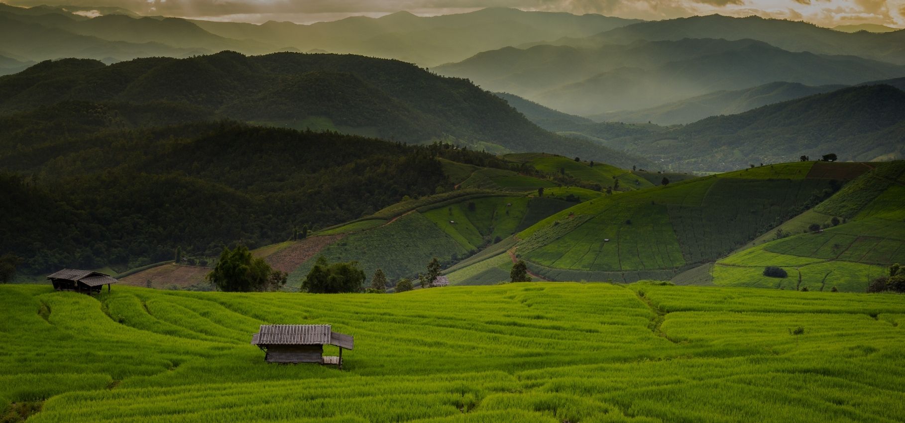
The rice terraces are particularly photogenic during different agricultural seasons. Green terraces create one landscape. Golden fields create another. Mist rolling over the mountains creates another.
The important point is that the scenery is not simply decorative.
It is an agricultural landscape maintained by people living within the mountain watershed.
Inthanon Royal Agricultural Station
Where Conservation Meets Highland Agriculture
The Inthanon Royal Agricultural Station at Ban Khun Klang is another important part of the wider Doi Inthanon story.
Established in 1979, the station conducts research and development involving flowers, ornamental plants, vegetables, fruit, highland crops, fisheries and agricultural technology.
The station also works with Pgakûenyau and Hmong communities in the surrounding highlands, transferring agricultural knowledge while supporting forest and watershed conservation.
This is one of the reasons Doi Inthanon is more interesting than a conventional national park.
The mountain is simultaneously a protected forest, a watershed, a research landscape, an agricultural landscape and a lived cultural landscape.
Coffee on the Mountain
From Highland Forest to Cup
Coffee has become an important part of the contemporary Doi Inthanon identity.
Highland Arabica production has been developed through Royal Project and highland-development programmes, particularly in environments where shade-grown agriculture can be integrated with conservation.
The Inthanon area has been used for research and development of Arabica varieties and conservation-oriented cultivation systems.
For travellers, this creates an opportunity to experience Doi Inthanon beyond sightseeing. A cup of highland coffee can be understood as part of a much larger story:
forest → watershed → highland agriculture → community → product.
For wider café and coffee context across Thailand, see ThailandLover’s Food & Drink guide.
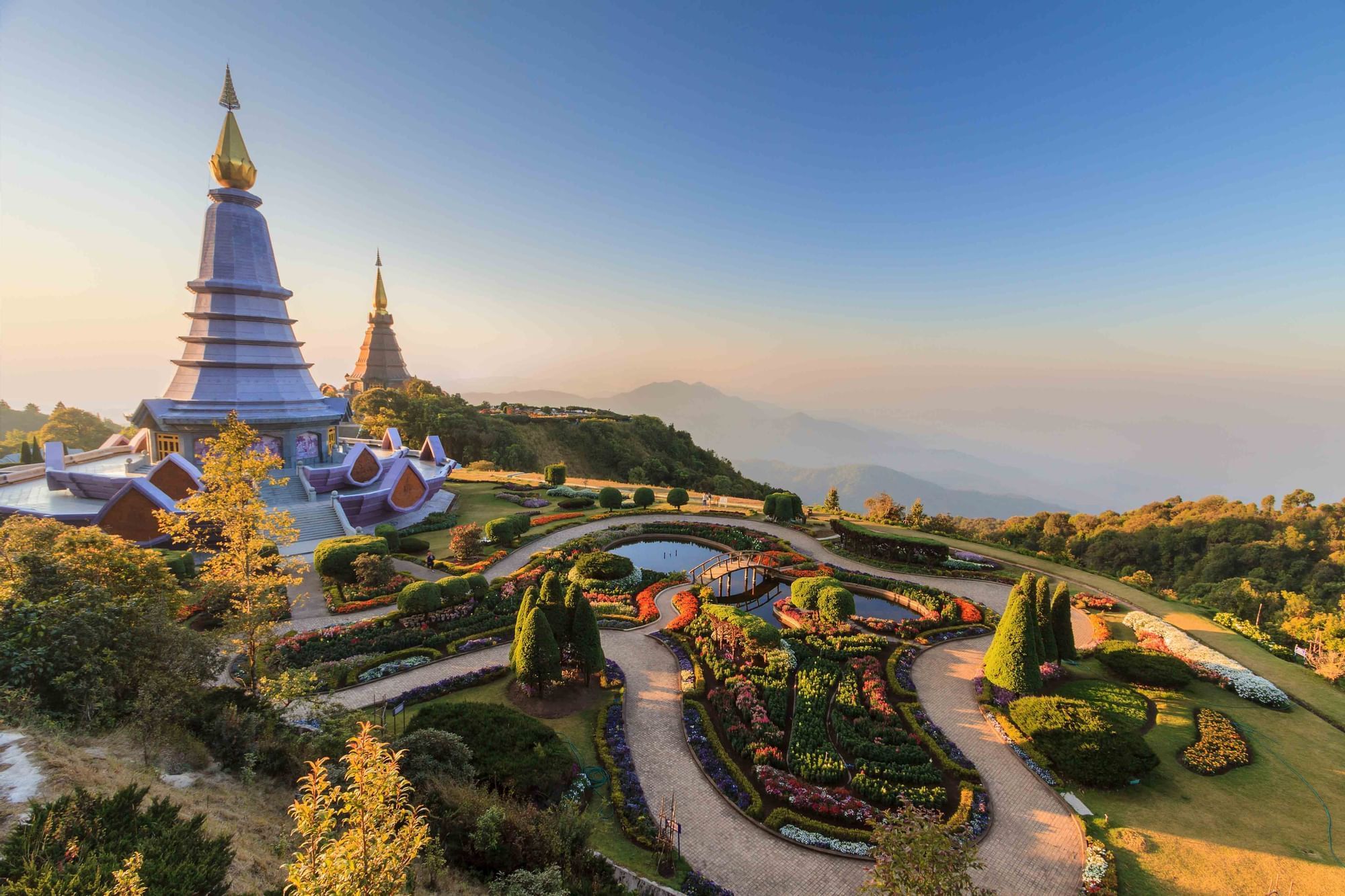
The Twin Royal Pagodas
Naphamethinidon & Naphaphonphumisiri
Near the upper mountain, two large royal pagodas dominate the landscape: Naphamethinidon and Naphaphonphumisiri. Together they are commonly referred to as the Twin Pagodas.
Their elevated gardens create a very different visual experience from the surrounding cloud forest.
On clear days, the viewpoints open toward the mountain ranges. On misty days, the pagodas become almost atmospheric objects emerging from the clouds.
The gardens also contain extensive highland ornamental planting.
For ThailandLover, the Twin Pagodas work best as part of the mountain’s cultural layer rather than as an isolated attraction — and they are not the summit itself.
The Memorial of King Inthawichayanon
The Name Behind the Mountain
The summit area is connected to the memory of King Inthawichayanon, the seventh ruler of Chiang Mai.
His historical importance to Doi Inthanon is closely associated with concern for the preservation of the mountain forest. A memorial and stupa commemorate him near the summit.
This gives the mountain an additional historical dimension. Doi Inthanon is not simply a geological feature. It is also part of the history of Lanna and the modern conservation story of northern Thailand.
For broader cultural context, see ThailandLover’s guide to Thai Culture & Traditions.
The People of the Mountain
Karen/Pgakûenyau and Hmong Highland Communities
Doi Inthanon is surrounded by highland communities with long histories in the mountain landscape.
Karen/Pgakûenyau and Hmong communities are particularly important to the area’s contemporary cultural landscape. Their presence can be seen through agriculture, coffee cultivation, rice terraces, local guiding, handicrafts, food, community tourism and traditional knowledge.
The relationship between forest conservation and community life is particularly visible around Ban Mae Klang Luang and the Royal Project areas.
Visitors should approach these communities as living places rather than tourist displays.
A Mountain of Water
Follow the Water Down
One of the best ways to understand Doi Inthanon is to follow water from the summit downward.
- Cloud Forest
- Captures moisture at the highest elevations.
- Mountain Wetlands
- Store water in cool, mossy highland basins.
- Streams
- Begin their descent through forested slopes.
- Waterfalls
- Appear where streams meet steep valleys.
- Agriculture & Communities
- Develop around reliable water sources within the watershed.
- River Systems
- Receive the water as it eventually joins larger northern Thai rivers.
This is the ecological logic of Doi Inthanon.
The mountain is not simply a high point.
It is a water tower.
Best Time to Visit Doi Inthanon
- Winter — November to February
- The classic Doi Inthanon season: cold mornings, mist, clear mountain air, rhododendron flowering, strong birdwatching and Kew Mae Pan reopening. Summit temperatures can fall close to freezing during cold spells. Bring a proper jacket — do not treat Doi Inthanon as merely “cool Chiang Mai.”
- Early Summer — March to May
- Lower elevations can be warm while higher elevations remain cooler. Visibility may be affected by northern Thailand’s seasonal haze and agricultural burning, so landscape conditions can vary substantially from day to day.
- Rainy Season — June to October
- The mountain becomes exceptionally green; waterfalls can become powerful; mist becomes frequent; forest textures become richer. Trails can become slippery, and Kew Mae Pan is normally closed for ecological recovery. This is not necessarily the “wrong” season — it is simply a different Doi Inthanon.
- Late Rainy / Early Winter — October to November
- A visually interesting transition: lush forest, strong waterfalls, cooling air, frequent mist, and high-elevation flowering plants preparing for the cooler season.
Best For
- Best Overall
- November–February
- Best for Kew Mae Pan
- November–May (confirm current opening)
- Best for Waterfalls
- Rainy season through early cool season
- Best for Birdwatching
- Cool season and migration periods
- Best for Misty Forest Photography
- Rainy season / early morning
- Best Chance of Frost
- Cold spells during December–January
There is no single “best” month. Doi Inthanon changes dramatically according to altitude, rainfall and time of day. For broader northern Thailand timing, see When to Go.
Opening Hours and Seasonal Closures
The park itself is accessible from early morning, while visitor-service facilities operate on more limited hours.
Published visitor information commonly places the main visitor/office operating period around 08:00–16:00.
Some access gates and attractions may operate earlier or later depending on location and season. For sunrise trips, do not assume that the visitor centre’s office hours represent the opening time of every road or attraction.
Seasonal Closures
Doi Inthanon is generally open year-round, but individual attractions may close.
The most important recurring closure is Kew Mae Pan Nature Trail, normally closed 1 June–31 October.
Other trails and waterfalls may be temporarily closed because of heavy rainfall, flash-flood risk, landslides, trail damage, forest recovery or safety operations.
Do not plan a Doi Inthanon trip solely from an old itinerary — and do not assume the entire park closes when Kew Mae Pan is closed. Check current park announcements immediately before travel.
Entrance Fees
The DNP national park fee structure places Doi Inthanon in Group 3.
Published standard rates are:
- Thai Visitors
- Adult 60 THB · Child 30 THB
- Foreign Visitors
- Adult 300 THB · Child 150 THB
Vehicle fees may apply separately. The Twin Pagodas and certain other attractions may have separate admission arrangements because they are not managed solely as standard national-park visitor facilities.
Fees can change or be temporarily waived on special national holidays. Verify current rates before travel.
How to Get to Doi Inthanon
From Chiang Mai
Doi Inthanon is approximately 80–100 kilometres southwest of central Chiang Mai depending on the destination within the park.
The main approach is:
Chiang Mai → Highway 108 → Chom Thong → Highway 1009 → Doi Inthanon
The road climbs progressively toward the upper mountain. The park headquarters is located around kilometre 31 of the mountain road according to DNP’s published route description.
By Private Car
The Best Option for Exploring the Full Mountain
A private car gives the greatest flexibility. This matters because Doi Inthanon is geographically large.
Mae Ya is in a different direction from the summit. Mae Klang is at the lower mountain. Wachirathan lies higher along the main ascent. Kew Mae Pan and Ang Ka are near the summit. Ban Mae Klang Luang and Pha Dok Sieo require additional planning.
Trying to see everything in one rushed itinerary can turn the mountain into a checklist.
The better approach is to select a geographic route.
A Smart One-Day Route
Chiang Mai → Mae Klang / lower waterfall zone → Wachirathan → Sirithan → Inthanon Royal Agricultural Station / Khun Klang → Twin Pagodas → Kew Mae Pan → Summit → Ang Ka Luang → return to Chiang Mai.
This route is suitable for a first visit. However, it is a long day.
A Better Two-Day Experience
Day 1 — Water + Community
Chiang Mai → Mae Ya → Mae Klang / lower mountain → Wachirathan → Siriphum → Ban Mae Klang Luang → Pha Dok Sieo → highland dinner / overnight.
Day 2 — Clouds + Summit
Early morning → Kew Mae Pan → Twin Pagodas → Summit → Ang Ka Luang → Royal Agricultural Station → return to Chiang Mai.
This is the more ThailandLover way to experience Doi Inthanon.
Instead of rushing from attraction to attraction, it allows the mountain to reveal itself progressively.
Also explore other parks in ThailandLover’s Nature & Parks collection, including Doi Pha Hom Pok National Park, Doi Luang National Park, Chae Son, Chaloem Rattanakosin and Chaloem Phrakiat Thai Prachan.
Photography Guide
Photograph Doi Inthanon as a Landscape, Not a Checklist
- Best Sunrise
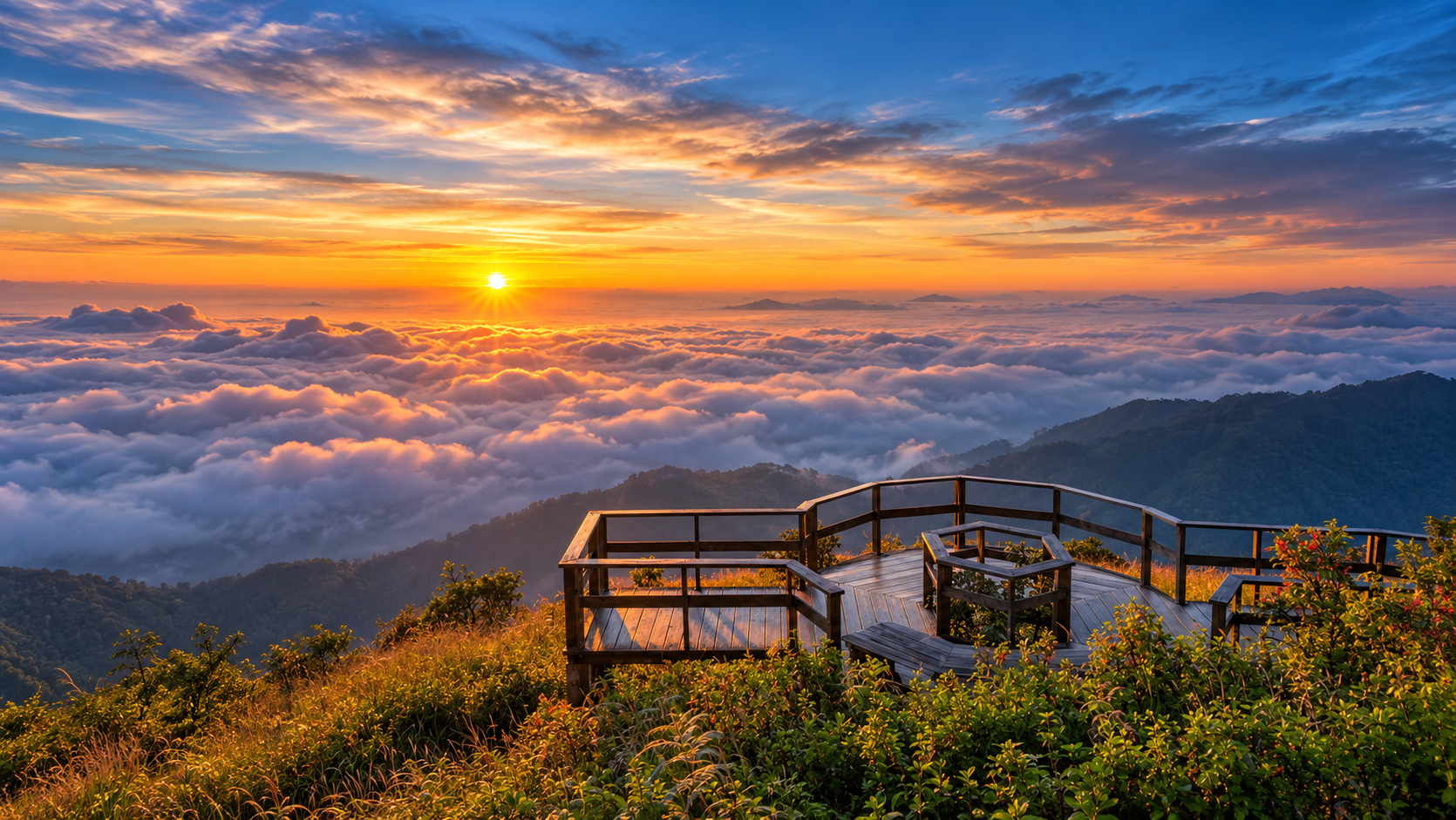
- The summit area can be beautiful in the early morning, particularly when cold air and moisture create layers of mist.
- Best Forest Photography
- Ang Ka Luang — moss, wet bark, ferns, fog, backlight, water droplets and tree textures.
- Best Mountain Panorama
- Kew Mae Pan — ridge, clouds and distant mountains create the park’s strongest high-altitude landscape compositions.
- Best Waterfall
- Wachirathan for vertical drama; Mae Ya for scale and breadth.
- Best Cultural Landscape
- Ban Mae Klang Luang — rice terraces, mountain forest and morning mist.
- Best Wildlife Photography
- Early morning. Move slowly. Do not play loud music. Avoid feeding birds. Use a telephoto lens rather than approaching animals.
Responsible Travel
Protect a Fragile High-Elevation Environment
- Stay on marked trails.
- Do not collect plants.
- Do not touch moss or orchids.
- Do not feed wildlife.
- Carry rubbish back out.
- Avoid loud music.
- Keep voices low on birding trails.
- Do not enter closed trails.
- Follow local guide instructions.
- Respect village privacy.
- Avoid photographing people without permission.
- Do not remove stones, flowers or forest material.
- Use refillable water bottles where practical.
At high elevations, even apparently small disturbances can have disproportionate effects on slow-growing ecosystems.
Weather & Safety
The Mountain Can Change Quickly
Doi Inthanon experiences conditions very different from Chiang Mai city.
At the summit, temperatures can be very low, fog can reduce visibility, roads can become wet, wind can be strong, trails can become slippery and rain can trigger flash-flood risks.
The DNP has previously closed waterfall attractions temporarily during periods of heavy rain because of flash-flood and landslide risks.
Never enter a waterfall area simply because it appears visually attractive during heavy rain.
Water levels can change rapidly upstream.
Who is Doi Inthanon for?
Perfect for
- Nature Lovers
- Who want a full mountain ecosystem, not a single viewpoint.
- Birdwatchers
- Seeking high-elevation diversity in a road-accessible landscape.
- Landscape Photographers
- Who enjoy mist, ridges, waterfalls and atmospheric forest.
- Hikers
- Looking for Kew Mae Pan, Ang Ka and eco-cultural trails.
- Families
- Who enjoy nature at a measured pace.
- Eco-Cultural Travellers
- Interested in highland communities, coffee and Royal Project landscapes.
- Cool-Weather Travellers
- Looking for genuine mountain cold near Chiang Mai.
Less Suitable for
- Nightlife Seekers
- This is a mountain watershed, not an evening destination.
- Rush Visitors
- Who dislike long mountain drives or expect one spectacular panoramic summit.
- Non-Walkers
- Unwilling to leave the car for trails and forest detail.
- Underdressed Winter Visitors
- Travelling without warm clothing during cold spells.
- Clear-Sky Guarantees
- Anyone who needs guaranteed clear views every day.
FAQ
- What is Doi Inthanon National Park famous for?
- Doi Inthanon National Park in Chiang Mai is famous as Thailand’s highest mountain at 2,565 metres, and for its high-elevation cloud forests, Kew Mae Pan and Ang Ka trails, major waterfalls such as Wachirathan and Mae Ya, highland birdwatching, and communities including Ban Mae Klang Luang. It is best understood as a complete mountain ecosystem rather than a single summit stop.
- Is Doi Inthanon the highest mountain in Thailand?
- Yes. Doi Inthanon reaches 2,565 metres above sea level and is Thailand’s highest mountain. The summit area is surrounded by dense montane forest rather than a barren alpine peak, so the experience is more about cool cloud forest and wetland environments than a panoramic rocky summit.
- How high is Doi Inthanon?
- The summit of Doi Inthanon rises to 2,565 metres above sea level. That elevation creates a compressed ecological journey: warmer lower forests and waterfalls give way to humid montane forest, mist, moss and highland wetlands as the road climbs toward the summit.
- Where is Doi Inthanon National Park?
- Doi Inthanon National Park is in Chiang Mai Province, Northern Thailand. It extends across parts of Chom Thong, Mae Chaem, Mae Wang and Doi Lo districts and covers approximately 481.89 km². The usual approach from Chiang Mai follows Highway 108 through Chom Thong, then Highway 1009 into the mountain.
- How far is Doi Inthanon from Chiang Mai?
- Doi Inthanon is roughly 80–100 kilometres southwest of central Chiang Mai, depending on which part of the park you are heading for. Allow extra time for the mountain climb, weather and stops at waterfalls or viewpoints. A private car is the most practical way to explore attractions that sit in different directions.
- When is the best time to visit Doi Inthanon?
- November to February is generally the strongest overall season for cool air, mist, birdwatching and Kew Mae Pan access. The rainy months bring greener forest and stronger waterfalls, while Kew Mae Pan is normally closed from 1 June to 31 October. Conditions change with altitude and weather, so confirm current park announcements before travel.
- When is Kew Mae Pan Nature Trail open?
- Kew Mae Pan is normally open outside the rainy-season recovery period and has traditionally closed from 1 June to 31 October, with reopening often from 1 November. Exact dates can change year to year. Always confirm the current DNP announcement before planning a hike, and do not assume older itineraries still apply.
- Is Kew Mae Pan difficult?
- Kew Mae Pan is a high-elevation nature trail above 2,000 metres rather than a technical climb. Expect changing surfaces, cool temperatures, mist and a mix of forest, streams and open ridge. Fitness helps, especially if you are unused to altitude. Walk steadily, wear proper shoes and follow local guide instructions throughout the route.
- Do I need a guide for Kew Mae Pan?
- Kew Mae Pan has traditionally operated with local guides who accompany visitors and interpret plants, wildlife and landscape. The guide is also part of protecting a sensitive high-elevation environment. Check current park requirements before arrival, as access rules can be updated, and treat guiding as part of the trail experience rather than an optional extra.
- What are the best waterfalls in Doi Inthanon?
- Wachirathan is the most dramatic and accessible curtain waterfall along the main ascent. Mae Ya, on the southern side, is a broad multi-level cascade commonly cited at around 260 metres. Siriphum, Sirithan, Mae Klang and Mae Pan add quieter forest stops. Treat Mae Ya as its own destination rather than a quick summit-circuit add-on.
- Can you see frost at Doi Inthanon?
- Yes, frost can occur during strong cold spells, especially in December and January at the summit and around Kew Mae Pan. Temperatures may fall close to freezing. It is never guaranteed. Bring a proper jacket and treat Doi Inthanon as a true high mountain, not simply a cool Chiang Mai day trip.
- What birds can be seen at Doi Inthanon?
- DNP materials document more than 400 bird species across the wider Doi Inthanon landscape. The Green-tailed Sunbird subspecies Aethopyga nipalensis angkanensis is especially associated with the mountain and described as endemic. Sightings are never guaranteed; early mornings, quiet walking and patience give the best chance of rewarding highland birdwatching.
- What is Ang Ka Luang?
- Ang Ka Luang is a short boardwalk nature trail near the summit through a rare high-elevation wetland and cloud-forest environment. Moss, ferns, lichens and old trees create a cool, wet landscape that feels very different from lower forests. It is best enjoyed slowly as an observation trail rather than a viewpoint rush.
- Can I visit Doi Inthanon in the rainy season?
- Yes. The rainy season makes the mountain greener and waterfalls more powerful, with frequent mist and rich forest texture. Trails can be slippery, and Kew Mae Pan is normally closed from June to October. Check current conditions for temporary waterfall or trail closures caused by heavy rain, flash-flood risk or landslides before travelling.
- What should I bring to Doi Inthanon?
- Bring warm layers for the summit, waterproof protection, proper walking shoes, drinking water, insect protection and a power bank. Binoculars help for birdwatching. In winter, pack a real jacket because summit temperatures can fall close to freezing. Avoid loud speakers, stay on marked trails and confirm current park conditions before departure.
Quick Facts
- Official Name
- Doi Inthanon National Park
- Thai
- อุทยานแห่งชาติดอยอินทนนท์
- Province
- Chiang Mai
- Districts
- Chom Thong · Mae Chaem · Mae Wang · Doi Lo
- Established
- 2 October 1972
- National Park No.
- 6th
- Area
- Approximately 481.89 km² / about 301,181 rai
- Highest Point
- 2,565 m
- Highest Mountain in Thailand
- Yes
- Signature Trail
- Kew Mae Pan
- Signature Forest
- High-elevation cloud / montane forest
- Signature Wetland
- Ang Ka Luang
- Signature Waterfalls
- Mae Ya · Wachirathan · Siriphum · Sirithan · Mae Klang · Mae Pan
- Signature Community
- Ban Mae Klang Luang
- Signature Agricultural Landscape
- Inthanon Royal Agricultural Station
- Signature Wildlife Interest
- Highland birds and rare montane species
- Best Overall Season
- November–February
- Kew Mae Pan
- Normally closed June–October
- Thai Entrance Fee
- 60 THB adult / 30 THB child
- Foreign Entrance Fee
- 300 THB adult / 150 THB child
- Park Contact
- Doi Inthanon National Park · 053-286-729
Location
Find Doi Inthanon National Park
Chom Thong / Mae Chaem area, Chiang Mai, Northern Thailand