

Nature & Parks · Chiang Mai
Ob Khan National Park
อุทยานแห่งชาติออบขาน
Where the Khan River Cuts Through Stone
Nam Phrae, Hang Dong · Chiang Mai · Northern Thailand
A mountain river disappears between walls of rock — a dramatic gorge, forest watershed and quiet Chiang Mai escape shaped by water, stone and time.
A River Through the Mountains
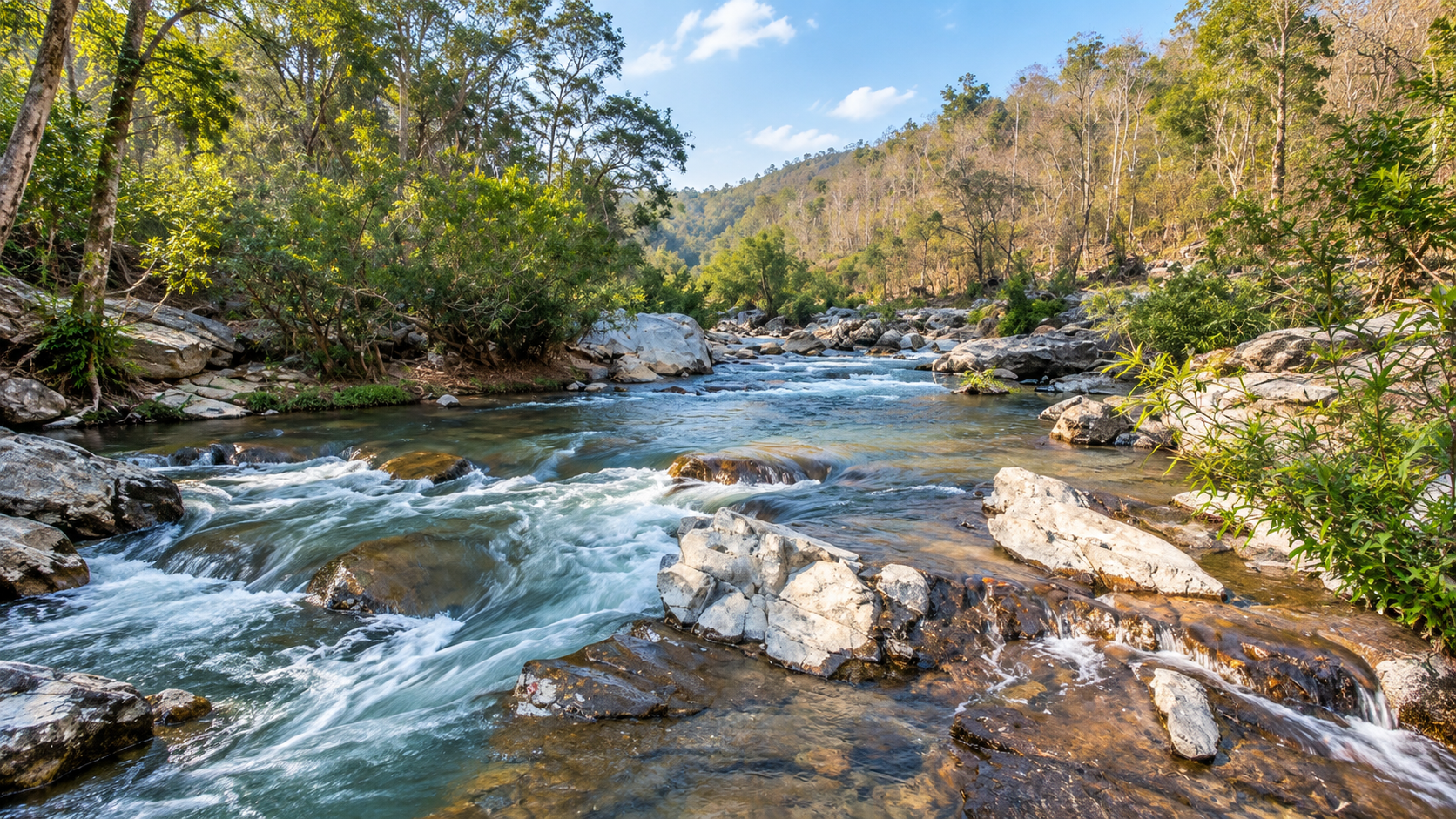
Just beyond the southern edge of Chiang Mai, a mountain river disappears between walls of rock.
The forest becomes quieter. The valley narrows. And the Mae Khan River squeezes through a dramatic natural gorge carved into the mountains.
This is Ob Khan.
Located in Chiang Mai Province, the Ob Khan landscape is a forested mountain area shaped by water, rock and time. Its signature feature is the Ob Khan Gorge, a narrow channel where the Mae Khan River flows between steep rock walls — one of the most distinctive river landscapes near Chiang Mai.
But Ob Khan is more than the gorge. The surrounding protected forest extends across parts of Samoeng, Hang Dong, Mae Wang and San Pa Tong districts, covering dry dipterocarp, mixed deciduous, dry evergreen, hill evergreen and pine forest.
The mountains also form an important watershed. Streams originating in the forest feed the Mae Khan, Mae Wang and Mae Win river systems before eventually becoming part of the wider Ping River basin.
A dramatic natural landscape that can be reached from Chiang Mai without a journey deep into the northern mountains.
At a Glance
- ~226 km²
- About 141,756 rai in the 2022 DNP proposal area.
- ~300 m
- Length of Ob Khan Gorge — cliffs roughly 25–30 m high.
- ~30 km
- Southwest of Chiang Mai city to the main visitor area.
- Preparation
- DNP status: Ob Khan National Park (Preparation).
- Common English name
- Ob Khan National Park
- Thai name
- อุทยานแห่งชาติออบขาน
- Current DNP status
- National Park (Preparation)
- Region
- Northern Thailand
- Province
- Chiang Mai
- Districts covered
- Samoeng, Hang Dong, Mae Wang and San Pa Tong
- Main visitor area
- Nam Phrae, Hang Dong
- Signature attraction
- Ob Khan Gorge
- Main river
- Mae Khan River
- Landscape
- Mountains, river gorges, cliffs, forests, streams and caves
- Proposed / surveyed area
- 141,756.26 rai / approximately 226 km²
- Elevation (2022 proposal)
- Approximately 300–1,338 m above sea level
- Highest mountain (older scope)
- Khun Tian — approximately 1,550 m
- Other highlights
- Ob Hai, Pha Tub, Huai Ya Sai, Huai Pong, Grasshopper Cave, Mae Sapok & Khun Win waterfalls
- Botanical highlight
- Manee Trai Rong orchid (traditional January flowering)
The 2022 DNP proposal area covered approximately 141,756.26 rai, or 226 km², with elevations from about 300 to 1,338 metres. The area contains five principal forest types and forms an important watershed for the Mae Khan basin.
Where Is Ob Khan?
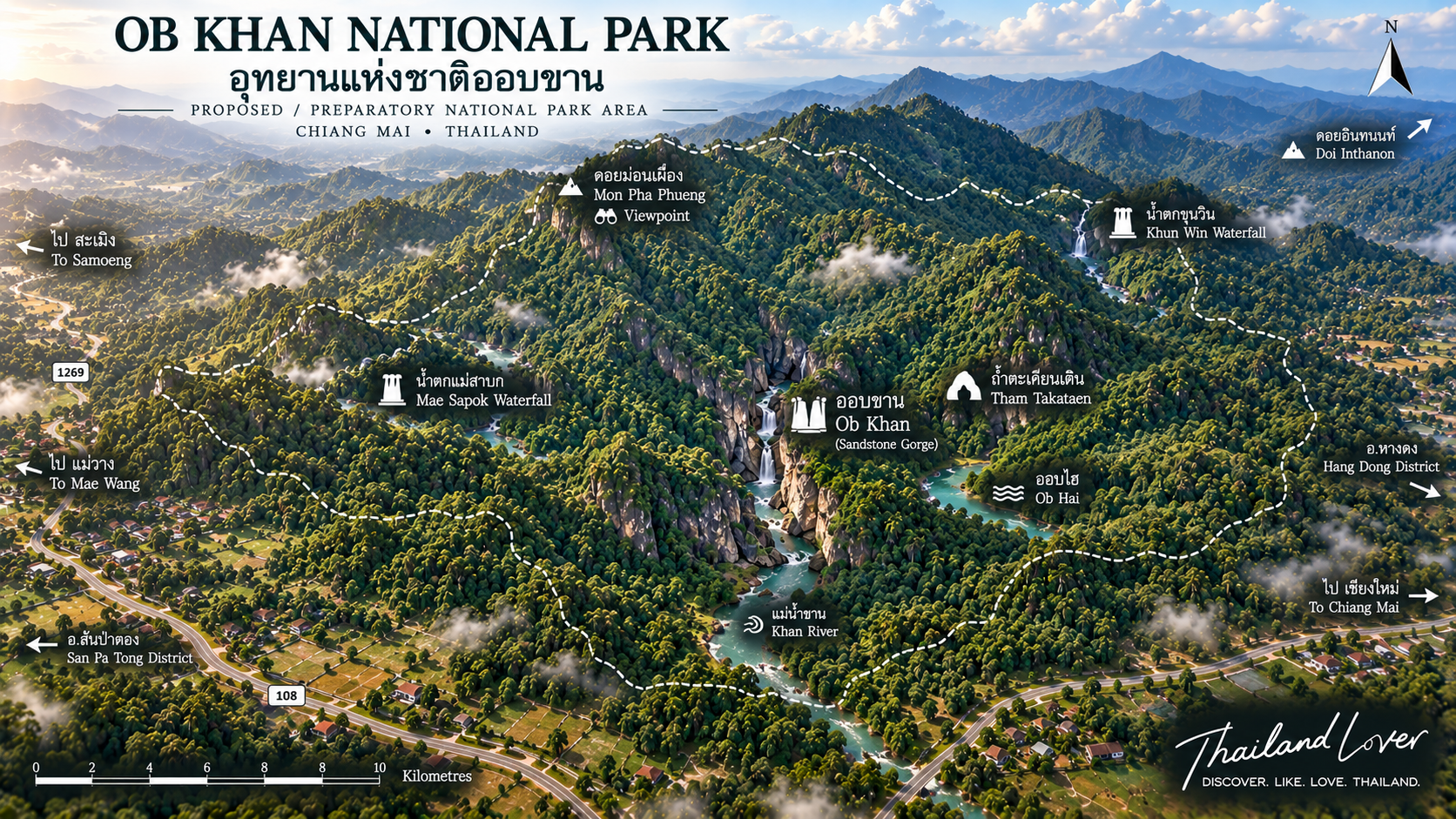
Ob Khan is located in Chiang Mai Province in northern Thailand, southwest of Chiang Mai city.
The principal visitor area is in:
Nam Phrae Subdistrict
Hang Dong District
Chiang Mai Province
Thailand
The wider proposed national park landscape extends into four districts:
- Samoeng
- Hang Dong
- Mae Wang
- San Pa Tong
This distinction matters. The Ob Khan Gorge visitor area is relatively close to Chiang Mai, while the wider protected forest extends much farther into the mountains. Visitors can experience the signature gorge as a short nature excursion — the larger ecological landscape remains considerably more extensive.
The Meaning of “Ob”
The Thai word “Ob” (ออบ) describes a narrow gorge or passage where a river flows between steep rock walls. It is a geographical description rather than simply a place name.
Ob Khan can be understood as the gorge of the Khan River.
- Ob
- Gorge — a narrow rock corridor shaped by water.
- Khan
- The Khan River — Mae Khan — cutting through stone.
A river. A narrow rock corridor. Cliffs shaped by water.
The Landscape
Ob Khan belongs to the mountainous terrain of the Thanon Thong Chai mountain system, with ridges extending through western and southwestern Chiang Mai. The terrain is not uniform:
- Mountain ridges and steep valleys
- River channels and rocky gorges
- Forest slopes and small plains along streams
- Limestone formations and igneous rock landscapes
- Caves and waterfalls
Elevation variation creates different environmental conditions and allows several forest types to exist within the same broader landscape.
Mountains and elevation
The DNP’s 2022 proposal described elevations within the proposed park area from approximately 300 metres to 1,338 metres above sea level.
Older park information identifies Khun Tian as the highest mountain associated with the wider Ob Khan landscape, at approximately 1,550 metres.
The Mae Khan River
The river that created Ob Khan
The Mae Khan River is the defining natural feature of Ob Khan. Over long periods, flowing water has moved through the mountain landscape, carrying sediment and gradually shaping the rock.
Where geological structure and river flow concentrate the water into a narrow corridor, the result is the dramatic gorge known as Ob Khan.
The river is not simply something flowing through the park — it is the geological force that helped create its most famous landscape.
Ob Khan Gorge
The signature landscape
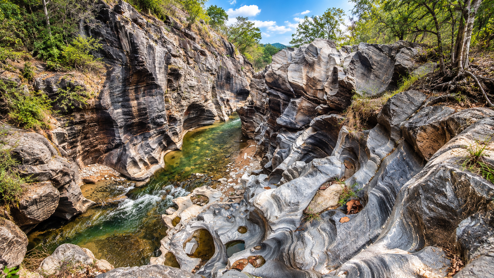
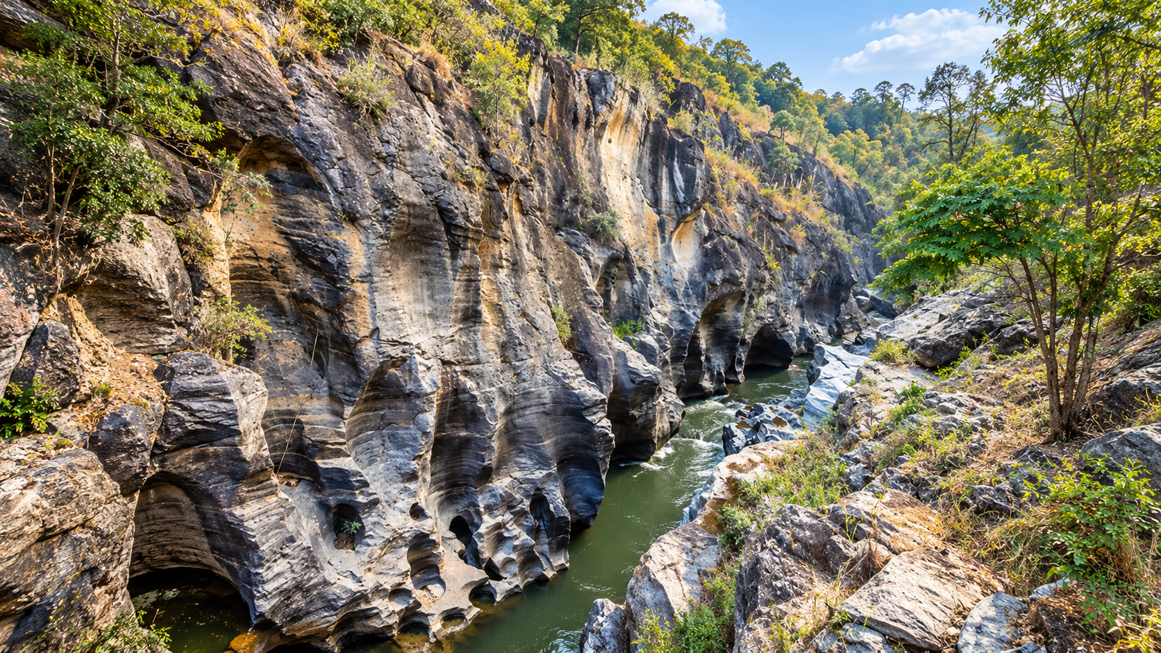
Here, steep rock walls rise on both sides of the Mae Khan River. The gorge is relatively narrow, creating the feeling of entering a natural stone corridor.
DNP information from 2022 describes the gorge as approximately 300 metres long, with walls rising roughly 25 metres above normal water level. Older DNP descriptions commonly describe the cliffs as approximately 30 metres high.
ThailandLover therefore describes the gorge as: a narrow, approximately 300-metre-long rock gorge with steep walls rising roughly 25–30 metres above the river.
How the gorge was formed
The landscape is the result of interaction between geological structure and river erosion over a very long period. Surrounding rock was uplifted and fractured; the Mae Khan then exploited weaknesses while continuously removing sediment.
Water does not need to carve quickly. It works continuously. Over thousands and millions of years, small amounts of erosion accumulate into dramatic geological forms. The smooth curves, grooves and hollows along the gorge are part of this long process.
The sculptures of the river
The river does not produce perfectly straight cliffs. Rock surfaces contain curves, hollows, grooves, rounded edges, channels and small rock shelves — forms that look almost sculptural. Unlike a sculpture made by a human artist, the process is still continuing. Every rainy season adds another chapter.
Beyond the Main Gorge
Ob Hai
Another rock gorge within the wider landscape — steep walls, a narrow river channel, water erosion and surrounding forest. Smaller than the main Ob Khan gorge, it shows how the same river-and-rock processes create multiple forms. The DNP lists Ob Hai among the important natural attractions of the proposed park.
Pha Tub
A distinctive rock formation shaped by erosion and weathering along the river environment. It demonstrates a theme throughout Ob Khan: water does not simply pass through the landscape — it changes it.
Huai Ya Sai
Here the Mae Khan makes an almost 90-degree turn. Current slows in parts of the bend; rocks and patches of ya sai grass give the site its name. A hillside viewpoint traditionally looks onto the winding river — excellent for landscape photography.
Huai Pong
A calmer, shallower section of the Mae Khan system, with shrubs and mature trees along the banks. For visitors who want quiet forest rather than the gorge alone, Huai Pong offers a different side of Ob Khan.
Narrow gorge → rocky river → shallow pools → quiet forest stream. The landscape is dynamic because the river is dynamic.
Grasshopper Cave
Tham Tak Taen — ถ้ำตั๊กแตน
A large limestone cave system in the Ban Pong area. Older descriptions report that the cave extends for more than 7 kilometres, with stalactites, stalagmites and multiple chambers.
Because cave-length figures can differ by survey method, ThailandLover uses safer wording: “a large limestone cave system extending for several kilometres” unless a current official cave survey is available.
Inside: stalactites, stalagmites, rock chambers, narrow passages, larger halls and underground geological formations.
The Forest
Five major forest types
The proposed Ob Khan landscape is particularly important for forest diversity. The DNP identified five principal types:
- Dry dipterocarp
- Lower elevations and drier slopes — more open canopy; Dipterocarpus, Shorea, Pentacme and related woodland trees.
- Mixed deciduous
- Seasonal mixture including teak, Xylia, Lagerstroemia, Schleichera, Terminalia and bamboo.
- Dry evergreen
- Denser canopy where moisture remains available — especially valleys and stream corridors.
- Hill evergreen & pine
- Cooler, wetter high ground — mosses, ferns, epiphytes, orchids; two- and three-needle pine environments.
This diversity is strongly related to elevation, slope, geology, moisture and exposure — a natural vertical journey through several northern Thai ecosystems.
The Watershed
Where the mountains become rivers
One of Ob Khan’s most important ecological roles is as a watershed. Forested mountains source streams including Mae Khan, Mae Wang, Mae Win, Mae Tien, Mae To, Mae Khanin and Huai La Luang — eventually connecting with larger river systems. The DNP identifies the area as an important source of streams within the Mae Khan watershed.
A healthy mountain forest captures rainfall, slows runoff, reduces soil erosion, helps maintain stream flow, recharges groundwater, protects river ecosystems, supports agriculture downstream and provides wildlife habitat.
The waterfall and river scenery visitors enjoy is only one visible part of a much larger ecological system.
Wildlife
The Ob Khan forest supports mammals, birds, reptiles, amphibians and insects. Historical DNP-linked descriptions associate the landscape with mainland serow, common muntjac, mouse deer, Malayan porcupine, Asian palm civet, mongooses, fishing cat, squirrels, langurs and numerous birds.
ThailandLover describes these as wildlife associated with the ecosystem — not animals visitors are guaranteed to see.
Mainland serow
One of the more significant mammals of rugged forested terrain and rocky slopes. Elusive and generally avoiding heavy human activity — their presence reinforces the need for connected mountain habitat.
Birds
Dry woodland, riverine forest, evergreen forest, pine forest and mountain forest create different bird communities. Early morning, when forest activity is highest, offers the best chance. A pair of binoculars can be more useful than a camera.
The Manee Trai Rong Orchid
A rare botanical highlight
Thai government tourism sources report the orchid known as Eueang Manee Trai Rong as being found only in Thailand at Ob Khan. It is associated with the forest environment and is especially notable because it blooms around January.
ThailandLover describes January as the traditional flowering period, rather than guaranteeing blooms on every day of the month — flowering depends on environmental conditions.
Waterfalls
The wider landscape contains several waterfalls and stream environments documented by government tourism sources, generally more remote than the main gorge:
- Mae Sapok Waterfall — forest waterfall in the Mae Wang area; flow strongly seasonal
- Khun Win Waterfall — cooler, quieter mountain setting deeper in the landscape
- Mae Wang Waterfall and related stream environments for broader southern Chiang Mai itineraries
- Mae Mueang / Mae Muet-related waterfall areas and other seasonal forest falls
These attractions may require additional travel or hiking beyond a short gorge visit.
Climate & Best Time
- Cool season
- November–February — most comfortable for walking; cooler mornings at higher elevations.
- Hot season
- March–May — lower elevations hot and dry; rock surfaces warm by midday.
- Rainy season
- June–October — greener forest, stronger streams; river crossings and rocks can be dangerous.
- January orchid
- Traditional flowering period of the Manee Trai Rong orchid.
Fire season & haze
Northern Thailand’s dry season can bring serious wildfire and haze. Smoke can affect visibility, mountain views, air quality, trails and wildlife behaviour. Check local air-quality and park announcements during the burning season.
Ob Khan in the rain
Rain changes the gorge’s personality — louder river, darker rock, saturated green, small slope cascades. The landscape can become extremely atmospheric. A river that looks calm in dry weather can also rise rapidly after upstream rainfall.
If the river changes colour, speed or sound, move away from the water.
River Safety
The Mae Khan is a natural river — not a controlled swimming pool. Water conditions can change rapidly.
- Check current conditions before entering the river
- Follow park staff instructions
- Avoid the river during heavy rain and slippery rocks
- Never stand in fast-moving water
- Keep children under close supervision
- Never jump from cliffs
- Leave immediately if water levels rise
The Main Walking Trail
The main Ob Khan visitor route has traditionally been a relatively short nature walk. Older park descriptions identify a loop of approximately 800 metres, taking roughly one hour at a leisurely pace.
The route follows the Mae Khan, passes rock formations and cliff sections, crosses uneven terrain and loops back through forest. Expect rocks, uneven ground, short climbs, riverbank sections and natural surfaces — not a paved urban park trail.
Forest → River → Rock → Gorge → Viewpoint → Forest — a short walk with big landscapes.
This makes Ob Khan especially suitable for travellers who want a genuine nature experience without a full-day mountain trek.
Things to Do
- 1. Walk the gorge
- Follow the trail along the river into the narrow rock corridor — the essential Ob Khan experience.
- 2. Photograph rock walls
- Look for grooves, curves, shadows, rock textures and reflections.
- 3. Explore the Mae Khan
- Where access and water conditions permit, spend time beside the river environment.
- 4. Huai Ya Sai & Huai Pong
- River bend viewpoint and a calmer forested stretch further along the system.
- 5. Pha Tub & Ob Hai
- Water-eroded rock formations and a second gorge landscape.
- 6. Orchid, cave & camp
- January orchid watching; Grasshopper Cave where officially open; camping when currently available.
Camping, Accommodation & Facilities
Government tourism information reports accommodation, camping areas, welfare facilities and visitor services around the main visitor area.
The camping area has historically been closed during 1 May–31 August according to DASTA visitor information. Present this as a reported seasonal arrangement and verify the current year’s closure before travel.
Basic park accommodation may be available — check the current DNP / park reservation system before travelling. Do not rely on outdated room numbers, prices or availability.
Facilities historically reported include visitor centre / park office, parking, toilets, welfare shop, camping, accommodation, nature trail and rest areas. Availability can vary by season and operational status.
Getting There
Ob Khan lies southwest of central Chiang Mai. A commonly used route is:
Chiang Mai → Highway 121 (Canal Road) → Hang Dong → Nam Phrae → Ob Khan
The road from the main highway becomes narrower and more rural. The final section includes paved and unpaved surfaces, slopes and curves. Drive slowly, particularly in rain.
The main visitor area is approximately 30 kilometres southwest of Chiang Mai city, depending on starting point and route. Exact driving distance varies — ThailandLover avoids a single permanent kilometre figure without a defined start location.
Best by private transport
Private car, rental car, taxi or ride-hailing for the outward journey. Public transport directly to the park is limited. Plan the return in advance rather than assuming a vehicle will always be available at the entrance.
A half-day escape
Leave the city in the morning, walk the gorge, spend time beside the river and return without a multi-day expedition — well suited to independent travellers, couples, families, photographers and short-stay visitors.
Who Should Visit?
- Nature lovers — compact introduction to Chiang Mai mountain ecosystems
- Photographers — rock, water and forest compositions
- Hikers — accessible main trail; wider landscape for more demanding routes
- Families — suitable with close supervision near river and cliffs
- Botanical enthusiasts — Manee Trai Rong orchid highlight
- Travellers avoiding crowds — quieter alternative to heavily visited Chiang Mai sites
Take extra care if you
- Travel with very young children
- Have limited mobility or dislike uneven trails
- Visit during heavy rain or wildfire season
- Plan to enter caves or swim in natural waterways
- Plan longer mountain trekking
Photography Guide
The gorge
Use a wide lens to capture river + cliffs + forest together, not only one wall.
The river
Look for reflections and smooth water. Early morning softens light; late afternoon warms the rock.
Rock details
Erosion patterns make excellent close-ups. A person at a safe distance can show cliff scale — never place anyone near an unsafe edge for a shot.
Rainy season
Wet rock contrasts with green foliage and white water. Photography should never override river safety.
Responsible Tourism
Ob Khan is a watershed landscape, not simply a recreational park.
- Leave no trace — take all rubbish with you
- No soap, shampoo or chemicals in the Mae Khan
- Do not remove rocks or pick orchids
- Keep the forest quiet for wildlife
- Stay on designated routes
- Respect temporary closures
- No fires outside designated areas
- Never throw cigarette butts or burn rubbish
Communities & Culture
Ob Khan is not an untouched wilderness isolated from people. Villages and agricultural communities surround the mountain landscape. Forest and rivers have historically connected to local livelihoods through water, agriculture, forest resources, travel routes and community traditions.
Rather than treating the park as an isolated attraction, travellers can explore nearby villages, agricultural landscapes, local food, coffee-growing areas, community products and mountain cultural sites — helping spread tourism spending beyond the main gorge.
Why Ob Khan Matters
- Geology
- Rock formations record the long interaction between geological forces and flowing water.
- Water
- The Mae Khan and associated streams form an important watershed.
- Forest
- Multiple forest types support biodiversity across elevation zones.
- People
- Communities depend on the surrounding landscape and water systems.
Rock + Water + Forest + Community — the real identity of Ob Khan.
Ob Khan, Ob Luang & Doi Inthanon
Ob Khan
Near Chiang Mai · Mae Khan River · Hang Dong / Samoeng / Mae Wang / San Pa Tong · signature: Ob Khan Gorge
Ob Luang
Further southwest · Mae Chaem / Hot area · Mae Chaem River · larger, more established national park destination
Doi Inthanon
Thailand’s highest summit and high-altitude mountain ecosystems — a different story from Ob Khan’s river gorge and watershed landscape. The two can complement each other in a Chiang Mai nature itinerary.
Suggested Experiences
- Morning
- Leave Chiang Mai early. Drive to Nam Phrae / Ob Khan before midday heat.
- Late morning
- Walk the main trail, explore the gorge, photograph rock formations, time beside the river where safe.
- Lunch
- Designated area or nearby community — do not leave food waste in the forest.
- Afternoon
- Huai Ya Sai or another open attraction, then return before darkness.
Two-day outline
Day 1: Ob Khan Gorge → Huai Ya Sai → Huai Pong → forest walk → camping / accommodation
Day 2: Grasshopper Cave (if open) → Mae Sapok / Khun Win area → local community → return to Chiang Mai
What to bring
Water, comfortable walking shoes, hat, sunscreen, insect repellent, rain protection, small first-aid kit, waterproof phone case, camera. For longer hikes: proper footwear, extra water and food, headlamp, rain jacket, navigation, power bank.
Before You Go
Operational conditions can change. Check opening status, temporary closures, river conditions, weather, wildfire restrictions, camping and accommodation, cave and trail access, and current visitor rules.
This is especially important because Ob Khan remains a national park preparation area according to the latest DNP material ThailandLover found.
Frequently Asked Questions
- What is Ob Khan National Park?
- A protected forest and mountain landscape in Chiang Mai centred on Ob Khan Gorge, where the Mae Khan River flows between steep rock walls. Currently managed as a national park preparation area under the latest DNP information available.
- Where is Ob Khan?
- Main visitor area: Nam Phrae Subdistrict, Hang Dong District, Chiang Mai Province, southwest of Chiang Mai city.
- How far from Chiang Mai?
- Roughly 30 kilometres southwest, depending on your starting point in the city.
- What is it famous for?
- The narrow river gorge, steep cliffs shaped by long-term erosion, and surrounding forest attractions.
- How long / how high is the gorge?
- About 300 metres long. Cliffs roughly 25 m above normal water level in the 2022 DNP description; older sources often say around 30 m.
- Can I swim?
- Shallow sections have historically been used, but safety depends on current conditions. Never enter during heavy rain or strong currents.
- Is it suitable for children?
- The main visitor area can work for families with close supervision near river, rocks and cliffs.
- Is it a real national park?
- Widely called Ob Khan National Park, but May 2026 DNP material still uses “Ob Khan National Park (Preparation)”. Confirm Royal Gazette status before stating full legal designation.
- How large is it?
- 2022 DNP proposal: about 141,756.26 rai / 226 km². Older tourism figures (~302,500 rai / 484 km²) describe a broader preparation scope — not the same boundary.
- Best time to visit?
- November–February for comfort; rainy season for greener forest and stronger streams; January for the reported Manee Trai Rong flowering period.
- Can I camp?
- Historically yes — verify current status. Reported seasonal closure 1 May–31 August should be confirmed for the current year.
The River That Carved a Door Through the Mountain
ThailandLover editorial story
The first thing you notice at Ob Khan is the rock. Then you hear the water. The two have been working together for a very long time.
The mountains rise around the Mae Khan River. Rain falls on the forest. The forest holds the water. The water begins to move. And slowly, patiently, relentlessly, the river cuts its way through the stone.
At Ob Khan, the mountains seem to open. Two walls of rock rise beside the river, creating a narrow natural corridor. The Thai name is simple: Ob Khan — the gorge of the Khan River.
But standing there, the name feels almost too simple. The walls are not smooth. They curve. They fold. They carry grooves and hollows. Every surface tells a small part of the river’s story.
And the water continues moving. It is still carving. Still shaping. Still changing the mountain.
SEE · FEEL · DISCOVER
- SEE
- A river disappearing between towering rock walls. Green forest climbing the mountains. Mist on distant ridges. Water reflecting stone.
- FEEL
- Cool forest air. Water moving over rock. The texture of ancient stone. The sudden quiet inside the gorge.
- DISCOVER
- A side of Chiang Mai beyond temples and cafés. A mountain watershed southwest of the city. Geology and water working together for thousands of years.
More Chiang Mai Nature
- Ob Luang National Park
- Another Chiang Mai river gorge — Mae Chaem / Hot area; a separate park from Ob Khan.
- Doi Inthanon National Park
- Thailand’s highest summit and high-altitude mountain ecosystems.
- Mae Wang National Park
- Mountain forest and waterfall landscapes adjoining southern Chiang Mai nature routes.
- Khun Khan National Park
- Another Chiang Mai protected forest landscape for mountain nature travellers.
- All Nature & Parks
- Browse ThailandLover’s national park guides across the country.
Location
Find Ob Khan
Nam Phrae Subdistrict, Hang Dong District, Chiang Mai Province, Thailand