

National Park · Eastern Thailand
Thap Lan National Park
อุทยานแห่งชาติทับลาน
Ancient Lan Palms · Mountain Forests · Waterfalls · Wildlife
Prachin Buri · Nakhon Ratchasima · Buriram, Thailand
One of Thailand’s largest protected landscapes — rare lan palms, wide mountain views, waterfalls and a living forest shared by elephants, gaurs and gibbons.
A Vast Forest Landscape of Eastern Thailand
Stretching across the forested mountains of eastern Thailand, Thap Lan National Park (อุทยานแห่งชาติทับลาน) is one of the country’s largest protected landscapes and one of the most important remaining forest areas in the region.
Its name comes from the remarkable lan palm forests that grow naturally in parts of the park. These giant palms are increasingly rare in Thailand, making Thap Lan an important place for understanding a distinctive landscape that once occurred much more widely across northeastern Thailand.
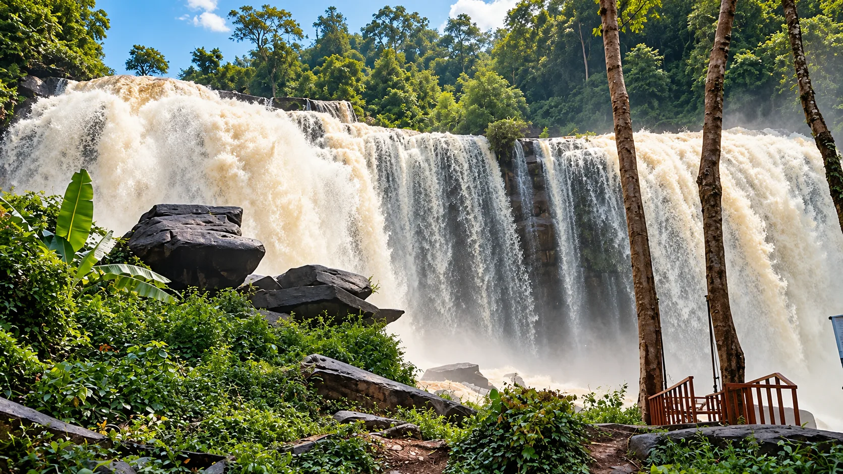
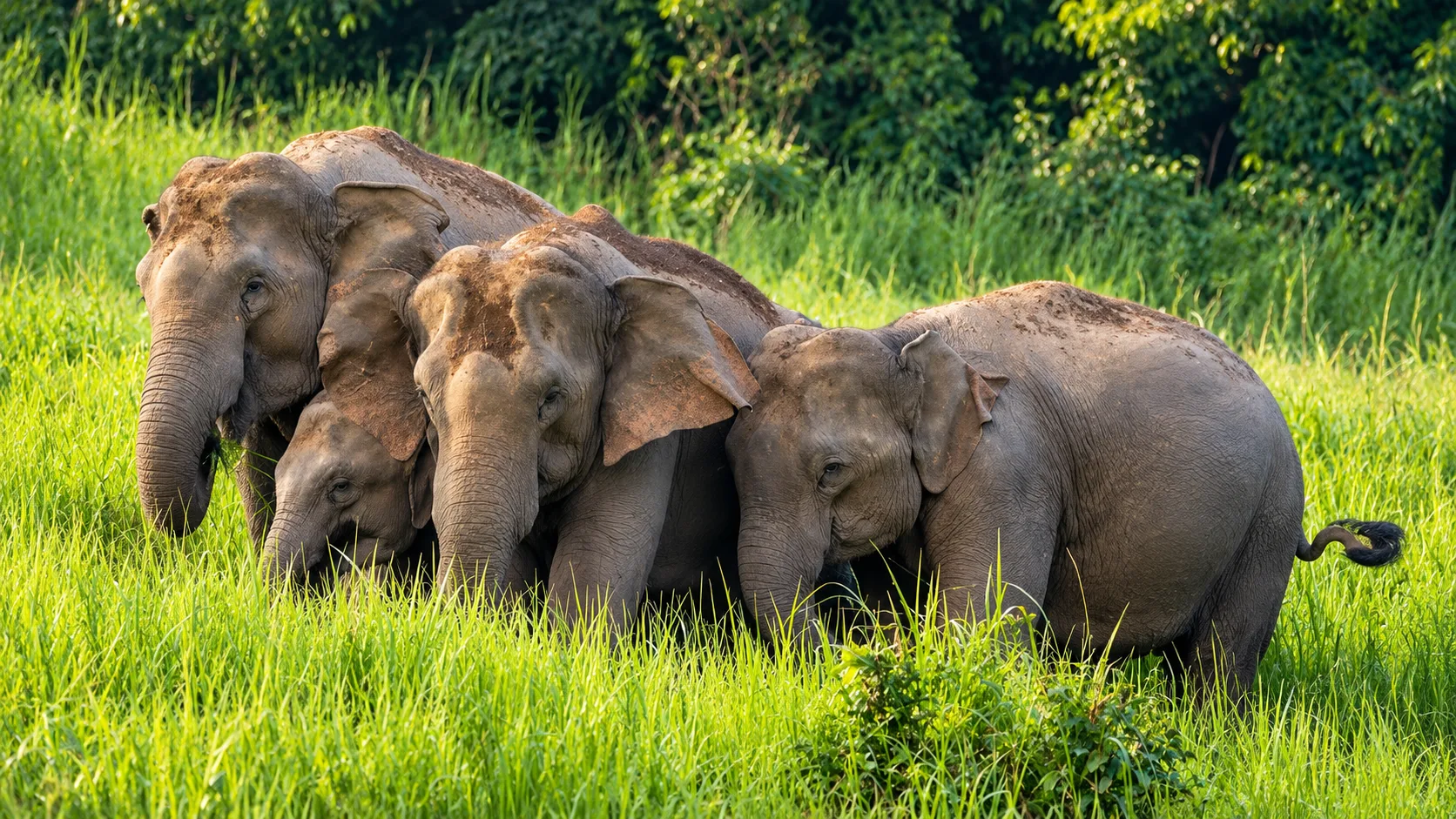
But Thap Lan is much more than a palm forest. Its mountains form an important watershed, its forests support elephants, gaurs, deer, gibbons and many bird species, and its valleys contain waterfalls, streams, cliffs and viewpoints overlooking a vast green landscape.
Forest, wildlife, waterfalls and wide-open mountain scenery — quieter and more expansive than the better-known parks nearby.
At a Glance
- ~2,236 km²
- Official DNP-listed area — about 1,397,375 rai.
- 1981
- Established 23 December as Thailand’s 39th national park.
- 992 m
- Khao Lamang — highest point in the park.
- 3 provinces
- Prachin Buri, Nakhon Ratchasima and Buriram.
- Lan palms
- Natural Corypha lecomtei forest that named the park.
- Official Name
- Thap Lan National Park
- Thai Name
- อุทยานแห่งชาติทับลาน
- Provinces
- Prachin Buri, Nakhon Ratchasima and Buriram
- Established
- 23 December 1981
- National Park No.
- 39
- Official DNP-listed Area
- Approximately 1,397,375 rai / 2,235.80 km²
- Landscape
- Mountain ranges, evergreen forest, deciduous forest, waterfalls, cliffs and natural lan-palm forest
- Highest Mountain
- Khao Lamang — approximately 992 m above sea level
- Famous For
- Natural lan-palm forest, Pha Kep Tawan, waterfalls and wildlife
- Best For
- Nature, wildlife, photography, camping, hiking and scenic drives
The Department of National Parks currently describes Thap Lan as covering approximately 1,397,375 rai (2,235.80 km²) and as Thailand’s second-largest national park by area on its published park profile.
Why Thap Lan Is Special
Thap Lan is one of those places where the landscape tells the story.
Its mountains belong partly to the Phanom Dong Rak mountain system, forming a broad belt of forested terrain across the region. Within the park are ridges, valleys, cliffs, streams and waterfalls. These forests also function as important watersheds.
Some streams eventually feed the Mun River, while others flow toward the Bang Pakong River system. In other words, the forest of Thap Lan is connected to major river systems far beyond the park itself.
And then there is the lan palm — the feature that gave the park its name and helped inspire the original conservation effort.
It is this combination of mountain forest + watershed + lan palm + wildlife that gives Thap Lan its distinctive identity.
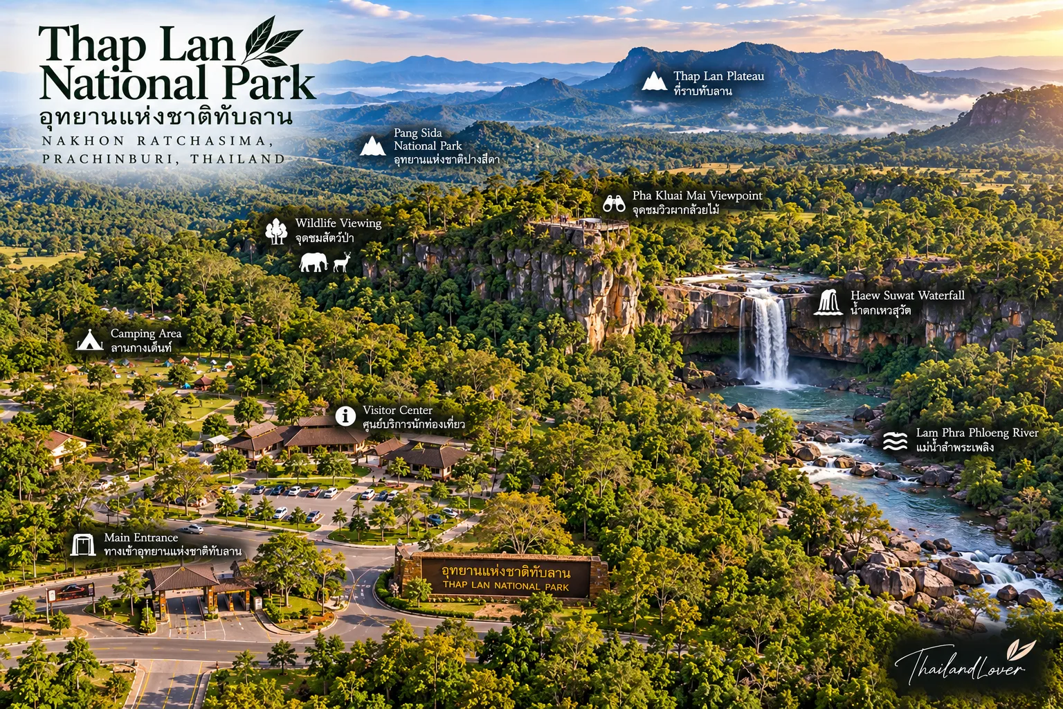
The Story of the Lan Palm Forest
A rare landscape in Thailand
The Thai name Thap Lan refers to an area associated with the lan palm, a large palm native to parts of mainland Southeast Asia. The species recorded by the Department of National Parks is Corypha lecomtei Becc.
Lan palms can grow into impressive solitary trees with enormous fan-shaped leaves. They are not the beach palms of tropical coasts — they belong to inland forest and open woodland.
Historically, lan palm forests were more widely distributed across northeastern Thailand. Agricultural expansion reduced these natural forests considerably. By the early 1970s, the lan-palm forest around Ban Thap Lan, Ban Khun Si, Ban Bu Phram and Ban Wang Mued in Prachin Buri had become particularly important as one of the last substantial natural examples in the country.
A field inspection on 24 March 1974 led forestry officials to recognise the need to conserve the area — the foundation for Thap Lan Forest Park and later the much larger national park.
From Forest Park to National Park
In the 1970s, the area was developed as Thap Lan Forest Park. Further surveys in 1980 found that the surrounding forests were extensive and relatively intact, with important wildlife habitat, scenic landscapes and watershed functions — including the headwaters of the Mun and Bang Pakong river systems.
On 23 December 1981, a Royal Decree established Thap Lan National Park, Thailand’s 39th national park.
The lan forest was the starting point. The surrounding mountain ecosystem became the protected landscape.
The Mountains of Thap Lan
Thap Lan is a mountainous national park rather than a flat forest reserve. Its terrain includes interconnected mountains and ridges, including:
- Khao Lamang
- Phu Sam Ngam
- Phu Sung
- Khao Yai
- Khao Wong
- Khao Salat Dai
- Khao Thit Si
- Khao Mai Plong
- Khao Thap Jek
- Khao Dan Ngio
Among them, Khao Lamang is identified by the DNP as the highest point, at approximately 992 metres above sea level.
A road may pass through open woodland before entering dense forest. A stream may disappear into a valley before emerging as a waterfall. A viewpoint may suddenly open across a seemingly endless green landscape.
A Forest That Feeds Two River Systems
Watershed first — scenery second
One of Thap Lan’s most important functions is less visible than its waterfalls. It is a watershed.
Numerous streams begin in the park’s mountains. Some eventually join the Mun River; others form tributaries of the Bang Pakong River. The forest helps regulate water movement, supports aquatic habitats and provides water to ecosystems and communities downstream.
When you stand beneath the canopy, it is easy to think of the trees as scenery. Ecologically, they are infrastructure.
The Forest Ecosystems
The Department of National Parks identifies four major forest communities:
- Dry Dipterocarp Forest
- Open woodland with relatively sparse tree cover and grasses beneath the canopy — Teng, Rang, Hiang and Phluang. Especially distinctive in the dry season.
- Mixed Deciduous Forest
- Diverse forest, often with bamboo — Daeng, Tabaek, Pradu, Makok and Chingchan. Rainy-season foliage creates important feeding habitat for herbivores and birds.
- Moist Evergreen Forest
- Particularly at higher elevations, roughly 400–1,000 m. Denser vegetation and important habitat for forest wildlife.
- Dry Evergreen Forest
- In relatively level areas — including yang na and yang daeng. Continuous canopy for primates, large mammals and forest birds.
Pha Kep Tawan
ผาเก็บตะวัน · one of Thap Lan’s signature viewpoints
Pha Kep Tawan is one of the best-known scenic areas associated with Thap Lan. The viewpoint looks across the forested landscape of the park, making it particularly attractive around sunrise and sunset.
The name refers to the act of “collecting the sun” — an evocative description that fits the location’s wide western-facing views. The surrounding landscape is especially impressive when the forest is green during the rainy season.
At the viewpoint, the experience is less about a single dramatic peak and more about scale — layer after layer of forested hills stretching toward the horizon.
The Lan Forest Landscape
According to the DNP, a remaining natural lan-palm forest covers approximately 200 rai on a plateau on Khao Lamang in the Bu Phram area of Na Di District, Prachin Buri.
Instead of dense southern rainforest, visitors encounter tall fan palms rising from a more open forest environment — one of the country’s remaining natural examples of this vegetation type.
Wildlife of Thap Lan
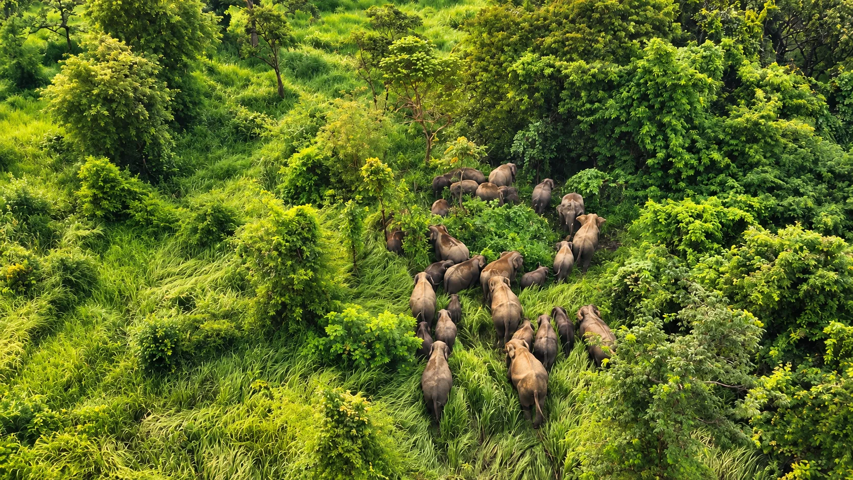
Thap Lan matters not only because of its size but because it forms part of a wider forest landscape supporting large mammals. Official park information records species associated with its different habitats, including:
- Asian elephant
- Gaur
- Sambar deer
- Barking deer
- White-handed gibbon
- Pileated gibbon
- Silvered langur
- Pig-tailed macaque
- Leopard cat
- Malayan porcupine
- Large flying squirrel
Birdlife includes Siamese fireback, silver pheasant, great hornbill, wreathed hornbill, Oriental pied hornbill, broadbills, woodpeckers, drongos and many other forest birds.
These species are not guaranteed sightings. Thap Lan is a functioning wild ecosystem, not a wildlife park. The best encounters happen without disturbing the animals.
The Gaur and Elephant Landscape
The park’s mixed deciduous and evergreen forests provide habitat for large herbivores such as gaur, sambar deer and wild elephants. The relationship between wildlife and surrounding communities is therefore an important part of the modern Thap Lan landscape.
In 2026, the DNP reported both a fatal snare incident involving a gaur and an incident in which a wild gaur injured a local resident in the Khon Buri area — reminders that conservation here means managing a living landscape shared by protected forests and communities.
Waterfalls and Streams
Thap Lan’s mountainous terrain produces numerous streams and waterfalls. Some of the park’s waterways include:
- Huai Khamin
- Huai Pla Kang
- Huai Kham Chae
- Huai Kham Khi Rat
- Huai Mun Sam Ngam
- Huai Phu Hom
- Huai Krathing
- Huai Lam Loei
- Huai Kut Ta Si
- Huai Lam Duan
Other streams flow toward the Bang Pakong system. Waterfalls are the visible expression of the park’s mountain watershed — and water levels vary significantly with rainfall.
Nature, Not Just Sightseeing
Thap Lan rewards travellers who slow down. A quick visit to a viewpoint can show you the scenery. Spending more time reveals the connections:
Forest → Water → Wildlife → People
The lan palms depend on their habitat. The forest protects the watershed. The streams support aquatic life. The forest provides habitat for elephants and gaurs. And communities live around the boundaries of this protected landscape.
Things to Do
- 1 · Pha Kep Tawan
- Watch the landscape around sunrise or sunset as light changes across the forested hills.
- 2 · Lan Palm Forest
- See one of Thailand’s rare remaining natural lan-palm landscapes.
- 3 · Waterfalls
- A different perspective on the park’s mountainous terrain. Access and swimming conditions vary seasonally.
- 4 · Wildlife watching
- Early morning and late afternoon are generally better for observing signs of wildlife — without expecting guaranteed sightings.
- 5 · Camping
- DNP currently lists Suan Hom, Pha Kep Tawan, Pa Lan and Lam Plai Mat. Book through the official reservation system.
- 6 · Photography
- Lan palms · mountains · waterfalls · wildlife · forest textures · sunrise · sunset.
Camping in Thap Lan
Beyond a day trip
The DNP currently lists four camping areas:
- Suan Hom
- Pha Kep Tawan
- Pa Lan
- Lam Plai Mat
There are also park accommodation facilities in the Suan Hom and other management zones. Availability changes — use the official DNP booking system rather than old third-party information.
A night in the park changes the experience completely. After sunset, the landscape becomes quieter — insects, nocturnal sounds and movement largely invisible to daytime visitors.
When to Visit
Thap Lan has a tropical monsoon climate. The DNP describes three broad seasons.
- Rainy · Mid-May – October
- Southwest monsoon moisture from the Andaman Sea and Gulf of Thailand. September is typically wettest. Forest becomes lush and waterfalls more active — but trails, rocks and roads can be slippery.
- Cool · November – January
- December is generally coolest, with an average minimum of about 22.8°C. Comfortable for hiking and scenic viewpoints.
- Hot · February – May
- April is generally hottest, with an average maximum of about 29.3°C. Dry forest landscapes become more pronounced.
Best Time by Experience
- Green forest & waterfalls
- Rainy season, subject to safety conditions
- Hiking
- Cooler months, especially Nov–Jan
- Viewpoints
- Cool/dry season or clear days
- Lan palms
- Year-round
- Wildlife observation
- Year-round; sightings depend on conditions
- Camping
- Cooler, drier periods are generally more comfortable
There is no single perfect month. The best timing depends on whether you prioritise green landscapes, flowing waterfalls, comfortable hiking or clear views.
How to Get There
Thap Lan covers a very large area, so there is no single road that represents the entire park. The park extends across parts of:
- Nakhon Ratchasima
- Pak Thong Chai · Wang Nam Khiao · Khon Buri · Soeng Sang
- Prachin Buri
- Na Di
- Buriram
- The DNP also identifies the park’s wider area in relation to Buriram.
- From Bangkok
- Travel east/northeast via major highways toward Nakhon Ratchasima or Prachin Buri, depending on which part of the park you plan to visit.
- By car
- Most flexible for combining Pha Kep Tawan, lan forest, waterfalls and camping.
- Public transport
- Can reach surrounding districts, but individual attractions often need local transport arranged in advance.
Connected to Khao Yai and Pang Sida
Thap Lan forms part of the larger forest landscape of eastern Thailand. Its protected forests are geographically connected with other important conservation areas, including the wider Dong Phayayen–Khao Yai Forest Complex — an internationally recognised UNESCO World Heritage property.
Wildlife does not recognise national-park boundaries. Large mammals such as elephants need extensive connected habitat. Thap Lan therefore plays an important role as part of a much larger forest ecosystem rather than an isolated island of protected forest.
Responsible Wildlife Tourism
Thap Lan is not a zoo. If you encounter an elephant, gaur or other large animal:
- Keep a safe distance
- Do not approach
- Do not block its path
- Do not feed it or use food to attract wildlife
- Follow instructions from park officers
- Do not leave your vehicle to get closer to wildlife on roads
The presence of large mammals is one of the park’s greatest ecological values — and a reason visitors must behave differently from ordinary tourist attractions.
Protecting the Lan Forest
The lan palm is more than the park’s namesake. It is a reminder of how quickly distinctive ecosystems can disappear. Agricultural expansion caused widespread loss of natural lan-palm forests in northeastern Thailand, leaving the Thap Lan area as an important remaining example.
When visiting, do not collect palm leaves, seeds, plants, flowers, rocks or wildlife. The landscape is valuable precisely because it remains a natural ecosystem.
Visitor Tips
- Wear proper shoes
- Forest trails, rocks and waterfalls can become slippery.
- Carry water
- Distances between attractions can be substantial.
- Bring rain protection
- Weather can change quickly during the monsoon.
- Start early
- Morning temperatures are more comfortable and wildlife activity may be higher.
- Check current conditions
- Roads, trails, waterfalls and camping can be affected by weather.
- Keep the forest clean
- Take all rubbish with you. Never feed or approach wild animals.
- Use the official park system
- For accommodation, camping and current services, rely on DNP reservation information.
The Thap Lan Boundary Issue
Thap Lan has become an important case in Thailand’s discussion about protected forests and communities. Some areas within the historic park boundary overlap with land that government agencies had previously allocated for residential or agricultural use before the national park was established.
In June 2026, the National Park Committee reviewed the boundary-adjustment process. The committee agreed in principle to remove 155,865.47 rai from the national-park boundary because these areas had previously been allocated through government programs. It also decided that 109,420.99 rai outside those government allocation projects should remain part of the national park while rights are examined under relevant laws. A further 86,966.29 rai of national-reserve forest was assigned for additional assessment regarding possible future inclusion.
ThailandLover Travel Guide
- Best for
- Nature lovers · Wildlife watchers · Photographers · Hikers · Campers · Road trippers
- Travel style
- Nature + Wildlife + Adventure
- Don’t miss
- Pha Kep Tawan · Natural lan palm forest · Forest waterfalls · Mountain landscapes · Wildlife habitat
- Best experience
- Combine a viewpoint, forest landscape and waterfall rather than treating Thap Lan as a single sightseeing stop
- Travel character
- Wild · Expansive · Green · Quiet · Biodiverse
Essential Information
- Park
- Thap Lan National Park · อุทยานแห่งชาติทับลาน
- Provinces
- Prachin Buri · Nakhon Ratchasima · Buriram
- Official DNP-listed area
- Approximately 1,397,375 rai / 2,235.80 km²
- Established
- 23 December 1981 · National Park No. 39
- Highest mountain
- Khao Lamang — approximately 992 m
- Main landscape
- Mountain forest · Lan-palm forest · Evergreen & deciduous forest · Waterfalls · Cliffs · Watersheds
- Signature experience
- Pha Kep Tawan and the natural lan-palm forest
- Wildlife
- Asian elephant · Gaur · Sambar deer · Gibbons · Langurs · Hornbills · Forest birds
- Camping (DNP-listed)
- Suan Hom · Pha Kep Tawan · Pa Lan · Lam Plai Mat
- Official park contact
- +66 37 210 340 · +66 92 550 0172
Frequently Asked Questions
- What is Thap Lan National Park?
- One of Thailand’s largest national parks — forested mountains across Prachin Buri, Nakhon Ratchasima and Buriram, known for lan palms, Pha Kep Tawan, waterfalls and wildlife.
- How large is it?
- About 1,397,375 rai / 2,235.80 km² on the current DNP profile. Boundary review in 2026 means the published figure should not automatically be treated as the final future boundary.
- What is it famous for?
- Natural lan-palm forest (Corypha lecomtei), Pha Kep Tawan, mountain forests, waterfalls and wildlife including elephants and gaurs.
- When is the best time to visit?
- November–January for comfortable hiking and viewpoints; rainy season for greener forest and stronger waterfalls, with more caution on trails and roads.
- Can I camp there?
- Yes — Suan Hom, Pha Kep Tawan, Pa Lan and Lam Plai Mat are currently listed. Book via the official DNP system.
- How do I get there from Bangkok?
- Drive east/northeast toward Nakhon Ratchasima or Prachin Buri depending on your destination inside the park. A private car is the most practical option.
More Eastern Forest Parks
- Khao Yai National Park
- Thailand’s first national park and the western anchor of the Dong Phayayen–Khao Yai Forest Complex.
- Pang Sida National Park
- Eastern butterfly forest, waterfalls and UNESCO World Heritage landscape in Sa Kaeo.
- Namtok Chet Sao Noi National Park
- Seven-tiered waterfall park near the Khao Yai travel corridor.
- Namtok Sam Lan National Park
- Forest waterfalls and day-trip nature close to Bangkok’s eastern approaches.
Location
Find Thap Lan National Park
Prachin Buri · Nakhon Ratchasima · Buriram — a vast mountain forest across eastern Thailand