


Preparatory Park Area · Tak
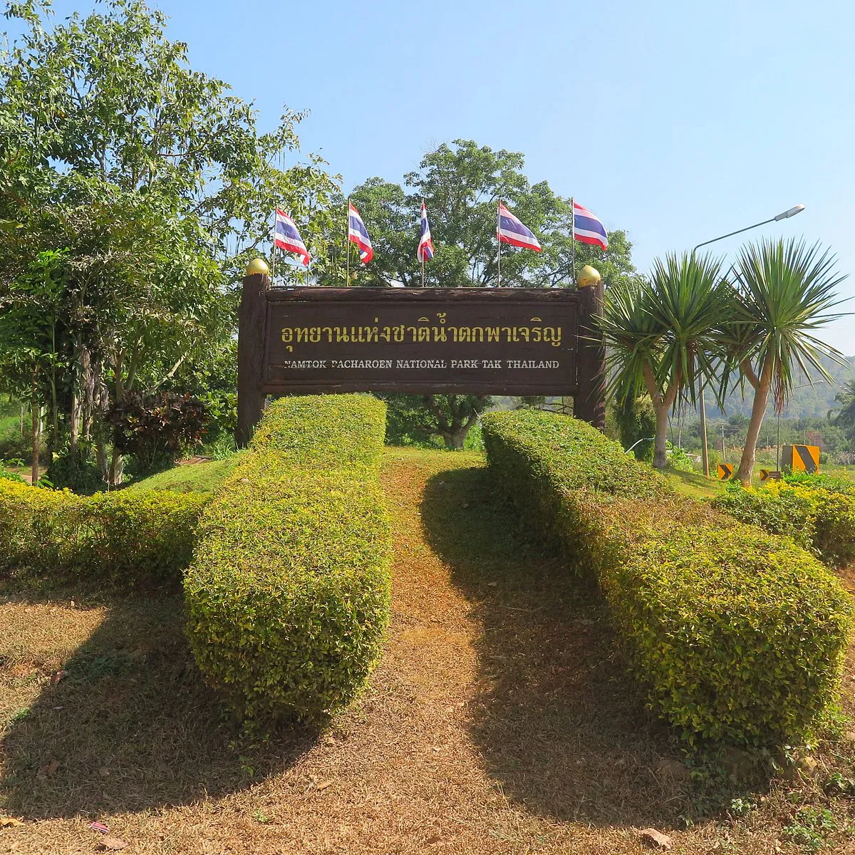
Namtok Pha Charoen National Park
อุทยานแห่งชาติน้ำตกพาเจริญ
A Mountain Landscape of Cascading Waterfalls, Forests & Highland Flowers
Phop Phra · Mae Sot · Tak, Northern Thailand
There are waterfalls that fall from a cliff. And then there are waterfalls that seem to unfold across the landscape. Pha Charoen belongs to the second kind — water moving down limestone through a famous series of cascading levels.
Welcome to the Pha Charoen Landscape
Instead of one dramatic vertical plunge, water moves down a broad limestone formation through a remarkable series of cascading levels — creating the waterfall’s famous 97 tiers.
But the waterfall is only the most visible part of a much larger story. Beyond Pha Charoen lies a vast mountain landscape stretching across western Tak, with forests, limestone formations, streams, hot springs, highland viewpoints and important watersheds.
The forests here form part of an important connection between the Mae Ping Forest Complex and the Western Forest Complex, while the mountains provide habitat and movement corridors for wildlife along the Thai–Myanmar border. And during the rainy season, another attraction appears: fields of brilliant orange Siam tulips.
Water. Forest. Limestone. Seasonal flowers. One western Tak landscape.
An Important Note About Its National Park Status
As of 2026, Namtok Pha Charoen has not yet been formally gazetted as a national park. The area is currently being prepared for official designation as Namtok Pha Charoen National Park.
The Department of National Parks, Wildlife and Plant Conservation opened a public consultation process in April 2026 as part of the procedure required under Thailand’s National Park Act B.E. 2562 (2019). The current proposed area covers approximately 414,062.28 rai, or 662.50 square kilometres.
At a Glance
- 97 tiers
- Pha Charoen’s signature limestone cascades — levels, not a 97-metre drop.
- 662.50 km²
- Current proposed park area — approx. 414,062.28 rai.
- Siam Tulip
- Highland orange blooms, roughly July–September after the rains.
- In transition
- Preparatory area pending formal national-park designation (2026).
- Thai name
- อุทยานแห่งชาติน้ำตกพาเจริญ
- English name
- Namtok Pha Charoen National Park
- Current status
- Preparatory area pending formal national-park designation
- Province
- Tak
- Main districts
- Phop Phra and Mae Sot
- Current proposed area
- Approx. 414,062.28 rai · 662.50 km²
- Main landmark
- Pha Charoen Waterfall
- Waterfall character
- Multi-tiered limestone waterfall · traditionally 97 tiers
- Other highlights
- Pa Wai Waterfall · Huai Nam Nak Hot Spring · Doi Kia Scenic Area · limestone caves and mountains
- Landscape
- Mountain forest, limestone terrain, streams, waterfalls and highland areas
- Signature seasonal flower
- Siam Tulip (Curcuma)
- Major ecological role
- Watershed and wildlife corridor
- Border landscape
- Western Thailand near the Thai–Myanmar frontier
The current boundary proposal follows extensive surveying and community consultation. DNP states that approximately 35,684.55 rai have been excluded from the proposed park to account for existing communities, agricultural land and essential infrastructure.

Why Visit Pha Charoen?
Pha Charoen is not simply a waterfall stop on the road between Mae Sot and Umphang. The larger landscape offers several different experiences: the famous 97-tier waterfall, forest and limestone walks, a natural hot spring, seasonal Siam tulips, mountain viewpoints — or a gateway into one of western Thailand’s important forest landscapes.
The attraction is its variety.
- A limestone waterfall that unfolds across the rock in 97 cascading tiers
- Forest trails around streams and limestone formations
- Huai Nam Nak Hot Spring — warm mineral water in a mountain landscape
- Seasonal orange Siam tulips in the rainy months
- Pa Wai Waterfall — another multi-tier limestone cascade
- Doi Kia and highland viewpoints across western Tak
- Watershed forests linking Mae Ping and Western Forest Complexes
- An accessible stop on the Mae Sot–Umphang mountain road
The 97-Tier Pha Charoen Waterfall
A waterfall that falls sideways through the landscape
Pha Charoen Waterfall is the defining feature of the area. Its most famous characteristic is the number of levels: 97 tiers. This does not mean a 97-metre waterfall. The number refers to the series of cascading steps through which water travels across the limestone formation.
The result is visually very different from Thailand’s classic single-drop waterfalls. Instead of one dramatic curtain of water, Pha Charoen spreads through a sequence of smaller cascades. Water moves, splashes, collects, drops again, then continues downward — giving photographers and visitors a constantly changing landscape rather than a single viewpoint.
Don’t count the tiers. Watch how the water moves.
Limestone: The Secret Behind the Waterfall
The character of Pha Charoen is closely connected to limestone. Over long periods, water can dissolve and reshape the rock, creating channels, terraces, pools and distinctive formations. At Pha Charoen, this geological process contributes to the waterfall’s stepped appearance.
The result is not simply water plus rock, but a landscape shaped over geological time — one reason the waterfall looks so different from a conventional cliff fall.
The shape
Water does not descend in one straight line. It spreads across the limestone surface. Some tiers are broad, some narrow; some create small pools, others form thin ribbons over the rock.
After rain vs dry spells
After heavy rain, the entire formation can appear to come alive. During lower flow, the underlying limestone becomes much more visible. The same waterfall can look remarkably different from one visit to another.
The Waterfall in the Rainy Season
The rainy season is generally the most dramatic period for Pha Charoen. More rainfall means more water moving through the limestone system. Vegetation becomes greener, colours richer, and individual tiers easier to see as water spreads across the rock. For photographers, this is often the most rewarding time.
Wet-season travel also requires caution. Limestone surfaces can become slippery, streams can rise rapidly, and mountain weather can change quickly. Always follow local safety instructions.
The Pha Charoen Nature Trail
A nature trail of approximately 1.5 kilometres has traditionally been associated with the waterfall area. The route provides a closer look at the forest, streams and limestone landscape surrounding the cascade — more about observing the environment than conquering elevation.
Take your time. Look at the forest floor. Look for insects. Listen for birds. Look at the plants growing around the water. The smaller details are often what make a nature trail memorable.
Siam Tulip — the Orange Flower of Pha Charoen
Curcuma · roughly July–September
During the rainy season, the landscape around Pha Charoen takes on another identity. The Siam Tulip, a native Thai flowering plant in the genus Curcuma, emerges from the ground. The flowers are typically bright pinkish-orange to orange-pink, creating a striking contrast against green forest and grass.
It is not a tulip in the European garden sense — it is a tropical plant related to turmeric and ginger. Local tourism information associates the flowering period with approximately July to September, although flowering varies with rainfall; some sources extend the season into October.
Rain + forest + mountain + seasonal change — that is the Siam tulip story.
Pa Wai Waterfall
Another limestone landscape · historically ~100 levels
Pa Wai Waterfall is another significant limestone waterfall within the larger protected landscape. Older national-park references describe Pa Wai as a multi-level waterfall with approximately 100 levels — an interesting companion to Pha Charoen’s 97.
Both demonstrate the importance of limestone geology to the region. Treat historical tier counts as descriptive rather than precise modern surveying data; current DNP information identifies Pa Wai as a key natural feature but does not give a revised tier count in its 2026 announcement.
Huai Nam Nak Hot Spring
Warm water in a mountain landscape
The proposed national park area also contains Huai Nam Nak Hot Spring — one of the most interesting contrasts within the landscape. The same mountains that produce cold streams and waterfalls also contain geothermal water emerging from underground.
DNP identifies the hot spring as one of the area’s notable natural attractions. It offers another way to experience the landscape: not through hiking or a waterfall, but through warm mineral water.
Caves, Limestone Mountains & Doi Kia
DNP identifies limestone caves and limestone mountains among the area’s notable natural features — caves, rock shelters, underground drainage, steep cliffs and water-eroded formations. This makes the area particularly interesting for travellers who enjoy geology as well as scenery.
Another attraction associated with the area is Doi Kia, a mountain viewpoint. Older national-park references identify a viewpoint around 1,018 metres above sea level along Highway 1090. Cooler months can clarify mountain layers; after rain, mist can transform the same scene completely.
A Major Watershed
This is perhaps the most important part of the Pha Charoen story that ordinary tourism articles often miss. The proposed protected area contains important headwaters for both the Salween River Basin and the Ping River Basin.
DNP identifies the area as an important watershed landscape supporting these two major river systems. The forest is not simply a scenic backdrop — it is part of the water infrastructure of western and northern Thailand.
Rain falls over the mountains. Forest vegetation slows the movement of water. Soils absorb and retain moisture. Streams form and move through valleys until the water joins larger river systems. The waterfall is the visible part. The watershed is the system behind it.
A Wildlife Corridor
DNP identifies the area as a connection between the Mae Ping Forest Complex and the Western Forest Complex. Wildlife does not recognise administrative boundaries — animals move between forest areas in search of food, water, mates, shelter and seasonal resources. Maintaining connected forest helps prevent populations from becoming isolated.
The proposed Pha Charoen landscape also lies near the Thai–Myanmar frontier, adding another dimension to its ecological importance.
Forest Types & Why Diversity Matters
DNP identifies dry dipterocarp forest, mixed deciduous forest, dry evergreen forest, moist evergreen forest and hill evergreen forest within the proposed landscape — a considerable range reflecting changes in elevation, rainfall, aspect, soil, moisture and geological substrate.
Different forest types provide different habitats. By protecting a connected mountain landscape containing several forest types, conservation becomes more effective. The value is not only in individual trees — it is in the whole ecological mosaic.
Wildlife & Birdlife
Historical national-park references list species including gaur, sambar deer, muntjac, bear, tiger, civets, macaques, gibbons and various forest birds. These records should not be interpreted as a guarantee that visitors will see these animals. Large mammals are elusive; some species may occur only in remote sections of forest. Regard every sighting as a privilege rather than an expectation.
Older park references also record birds such as Spotted Dove, Thick-billed Pigeon, White-rumped Shama, Striped Tit-Babbler, Greater Coucal, Olive-backed Sunbird, Great Barbet, Puff-throated Babbler and flycatchers — useful as an indication of habitat diversity, not a guarantee of current sightings. For serious birdwatching, spend time in the forest rather than simply stopping at the waterfall.
The Thai–Myanmar Border Landscape
Pha Charoen lies in western Tak, a region shaped by mountains and the proximity of Myanmar. This geography has influenced history, settlement patterns, transport routes and ecosystems. For wildlife, the border is not necessarily a barrier. For people, it can be. That makes the conservation of connected forest especially important.
Local Communities & the Boundary
One of the most important developments in the current national-park preparation process is the effort to establish a legally appropriate boundary. DNP reports that community consultations were carried out to exclude existing settlements, agricultural areas and necessary infrastructure from the proposed park.
Areas associated with communities including Thong Chai, Huai Raphing, Huai Phak Kut and Mae Lamao were among those considered during boundary adjustment. More than 35,684.55 rai were excluded through this process.
Conservation + community rights + land use + infrastructure + ecological protection.
The Story of the Park
According to DNP, the area was first proposed for protection in 1987 by a member of the Tak Provincial Council. It was subsequently declared a forest park in 1992. Further surveys then expanded the proposed protected area to include additional forest landscapes in the Mae Sot, Mae Lamao, Chong Khaep and nearby forest areas.
The process has continued for decades because the objective is not merely to protect the waterfall — it is to protect the much larger watershed and forest system surrounding it. Older references may say Pha Charoen Forest Park; more recent tourism materials often use Namtok Pha Charoen National Park. The second name reflects the intended future designation. The legal process, however, is still ongoing as of 2026.
A Destination in Transition
DNP is preparing the area for formal national-park status while refining boundaries and consulting affected communities. The current proposed area is approximately 414,062.28 rai — or 662.50 km². That is a substantial landscape.
Formal national-park status would strengthen the long-term framework for protecting watersheds, forest ecosystems, wildlife habitat, limestone formations, waterfalls, hot springs, botanical resources and ecological corridors. It could also provide a stronger basis for environmentally responsible tourism.
DNP reports that the area already attracts approximately 100,000 visitors per year on average. The challenge is not whether Pha Charoen can attract visitors — it already can. The larger question is how tourism should develop: nature-based tourism, local participation and conservation, encouraging visitors to stay longer and spend in surrounding communities rather than simply stopping for a photograph.
What to Do at Pha Charoen
- 1. The 97-tier waterfall
- The essential experience — take time to see it from different angles.
- 2. Nature trail
- Walk the approximately 1.5 km trail to experience forest, not only the falls.
- 3. Siam tulip season
- If travelling roughly July–September, look for the seasonal orange blooms.
- 4. Pa Wai Waterfall
- Explore another multi-tier limestone waterfall if access and conditions permit.
- 5. Huai Nam Nak Hot Spring
- Experience the geothermal side of the same mountain system.
- 6. Mountain viewpoint
- Stop at Doi Kia or another highland lookout across forested ridges.
- 7. Photograph limestone
- The geological character of the region is one of its strongest visual features.
- 8. Watch for birds
- Early morning is ideal. Move quietly. Let the forest come to you.
Best Time to Visit
- July – September
- Best for Siam tulips. Lush vegetation and stronger waterfalls after rainfall — also the wettest, most slippery period.
- October – November
- Green landscape & strong water. Forest can remain beautifully green while travel may be more manageable than peak rains.
- December – February
- Cooler mountain weather. Comfortable for walking and exploring; generally less intensely wet.
- March – May
- Hotter & drier. Water levels may be lower; check air quality for seasonal smoke and haze.
Want the fullest waterfall?
Choose a period with substantial rainfall — and check recent conditions before you go.
Want comfortable hiking?
The cooler months are generally more pleasant. For dramatic photography, visit shortly after rain.
Getting There
Pha Charoen Waterfall is located in Phop Phra District, Tak Province, along Highway 1090, the road connecting Mae Sot and the Umphang area. The waterfall entrance is near the 36–37 kilometre area of Highway 1090. From the highway, a short side road leads toward the waterfall and visitor area.
This makes Pha Charoen considerably more accessible than many remote waterfalls in western Thailand — and part of a larger scenic journey through the mountains between Mae Sot and Umphang.
The Mae Sot–Umphang journey
- Mae Sot → urban edge and border-town energy
- Phop Phra → agricultural landscapes opening into hills
- Pha Charoen → limestone waterfall and mountain forest
- Onward mountain road toward Umphang
How Long Should You Spend?
- Quick visit
- 1–2 hours — waterfall and a short walk.
- Half day
- 3–5 hours — waterfall, nature trail and surrounding area without rushing.
- Full day
- Combine waterfall, trail, hot spring, viewpoint and nearby attractions.
- More than one day
- Best for exploring wider western Tak and continuing toward Umphang.
Families, Photography & Practical Advice
Family-friendly?
The main waterfall area is relatively accessible compared with remote mountain falls. Families can enjoy the scenery without a major trek — but limestone is slippery, streams strengthen after rain, children need supervision near water, and deeper forest requires more preparation.
Photography tip
Do not photograph Pha Charoen as if it were a single waterfall. Treat it as a landscape: repeating tiers, leading lines, reflections, moss, roots, flowers, water movement and people for scale.
What to bring
- Comfortable shoes with grip — especially around wet limestone
- Water, even for short walks
- Rain jacket in the rainy season
- Insect repellent and sun protection
- Camera protection against rain and spray
- Binoculars for birdwatching
- A small dry bag for electronics
Safety & what not to do
Respect slippery limestone, heavy rainfall, flash flooding, strong streams, steep terrain, heat, insects and seasonal wildfire smoke. If local officials advise against entering a stream or trail, follow the advice.
- Do not collect plants or pick Siam tulips
- Do not capture, feed or approach wildlife for photographs
- Do not move rocks or leave rubbish
- Do not enter restricted areas or swim where conditions are unsafe
- Do not light fires outside designated areas
- Do not assume an old online guide reflects current regulations
Essential Information
- Name
- Namtok Pha Charoen National Park
- Thai
- อุทยานแห่งชาติน้ำตกพาเจริญ
- Current legal status
- Area being prepared for formal national-park designation
- Province
- Tak
- Main districts
- Phop Phra and Mae Sot
- Current proposed area
- 414,062.28 rai / 662.50 km²
- Main attraction
- Pha Charoen Waterfall — approximately 97 cascading tiers
- Landscape
- Mountain forests, limestone formations, waterfalls, streams and highland areas
- Other attractions
- Pa Wai Waterfall · Huai Nam Nak Hot Spring · Doi Kia Scenic Area · caves and limestone mountains
- Signature seasonal flower
- Siam Tulip
- Important watersheds
- Salween and Ping river systems
- Ecological connection
- Mae Ping Forest Complex ↔ Western Forest Complex
- Nearest major city
- Mae Sot
- Main route
- Highway 1090 toward Phop Phra and Umphang (near km 36–37)
Frequently Asked Questions
- Is Namtok Pha Charoen officially a national park?
- Not yet, as of 2026. The area is undergoing formal designation. DNP opened a public consultation process in April 2026.
- Why do many websites already call it a national park?
- Tourism materials have long used the national-park name, and the area has been managed as a protected nature destination. Formal gazetting is still being completed — ThailandLover keeps that distinction visible.
- How many levels does Pha Charoen Waterfall have?
- Traditionally 97 tiers — cascading limestone levels, not a 97-metre vertical drop.
- Is it a limestone waterfall?
- Yes. The multi-tiered structure is associated with limestone geology and water flowing across the formation.
- Where is Pha Charoen Waterfall?
- Phop Phra District, Tak, along Highway 1090 between Mae Sot and Umphang, near km 36–37.
- Can I visit from Mae Sot?
- Yes — a practical stop on the road toward Phop Phra and onward to Umphang.
- When can I see Siam tulips?
- Commonly July to September, depending on rainfall; some sources extend into October.
- Is there a hot spring?
- Yes — Huai Nam Nak Hot Spring within the wider proposed park landscape.
- Are there other waterfalls?
- Yes — Pa Wai Waterfall, another multi-tier limestone cascade (historically described as ~100 levels).
- How large is the proposed national park?
- Current DNP figure: approximately 414,062.28 rai / 662.50 km². Older figures such as 534,575 rai or 855 km² refer to earlier, larger proposals before community land and infrastructure were excluded.
- Is Pha Charoen suitable for a day trip?
- Yes. Accessible from Highway 1090 for a short stop or half day; longer visits can add the trail, hot spring, viewpoint and nearby attractions.
More Tak Nature
- Lan Sang National Park
- Closer to Tak town — waterfalls and forest on the provincial side of the mountains.
- Taksin Maharaj National Park
- Giant trees and highland forest west of Tak, another classic western Tak stop.
- Khun Phawo National Park
- Mountain forest further along the Tak highland corridor.
- Doi Soi Malai National Park
- High ridges and green mountain forest in Tak’s upland landscape.
- Mae Moei National Park
- Border-mountain nature along the Thai–Myanmar frontier.
- All Nature & Parks
- Browse ThailandLover’s national park guides across the country.
Location
Find Namtok Pha Charoen
Highway 1090, near km 36–37 · Phop Phra, Tak — on the Mae Sot–Umphang road