


National Park (Preparatory) · Lampang
Khelang Banphot National Park
อุทยานแห่งชาติเขลางค์บรรพต (เตรียมการ)
The Forest Mountain Above Lampang
Lampang · Northern Thailand
Rising behind Lampang, Khelang Banphot is a landscape of dry forest, pine ridges, reservoirs and mountain viewpoints — a community-supported conservation area protecting one of the city’s most important remaining forest landscapes.
The Mountain Above Lampang
There is a mountain landscape that rises quietly behind Lampang.
It does not have the overwhelming scale of Doi Inthanon. It does not have the famous waterfalls of Erawan or the limestone drama of Khao Sam Roi Yot. And it does not yet receive the international attention of Thailand’s established national parks.
But from Lampang, the mountains of Khelang Banphot form a powerful part of the city’s natural identity. Dry dipterocarp woodland, mixed deciduous forest, pine ridges, reservoirs and panoramic viewpoints come together in one of the city’s most important remaining forest landscapes.
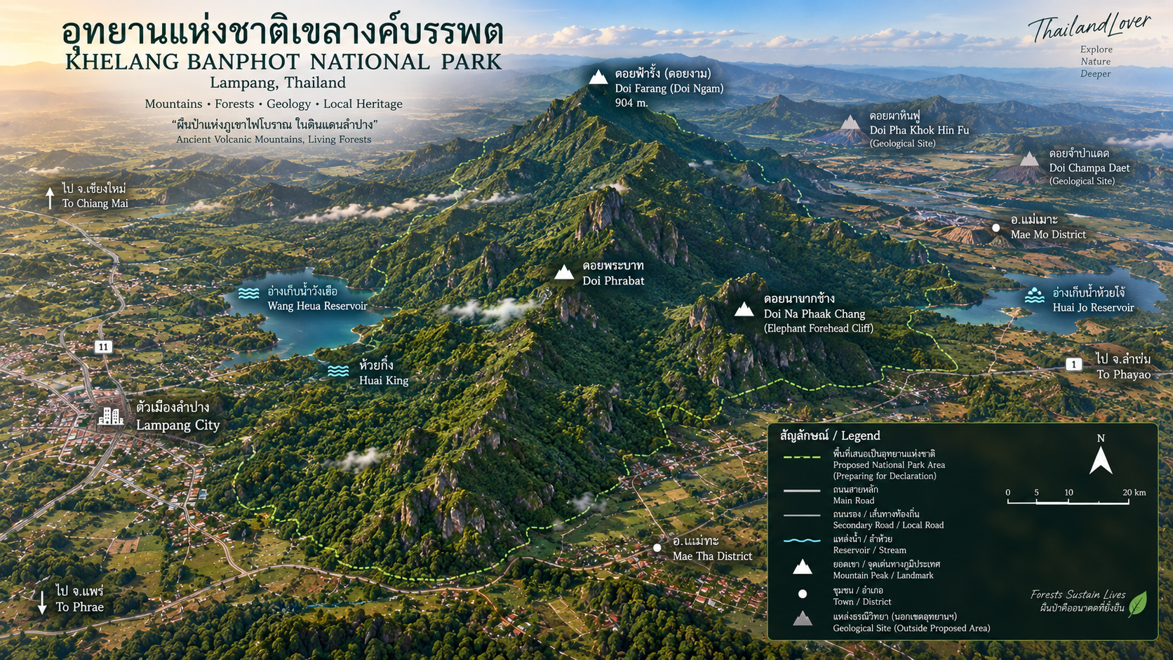
The range stretches broadly through Mueang Lampang, Mae Mo and Mae Tha — a forested mountain barrier between communities, agricultural land and the industrial landscape of Mae Mo. At its highest point, Doi Farang, the mountain rises to approximately 904 metres above sea level.
Climb the ridge. Look over the city. Discover the forest behind Lampang.
At a Glance
- Official Working Name
- Khelang Banphot National Park (Preparatory)
- Thai Name
- อุทยานแห่งชาติเขลางค์บรรพต (เตรียมการ)
- Province
- Lampang
- Districts
- Mueang Lampang, Mae Mo, Mae Tha
- Landscape
- Long north–south mountain ridge, dry dipterocarp forest, mixed deciduous forest, pine areas, streams and reservoirs
- Elevation
- Approximately 400–900 m across much of the surveyed landscape
- Highest Point
- Doi Farang / Doi Ngam — approximately 904 m
- Main Mountain
- Doi Phrabat
- Major Nature Trail
- Pha Chang Cliff – Kio Son – Doi Farang · approximately 4.5 km
- Major View Areas
- Doi Farang, Pha Chang Cliff, Mon Phraya Chae
- Reservoirs
- Huai Cho, Wang Hua / Wang Heua, Huai King
- Major Forest Types
- Deciduous dipterocarp and mixed deciduous forest
- Key Wildlife Reported
- Leopard cat, wild junglefowl, squirrels, civets, birds, reptiles and freshwater species
- Conservation Issue
- Forest fire, smoke haze, habitat protection and wildlife hunting
- Current Legal Status
- National Park (Preparatory)
The DNP’s 2025–2026 communications continue to identify the area as a preparatory national park.
Why “Khelang Banphot”?
The name carries a much older cultural identity than the modern conservation project. Khelang is associated with the historical name of Lampang, while Banphot means mountain or elevated massif.
The mountain landscape around Doi Phrabat and Mon Phraya Chae has long been part of Lampang’s cultural geography. Local cultural sources connect the mountain with the ancient name Khelang Banphot / Doi Ngam and with traditions surrounding sacred guardians of the mountain.
The mountain landscape of Khelang — the forested high ground overlooking Lampang.
A National Park Born from the Community
Khelang Banphot has an unusual origin story. The proposal to protect the forest did not begin simply as a government tourism project. It was strongly supported by communities surrounding Doi Phrabat.
For years, the mountain landscape faced recurring problems: forest fires, dry-season degradation, smoke haze, water scarcity, forest encroachment, hunting, and difficulty in maintaining a unified protection system. Local residents increasingly saw the forest as something that needed stronger long-term protection.
A civic network was formed to support the creation of Khelang Banphot as a national park. The proposal was unusual because local communities were actively asking the state to strengthen the area’s protection rather than opposing the creation of a protected area.
This community-driven origin is one of the most distinctive aspects of Khelang Banphot’s story.
Three Districts, One Forest Landscape
The proposed protected landscape extends across three districts of Lampang.
- Mueang Lampang
- The mountain rises directly behind the city and forms one of the most important natural backdrops to Lampang.
- Mae Mo
- The eastern side of the landscape meets the Mae Mo basin and the large-scale industrial and energy landscape associated with the district.
- Mae Tha
- The southern section contains forest and mountain terrain linking the protected landscape with surrounding rural communities.
The DNP’s 2022 survey specifically identified areas in Ban Sadet, Pichai, Phra Bat, Ban Dong, Mae Mo, Mae Tha and Hua Suea as part of the proposed establishment process.
The Mountain Ridge
Khelang Banphot is not a single isolated peak. It is a long mountain system, generally extending north–south. The terrain consists of larger mountain masses, smaller ridges, valleys, foothills, rolling terrain, steep forested slopes and exposed rock formations.
Survey information describes elevations broadly around 400–900 metres above sea level, with Doi Farang / Doi Ngam — approximately 904 metres forming the highest identified summit in the area.
The strongest visual identity of Khelang Banphot is its relationship with Lampang city. Unlike remote national parks where the nearest city may be hours away, Khelang Banphot rises almost immediately behind an urban centre: city → foothills → forest → mountain ridge → Doi Farang.
Lampang’s urban forest frontier.
Doi Farang — 904 Metres Above Lampang
Doi Farang is the defining high point of Khelang Banphot. From the summit, the landscape opens in two directions: Lampang city to one side, Mae Mo to the other.
On clear days, the contrast is striking. Below the mountain are settlements, roads, agricultural land and the urban landscape. Above them is forest. Doi Farang therefore offers something unusual: a high mountain viewpoint overlooking a living city rather than a remote wilderness.
The official DNP-featured description identifies the Pha Chang Cliff–Kio Son–Doi Farang nature trail as approximately 4.5 km, with Doi Farang providing views over both Mueang Lampang and Mae Mo.
Pha Chang Cliff, Kio Son and the 4.5-Kilometre Trail
Pha Chang — Elephant Cliff — is one of the distinctive landscape features along the Doi Farang trail. The cliff and exposed rock sections create a dramatic contrast with the surrounding dry forest. The landscape becomes particularly attractive during the cooler months, when visibility improves and the deciduous forest changes character.
From the higher sections of the route, visitors can begin to understand the geography of Khelang Banphot: Lampang below. Mae Mo beyond. Forest between them.
Kio Son is part of the mountain route connecting Pha Chang and Doi Farang. Rather than being a standalone major tourist attraction, it is best understood as a mountain passage and ecological section of the nature trail. The trail moves through forest, ridge terrain and changing elevation before reaching the Doi Farang summit. For hikers, this is where Khelang Banphot becomes more than a viewpoint. It becomes a mountain experience.
- Distance
- Approximately 4.5 km
- Character
- Mountain forest / ridge trail
- Main destination
- Doi Farang
- Main experience
- Forest + mountain terrain + Lampang panorama
- From Lampang
- The mountain is approximately 10 km from the city centre
This should not be interpreted as a simple urban walking trail. It is a mountain route. Visitors should prepare sufficient drinking water, proper hiking shoes, sun protection, insect protection, navigation or guide support when required, and appropriate weather awareness.
The Forests of Khelang Banphot
Khelang Banphot is particularly important as a dry-forest landscape. Research using remote sensing and field verification identified two principal forest types: deciduous dipterocarp forest and mixed deciduous forest. Deciduous dipterocarp forest covered the majority of the surveyed forest landscape during the study years, while mixed deciduous forest occupied a smaller area.
Khelang Banphot should not be described as a tropical rainforest. Its ecological character is much closer to the dry seasonal forests of northern Thailand.
- Deciduous dipterocarp forest
- Adapted to northern Thailand’s pronounced dry season. During the rains it is green, dense and productive. During the dry season it is dry, open and highly flammable: trees shed leaves, grasses dry, leaf litter accumulates, humidity falls — and fire becomes a major ecological and management challenge. A scientific study of the landscape found that fire hotspots occurred more frequently here than in mixed deciduous forest.
- Mixed deciduous forest
- Occurs where different tree species coexist with seasonal leaf fall. Compared with dry dipterocarp woodland, it can form denser vegetation and provide different habitats for wildlife. The combination of the two forest types creates habitat diversity — and different fire behaviour — across the mountain.
- Two-leaf pine
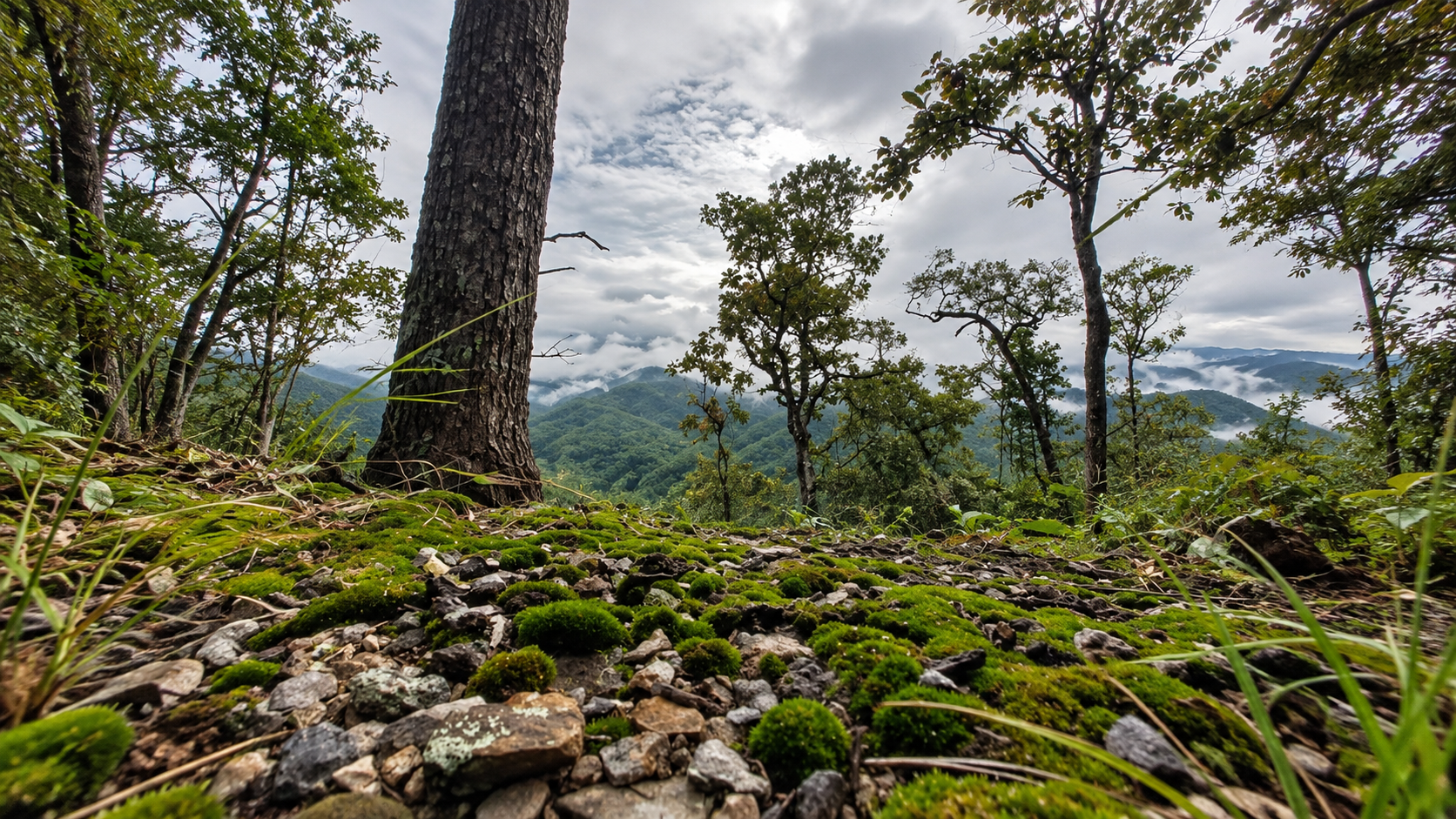
- Local descriptions of the proposed park identify Pinus kesiya / two-leaf pine areas among the attractions of the mountain landscape. The tall, straight pine trunks create a noticeably different atmosphere from the surrounding deciduous forest. In suitable seasons, pine trees, mountain ridge, cool air and morning mist create one of Khelang Banphot’s most photogenic environments.
Geology — Not a Volcanic Mountain Range
Some visual interpretations of Khelang Banphot can make the landscape appear volcanic. The available geological survey material does not support describing the area simply as an ancient volcanic mountain range.
Survey descriptions identify geological materials including shale, hard sandstone, sandstone, conglomerate and limestone, along with river and residual deposits. The landscape has been shaped by sedimentation → uplift → weathering → erosion → stream action, rather than being appropriately summarized as a volcanic landscape.
The lower landscape contains gently rolling terrain. Higher areas transition into hills, ridges, steep mountain slopes, exposed rock and narrow valleys. The geological survey description identifies surfaces left behind by erosion and weathering of the underlying rocks. The result is a landscape that changes dramatically over relatively short distances: rolling agricultural country from the foothills, mountain forest from the ridge, and a broad view over Lampang and Mae Mo from Doi Farang.
Water: The Hidden Value of Khelang Banphot
The forest is also a water system. Rain falling on the mountain does not simply disappear. It moves through forest soil, small streams, gullies, mountain creeks, reservoirs and downstream agricultural landscapes.
These water bodies are not simply recreational scenery. They form part of the human–forest relationship around the mountain.
- Huai Cho Reservoir
- Associated with the Mon Phraya Chae side of the protected landscape. The area has been used for camping, nature study, recreation and landscape viewing. The reservoir creates a strong visual contrast between water and the surrounding dry forest. During the cooler season, the area becomes particularly attractive for outdoor activities.
- Wang Heua Reservoir
- Also known as Wang Hua. Together with the mountain forests, the reservoir demonstrates the connection between forest conservation, water storage and the community landscape. It should be presented as part of the wider ecological and human landscape rather than simply as a tourist lake.
- Huai King
- Another stream and water feature associated with the proposed park landscape. During the wet season, mountain streams become more active. During the dry season, water availability becomes a much more critical ecological issue. This seasonal contrast is fundamental to understanding northern Thailand’s dry forests.
Wildlife, Birdlife and the Smaller Creatures
Khelang Banphot is not a large wilderness on the scale of Khao Yai or Kaeng Krachan. Its importance lies partly in its proximity to Lampang’s urban and agricultural landscape. Sightings are never guaranteed. Khelang Banphot is a living ecosystem, not a wildlife park.
- Leopard cat
- Prionailurus bengalensis. A small wild cat adapted to forest and mixed landscapes.
- Wild junglefowl
- Gallus gallus. One of the most characteristic ground birds of mainland Southeast Asian forests.
- Squirrels and civets
- Several squirrel species are associated with the forest. Civets are nocturnal mammals that can inhabit forest and agricultural interfaces, alongside other small forest-edge mammals.
- Birdlife
- Species reported in local documentation include wild junglefowl, red-whiskered bulbul and other local bulbuls, white-rumped shama and forest flycatchers, forest passerines and other seasonal woodland birds. Open woodland and mixed forest create different feeding niches. The best periods are generally early morning and late afternoon, when temperatures are lower and bird activity increases.
- Reptiles, amphibians and invertebrates
- Reported groups include agamid lizards, geckos, skinks, snakes, frogs, freshwater fish, insects, beetles and butterflies. Among the insects reported from local educational material are large beetles and forest insects, including rhinoceros beetle-type species. These species are not merely background details. They form the lower layers of the food web.
The Forest Fire Problem
For Khelang Banphot, conservation cannot be discussed without discussing fire. Northern Thailand experiences severe dry-season fire conditions. Khelang Banphot’s dry dipterocarp forest is particularly vulnerable because its vegetation becomes highly flammable during the dry season.
Research covering 2018–2020 found significant concentrations of fire hotspots in the forest and surrounding village areas. A scientific study specifically examining Khelang Banphot used satellite-derived vegetation indices and field verification. It classified the forest primarily into deciduous dipterocarp and mixed deciduous forest, and found that fire hotspots were more concentrated in deciduous dipterocarp forest — including significant fire activity around villages bordering the forest. The fire problem is not simply an abstract seasonal concern. It is measurable.
The issue is not only ecological. Smoke from northern Thailand contributes to PM2.5, reduced visibility, respiratory health concerns, disruption of tourism, agricultural impacts and broader regional haze.
The mountain’s position immediately beside Lampang makes its conservation unusually important. The forest forms a green belt between urban communities and the wider mountain landscape. In 2026, Lampang provincial authorities expanded surveillance infrastructure around Doi Phrabat, including a network of 54 CCTV cameras under the province’s fire and haze prevention programme. DNP also reported the deployment of a larger intelligent CCTV system in the preparatory park area for real-time fire detection.
This demonstrates that Khelang Banphot is now being managed not simply as a potential tourism destination but as an important urban-adjacent conservation and fire-management landscape.
The Forest as Lampang’s Natural Shield
Khelang Banphot stands directly beside the city. That creates an important ecological relationship. The forest stores carbon, supports wildlife, slows water runoff, protects soils, contributes to local watershed function, provides recreation, helps preserve landscape connectivity, forms a natural green backdrop to Lampang, and acts as a strategic area for fire and haze management.
The mountain functions as a buffer between different landscapes: Lampang’s urban area ↔ forest ↔ agricultural land ↔ the Mae Mo landscape. This makes conservation here strategically important. The mountain is effectively part of Lampang’s environmental infrastructure.
The value of the mountain is therefore much greater than the number of visitors it receives.
Mon Phraya Chae — The Cultural Gateway
Wat Mon Phraya Chae is one of the most culturally important landmarks associated with the Khelang Banphot landscape. The temple stands on a mountain associated with Doi Phrabat, Doi Ngam, Khelang Banphot and local religious traditions. It is known for its hilltop chedi and panoramic view over Lampang.
The Ministry of Culture’s cultural database describes Mon Phraya Chae as an old religious site of Lampang and records local traditions connecting the mountain with ancient legends of hermits and sacred relics.
According to local Buddhist tradition, five hermits accompanied the Buddha and were instructed to enshrine sacred relics at a mountain identified with Khelang Banphot. Another part of the legend tells of a ruler named Phaya Wuttho, who came seeking the knowledge of a hermit said to possess the ability to restore youth. The story eventually explains the name Mon Phraya Chae as a place associated with the ruler’s immersion in medicinal water.
This is local religious tradition and legend, not a historically verified account of the Buddha physically visiting the mountain. For ThailandLover, the correct presentation is therefore “according to local Buddhist tradition…” rather than presenting the legend as archaeological fact.
The Ministry of Culture describes the present chedi as having a Burmese-influenced appearance, with a square base, lotus-form architectural elements, a bell-shaped upper body, a tiered finial, a gilded umbrella and Buddha niches. The temple’s documented history includes reconstruction after earlier damage, including destruction associated with the World War II period.
Doi Phrabat — The Heart of the Conservation Story
Doi Phrabat is not merely another mountain name. It is central to the establishment story of Khelang Banphot. The forest around Doi Phrabat was the focus of community efforts to strengthen protection. Today, the Doi Phrabat landscape covers parts of Mueang Lampang, Mae Mo and Mae Tha, and is described by Lampang authorities as an important forest-conservation area.
Camping, Sunset and Stars on Earth
The Mon Phraya Chae area has camping facilities associated with the protected-area management system. Facilities reported by the DNP-featured 2025 description include a camping ground, toilets, electricity, parking and a viewpoint pavilion. From the viewpoint, Lampang’s city lights become visible after dark. This has given rise to the evocative description “Stars on Earth” — because the city lights below resemble a field of stars from the mountain.
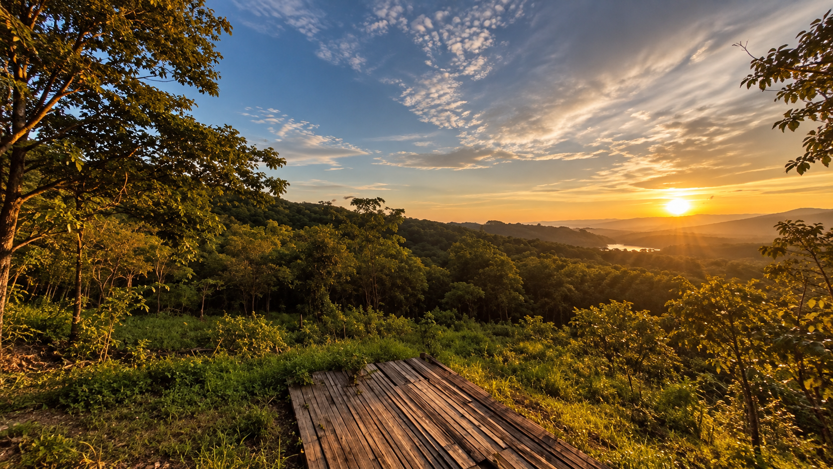
The mountain is particularly attractive in late afternoon. As the sun drops, the forest darkens, the valley turns gold, the city begins to illuminate, Mae Mo becomes a distant silhouette, and the mountain changes from a daytime landscape into a night panorama. For photographers, this transition is one of Khelang Banphot’s strongest experiences.
At night, the attraction is not artificial entertainment. It is perspective. From the high viewpoint, Lampang becomes a constellation. The city lights stretch across the valley. Above them: the actual stars. Below: the dark forest.
The Seasonal Personality of Khelang Banphot
- Cool season · November–January
- Generally the most comfortable period for hiking, camping, mountain viewpoints, photography, sunrise and mist. Dry forest becomes cooler and more pleasant.
- Hot season · February–May
- The most challenging season. Vegetation becomes dry, fire risk increases, and smoke haze can reduce visibility. This is also the period when conservation agencies intensify fire monitoring.
- Rainy season · June–October
- The forest becomes greener. Streams become stronger. The landscape becomes more humid. Trails can become slippery. Clouds and mist often add atmosphere to the mountain ridges.
The Best Time for Photography
- Sunrise · Doi Farang
- Mountain silhouettes, morning mist, Lampang panorama, soft light.
- Golden hour · Pha Chang / ridge areas
- Forest texture, mountain layers, backlighting.
- Sunset · Mon Phraya Chae viewpoint
- Lampang city, golden mountain light, blue-hour photography.
- Night · Mon Phraya Chae
- City lights, star-field contrast, long exposure.
Who Should Visit Khelang Banphot?
- Hikers
- The Pha Chang–Kio Son–Doi Farang route is the signature mountain experience.
- Photographers
- The combination of forest, mountain and city is unusual and highly photogenic.
- Birdwatchers
- Dry dipterocarp and mixed deciduous forests provide habitat for woodland birds.
- Campers
- Mon Phraya Chae and reservoir areas offer opportunities for outdoor stays, subject to current management conditions.
- Culture lovers
- Mon Phraya Chae adds an important cultural dimension to the mountain landscape.
- Responsible nature travellers
- Khelang Banphot is particularly suitable for travellers interested in conservation, because the destination is still developing and its environmental future remains part of the story.
Khelang Banphot Is Not Khao Yai
This distinction is important. Khao Yai is an established, nationally and internationally recognised large protected landscape. Khelang Banphot is a much smaller, urban-adjacent northern forest landscape still undergoing the legal process toward full national-park designation.
Its strength is different. Khao Yai says: “Enter the wilderness.” Khelang Banphot says: “Protect the forest beside the city.” That difference is precisely what makes it interesting.
Khelang Banphot represents a different model of conservation. It is not a remote wilderness surrounded by almost no human settlement. It is a forest surrounded by villages, farmland, roads, Lampang city, Mae Mo’s industrial landscape and community forests. This creates both opportunity and pressure. The forest must coexist with people.
Why National Park Status Matters
The proposed national-park designation is intended to provide a stronger long-term framework for forest protection, wildlife conservation, fire management, watershed protection, prevention of encroachment, ecological restoration, controlled recreation and environmental education.
The DNP began formal public participation around the proposed establishment process in 2022. As of 2026, however, the process is still not complete.
- Fire
- The most obvious threat. Dry dipterocarp forest is highly flammable in the dry season.
- Hunting
- Wildlife hunting remains a real enforcement issue. In March 2024, DNP officers reported an arrest involving illegal hunting of wild junglefowl in the Khelang Banphot preparatory park area, with the seizure of a carcass and firearm.
- Encroachment
- As with many forest landscapes near communities, boundary protection remains important.
- Haze
- Fire inside and around the forest affects Lampang’s air quality.
- Human–forest pressure
- The closer a protected forest is to people, the more complex its management becomes.
What Makes the Landscape Special?
Not one spectacular waterfall. Not one enormous peak. Not one famous animal. Its value comes from the combination.
- Mountains
- 400–900+ metres
- Forest
- Dry dipterocarp + mixed deciduous
- Water
- Streams + reservoirs
- Wildlife
- Small carnivores + birds + reptiles + forest mammals
- Culture
- Mon Phraya Chae + sacred mountain traditions
- City
- Lampang directly below
- Conservation
- A community-supported protected-area initiative
A Perfect Khelang Banphot Day
- Morning
- Start early. Head toward the mountain. Walk the Pha Chang – Kio Son – Doi Farang Trail. Allow sufficient time for the approximately 4.5-km route and mountain terrain. Reach Doi Farang and enjoy the view over Lampang and Mae Mo.
- Afternoon
- Descend toward Mon Phraya Chae. Visit the temple and viewpoint. Continue toward Huai Cho Reservoir for a quieter forest-and-water landscape.
- Evening
- Return to the mountain viewpoint. Watch Lampang turn from a city into a field of lights.
A two-day shape: Day 1 for mountain and forest — Pha Chang → Kio Son → Doi Farang → Lampang panorama → forest descent. Day 2 for culture, water and sunset — Mon Phraya Chae → Huai Cho → Wang Heua → Huai King → sunset viewpoint. This itinerary should be adapted to the current access and management rules of the preparatory park.
Responsible Travel
Because Khelang Banphot is still developing as a protected-area destination, responsible travel matters even more.
- Do not start fires — dry dipterocarp forest is highly vulnerable during the dry season
- Do not throw cigarette butts — one spark can become a forest fire
- Do not feed wildlife — wild animals should remain wild
- Do not hunt or collect wildlife — even apparently common animals are part of the ecosystem
- Do not collect plants — the forest belongs to the ecosystem
- Do not leave food waste — food can alter animal behaviour
- Stay on designated routes — especially around steep ridges and sensitive forest
- Respect local sacred sites — Mon Phraya Chae is not simply a viewpoint; it is a living cultural landscape
Khelang Banphot and the Future of Lampang
The future of Khelang Banphot is larger than tourism. It concerns a fundamental question: what kind of relationship should a northern Thai city have with the forest standing beside it?
Lampang needs clean air, water, forests, wildlife, recreation, cultural landscapes and climate resilience. Khelang Banphot sits at the intersection of all six.
If the establishment process is completed, Khelang Banphot could become one of Thailand’s most distinctive urban-adjacent national parks. Not because it is the largest. Not because it has the highest mountain. But because it would represent a rare conservation model: a national park shaped by the desire of surrounding communities to protect their own mountain forest.
That story deserves attention.
Essential Khelang Banphot
- Name
- Khelang Banphot National Park (Preparatory)
- Thai
- อุทยานแห่งชาติเขลางค์บรรพต (เตรียมการ)
- Province
- Lampang
- Districts
- Mueang Lampang, Mae Mo, Mae Tha
- Highest identified summit
- Doi Farang / Doi Ngam · approximately 904 m
- Main mountain
- Doi Phrabat
- Main trail
- Pha Chang Cliff – Kio Son – Doi Farang · approximately 4.5 km
- Forest types
- Deciduous dipterocarp + mixed deciduous · two-leaf pine areas
- Water features
- Huai Cho, Wang Heua, Huai King
- Cultural landmark
- Wat Mon Phraya Chae
- Wildlife reported
- Leopard cat, junglefowl, civets, squirrels, birds, reptiles, amphibians and freshwater species
- Main conservation issue
- Forest fire and seasonal haze
- Legal status in 2026
- National Park (Preparatory) — not yet a fully gazetted national park
ThailandLover Verdict
- Why go?
- To discover the mountain forest immediately behind Lampang and experience a protected landscape that is still emerging.
- Best for
- Hiking · Mountain views · Camping · Photography · Birdwatching · Forest · Local culture · Responsible travel
- Don’t miss
- Doi Farang · Pha Chang Cliff · Kio Son · Mon Phraya Chae · Huai Cho Reservoir · Wang Heua Reservoir · Huai King
- Best experience
- Walk the Pha Chang–Kio Son–Doi Farang route. Then watch Lampang light up beneath the mountain.
Frequently Asked Questions
- Is Khelang Banphot a fully gazetted national park?
- No. As of 2026, DNP still refers to the area as Khelang Banphot National Park (Preparatory). The establishment process had not yet reached final publication in the Royal Gazette.
- Where is Khelang Banphot?
- In Lampang, spanning Mueang Lampang, Mae Mo and Mae Tha. The mountain rises almost immediately behind the city. The DNP-featured trail is described as about 10 km from central Lampang.
- What is the highest point?
- Doi Farang / Doi Ngam, approximately 904 metres. The main mountain of the conservation story is Doi Phrabat.
- What is the main hiking trail?
- Pha Chang Cliff – Kio Son – Doi Farang, approximately 4.5 km. It is a mountain route, not a city walk. Bring water, proper shoes, sun and insect protection.
- When is the best time to visit?
- November–January is generally most comfortable. February–May is hotter, drier and more fire-prone. June–October is greener, with stronger streams and sometimes slippery trails.
- What wildlife might I see?
- Leopard cat, junglefowl, squirrels, civets, woodland birds, reptiles, amphibians and forest insects have been reported. Sightings are never guaranteed.
- How is it different from Khao Yai?
- Khao Yai is a large, established wilderness. Khelang Banphot is a smaller urban-adjacent northern forest still moving toward full national-park designation. Its story is: protect the forest beside the city.
- Why do the area figures differ?
- They are not interchangeable legal boundaries. Documents cite about 94,380 rai (2022 survey), 49,238 rai (2025 preparatory process) and about 70,000 rai around Doi Phrabat (Lampang agencies, 2026).
Related Destinations
- Chae Son National Park
- Lampang’s established mountain park of hot springs, waterfalls and highland forest — a different face of the same province.
- Tham Pha Thai National Park
- Cave, teak forest and limestone country in Lampang, another northern landscape close to the city.
- Doi Khun Tan National Park
- The railway mountain between Lamphun and Lampang — forest walking with a different northern signature.
- Doi Luang National Park
- A larger northern mountain forest spanning Lampang, Phayao and Chiang Rai.
- Nature & Parks
- More protected landscapes across ThailandLover’s national-park collection.
Location
Find Khelang Banphot
Phichai Subdistrict, Mueang Lampang District, Lampang 52000