


National Park · Kanchanaburi
Khao Laem National Park
อุทยานแห่งชาติเขาแหลม
Deep Forests. A Vast Lake. The Wild Heart of Western Thailand.
Kanchanaburi · Thong Pha Phum & Sangkhla Buri
A vast protected landscape of limestone mountains, evergreen forest, waterfalls and the enormous Vajiralongkorn Reservoir — where forest, water and mountains become one.
Where the Landscape Becomes the Experience
There are places in Thailand that you visit for a waterfall. There are places you visit for a mountain. And then there are places where the landscape itself becomes the experience.
Khao Laem National Park is one of them.
Stretching across the mountainous western edge of Kanchanaburi, close to the Myanmar frontier, Khao Laem is a vast protected landscape of limestone mountains, evergreen forests, streams, waterfalls and the enormous Vajiralongkorn Reservoir.
Here, mountains do not simply surround a lake. They fold into it. Peninsulas disappear beneath the water. Forested ridges rise again as islands. Rivers and streams descend from the mountains into the reservoir. Mist settles between the hills. And deep inside the forest, trails lead to waterfalls that require time, effort and a willingness to leave the road behind.
This is not a polished postcard version of Thailand. It is a wilder one.
Khao Laem is Thailand at its most expansive — where forest, water and mountains become one landscape.
At a Glance
- Official Name
- Khao Laem National Park
- Thai Name
- อุทยานแห่งชาติเขาแหลม
- Province
- Kanchanaburi
- Districts
- Thong Pha Phum and Sangkhla Buri
- Region
- Western Thailand
- National Park
- 67th national park of Thailand
- Established
- 5 December 1991
- Area
- 935,584.69 rai / approximately 1,497 km²
- Highest Point
- San Nok Wua · approximately 1,767 m
- Major Water Body
- Vajiralongkorn Reservoir
- Main Highway
- Route 323, Thong Pha Phum–Sangkhla Buri
- Ecosystem
- Western Forest Complex
Official provincial planning data records the park at 935,584.69 rai within Thong Pha Phum and Sangkhla Buri. It belongs to the Western Forest Complex, one of Thailand’s most important connected protected landscapes.
Where Khao Laem Really Is
Khao Laem occupies a strategic position in western Thailand. The park lies in the Tenasserim mountain system, extending along the mountainous region toward the Myanmar border.
Its landscape is very different from the flat agricultural plains of central Thailand. Mountains dominate the horizon. Long ridges run through the park, while limestone formations and forested slopes create a complex network of valleys and watersheds.
The national park is adjacent to other major protected areas, including:
- Thungyai Naresuan Wildlife Sanctuary
- Lam Khlong Ngu National Park
- Thong Pha Phum National Park
Together, these protected areas form part of an exceptionally important wildlife and forest landscape in western Thailand. Khao Laem is therefore not an isolated patch of forest. It is part of a much larger ecological system.
A National Park Built Around Water
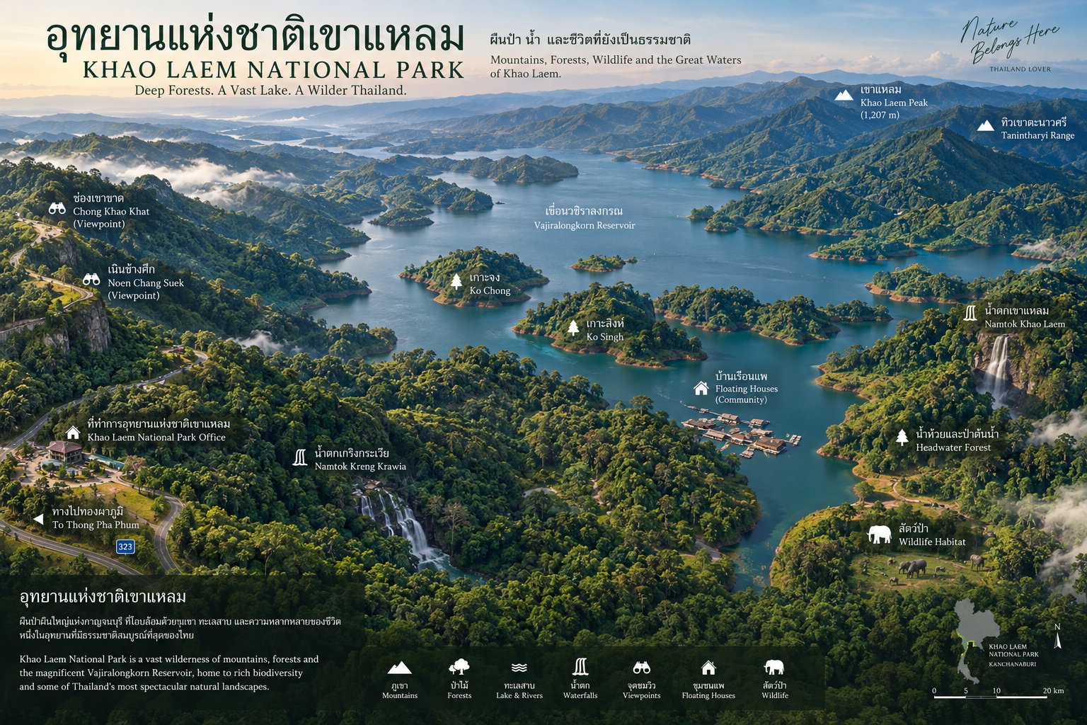
The defining geographical feature of Khao Laem is the Vajiralongkorn Reservoir, historically known as the Khao Laem Reservoir. It was created following construction of the Vajiralongkorn Dam across the Khwae Noi River in the 1980s.
Today the enormous body of water occupies a major part of the surrounding landscape. From above, it creates a remarkable geography:
mountains → forest → water → forested islands → mountains again.
The reservoir extends toward Sangkhla Buri, creating countless bays, inlets and drowned valleys. What looks like a chain of islands is often the upper portions of former mountain ridges left above the water after the valleys were flooded.
This is one reason the Khao Laem landscape looks so different from a conventional lake. It is essentially a mountain landscape transformed into a vast inland water system.
Vajiralongkorn Dam
The dam is one of the major engineering landmarks of Kanchanaburi: a rockfill dam with a reinforced-concrete facing, approximately 92 metres high and 1,019 metres long along its crest.
For travellers, the engineering structure is only one part of the story. Boats move between communities. Floating accommodation sits above the water. Forest-covered hills rise around the shoreline. Sunlight changes the colour of the reservoir throughout the day. During the dry season, changing water levels can dramatically alter the appearance of the exposed shoreline.
The reservoir is not simply a dam lake. It is one of the defining geographical features of modern Khao Laem.
The Mountains of Khao Laem
Khao Laem is fundamentally a mountain park. The terrain consists largely of steep, rugged ranges with significant limestone formations. Elevations vary dramatically, creating different environmental conditions across relatively short distances.
The mountains also perform an essential ecological function. Rain falling on the forest is absorbed and released through streams and waterways, feeding the Khwae Noi system and the Vajiralongkorn Reservoir.
The park is therefore both a wildlife habitat and a watershed. Protecting the forest matters far beyond the boundary of the national park itself.
San Nok Wua
สันนกหว้า · The Highest Peak of Khao Laem
Located in the Khao Khiao–Khao Yai forest area of Sangkhla Buri, San Nok Wua rises to approximately 1,767 metres above sea level. It is the highest summit within Khao Laem National Park and the highest mountain in Kanchanaburi Province.
The name comes from the distinctive shape of the summit. From certain angles, the ridge resembles the raised hump on the back of a cow — “san nok wua,” literally the ridge of a cow’s hump.
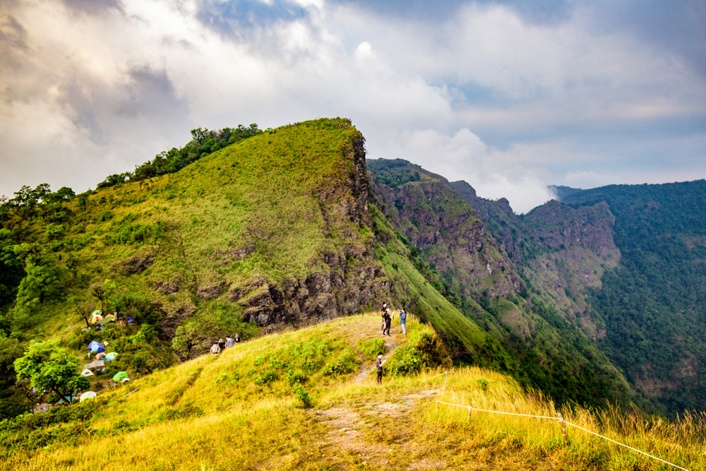
From the upper ridge, the landscape opens in every direction. Mountain ranges extend toward the horizon. The Vajiralongkorn Reservoir appears far below. On suitable mornings, clouds gather beneath the ridge and create a classic western Thailand sea of mist.
Mountains floating above clouds, with the reservoir appearing between them.
The San Nok Wua Trail
The long-distance nature trail is approximately 9 kilometres and climbs from roughly 983 metres toward the summit. It crosses several forest environments:
- Tropical rainforest
- Mixed deciduous forest
- Bamboo forest
- Hill evergreen forest
- Grassland
The journey is therefore not simply a climb. It is a transition through ecosystems. The government public-relations office has described the trail as physically demanding, with approximately six hours required to reach the summit under typical conditions. Access is controlled and seasonal.
This is not a casual viewpoint walk. It is a genuine mountain trek.
The View from San Nok Wua
The summit provides an expansive 360-degree panorama. On clear days, the surrounding mountain systems stretch across the western horizon. Below them lies the reservoir. During misty conditions, the valleys disappear beneath cloud. At sunrise and sunset, altitude, mist and layered mountains can create some of the most dramatic scenery in Kanchanaburi.
The weather is never guaranteed. That is part of the character of San Nok Wua.
You climb the mountain for the landscape. The mountain decides what you will actually see.
Waterfalls of Khao Laem
Streams cut through forest and limestone across the park. Some falls sit beside the highway. Others require a full day’s walk. Together they show how rain, mountain and reservoir are connected.
- Kra Teng Jeng Waterfall
- น้ำตกกระเต็งเจง. Unlike an easily accessible roadside waterfall, Kra Teng Jeng is fundamentally a forest trekking experience. The system contains approximately 23 levels along a trail of around 2 kilometres. Some sections are narrow and enclosed by vegetation; others open into rock pools. Visitors pass through bamboo, banana vegetation, evergreen forest and mixed deciduous forest — ecology at walking speed, not simply a photograph stop.
- A Giant Tree on the Trail
- One memorable feature along the Kra Teng Jeng route is a large tree whose trunk requires many people standing together to encircle it. Exact dimensions vary depending on where and how they are measured. The important point is simple: this is old forest — the difference between a landscaped tourist attraction and a living forest system.
- The Upper Viewpoint
- After climbing through the forest, the landscape opens toward the reservoir. At the bottom you hear water. Higher up, you see the entire mountain-and-water system. That transition is what makes the trail special.
- Kroeng Krawia Waterfall
- น้ำตกเกริงกระเวีย. If Kra Teng Jeng is the adventurous side of Khao Laem, Kroeng Krawia is its accessible side. Close to Highway 323, it is a relatively small waterfall. Its charm is atmosphere: water flowing over limestone and rocks in multiple small cascades, pools surrounded by trees and exposed roots. Park the car. Walk into the forest. Listen to the water. Continue the journey.
- Kroeng Krawia Pond
- Near the waterfall is a wetland and pond surrounded by vegetation — habitat for birds and other wildlife. For birdwatchers, the quieter wetland can be more interesting than the waterfall itself. Not dramatic. Not loud. Biologically active.
- Dai Chong Thong Waterfall
- น้ำตกไดช่องทอง. Water descending through limestone cascades toward the lower landscape of the Vajiralongkorn Reservoir. Local and provincial tourism information describes a multi-tiered limestone waterfall surrounded by forest. Here the hydrological story becomes visible: rain → forest → stream → waterfall → reservoir.
- Pha Tak Waterfall
- น้ำตกผาตาก. Recorded as a five-tier waterfall. Unlike San Nok Wua or Pom Pee, Pha Tak represents the quieter side of Khao Laem. It belongs to the forest rather than the tourism spotlight.
- Pha Taek Waterfall
- น้ำตกผาแตก. Associated with the longer-distance trekking side of the park — not the easily accessible falls near Highway 323. The park has historically imposed seasonal closures because of environmental and safety conditions. Seasonal schedules have listed Pha Taek, along with San Nok Wua and Dai Chong Thong, among attractions subject to restrictions. Check current conditions with the park before departure.
Pom Pee Viewpoint
จุดชมวิวป้อมปี๋ · The Iconic Lakeside Khao Laem
If San Nok Wua represents the high mountains, Pom Pee represents the park’s relationship with water. It sits beside the Vajiralongkorn Reservoir, approximately 2 kilometres from headquarters along Route 323.
The setting is remarkably simple. Forest-covered mountains on one side. A vast reservoir on the other. Between them: a grassy lakeside landscape. It is one of the best places in Khao Laem to slow down.
Sunset at Pom Pee
As the sun drops behind distant mountain ridges, the reservoir reflects the changing colours of the sky. The surrounding mountains become silhouettes. The water becomes darker. The landscape gradually becomes quiet.
This is not a viewpoint that requires dramatic architecture. The landscape does all the work.
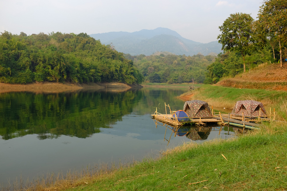
Camping Beside the Reservoir
The combination of open grassland, reservoir and mountains makes Pom Pee one of Khao Laem’s most attractive places for travellers who want to stay close to nature. Depending on current park regulations and water conditions, activities around the reservoir can include:
- Camping
- Birdwatching
- Boating
- Kayaking or paddling
- Lakeside relaxation
- Fishing where permitted
- Sunset watching
Facilities and permissions can change. Confirm current conditions with the park before planning a specific activity.
Wang Pato Viewpoint
จุดชมวิววังปะโต · A Quieter Lakeside Corner
Wang Pato is managed through the park’s Huai Khayeng protection unit and sits beside the reservoir in Thong Pha Phum District. The Tourism Authority of Thailand describes it as a quiet lakeside area suitable for camping and watching the sunset.
Compared with Pom Pee, Wang Pato is better understood as a quieter alternative for travellers seeking space and a slower atmosphere.
Forest Types
Khao Laem is not one uniform forest. Changing elevation and moisture create several different environments — one reason the park supports such a diverse range of wildlife.
- Mixed deciduous forest
- Found across parts of the lower and middle elevations. Trees shed leaves during the dry season, changing the appearance of the forest throughout the year.
- Dry evergreen forest
- A more continuously green environment with greater moisture retention.
- Hill evergreen forest
- Associated with higher elevations and cooler, wetter conditions.
- Bamboo forest
- Particularly noticeable along some trekking routes.
- Grassland
- Open areas occur naturally in parts of the mountain landscape and are particularly noticeable along higher trekking routes.
Wildlife
Khao Laem belongs to one of the most important wildlife regions in Thailand. The wider Western Forest Complex supports large mammals and other species requiring extensive connected forest.
- Asian elephant
- Gaur
- Sambar deer
- Barking deer
- Wild boar
- Bears
- Numerous bird species
- Reptiles, amphibians and freshwater fish
A single national park boundary is rarely enough for large mammals. The connected forests surrounding Khao Laem provide the scale needed for wildlife movement and long-term conservation.
Elephants in the Western Forest
The western forests of Thailand are among the country’s most important habitats for Asian elephants. Visitors should understand that seeing an elephant inside Khao Laem is not a guaranteed tourism experience.
That is a good thing. Wild elephants are not attractions to be chased. They are wild animals moving through their own habitat. Keep distance. Do not feed wildlife. Do not attempt to approach animals for photographs. Follow ranger instructions.
The correct experience is to recognize that you are entering a landscape where large wildlife still exists.
Birdwatching
The mixture of forest, reservoir, streams and wetland habitats creates opportunities for birdwatching. The lakeside environment around Pom Pee and the Kroeng Krawia wetland can be particularly interesting. Species reported in the broader environment include hornbills, kingfishers and a wide range of forest birds.
Go early. Move quietly. Look beyond the obvious. In a forest this large, the birds are rarely waiting for the visitor.
The Western Forest Complex
One of Thailand’s Most Important Conservation Landscapes
Khao Laem should not be viewed independently from the forests surrounding it. The park is part of the Western Forest Complex (WEFCOM) — a system that extends through the Tenasserim and Dawna mountain region and contains habitats capable of supporting species that have disappeared from more fragmented landscapes elsewhere.
The waterfalls are beautiful. The lake is beautiful. The mountains are beautiful. Underneath all of that is something more important:
habitat.
The Human Landscape
Khao Laem is not an empty wilderness. The wider landscape around the park has long been home to communities, including Mon and Karen communities, particularly around Sangkhla Buri and the reservoir.
The mountains are not simply scenery. They are lived landscapes. People have traveled through these valleys, cultivated land, traded across the frontier region and built communities here for generations.
Sangkhla Buri and the Reservoir
The creation of the Vajiralongkorn Reservoir dramatically changed the geography of the Sangkhla Buri area. Several settlements were affected. Communities were relocated. Valleys became a vast body of water. Remnants of the former landscape can still appear depending on water levels — particularly around the famous sunken temples of Sangkhla Buri.
The submerged landscape is not technically the same thing as the national park’s natural attractions, but it is an essential part of understanding the Khao Laem destination.
The Sunken Temples
Among the most famous cultural features of the wider reservoir landscape are the remains of old temples associated with former communities. The best known is Wat Wang Wiwekaram Kao, often called the Sunken Temple or Wat Samprasop.
There were villages here. There were temples. There were roads and communities. Then the valley became water. During periods when the reservoir level falls sufficiently, parts of the old structures become visible — an extraordinary landscape where archaeology, memory and modern infrastructure overlap.
Best understood as cultural heritage of the wider Sangkhla Buri–Vajiralongkorn Reservoir landscape, rather than simply as attractions inside the national park.
Mon Bridge — Uttamanusorn Bridge
The famous Uttamanusorn Bridge, commonly known as Mon Bridge, connects the communities around Sangkhla Buri and is one of the cultural icons of the region. It is closely associated with the Mon community.
Mon Bridge is part of the wider Khao Laem / Sangkhla Buri destination, not a natural attraction inside the national park boundary. That distinction matters when presenting Khao Laem accurately.
Khao Laem and the Myanmar Frontier
The park’s western location gives it another layer of geographical significance. The mountain landscape extends toward the Thai–Myanmar frontier. Historically, these mountains formed natural corridors through which people, wildlife and trade moved. Today the border remains an important geographical feature of the region.
The combination of rugged terrain, forest and relatively remote communities contributes to the distinctive character of western Kanchanaburi. Khao Laem feels remote partly because it is.
Three Pagodas Pass
Three Pagodas Pass lies farther north in Sangkhla Buri District near the Myanmar border. The pass has long been an important route through the Tenasserim mountains, connecting territories on either side of the present international border. The three small pagodas that give the pass its name are a cultural landmark.
Three Pagodas Pass belongs to the wider Sangkhla Buri destination rather than being presented as a core natural attraction of Khao Laem National Park.
What Makes Khao Laem Different?
Several very different experiences exist within one geographical system.
- The Mountain
- San Nok Wua rises to approximately 1,767 metres.
- The Forest
- Large areas remain protected and connected to the Western Forest Complex.
- The Water
- The Vajiralongkorn Reservoir dominates the central landscape.
- The Waterfalls
- Kra Teng Jeng, Kroeng Krawia, Dai Chong Thong and other falls cut through the forest.
- The Viewpoints
- Pom Pee and Wang Pato reveal the relationship between mountain and reservoir.
- The Wildlife
- The surrounding protected forests support large mammals and diverse birdlife.
- The Culture
- Mon and Karen communities form an important part of the wider landscape.
- The Memory
- The reservoir itself changed the geography of settlements and temples.
It is easy to look at photographs and think: beautiful lake, beautiful mountains. That only captures the surface. The reservoir is connected to the forest. The forest is connected to the mountains. The mountains are connected to the watershed. The watershed is connected to communities. And the communities are connected to a landscape that has changed dramatically within living memory.
Khao Laem is best understood as a living geographical system.
The Best Experiences
- 01 — Watch the sunset at Pom Pee
- Sit beside the reservoir as the sun disappears behind the mountains. No elaborate itinerary required. Just time.
- 02 — Trek to San Nok Wua
- For serious hikers, the summit offers one of the most spectacular highland experiences in Kanchanaburi. The reward is not simply the summit. It is the journey through multiple forest ecosystems and the possibility of seeing the reservoir from above.
- 03 — Walk Kra Teng Jeng
- Follow the stream into the forest. Cross changing terrain. Listen to the waterfall. Experience Khao Laem at walking speed.
- 04 — Stop at Kroeng Krawia
- An easy roadside nature stop for travellers heading toward Sangkhla Buri. Small scale. Very green. Very peaceful.
- 05 — Explore the reservoir
- Where permitted, explore the lake by boat or paddle. From the water, the mountains rise around you. The forest reaches down to the shoreline. The reservoir seems much larger than it appears from land.
- 06 — Discover the wider Sangkhla Buri landscape
- Combine the national park with Mon Bridge, the old sunken temples, local Mon communities, Three Pagodas Pass and the reservoir. These places are not interchangeable with the park, but together they create the broader Khao Laem–Sangkhla Buri experience.
When to Visit
Khao Laem has a tropical monsoon climate influenced by the western mountain system and moisture from the Andaman side.
- Rainy season · June–October
- The forest becomes intensely green. Streams and waterfalls become more powerful. Trails can become slippery and difficult. Leeches may be encountered on wet forest trails. Some remote routes are seasonally closed for safety and environmental protection.
- Cooler season · November–February
- Generally the most comfortable period for mountain trekking and camping. Early mornings can be cold at higher elevations. A favoured period for sea-of-mist conditions at high viewpoints such as San Nok Wua.
- Hot season · March–May
- The lower landscape becomes warmer and drier. Water levels in the reservoir can change considerably. The forest may appear less lush, but clear mountain views can still be excellent.
The Sea of Mist
Khao Laem’s sea of mist is not a permanent geographical feature. It is weather. Mist forms when moisture, temperature and atmospheric conditions align. At high elevations such as San Nok Wua, visitors may find themselves above a layer of cloud in the early morning.
The effect can be spectacular. It should never be promised as a guarantee.
Come for the mountain. If the weather gives you the mist, consider it a gift.
Responsible Travel
Khao Laem is a serious conservation landscape. Visitors should treat it accordingly.
Do
- Stay on designated trails
- Follow ranger instructions
- Carry out all rubbish
- Use designated camping areas
- Keep noise low
- Respect local communities
- Observe wildlife from a safe distance
- Check seasonal trail closures before travelling
Do not
- Feed wildlife
- Approach wild elephants or other large animals
- Collect plants, rocks or other natural objects
- Leave plastic or food waste
- Enter closed trails
- Play loud music in forest areas
- Assume a photograph is worth risking your safety
Leave the forest as you found it — or better.
The Khao Laem Distinction
For anyone creating serious travel content, one distinction is essential.
Khao Laem National Park is not the same thing as the entire Khao Laem–Sangkhla Buri destination.
Inside / directly associated with the national park
- San Nok Wua
- Kra Teng Jeng Waterfall
- Kroeng Krawia Waterfall
- Dai Chong Thong Waterfall
- Pha Taek Waterfall
- Pom Pee
- Wang Pato
- Vajiralongkorn Reservoir landscape
- Extensive protected forest
Wider Sangkhla Buri destination
- Mon Bridge
- Wat Wang Wiwekaram
- Old Wat Wang Wiwekaram / Sunken Temple
- Three Pagodas Pass
- Mon communities
- Karen communities
- Sangkhla Buri town
- Other reservoir communities
This distinction prevents the common mistake of placing every famous attraction around Sangkhla Buri inside the national park.
Why Khao Laem Matters
Stand at Pom Pee and look across the reservoir. You see water. Look beyond it. You see mountains. Look at the mountains. You see forest. Follow the forest upward. You eventually reach San Nok Wua.
Now imagine the rain falling on that mountain. It enters the forest. It becomes streams. The streams become waterfalls. The water eventually reaches the reservoir. That reservoir supplies water and supports communities.
Everything is connected.
Khao Laem protects forests that provide habitat for wildlife; watersheds that feed major rivers and reservoirs; mountain ecosystems that connect protected areas across western Thailand; wildlife corridors that allow animals to move through a larger connected landscape; and water resources that support communities. It also protects something less measurable:
a landscape that still feels genuinely wild.
Essential Khao Laem
- Destination
- Khao Laem National Park
- Thai
- อุทยานแห่งชาติเขาแหลม
- Province
- Kanchanaburi
- Districts
- Thong Pha Phum and Sangkhla Buri
- Area
- 935,584.69 rai / approximately 1,497 km²
- Established
- 5 December 1991 · 67th national park
- Landscape
- Tenasserim mountain system
- Highest Summit
- San Nok Wua · approximately 1,767 m
- Major Water System
- Vajiralongkorn Reservoir
- Signature Viewpoint
- Pom Pee
- Signature Trek
- San Nok Wua
- Signature Waterfall Trek
- Kra Teng Jeng
- Accessible Waterfall
- Kroeng Krawia
- Nearby Cultural Centre
- Sangkhla Buri
- Main Access Route
- Highway 323
- Character
- Wilderness + water + mountains + culture
Frequently Asked Questions
- What is Khao Laem National Park?
- Thailand’s 67th national park, established on 5 December 1991 in Kanchanaburi. About 935,584 rai (1,497 km²) of mountains, forest, waterfalls and the Vajiralongkorn Reservoir across Thong Pha Phum and Sangkhla Buri.
- Is Mon Bridge inside the national park?
- No. Mon Bridge, the sunken temples and Three Pagodas Pass belong to the wider Sangkhla Buri destination, not as core natural attractions inside the park boundary.
- How difficult is San Nok Wua?
- About 9 kilometres, climbing from roughly 983 metres to 1,767 metres. Typical conditions require around six hours to the summit. Access is controlled and seasonal — a genuine mountain trek, not a casual viewpoint walk.
- When is the best time to visit?
- November–February is generally most comfortable for trekking and camping, and a favoured time for sea of mist. June–October makes waterfalls stronger, but trails can be slippery and some remote routes close.
- Can I see wild elephants?
- Not as a guaranteed experience. Wild elephants move through the Western Forest Complex on their own terms. Keep distance, do not feed wildlife, and follow ranger instructions.
- How do I contact the park?
- Published contacts include 0 3454 6802 (VoIP) and 0 3453 2099. Headquarters are associated with Thong Pha Phum, Kanchanaburi 71180, along Highway 323.
Related Destinations
- Thong Pha Phum National Park
- The neighbouring western forest — another piece of the connected mountain landscape beside Khao Laem.
- Lam Khlong Ngu National Park
- Caves, forest and limestone country adjoining Khao Laem in Kanchanaburi.
- Sai Yok National Park
- River, forest and waterfalls farther down the Khwae Noi — another face of western Kanchanaburi.
- Erawan National Park
- Kanchanaburi’s famous seven-tier waterfall — a more visited counterpart to Khao Laem’s wilder lake-and-mountain country.
- Nature & Parks
- More protected landscapes across ThailandLover’s national-park collection.
Location
Find Khao Laem National Park
Highway 323, Thong Pha Phum–Sangkhla Buri, Kanchanaburi 71180