


Nature & Parks · Kanchanaburi
Sai Yok National Park
อุทยานแห่งชาติไทรโยค
Rivers, Waterfalls, Limestone Caves & the Living Landscape of the Death Railway
Kanchanaburi Province · Western Thailand
A waterfall that meets the Khwae Noi River, caves that shelter the world’s smallest mammal, and forest that still holds the traces of the Thailand–Burma Railway — a landscape to explore slowly.
Where Nature and History Meet
There are places in Thailand where nature and history are inseparable. Sai Yok National Park is one of them.
Set among the forested mountains of western Kanchanaburi, the park follows the landscape of the Khwae Noi River, where limestone cliffs, waterfalls, caves and dense forest meet one of the most significant historical landscapes of World War II in Thailand.
Here, a waterfall can plunge directly toward the river. A limestone cave can shelter one of the world’s smallest mammals. And deep in the surrounding forest, traces of the Thailand–Burma Railway, commonly known as the Death Railway, remain as reminders of a much darker chapter in the region’s history.
Sai Yok is not simply a waterfall destination. It is a landscape to explore slowly — by river, forest trail, cave and railway history.
Sai Yok at a Glance
- ~500 km²
- 312,500 rai originally gazetted across Sai Yok and Thong Pha Phum.
- ~1,327 m
- Khao Khwae — the park’s highest point.
- 19th
- Thailand’s national park number, gazetted 27 October 1980.
- 1.5–2 g
- Kitti’s hog-nosed bat — the world’s smallest mammal, discovered here.
- Official name
- Sai Yok National Park
- Thai name
- อุทยานแห่งชาติไทรโยค
- Province
- Kanchanaburi
- Districts
- Sai Yok & Thong Pha Phum
- Established
- 27 October 1980 · Thailand’s 19th national park
- Gazetted area
- 312,500 rai · approximately 500 km²
- Highest point
- Khao Khwae — approximately 1,327 m
- Landscape
- Mountains, limestone terrain, forest, caves & the Khwae Noi River
- Signature experiences
- Waterfalls, caves, river landscapes, wildlife & World War II heritage
Why Sai Yok Is Special
Sai Yok has a character very different from Thailand’s high-altitude mountain parks. Its identity comes from the relationship between river, forest and limestone.
The Khwae Noi River passes through the protected landscape, while mountain ranges rise on either side. Most of the terrain lies at roughly 300–600 metres above sea level, but the park rises considerably higher in the surrounding mountains, with Khao Khwae reaching approximately 1,327 metres. The western side of the park meets the Thailand–Myanmar border.
A remarkably varied landscape
- Limestone caves
- Forest-covered mountains
- River valleys
- Waterfalls
- Natural streams
- Wildlife habitat
- Historical railway remains
- Former World War II sites
The attraction is not one single viewpoint. Sai Yok works best as a landscape journey.
The Khwae Noi River
The river that gives Sai Yok its rhythm
The Khwae Noi River is one of the defining features of Sai Yok. Rather than simply passing beside the park, the river is deeply integrated into its landscape and history. Numerous streams and tributaries descend from the surrounding mountains and feed the river system.
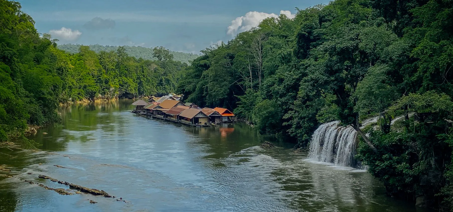
The river also provides the setting for one of Sai Yok’s most distinctive travel experiences: seeing the forest from the water. River journeys and floating accommodation are particularly associated with this part of Kanchanaburi, letting visitors experience the limestone hills and forested banks from a completely different perspective.
This is one of the places where the journey itself is part of the destination.
Sai Yok Yai Waterfall
A waterfall that meets the river
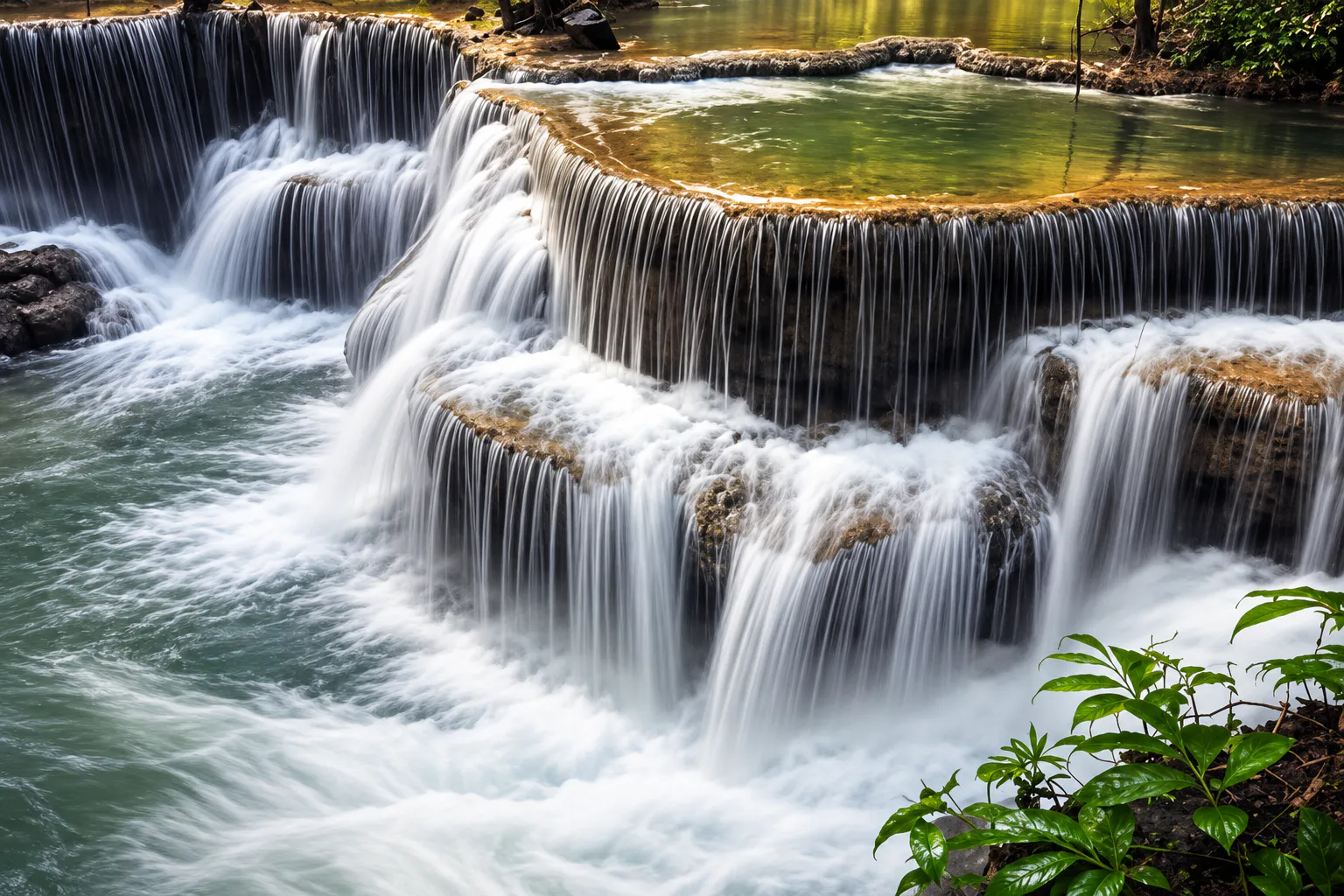
Sai Yok Yai Waterfall is one of the park’s signature natural landmarks. Unlike many Thai waterfalls that fall into an inland pool, Sai Yok Yai descends toward the Khwae Noi River, creating an unusually intimate relationship between waterfall and river landscape.
The surrounding forest and limestone scenery make the waterfall particularly atmospheric during periods of stronger flow. The experience is less about standing in front of a huge vertical cascade and more about seeing water, forest and river occupy the same landscape.
Best for
- Nature photography
- Riverside scenery
- Forest atmosphere
- Combining with a river excursion
- A relaxed stop rather than a strenuous hike
Water levels vary considerably with rainfall and season, so the character of the waterfall changes throughout the year.
Sai Yok Noi Waterfall
Also known as Khao Phang Waterfall
Sai Yok Noi Waterfall, also called Khao Phang Waterfall, is another famous waterfall associated with the Sai Yok area. It sits along the main route through Sai Yok and is particularly accessible for travellers exploring Kanchanaburi by road or railway.
It is much smaller in scale than Thailand’s major multi-tier waterfalls, but its accessibility and setting have made it a popular stop on the way deeper into western Kanchanaburi.
Limestone Caves
A hidden world beneath the forest
Sai Yok’s limestone landscape creates another of the park’s defining characteristics: caves. Several cave systems occur within the park and surrounding protected landscape, from relatively accessible caves to deeper chambers decorated with stalactites and stalagmites.
Tham Lawa · Lawa Cave
One of the most impressive cave systems associated with Sai Yok. Lawa Cave extends for approximately 500 metres and contains several large chambers of stalactites and stalagmites.
Instead of wide open landscapes, you enter a dark limestone environment shaped slowly by water over geological time — ideal for travellers interested in karst geology, cave formations, photography and natural history.
Tham Dao Wadueng
Dao Wadueng Cave contains multiple chambers with stalactite and stalagmite formations. Earlier exploration records describe approximately eight chambers, making it rewarding for travellers who want to go beyond the park’s better-known waterfalls.
Access conditions can vary. Cave visits should always follow current instructions from park staff.
The World’s Smallest Mammal
Kitti’s hog-nosed bat · Craseonycteris thonglongyai
One of Sai Yok’s most remarkable biological stories concerns an animal that is almost impossibly small. Kitti’s hog-nosed bat, commonly known as the bumblebee bat, is recognised as the world’s smallest mammal by body mass.
The species was discovered in the Sai Yok area in 1973 by Kitti Thonglongya, and the park’s limestone caves became closely associated with its scientific story.
- 1.5–2 g
- Approximate body weight.
- 2.5–3 cm
- Approximate body length.
- 1973
- Discovered in the Sai Yok area by Kitti Thonglongya.
It has a distinctive pig-like nose and lives in limestone cave environments. This is not an animal to be treated as a tourist attraction: the species is extremely sensitive to disturbance. Never enter restricted areas, attempt to capture bats, shine powerful lights at animals or interfere with cave colonies.
A seemingly ordinary limestone cave can contain an extraordinary piece of natural history.
Forest & Wildlife
Sai Yok forms part of the larger Western Forest Complex, one of Thailand’s most important connected forest landscapes. The park contains a mix of forest types associated with the western Thai mountains, including mixed deciduous and dry evergreen forest, bamboo and areas of teak.
The landscape provides habitat for mammals, birds, reptiles, amphibians and freshwater species. Recorded wildlife includes:
- Sambar deer
- Barking deer
- Wild boar
- Gibbons
- Porcupines
- Slow lorises
- Serow
- Civets
- Forest birds
- Freshwater fish
Large mammals may occur in the wider forest complex, but sightings are never guaranteed. Sai Yok should be approached as a protected ecosystem rather than a conventional wildlife-viewing park.
The Death Railway Landscape
Where nature meets wartime history
Sai Yok’s landscape cannot be separated from the history of the Thailand–Burma Railway, built during World War II under Japanese military control. Sections of the route passed through the Sai Yok region alongside the Khwae Noi River.
Construction involved Allied prisoners of war and large numbers of Asian forced labourers. Conditions were extremely harsh, with disease, malnutrition, exhaustion and violence contributing to enormous loss of life.
Within and around the park are surviving traces of this history, including railway remains and evidence of wartime camps. The Department of National Parks specifically identifies the World War II railway route and surviving Japanese wartime structures as part of Sai Yok’s historical significance.
Hellfire Pass
A short drive from the national park landscape
Hellfire Pass is one of the most important World War II heritage sites in the Sai Yok area. The Hellfire Pass Interpretive Centre preserves the history of the railway cutting known as Konyu Cutting, where Allied prisoners of war and Asian labourers were forced to cut a passage through solid rock under brutal conditions.
The name “Hellfire Pass” came from the appearance of the site at night, when workers laboured under torch and firelight. Today the centre provides historical interpretation, personal stories and an audio-guided walking trail along original sections of the railway route.
It is not simply another tourist attraction. It is a memorial landscape.
Approach it respectfully and allow time to understand the human history before walking the trail.
A Royal Connection to Sai Yok
Sai Yok’s fame predates modern tourism. During the reign of King Chulalongkorn (Rama V), the royal party visited Sai Yok’s waterfalls.
The beauty of the landscape later inspired Prince Narisara Nuvadtivongse to create the famous Thai musical composition “Khamen Sai Yok” (เขมรไทรโยค).
This cultural connection helped establish Sai Yok as one of Thailand’s celebrated natural landscapes long before national-park tourism became widespread.
What to Do in Sai Yok
- Waterfalls
- Visit when water levels are favourable and see streams descend toward the Khwae Noi River.
- Caves
- Lawa and Dao Wadueng reveal another side of the park — geological, dark and far older than the human history around the river.
- River
- A boat trip or riverside stay offers a different perspective on the forested mountains and limestone.
- History
- Combine the natural landscape with railway history, surviving railway traces and the Hellfire Pass area.
- Wildlife
- Birdwatching and quiet forest observation. Birds and small species are a more realistic focus than large mammals.
- Stay
- Park houses and camping near headquarters and the Khwae Noi River, bookable via the DNP system with equipment rental.
When to Visit
Sai Yok can be visited through much of the year, but each season produces a very different experience.
- May–Oct
- Green season. Greener forest and stronger waterfalls, though rain can affect trails, cave access and river activities.
- Nov–Feb
- Cool & dry. More comfortable conditions for exploring, with atmospheric morning light over the river and forest.
- Mar–Apr
- Hot season. Lower water levels, and exposed areas can become considerably warmer.
How to Get There
Sai Yok National Park is in Kanchanaburi Province, western Thailand, roughly 100 km northwest of Kanchanaburi town depending on your destination within the park. For most international travellers, a private car, rental car or organised day or overnight trip is the most practical option.
By road
From Kanchanaburi, head northwest on Highway 323 toward Sai Yok and Thong Pha Phum. The road follows the general direction of the Khwae Noi River and passes several major attractions.
By train
The railway from Kanchanaburi continues west to Nam Tok, along surviving sections of the former Thailand–Burma Railway — the journey itself becomes part of the history.
By public transport
Buses and local transport connect Kanchanaburi with Sai Yok and destinations farther west. Reaching individual caves, waterfalls and river accommodation, however, often requires additional local transport.
One Day — Nature + History
- Morning
- Kanchanaburi → Sai Yok National Park → Sai Yok waterfall area → forest and river scenery.
- Afternoon
- Limestone cave experience → Khwae Noi River → continue toward the Hellfire Pass area.
- Late afternoon
- Hellfire Pass Interpretive Centre → memorial walking trail.
- Evening
- Return to Kanchanaburi or stay overnight in Sai Yok.
Two Days — The Better Way to Experience Sai Yok
Day 1 · River & Forest
Kanchanaburi → Sai Yok National Park → Sai Yok Yai → Khwae Noi River → cave exploration → riverside accommodation
Day 2 · History & Landscape
Morning river scenery → Sai Yok area → Hellfire Pass Interpretive Centre → historical railway landscape → return to Kanchanaburi
Two days let the park be experienced as a landscape rather than a checklist of attractions.
Travel Tips
Wear proper shoes
Caves, forest paths and railway trails can involve uneven surfaces, rocks, mud and slippery sections.
Carry water
Heat and humidity can be significant, particularly outside the cooler months.
Respect caves
Never touch cave formations unnecessarily. Do not disturb bats or other cave wildlife.
Don’t expect guaranteed wildlife
Sai Yok is a protected forest, not a wildlife park.
Check conditions first
Waterfalls, caves, trails and some facilities can be affected by rainfall, flooding, maintenance or seasonal safety restrictions.
Park vs district
Many attractions in Sai Yok District are not inside the national park boundary. Check each location rather than assuming everything labelled “Sai Yok” belongs to the park.
A Note on the Park Boundary
The current DNP park page continues to identify the original legal area as 312,500 rai / 500 km².
In 2025, however, the Department of National Parks announced a process to correct and revise the legal boundary after geographic-information-system checks found discrepancies between the original decree and the current mapped area. The proposed revised area was approximately 595,868 rai / 953.38 km², including the addition of Tha Sao Subdistrict and the removal of Bong Ti and Lum Sum from the administrative areas named in the original decree.
Four Landscapes, One Park
Sai Yok is best understood as a meeting point of four landscapes:
- The River
- The Khwae Noi gives the park its distinctive rhythm.
- The Forest
- Western Thailand’s forests provide the ecological foundation.
- The Limestone
- Caves and karst create a hidden world beneath the mountains.
- The History
- The railway landscape preserves memories of one of the region’s darkest periods.
A place where nature, geology, wildlife and history occupy the same landscape.
Frequently Asked Questions
- Where is Sai Yok National Park?
- Kanchanaburi Province, western Thailand — across Sai Yok and Thong Pha Phum districts along the Khwae Noi River, reaching the Myanmar border in the west.
- What is Sai Yok famous for?
- Sai Yok Yai Waterfall on the Khwae Noi River, Lawa and Dao Wadueng caves, Kitti’s hog-nosed bat, river scenery and Death Railway history.
- Sai Yok Yai or Sai Yok Noi?
- Sai Yok Yai is the park’s signature waterfall by the river. Sai Yok Noi (Khao Phang) is a smaller, easily reached roadside waterfall and a separate stop.
- What is Kitti’s hog-nosed bat?
- The bumblebee bat — the world’s smallest mammal by body mass at around 1.5–2 g, discovered in the Sai Yok area in 1973. Never disturb cave colonies.
- How far is Hellfire Pass?
- A short drive along Highway 323. The Interpretive Centre is open 09:00–16:00, with seasonal and holiday closures.
- When should I visit?
- November–February for comfort; May–October for green forest and stronger waterfalls; March–April is hot with lower water.
- How do I get there?
- Drive about 100 km northwest from Kanchanaburi on Highway 323, or take the railway west to Nam Tok and continue by local transport.
- Can I stay overnight?
- Yes — park houses and camping near headquarters and the Khwae Noi River, plus floating and riverside accommodation nearby.
- How long should I spend?
- One day for the highlights; two days to enjoy the river, caves and Hellfire Pass at a slower pace.
Essential Facts
- Park
- Sai Yok National Park · อุทยานแห่งชาติไทรโยค
- Location
- Sai Yok & Thong Pha Phum districts, Kanchanaburi, Thailand
- Established
- 27 October 1980 · National Park No. 19
- Original gazetted area
- 312,500 rai · approximately 500 km²
- Highest mountain
- Khao Khwae — approximately 1,327 m
- Main river
- Khwae Noi River
- Signature waterfall
- Sai Yok Yai
- Other well-known waterfall
- Sai Yok Noi / Khao Phang
- Major caves
- Lawa Cave · Dao Wadueng Cave
- Signature wildlife
- Kitti’s hog-nosed bat
- Historical significance
- Thailand–Burma Railway / World War II
- Nearby heritage site
- Hellfire Pass Interpretive Centre
- Recommended stay
- 1–2 days
- Best for
- Nature lovers, photographers, history travellers, cave explorers, river travellers & slow travel
More Kanchanaburi Nature
- Erawan National Park
- Kanchanaburi’s famous seven-tier emerald waterfall.
- Khuean Srinagarindra National Park
- Reservoir, hot springs and Huai Mae Khamin Waterfall.
- Thong Pha Phum National Park
- Misty ridges and forest along the western border.
- All Nature & Parks
- Browse ThailandLover’s national park guides across the country.
Location
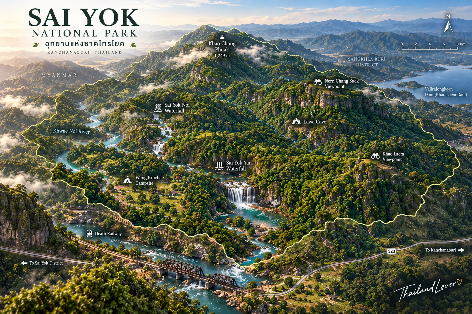
Find Sai Yok
Sai Yok National Park, Kanchanaburi Province, Thailand