

National Park · UNESCO Forest Complex
Kaeng Krachan National Park
อุทยานแห่งชาติแก่งกระจาน
The Wild Heart of Western Thailand
Phetchaburi & Prachuap Khiri Khan · Western Thailand
Thailand’s largest national park is not a single viewpoint. It is an entire forest — mountains, rivers, elephants, hornbills and a sea of mist that only appears when the weather allows.
The Wild Heart of Western Thailand
Some national parks are famous for a waterfall. Some are known for a mountain. Some become famous because of a single photograph.
Kaeng Krachan is different. It is an entire landscape.
A vast expanse of forest stretches across the western mountains of Thailand, rising from lowland valleys toward the Tenasserim Range and the Myanmar border.
Rivers begin here. Clouds gather here. Elephants, leopards, hornbills, gibbons and countless smaller species move through the forest.
And somewhere deep inside this enormous green landscape, a narrow mountain road climbs toward Ban Krang and Phanoen Thung, where the forest opens into one of Thailand’s most atmospheric viewpoints.
On a good morning, the mountains disappear beneath a sea of mist. But the mist is only the visible part of the story. The real story is the forest.
This is one of the great remaining forest landscapes of Thailand — and a standout destination in ThailandLover’s Nature & Parks collection.
Kaeng Krachan is not simply a destination to visit. It is one of the great remaining forest landscapes of Thailand.
At a Glance
- Official Name
- Kaeng Krachan National Park
- Thai Name
- อุทยานแห่งชาติแก่งกระจาน
- Region
- Western Thailand
- Provinces
- Phetchaburi and Prachuap Khiri Khan
- Established
- 12 June 1981 · Thailand’s 28th national park
- Area
- Approximately 2,915 km² — Thailand’s largest national park
- Mountain Range
- Tenasserim Range
- Highest Elevation
- Approximately 1,513 metres
- Signature Mountain
- Khao Phanoen Thung — approximately 1,207 metres
- Major Rivers
- Phetchaburi River and Pran Buri River systems
- Signature View
- Phanoen Thung sea of mist
- Signature Wildlife Area
- Ban Krang
- Major Waterfall
- Pala-U Waterfall
- UNESCO
- Kaeng Krachan Forest Complex, inscribed 2021
Kaeng Krachan was established on 12 June 1981 as Thailand’s 28th national park. At approximately 2,915 square kilometres, it is the country’s largest national park by area.
Where Is Kaeng Krachan?
Kaeng Krachan National Park lies in western Thailand, principally within Phetchaburi and Prachuap Khiri Khan.
The park extends across areas associated with Nong Ya Plong, Kaeng Krachan and Tha Yang in Phetchaburi, as well as Hua Hin District in Prachuap Khiri Khan. Its western edge approaches the Thai–Myanmar frontier.
This geographical position gives the park extraordinary ecological importance. It sits within the Tenasserim Range, one of the great mountain systems forming the natural backbone of the Thai–Myanmar border region.
The mountains continue beyond Thailand. The forest does not recognise the international boundary.
A National Park on a Different Scale
Kaeng Krachan is difficult to understand if you approach it like an ordinary tourist attraction. It is simply too large.
At approximately 2,915 square kilometres, the park is larger than many cities and metropolitan areas. Its landscape extends from relatively low elevations into the mountains of the Tenasserim Range.
Much of the terrain is steep. Historical ecological studies indicate that areas with slopes greater than 30 percent cover roughly 60 percent of the park.
This is not a landscape designed for easy movement. It is a landscape designed by mountains. And that is precisely why it remains so important.
The Tenasserim Range
The Tenasserim Range is one of the defining geographical features of western Thailand. Kaeng Krachan occupies part of its eastern side.
The landscape is characterised by long mountain ridges, steep valleys, granite formations, areas of limestone, forested slopes, river headwaters and high mountain ridges.
The highest point within the park reaches approximately 1,513 metres above sea level, near the Thai–Myanmar border. This is significantly higher than the more accessible Phanoen Thung area.
That distinction is important. The famous viewpoint is not the highest point of the park. It is simply the most accessible high mountain landscape for visitors.
Khao Phanoen Thung
The Mountain Above the Clouds · Approximately 1,207 metres
If Kaeng Krachan has an iconic mountain, it is Khao Phanoen Thung.
The mountain rises to approximately 1,207 metres above sea level. It is one of the most recognisable destinations within the park because visitors can reach the highland area through the park’s mountain road system.
The summit and surrounding landscape are characterised by open areas, forest and dramatic views across the western mountains. But the most famous experience occurs when the valleys below fill with mist. Then the landscape changes completely.
The Sea of Mist
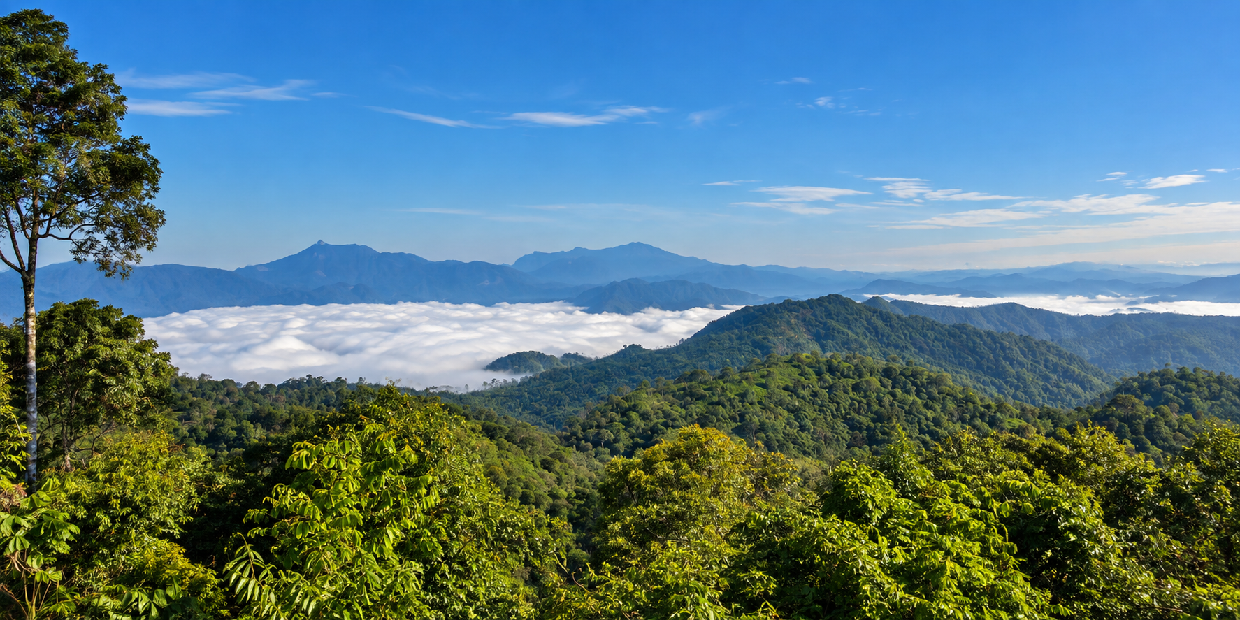
The sea of mist is one of Kaeng Krachan’s most photographed natural phenomena. At dawn, moisture can accumulate in the valleys below the mountain. From an elevated viewpoint, the clouds appear to form a white ocean between the mountain ridges. The higher peaks rise above the cloud layer.
The result is an almost surreal landscape. But there is an important distinction: the sea of mist is not guaranteed.
It depends on temperature, humidity, rainfall, overnight weather, wind and local topography. Some mornings will produce a dramatic cloud inversion. Others will reveal clear mountain ridges. Some mornings may be completely obscured by cloud.
That unpredictability is part of the attraction.
Why the mist happens
The geography of Kaeng Krachan creates ideal conditions for atmospheric variation. Moisture enters the valleys. Cooler night temperatures encourage condensation. Air movement and topography determine where the cloud settles. From above, the valley floor can disappear.
This is why the same viewpoint can look completely different from one morning to the next. The mist is therefore not a permanent landscape feature. It is a temporary expression of the mountain climate.
The Forest Is the Real Attraction
The sea of mist may be what appears on social media. But the forest is why Kaeng Krachan matters.
The park forms part of one of mainland Southeast Asia’s most important remaining forest complexes. UNESCO describes the wider Kaeng Krachan Forest Complex as a meeting point between several major biogeographical regions, including Himalayan, Indochinese and Sundaic influences.
This creates an unusual mixture of species. Some species reach their northernmost distribution here. Others reach their southernmost distribution. The result is exceptional biological diversity.
UNESCO identifies at least 459 known wild animal species, including rare and endemic species, within the World Heritage property.
Six major forest types
The Kaeng Krachan Forest Complex contains several major forest formations: semi-evergreen forest, dry evergreen forest, moist evergreen forest, mixed deciduous forest, montane forest and deciduous dipterocarp forest.
Within the World Heritage property, forest ecosystems cover more than 96 percent of the area, with dry evergreen forest forming the largest component.
This diversity is one of the reasons Kaeng Krachan supports such a remarkable range of animals. A forest is not one habitat. It is many habitats layered across elevation, moisture, soil and geology.
A Watershed of National Importance
Kaeng Krachan is also one of western Thailand’s most important watershed landscapes. The mountains collect rainfall. The forest stores and regulates water. Streams descend through valleys. Eventually, major river systems carry that water toward the lowlands.
Two major river systems associated with the park are the Phetchaburi River and the Pran Buri River.
The Phetchaburi River is particularly important to Phetchaburi Province. Its water eventually supports agriculture, communities and ecosystems downstream. The forest therefore performs a service that is easy to overlook.
It is infrastructure. Not concrete infrastructure. Natural infrastructure.
Kaeng Krachan Reservoir
Where the River Meets the Dam
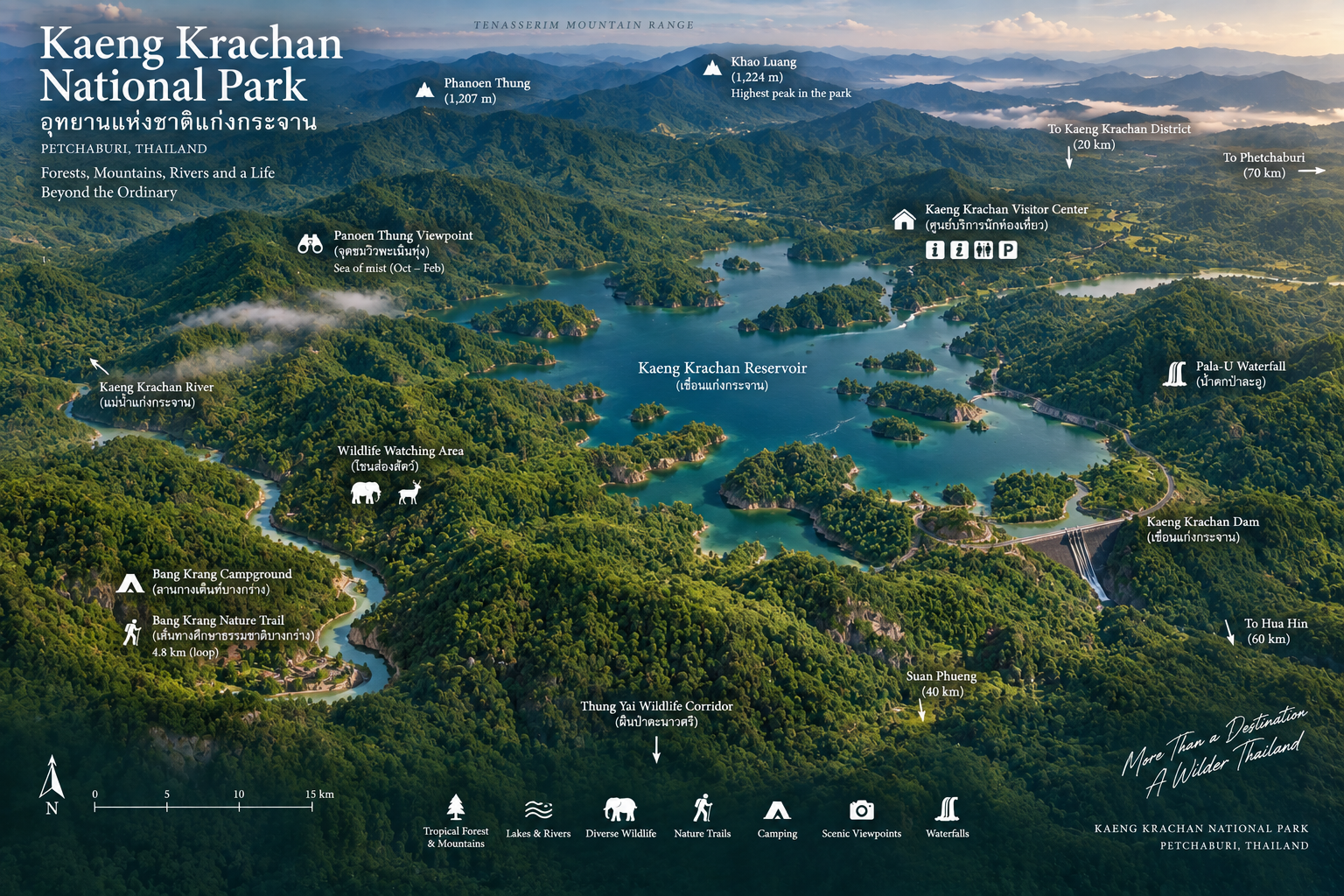
At the eastern side of the landscape lies Kaeng Krachan Reservoir, created by the Kaeng Krachan Dam on the Phetchaburi River. From above, the water extends into a network of forested hills and peninsulas.
Visitors should distinguish between Kaeng Krachan National Park and the reservoir landscape around the dam. They are geographically connected, but the reservoir should not be treated as though the entire water body is simply an attraction located inside the protected forest.
The dam represents the transition between protected mountain watershed and downstream water management.
Ban Krang
Into the Forest
For wildlife enthusiasts, Ban Krang is one of the most important visitor areas in Kaeng Krachan. The route toward Ban Krang gradually leaves the more developed lowland environment and enters deeper forest.
This is where the character of the park changes. The road becomes narrower. The forest becomes denser. The landscape becomes quieter. And wildlife becomes the main reason for being there.
Ban Krang is particularly well known among birdwatchers and wildlife photographers.
Why Ban Krang matters
Ban Krang sits within an extensive forest landscape where wildlife movement is still possible across large areas. This matters because large mammals cannot survive simply inside small isolated patches of forest.
They need space, food, water, breeding areas, shelter and movement corridors. Kaeng Krachan provides that scale. The park’s connection to the wider Kaeng Krachan Forest Complex increases its conservation importance even further.
Wildlife
One of Thailand’s Great Wildlife Landscapes
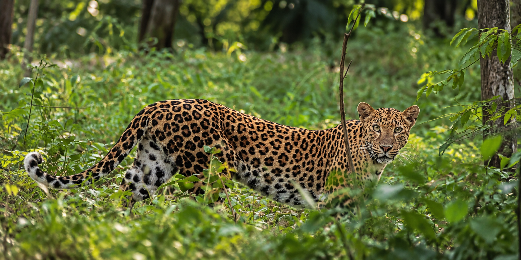
Kaeng Krachan supports an extraordinary variety of mammals. Among the species documented within the park and wider forest complex are Asian elephant, tiger, leopard, clouded leopard, Asian golden cat, marbled cat, fishing cat, leopard cat, jungle cat, dhole, banteng, gaur, Malayan tapir, sambar, serow, Asiatic black bear, Sunda pangolin, Asian giant tortoise, elongated tortoise and white-handed gibbon.
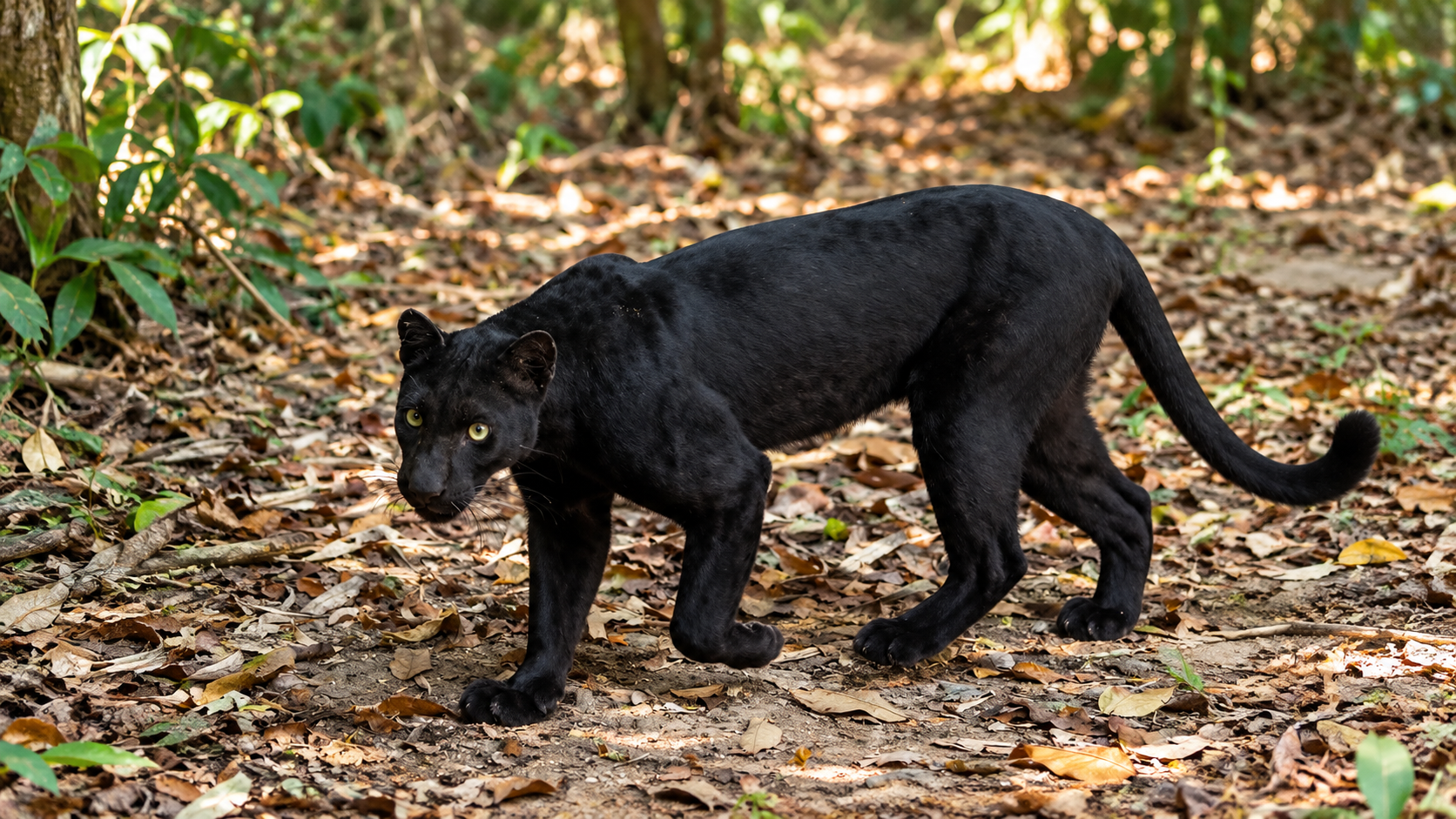
UNESCO identifies eight species of wild cats in the Kaeng Krachan Forest Complex, including tiger, fishing cat, leopard, Asian golden cat, clouded leopard, marbled cat, jungle cat and leopard cat. This is an extraordinary concentration of carnivore diversity.
The tiger
The tiger is one of the most important large carnivores associated with the Kaeng Krachan Forest Complex. But visitors should understand what that means.
Kaeng Krachan is not a tiger safari. There are no guaranteed sightings. A tiger may move through enormous areas of forest without ever being seen by a person.
The importance of the tiger is therefore ecological rather than touristic. A landscape capable of supporting a tiger is a landscape containing sufficient prey, habitat and ecological connectivity to support an entire food web.
The tiger is an indicator of the forest’s scale.
Asian elephants
Asian elephants are another major species associated with Kaeng Krachan. Elephants require large areas and access to water, food and movement corridors. Their presence therefore reinforces the importance of maintaining connected forest.
An elephant seen on a road is an unforgettable encounter. But the better conservation outcome is one in which elephants can move through the forest without needing to interact with people at all.
Leopards and other cats
Kaeng Krachan is particularly important for felids. The wider World Heritage complex supports tiger, leopard, clouded leopard, marbled cat, Asian golden cat, fishing cat, jungle cat and leopard cat.
Some are large predators. Others are small, secretive forest cats. Together, they demonstrate how many different ecological niches can exist within one continuous forest landscape.
Dhole, tapir, banteng and gaur
The dhole, or Asian wild dog, is another globally threatened carnivore associated with the forest complex. Dholes are social predators. They require prey and extensive habitat. Sightings are extremely uncommon. The value is not seeing one. The value is knowing that the forest can still support one.
The Malayan tapir is one of Southeast Asia’s most recognisable large mammals. Tapirs are primarily associated with forest environments and require substantial habitat.
Banteng and gaur occupy important positions in the forest food web and provide prey opportunities for large carnivores. Their presence contributes to the ecological completeness of the landscape.
Pangolins, tortoises and the Siamese crocodile
Kaeng Krachan also protects species that are less visually spectacular but equally important, including the Sunda pangolin, elongated tortoise and Asian giant tortoise. These animals face serious pressures elsewhere in Southeast Asia, including habitat loss and illegal wildlife trade.
One of Kaeng Krachan’s most extraordinary conservation stories concerns the Siamese crocodile. UNESCO identifies the species as critically endangered and notes that the Kaeng Krachan Forest Complex is one of the last places where it remains in the wild.
Its presence in the Phetchaburi River system therefore has exceptional conservation significance. Rivers inside Kaeng Krachan cannot be treated simply as recreational waterways. They are wildlife habitat.
Birdwatcher’s Paradise
Kaeng Krachan has long been recognised as one of Thailand’s premier birdwatching destinations. Among the birds associated with the park and wider forest are hornbills, trogons, kingfishers, barbets, pittas, flycatchers, broadbills, sunbirds, laughingthrushes, woodpeckers and raptors.
The park is especially famous for hornbills.
Hornbills
Several hornbill species occur in the Kaeng Krachan landscape, including Great Hornbill, Wreathed Hornbill, Oriental Pied Hornbill, White-crowned Hornbill, Tickell’s Brown Hornbill, Plain-pouched Hornbill and Helmeted Hornbill.
Hornbills are particularly valuable ecological indicators because many species depend on large mature trees for nesting cavities. When a forest retains hornbills, it often indicates that some of the forest’s structural complexity has survived.
The sound of a hornbill moving through the canopy is one of the most distinctive experiences in Kaeng Krachan.
Butterflies
Another World Beneath the Canopy
Kaeng Krachan is also famous among butterfly enthusiasts. The combination of tropical forest, streams, clearings and elevation creates a remarkably diverse butterfly environment. Hundreds of species have been recorded in the broader region.
For photographers, butterflies offer a different way to experience the park. Instead of looking for elephants or big cats, look down. The forest floor can be full of colour. Look around wet areas. Check flowers. Watch stream edges. And move slowly.
A Biological Meeting Point
One of Kaeng Krachan’s most important scientific characteristics is its geographical position. It lies where different biogeographical influences meet.
UNESCO describes the wider complex as a meeting point of several zoogeographical and floristic regions. This explains why the forest contains such an unusual combination of species.
It is not simply “rich because it is large.” It is rich because large scale + habitat diversity + geographical position + ecological connectivity all occur together.
Rare plants
UNESCO highlights several rare and threatened plant species associated with the forest complex. Among the most remarkable is Prunus kaengkrachanensis, a species described in 2015 and found only within the Kaeng Krachan Forest Complex.
Another extraordinary botanical story involves Magnolia gustavii. The species had not been recorded for more than a century and was believed to be extinct in the wild. It was rediscovered in Kaeng Krachan National Park in 1998.
Sometimes a forest is not merely protecting what we already know. It is still revealing what we do not know.
The World Heritage Story
Kaeng Krachan Forest Complex
This is one of the most important facts for ThailandLover.
In 2021, UNESCO inscribed the Kaeng Krachan Forest Complex on the World Heritage List under natural criterion (x), recognising its exceptional biodiversity.
The World Heritage property covers approximately 408,940 hectares and includes protected areas across Phetchaburi, Prachuap Khiri Khan and Ratchaburi. It encompasses three national parks and one wildlife sanctuary:
- Kaeng Krachan National Park
- Kui Buri National Park
- Chaloem Phrakiat Thai Prachan National Park
- Mae Nam Phachi Wildlife Sanctuary
UNESCO’s reasoning is fundamentally about biodiversity: extensive intact forests, multiple forest types, rare plants, threatened mammals, diverse birds, major carnivores and important watershed systems, located within the Indo-Burma biodiversity hotspot.
The western edge of Kaeng Krachan reaches the Thai–Myanmar frontier. Across the border, forests continue into Myanmar. Animals do not understand national boundaries. The Tenasserim landscape therefore functions at a scale much larger than any single national park.
Pala-U Waterfall
Where the Forest Falls
Pala-U Waterfall is one of the best-known attractions associated with Kaeng Krachan National Park. Located on the Hua Hin / Prachuap Khiri Khan side of the park, Pala-U is known for its multi-tiered waterfall and forest environment.
The waterfall is particularly attractive during periods when water levels are higher. But rainfall also affects accessibility. Heavy rain can make trails slippery and streams dangerous.
The experience at Pala-U is different from Phanoen Thung.
Phanoen Thung is altitude, mountains, mist and horizon. Pala-U is water, forest, rocks and shade.
One destination looks outward. The other draws you into the forest.
Tho Thip Waterfall
Tho Thip Waterfall is another significant waterfall associated with the interior of the park. It lies deeper within the forest than the most accessible visitor attractions. The journey itself is part of the experience.
This is not a destination for travellers looking for a quick photograph from a roadside viewpoint. Because access conditions can change, visitors should check with park authorities before planning a specific route.
Nature trails
Some trails are short and suitable for general visitors. Others require physical fitness, local knowledge, ranger guidance, permission and appropriate equipment.
Deep forest routes should not be treated like ordinary tourist walking trails. The terrain can be steep. Streams can rise quickly. Wild animals may be present. Mobile-phone coverage may be unreliable.
A responsible traveller respects the mountain rather than assuming that every trail is safe simply because it appears on a map.
Weather, Closure and Carrying Capacity
The park experiences a tropical monsoon climate. The wet season generally begins around late May and continues into October. September and October can receive particularly heavy rainfall.
The forest becomes exceptionally green. Waterfalls become stronger. Streams become more dramatic. At the same time, roads, trails and mountain areas become more difficult and potentially dangerous. Mudslides, flash floods and slippery terrain are genuine risks.
If thousands of people enter the same mountain environment continuously, wildlife becomes disturbed, waste increases, vegetation is damaged and water systems receive more pressure. A seasonal closure creates a period in which the ecosystem can operate with less human disturbance.
The park has stated that visitor numbers in the Ban Krang and Phanoen Thung areas will be controlled according to the carrying capacity of the natural environment. The objective is not simply to maximise the number of visitors.
A national park does not exist solely to provide access. Sometimes conservation means saying: not today.
The Human Landscape
Kaeng Krachan is not an empty wilderness. People have lived in and around the landscape for generations. Communities include Karen populations whose relationship with the forest predates the modern national park system.
This makes the landscape culturally complex. Conservation is therefore not simply about drawing a line around a forest. It also involves land rights, traditional livelihoods, community participation, resource management, protected-area law, human rights and conservation policy.
UNESCO’s World Heritage decision explicitly recognised the importance of consultation and participation with local communities in management of the property.
For ThailandLover, this should never be reduced to a tourist stereotype. A village is not an attraction simply because tourists can photograph it. A community is a living society. The appropriate approach is respectful cultural engagement, ideally through locally led or community-benefiting experiences.
Responsible Wildlife Tourism
Kaeng Krachan is one of the places where responsible wildlife tourism matters enormously. If visitors crowd wildlife, animals change their behaviour. If photographers bait animals, natural behaviour is disrupted. If food is provided, animals can become habituated to humans.
Good wildlife tourism is not about getting the closest photograph. It is about allowing the animal to remain wild.
- Keep noise low
- Avoid playback in sensitive areas
- Do not chase birds or block roads
- Do not disturb nests
- Keep a respectful distance
- Never feed wildlife
- Keep camp food properly secured
- Follow park instructions
Camping, Night and Photography
Camping is one of the best ways to experience the park, especially in the Ban Krang and Phanoen Thung areas when they are open. But camping in a rainforest environment is different from camping in a developed campground.
Expect changing weather, insects, humidity, cool nights at higher elevation, wildlife activity and limited services. Food smells can attract animals. Keep food properly secured. Never leave food waste behind.
After sunset, birds give way to insects and frogs. Nocturnal mammals become active. The forest becomes almost completely dark. Darkness is not a problem. It is part of the ecosystem.
Remote areas of the park can offer impressive night skies when conditions are favourable. On clear nights, the forest becomes almost invisible. The stars become the landscape.
The park changes with the light
- Sunrise
- Mist and layered mountains.
- Morning
- Wildlife and bird activity.
- Midday
- Deep greens and forest detail.
- Afternoon
- Long shadows through the forest.
- Sunset
- Mountain silhouettes.
- Night
- Stars and darkness.
The best approach is therefore not to photograph only the famous viewpoint. Photograph the entire ecosystem.
Best Things to Do
- 1. Experience Phanoen Thung
- The essential mountain experience. Go for the landscape, not merely the photograph.
- 2. Watch the sea of mist
- Arrive early. Stay patient. The mist may change dramatically within minutes.
- 3. Explore Ban Krang
- A key area for birdwatchers and wildlife enthusiasts.
- 4. Visit Pala-U Waterfall
- Experience the forest from ground level rather than only from a mountain viewpoint.
- 5. Photograph hornbills
- Bring binoculars and a long lens. Do not approach nests.
- 6. Look for butterflies
- Slow down around forest edges, streams and flowering plants.
- 7. Camp
- When the relevant zones are open, camping provides a much deeper experience than a short daytime visit.
- 8. Learn about the forest
- Understand the watershed, wildlife corridors, local communities and conservation. That is the deeper Kaeng Krachan experience.
Best Time to Visit
- November–February · Classic mountain season
- Generally the most attractive period for cooler weather, mountain views, camping, mist, photography and wildlife observation. It is also a popular period.
- March–May · Hotter and hazier
- Temperatures rise. Visibility can vary. Forest conditions become drier. Wildlife and bird activity can still be rewarding, but the experience is different from the cool season.
- June–October · The green season
- The forest becomes intensely green. Waterfalls become stronger. Rainfall also increases, and road and trail conditions can become difficult. The annual Ban Krang–Phanoen Thung closure from 1 August through 31 October is particularly important.
How Long Should You Stay?
- Half day
- Suitable for a short visit around the lower park and reservoir landscape — but this barely scratches the surface.
- One day
- Enough to experience one major area. Still not enough to understand the park.
- One night
- Much better. You experience the transition from daylight to darkness.
- Two days
- Recommended for travellers who want forest, wildlife, birdwatching, waterfall and mountain landscape.
- Three days or more
- Ideal for serious nature travellers. The larger the park, the less sense it makes to rush through it.
Who Is Kaeng Krachan For?
- Wildlife enthusiasts
- One of Thailand’s most important protected landscapes for large mammals and carnivores.
- Birdwatchers
- Exceptional diversity and famous hornbill habitat.
- Photographers
- Mist, mountains, wildlife, forests and waterfalls provide enormous variety.
- Nature lovers
- The park is much more than a viewpoint.
- Campers
- Particularly those comfortable with changing mountain conditions.
- Road trippers
- The park combines naturally with Phetchaburi and Hua Hin itineraries.
- Serious travellers
- People who want to understand Thailand’s wilderness rather than simply photograph it.
Who may not enjoy it?
Kaeng Krachan may not be ideal for travellers who want guaranteed wildlife sightings, luxury facilities everywhere, predictable weather, easy walking everywhere, nightlife, shopping or a tightly scheduled itinerary.
This is wilderness. And wilderness is unpredictable.
Essential Kaeng Krachan
- Best known for
- Phanoen Thung and its sea of mist
- Established
- 12 June 1981 · Thailand’s 28th national park
- Approximate area
- 2,915 km²
- Highest elevation
- Approximately 1,513 metres
- Phanoen Thung
- Approximately 1,207 metres
- Major watershed
- Phetchaburi and Pran Buri river systems
- Wildlife highlights
- Elephant, tiger, leopard, dhole, banteng, gaur, tapir, serow, pangolin and multiple wild cat species
- Bird highlights
- Hornbills, trogons, kingfishers, pittas and many other forest birds
- Waterfall highlight
- Pala-U
- Major visitor wildlife area
- Ban Krang
- World Heritage
- Part of the Kaeng Krachan Forest Complex, inscribed in 2021
- Annual closure
- Ban Krang and Phanoen Thung, 1 August–31 October · reopening 1 November 2026
- Best mindset
- Come to experience a forest, not to collect sightings
Frequently Asked Questions
- Is Kaeng Krachan the largest national park in Thailand?
- Yes. At approximately 2,915 km², it is widely recognised as Thailand’s largest national park by area.
- Is Kaeng Krachan a UNESCO World Heritage Site?
- The Kaeng Krachan Forest Complex is a UNESCO World Heritage Site. Kaeng Krachan National Park is one of the protected-area components of that larger World Heritage property.
- When was Kaeng Krachan established?
- 12 June 1981. It was Thailand’s 28th national park.
- How large is Kaeng Krachan National Park?
- Approximately 2,915 square kilometres.
- What is the highest point?
- Approximately 1,513 metres above sea level, near the Thai–Myanmar border. This is higher than Khao Phanoen Thung, which is approximately 1,207 metres.
- Is Phanoen Thung the highest mountain in the park?
- No. Phanoen Thung is approximately 1,207 metres. The highest point of the park is approximately 1,513 metres.
- Can I see the sea of mist all year?
- No. The sea of mist depends on weather and atmospheric conditions. Cooler months often provide favourable conditions, but sightings are never guaranteed.
- Can I see elephants?
- Elephants live in the forest, but sightings are not guaranteed. Wildlife should never be treated as a scheduled attraction.
- Are there tigers?
- Yes. Tiger is among the globally threatened species associated with the Kaeng Krachan Forest Complex. Seeing one in the wild is extremely unlikely for ordinary visitors.
- Are there leopards?
- Yes. Leopards are among the large carnivores documented in the wider forest complex.
- Are there hornbills?
- Yes. Kaeng Krachan is one of Thailand’s best-known birdwatching landscapes and supports several hornbill species.
- Is Pala-U inside Kaeng Krachan National Park?
- Pala-U Waterfall is associated with Kaeng Krachan National Park on the Prachuap Khiri Khan side of the protected landscape. Access and operating conditions can vary with weather and park management.
- Can I camp at Phanoen Thung?
- Camping is available when the area is open. However, Phanoen Thung and Ban Krang undergo an annual closure from 1 August to 31 October. For 2026, the park has announced reopening from 1 November 2026.
- Why does the park close during the rainy season?
- For visitor safety and ecosystem recovery. Heavy rainfall increases risks such as landslides and flash floods, while reduced visitation gives wildlife and the forest a period with less human disturbance.
- Is Kaeng Krachan suitable for children?
- Some lower-access areas can be suitable for families. Deep forest routes, mountain roads and waterfalls require greater caution. Always consider weather, terrain and current park conditions.
- Is Kaeng Krachan worth visiting if I don’t care about wildlife?
- Yes. The landscape itself is exceptional. Mountains, forest, waterfalls, rivers and mist make the park worthwhile even without seeing a single animal.
Related Destinations
- Chaloem Phrakiat Thai Prachan National Park
- Another component of the Kaeng Krachan Forest Complex — western mountain forest in Ratchaburi.
- Hat Wanakon National Park
- A quieter Gulf coast of pines, camping and reef, further south in Prachuap Khiri Khan.
- Namtok Huai Yang National Park
- Waterfalls and coastal-mountain forest near Hua Hin, for travellers combining the park with the Gulf.
- Erawan National Park
- Western Thailand’s most famous waterfall landscape, for a different kind of forest day.
- Sai Yok National Park
- River, caves and limestone forest further north along the western mountain corridor.
- Western Thailand national parks
- More mountains, forests and protected landscapes across ThailandLover’s national-park collection.
Location
Find Kaeng Krachan National Park
Kaeng Krachan, Phetchaburi · Hua Hin, Prachuap Khiri Khan