

Marine National Park · Gulf Coast
Hat Wanakon National Park
อุทยานแห่งชาติหาดวนกร
A Quiet Coast of Pines, Forest and Living Reef
Prachuap Khiri Khan · Upper Gulf of Thailand
A seven-kilometre pine-lined beach, camping under coastal trees, and shallow reefs around Ko Chan and Ko Thai Tree — a landscape for slowing down, not collecting landmarks.
A Beach That Lets You Slow Down
There are beaches in Thailand that are famous because they are spectacular.
And then there are beaches that become memorable because they allow you to slow down.
Hat Wanakon National Park belongs to the second kind.
Located on the Gulf of Thailand in Prachuap Khiri Khan Province, Hat Wanakon is a coastal national park shaped by a long sandy beach, wind-shaped coastal trees, forest, rocky shoreline and a pair of offshore islands surrounded by shallow coral reefs.
It is not a destination built around a single dramatic landmark. Its character comes from the relationship between land and sea.
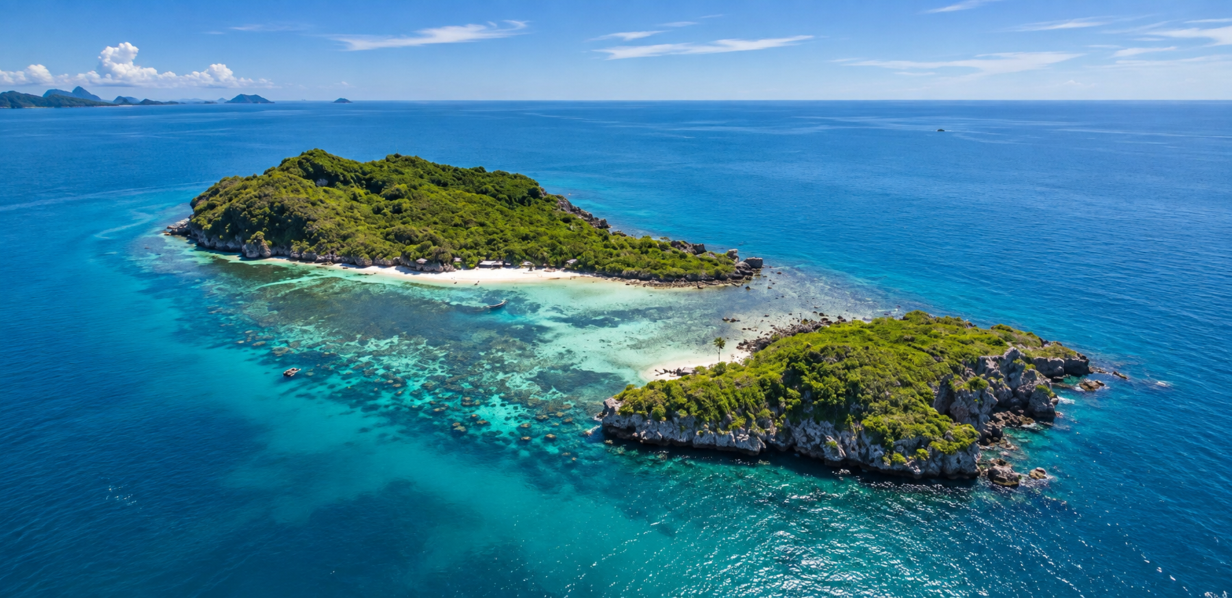
A line of coastal pines follows the shoreline. The beach stretches for approximately seven kilometres from the Khlong Nam Chuet area toward Huai Ban Yang. Offshore, Ko Chan and Ko Thai Tree form the marine counterpart of the park, with coral communities and shallow reef habitat beneath the Gulf of Thailand.
Forest behind you, beach beneath your feet, and a living reef offshore.
At a Glance
- Official Name
- Hat Wanakon National Park
- Thai Name
- อุทยานแห่งชาติหาดวนกร
- Province
- Prachuap Khiri Khan
- Districts
- Mueang Prachuap Khiri Khan and Thap Sakae
- Region
- Upper Gulf of Thailand
- Established
- 30 December 1992
- Status
- Marine national park
- Signature Landscape
- Wanakon Beach — approximately 7 kilometres
- Key Marine Sites
- Ko Chan and Ko Thai Tree
- Main Coastal Viewpoint
- Ao Makha
- Nature Study
- Hat Rang and Hin Chuang Nature Study Route
- Main Experiences
- Beach, camping, cycling, nature study, birdwatching, snorkeling and diving
The park was formally declared a national park on 30 December 1992. Tourism Authority of Thailand material identifies it as Thailand’s 62nd national park and 18th marine national park.
Where Is Hat Wanakon?
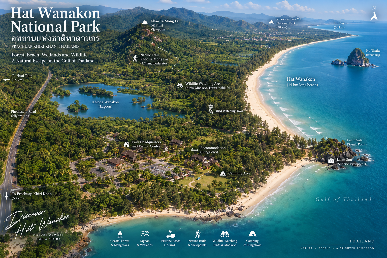
Hat Wanakon National Park lies on the coast of Prachuap Khiri Khan Province in western Thailand. Its land area extends across parts of Mueang Prachuap Khiri Khan District and Thap Sakae District, with the park headquarters and principal visitor area associated with Huai Yang, Thap Sakae.
The park sits along the country’s southern coastal corridor, close to Phetkasem Road (Highway 4) and the Southern Railway. That location gives Hat Wanakon an unusual advantage: accessible enough for a road trip from Bangkok, yet sufficiently removed from the major resort centres to retain a quieter atmosphere.
For travellers moving south through Prachuap Khiri Khan, Hat Wanakon can therefore work as both a destination and a slower coastal stop.
Where Forest Meets the Gulf
Hat Wanakon is not simply a beach protected by a national-park boundary. It is a coastal landscape in which several environments meet.
Behind the shoreline are forested areas and recovering vegetation. Along the coast is a beach-forest landscape dominated visually by rows of coastal trees. Between land and sea are sandy flats, rocky sections and shallow coastal waters. Further offshore are Ko Chan and Ko Thai Tree, where the terrestrial landscape gives way to a marine ecosystem of coral and reef-associated species.
Forest → coastal vegetation → beach → shallow sea → coral reef
You can move through several ecological environments within a relatively compact landscape. Hat Wanakon is therefore best understood as a land-and-sea ecosystem, rather than simply a beach destination.
Wanakon Beach
Seven Kilometres of Quiet Coast
The signature landscape of the park is Wanakon Beach. The beach stretches approximately 7 kilometres, running from the Khlong Nam Chuet area toward Huai Ban Yang.
Unlike many highly developed Thai beaches, the shoreline here is defined by a long, relatively continuous relationship between sand and coastal vegetation. Rows of coastal pine trees run parallel to the sea, creating one of the most recognisable visual characteristics of Hat Wanakon.
White sand, blue water and a long green line of trees.
There is no need for monumental buildings or dense commercial development to define the landscape. The trees, wind and changing tide do most of the work.
The Beach Changes With the Tide
At very low tide, the sandy shoreline can extend approximately 150 metres toward the sea. Instead of appearing as a narrow strip between forest and water, the intertidal zone becomes a broad coastal landscape.
The beach is not a static object. It is part of a tidal system. For photographers, that can mean long reflections after the water retreats, exposed sand patterns, rows of coastal trees, silhouettes at sunrise and changing textures between wet and dry sand. The best photograph may not be the same photograph at every hour.
The Pine Coast
Sea pines and other coastal trees form long rows beside the beach, creating a natural transition between forest and open sea. Their shape is strongly influenced by the coastal environment: wind, salt air, and trees that bend toward the prevailing conditions.
This gives Hat Wanakon a landscape that feels distinctly maritime even before you reach the water. The pines are not simply decoration. They are part of the coastal environment that gives the beach its identity.
Ao Makha
The Park’s Coastal Viewpoint
Away from the long sandy beach, Ao Makha provides a different perspective: a more rugged coastline of rocky shore and steeper terrain, with a ranger station in the area.
From Ao Makha, the Gulf of Thailand opens outward toward the offshore islands of Ko Chan and Ko Thai Tree. This creates one of the clearest visual connections between the terrestrial and marine sides of Hat Wanakon.
From the mainland: forest → rocky coast → open Gulf → offshore islands. From the sea: islands → coral reef → coastline → forest. The two landscapes are part of the same story.
Ko Chan and Ko Thai Tree
Hat Wanakon’s Marine World
If Wanakon Beach is the public face of the park, Ko Chan and Ko Thai Tree are its underwater heart. The two offshore islands are among the most important marine attractions associated with the park.
Their geology is visually different from the long sandy beach. The islands have rocky and limestone characteristics, while the surrounding waters support shallow coral reef communities.
- On the mainland
- Soft sand and coastal pines.
- Around the islands
- Rock, reef and open water.
Together, these environments form one connected coastal system.
Published tourism information notes that the islands have bird’s-nest concession areas. Access and activities around the islands can therefore be subject to specific management arrangements. Follow park officers and authorised operators rather than assuming that every part of the islands is freely accessible. The most important visitor experience is the surrounding marine environment.
A Living Reef Beneath the Gulf
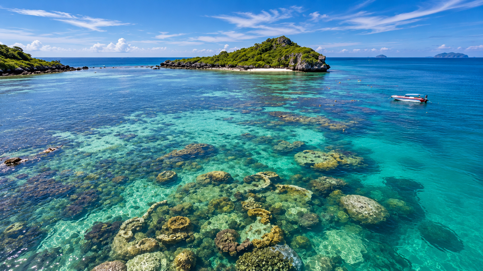
The coral reefs around Ko Chan and Ko Thai Tree are not simply places for recreational snorkeling. They are living ecosystems. Coral structures provide habitat for fish and numerous marine organisms.
Recent Department of National Parks surveys in 2026 found healthy reef communities at several depths around the islands. A March 2026 survey using the Line-Intercept Transect method recorded reef communities at depths of approximately 2–10 metres, reporting healthy coral communities with no signs of bleaching — massive corals, staghorn corals, flower-like coral communities, clownfish, damselfish, longfin bannerfish, sea anemones and orange cup corals. Water temperatures were approximately 29–30°C, with salinity around 31–32 ppt.
These measurements show something more meaningful than simply saying that the reef is “beautiful.” They demonstrate that the park continues to actively monitor the condition of its marine ecosystem.
The 2026 Reef Story
In February, park officials reported that the reefs around Ko Chan and Ko Thai Tree were in very good condition and showed no signs of coral bleaching. A second survey in March again found healthy reef communities without bleaching. In April, another survey at approximately 7–8.3 metres depth again found no bleaching. During that survey, officials also observed a green turtle feeding around the shallow reef in front of Ko Chan. In June, park officers returned to the islands to remove marine debris and continue monitoring reef health.
A national park is not simply a place where visitors arrive, take photographs and leave. The condition of the reef depends on continuous monitoring, enforcement, waste removal and management. Hat Wanakon is currently demonstrating that process in practice.
Recent surveys showing healthy coral should not be interpreted as meaning that the reef is permanently safe. Coral reefs remain vulnerable to rising sea temperatures, bleaching, physical damage, marine debris, abandoned fishing gear, inappropriate anchoring, careless tourist behaviour and changes in water quality. The 2026 surveys are a current snapshot of reef health, not a permanent guarantee.
A healthy reef is something to protect, not something to consume.
Marine Conservation at Hat Wanakon
In 2026, the park has continued active marine conservation work: underwater surveys, marine-debris removal and increased monitoring of coral health. During one April operation, officers recovered more than 15 kilograms of old fishing net from the reef area. In June, another operation focused on remaining debris and biodiversity monitoring.
The park has also been implementing strict environmentally responsible tourism measures, including strong restrictions on single-use plastic and foam. This makes Hat Wanakon particularly relevant for travellers interested in Thailand’s transition from conventional tourism toward conservation-oriented destination management.
Hat Rang and Hin Chuang
Nature Study Route
Hat Wanakon is not only about the sea. Within the park is a nature-study environment traditionally described through the Hat Rang and Hin Chuang Nature Study Route — designed more as an outdoor classroom than as a conventional hiking attraction.
Rather than simply looking at trees, visitors learn how different organisms interact: bamboo, wild mango, wild olive, ant colonies, termite mounds and other forest organisms. Older published descriptions divide the route into several sections of different lengths and describe a series of interpretation stations.
Because trail configuration and visitor access can change, historical route lengths should be confirmed with the park before treating them as current operational trail specifications. The important point is not the number of kilometres. It is the philosophy: Hat Wanakon encourages visitors to understand the forest as a living system rather than simply walking through it.
The Forest Side of Hat Wanakon
The vegetation of Hat Wanakon is not the dense evergreen rainforest landscape associated with Thailand’s famous mountain parks. Its character is more open. Historical descriptions record mixed deciduous forest and recovering forest, together with bamboo and a variety of native and planted trees — Burmese rosewood, Sindora, dry-forest trees, teak, Queen’s flower, Lagerstroemia species, beach pine and casuarina.
Near the coast, wind, salt and sunlight dominate. Further inland, forest structure becomes more complex. This gradual ecological transition is one of the quieter strengths of Hat Wanakon.
Wildlife and Birdlife
Hat Wanakon is not primarily known as a large-mammal safari destination. Its ecological value is more strongly associated with its coastal environment, birds, forest organisms and marine biodiversity.
The mixture of beach, coastal forest, open woodland, rocky shore and shallow marine habitat creates different opportunities for observing wildlife. Birds recorded in published park descriptions include junglefowl, coastal herons, drongos, kingfishers and other coastal and forest birds. Migratory birds can also appear in the broader coastal region.
In January 2026, the Department of National Parks reported the recovery and handover of a rare migratory spoon-billed skua found near Bang Saphan, illustrating the wider importance of the upper Gulf coast for birdlife.
Seeing a particular species is never guaranteed. The value of Hat Wanakon is the habitat itself.
How to Experience Hat Wanakon
Camping by the Sea
One of Hat Wanakon’s strongest visitor experiences is camping. Accommodation and camping facilities allow visitors to stay close to the beach rather than making a short daytime visit.
During the day the beach becomes a wide open landscape. Toward evening the heat falls, the pine trees become silhouettes, and the sound of the sea becomes more noticeable. At night the park becomes quieter. It is not necessarily a place you visit to collect attractions. It is a place you visit to experience time moving more slowly.
Cycling & Birdwatching
The relatively gentle coastal landscape also makes Hat Wanakon suitable for cycling. Instead of seeing the beach as a single destination, the coastline becomes a sequence: trees → sand → sea → forest → open space.
For birds, do not arrive expecting a dramatic wildlife spectacle. Walk slowly. Listen. Look into the trees. Check the shoreline. Early morning is generally the most rewarding period. A pair of binoculars can make a significant difference.
Snorkeling and Diving
The main marine recreation area is around Ko Chan and Ko Thai Tree, when conditions and park regulations permit. Treat the marine environment as a protected ecosystem rather than an unrestricted swimming area.
- Follow instructions from park officers and use approved operators
- Wear appropriate flotation equipment
- Do not touch or stand on coral, or rest equipment on it
- Keep fins away from coral
- Do not collect shells or marine organisms, or feed marine animals
- Leave no waste behind
The best underwater experience is one in which the reef remains completely undisturbed.
Best Things to Do
- Walk Wanakon Beach
- The simplest activity is arguably the best. Let the beach remain a beach.
- Watch sunrise
- The park faces the Gulf of Thailand. Early morning is peaceful — and good for photography and birds.
- Camp beside the coast
- Spend a night. The park’s character becomes clearer after day visitors leave.
- Visit Ao Makha
- See the relationship between mainland coast and offshore islands.
- Explore the nature-study route
- Hat Rang and Hin Chuang for coastal-forest ecology.
- Snorkel or dive
- When marine activities are open and conditions are suitable, around Ko Chan and Ko Thai Tree.
- Watch birds
- Bring binoculars. Move slowly.
What Makes Hat Wanakon Different?
Thailand has many famous marine national parks — limestone cliffs, dramatic islands, turquoise lagoons, spectacular beaches. Hat Wanakon is different. Its attraction is more restrained. It is the continuity of the landscape.
The beach is long. The trees are continuous. The forest is close. The offshore islands remain visible from the coast. The reef exists beneath the same sea that forms the horizon. There is no need for one spectacular landmark because the destination itself is the composition.
- If you want dramatic limestone cliffs
- Hat Wanakon is not the obvious choice.
- If you want large resort infrastructure
- Hat Wanakon is not the obvious choice.
- If you want crowded island-hopping
- Hat Wanakon is not the obvious choice.
- If you want quiet camping beside a long natural beach
- Hat Wanakon becomes much more interesting.
- If you want coastal forest and reef together
- Hat Wanakon deserves attention.
It is a destination for people who appreciate landscape rather than spectacle.
When Should You Visit?
There is no single perfect month for every activity. Your ideal timing depends on what you want.
- For the beach
- The cooler and drier months generally provide more comfortable conditions for walking, camping and outdoor activities.
- For marine activities
- Sea conditions are more important than the calendar alone. Confirm current sea conditions and whether boat and reef activities are operating.
- For birdwatching
- Early morning is more important than simply choosing a particular month.
- For camping
- Avoid periods of severe weather and check the park’s current operating status before travelling.
Seasonal Closures
Older tourism information states that Hat Wanakon National Park has traditionally had a tourism and overnight-stay closure from 1 November to 15 December. Visitors should not treat an old published closure calendar as a permanent rule.
National parks can change opening periods, close individual attractions, restrict marine activities or adjust operations because of weather, ecological recovery, safety or management requirements.
Always confirm the current operating status with the park before making a trip specifically for camping or island activities — especially Ko Chan and Ko Thai Tree.
Environmental Rules
Hat Wanakon is a protected area. Expect stricter environmental rules than at an ordinary public beach. The park has specifically promoted measures against single-use plastic, foam containers, marine debris and inappropriate tourist behaviour.
- Do not touch, stand on or collect coral, shells or marine life
- Do not feed wildlife
- Do not make excessive noise or leave food waste
- Do not leave fishing line, cigarette butts or other equipment behind
Leave the park looking as though you were never there.
Responsible Camping
Bring reusable containers where possible. Reduce packaging. Keep food waste contained. Do not play loud music. Do not disturb other campers. And most importantly: take your waste with you.
Getting There
Hat Wanakon is accessible from the main southern transport corridor along Phetkasem Road (Highway 4) and the Southern Railway. For road travellers from Bangkok, it can be incorporated into a longer Prachuap Khiri Khan or southern Thailand road trip. For rail travellers, the Southern Railway reaches the broader area, followed by local transport.
Because local access arrangements can change, visitors planning to camp or join marine activities should confirm the latest route and service information directly with the park.
How Long Should You Stay?
- Half day
- Beach walk, photography, a short nature experience and Ao Makha.
- One day
- Beach, nature route, birdwatching, slower exploration, sunset or sunrise.
- One night
- Recommended if you want to understand the park. Camping lets you experience the coastline after the day-trip rhythm disappears.
- Two days
- Best for combining beach, camping, nature study, marine activity and relaxed photography.
Hat Wanakon rewards slower travel.
Who Is Hat Wanakon For?
Hat Wanakon is particularly suitable for nature lovers, campers, photographers of minimalist coastal landscapes, birdwatchers, families (with normal beach and marine safety), couples looking for a quieter coast, slow travellers, and marine enthusiasts interested in responsible snorkeling or diving.
If you are looking for luxury beach clubs, nightlife, dense restaurant choices, shopping, large resort complexes or constant entertainment, Hat Wanakon may feel too quiet.
That is not a weakness. It is the point.
Frequently Asked Questions
- Is Hat Wanakon National Park worth visiting?
- Yes, particularly if you prefer quiet beaches, camping, coastal landscapes and nature rather than highly commercial tourism. Its strength is the combination of beach, coastal forest and marine ecosystem.
- Where is Hat Wanakon National Park?
- On the Gulf of Thailand in Prachuap Khiri Khan Province, across parts of Mueang Prachuap Khiri Khan and Thap Sakae districts. Headquarters are associated with Huai Yang, Thap Sakae, along Phetkasem Road (Highway 4).
- How long is Wanakon Beach?
- Approximately 7 kilometres. At very low tide, the exposed sandy area can extend approximately 150 metres toward the sea.
- Can I camp at Hat Wanakon?
- The park has camping facilities and accommodation, but availability and operating arrangements can change. Confirm the current status before travelling.
- Can I go snorkeling at Hat Wanakon?
- Snorkeling and diving are associated with Ko Chan and Ko Thai Tree, subject to current park conditions, regulations, sea conditions and authorised arrangements.
- Can I see coral at Hat Wanakon?
- Yes. The waters around Ko Chan and Ko Thai Tree contain coral reef communities. Recent DNP surveys in 2026 reported healthy coral communities and no signs of bleaching during the survey periods.
- Can I see turtles at Hat Wanakon?
- Turtles occur in the marine ecosystem, and a green turtle was documented during a DNP reef survey in April 2026. Turtle sightings are wildlife encounters and cannot be guaranteed.
- Is Hat Wanakon crowded?
- Compared with Thailand’s most famous beach and island destinations, Hat Wanakon generally has a quieter character. Visitor numbers can nevertheless increase during weekends, holidays and camping periods.
- Is Hat Wanakon suitable for families?
- Yes, particularly for families interested in beaches, camping and nature. Parents should pay particular attention to tides, sea conditions, heat, sun exposure and children’s behaviour around marine environments.
- Is there a nature trail?
- Yes. The park has the Hat Rang and Hin Chuang nature-study area, historically described as an outdoor classroom focusing on relationships between plants, animals and forest organisms.
- Is Hat Wanakon a marine national park?
- Yes. Although much of the visitor experience is terrestrial, the park also protects important coastal and marine environments, including the waters and reef ecosystem associated with Ko Chan and Ko Thai Tree.
- What is the main difference between Hat Wanakon and a typical beach destination?
- Hat Wanakon is protected landscape rather than simply a beach resort. Its value comes from the relationship between forest, coastal vegetation, beach, sea, islands and coral reef.
Related Destinations
- Khao Sam Roi Yot National Park
- Limestone mountains, wetlands and coastline just north along the same Gulf shore.
- Namtok Huai Yang National Park
- A waterfall and forest park inland from this stretch of Prachuap Khiri Khan.
- Hat Khanom–Mu Ko Thale Tai
- A quieter Gulf coast further south, of beaches, islands and pink dolphins.
- Nature & Parks
- More protected landscapes across ThailandLover’s national-park collection.
Location
Find Hat Wanakon National Park
Huai Yang, Thap Sakae, Prachuap Khiri Khan