

Park Preparation Area · Slow Coast
Hat Khanom–Mu Ko Thale Tai
อุทยานแห่งชาติหาดขนอม–หมู่เกาะทะเลใต้
Where Mountains Meet the Gulf, and Dolphins Still Call the Coast Home
Nakhon Si Thammarat & Surat Thani · Gulf of Thailand
A quieter southern coast of long beaches, forested hills, small islands and Indo-Pacific humpback dolphins — a landscape still being prepared as a national park.
A Quieter Side of the Southern Coast
There is a quieter side of Thailand’s southern coast.
Beyond the famous island destinations and resort towns, the Gulf of Thailand opens into a landscape of long beaches, forested mountains, small limestone islands, coral reefs, mangroves and traditional coastal communities.
This is the world of Hat Khanom–Mu Ko Thale Tai.
The area is best known for Khanom’s long coastline, its pink dolphins, forested headlands, offshore islands and remarkable folded-rock formations.
But there is a deeper story here.
This is a landscape where mountains supply freshwater to coastal communities, forests protect watersheds, mangroves connect land and sea, coral reefs support marine life, and coastal waters provide habitat for the Indo-Pacific humpback dolphin — the animal popularly known in Khanom as the “pink dolphin.”
And unlike many established national parks in Thailand, this landscape is currently in an unusual stage of its conservation history. The area is still being prepared for designation as a national park.
That makes Hat Khanom–Mu Ko Thale Tai not only a destination to explore, but also a living example of how Thailand is trying to balance conservation, local livelihoods, tourism and community rights.
Come for the dolphins and coastline. Stay for the landscape behind them.
At a Glance
- English Name
- Hat Khanom–Mu Ko Thale Tai National Park
- Thai Name
- อุทยานแห่งชาติหาดขนอม–หมู่เกาะทะเลใต้
- Current Legal Status
- National Park Preparatory Area
- Provinces
- Nakhon Si Thammarat and Surat Thani
- Main Areas
- Khanom, Sichon and parts of Don Sak / Ko Samui-related areas under the current preparatory process
- Coast
- Gulf of Thailand
- Landscape
- Mountains, forests, beaches, islands, mangroves, coral reefs and coastal waters
- Signature Wildlife
- Indo-Pacific humpback dolphin
- Popular Local Name
- Pink dolphin
- Signature Geology
- Hin Phap Pha / folded-rock formation
- Key Islands
- Ko Tha Rai, Ko Nui and other islands within the evolving preparatory boundary
- Preparatory Area
- Approximately 73,092 rai (DNP, April–May 2026) — not a final gazetted park area
First, An Important Distinction
This Is Not Yet a Fully Gazetted National Park
Many tourism websites already use the English name Hat Khanom–Mu Ko Thale Tai National Park. That name is understandable because it is the official project name.
However, legally and administratively, the area remains Hat Khanom–Mu Ko Thale Tai National Park (Preparatory).
The Department of National Parks has been preparing the area for national-park designation since the early 1990s. As recently as 2026, government agencies were still working on boundary definition, community participation, land-use issues, marine zoning, fishing rights, tourism management and conservation measures.
A Landscape in the Making
The current preparatory area extends across parts of Khanom District, Sichon District, Don Sak District and areas associated with Ko Samui.
The DNP’s 2025 description identifies forest reserves, islands and forest areas proposed for inclusion across Nakhon Si Thammarat and Surat Thani. The landscape includes both terrestrial and marine environments.
The proposed protected landscape is therefore not simply a beach park. It is a connected system of:
Forest → Mountain → Stream → Coast → Island → Sea
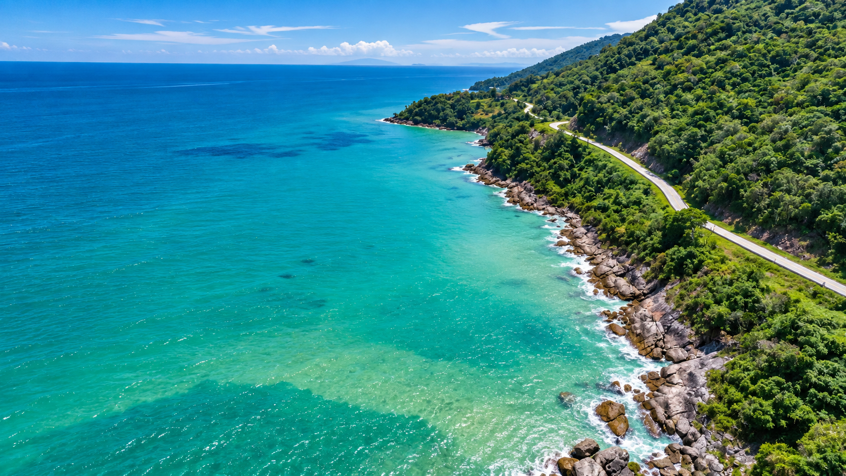
Unlike the dramatic Andaman coast, where limestone islands often rise sharply from deep blue water, the Khanom coast has a more varied and intimate character: long sandy beaches, forested hills, rocky headlands, small offshore islands, shallow coastal waters, coral areas, mangrove ecosystems, fishing communities and coastal roads.
The result feels less like a single resort destination and more like a long, unfolding coastal journey.
Khanom: The Gateway
The town of Khanom is the natural gateway to the landscape. It has developed as a coastal destination without reaching the intensity of some of Thailand’s better-known beach towns.
That gives the area an important quality: space.
The coastline still feels connected to ordinary local life. Fishing boats operate along the coast. Local seafood remains important. Small communities sit behind the beaches. Roads wind between forested hills and the sea.
The landscape remains visible rather than being completely hidden behind resort development.
The Beaches of Khanom
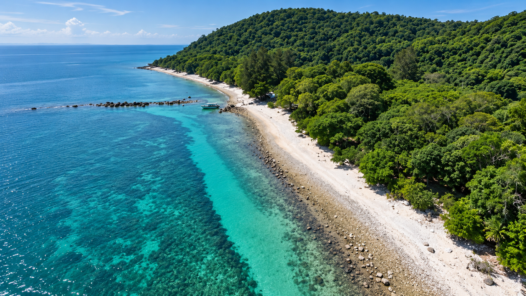
Khanom’s coastline is not one single beach. It is a sequence of beaches and bays separated by headlands and coastal hills.
Important coastal areas include Na Dan, Nai Phlao, Pak Nam, Khanom Beach, Ao Khanom, Thong Yang, Thong Ching, Thong Yee and other smaller bays. Exact classifications can vary between tourism and administrative sources.
For ThailandLover, they are best presented as a coastal sequence, rather than pretending that every beach is a separate protected-zone entity.
Na Dan Beach
The Long Coastal Face of Khanom
Na Dan is one of the best-known stretches of Khanom’s coastline. The beach forms part of a longer coastal landscape of sand, coconut trees, coastal vegetation and the Gulf of Thailand.
It is a good place to understand the scale of Khanom. This is not an island beach. There is no need to cross the sea to reach it. The landscape begins directly from the mainland.
Nai Phlao Beach
A Quieter Coastal Landscape
Nai Phlao is framed by hills and coastal vegetation, creating a more enclosed atmosphere than the longest open stretches of Na Dan.
For travellers who prefer a slower coastal experience, this section of Khanom can be more appealing than highly developed beach destinations elsewhere in southern Thailand.
Pak Nam & Ao Khanom
Pak Nam represents the meeting point between the coastal landscape and the local working waterfront — a reminder that Khanom is not simply a tourism destination. The sea remains economically important to local communities.
The broad coastal area around Khanom Bay is one of the district’s most recognizable landscapes. From elevated roads and viewpoints, the combination of forest + beaches + Gulf of Thailand becomes particularly clear.
The Mountains Behind the Beach
The most important thing to understand about Khanom is that the sea is only half the story.
Behind the coastline are forested hills and mountain systems. These landscapes act as watersheds. Rainfall moves through the forest and eventually becomes streams and waterways that support communities and coastal ecosystems.
The DNP notes that the area contains important headwater forests and 22 streams, including Khlong Hin Lat and Khlong Tha Noi. Forest conservation is therefore directly relevant to coastal health.
Khao Phlai Dam
Mountain Meets Sea
Khao Phlai Dam is one of the important scenic landscapes around the Khanom coast. The mountain rises behind the coastline and creates elevated views across the Gulf.
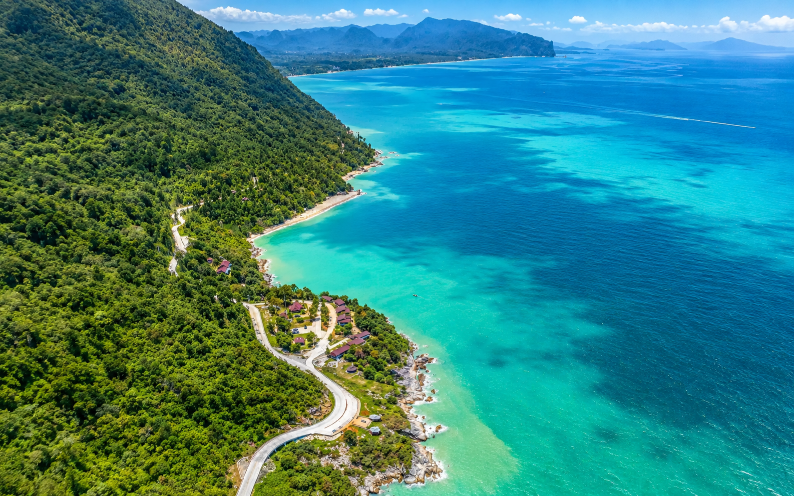
The area demonstrates the characteristic Khanom relationship of Mountain → Forest → Road → Beach → Sea. For ThailandLover, this is more than a viewpoint. It is a way to understand the geography of Khanom.
Plai Chamroen Viewpoint
Looking Across the Dolphin Coast
The Plai Chamroen viewpoint is associated with the park’s headquarters area and provides views toward the Gulf of Thailand. It is also part of the coastal landscape associated with dolphin sightings.
The DNP has documented sightings of more than ten Indo-Pacific humpback dolphins in the waters visible from this area.
The Pink Dolphin
The Animal That Became Khanom’s Symbol
If there is one creature that defines Khanom’s identity, it is the Indo-Pacific humpback dolphin (Sousa chinensis).
The species is also known as the Chinese white dolphin, humpback dolphin or pink dolphin. The local term “pink dolphin” is particularly popular in Khanom.
There is an important scientific detail. These dolphins are not born pink. Their coloration can become progressively lighter with age. The pinkish appearance is associated with blood vessels visible through the lighter skin rather than a special pink pigment.
Indo-Pacific humpback dolphins, locally known as Khanom’s pink dolphins.
That wording is more accurate than simply calling them a species of pink dolphin.
The DNP describes the marine area as an important habitat for Indo-Pacific humpback dolphins and green turtles. The dolphins are not simply an attraction. They are part of the ecological identity of the coast.
Dolphin Watching
See Them Without Chasing Them
Dolphin watching is one of the most popular experiences in Khanom. Visitors typically travel by local boat into coastal waters where dolphins may be encountered.
There is an important difference between wildlife watching and wildlife pursuit.
- Do not chase dolphins
- Do not surround them with boats
- Do not attempt to touch them
- Do not feed them
- Avoid sudden changes in speed
- Keep noise levels controlled
- Follow local navigation and conservation guidance
The objective is not to force a close encounter. The objective is to observe natural behaviour.
Sightings Are Never Guaranteed
No responsible wildlife destination should promise that you will definitely see pink dolphins. They are wild animals. Their movements depend on food, tides, weather, sea conditions, boat traffic, season and natural behaviour.
Khanom offers an opportunity to look for Indo-Pacific humpback dolphins in their natural coastal habitat.
Coral, Turtles, Mangroves & Seagrass
The marine landscape also includes coral habitats that support reef fish, molluscs, crustaceans and other marine organisms. The DNP has specifically identified coral resources in the proposed protected landscape.
The marine area also provides habitat for green turtles. Their presence reinforces the importance of protecting the wider coastal environment rather than focusing solely on dolphins.
A healthy marine landscape needs clean water + healthy seagrass and coral habitats + safe coastal zones.
Mangroves
Mangroves occupy the transition between land and sea. They provide nursery habitat for young fish, habitat for crabs and molluscs, feeding grounds for birds, coastal protection, sediment retention and carbon storage. They are essentially biological infrastructure.
You may not visit Khanom specifically to see a mangrove. But without healthy coastal wetlands, the wider marine ecosystem becomes weaker.
Seagrass
The DNP specifically identifies seagrass resources alongside coral and marine wildlife. Seagrass meadows connect coastal biodiversity with larger marine animals. They provide habitat and feeding grounds and can help stabilize sediments in shallow water.
The Islands
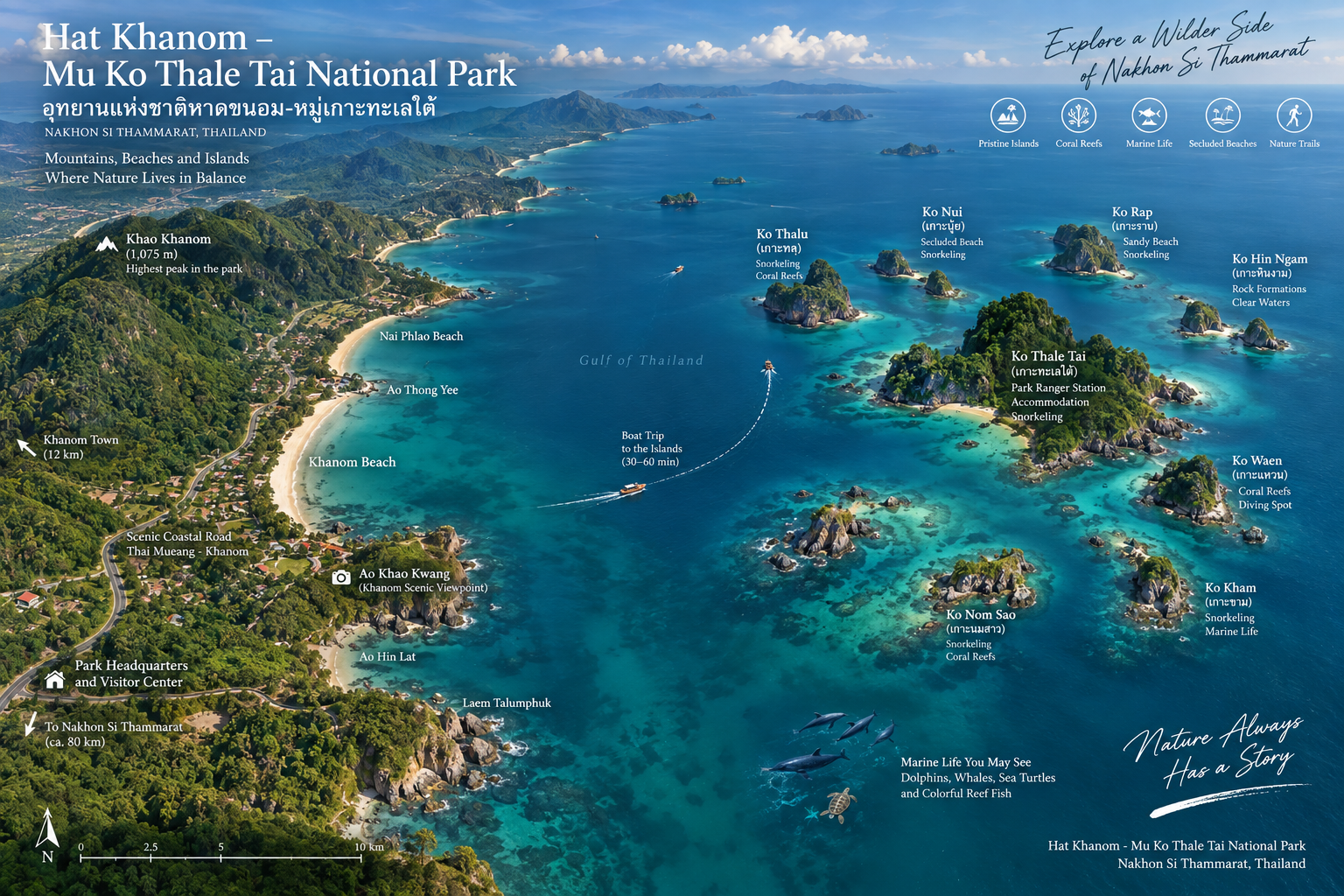
The “Mu Ko Thale Tai” portion of the name refers to the southern island group associated with the proposed protected landscape. The exact legal list and boundaries of islands should be treated carefully because the preparatory boundary is still being revised.
DNP materials specifically identify important islands including Ko Tha Rai and Ko Nui, and the wider landscape includes other offshore islands.
Ko Tha Rai
Ko Tha Rai’s significance comes from its combination of rocky coastline, marine environment and relationship to the surrounding coastal waters. It is best understood as part of the larger Khanom marine system rather than as an isolated resort island.
Ko Nui
A Small Island With a Large Story
Ko Nui is known locally for the cultural story surrounding Luang Pu Thuat and the phenomenon popularly described as freshwater in the sea.
This makes Ko Nui interesting because it combines natural landscape, local belief and cultural memory. The island is not simply a geological object. It is part of the cultural landscape of Khanom.
ThailandLover presents the cultural story and the hydrological phenomenon as related, but not the same thing. The island can be appreciated through geology, hydrology, local belief and religious tradition at once.
Hin Phap Pha
Thailand’s Layered-Rock Coast
One of Hat Khanom–Mu Ko Thale Tai’s most distinctive geological features is Hin Phap Pha — “folded rock.”
The rocks appear as layers stacked one above another, creating a visual resemblance to folded fabric. The phenomenon is particularly associated with areas around Ko Tha Rai, Ko Nui Nok, Khao Lak So, Ao Talet and parts of the Khanom coastal landscape.
How It Formed
Sediments accumulated in layers. Different layers developed different physical properties. Geological forces tilted and uplifted the strata. Waves and weathering attacked weaker layers. Stronger layers remained more prominent.
The result is a striking sequence of layered rock. From a distance it can look almost artificial. It is not. It is geological history exposed at the coast.
Hin Phap Pha is sometimes compared with the Pancake Rocks of New Zealand. The comparison is useful visually, but the sites are not identical geological formations.
Khanom’s folded-rock landscape
is a better phrase than presenting it as literally the same phenomenon.
From Mountain to Sea
Although Khanom is famous for the sea, the proposed protected landscape also contains forest and watershed systems. Klang Thong Waterfall lies within the forested mountain landscape and illustrates the relationship between the upland watershed and the coastal environment.
The sea does not begin at the beach. It begins much farther inland.
- Mountain
- Rain falls over the forest.
- Forest
- Vegetation captures water and protects soil.
- Streams
- Water flows through mountain valleys — 22 streams, including Khlong Hin Lat and Khlong Tha Noi.
- Coast
- Freshwater reaches coastal ecosystems.
- Mangrove
- Sediment and nutrients are processed.
- Sea
- Marine habitats support fish, turtles and dolphins.
Protecting the beach alone would never be enough.
Wildlife
DNP identifies terrestrial wildlife including serow, sambar deer, wild boar, civets, pangolins, dusky langurs, long-tailed macaques and binturong. The marine side is particularly associated with Indo-Pacific humpback dolphins, green turtles, reef fish and coral communities.
The dolphin’s continued presence has conservation significance. Dolphins need food, suitable water quality, coastal habitat and relatively safe movement corridors. The DNP describes the dolphin population in the area as an important and vulnerable marine resource.
A Landscape Under Pressure
The future national park is not being created in an empty landscape. People already live and work here: fishing communities, agricultural areas, tourism businesses, coastal roads, traditional resource use and existing settlements.
That creates one of the most important issues surrounding the proposed park: how can conservation protect nature without unnecessarily damaging legitimate community livelihoods?
The proposed park boundary has been revised repeatedly. As of April 2026, the area under preparation had been reduced from approximately 197,614 rai to 73,092 rai. In May 2026, DNP was still conducting participation processes. In May and June 2026, the National Human Rights Commission also documented continued community discussions concerning land rights, fishing, coastal use, marine boundaries, traditional livelihoods and community participation.
ThailandLover should not present this as conservation equals good and community equals problem. A successful protected landscape needs both healthy ecosystems and healthy communities.
In September 2026, authorities inspected an area around Ko Wang Nok after detecting coastal encroachment and alteration of the marine environment. The operation involved more than three rai and included reported coral damage. The conservation story here is not theoretical. It is happening now.
When to Visit
Khanom has a tropical climate influenced by the Gulf of Thailand. For beach and boat activities, visitors should prioritize periods with calmer seas, better visibility, lower rainfall and stable weather.
For hiking and forest exploration, wetter conditions can make the landscape greener but also increase slippery trails, stream levels, rainfall and reduced visibility. Always check current local conditions before boat trips.
- Morning
- Generally best for dolphin watching, boat excursions, photography, cooler temperatures and coastal walks.
- Afternoon
- Better suited to beach time, scenic drives, viewpoints and relaxed exploration.
- Sunset
- The Gulf-facing coastline can produce beautiful evening light. Do not confuse a beautiful sunset with a reason to remain in an unsafe or restricted area.
How Long Should You Stay?
- One day
- Enough for the Khanom coastline, dolphin watching, one viewpoint and selected beach areas.
- Two days
- Much better. Combine beach, dolphin, mountain and geological landscape.
- Three days
- Ideal for a slower ThailandLover experience: coastal drives, beaches, dolphin watching, Ko Nui, Hin Phap Pha, Khao Phlai Dam, forest, local food and community time.
The Scenic Coastal Drive
One of Khanom’s greatest attractions is not a single destination. It is the road itself — linking beaches, headlands, forested hills, small communities, viewpoints, seafood restaurants and coastal landscapes.
This is a place where the journey is part of the destination.
A ThailandLover Day on the Slow Coast
- 07:00
- Walk the Khanom coast while the air is still cool.
- 08:00
- A responsible local boat — without expecting a guaranteed sighting.
- 10:30
- Return to the mainland. Explore coastline and viewpoints.
- 12:00
- Eat locally. Khanom’s coastal identity is inseparable from seafood.
- 14:00
- Drive into the hills at Khao Phlai Dam for a different perspective of the coast.
- 16:00
- Hin Phap Pha and coastal geology, where access and conditions permit.
- 17:30
- Return toward the coast. Let the landscape slow down.
A Better Two-Day Experience
Day 1 — The Sea: Khanom Beach → dolphin watching → Ko Nui → coastal lunch → Na Dan / Nai Phlao → sunset.
Day 2 — The Mountain: Khao Phlai Dam → forest → Klang Thong Waterfall → Hin Phap Pha → local community → coastal dinner.
Responsible Travel
Choose operators who maintain distance from dolphins, do not chase animals, avoid surrounding one animal with multiple boats, do not feed wildlife, follow local marine rules, understand tides and put safety before guaranteed sightings. A good operator should be willing to return without a sighting rather than force an encounter.
- Do not feed or chase dolphins
- Do not touch coral
- Do not collect shells or marine life
- Do not litter — especially plastic
- Respect local fishermen: the sea is a workplace
- Respect community rights in this living landscape
Photography Guide
Hat Khanom is particularly strong for environmental photography. The most interesting photographs may not be the obvious ones.
- Dolphins
- Use longer lenses when possible. Do not move closer simply to get a larger frame.
- Coastal road
- The winding road against forest and sea creates strong leading lines.
- Hin Phap Pha
- Look for repeated geological layers.
- Khao Phlai Dam
- Shoot toward the coastline for the relationship between mountain and sea.
- Beaches
- Early morning and late afternoon produce softer light.
- Islands
- Use foreground rocks or vegetation to create depth.
Look for fishing boats against forested hills, dolphins beneath an open Gulf horizon, rock layers resembling folded fabric, mangrove roots meeting tidal water, a beach disappearing around a forested headland, and local life beside a protected landscape.
What Makes Hat Khanom Different?
Thailand has many beaches, many islands and many marine parks. Khanom’s difference is the combination.
- Mountain
- Forest-covered hills form the backdrop.
- Beach
- Long quiet beaches stretch along the Gulf.
- Island
- Small offshore islands break the horizon.
- Geology
- Folded rocks reveal geological history.
- Wildlife
- Dolphins move through coastal waters.
- Community
- Fishing villages and local livelihoods remain part of the landscape.
- Conservation
- The entire system is moving toward stronger formal protection.
Khanom’s strongest identity is not luxury, nightlife or mass tourism. Its identity is Slow Coast: a place where roads still matter, fishing boats remain visible, beaches remain relatively open, forest meets the sea, wildlife is part of the destination and local communities remain visible.
Frequently Asked Questions
- Is Hat Khanom–Mu Ko Thale Tai already a national park?
- Not yet. As of September 2026, it remains a National Park Preparatory Area. The designation process is still underway.
- How large is Hat Khanom–Mu Ko Thale Tai?
- The current area under preparation is approximately 73,092 rai, according to information dated April–May 2026. This should not be described as the final legal area of a gazetted national park because the boundary remains under review.
- Where is Hat Khanom–Mu Ko Thale Tai?
- The proposed protected landscape spans parts of Nakhon Si Thammarat and Surat Thani. The core mainland landscape is associated with Khanom and Sichon, while the broader preparatory boundary also involves areas in Surat Thani.
- What is the most famous attraction at Khanom?
- The Indo-Pacific humpback dolphin, popularly called the pink dolphin.
- Are pink dolphins actually pink?
- Some older individuals can develop a pronounced pinkish appearance. They are not a separate pink-dolphin species. The colour is associated with age and circulation rather than a special pigment.
- Can I see dolphins every time in Khanom?
- No. They are wild animals and sightings are never guaranteed. Khanom offers an opportunity to look for Indo-Pacific humpback dolphins in their natural coastal habitat.
- What is Hin Phap Pha?
- A distinctive geological formation of layered rock that has been tilted and exposed by geological processes and later erosion — Khanom’s folded-rock landscape.
- What wildlife lives in Hat Khanom–Mu Ko Thale Tai?
- DNP identifies species including serow, sambar deer, wild boar, civets, pangolins, dusky langurs, long-tailed macaques and binturong, as well as important marine wildlife such as Indo-Pacific humpback dolphins and green turtles.
- Is there coral at Hat Khanom–Mu Ko Thale Tai?
- Yes. Coral resources are among the marine resources identified in the proposed protected area.
- Is there a waterfall at Hat Khanom–Mu Ko Thale Tai?
- Yes. Klang Thong Waterfall is one of the natural attractions identified in the forested mountain landscape.
- Is Ko Nui important?
- Yes. It is associated with the local cultural landscape, the Luang Pu Thuat tradition and the well-known freshwater-in-the-sea phenomenon.
- Is there a conflict between conservation and local communities?
- There are ongoing discussions concerning land, fishing, marine boundaries and traditional livelihoods. The boundary has been revised during the preparation process, and community participation remains an active part of the designation process.
Related Destinations
- Mu Ko Ang Thong National Park
- A Gulf island archipelago further toward Surat Thani and Ko Samui.
- Khao Luang National Park
- The mountain heart of Nakhon Si Thammarat, inland from this slow coast.
- Hat Chao Mai National Park
- A different southern seascape — limestone islands and seagrass on the Andaman coast of Trang.
- Nature & Parks
- More protected landscapes across ThailandLover’s national-park collection.
Location
Find Hat Khanom–Mu Ko Thale Tai
Khanom, Nakhon Si Thammarat