


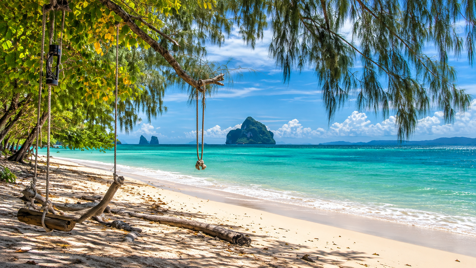
Marine National Park · Trang
Hat Chao Mai National Park
อุทยานแห่งชาติหาดเจ้าไหม
Where Limestone Coast, Emerald Seas & Seagrass Meet
Trang · Southern Thailand · Andaman Sea
A connected coastal landscape of beaches, karst islands, mangroves, coral reefs and seagrass meadows — famous for Koh Muk, the Emerald Cave and Koh Kradan, and essential for the dugong.
Where Land and Sea Stay Connected
There are places in Thailand where the sea is the attraction.
And there are places where the sea is part of a much larger story.
Hat Chao Mai National Park is one of them.
Stretching along the Andaman coast of Trang Province and extending into a remarkable chain of offshore islands, the park brings together beaches, limestone headlands, mangrove forests, coral reefs, seagrass meadows, sea caves and some of the most distinctive island landscapes in southern Thailand.
It is best known for places such as Koh Muk, the Emerald Cave and Koh Kradan.
But beneath those famous names lies something more important.
Hat Chao Mai protects a coastal ecosystem in which forests, wetlands, islands and shallow marine habitats are connected.
This is also one of Thailand’s important remaining landscapes for the dugong, a marine mammal whose survival depends heavily on healthy seagrass meadows.
So while visitors may come looking for turquoise water and white sand, the deeper story of Hat Chao Mai is about the relationship between land and sea.
Come for the islands. Look closer at the sea.
Hat Chao Mai at a Glance
- Official Name
- Hat Chao Mai National Park
- Thai Name
- อุทยานแห่งชาติหาดเจ้าไหม
- Province
- Trang
- Region
- Southern Thailand
- Coast
- Andaman Sea
- Districts
- Sikao and Kantang
- Established
- 14 October 1981
- Protected Area
- Approximately 230.87 km²
- Approximate Area
- 144,292 rai
- Coastline
- Approximately 20 km
- Type
- Marine National Park
- Signature Landscapes
- Beaches, limestone karst, islands, mangroves, coral reefs and seagrass beds
- Signature Wildlife
- Dugong and diverse marine and coastal species
- International Recognition
- Part of the Hat Chao Mai–Ko Libong–Trang River Estuaries Ramsar Wetland
- Ramsar Site No.
- 1182
- Ramsar Designation
- 14 August 2002
Why Hat Chao Mai Matters
Hat Chao Mai is unusual because it protects a landscape that does not stop at the shoreline.
Its protected environment extends from terrestrial forests and beaches into shallow coastal waters and offshore islands. This creates a connected ecological system.
Rain falls on the land. Water moves through forests and wetlands. Mangroves filter sediments and provide nursery habitat. Seagrass meadows provide food for dugongs. Coral reefs provide habitat for marine organisms. Islands and limestone formations shelter beaches and coastal ecosystems.
The result is a landscape where the health of one environment can directly influence another.
This is the real significance of Hat Chao Mai. It is not simply a collection of beautiful places.
It is a coastal ecosystem.
The Geography of Hat Chao Mai
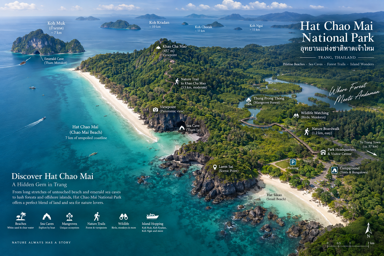
The national park occupies parts of Sikao and Kantang districts in Trang Province. Its mainland section follows the Andaman coastline, while its marine territory includes a group of offshore islands.
The landscape can broadly be understood as two connected worlds.
- The Mainland
- Beaches, coastal forest, casuarina-lined shores, limestone hills, mangrove areas, caves, coastal wetlands, nature trails and visitor facilities.
- The Offshore Islands
- Koh Muk, Koh Kradan, Koh Chueak, Koh Waen, Koh Pling, Koh Meng and Koh Chao Mai — each with a different physical character, from beaches and reefs to limestone cliffs, caves and marine habitat.
Together they create the distinctive island geography of the Trang Sea.
A Coastline Built by Limestone
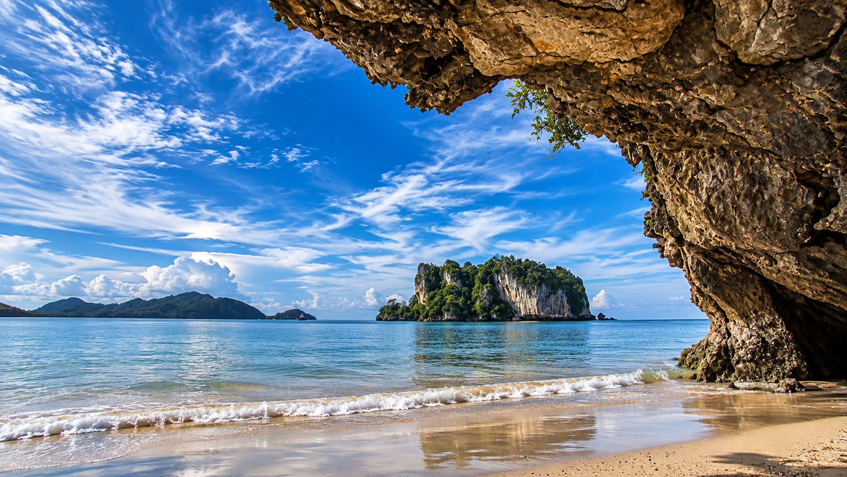
One of the defining features of Hat Chao Mai is its limestone geology. Limestone has shaped much of the coastline.
It appears as rocky headlands, isolated islands, sea cliffs, caves, karst formations and offshore rock formations.
This geological character gives Trang’s coastline a different appearance from long, uninterrupted sandy shores. Here, beaches repeatedly meet rock. Forest climbs over limestone. The sea enters caves. And offshore islands rise abruptly from shallow Andaman waters.
The result is a coastline that feels almost sculpted.
The Beaches of Hat Chao Mai
The mainland side of the national park contains a sequence of beaches. They are not identical. Each has a slightly different relationship with the surrounding forest, limestone formations and sea.
Pak Meng Beach
หาดปากเมง · Gateway to the Islands
Pak Meng is one of the best-known coastal landmarks in Trang. The beach stretches along the mainland coast and is associated with the distinctive Khao Meng limestone formation rising from the sea.
From the shoreline, the mountain-like rock creates one of Trang’s recognizable coastal views. Pak Meng also functions as an important gateway toward the Trang islands. It is therefore both a destination and a departure point for exploring the wider marine landscape.
Chang Lang Beach
หาดฉางหลาง · Park Headquarters
Chang Lang Beach is closely associated with the national park headquarters. The coastline here combines sandy beach, coastal vegetation and limestone scenery.
It is a useful base for visitors who want to experience the mainland side of Hat Chao Mai before heading toward the islands. The park’s visitor facilities and accommodation are concentrated around this area.
Chao Mai Beach
หาดเจ้าไหม · The Name of the Park
Chao Mai Beach gives the national park its name. The beach is relatively broad and shallow in sections, with coastal vegetation and a quieter atmosphere than some of the better-known island destinations.
It is particularly interesting when viewed together with the surrounding karst landscape. The beach is not simply an isolated strip of sand. It forms part of the transition between terrestrial forest and the Andaman Sea.
Yong Ling Beach
หาดหยงหลิง
Yong Ling is a curved sandy beach framed by limestone terrain. The relationship between the beach and surrounding hills creates a more enclosed landscape.
It is one of the places where Hat Chao Mai’s characteristic combination of sand + forest + limestone + sea can be appreciated without needing to travel offshore.
Yao Beach
หาดยาว
Hat Yao is another important mainland beach within the park landscape. Its long shoreline provides a different perspective from the more enclosed beaches around limestone headlands.
The beach is part of the broader coastal corridor connecting the mainland attractions of Hat Chao Mai.
San Beach
หาดสั้น
San Beach forms part of the coastal sequence protected by the national park. Like the other mainland beaches, its significance lies not only in the sand but in the surrounding coastal ecosystem.
Koh Muk
The Island of the Emerald Cave
Koh Muk is perhaps the most famous island associated with Hat Chao Mai. Its identity is dominated by limestone cliffs, forest, beaches and the extraordinary geological feature known as Tham Morakot — the Emerald Cave.
Koh Muk is also a living island community. The island is not simply a tourist attraction. Local residents have long depended on fishing, agriculture and tourism.
This gives Koh Muk a cultural dimension that is easily missed when visitors arrive only for the cave.
Tham Morakot
The Emerald Cave
Tham Morakot is one of southern Thailand’s most extraordinary natural attractions. From the outside, the entrance can appear surprisingly small. Inside, however, the cave opens into a dramatic hidden landscape.
Visitors enter through a dark sea passage before emerging into a concealed lagoon surrounded by steep limestone walls.
The contrast is spectacular. Darkness. Then green water. Then sunlight. Then a hidden beach. This sequence is what gives the cave its name.
Why Is It Emerald?
When sunlight enters through the cave opening and interacts with the shallow seawater, the water can take on an intense emerald-green appearance. The colour becomes particularly dramatic when viewed from inside the cave toward the entrance.
Entering the Emerald Cave
The Emerald Cave is not a conventional walk-in cave. Visitors traditionally enter through the marine passage. Depending on conditions and park regulations, access may involve swimming or floating through the cave with appropriate safety equipment.
The passage is dark and confined. For that reason, visitors should follow the instructions of park staff and experienced local operators.
The cave is a natural environment, not a theme-park attraction. Weather, tide, waves and visitor-management conditions can affect access.
Inside the Emerald Cave
The hidden interior contains a small beach surrounded by limestone cliffs. This creates the impression of a secret lagoon completely separated from the open sea.
It is one of the strongest examples in Thailand of how marine erosion and limestone geology can create a dramatic coastal landscape.
The experience is not really about the beach itself. It is about the transformation:
Open Sea → Dark Passage → Emerald Water → Hidden Lagoon
That sequence is what makes Tham Morakot unforgettable.
The Islands of the Trang Sea
Koh Kradan
The Beach Island
If Koh Muk is associated with the Emerald Cave, Koh Kradan is associated with beaches and exceptionally clear coastal water.
The island is famous for its pale sand and turquoise sea. Its shallow waters also provide access to coral and marine environments.
The island became internationally recognized after Koh Kradan was included among highly ranked beaches in global travel publications. But rankings are not the real reason it matters.
Its strongest quality is the relationship between white sand + shallow sea + offshore reef + tropical forest. That combination creates the classic image of the Trang islands.
Koh Chueak
Small Island, Big Marine Character
Koh Chueak is a small limestone island located within the Trang island group. It is particularly associated with snorkeling. Its surrounding waters contain coral and marine habitats that support a variety of fish.
The island demonstrates an important characteristic of the Trang Sea: you do not need a large island to have a major ecological role. Small limestone islands can provide shelter, reef habitat and distinctive underwater environments.
Koh Waen
Koh Waen is another small island in the Trang marine landscape. Its importance is closely connected to the surrounding sea rather than to extensive terrestrial facilities.
Like Koh Chueak, it is primarily experienced from the water. For travellers interested in snorkeling and marine landscapes, these smaller islands are part of the broader ecological story of Hat Chao Mai.
Koh Pling, Koh Meng & Koh Chao Mai
Koh Pling is one of the smaller offshore islands associated with the park. Its limestone formation and surrounding marine waters contribute to the visual character of the Trang archipelago.
Koh Meng is another island within the wider park landscape. The name is also associated with the famous Khao Meng coastal formation near Pak Meng.
Koh Chao Mai forms another component of the offshore island landscape. Like several of the smaller islands, it is better understood as part of the wider marine ecosystem than as a stand-alone mass-tourism destination.
Seagrass Meadows
The Hidden Foundation of Hat Chao Mai
If the Emerald Cave is the photograph people remember, the seagrass meadows are the reason Hat Chao Mai matters as a protected marine landscape.
Seagrass grows in shallow, relatively sheltered water. It is easy to overlook. From a boat it can look like nothing more than a darker patch on the sea floor. Ecologically, however, these meadows are among the most important habitats in the park.
They stabilize sediments, store carbon, shelter juvenile fish and provide the principal food of dugongs. The wider Hat Chao Mai–Ko Libong–Trang River Estuaries Ramsar wetland is regarded as one of Thailand’s healthiest and most diverse seagrass ecosystems.
The turquoise water is the surface. The seagrass is the foundation.
The Dugong
Hat Chao Mai is one of Thailand’s important remaining landscapes for the dugong.
Dugongs are slow-moving marine mammals that graze on seagrass. Their survival is therefore tied directly to the condition of shallow coastal meadows. When seagrass is damaged — by boats, sedimentation, pollution or destructive fishing — dugongs lose the habitat they depend on.
A sighting is never guaranteed. That is part of the point. The animals belong to the sea, not to a visitor itinerary.
If you are fortunate enough to see a dugong, observe from a distance. Do not approach, chase, surround or attempt to swim with the animal. Keep engines slow in known seagrass areas and follow current park instructions.
The privilege is to share the water. Not to claim it.
Mangroves, Coral & Wildlife
Mangrove Forests
Mangroves occupy the quieter edges of the park — estuaries, sheltered inlets and the transition between freshwater and sea. They filter sediment, protect the shoreline and provide nursery habitat for fish, crabs and birds.
Around the headquarters landscape, mangrove forest is part of the mainland visitor experience, not a separate destination far from the beaches.
Coral Reefs
Coral habitats surround several of the offshore islands, especially where water remains relatively clear. Koh Kradan and Koh Chueak are particularly associated with snorkeling.
Reefs here should be treated as living structures. Do not stand on coral, collect souvenirs or drop anchors onto reef. The photograph of turquoise water depends on the health of what lies beneath it.
Wildlife of Land and Sea
The wider Ramsar landscape supports a remarkable mix of marine, coastal and forest life: dugongs, fish, shorebirds, forest mammals and the quieter species that visitors rarely notice.
Large animals are not the measure of a healthy park. The seagrass, the mangrove, the reef and the forest are.
Mainland Trails & Quiet Shores
Hat Chao Mai is not only an island-hopping park. The mainland around the headquarters offers beaches, limestone viewpoints, a mangrove landscape and short nature walks.
This is useful for visitors who arrive late, who want a slower first day, or who prefer not to spend every hour on a boat.
- Headquarters landscape
- Chang Lang and Chao Mai beaches, visitor facilities, camping and the immediate coastal forest.
- Mangrove and boardwalk
- A chance to see the wetland side of the park without leaving the mainland.
- Limestone viewpoints
- Headlands and short climbs that reveal how beach, forest and sea fit together.
The islands are the headline. The mainland is how the ecosystem begins.
When to Visit Hat Chao Mai
The character of the park changes with the Andaman monsoon.
- Cool and dry season · November–April
- Generally the most reliable period for calmer seas, island boat trips, snorkeling, photography and the Emerald Cave. This is when most visitors come — and when the islands are busiest.
- Monsoon · May–October
- The mainland beaches and forest remain part of the experience, but boat access, cave entry and snorkeling can be restricted by rain, wind and swell. Always follow current park and operator advice.
The Best Time of Day
Start early for boats. Morning usually offers calmer water, softer light and a better chance of reaching the Emerald Cave before peak crowding. Weekends and Thai public holidays can become substantially busier at Pak Meng and on Koh Muk.
How Long Should You Spend?
- Half day
- Enough for the mainland beaches around Chang Lang and Chao Mai, or a focused boat trip if conditions and timing allow.
- Full day
- The classic first visit: Pak Meng or Chang Lang as a base, then Koh Muk and the Emerald Cave, with time for Koh Kradan or a snorkel stop if the sea cooperates.
- Overnight or longer
- Best if you want both the islands and the quieter mainland — mangrove, beaches at different tides, and an earlier start on the water.
Who Will Enjoy Hat Chao Mai Most?
- Island travellers
- Koh Muk, Koh Kradan and the smaller limestone islets are the reason many people come to Trang.
- Snorkellers
- Clear shallows and reef around the smaller islands reward visitors who look underwater as well as at the beach.
- Photographers
- Limestone, turquoise water, casuarina shade and cave light create some of the Andaman’s strongest coastal compositions.
- Families
- Mainland beaches are relatively accessible. Island trips and the Emerald Cave need more planning, swimming ability and attention to conditions.
- Slow travellers
- Hat Chao Mai rewards visitors who stay long enough to see mangrove, seagrass and the mainland coast, not only the famous cave.
Visiting the Islands
Most island trips begin from the mainland around Pak Meng. Long-tail boats and local operators run toward Koh Muk, the Emerald Cave, Koh Kradan and the smaller snorkel islands when sea conditions allow.
The Emerald Cave is a managed natural site. Visitor numbers, entry method and opening can change. Do not assume that a photograph from a previous year still describes current access.
- Confirm boat, cave and snorkel conditions on the day
- Wear a life jacket in the cave passage when required
- Allow time for the return journey and changing weather
- Carry out all rubbish, including from island beaches
- Stay off coral and out of closed or seagrass-protection zones
Food, Facilities & Overnight Stay
Visitor services are concentrated around the mainland beaches and park headquarters at Chang Lang. Food, parking and basic facilities are easier to find here than on the smaller islands.
The park provides camping and accommodation in the headquarters area, subject to availability and current regulations. Staying overnight is a good option if you want an early boat and a slower look at the mainland coast.
On Koh Muk, a resident community means guesthouses and local food exist beyond the park’s own facilities. Treat the island as a neighbourhood as well as a destination.
How to Get to Hat Chao Mai
Hat Chao Mai National Park is on the Andaman coast of Sikao and Kantang districts, Trang Province. From Trang town, the usual approach follows the road toward Sikao and Pak Meng. The headquarters sits at Chang Lang Beach, not far from that coastal corridor.
By Private Car
Driving is the most flexible option, especially if you want to move between Pak Meng, Chang Lang, Chao Mai and Yong Ling. From Trang, allow roughly 40–50 kilometres depending on your destination along the coast.
By Public Transport
Songthaews and vans run between Trang and the Pak Meng area. From Pak Meng you may still need a local transfer to the headquarters or a boat pier. Check current return times before you travel.
Visitor Information
National-park admission applies. Vehicle charges may apply separately. Because government fees and operating policies can change, verify the current rate with the park or the Department of National Parks before travelling.
Responsible Travel at Hat Chao Mai
The park is beautiful because the sea is still a working ecosystem. Help keep it that way.
- Leave no trace — take rubbish with you, including from boats and islands
- Do not stand on, collect or damage coral
- Keep boats off seagrass meadows where possible
- Never approach, chase or feed dugongs or other wildlife
- Follow cave capacity and safety instructions
- Stay on designated trails and boardwalks in mangrove and limestone areas
- Keep noise down around forest, beaches and village communities
Photography Guide
Hat Chao Mai is easy to photograph as a postcard. It is more interesting when you photograph relationships:
Sand + limestone · Forest + sea · Cave + light · Human scale + island
- Early morning
- Softer light on mainland beaches and calmer water for island approaches.
- Emerald Cave
- The colour is strongest when sunlight reaches the hidden lagoon. Follow staff on timing and crowding.
- Koh Kradan
- Look for the meeting of pale sand, shallow turquoise and darker reef water — not only the shoreline.
- Mainland
- Casuarina shade, Khao Meng and the limestone headlands often make stronger images than a wide empty beach.
Nearby Experiences
- Ko Libong & the Ramsar wetland
- The wider Hat Chao Mai–Ko Libong–Trang River Estuaries landscape extends the story of seagrass, birds and dugong habitat beyond a single park boundary.
- Trang
- The provincial capital is the usual gateway — food, overnight stays and the road toward Sikao and Pak Meng.
- Kantang
- A quieter coastal district associated with the southern side of the park and the river-estuary landscape.
- Ao Phang Nga National Park
- Further north, another Andaman limestone seascape of karst islands, mangroves and hidden waterways.
- Mu Ko Phetra National Park
- A neighbouring Andaman island park in the far south, useful if you are continuing along this coast.
Frequently Asked Questions
- What is Hat Chao Mai National Park?
- Hat Chao Mai National Park, or อุทยานแห่งชาติหาดเจ้าไหม, is a marine national park in Trang Province, established on 14 October 1981. It covers about 230.87 km² of Andaman coastline, limestone islands, mangroves, coral reefs and seagrass meadows, and forms part of Ramsar Site 1182.
- Where is Hat Chao Mai National Park?
- The park occupies parts of Sikao and Kantang districts in Trang Province, along the Andaman Sea of southern Thailand. Headquarters are at Chang Lang Beach in Mai Fat Subdistrict.
- What is Hat Chao Mai famous for?
- It is best known for Koh Muk, Tham Morakot (the Emerald Cave) and Koh Kradan, together with mainland beaches such as Pak Meng and Chao Mai. The deeper story is a connected coastal ecosystem of limestone, mangroves, coral reefs, seagrass and dugong habitat.
- How do you enter the Emerald Cave?
- Visitors traditionally enter Tham Morakot through a dark marine passage, swimming or floating with appropriate safety equipment depending on conditions and park regulations. Access can change with weather, tide, waves and visitor-management rules.
- Do you have to swim to visit the Emerald Cave?
- Yes. The cave is not a conventional walk-in cave. Entry is through a confined sea passage, so swimming or floating ability, a life jacket when required, and current park instructions all matter.
- Can you see dugongs at Hat Chao Mai?
- The park is one of Thailand’s important remaining landscapes for dugongs, which depend on healthy seagrass meadows. Sightings are never guaranteed. Observe from a distance and never approach, chase or disturb the animals.
- When is the best time to visit Hat Chao Mai?
- November through April is generally the most reliable period for calmer Andaman seas, island boat trips, snorkeling and the Emerald Cave. The monsoon months can restrict boat access.
- How do I get to Hat Chao Mai from Trang?
- From Trang town, follow the road toward Sikao and Pak Meng. The park headquarters is at Chang Lang Beach. Pak Meng is the main mainland gateway toward the islands. Driving is the most flexible option; vans and songthaews also run toward Pak Meng.
- How far is Hat Chao Mai from Trang town?
- From Trang town, allow roughly 40–50 kilometres depending on whether you are heading to Pak Meng, Chang Lang or another point along the coast.
- Can you stay overnight at Hat Chao Mai National Park?
- Yes. The park provides camping and accommodation around the headquarters at Chang Lang, subject to availability and current regulations. Koh Muk also has guesthouses in the island community.
- Is Hat Chao Mai only about the islands?
- No. The mainland includes Pak Meng, Chang Lang, Chao Mai, Yong Ling, Yao and San beaches, plus mangrove, limestone viewpoints and short nature walks around headquarters.
- Which islands are in Hat Chao Mai National Park?
- Islands associated with the park include Koh Muk, Koh Kradan, Koh Chueak, Koh Waen, Koh Pling, Koh Meng and Koh Chao Mai.
Related Destinations
- Ao Phang Nga National Park
- Limestone islands, mangroves and hidden lagoons further north on the Andaman coast.
- Mu Ko Phetra National Park
- Island and sea landscapes continuing along the far-southern Andaman shore.
- Nature & Parks
- More protected landscapes across ThailandLover’s national-park collection.
Location
Find Hat Chao Mai National Park
Mai Fat, Sikao, Trang 92150