

Marine National Park · Satun & Trang
Mu Ko Phetra National Park
อุทยานแห่งชาติหมู่เกาะเภตรา
Where Limestone Islands Meet the Andaman Sea
Satun & Trang · Southern Thailand · Andaman Sea / Malacca Strait
Sheer limestone, carved cliffs, mangroves and island seas — a marine park where geology and the Andaman meet in one landscape.
More Than White Sand and Blue Water
Some places in Thailand are not only “white sand and turquoise sea.” Mu Ko Phetra is one of them.
Here the world is limestone mountains, oddly shaped islands, sea-carved cliffs, caves, notches, beaches, mangrove forest and Andaman water stretching toward the Malacca Strait.
The park covers coast and islands in Satun and Trang — about 494.38 square kilometres, or 308,987 rai. It was gazetted on 31 December 1984 as Thailand’s 49th national park.
What makes Phetra more interesting than “pretty islands” is that the landforms tell a deep-time story: limestone layers carved by the sea over millions of years.
You are not only visiting the sea. You are travelling through geology, natural history and coastal life in one place.
The Park at a Glance
- Official Name
- Mu Ko Phetra National Park
- Thai Name
- อุทยานแห่งชาติหมู่เกาะเภตรา
- Type
- Marine National Park
- Provinces
- Satun & Trang
- Established
- 31 December 1984
- National Park No.
- 49
- Area
- 494.38 km² / 308,987 rai
- Headquarters
- Ao Nun, Pak Nam, La-ngu, Satun
- Region
- Southern Thailand — Andaman Coast
- Sea
- Andaman Sea / Malacca Strait
- Main Landscape
- Limestone islands, cliffs, beaches, mangroves and sea
- Key Islands
- Ko Phetra, Ko Khao Yai, Ko Lidi, Mu Ko Bulon, Ko Laoliang
- Main Gateway
- Pak Bara / La-ngu, Satun
Where Is Mu Ko Phetra?
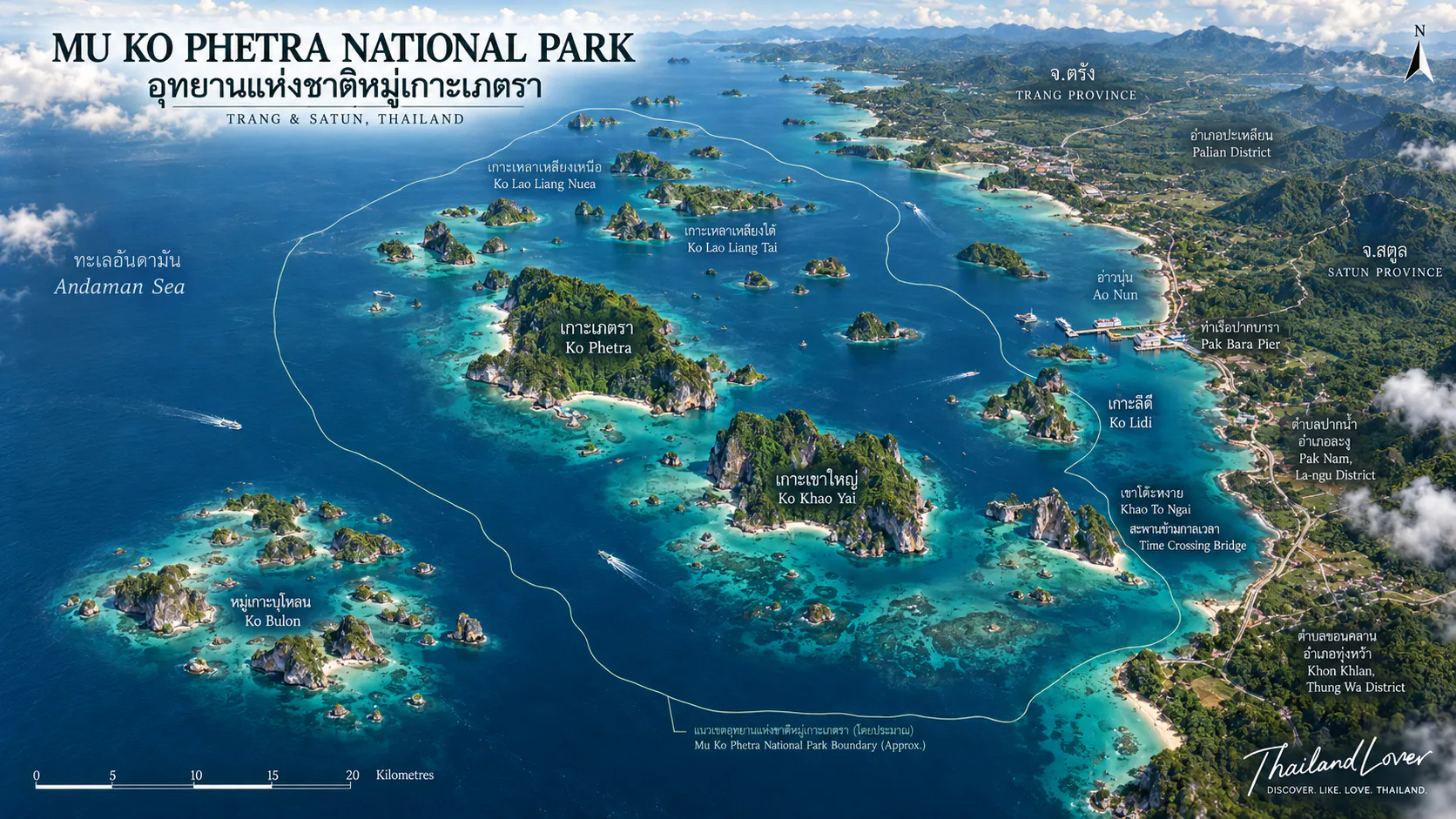
The park sits on Thailand’s west coast, in Andaman waters of the Malacca Strait. Mainland areas lie mainly in Satun — especially La-ngu and Thung Wa — while northern and north-eastern sea and islands reach into Palian District, Trang.
Park headquarters are at Ao Nun, Pak Nam, La-ngu, Satun. That bay is more than an office: it is a coastal starting point where mountain, shore, forest and sea can be felt before you board a boat.
A Landscape Built by the Sea
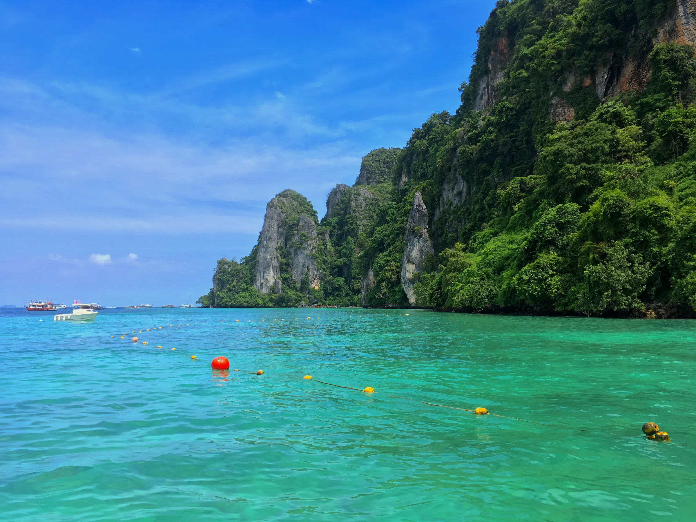
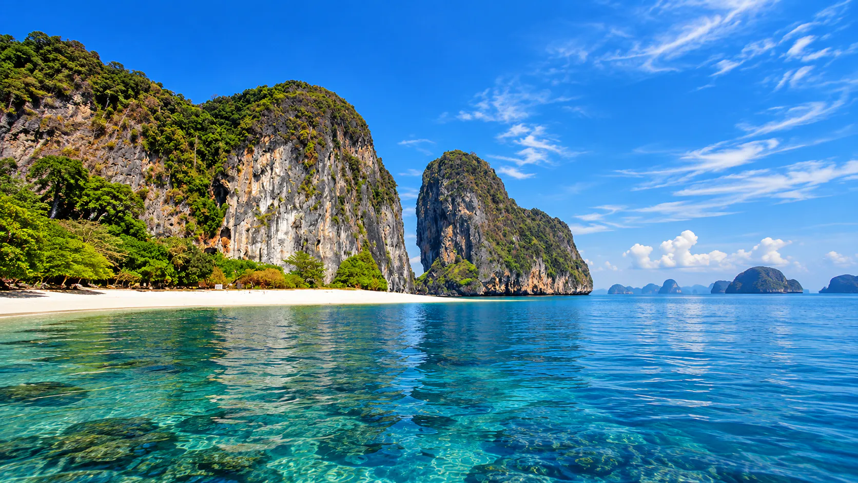
The postcard image is limestone rising from the water. Behind it sits a fuller coast:
- Open sea
- Limestone islands
- Mountains and cliffs
- Rocky shores, caves and hollows
- Valleys, sand beaches and beach forest
- Mangrove, coral reef and intertidal flats
Many islands are steep; flat ground is limited — valleys, beaches and sheltered bays. The skyline is sharp: high limestone from the surface, broken by coves and small beaches. This is not a chain of low round islets or one long continuous strand.
Phetra is a landscape of limestone coast.
The Limestone World
Sea, rain and time carve limestone into cliffs, caves, hollows, slots and mountain shapes. From the water the forms do not look like ordinary inland hills. Some read as natural walls, some as fortresses, some as whole islands sculpted by waves.
That geology is a large part of why Phetra’s scenery feels so distinct.
Why Is It Called “Phetra”?
The name links to a common image of the main island resembling a junk sail from certain angles. That visual story belongs in the place’s memory.
ThailandLover keeps name lore and proven history apart: the “junk” idea can be told as a landscape association, without inventing history beyond evidence.
How Mu Ko Phetra Became a National Park
Surveys in the early 1980s found many islands, beaches, coral, cliffs, caves and striking limestone, plus importance for some marine wildlife. On 15 March 1983 the National Park Committee agreed the area should become a national park.
A Royal Decree followed in the Government Gazette, Volume 101, Part 200, 31 December 1984. Phetra became Thailand’s 49th national park.
Editorial note: Some websites say B.E. 2537 (1994). Establishment records and reliable government tourism material align on 31 December 1984. ThailandLover uses 1984 as the primary date.
The Islands
Phetra is not one island. It is a system of islands and coast. Names that appear most often include:
Ko Phetra
เกาะเภตรา · Trang side
A major southern island of the park, in Trang. Steep limestone and cliffs dominate; beaches and flat land are limited. The island’s form from the sea gave the whole group its name. Tourism material notes beach and reef on parts of the shore, but bird’s-nest concessions mean it is not a free-access tourist island like some others.
Ko Khao Yai
เกาะเขาใหญ่ · Satun side
Limestone with sea-carved forms — including a natural bridge or stone arch that shifts character with the tide. Ao Kam Pu is a sheltered bay with natural seepage water.
Ko Lidi
เกาะลิดี · Big and small Lidi
Beach, cliff, cave and mangrove. The islands hold both visitor sites and park protection work. In 2026 the park ran residual-waste clean-ups on Ko Lidi Noi and Ko Lidi Yai with civil society — a reminder that this is a conservation landscape, not only a day-trip postcard.
Mu Ko Bulon
หมู่เกาะบุโหลน · Western islands
Ko Bulon Le (Bulon Yai) is known for white sand, clear water and a coastal fishing community still present in the scene. Shallow and deeper dive sites surround the islands; hermit crabs and ghost crabs appear on shore when the timing is right.
Ko Laoliang
เกาะเหลาเหลียง · Trang limestone
High limestone walls above the sea — a vertical limestone landscape more than a beach-first postcard. Different character from Bulon or Lidi.
Ao Nun
อ่าวนุ่น · The gateway to Phetra
Ao Nun is the bay of park headquarters — a natural cove held by mountain and shore, with visitor facilities and nature learning space. It is a strong place to understand Phetra before island hopping. Not only a “passing point,” but a clear meeting of mountain, coast, forest and sea.
Khao To Hong & the Time Bridge
เขาโต๊ะหงาย · สะพานข้ามกาลเวลา
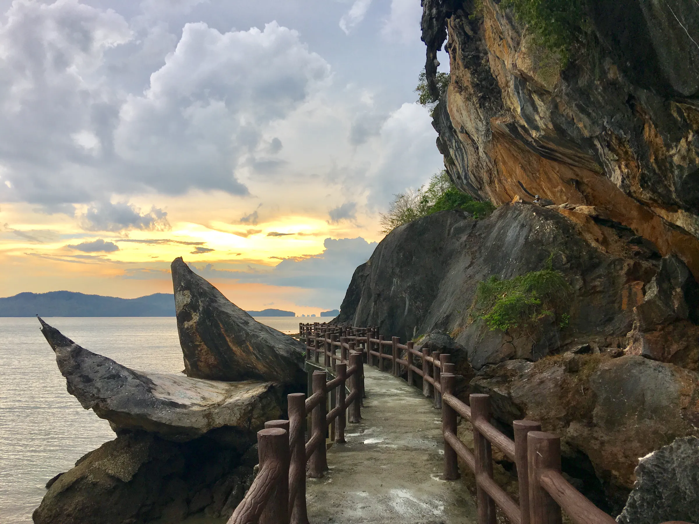
One of the most interesting mainland places linked to the park area is Khao To Hong. The draw is not only a sea view. The Time Bridge walk brings visitors into coastal rock layers and geological story.
Satun matters deeply for southern Thailand’s geology. This site takes geology out of textbooks and into the landscape.
A place where geological time becomes visible — more than a viewpoint.
Marine Life, Coral and Mangrove
Habitats include coral reef, rocky shore, sand beach, mangrove, intertidal flats and open sea. That mix supports many coastal and island communities of life. Historic surveys also note past nesting by some sea turtles; islands remain important for marine animals and seabirds.
Coral reefs shape the underwater landscape — but “clear water” is not true of every corner of the park every day. River mouths and bay openings can carry sediment; some open-sea sites suit diving better. Prefer wording such as clear water when weather and sea allow, not “clearest all year.”
Mangrove matters especially around Ko Lidi and shallow tidal coasts — nursery ground, wave buffer and the link between land and sea.
Limestone cliffs and caves also hold wildlife stories: rock → cave → bird → sea. Nest areas and fragile cliffs deserve quiet, respectful travel.
The Geology of Satun
If Phetra is only “beautiful sea,” a larger story is missed. Satun is one of Thailand’s key geology provinces, and Phetra’s limestone is part of that regional story — ancient marine sediment, uplift and long erosion.
Limestone that once lay under ancient seas now stands as islands and cliffs above today’s Andaman.
The tide also rewrites the scene. Low water exposes rock, some reef, wider beach and reachable slots; high water can turn the same place into open sea. Plan around tide + weather + sea conditions, not only a calendar.
What Can You Do Here?
- Island hopping
- Travel between islands for character, not a checklist. Beaches, limestone viewing, snorkelling and restricted conservation zones all sit in the same park.
- Snorkelling
- Ko Bulon and other sites when conditions allow. Do not stand on coral or handle marine life.
- Diving
- Shallow and deeper sites exist; suitability depends on sea, current, season and management. Not every point is diveable.
- Kayaking
- Limestone coast and natural channels — especially around Ko Khao Yai’s rock structure.
- Nature photography
- Cliffs + sea + islands + forest + beach + changing light. Soft mornings; evening silhouettes of rock and island.
- Geological exploration
- Khao To Hong and surrounding limestone for earth history in the real landscape.
Best way to experience Phetra: a few hours — Ao Nun → Khao To Hong → landscape and geology. A full day — add island time, snorkelling and limestone coast. Several days — split mainland + Lidi + Bulon + Trang-side islands.
When to Go
On the Andaman, sea state, wind, rain and boat safety matter more than whether the sky looks “nice.” Check park announcements before every marine trip.
Some areas — including Ko Bulon and Ko Laoliang — have had seasonal closures for recovery and safety. Closure dates can change by year. Do not hard-code closure days in evergreen copy without the latest notice.
Check the park’s latest announcement before planning an island trip.
How to Get There
From Bangkok: travel to Trang or Satun, then continue to the coast. On the Satun side a common line is Hat Yai → Satun / La-ngu → Pak Bara → Mu Ko Phetra. Pak Bara is a key pier for many island routes.
From Hat Yai: the airport is a major gateway; continue by car or transfer to La-ngu and Pak Bara.
By boat: islands require boats. Time depends on pier, boat type, sea, wind, tide and route — not a single fixed number.
Responsible Travel
Phetra is a protected area. Every visitor is part of that system.
- Carry rubbish off the islands
- Use reef-safe practices; do not stand on or touch coral
- Do not take rock, shells or living things
- Respect nesting and restricted zones; follow staff guidance
- Use responsible local operators; check closures before travel
- Do not feed or handle wildlife, climb fragile rock, shout near caves or drop anchors on reef
Good travel is not how many islands you tick. It is whether the place stays whole after you leave.
Frequently Asked Questions
- What is Mu Ko Phetra National Park?
- A marine national park in Satun and Trang covering about 494.38 km² of limestone islands, cliffs, beaches, mangroves and Andaman Sea.
- When was it established?
- 31 December 1984 — Thailand’s 49th national park. Prefer this date over online claims of 1994.
- Where is headquarters?
- Ao Nun, Pak Nam, La-ngu, Satun.
- What are the main islands?
- Ko Phetra, Ko Khao Yai, Ko Lidi, Mu Ko Bulon and Ko Laoliang among others.
- Is it good for snorkeling?
- Yes when conditions allow, especially around Bulon and other reef areas. Clarity varies.
- What is Khao To Hong?
- A mainland geology coastal site with the Time Bridge walk — where geological time becomes visible.
- How do I get there?
- Commonly via Hat Yai to La-ngu / Pak Bara, then boat to the islands. Check sea conditions and park notices.
Related Destinations
- Tarutao National Park
- Satun’s other great Andaman park — Ko Tarutao, Adang and the road toward Ko Lipe.
- Hat Chao Mai National Park
- Trang’s limestone coast, Emerald Cave and dugong seascapes.
- Mu Ko Lanta National Park
- Further north on the Andaman — Ko Rok, Ko Ha and Laem Tanod.
- Thale Ban National Park
- Satun inland forest and wetland, a different face of the province.
- Khao Sok National Park
- Inland limestone rainforest — geology in a different register.
Location
Find Mu Ko Phetra National Park
Ao Nun, Pak Nam, La-ngu, Satun