

National Park · Phang Nga
Ao Phang Nga National Park
Where Limestone Meets the Sea
Phang Nga, Southern Thailand
A surreal world of towering limestone islands, hidden lagoons, sea caves and mangrove forests rising from the emerald waters of Phang Nga Bay.
Basic Information
- Name
- Ao Phang Nga National Park
- Thai Name
- อุทยานแห่งชาติอ่าวพังงา
- Province
- Phang Nga
- Region
- Southern Thailand
- Location
- Mueang Phang Nga District, Phang Nga, Thailand
- Coast
- Andaman Sea
- Area
- Approximately 400 km²
- Established
- 29 April 1981
- Type
- Marine & Coastal National Park
- Opening Hours
- 08:00–16:30 daily
- Best Time to Visit
- November–April
- Main Experiences
- Limestone Landscapes · Kayaking · Sea Caves · Mangroves · Islands · Wildlife · Culture
A Landscape Shaped by the Sea
Ao Phang Nga National Park is one of Thailand’s most distinctive coastal landscapes.
Spread across approximately 400 square kilometres, the park protects a remarkable world of limestone islands, dramatic cliffs, mangrove forests, tidal waterways and hidden caves along the Andaman coast.
The landscape is instantly recognizable: enormous limestone formations rise vertically from shallow emerald waters, while dense tropical vegetation clings to cliffs and rocky islands.
But Ao Phang Nga is much more than the famous James Bond Island.
Its real character lies in the relationship between limestone, sea, forest, wetlands and people.
Why Visit
Why Ao Phang Nga?
- Limestone Islands
- Towering limestone formations rise directly from the sea, creating one of Thailand’s most dramatic coastal landscapes.
- Hidden Lagoons
- Paddle through narrow passages and limestone caves to discover enclosed lagoons hidden inside the islands.
- Mangrove Forests
- Explore one of Southern Thailand’s important coastal ecosystems, where forests meet tidal channels and shallow waters.
- Sea Caves
- Kayaking offers an intimate way to experience the caves, rock formations and changing light inside the karst landscape.
- James Bond Island
- See the iconic limestone pinnacle made famous by The Man with the Golden Gun — then look beyond the landmark to discover the wider bay.
- Local Life
- Visit Ko Panyi, a traditional Muslim fishing community whose homes and everyday life have developed around the sea.
A Bay of Limestone & Water
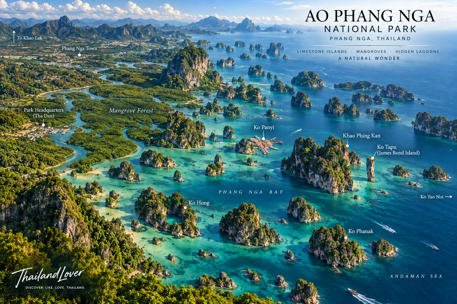
Phang Nga Bay is a landscape of extraordinary contrasts.
Shallow emerald waters surround dozens of limestone islands and rocky formations, many rising almost vertically from the sea.
Over millions of years, erosion and geological movement have shaped the limestone into cliffs, towers, caves and enclosed waterways.
The result is a landscape that feels almost otherworldly.
Stone rises from the sea.
Forest grows from the stone.
And life follows the water.
Signature Places
James Bond Island
Ko Tapu & Khao Phing Kan
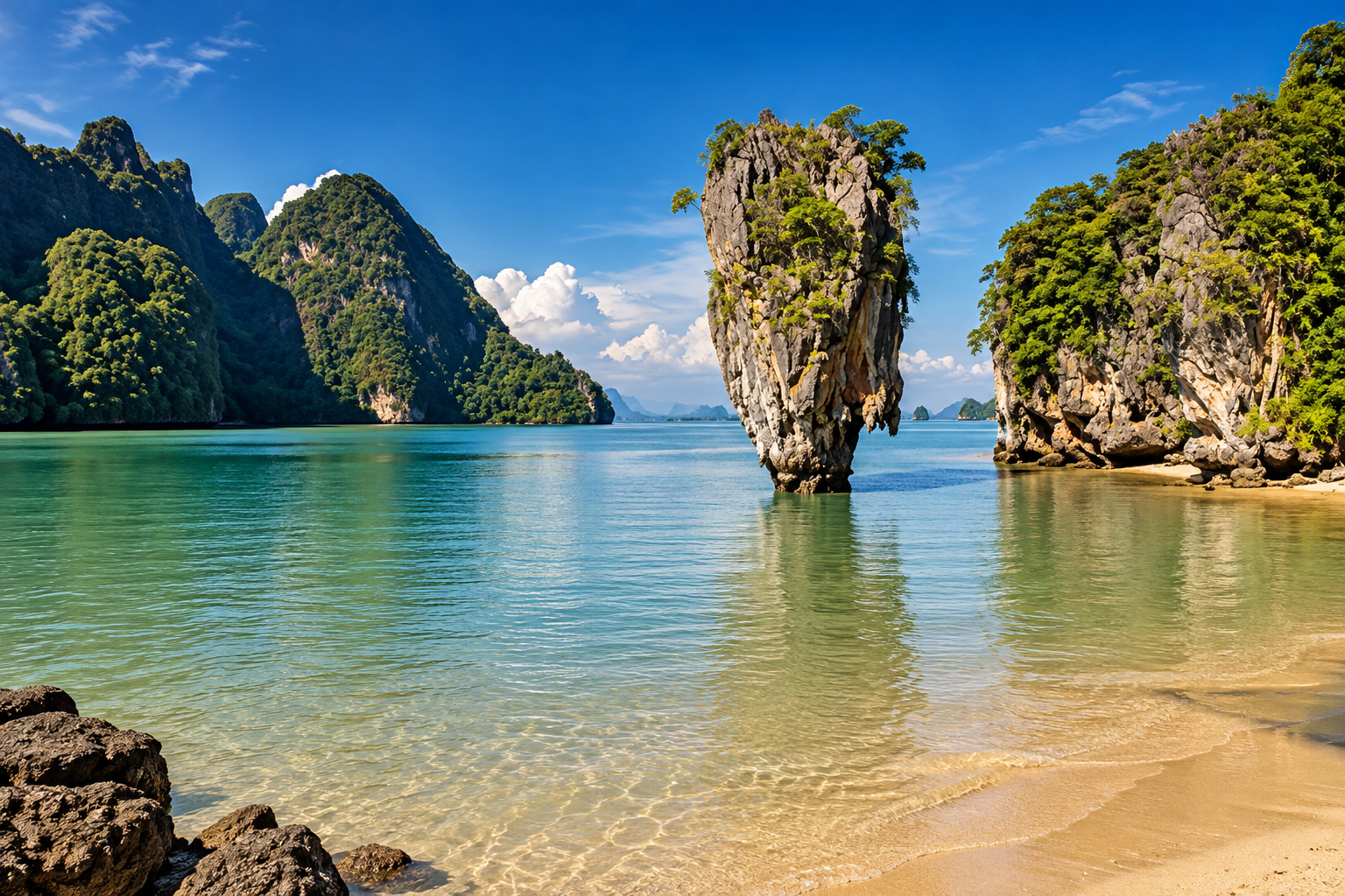
The world’s most recognizable image of Phang Nga Bay is Ko Tapu, the slender limestone pinnacle standing dramatically in the sea.
The landscape became internationally famous after appearing in the 1974 James Bond film The Man with the Golden Gun.
Today, the site remains one of Thailand’s most photographed natural landmarks.
But James Bond Island is only one small part of the much larger Phang Nga landscape.
Ko Panyi
A Village Built Around the Sea
Ko Panyi is a traditional Muslim fishing community built around the limestone island landscape.
Homes, restaurants, shops and community spaces extend over the water, reflecting generations of life shaped by fishing and the sea.
One of its most famous features is the floating football field.
For travelers, Ko Panyi offers something different from the natural scenery of the bay: a chance to see how people have adapted to living within this extraordinary landscape.
Ko Phanak
Into the Limestone
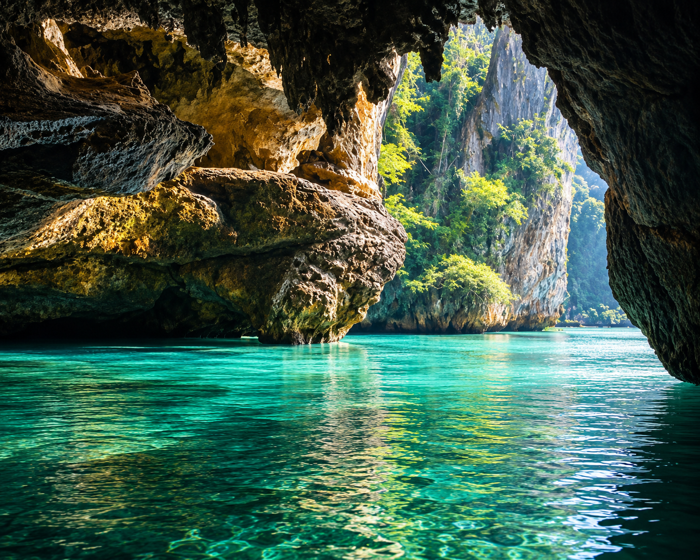
Ko Phanak is known for its limestone caves, passages and hidden chambers.
Depending on conditions and the route, visitors can explore the island by canoe or kayak, moving through narrow openings in the rock and into enclosed natural spaces.
The experience changes constantly with the tide and light.
Ko Hong
A Hidden World Within the Islands
Some of Phang Nga’s limestone islands contain enclosed lagoons surrounded by towering cliffs.
Ko Hong is one of the places where travelers can paddle through a narrow opening and enter a natural chamber hidden inside the island.
From the outside, it can appear to be just another limestone formation. Inside, the landscape changes completely.
Where Forest Meets the Sea
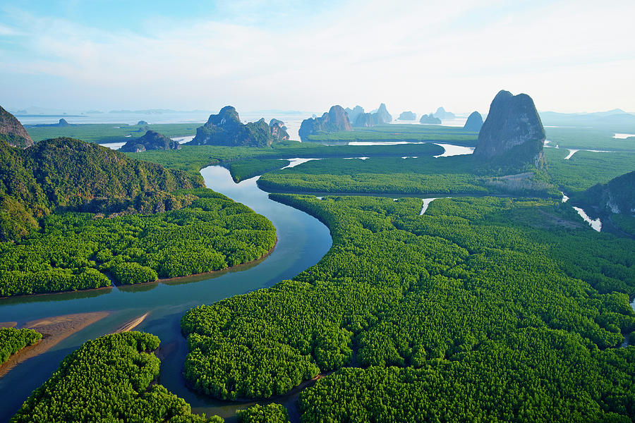
Beyond the spectacular limestone formations lies another important side of Ao Phang Nga: its mangrove ecosystem.
Mangrove forests occupy the intertidal zone, where freshwater, seawater and land meet.
Their tangled roots create shelter and nursery habitats for fish, crustaceans and other marine life while helping protect the coastline from waves and erosion.
For nature lovers, the mangroves reveal a quieter side of the national park.
Less dramatic.
More alive.
Life Between Land & Sea
The park supports a diverse range of terrestrial, coastal and marine wildlife.
Recorded wildlife includes mammals such as monkeys, langurs, gibbons and otters, together with numerous species of birds, reptiles and amphibians.
The mangrove and tidal environments are particularly important for coastal birds and aquatic species.
Look closely and the park becomes more than a landscape.
It becomes an ecosystem.
A Living Coastal Ecosystem
Ao Phang Nga protects several interconnected environments:
- Limestone Forest
- Vegetation grows within cracks and pockets of soil across the karst landscape.
- Mangrove Forest
- Dense coastal forests follow tidal waterways and sheltered shorelines.
- Mudflats & Tidal Channels
- The changing tide creates feeding grounds and habitats for numerous species.
- Marine Environment
- Shallow coastal waters support fish, crustaceans and other marine organisms.
Together, these environments form one of the most distinctive coastal ecosystems in Southern Thailand.
Before Tourism
Phang Nga Bay has a human history extending far beyond modern tourism.
Archaeological evidence in the wider landscape includes rock paintings, stone tools and other remains associated with prehistoric communities.
Rock art depicting humans and animals provides evidence that people have interacted with the coastal environment for thousands of years.
Long before visitors arrived to photograph the limestone islands, people were already living within this landscape.
How to Experience Ao Phang Nga
- Kayaking
- The most immersive way to experience the karst landscape. Move slowly beneath towering cliffs, through narrow cave entrances and into hidden lagoons.
- Longtail Boat
- A traditional way to explore the bay and connect multiple islands and communities in a single journey.
- Photography
- The combination of limestone, tropical forest, emerald water and dramatic skies makes Phang Nga one of Southern Thailand’s strongest landscape-photography destinations.
- Slow Exploration
- Don’t rush from landmark to landmark. The character of Phang Nga is found in the spaces between them — the changing light, tidal channels, rock textures and quiet corners of the bay.
A Photographer’s Landscape
Ao Phang Nga offers several distinct photographic perspectives.
- Wide Angle
- Capture the relationship between limestone formations, sea and sky.
- Low Perspective
- Shoot from the water to emphasize the scale of the cliffs.
- Inside the Caves
- Use the dark foreground of the cave to frame the bright landscape beyond.
- Mangroves
- Look for reflections, roots, tidal channels and wildlife.
- Golden Hour
- Late-afternoon light brings warmth and texture to the limestone cliffs.
When to Visit
The Andaman coast experiences a tropical monsoon climate.
For travelers primarily interested in boat trips, kayaking and outdoor exploration, the drier season from approximately November to April is generally the most comfortable period.
Weather and sea conditions can change quickly, however.
For cave and kayaking experiences, tide, wind and sea conditions are particularly important.
Always check local conditions before departure.
Visitor Information
Open daily · 08:00–16:30
Opening hours refer to general national-park visitor operations. Boat trips, kayaking routes, individual islands and local attractions may operate according to different schedules and conditions.
Tide and weather conditions may affect access to caves, lagoons and waterways.
Getting to Ao Phang Nga
The national park is located in Mueang Phang Nga District, Phang Nga Province, on Thailand’s Andaman coast.
The main park area is accessed from the mainland, while most experiences within Phang Nga Bay require transportation by boat.
The destination is easily incorporated into itineraries connecting:
Phuket · Phang Nga · Khao Lak · Krabi
Continue Exploring Southern Thailand
- Phuket
- Thailand’s best-known Andaman destination and a convenient base for exploring Phang Nga Bay.
- Khao Lak
- A quieter coastal destination north of Phuket, with access to beaches, forests and marine parks.
- Krabi
- Famous for its limestone cliffs, islands and dramatic Andaman landscapes.
- Ko Yao
- A slower island experience between Phuket and Phang Nga Bay, with a more relaxed local atmosphere.
Before You Go
Bring
- Sun protection
- Drinking water
- Comfortable clothing
- Dry bag
- Waterproof phone protection
- Camera
Remember
- Follow park regulations
- Do not touch or damage limestone formations
- Avoid leaving waste
- Respect local communities
- Follow guides when entering caves
- Check weather and tide conditions
Quick Facts
- Province
- Phang Nga
- Region
- Southern Thailand
- Established
- 29 April 1981
- Area
- Approximately 400 km²
- Landscape
- Limestone Karst · Islands · Mangroves · Sea Caves · Wetlands
- Sea
- Andaman Sea
- Famous For
- Phang Nga Bay · Ko Tapu · James Bond Island
- Culture
- Ko Panyi
- Best Experience
- Kayaking & Boat Exploration
- Opening Hours
- 08:00–16:30 daily
- Recommended Season
- November–April
- Travel Style
- Nature · Landscape · Adventure · Culture · Photography
Location
Find Ao Phang Nga National Park
Mueang Phang Nga District, Phang Nga, Thailand