

National Park · Nakhon Si Thammarat
Khao Luang National Park
อุทยานแห่งชาติเขาหลวง
Where Southern Thailand Rises into the Clouds
Nakhon Si Thammarat · Southern Thailand
A ThailandLover guide to the highest mountain in the South — rainforest, waterfalls and a living watershed born from the clouds.
The Mountain at the Heart of the South
There is a point in southern Thailand where the landscape stops being coastal lowland and begins to rise into one of the most important mountain systems of the peninsula. This ThailandLover guide covers Khao Luang National Park — the legally protected mountain and rainforest — not every village or viewpoint around the massif.
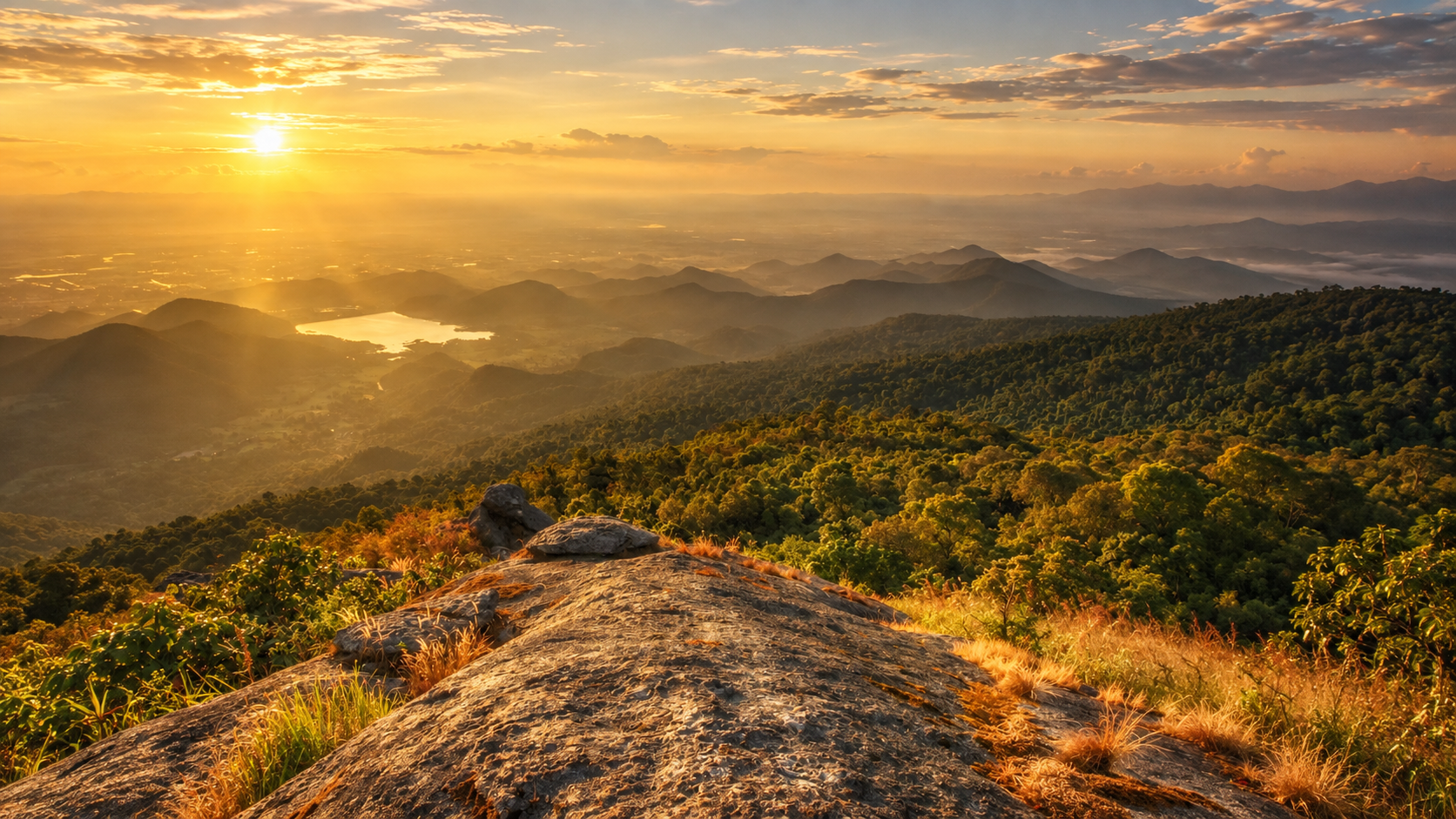
At approximately 1,835 metres, Khao Luang is the highest mountain in Southern Thailand. Its forested slopes form the heart of a vast watershed, feeding more than 15 streams and rivers and supporting one of the region’s most important remaining tropical forest ecosystems.
Surrounding the mountain is Khao Luang National Park — a protected landscape of approximately 356,250 rai / 570 km², established as Thailand’s 9th national park on 18 December 1974. This is not simply a mountain destination. It is high peaks, ancient rainforest, waterfalls, caves, rivers, wildlife and villages at the forest edge — a standout in ThailandLover’s Nature & Parks collection.
Water begins in the mountains and eventually connects the forest to the lowlands of Nakhon Si Thammarat.
At a Glance
- Official Name
- Khao Luang National Park
- Thai Name
- อุทยานแห่งชาติเขาหลวง
- Province
- Nakhon Si Thammarat
- Region
- Southern Thailand
- National Park
- 9th national park of Thailand
- Established
- 18 December 1974
- Area
- Approximately 356,250 rai / 570 km²
- Highest Peak
- Khao Luang · approximately 1,835 metres
- Mountain Range
- Nakhon Si Thammarat mountain range
- Main Ecosystem
- Tropical evergreen / moist evergreen forest
- Districts
- Lan Saka, Chawang, Mueang Nakhon Si Thammarat, Phipun, Phrom Khiri, Chang Klang and Nopphitam
- Major Waterfalls
- Karom, Phrom Lok, Ai Khiao, Krung Ching, Tha Phae, Suan Ai, Suan Khan and Yot Lueang
Khao Luang — 1,835 Metres Above the Sea
The defining feature of the park is Khao Luang itself. The mountain rises dramatically from the surrounding lowlands and forms part of the central Nakhon Si Thammarat mountain system. The summit is not merely a geographical statistic. It creates an enormous vertical ecosystem.
lowland → foothill → evergreen forest → mountain forest → cloud-covered highland
Temperature, humidity, vegetation and wildlife all change with altitude. The result is a mountain environment unusually rich in ecological variation.
A Mountain of Water
The park protects a substantial portion of the Nakhon Si Thammarat mountain range, which runs broadly north–south through the interior of the province and lies roughly parallel to Thailand’s eastern coastline. The mountains form a dramatic natural divide between the interior highlands and the coastal plains — and one of the most important watershed landscapes in Southern Thailand.
From the forested slopes, water flows into numerous streams and river systems, including the Tapi River system, Pak Phanang River system, Krung Ching streams, Khlong Khao Kaeo, Khlong Tha Phae, Khlong Ranu, Khlong La-oi and numerous smaller tributaries. TAT describes the mountain as the source of more than 15 streams and rivers.
The exact hydrological connections vary across the park’s different watersheds. The central principle is constant: Khao Luang is a mountain of water.
A Forest Built by Rain
Southern Thailand receives considerably more rainfall than many other parts of the country. Khao Luang stands directly within this humid environment. High rainfall, mountain terrain, deep valleys, streams, dense forest and elevational variation create ideal conditions for tropical evergreen forest.
The park’s forests are dominated by moist evergreen vegetation, with plant communities changing according to elevation, geology, slope and moisture. The forest remains green through much of the year. Mist hangs over the upper mountains. Clouds gather around the ridges. Water flows through the valleys. Sunlight reaches the forest floor through multiple layers of vegetation.
This is the classic character of the Southern Thai rainforest.
Biodiversity, Ferns & Orchids
Khao Luang is recognised as one of Southern Thailand’s important biodiversity areas. TAT describes it as a major biodiversity resource and notes the presence of more than 200 species of ferns and orchids, including endemic plants.
The forest contains multiple layers: a canopy of large evergreen trees; a middle layer of smaller trees, palms and shade-tolerant plants; an understory of ferns, shrubs, herbs and vines; a forest floor of leaf litter, fungi and mosses; and streams that support amphibians, insects and aquatic organisms. Biodiversity is not concentrated in one spectacular feature. It exists everywhere.
The humid mountain environment is particularly suitable for epiphytic plants. Orchids may be found attached to trunks and branches, around humid clearings, near streams and along mountain trails. Large terrestrial ferns, climbing ferns and smaller species contribute to the layered appearance of the rainforest.
Wildlife & Birdlife
The extensive forest provides habitat for deer, wild boar, primates, small carnivores, rodents, bats, reptiles, amphibians, forest birds, butterflies and insects. Larger and more elusive animals can be difficult to observe because much of the park is dense forest and steep terrain.
Khao Luang is a wildlife habitat first and a wildlife-viewing destination second. Visitors should not expect guaranteed sightings. The forest reveals itself through bird calls, tracks, droppings, scratches on trees, movement in the canopy, butterflies, frog calls and signs of feeding. The absence of a visible animal does not mean the forest is empty. Often it means the forest is healthy enough for wildlife to remain hidden.
Elevation and forest diversity create excellent conditions for birds. Lower forest may hold bulbuls, drongos, barbets, sunbirds, leafbirds, woodpeckers, malkohas, pigeons and doves. Higher and deeper, communities become increasingly associated with mature evergreen forest. Early morning is the ideal period: cooler air, weaker wind, higher bird activity and a clearer soundscape.
The Waterfall Country of Khao Luang
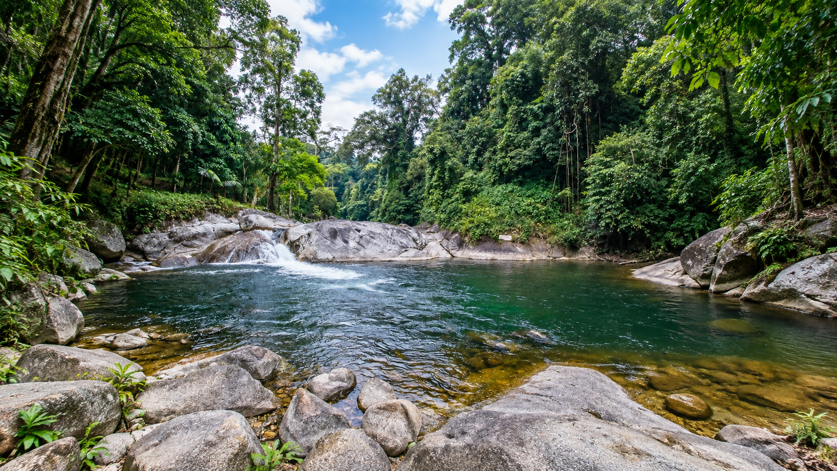
Khao Luang is one of the great waterfall landscapes of Southern Thailand. A high mountain receives enormous amounts of rain. That water has only one direction to go: down. It flows through granite and other formations, drops through cliffs and narrow valleys, and forms cascades throughout the park.
- Karom Waterfall
- Phrom Lok Waterfall
- Ai Khiao Waterfall
- Krung Ching Waterfall
- Tha Phae Waterfall
- Suan Ai Waterfall
- Suan Khan Waterfall
- Yot Lueang Waterfall
Each waterfall represents a different part of the mountain’s hydrological system.
Karom Waterfall
น้ำตกกะโรม · Namtok Karom
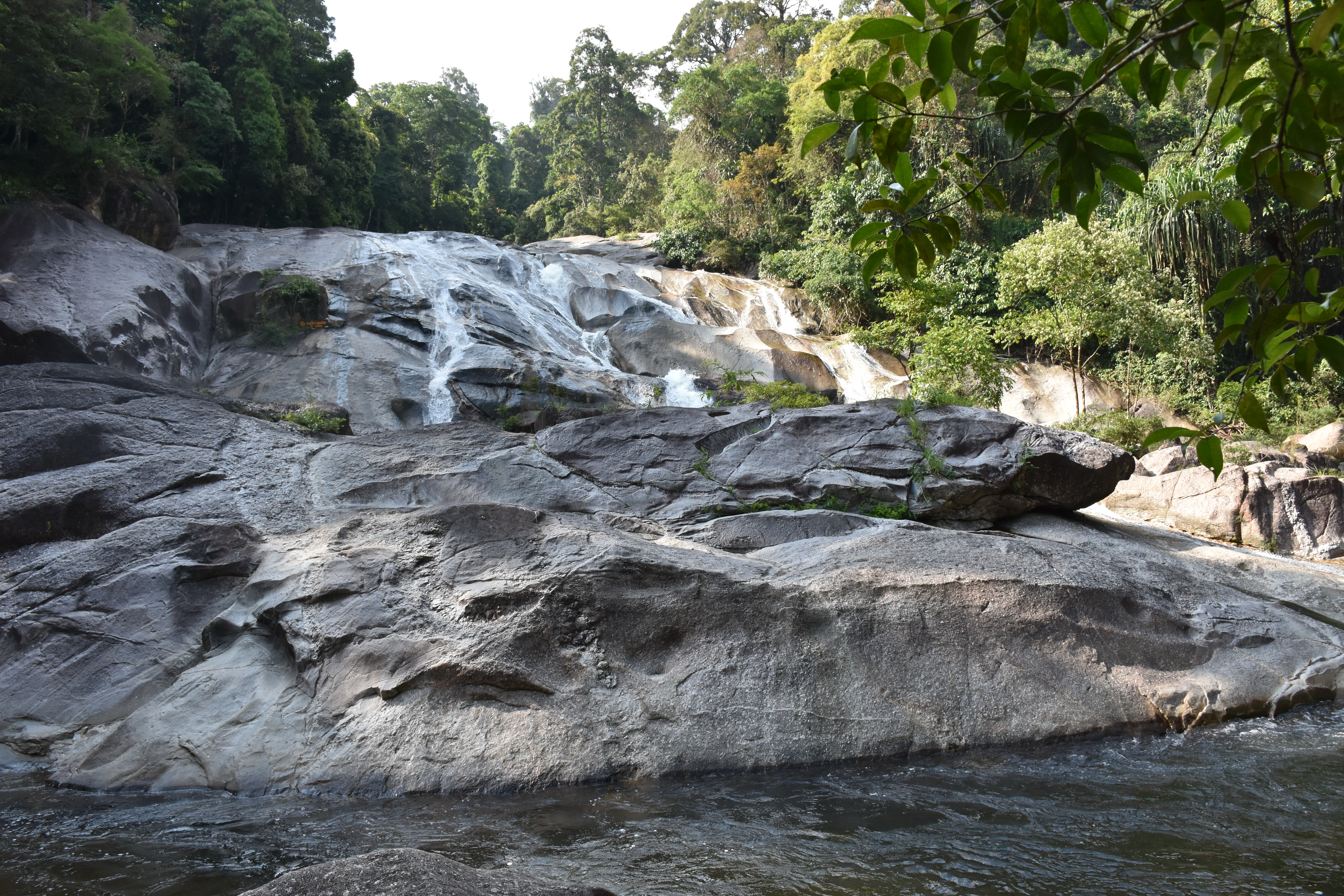
Karom is one of the park’s most accessible and well-known waterfall attractions, on the western side of the mountain system near Lan Saka and park headquarters. It descends through a forested valley of rock, flowing water and dense vegetation — a classic southern rainforest environment.
Karom is particularly suitable for visitors who want to experience Khao Luang without committing to a multi-day mountain expedition. It is a relatively accessible introduction to the relationship between mountain, forest, stream and waterfall.
Phrom Lok Waterfall
น้ำตกพรหมโลก · Namtok Phrom Lok
Phrom Lok is one of the best-known natural attractions around Khao Luang. Located in the Phrom Khiri area, it is fed by the forested slopes of the mountain. Water flows through multiple levels of rock and forest before descending toward the lower landscape.
The surrounding environment is heavily forested and humid, with large trees and dense vegetation. Phrom Lok demonstrates how the mountain’s high rainfall becomes a visible landscape feature: water that begins as rain high on Khao Luang eventually becomes the waterfall visitors see below.
Ai Khiao Waterfall
น้ำตกอ้ายเขียว · Namtok Ai Khiao
Ai Khiao is another major waterfall associated with the western side of the Khao Luang massif, surrounded by dense rainforest and part of the network of streams flowing from the mountain. Its character changes according to rainfall. During wetter periods the stream becomes substantially stronger and the forest around it intensely green. For photography, moving water, dark rock and dense foliage create one of the classic visual landscapes of Khao Luang.
Krung Ching Waterfall
น้ำตกกรุงชิง · The Icon of Khao Luang’s Deep Forest
Among all the waterfalls of Khao Luang, Krung Ching has perhaps the strongest identity. Located in the Nopphitam side of the park, it is reached through a dedicated nature trail. The Department of National Parks has described the trail as approximately 3.7 kilometres long. The waterfall consists of several levels, with the highest major drop reaching approximately 100 metres.
The landscape is dramatic: deep rainforest, massive rock formations, cascading water and mist. Krung Ching is not a roadside waterfall. The journey into the forest is part of the experience.
The 1,000-baht banknote
An image of Krung Ching Waterfall appeared on the 1,000-baht banknote issued in 1992. DNP has highlighted this connection when presenting the Krung Ching nature trail. That helped make Krung Ching one of the most recognisable waterfall landscapes in Nakhon Si Thammarat.
For ThailandLover, the significance goes beyond the banknote. It is a reminder that a landscape can become part of the visual identity of an entire country.
Tha Phae, Suan Ai, Suan Khan & Yot Lueang
- Tha Phae Waterfall
- น้ำตกท่าแพ. Another waterfall associated with the Khao Luang watershed. Compared with the fame of Krung Ching or Phrom Lok, Tha Phae receives less international attention — precisely what makes it interesting for travellers seeking a quieter side of Nakhon Si Thammarat.
- Suan Ai Waterfall
- Part of the park’s extensive waterfall network. In wet conditions water flows strongly through the forest. During drier periods the exposed rock formations become more visible. A good example of how the park should be understood as a network of watersheds rather than isolated attractions.
- Suan Khan Waterfall
- น้ำตกสวนขัน. A relatively small waterfall surrounded by beautiful natural forest, particularly suitable for walking, nature study, plant observation and photography. No giant cliff is necessary. Sometimes the value is simply forest + water + silence.
- Yot Lueang Waterfall
- Another waterfall associated with the mountain landscape, reinforcing the park’s characteristic pattern: high mountain rainfall → streams → cascades → lowland rivers.
Caves of Khao Luang
The park’s geology also creates cave environments. One of the named attractions is Tham Kaeo Surakan — Kaeo Surakan Cave. Unlike the open forest, caves create low-light environments, stable temperatures, high humidity, special geological formations and habitat for bats and cave-associated organisms.
They also demonstrate that Khao Luang is not simply a forest-covered mountain. Its landscape exists both above and below ground.
The Khao Luang Summit Trail
The Ultimate Khao Luang Experience
The most demanding experience in the park is the journey toward the summit. This is not a casual sightseeing trail. It is a genuine mountain trek through dense forest, streams, large rocks, steep slopes, narrow ridges and high-elevation vegetation. The terrain becomes progressively more demanding as elevation increases.
TAT’s current destination information describes both short and long hiking routes and notes that the summit journey can involve a two-night, three-day trek, with guides and appropriate equipment and food preparation required.
At a waterfall, the mountain comes to you. At the summit, you climb into the mountain. The forest becomes increasingly atmospheric. Clouds may move across ridges. Mist can reduce visibility. Vegetation becomes shorter and more exposed. On clear days, the scale of the southern landscape becomes apparent.
This is the experience that transforms Khao Luang from a waterfall destination into a true mountain destination.
Above the lower rainforest, conditions are increasingly influenced by lower temperatures, stronger winds, higher cloud exposure, greater humidity, steeper terrain and thinner soils. Trees become smaller. Branches become more twisted. Mosses and epiphytes become more prominent. The mountain tells an ecological story simply by climbing it.
A Cloud-Forest Landscape
Khao Luang is frequently enveloped in clouds and mist because of its elevation and the humid climate of Southern Thailand. A mountain ridge disappears, then reappears. Trees become silhouettes. Water droplets collect on leaves. The forest floor becomes saturated. The distinction between sky and mountain becomes almost impossible to see.
The mountains consist of a complex geological landscape including granite formations, limestone areas and associated rock systems. These differences help explain rocky ridges, cliffs, waterfall channels, caves, stream beds and deep valleys. Over geological time, rainfall and erosion carve channels into the mountains. The waterfalls visitors see today are part of a much longer process.
The Water Cycle of Khao Luang
- 01 — Rain
- Southern Thailand’s monsoon climate delivers heavy rainfall to the mountain.
- 02 — Forest
- Vegetation slows the movement of water and helps retain moisture.
- 03 — Mountain soil
- Water infiltrates the ground and feeds springs and streams.
- 04 — Streams
- Small channels merge into larger waterways.
- 05 — Waterfalls
- Steep terrain creates cascades and falls.
- 06 — Rivers
- Water continues toward the lowlands.
- 07 — Communities
- Downstream populations depend on these watersheds.
This is why protecting Khao Luang means protecting far more than scenery.
Khao Luang and Kiriwong
คีรีวง · Community at the Mountain’s Edge
Communities surround the mountain landscape. One of the best-known is Kiriwong, in the Lan Saka area at the foot of Khao Luang. Kiriwong is not the same thing as Khao Luang National Park, but it forms an important cultural and geographical gateway to the mountain. The community is known for its relationship with the surrounding forest, mountain streams, agriculture and nature-based tourism.
- Khao Luang
- The legally protected mountain and rainforest landscape of about 570 km².
- Kiriwong
- A community at the mountain’s edge: mountain views, streams, local agriculture, small-scale accommodation, local food and traditional ways of living. A cultural complement — not an attraction inside the park boundary.
Seven Districts, Many Entrances
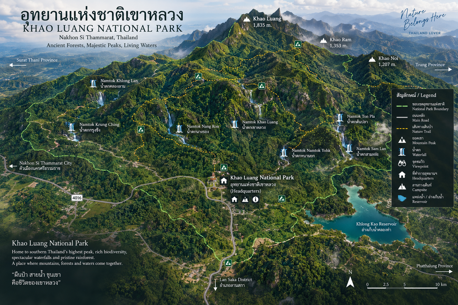
The park extends across a large part of Nakhon Si Thammarat Province. There is not one single road that takes visitors to “Khao Luang National Park” and immediately reveals everything. Different access areas belong to different attractions.
- Lan Saka
- The western gateway: Khao Kaeo / Kiriwong area, Karom and the western mountain landscape. Headquarters sits here.
- Phrom Khiri
- The Phrom Lok side of the mountain — waterfall, forest and accessible nature tourism.
- Nopphitam
- The Krung Ching side: deep northern forest and a dedicated waterfall trail.
- Phipun, Chawang, Chang Klang & Mueang
- Northern, eastern and southern mountain and watershed landscapes, and the mountain’s relationship with the provincial lowlands.
This is why a map of Khao Luang should show a large mountainous protected landscape, not one compact visitor site.
What Makes Khao Luang Different?
Krung Ching and Phrom Lok are both major waterfalls, but they offer different experiences. Phrom Lok is more closely associated with the accessible western side: waterfall + forest + easier nature tourism. Krung Ching is deeper into the park: rainforest + hiking + dramatic waterfall + adventure. Neither is better. They simply reveal different sides of the mountain.
Southern Thailand has many famous protected landscapes. Khao Sok is famous for limestone mountains and Cheow Lan Reservoir. Khao Phanom Bencha is known for mountain forest and waterfalls in Krabi. Kaeng Krung is characterised by deep forest and rivers. Khao Luang has a different identity:
- Southern Thailand’s highest peak
- A huge rainforest watershed
- Multiple waterfall systems
- High botanical diversity
- Long mountain trekking routes
- Close connection to Nakhon Si Thammarat communities
It is a mountain ecosystem, rather than an island or coastal park.
Who Should Visit
- Nature lovers
- Exceptionally rewarding for travellers interested in rainforest ecology.
- Hikers
- Routes range from accessible waterfall walks to demanding multi-day mountain trekking.
- Birdwatchers
- Elevation and evergreen forest make the park particularly interesting.
- Photographers
- Mist, waterfalls, giant trees, streams and mountain ridges.
- Botanical enthusiasts
- Ferns, orchids and other forest plants are one of the park’s major strengths.
- Slow travellers
- Especially rewarding when approached without rushing from attraction to attraction.
Visitors planning to reach the 1,835-metre summit should understand that this is a serious trekking experience. It can require physical preparation, proper footwear, sufficient food and water, appropriate clothing, rain protection, navigation support, ranger or guide coordination, overnight equipment and awareness of weather. TAT specifically recommends preparation, guides, hiking equipment and food for the longer summit route.
Do not confuse visiting Khao Luang National Park with climbing Khao Luang summit.
Weather and Season
Khao Luang is located in one of Thailand’s wetter climatic regions. Rain can arrive quickly in the mountains. Conditions can change from sun to cloud to rain to mist within a relatively short period. That is normal mountain weather.
For waterfall photography, rainfall can make the landscape dramatically more powerful. For hiking, heavy rain can create slippery rocks, strong currents, muddy trails, reduced visibility, difficult river crossings and increased risk of falling. Mountain conditions should always take priority over itinerary plans.
One of the best times to understand Khao Luang’s character is immediately after rainfall. The forest becomes intensely green. Water runs from leaves. Small streams become louder. Mist forms between trees. Moss appears brighter. Waterfalls increase in volume. The air becomes saturated with the smell of wet soil and vegetation.
This is Khao Luang at its most elemental.
How to Get There
Park headquarters sit in the Karom Waterfall sector: Moo 4, Ban Ron, Khao Kaeo Subdistrict, Lan Saka District, Nakhon Si Thammarat 80230.
- From Bangkok
- Travel first to Nakhon Si Thammarat by plane, train or car. DNP notes the provincial town is about 800 kilometres from Bangkok.
- From Nakhon Si Thammarat town
- DNP describes the route along Highway 4015 toward Lan Saka for about 20 kilometres. Headquarters is about 1 kilometre inside. Wikipedia places the office around 30 kilometres from the provincial town depending on the measured point.
- Other sectors
- Phrom Lok is reached via Phrom Khiri. Krung Ching is reached via Nopphitam. Summit routes require separate planning with rangers. The park is too large to treat as a single gate.
ThailandLover treats Khao Luang as a mountain landscape to understand, not a checklist of roadside stops.
Responsible Travel
Khao Luang is a functioning ecosystem and a critical watershed, not simply a scenic backdrop.
- Stay on designated trails
- Follow ranger instructions
- Never feed wildlife
- Never collect plants, orchids, ferns or rocks
- Carry rubbish out
- Avoid loud music
- Do not enter restricted areas
- Avoid swimming in dangerous waterfall pools
- Never stand directly beneath unstable waterfall cliffs
- Use caution around slippery rocks
- Respect local communities
- Do not damage vegetation for photographs
The best visitor leaves almost no evidence that they were there.
Must-Experience
- 01 — Khao Luang Summit
- The highest point of Southern Thailand at approximately 1,835 metres — for prepared hikers only.
- 02 — Krung Ching Waterfall
- Follow the approximately 3.7-kilometre nature trail toward one of Southern Thailand’s most spectacular waterfalls.
- 03 — Phrom Lok Waterfall
- Forest and waterfall landscape on the western side of the mountain.
- 04 — Karom Waterfall
- A classic Khao Luang waterfall experience near Lan Saka and headquarters.
- 05 — Ai Khiao Waterfall
- Forest, rock and flowing water beneath the mountain.
- 06 — Suan Khan & quieter falls
- Smaller waterfalls suited to nature walking and plant observation, including Tha Phae and Suan Ai.
- 07 — Kaeo Surakan Cave
- An underground dimension of the Khao Luang landscape.
- 08 — Kiriwong
- Local life at the foot of the mountain — outside the park boundary, closely connected to the watershed.
Essential Khao Luang
- Name
- Khao Luang National Park
- Thai
- อุทยานแห่งชาติเขาหลวง
- Province
- Nakhon Si Thammarat
- Area
- Approximately 356,250 rai / 570 km²
- Established
- 18 December 1974 · 9th national park
- Highest Peak
- Khao Luang · approximately 1,835 metres
- Mountain System
- Nakhon Si Thammarat Range
- Primary Forest
- Moist / tropical evergreen forest
- Districts
- Lan Saka, Phrom Khiri, Nopphitam, Phipun, Chawang, Chang Klang and Mueang Nakhon Si Thammarat
- Major Waterfalls
- Karom, Phrom Lok, Ai Khiao, Krung Ching, Tha Phae, Suan Ai, Suan Khan and Yot Lueang
- Major Cave
- Kaeo Surakan Cave
- Headquarters
- Khao Kaeo, Lan Saka, Nakhon Si Thammarat 80230
- Access
- Highway 4015 from Nakhon Si Thammarat town toward Lan Saka
Frequently Asked Questions
- What is Khao Luang National Park?
- Thailand’s 9th national park, established on 18 December 1974 in Nakhon Si Thammarat. About 356,250 rai / 570 km² of mountain rainforest, including Khao Luang — Southern Thailand’s highest peak at approximately 1,835 metres.
- Is Kiriwong inside the national park?
- No. Kiriwong is a community at the foot of Khao Luang in Lan Saka and an important gateway to the mountain, but it should not automatically be presented as being inside the park boundary.
- Can I climb the 1,835-metre summit as a day trip?
- Treat the summit as a serious mountain trek. TAT notes that the longer summit journey can involve a two-night, three-day trek with guides, equipment and food. Visiting a waterfall is not the same as climbing Khao Luang.
- What is Krung Ching Waterfall?
- A deep-forest waterfall in the Nopphitam sector, reached by a nature trail of about 3.7 kilometres. The highest major drop is about 100 metres. An image of Krung Ching appeared on the 1,000-baht banknote issued in 1992.
- How is Krung Ching different from Phrom Lok?
- Phrom Lok is associated with the more accessible western side. Krung Ching is deeper in the park and reached through a dedicated rainforest trail.
- How do I get to park headquarters?
- DNP places headquarters at Moo 4, Ban Ron, Khao Kaeo, Lan Saka, Nakhon Si Thammarat 80230, at the Karom Waterfall sector. From Nakhon Si Thammarat town, take Highway 4015 toward Lan Saka for about 20 kilometres; headquarters is about 1 kilometre inside.
- Do I need a national park ticket?
- Yes. Headquarters, waterfall sectors and forest trails sit inside the national park. Official DNP fees can change — confirm current rates with the park before travelling.
- When is the best time to visit?
- Khao Luang sits in one of Thailand’s wetter regions. Rain makes waterfalls more powerful and the forest intensely green, but trails and rocks can be unsafe. Mountain weather can change from sun to mist quickly. Check current conditions with the park.
- Did Krung Ching appear on a Thai banknote?
- Yes. An image of Krung Ching Waterfall appeared on the 1,000-baht banknote issued in 1992. DNP has highlighted this connection when presenting the Krung Ching nature trail.
- How do I get there from Bangkok?
- Travel first to Nakhon Si Thammarat by plane, train or car — DNP notes the provincial town is about 800 kilometres from Bangkok. From town, take Highway 4015 toward Lan Saka for about 20 kilometres to headquarters at the Karom Waterfall sector.
- How do I contact the park?
- DNP lists 0 7530 0494 and 0 7530 0495, and Khaoluang2517@gmail.com. Headquarters are at Moo 4, Ban Ron, Khao Kaeo, Lan Saka, Nakhon Si Thammarat 80230.
Related Destinations
- Khao Nan National Park
- Another mountain-forest landscape in Nakhon Si Thammarat, north of the Khao Luang massif.
- Khao Sok National Park
- Limestone mountains and Cheow Lan Reservoir — a different southern rainforest identity.
- Khao Phanom Bencha National Park
- Mountain forest and waterfalls in Krabi, another highland face of the South.
- Kaeng Krung National Park
- Deep forest and rivers in Surat Thani — a quieter watershed counterpart.
- Nature & Parks
- More protected landscapes across ThailandLover’s national-park collection.
Location
Find Khao Luang National Park
Moo 4, Ban Ron, Khao Kaeo Subdistrict, Lan Saka District, Nakhon Si Thammarat 80230