

National Park · Nakhon Si Thammarat
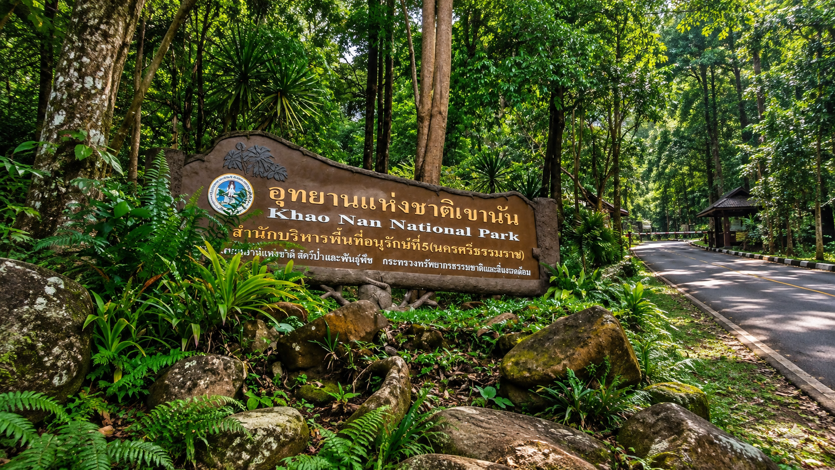
Khao Nan National Park
อุทยานแห่งชาติเขานัน
Where the Mountains Hold the Rain
Nakhon Si Thammarat · Southern Thailand
A ThailandLover guide to a hidden southern mountain: rainforest, waterfalls, caves, cloud forest and peaks rising to 1,438 metres.
The Hidden Mountain of Nakhon Si Thammarat
Far from the familiar image of Southern Thailand as a destination of beaches and islands, Khao Nan National Park reveals another side of the region: a vast mountain landscape of rainforest, cloud forest, waterfalls, caves and headwater streams. This ThailandLover guide covers the legally protected park — not every neighbouring mountain, village or waterfall in Nakhon Si Thammarat.
Stretching along the Nakhon Si Thammarat Mountain Range, the park forms one of the important forested watersheds of the province. Its mountains run broadly from north to south, creating a complex landscape of ridges, steep valleys and deeply forested slopes.
At its highest point, Khao Nan Yai rises to approximately 1,438 metres — high enough for cloud, mist and a distinctive high-elevation forest ecosystem to develop. Research has documented cloud-forest characteristics around the 1,400-metre elevation zone, with mosses, ferns and orchids thriving in the humid mountain environment.
This is not a park built around a single spectacular viewpoint. Khao Nan is a landscape to explore — a standout in ThailandLover’s Nature & Parks collection.
At a Glance
- Official Name
- Khao Nan National Park
- Thai Name
- อุทยานแห่งชาติเขานัน
- Province
- Nakhon Si Thammarat, Southern Thailand
- Districts
- Tha Sala, Nopphitam and Sichon
- National Park
- 113th national park of Thailand
- Gazetted
- 23 December 2009
- Area
- Approximately 256,121 rai / 409.79 km²
- Highest Peak
- Khao Nan Yai · approximately 1,438 metres
- Mountain System
- Nakhon Si Thammarat Mountain Range
- Forest Type
- Moist evergreen rainforest, with high-elevation / cloud-forest environments
- Best Known For
- Khao Nan Yai, Sunantha Waterfall, Krung Nang Waterfall, Tham Hong, forest trails and highland ecosystems
The park’s legal establishment was published in the Royal Gazette on 23 December 2009, making Khao Nan Thailand’s 113th national park. The gazette describes the protected area across parts of Sichon, Nopphitam and Tha Sala.
A Southern Range of High, Forested Ridges
Unlike isolated limestone hills or individual peaks, this landscape is a complicated succession of ridges and valleys extending along a north–south axis. Important peaks and mountain features associated with the park include Khao Nan Yai, Khao Nan Mia, Khao Lek, Khao Chong Lom, Khao Dai, Khao Khom and Khao Liam.
Khao Nan Yai is the highest at approximately 1,438 metres. Historical park descriptions identify the summit as one of the major high points of the Nakhon Si Thammarat range. Elevation creates a remarkable ecological gradient: warm tropical rainforest at lower elevations; cooler, wetter, more cloud-exposed forest higher up; and, near the upper zones, mosses, ferns, orchids and epiphytes as increasingly important components of the forest.
A Forest That Makes Water
One of Khao Nan’s most important roles is not something visitors immediately see. It is water. Dense forest captures rainfall across the mountain slopes. Water then moves through countless small streams, channels and tributaries before feeding larger waterways and communities downstream.
Scientific research describes Khao Nan as a productive rainforest landscape and an important watershed, with streams and waterfalls including Sunantha, Khao Nan, Krung Nang and Khlong Pean associated with the mountain system. During periods of heavy rainfall, these same systems can produce powerful runoff and flash-flood conditions. The park and surrounding communities have experienced significant flood events, demonstrating how closely forest, waterways and settlements are connected.
Rain → mountain forest → streams and headwaters → waterfalls → caves and underground water → valleys and communities.

Where the Southern Forest Stays Green
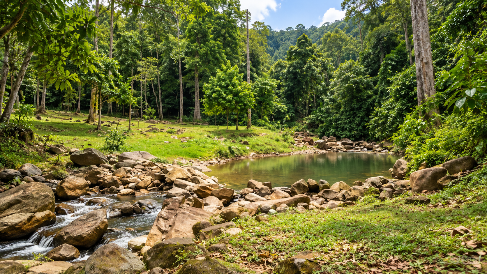
The dominant vegetation is moist evergreen forest. High rainfall, persistent humidity, shaded valleys, flowing streams, steep mountain slopes and relatively cool upper elevations create a forest with multiple layers: a continuous green canopy, smaller trees and palms in the understory, vines, ferns along damp slopes, moss on rocks and trunks, and orchids and other epiphytes on branches.
In the highest areas, the forest begins to resemble a cloud forest — an ecosystem associated with persistent cloud, high humidity and abundant epiphytes. Research on Khao Nan has documented cloud-forest characteristics at around 1,400 metres, with particularly high densities of mosses, ferns and orchids.
During approximately February–April, the Pa Pra / forest-change trail can show trees of the pra group producing striking young foliage in reddish tones, temporarily changing the appearance of the canopy. It is a subtle attraction rather than a spectacular viewpoint — and that is why it is interesting. Khao Nan rewards visitors who pay attention to the forest itself.
A fast walk through the forest reveals the trail. A slow walk reveals the ecosystem.
Wildlife & Birdlife
Khao Nan is part of a larger southern forest landscape. Species reported from the park and surrounding forest include Asian elephant, Malayan tapir, serow, barking deer, wild boar, long-tailed macaque, gibbons, civets, various reptiles and amphibians, and numerous forest birds. The presence of tapir and serow is particularly significant because both require relatively intact forest habitat.
Wildlife sightings should never be treated as guaranteed. The best experience is not to enter expecting to “see animals.” It is to enter knowing that the forest is their habitat first. Recent Department of National Parks patrol reports have documented efforts to rescue wildlife such as barking deer and serow caught in snares — highlighting both biodiversity value and continuing conservation challenges.
Forest streams, mature evergreen forest and high-elevation environments create different niches for birds. One of the most memorable experiences is often not seeing a bird at all. It is hearing one. A call travelling through the forest can reveal wildlife long before the animal itself becomes visible.
Listen before you look.
Sunantha, Krung Nang and Khlong Pean
The park’s waterfalls should not be viewed as isolated attractions. They are expressions of the same watershed.
- Sunantha Waterfall
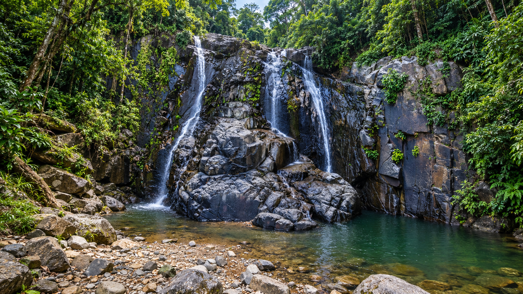
- น้ำตกสุนันทา. One of the best-known natural attractions associated with the park. Water moves over rock terraces in a forested mountain environment before continuing downstream. It is among the more accessible ways to experience Khao Nan’s rainforest compared with the much more demanding high-mountain routes, and is specifically identified in national-park visitor information as a principal attraction.
- Krung Nang Waterfall
- น้ำตกกรุงนาง. A major waterfall system deeper in the landscape, characterised by multiple levels of falling water and forested rock formations. The surrounding environment becomes increasingly dominated by forest, streams and mountain terrain, making the journey itself part of the attraction.
- Khlong Pean / Khlong Pao
- Another important waterfall and stream environment. Thai place names are transliterated inconsistently, so English-language references may use slightly different spellings. The landscape itself is a forest stream descending through the mountain system, creating cascades, pools and wet-rock habitats inside the rainforest.
Tham Hong and Tham Lot
- Tham Hong
- ถ้ำหงส์ — Hong Cave. One of Khao Nan’s most distinctive features: limestone cave + flowing mountain water. A stream passes through the system, creating a wet, dark environment of stalactites, stalagmites, chambers and waterfalls inside the cave. The name Hong, meaning “swan” in Thai, is associated with the cave’s distinctive formations. This is fundamentally different from a dry show cave. Here the cave is part of a living water system.
- Tham Lot
- ถ้ำลอด. The name suggests a passage or tunnel through the mountain. Inside: darkness, flowing or dripping water, bats, stalactites, stalagmites, narrow passages and underground rock. Above ground, water cuts valleys through the forest. Below ground, water slowly dissolves and reshapes rock.
Khao Nan Yai — 1,438 Metres
The ultimate expression of Khao Nan is the high mountain itself. At this altitude the air becomes cooler, clouds move through the forest, moss becomes increasingly prominent, epiphytes cling to branches, and the forest becomes lower and more exposed. On clear days, elevated viewpoints can reveal the scale of southern Thailand’s mountain landscape.
This is not a casual viewpoint. It belongs to serious trekking and wilderness travel, where preparation, weather awareness, physical fitness and local guidance matter. Historical trekking accounts describe demanding routes toward the upper peaks, including the 1,410-metre “Yot Hok Phu” route, while official park information has consistently identified Khao Nan Yai at approximately 1,438 metres as the highest point.
In January 2026, the Department of National Parks announced preparations for a new long-distance trail to Yot Khao Khom — approximately 5.5 kilometres, designed as a 2-day, 1-night trekking experience. DNP describes the route as steep and physically demanding. In return, trekkers encounter dense southern rainforest, biodiversity, signs of wildlife and panoramic mountain scenery. Khao Nan is not being developed as a mass-tourism mountain. The emphasis is on controlled adventure, nature interpretation and conservation.
Three Ways to Experience Khao Nan
- 01 — The easy introduction
- Sunantha Waterfall and forest trails: rainforest, streams, waterfall scenery, native plants, forest sounds and the humid southern environment — without a serious expedition.
- 02 — The adventure day
- Forest trails, waterfall exploration and cave environments, including Tham Hong. This requires considerably more preparation than a conventional sightseeing stop.
- 03 — The mountain expedition
- High-elevation Khao Nan / Yot Khao Khom routes. Expect steep terrain, high humidity, changing weather, difficult forest trails, overnight camping on some routes, limited infrastructure, wildlife signs, cloud and mist, and substantial physical exertion. The 2026 Yot Khao Khom announcement describes the route as suitable for prepared trekkers rather than casual visitors.
When to Go
The South does not have a simple “dry season.” Khao Nan is part of one of Thailand’s wettest mountain environments. Rain can occur throughout much of the year, and conditions can change quickly. After rain the forest becomes intensely green, streams more powerful, waterfalls more impressive, and mist can settle across the mountains. Trails can also become slippery, muddy, difficult to cross and vulnerable to flash flooding.
Khao Nan has historically used seasonal closures for sensitive attractions during the wetter part of the year. TAT’s published national-park status information has listed Sunantha Waterfall, Khlong Yot Nam Waterfall, Tham Hong, Accommodation Zone 1 and Khao Nan Campground as attractions or facilities subject to seasonal closure from 1 October to 30 November in the cited operating schedule. Seasonal schedules can change from year to year. Confirm directly with the park before travelling, particularly for trekking routes, caves, camping and waterfalls.
How to Get to Khao Nan National Park
Headquarters: Moo 8, Taling Chan Subdistrict, Tha Sala District, Nakhon Si Thammarat 80160, associated with Ban Khao Nan / Ban Pak Chao. The park is about 30 kilometres from Tha Sala town.
- From Nakhon Si Thammarat city
- Follow Highway 401 toward Tha Sala and Sichon. At Ban Klai Intersection around kilometre 110, turn toward Ban Pak Chao. Headquarters is about 15 kilometres further. Allow extra time after rain.
- From Highway 401
- Published park information describes the route to Ban Klai Intersection, Tha Sala, around kilometre 110, then about 15 kilometres via Ban Pak Chao to headquarters.
- Tha Sala
- The eastern side of the park, where headquarters sits and where some of the more accessible visitor experiences begin.
- Nopphitam
- Deeper western mountain environment — more rugged landscapes, streams and adventure-oriented routes.
- Sichon
- The northern and northeastern side, another gateway into the broader Nakhon Si Thammarat mountain system.
Because individual attractions are spread across a large mountain landscape, reaching headquarters is not the same as reaching every attraction. Khao Nan is not a single-point destination. It is a large protected mountain landscape.
Khao Nan and the Greater Mountains
Khao Nan should not be considered in isolation. Nearby national parks include Khao Luang, Namtok Yong and Namtok Si Khit. These are separate protected areas with their own boundaries, attractions and management systems.
Kiriwong is not Khao Nan. Khao Luang is not Khao Nan. Khao Men belongs to Namtok Yong National Park.
The mountains may look continuous on the landscape, but legally and administratively these are different protected areas.
- Khao Nan
- Nakhon Si Thammarat Range · highest about 1,438 m · wild rainforest, caves, waterfalls, remote mountain trails · Sunantha, Tham Hong, highland ecosystems
- Khao Luang
- The same broad mountain system, a separate park · highest about 1,835 m · major waterfalls and summit trekking · Krung Ching, Phrom Lok, Karom
Responsible Travel & Safety
Khao Nan’s greatest attraction is its relative wildness. That means visitors have a responsibility to leave it that way. The forest is not a backdrop. It is the destination.
- Stay on designated trails and follow ranger instructions
- Use local guides where required
- Carry drinking water, rain protection and proper trekking footwear
- Take rubbish back out
- Keep noise low and never use loud music
- Observe wildlife from a safe distance — never feed or touch wild animals
- Do not collect plants, orchids, rocks or cave formations
- Do not enter closed trails or caves without appropriate guidance and equipment
- Avoid swimming in dangerous waterfall pools
- Respect seasonal closures and check weather before remote routes
Mountain rainforests can become dangerous quickly: slippery rocks, steep slopes, sudden rainfall, flash floods, strong currents, falling branches, limited mobile coverage, cave hazards, getting lost, leeches, heat exhaustion and dehydration. For remote trails and high-mountain routes, visitors should not travel alone unless they have appropriate wilderness experience.
Khao Nan is listed by DNP in Group 2. Published entrance fees: Thai adults 40 THB, children 20 THB; foreign adults 200 THB, children 100 THB. Always verify the current fee and attraction-specific charges with the park before travel.
Must-Experience
- 01 — Sunantha Waterfall
- The most accessible introduction to Khao Nan’s rainforest and mountain-water system.
- 02 — Krung Nang Waterfall
- A deeper, multi-level forest waterfall where the journey matters as much as the fall.
- 03 — Tham Hong
- A cave where a mountain stream still flows — limestone, darkness and living water.
- 04 — Tham Lot
- A passage through the mountain: bats, formations and underground hydrology.
- 05 — Forest trails
- Orchids, ferns, mosses and the sound of the canopy rather than a hunt for large animals.
- 06 — Colour-changing forest
- Reddish young foliage on pra trees, roughly February–April — a quiet seasonal highlight.
- 07 — Khao Nan Yai
- The 1,438-metre high mountain and cloud-forest zone — for prepared trekkers only.
- 08 — Yot Khao Khom
- A demanding 2-day, 1-night DNP trail of about 5.5 kilometres, announced for 2026.
Essential Khao Nan
- Name
- Khao Nan National Park
- Thai
- อุทยานแห่งชาติเขานัน
- Province
- Nakhon Si Thammarat
- Districts
- Tha Sala, Nopphitam and Sichon
- Area
- Approximately 256,121 rai / 409.79 km²
- Established
- 23 December 2009 · 113th national park
- Highest Peak
- Khao Nan Yai · approximately 1,438 metres
- Mountain Range
- Nakhon Si Thammarat Mountain Range
- Landscape
- Moist evergreen forest · cloud forest · mountains · waterfalls · streams · caves
- Signature Experiences
- Sunantha · Krung Nang · Tham Hong · Tham Lot · high-mountain trekking
- Headquarters
- Taling Chan, Tha Sala, Nakhon Si Thammarat 80160
- Access
- Highway 401 · Ban Klai Intersection · Ban Pak Chao
Frequently Asked Questions
- What is Khao Nan National Park?
- Thailand’s 113th national park, gazetted on 23 December 2009. About 256,121 rai / 409.79 km² of moist evergreen forest, cloud forest, waterfalls and caves in Tha Sala, Nopphitam and Sichon.
- Is Khao Nan the same as Khao Luang?
- No. Both sit on the Nakhon Si Thammarat Mountain Range, but they are separate parks. Khao Nan’s highest point is about 1,438 metres; Khao Luang’s is about 1,835 metres.
- What are the main attractions?
- Sunantha Waterfall, Krung Nang Waterfall, Khlong Pean / Khlong Pao, Tham Hong, Tham Lot, forest trails, and high-mountain trekking toward Khao Nan Yai and Yot Khao Khom.
- How do I get there from Nakhon Si Thammarat city?
- Follow Highway 401 toward Tha Sala and Sichon. At Ban Klai Intersection around kilometre 110, turn toward Ban Pak Chao. Headquarters is about 15 kilometres further in Taling Chan, Tha Sala — about 30 kilometres from Tha Sala town.
- Can I climb Khao Nan Yai as a day trip?
- Treat the 1,438-metre summit as a serious mountain trek. The Yot Khao Khom trail announced by DNP in 2026 is about 5.5 kilometres as a 2-day, 1-night itinerary. Sunantha Waterfall is the easier introduction.
- Is Tham Hong open in the rainy season?
- Not always. TAT has listed Tham Hong and Sunantha Waterfall among attractions that have been seasonally closed from 1 October to 30 November in cited schedules. Confirm with the park.
- How do I get there?
- Headquarters: Moo 8, Taling Chan, Tha Sala, Nakhon Si Thammarat 80160. Highway 401 to Ban Klai Intersection around kilometre 110, then about 15 kilometres via Ban Pak Chao. About 30 kilometres from Tha Sala town.
- When is the best time to visit?
- Rain can occur through much of the year. After rain the forest is greener and waterfalls stronger, but trails can be unsafe. Some attractions have historically closed 1 October–30 November. Confirm with the park.
- What are the entrance fees?
- DNP Group 2 published rates: Thai adults 40 THB, children 20 THB; foreign adults 200 THB, children 100 THB. Verify before travel.
- How do I contact the park?
- Published numbers: 0 7580 9176 and 06 1134 3580. Headquarters: Moo 8, Taling Chan, Tha Sala, Nakhon Si Thammarat 80160.
Related Destinations
- Khao Luang National Park
- The same mountain system, a separate park — Southern Thailand’s highest peak at about 1,835 metres.
- Namtok Yong National Park
- Another Nakhon Si Thammarat mountain-forest park — including Khao Men, which is not part of Khao Nan.
- Namtok Si Khit National Park
- Waterfalls and forest in the same provincial mountain landscape, under separate management.
- Tai Rom Yen National Park
- A neighbouring southern mountain forest, another face of the peninsula’s highland wilderness.
- Nature & Parks
- More protected landscapes across ThailandLover’s national-park collection.
Location
Find Khao Nan National Park
Moo 8, Taling Chan Subdistrict, Tha Sala District, Nakhon Si Thammarat 80160