


National Park · Chiang Mai & Mae Hong Son
Huai Nam Dang National Park
อุทยานแห่งชาติห้วยน้ำดัง
Where Mountains Become Clouds
Chiang Mai & Mae Hong Son · Northern Thailand
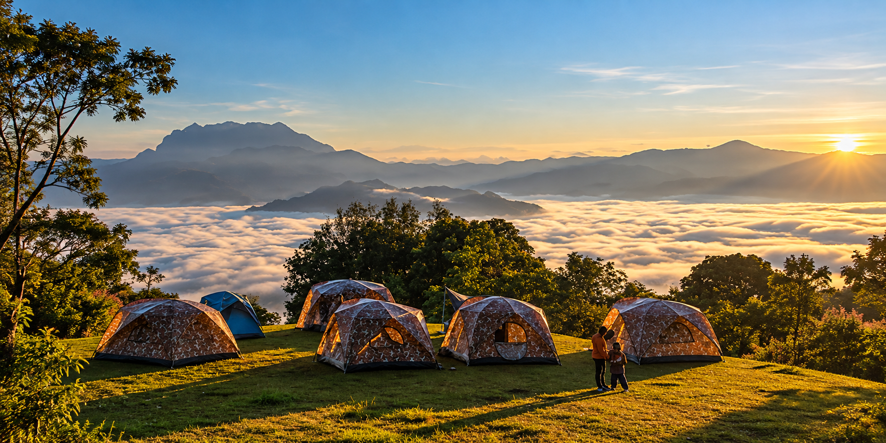
At dawn the valleys can disappear beneath a sea of mist. The ridges become islands. And beyond them, Doi Luang Chiang Dao can rise from the horizon. Huai Nam Dang is where the mountains become clouds.
Where Mountains Become Clouds
There are mountains that you climb for the summit.
And there are mountains you visit for the view.
Huai Nam Dang is different.
Here, the mountains are not simply something to look at. They become the stage for clouds, mist, sunrise, forests, rivers and the changing light of Northern Thailand.
At dawn, the valleys below can disappear beneath a vast sea of mist. Above it, mountain ridges emerge one after another. And beyond them, on clear mornings, the unmistakable silhouette of Doi Luang Chiang Dao rises from the horizon.
This is the landscape that made Huai Nam Dang one of Northern Thailand’s most celebrated mountain national parks — and a standout destination in ThailandLover’s Nature & Parks collection.
But the park is much more than a viewpoint.
Spread across approximately 1,252.12 square kilometres, Huai Nam Dang protects an enormous mountainous landscape extending across Chiang Mai and Mae Hong Son.
Within its boundaries are high ridges, deep valleys, watershed forests, waterfalls, hot springs, mountain communities and habitats supporting a remarkable diversity of plants and wildlife.
The famous sea of mist is simply the moment when all of these elements come together.
Huai Nam Dang is where the mountains become clouds.
At a Glance
- Official Name
- Huai Nam Dang National Park
- Thai Name
- อุทยานแห่งชาติห้วยน้ำดัง
- Region
- Northern Thailand
- Provinces
- Chiang Mai and Mae Hong Son
- Districts
- Mae Taeng and Wiang Haeng, Chiang Mai · Pai, Mae Hong Son
- Area
- Approximately 1,252.12 km² · 782,575 rai
- Established
- 14 August 1995 · Thailand’s 81st national park
- Elevation
- Approximately 400–1,962 metres
- Highest Peak
- Doi Chang — 1,962 metres
- Signature Viewpoint
- Doi Kiew Lom — approximately 1,615 metres
- Signature Phenomenon
- Sea of mist
- Major Hot Springs
- Pong Dueat Pa Pae · Tha Pai Hot Spring
- Major Waterways
- Pai River and Mae Taeng River systems
Huai Nam Dang was officially declared a national park on 14 August 1995, covering approximately 782,575 rai or 1,252.12 square kilometres. The Department of National Parks identifies it as Thailand’s 81st national park.
Where Is Huai Nam Dang?
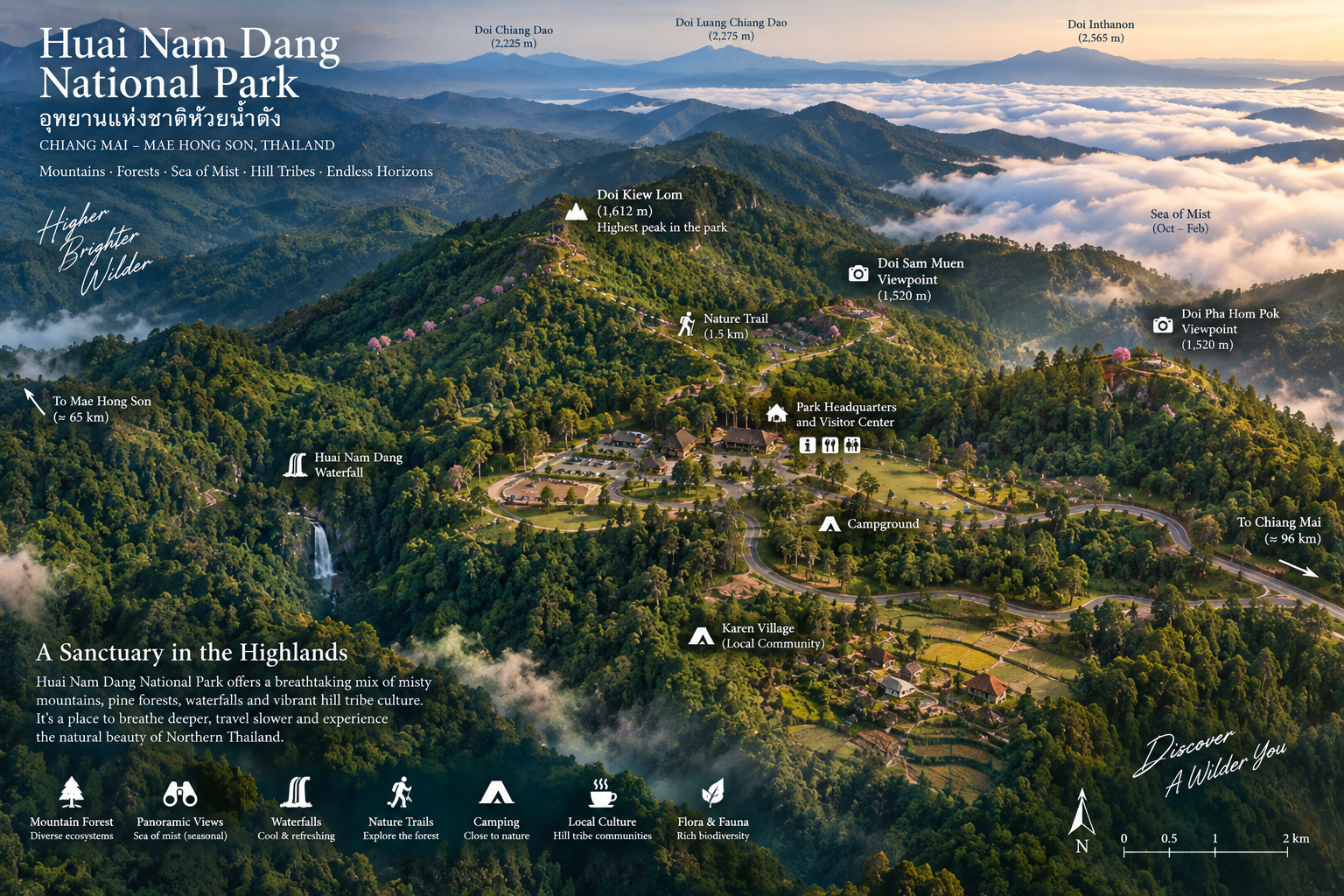
Huai Nam Dang National Park lies across the mountainous borderland between Chiang Mai and Mae Hong Son.
The park encompasses areas associated with Mae Taeng and Wiang Haeng in Chiang Mai, and Pai District in Mae Hong Son.
This geographical position is important. Huai Nam Dang is part of the great mountainous landscape of Northern Thailand, where several major mountain systems overlap and where ridges, valleys and watersheds create an intricate landscape.
The park also sits close to the famous route between Chiang Mai and Pai — typically along Highway 1095, the mountain road from Mae Malai.
For many travellers, Huai Nam Dang is therefore encountered as part of a northern road journey. But stopping here changes the rhythm of that journey.
Instead of simply driving through the mountains, you stop above them.
The Scale of Huai Nam Dang
Huai Nam Dang is large. Very large.
At approximately 1,252 square kilometres, it is not a compact park built around one attraction. Its landscape extends across mountain ridges and watersheds.
Elevation ranges from roughly 400 metres to 1,962 metres above sea level. That vertical range is one of the reasons the park contains such different environments.
Lower elevations contain warmer forest ecosystems. Higher elevations become cooler and more mountainous. The result is a landscape of ecological transitions rather than a single uniform forest.
This is one reason Huai Nam Dang feels much larger than the famous viewpoint might suggest.
The viewpoint is only one window into the park.
A Mountain Watershed
Huai Nam Dang is fundamentally a watershed landscape.
The mountains collect rainfall. The forest slows the movement of water. Streams form in the valleys. And those streams eventually feed larger river systems.
Important waterways originating within or associated with the park include the Pai River and Mae Taeng River systems. The park’s many smaller streams and tributaries are therefore part of a much larger hydrological network.
This is one of the most important things to understand about Huai Nam Dang. The forest is not simply scenery. It is infrastructure provided by nature.
It stores water. It regulates runoff. It protects soil. And it supports downstream communities.
The Mountains of Huai Nam Dang
The landscape is dominated by long mountain ridges rather than a single isolated peak. Some ridges rise steeply from deep valleys. Others form rounded highland landscapes covered in forest.
The highest point of the park is Doi Chang, reaching approximately 1,962 metres above sea level.
Doi Chang is one of the park’s major high-elevation landscapes and provides broad views across the surrounding mountains.
But the mountain that made Huai Nam Dang famous is another:
Doi Kiew Lom.
Doi Kiew Lom Viewpoint
The View That Made Huai Nam Dang Famous
If Huai Nam Dang has one defining image, it is Doi Kiew Lom at dawn.
The viewpoint sits at approximately 1,615 metres above sea level. From here, the landscape opens toward a vast succession of mountain ridges.
On favourable mornings, the lower valleys disappear beneath clouds. Only the higher ridges remain visible. And in the distance, Doi Luang Chiang Dao can rise prominently above the cloud layer.
This is the famous sea of mist.
The experience is not simply about fog. It is about perspective. You are standing above the cloud layer, looking across a three-dimensional landscape in which valleys have disappeared and mountains have become islands.
The Sea of Mist
The sea of mist is one of Northern Thailand’s most recognisable natural phenomena. At Huai Nam Dang, it is particularly dramatic because of the elevation and mountainous terrain.
During suitable weather conditions, cool air and moisture accumulate in the valleys overnight. As morning approaches, the valleys can fill with low cloud. From the elevated viewpoint, the clouds appear like an ocean. The mountains become islands. The horizon becomes layered. And the first sunlight begins to illuminate the ridges one by one.
The important word is conditions. A sea of mist cannot be guaranteed. It depends on humidity, temperature, overnight weather, wind, cloud formation and local topography.
This is why two mornings at Huai Nam Dang can look completely different. One morning may reveal a spectacular white ocean. The next may offer a completely clear mountain panorama.
Both are real Huai Nam Dang.
Sunrise at Doi Kiew Lom
Sunrise is the signature moment. Arriving before dawn allows the landscape to change in front of you.
silhouettes → brightening sky → visible mist → sun on the ridges
The landscape changes every few minutes. For photographers, this is one of the most rewarding parts of Huai Nam Dang.
The goal is not simply to photograph the sun. It is to photograph the layers: foreground mountain, middle-distance mist, distant ridges — and, when conditions allow, Doi Luang Chiang Dao emerging from the clouds.
Doi Luang Chiang Dao on the Horizon
One of the reasons the Doi Kiew Lom view is so recognisable is the relationship between Huai Nam Dang and the surrounding mountain systems.
On clear days, Doi Luang Chiang Dao can be seen across the distant landscape. This creates a powerful visual composition: mist in the foreground, layered mountains in the middle distance, and one of Northern Thailand’s most distinctive high peaks on the horizon.
The view is therefore much more than “mountains and fog.” It is a panorama of the northern highlands.
Doi Chang
The Highest Point · Approximately 1,962 metres
At approximately 1,962 metres, Doi Chang is the highest point within Huai Nam Dang National Park.
Its high elevation produces a cooler mountain environment and different ecological conditions from the lower valleys. The area is associated with highland forest and birdlife. On clear mornings, Doi Chang also provides extensive views over surrounding mountain systems.
For visitors who appreciate altitude and wilderness, Doi Chang represents a different side of the park from the more accessible Doi Kiew Lom viewpoint.
Doi Kiew Lom is about the iconic panorama. Doi Chang is about the high mountain landscape itself.
Forests of Huai Nam Dang
The park contains a variety of forest types reflecting differences in elevation and moisture, including evergreen forest, deciduous forest, mixed forest, dry forest, highland forest and dipterocarp-dominated forest in suitable areas.
The vegetation changes as you move through the park. At lower elevations, deciduous landscapes can become more prominent. Higher and wetter areas support denser evergreen vegetation.
This vertical transition is one of the park’s most important ecological characteristics.
Pine Forests and the Highland Landscape
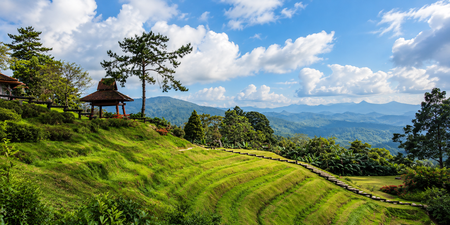
Pine trees are strongly associated with the visual identity of Huai Nam Dang. In the higher areas, pine woodland creates a distinctly northern landscape. The tall, relatively open trees allow sunlight to reach the forest floor.
During the cool season, the combination of pine trees + cold air + mist + golden light creates one of the most recognisable visual moods of Northern Thailand.
This is one reason Huai Nam Dang photographs so well. Its landscape already has strong natural composition.
Flowers in the Cold Season
The cool season brings another visual dimension to the park. Certain highland flowers bloom during the colder months.
One of the most famous is Phaya Suea Krong, the Himalayan cherry, which can produce pink blossoms against the mountain landscape.
The timing varies with weather and elevation. Flowering should not be treated as a guaranteed annual calendar event. Temperature and rainfall influence the timing.
The best approach is to check current park conditions before travelling specifically to see the blossoms.
Hot Springs
Huai Nam Dang is unusual because it combines two very different natural experiences: cold mountain air and geothermal heat.
Pong Dueat Pa Pae
The Famous Geothermal Landscape
At Pong Dueat Pa Pae, underground geothermal energy produces one of the most distinctive hot-spring systems in the region. The site includes several large hot pools and smaller thermal features. It is particularly notable for its geyser-like behaviour.
Hot water can erupt upward from underground, sometimes reaching approximately 1–2 metres. Published tourism information records surface temperatures around 90–99°C in the hot spring system.
That means this is not a natural pool in which visitors should simply enter. The geothermal feature itself is the attraction. Where bathing facilities are provided separately, visitors should use only the designated areas and follow park instructions.
Why Pong Dueat is scientifically interesting
Pong Dueat is more than a tourist hot spring. It demonstrates geothermal activity beneath the northern mountain landscape. Water moves underground, encounters heated geological zones, pressure builds, and hot water returns toward the surface.
The result is a landscape where the ground itself appears to breathe. Steam rises. Water bubbles. And occasionally the geothermal pressure produces a visible eruption.
This is a completely different expression of the same mountain environment.
At Doi Kiew Lom, the mountain produces clouds. At Pong Dueat, the mountain produces heat.
Pong Dueat nature trail
The hot spring area is also associated with a nature-study trail. Historical park information describes the Pong Dueat nature trail at approximately 1.55 kilometres.
The trail allows visitors to experience the forest and geothermal landscape together. Rather than treating the hot spring as a single attraction, the trail helps explain the surrounding environment.
As always, visitors should confirm current trail access because trails can close temporarily during maintenance, heavy rain or environmental protection periods.
Tha Pai Hot Spring
The Mae Hong Son side of the park contains another important geothermal area: Tha Pai Hot Spring.
Located near Pai, this hot-spring environment is surrounded by forest and is characterised by naturally hot water emerging from underground. Historical descriptions record very high temperatures in the natural hot-spring zone.
Again, the important distinction is between natural geothermal features and designated bathing facilities.
Visitors should never enter an untreated natural hot spring simply because it looks like a pool.
Waterfalls
The park also contains waterfalls — including the waterfall from which the national park takes its name. Water that begins as rain in the mountains eventually becomes streams and waterfalls. Those streams then contribute to larger river systems.
In this sense, the waterfalls are not isolated attractions. They are part of the watershed.
Huai Nam Dang Waterfall
Published descriptions describe it as a multi-tiered waterfall formed by Huai Nam Dang stream, associated with rocky terrain and forest.
Mae Yen Waterfall
Mae Yen stream eventually flows toward the Pai River. The waterfall environment is more deeply connected to the forest than the panoramic Doi Kiew Lom viewpoint.
Visitors who come primarily for the sea of mist may therefore miss an important part of Huai Nam Dang’s identity. The park is not just a high viewpoint. It is a mountain water system.
Mae Hat Waterfall
Tourism Directory information describes it as a four-tier waterfall where water flows over rocky formations and forms pools.
It provides a very different experience from the cold, open mountain viewpoint. Instead of looking outward across the horizon, the waterfall experience draws attention inward: water, rocks, trees, shade and sound.
Mae Lat Waterfall
Associated with the Wiang Haeng area, published descriptions identify it as a multi-tier waterfall surrounded by forest.
Together, these waterfalls demonstrate how extensive the park’s geography really is. A visitor standing at Doi Kiew Lom sees one small part of an enormous protected landscape.
Wildlife
A Forest Rather Than a Zoo
Huai Nam Dang supports a wide range of wildlife because of its large area and varied elevations. Reported wildlife includes mammals, birds, reptiles and amphibians associated with northern Thai mountain forests.
Species recorded in historical descriptions include wild boar, deer, fishing cat, elephant, serow, various small mammals and numerous forest birds.
However, there is an important distinction. The presence of an animal in the park does not mean visitors are likely to see it.
Large mammals are generally elusive. They avoid roads and busy visitor areas. The real wildlife experience at Huai Nam Dang is therefore about habitat. You are entering a functioning forest ecosystem.
Birdwatching
For many visitors, birds are much easier to encounter than large mammals. The elevation gradient creates habitats for different bird communities. At higher elevations, visitors may encounter mountain and forest species.
Historical descriptions of Doi Chang mention highland birds including thrushes, flycatchers, robins and bulbuls. The exact species encountered will vary by season, altitude and habitat.
For serious birdwatchers, Huai Nam Dang deserves more attention than its reputation as a sea-of-mist destination might suggest.
The Human Landscape
Huai Nam Dang is not an empty wilderness. People have lived in the northern highlands for generations.
The wider park landscape is connected with mountain communities and villages, including communities of ethnic minority groups. This human geography is part of the landscape. Agriculture, traditional knowledge, forest use and conservation policy all meet here.
This creates a more complicated story than simply “forest versus people.” Modern protected-area management increasingly has to address both conservation and the legitimate presence and livelihoods of communities living within or around protected landscapes.
Conservation and Communities
This is particularly relevant to Huai Nam Dang today. As recently as September 2026, park officials were involved in local-level processes concerning land occupation and participation in a conservation and natural-resource stewardship programme in Pai District.
This demonstrates that protected-area management remains an active process rather than a historical event that ended when the park was gazetted.
The modern national park is simultaneously a conservation area, a watershed, a tourism destination, and a landscape in which communities live and work.
Understanding all four dimensions gives a more accurate picture of Huai Nam Dang.
The Cultural Landscape
Mountain communities in Northern Thailand have developed distinctive relationships with their environment. Agriculture, forest resources, seasonal weather and mountain geography have shaped local life for generations.
Visitors should therefore avoid treating hill-tribe communities as tourist “exhibits.” The more respectful approach is to recognise them as communities with their own histories, languages, traditions and contemporary lives.
Where community tourism is available, choose experiences that are locally operated and transparent about where visitor spending goes.
The Dark Sky of Huai Nam Dang
Huai Nam Dang has another distinction that many daytime visitors overlook.
The park is recognised as a Dark Sky Park by the National Astronomical Research Institute of Thailand. The designated astronomical observation area is around 1,615 metres above sea level.
At this elevation, combined with relatively favourable sky conditions and controlled lighting, the park can offer excellent opportunities for stargazing, astrophotography, observing astronomical phenomena and viewing the Milky Way.
The landscape therefore changes completely after sunset.
During the day, mountains become the subject. At night, the sky becomes the subject.
A Different Way to Experience Huai Nam Dang
Most visitors think of Huai Nam Dang in this sequence:
arrive → see mist → take photographs → leave
ThailandLover would suggest another sequence.
Arrive before sunrise. Watch the mountains emerge. Stay after the mist begins to disappear. Walk through the forest. Visit a waterfall. Explore the geothermal landscape. Watch the sunset. Then stay after dark. Look upward.
The same mountain that looked dramatic in the morning becomes a silhouette beneath the stars.
That is a much more complete Huai Nam Dang experience.
Best Things to Do
- 1. Watch sunrise at Doi Kiew Lom
- The essential experience. Arrive before sunrise. Give yourself enough time to find a viewpoint and allow the landscape to change.
- 2. Photograph the sea of mist
- Do not photograph only the mist. Look for layers: mountain, cloud, peak, tree, light. These elements create depth.
- 3. Look for Doi Luang Chiang Dao
- On clear mornings, look toward the distant mountain horizon. The silhouette of Doi Luang Chiang Dao can transform an already dramatic panorama.
- 4. Visit Pong Dueat Pa Pae
- Experience the geothermal landscape. Watch the hot water erupt. Walk the nature trail. Do not enter the natural hot spring.
- 5. Visit Tha Pai Hot Spring
- Combine the hot spring with a visit to Pai. Use only designated bathing areas.
- 6. Explore the waterfalls
- Depending on current accessibility, explore Huai Nam Dang, Mae Yen, Mae Hat and Mae Lat waterfalls. Each reveals a different side of the park.
- 7. Camp in the highlands
- Camping is one of the best ways to experience the park’s temperature and changing light. The difference between afternoon, sunset, midnight and sunrise is substantial.
- 8. Stargaze
- If the weather is clear, stay after dark. Huai Nam Dang’s Dark Sky status makes astronomy a legitimate part of the destination rather than simply an incidental activity.
- 9. Watch the forest
- Do not rush. Listen for birds. Look for movement. Observe the vegetation. Mountain forests reward patience.
The Best Season
Huai Nam Dang can be visited throughout the year, but the experience changes dramatically by season.
- November–February · Cool Season
- The classic Huai Nam Dang season. Expect cooler temperatures, sunrise photography, stronger chances of sea-of-mist conditions, highland flowers, cold-weather camping and clearer mountain views on suitable mornings. This is also the period when visitor demand is typically highest.
- March–April · Hot Season
- The mountains can still be pleasant compared with lowland Thailand. However, visibility can vary and haze can affect distant mountain views. The experience is less associated with the classic winter sea-of-mist image.
- May–October · Rainy Season
- The forest becomes greener. Waterfalls can become more impressive. Mist can also appear under suitable conditions. But heavy rain can affect mountain roads, trails and outdoor activities. Some specific park activities or routes may also have seasonal closures.
Camping
Camping is one of the strongest ways to experience Huai Nam Dang. The combination of altitude and open mountain landscape makes the park particularly suitable for overnight stays.
At night, temperatures can fall significantly compared with the daytime. Bring appropriate cold-weather equipment during the cool season.
The most important item is not simply a tent. It is a proper sleeping system. At high elevation, a warm sleeping bag and insulating ground mat can make a major difference.
Photography
Sunrise photography guide
- Before dawn
- Arrive early. The most beautiful mist can already be present before the sun appears.
- During blue hour
- Look for silhouettes. This is often when the mountains have the strongest depth.
- Sunrise
- Expose carefully. The sky can be significantly brighter than the foreground.
- After sunrise
- Do not leave immediately. The light becomes warmer and the mountain layers often become more visible as the mist changes. The best photograph may come 20–40 minutes after sunrise, not necessarily at the exact moment the sun appears.
Photography beyond the mist
If you only photograph the sea of mist, you will miss most of the park.
- Pine forest
- Mountain roads
- Waterfall textures
- Geothermal steam
- Highland flowers
- Local architecture
- Clouds moving through valleys
- Sunset silhouettes
- Stars and Milky Way landscapes
Huai Nam Dang is unusually photogenic because its visual character changes dramatically throughout the day.
Responsible Travel
Huai Nam Dang is a protected watershed. That should influence how you travel.
- Do not litter — even small pieces of plastic can enter streams and move downstream
- Do not collect plants — flowers, orchids, mosses and other plants are part of the ecosystem
- Do not feed wildlife — feeding animals changes natural behaviour
- Do not play loud music — sound travels exceptionally well across mountain valleys
- Respect local communities — do not photograph people without permission
- Stay on designated trails — mountain environments are fragile and difficult to restore
- Use hot springs responsibly — natural geothermal features can be dangerously hot
- Leave no trace
Take photographs, not pieces of the landscape.
What Makes Huai Nam Dang Special?
Thailand has many mountain national parks. So why does Huai Nam Dang remain so memorable? Because of the combination.
Few destinations bring together 1,600-metre viewpoints, vast mountain horizons, sea of mist, pine forests, highland flowers, waterfalls, geothermal springs, dark skies and mountain communities within one enormous protected landscape.
The sea of mist is the headline. But the ecosystem is the story.
Huai Nam Dang is not just a viewpoint
This distinction matters. Many travellers know Huai Nam Dang because they have seen photographs of Doi Kiew Lom. But if you only visit the viewpoint, you have experienced perhaps one chapter of the park.
The national park extends across more than 1,250 square kilometres. Its forests protect watersheds. Its mountains create different ecological zones. Its streams feed larger rivers. Its geothermal systems reveal the geological forces beneath the landscape. Its wildlife depends on the forest. Its communities are part of the human geography. And its night sky provides another dimension entirely.
The viewpoint is the introduction. Not the whole story.
Huai Nam Dang, Pai and Chiang Mai
Huai Nam Dang and Pai
For many international travellers, Huai Nam Dang is associated with Pai. This is understandable. Pai is one of the most popular destinations in Mae Hong Son Province, and parts of Huai Nam Dang lie close to the Pai landscape.
But the two should not be treated as the same destination.
Pai is a town and cultural tourism destination. Huai Nam Dang is a protected mountain landscape.
The best experience may be to combine them. Spend time in Pai. Then leave the town behind. Climb into the mountains. Watch the sunrise above the clouds.
Huai Nam Dang and Chiang Mai
Huai Nam Dang is also naturally connected with Chiang Mai. The park is accessible through the northern mountain corridor from Chiang Mai toward Pai.
This makes it a logical addition to a Northern Thailand itinerary. Instead of treating the drive as merely transportation, consider making the mountain landscape part of the journey.
The road itself becomes part of the experience.
How Long Should You Stay?
- A few hours
- Enough for Doi Kiew Lom, sea of mist, sunrise and photography — but this is the minimum experience.
- One day
- Better. You can combine viewpoint, forest, waterfall and hot spring, depending on current access and distances.
- One night
- Recommended. You can experience sunset → stars → sunrise → sea of mist. This reveals three completely different landscapes within one location.
- Two days
- Ideal for slow travel. Use the first day to explore the park. Stay overnight. Wake before sunrise. Then explore another part of the park or continue toward Pai.
Who Is Huai Nam Dang For?
- Photographers
- One of Northern Thailand’s most rewarding landscapes for mountain and atmospheric photography.
- Campers
- Especially those who enjoy cold mornings and dramatic landscapes.
- Nature lovers
- The park’s scale and ecological diversity make it much more than a scenic viewpoint.
- Stargazers
- Its Dark Sky designation adds an unusual nighttime dimension.
- Road trippers
- It works naturally within a Chiang Mai–Pai–Mae Hong Son journey.
- Slow travellers
- Those willing to stay overnight will see much more than day visitors.
- Families
- Suitable for nature-focused trips, subject to weather, road and trail conditions.
Who may not enjoy it?
Huai Nam Dang may not be ideal if you want luxury resort infrastructure, nightlife, shopping, guaranteed sea-of-mist conditions, easy access to every attraction or predictable weather.
This is a mountain environment. Weather changes. Roads can be difficult. Visibility can disappear. And nature does not operate according to an itinerary.
That is part of the experience.
Essential Huai Nam Dang
- Best known for
- Doi Kiew Lom and the sea of mist
- Highest point
- Doi Chang — approximately 1,962 metres
- Signature viewpoint
- Doi Kiew Lom — approximately 1,615 metres
- Best sunrise experience
- Doi Kiew Lom
- Major geothermal attraction
- Pong Dueat Pa Pae
- Other hot spring
- Tha Pai Hot Spring
- Waterfalls
- Huai Nam Dang, Mae Yen, Mae Hat and Mae Lat
- Best season for the classic experience
- Cool season, particularly when weather conditions favour mist
- Best experience
- Stay overnight and experience sunset, stars and sunrise
- Special distinction
- Recognised as a Dark Sky Park
- Most important reminder
- A sea of mist is a natural phenomenon, not a guaranteed attraction
Frequently Asked Questions
- Where is Huai Nam Dang National Park?
- It spans parts of Chiang Mai and Mae Hong Son provinces in Northern Thailand, including areas around Mae Taeng, Wiang Haeng and Pai.
- How large is Huai Nam Dang National Park?
- Approximately 1,252.12 square kilometres, or about 782,575 rai.
- When was Huai Nam Dang established?
- It was officially declared a national park on 14 August 1995 and is recognised by the Department of National Parks as Thailand’s 81st national park.
- What is the highest mountain in Huai Nam Dang?
- Doi Chang, at approximately 1,962 metres above sea level.
- How high is Doi Kiew Lom?
- The viewpoint is approximately 1,615 metres above sea level.
- Can I always see the sea of mist?
- No. The sea of mist depends on weather, humidity, temperature, wind and local atmospheric conditions. Winter generally offers the classic experience, but even then it is not guaranteed.
- What is the best time to see the sea of mist?
- Early morning around sunrise is the key period. Arrive before sunrise rather than after it.
- Can I see Doi Luang Chiang Dao?
- On clear days, Doi Luang Chiang Dao can be seen from the Doi Kiew Lom area as part of the distant mountain panorama.
- Is Pong Dueat a normal hot spring?
- No. Pong Dueat is a geothermal system with geyser-like hot-water eruptions. The natural water can be extremely hot, with published measurements around 90–99°C at the surface. Use only designated facilities and follow park instructions.
- Is Huai Nam Dang good for stargazing?
- Yes. The park has been recognised by the National Astronomical Research Institute of Thailand as a Dark Sky Park, and its high elevation and relatively dark environment can provide good conditions for astronomy.
- Can I camp?
- Camping facilities are available in the park, subject to current operation and availability. Cold-weather equipment is strongly recommended during the cool season.
- Is Huai Nam Dang suitable for a Chiang Mai–Pai road trip?
- Yes. Its location makes it a natural stop on a Northern Thailand mountain journey, particularly for travellers travelling between Chiang Mai and Pai.
- Is the park open all year?
- Different areas and activities can have different operating periods. A government seasonal-closure schedule has listed certain trekking routes and rafting on the Mae Taeng River as closed from 1 July to 30 September. Always verify current conditions before travelling for a particular activity.
Related Destinations
- Doi Inthanon National Park
- Thailand’s highest mountain — cloud forest, waterfalls and highland trails in Chiang Mai.
- Doi Pha Hom Pok National Park
- Thailand’s second-highest mountain — summit trekking and another northern sea-of-mist landscape.
- Doi Suthep–Pui National Park
- The mountain behind Chiang Mai — temple, forest and an easy introduction to northern highland landscapes.
- Si Lanna National Park
- Lakes, forest and cooler northern landscapes north of Chiang Mai.
- Namtok Mae Surin National Park
- A dramatic waterfall landscape further into Mae Hong Son, for travellers continuing west from Pai.
- Northern Thailand national parks
- More mountains, forests and protected landscapes across ThailandLover’s national-park collection.
Location
Find Huai Nam Dang National Park
Kuet Chang, Mae Taeng, Chiang Mai · Pai, Mae Hong Son