

National Park · Chaiyaphum
Tat Ton National Park
อุทยานแห่งชาติตาดโตน
Waterfalls, Forest & Wide Rocky Landscapes in Chaiyaphum
Mueang Chaiyaphum · Phu Laen Kha · Northeastern Thailand
Streams leave the Phu Laen Kha range and spread across broad rock terraces — a wide, shaded waterfall landscape about 21 kilometres from Chaiyaphum city.
A Waterfall You Cross, Not Just Look Up At
Tat Ton National Park (อุทยานแห่งชาติตาดโตน) is one of Chaiyaphum’s most accessible natural destinations — a mountain-and-forest landscape where streams descend from the Phu Laen Kha mountain range into broad rocky terraces and waterfalls.
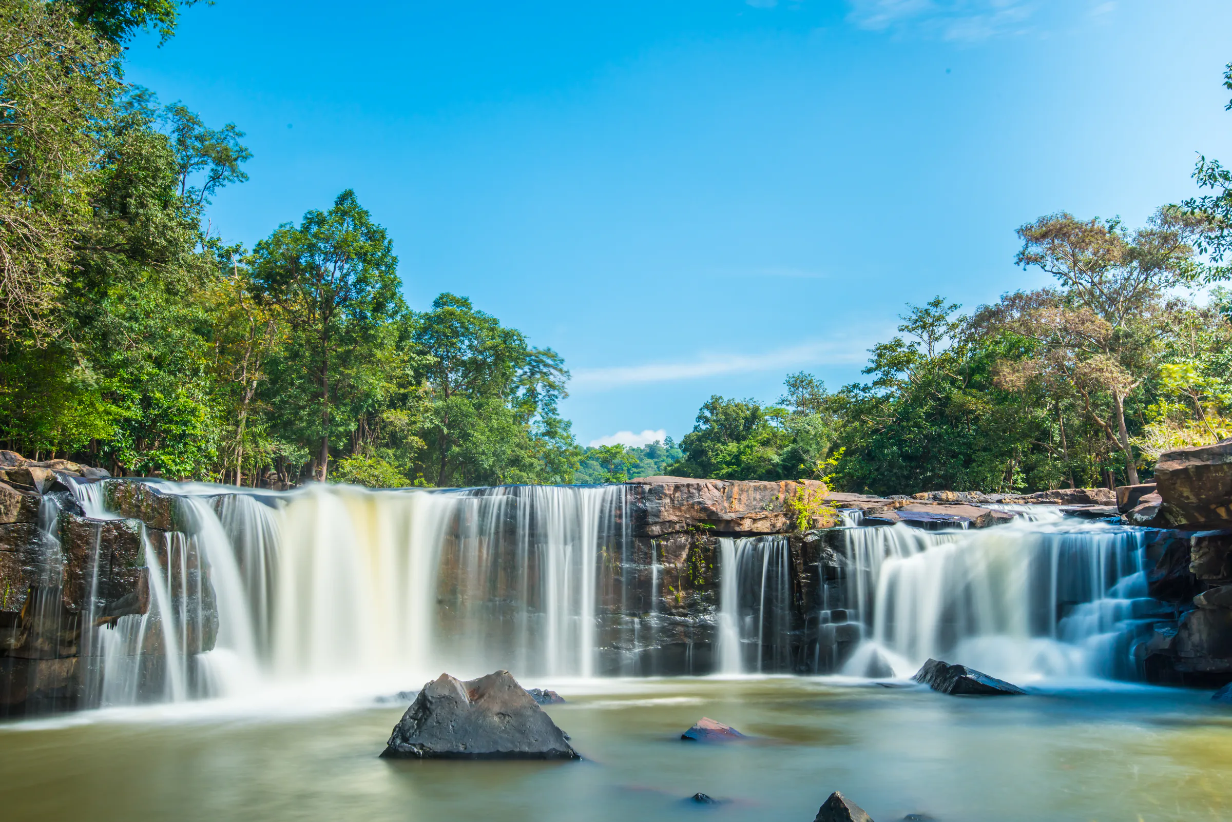
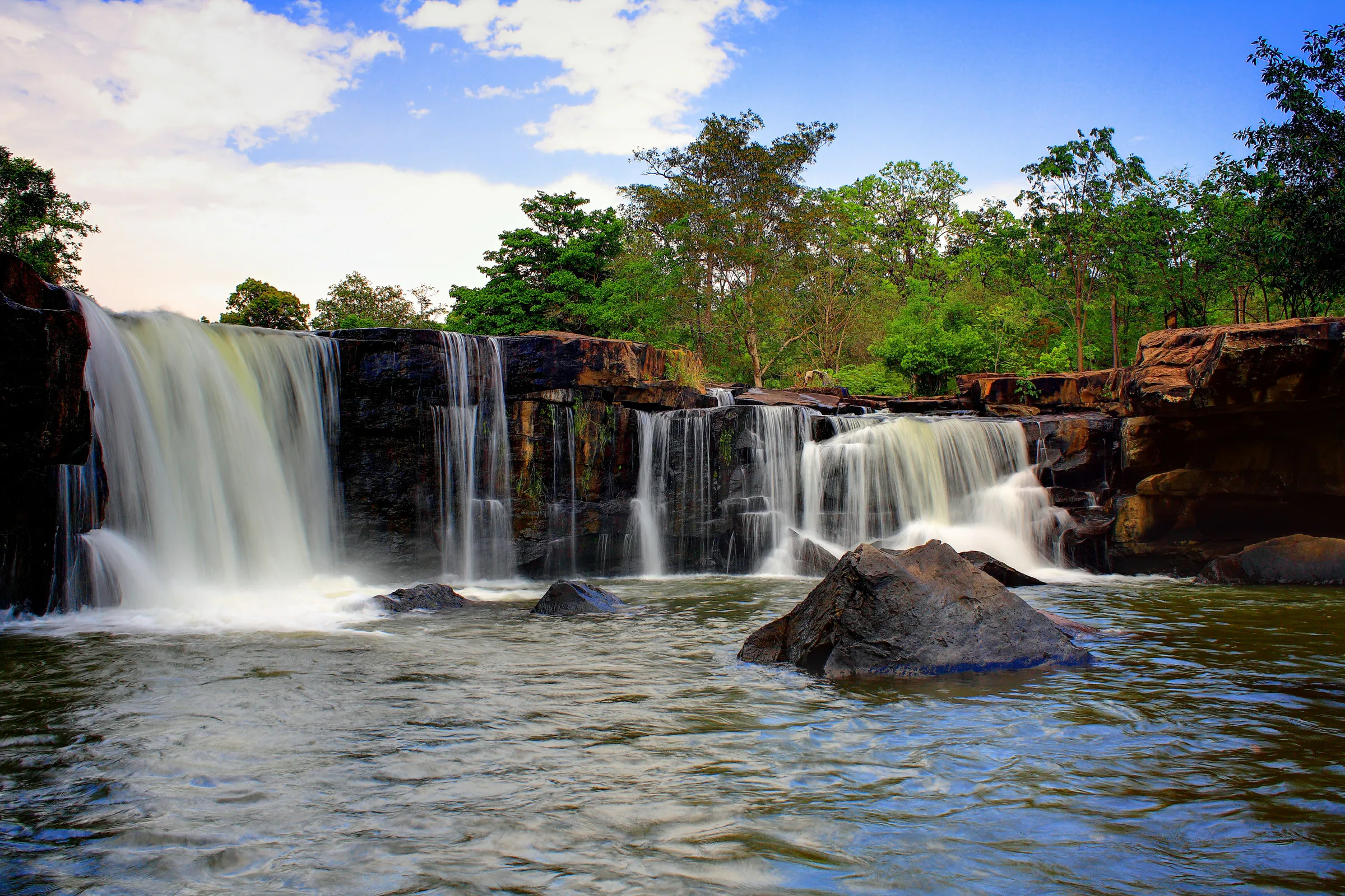
The park is best known for Tat Ton Waterfall, a wide, low waterfall flowing across a large sandstone-and-rock terrace. The character of the place comes from the combination of wide rock platforms, flowing water, mature trees, forest, swimming areas and the surrounding mountains.
Located in the northern part of Mueang Chaiyaphum District, the park is approximately 21 kilometres from Chaiyaphum city by road. It is one of the easiest places to leave the city for a few hours, or to spend a full day in nature.
Come for the waterfall. Stay for the landscape.
At a Glance
- ~217 km²
- Park area — approximately 135,737.50 rai.
- 1980
- Established 31 December, Thailand’s 23rd national park.
- ~50 m wide
- Tat Ton Waterfall across a low rock terrace, about 6 metres high.
- 21 km
- From Chaiyaphum city to the park headquarters.
- 945 m
- Highest ground, around the summit of Phu Laen Kha.
- Thai Name
- อุทยานแห่งชาติตาดโตน
- Province
- Chaiyaphum
- District
- Mueang Chaiyaphum
- Mountain Range
- Phu Laen Kha
- Area
- Approx. 217.18 sq km / 135,737.50 rai
- Established
- 31 December 1980
- National Park Order
- Thailand’s 23rd national park
- Main Landscape
- Dry evergreen forest, deciduous dipterocarp forest, streams and rocky plateaus
- Signature Attraction
- Tat Ton Waterfall
- Other Waterfalls
- Tat Fa, Pha Iang, Tat Ton Noi and smaller cascades
- Main City Access
- Chaiyaphum — approx. 21 km to the park headquarters
- Main Activities
- Waterfall visits, swimming where permitted, nature walks, camping, photography and wildlife observation
The Department of National Parks currently gives the park’s area as approximately 135,737.50 rai, or 217.18 square kilometres.
Why Visit Tat Ton?
Tat Ton offers something many larger national parks cannot: real nature without a major expedition. From Chaiyaphum city, visitors can reach the park relatively quickly.
- Half-day escapes
- Full-day nature trips
- Family outings
- Waterfall visits
- Photography
- Camping
- Short nature walks
- Time beside the streams
- A stop combined with other Chaiyaphum attractions
The park also protects an important watershed in the Phu Laen Kha range. Several streams begin in the surrounding mountains before joining larger waterways in the Chaiyaphum area.
The Landscape of Tat Ton
Phu Laen Kha — ridges, valleys and rock terraces
Tat Ton National Park occupies part of the Phu Laen Kha mountain range. The landscape is built from mountain ridges, upland areas, forested valleys, rocky streambeds, natural rock terraces, and seasonal streams and waterfalls.
The highest point within the park is around 945 metres above sea level, at the summit area of Phu Laen Kha. Other high ground includes Phu Khiao and Phu Klang, reaching around 905 metres. These mountains feed the streams that run through the park and on into the surrounding lowlands.

Tat Ton Waterfall
The heart of the national park
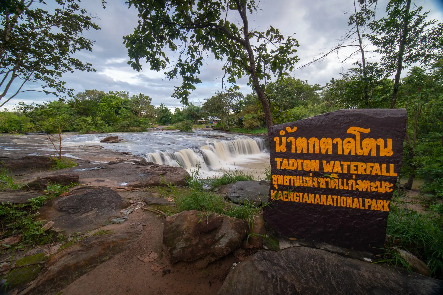
Tat Ton Waterfall gave the national park its name. Water spreads across a wide rocky terrace approximately 50 metres across. The main drop is relatively low — commonly described in government and geological tourism sources as approximately 5–7 metres, with around 6 metres a useful representative figure.
What makes it impressive is width and landscape. Water flows across the rock platform above the main drop, creating shallow channels and natural pools before falling over the ledge. Large trees shade the stream, which makes the area especially pleasant in the hotter months. During the rainy season, the volume rises and the whole rock terrace becomes much more dramatic.
Water + rock + forest + shade — the visual signature of Tat Ton.
The Rocky Terrace
The rock platform above Tat Ton Waterfall is part of the experience. Visitors arrive at a broad landscape where water moves over exposed rock, rather than at a narrow viewpoint facing a single drop.
Geological information identifies limestone and shale among the area’s underlying rock formations. The waterfall zone itself is extensive exposed rock, shaped by water erosion.
Swimming at Tat Ton
Tat Ton has long been popular with local visitors because some sections of the stream are used for recreation and swimming. That does not mean the entire waterfall area is safe. Water depth, current strength and rock conditions change with rainfall. In the rainy season, the volume can become significantly stronger.
Chaopho Tat Ton Shrine
เจ้าพ่อตาดโตน · also known as Pu Duang
Near Tat Ton Waterfall is the shrine of Chaopho Tat Ton, also known as Pu Duang. Local people hold it in deep respect. It is part of the cultural landscape around the waterfall.
For local communities, the forest and mountain landscape carry cultural and spiritual meaning. Treat the shrine as a place of respect. The Tourism Authority of Thailand identifies Chaopho Tat Ton as an important local sacred site, visited by people from Chaiyaphum and neighbouring provinces.
Tat Ton Noi Waterfall
A quieter stream in the same landscape
Tat Ton Noi Waterfall is another waterfall system in the park, formed by smaller streams from the surrounding mountains. Compared with the main Tat Ton waterfall, it is less developed as a mass visitor attraction and sits closer to the forest and stream environment.
Its flow follows the seasons, although geological information records water continuing through the area during much of the year. Tat Ton Noi is a good reason to understand the park as a waterfall landscape, with more than one fall.
Tat Fa Waterfall
น้ำตกตาดฟ้า · forest on the eastern side
Tat Fa Waterfall lies on the eastern side of the park and has a more natural, forest-oriented character than the main Tat Ton recreation area. The Department of Mineral Resources describes Tat Fa as a broad rocky waterfall zone at the foot of Phu I Tao, with the exposed rock terrace extending approximately 80–90 metres. Flow is particularly strong toward the end of the rainy season.
TAT places Tat Fa approximately 25 kilometres from Chaiyaphum city along the Chaiyaphum–Kaeng Khro route — a useful option for travellers who want to go beyond the main waterfall.
Pha Iang Waterfall
ผาเอียง · the Chi Long stream
Pha Iang Waterfall sits in another part of the park, on the forested Chi Long stream. It is described as a medium-sized waterfall formed where the stream crosses an angled rock cliff. The surrounding forest is relatively dense, so Pha Iang feels more secluded.
The area also contains smaller waterfalls, including Pha Nit and Pha Song Chan, although their flow is more strongly seasonal. TAT places Pha Iang approximately 32 kilometres from Chaiyaphum city along the Chaiyaphum–Nong Bua Daeng road.
Forests of Tat Ton
Tat Ton’s forests fall mainly into two types.
- Dry evergreen forest
- Especially around streams, valleys and moister ground. The canopy can be relatively dense, and the air feels cooler and greener.
- Deciduous dipterocarp forest
- More common on drier, rockier ground. Typical trees include dipterocarp species, teng, rang, phluang, daeng, makha, kradon, olive trees, and various bamboo and understory plants.
The forest changes with the seasons. In the rains, grasses and understory vegetation become dense. In the dry season, parts of the deciduous forest open up and sunlight reaches the floor.
Wildlife
A protected forest, not a wildlife park
Tat Ton supports wildlife of both dry forest and evergreen forest. Recorded species include:
- Wild boar
- Muntjac
- Mongooses
- Rabbits
- Squirrels
- Treeshrews
- Junglefowl
- Forest birds, reptiles, amphibians and freshwater fish
Birdlife gathers along the stream corridors and in the canopy. Visitors may see kingfishers, drongos, bulbuls, woodpeckers and sunbirds. Sightings are never guaranteed. Arrive early, move quietly, and watch rather than search aggressively.
Tat Ton as a Watershed
One of the most important facts about Tat Ton is also one of the least visible. The mountains are a water source. Streams around the Phu Laen Kha highlands feed waterways including the Lam Pa Thao / Huai Tat Ton system, which contributes to the wider river network around Chaiyaphum.
The park protects scenery, and also part of the natural infrastructure that supports ecosystems and communities downstream. The forest matters even when there is no waterfall in front of you.
Geological Character
The park contains areas of limestone and shale. Exposed rock terraces around the waterfalls have been shaped by long-term weathering and flowing water. These landscapes are geological features, continuously modified by rain, stream erosion, rock weathering, seasonal flow and sediment movement.
That makes the park rewarding for travellers who like to see geology and ecology working together.
Best Time to Visit
- October – January · Cool season
- Temperatures are generally more comfortable, particularly in the forest. A good period for walking and camping.
- February – May · Hot season
- Temperatures can become high. DNP records temperatures reaching approximately 42.6°C in April. This is also when many visitors come to enjoy the waterfall and cool water.
- June – September · Rainy season
- Generally the most visually impressive period for waterfalls. Tat Ton receives much more water and the forest turns greener. Rocks are slippery, currents stronger, and water levels can change suddenly.
For photographers, the rainy season can be excellent. For swimming, caution matters more.
Getting There
- From Chaiyaphum city
- The main park area is approximately 21 kilometres from central Chaiyaphum. The standard route is Highway 2159 → Highway 2051 → Tat Ton National Park. The road to the headquarters is paved. TAT and DNP both identify this connection.
- From Highway 201
- Travellers approaching from the direction of Phu Khiao can use Highway 201 and connect toward Tat Ton. By car, the park is easy to combine with other attractions in the province.
A Half-Day Escape from Chaiyaphum
Enough to feel the central landscape
- Morning
- Chaiyaphum → Tat Ton National Park. Arrive before the heat becomes intense.
- Late morning
- Explore Tat Ton Waterfall. Walk the rock terrace and the stream.
- Midday
- Rest under the trees. If swimming is permitted under current conditions, use designated areas only.
- Afternoon
- Return to Chaiyaphum, or continue toward another attraction.
A Full-Day Tat Ton Experience
A slower day, suited to families and travellers who want a nature visit without a demanding trek.
- 08:00
- Arrive at the park.
- 08:30
- Explore Tat Ton Waterfall and the surrounding stream.
- 10:30
- Visit the Chaopho Tat Ton shrine respectfully.
- 11:00
- Walk nearby forest and recreational areas.
- 12:00
- Lunch and rest.
- 13:00
- Continue toward another waterfall or scenic area, depending on current road and trail conditions.
- 15:30
- Return toward the main park area.
- 16:30
- Leave the park.
Camping & Staying Overnight
Tat Ton is more developed for overnight visitors than many smaller waterfall parks. DNP’s reservation system lists park houses, youth-camp accommodation and camping facilities. The current accommodation database includes multiple park houses around the Tat Ton stream, Tat Ton Waterfall, the main park office and youth-camp areas.
What to Bring
For a day visit
- Comfortable walking shoes
- Sandals for permitted water areas
- Lightweight clothing
- Sun protection
- Insect repellent
- Reusable water bottle
- Waterproof bag and extra clothes
- Small first-aid kit and personal medication
- Power bank
- Rain protection in the wet season
If you are camping
- A warm layer
- Flashlight or headlamp
- Appropriate sleeping equipment
- Personal toiletries
- Food supplies if required
Safety Around the Waterfall
Tat Ton can look easy and family-friendly. Water and smooth rock can become dangerous quickly.
- Depth changes
- Shallow-looking water is not automatically safe. Depth changes between pools.
- Wet rock
- Algae and constantly flowing water can make rock surfaces extremely slippery.
- Heavy rain
- Upstream rain can increase flow even when the water in front of you first looks calm. Avoid the waterfall during strong rainfall.
- Closures
- If park officers close an area, stay out.
- Children
- The broad rock terraces can look safer than they are. Watch children closely.
Responsible Travel
Tat Ton receives significant local visitation, particularly during holidays and hot weather. That makes careful behaviour especially important.
- Keep the stream clean. Do not wash food, soap or chemicals in natural waterways.
- Take rubbish with you. Use designated bins where they exist.
- Leave the rocks. The terraces are part of the park’s geological landscape.
- Leave the plants. Trees and small forest plants both belong to the ecosystem.
- Do not feed wildlife. Animals that learn to expect human food can become dangerous.
- Respect the shrine. Dress and behave appropriately around Chaopho Tat Ton.
Photography Guide
Tat Ton is a landscape of horizontal composition — width across the rock, rather than a single tall drop.
- Tat Ton Waterfall
- Use the width of the rock terrace. Include flowing water, trees, rock, and people for scale.
- Rainy season
- The broad waterfall can become a powerful sheet of water across the rock.
- Forest
- Look for stream reflections, ferns, tree textures, light through the canopy, and water moving over rock.
- Early morning
- Soft light works particularly well around the forest and stream.
- Late afternoon
- Warm light can reveal the textures of the exposed rock.
Tat Ton for Families
Tat Ton is one of the more accessible national-park experiences in Chaiyaphum. The main waterfall area sits relatively close to the park’s developed facilities, so a long trek is unnecessary.
- Waterfall viewing
- Nature walks
- Watching the stream
- Picnicking in permitted areas
- Camping
Parents should stay particularly attentive around water and wet rock.
Tat Ton for Nature Lovers
Beyond the main waterfall, the park becomes considerably more interesting. Dry forest, evergreen forest, mountain streams, exposed rock and wildlife sit together as a compact example of northeastern Thailand’s forest ecology.
Birdwatchers may find the stream corridors particularly rewarding. Arrive early and spend time listening, rather than only moving between attractions.
Tat Ton and Phu Laen Kha
These two parks share the same mountain country and offer different days. A ThailandLover itinerary can comfortably combine them.
| Tat Ton | Phu Laen Kha | |
|---|---|---|
| Landscape | Waterfalls and streams | Mountain and geological landscapes |
| Access | Easy from Chaiyaphum | More extensive scenic country |
| Best for | Family-friendly waterfall areas | Hiking and viewpoints |
| Water & rock | Swimming in permitted areas | Rock formations and panoramic views |
| Pace | Forest recreation, excellent for a short trip | Broader mountain exploration |
ThailandLover Quick Take
Go for
- Waterfalls
- Rocky terraces
- Forest
- Swimming where permitted
- Family nature trips
- Photography
- Camping
- Signature experience
- Tat Ton Waterfall
- Also explore
- Tat Fa Waterfall · Pha Iang Waterfall · Tat Ton Noi · Chaopho Tat Ton Shrine
- Best for waterfalls
- Rainy season, approximately June–September
- Best outdoor weather
- Cool season, approximately October–January
- Best for cooling off
- Hot season, subject to current water-safety conditions
- Best for
- Families, couples, nature lovers, photographers, short-trip travellers and campers
- Defining character
- Wide rock terraces, flowing water and forest close to Chaiyaphum city
Essential Information
- Official Name
- Tat Ton National Park · อุทยานแห่งชาติตาดโตน
- Province
- Chaiyaphum
- District
- Mueang Chaiyaphum
- Mountain Range
- Phu Laen Kha
- Established
- 31 December 1980 · Thailand’s 23rd national park
- Area
- Approx. 217.18 sq km / 135,737.50 rai
- Main Waterfall
- Tat Ton — approximately 6 metres high and 50 metres wide
- Other Waterfalls
- Tat Ton Noi, Tat Fa and Pha Iang
- Distance
- Approx. 21 km from Chaiyaphum city to the main park area
- Accommodation
- Park houses and camping, subject to current DNP arrangements
- Telephone
- +66 44 853 293 / +66 44 853 3333
Frequently Asked Questions
- What is Tat Ton National Park?
- A mountain-and-forest park in northern Mueang Chaiyaphum, where streams from Phu Laen Kha cross wide rocky terraces. Tat Ton Waterfall is the centre of the visit.
- How large is it, and when was it established?
- About 135,737.50 rai, or 217.18 km². Established 31 December 1980 as Thailand’s 23rd national park.
- How big is the main waterfall?
- About 50 metres wide, with a drop commonly described as 5–7 metres — around 6 metres is a useful figure. Width and setting define it.
- When should I go?
- June–September for the strongest water. October–January for comfortable walking and camping. February–May for cooling off, with care around the water — April can reach about 42.6°C.
- Can I swim?
- Only in areas the park currently permits. Depth, current and rock change with the rain. Stay out below a strong cascade and after heavy rainfall.
- How do I get there?
- About 21 km from central Chaiyaphum via Highway 2159 and Highway 2051. The road to the headquarters is paved.
- Can I stay overnight?
- Yes — park houses, youth-camp accommodation and camping, subject to the current DNP reservation system.
More of Chaiyaphum’s Wild Parks
- Phu Laen Kha National Park
- The same mountain range, with Mo Hin Khao, Pha Hua Nak, hiking and wider geological landscapes.
- Pa Hin Ngam National Park
- Sandstone formations, viewpoints and seasonal Siam tulips in Chaiyaphum.
- Sai Thong National Park
- Dok Krachiao meadows, Pha Pho Mueang cliffs, Sai Thong Waterfall and mountain camping.
Location
Find Tat Ton National Park
Mueang Chaiyaphum, Chaiyaphum · about 21 km north of the city via Highways 2159 and 2051