



Nature & Parks · Chaiyaphum
Pa Hin Ngam National Park
อุทยานแห่งชาติป่าหินงาม
Where Stone Sculptures Meet the Pink Flowering Season
Thep Sathit · Chaiyaphum · Northeastern Thailand
Ancient sandstone, seasonal Siamese tulips, dry dipterocarp forest and mountain viewpoints on the Phang Hoei range — a different side of the Northeast.
A Landscape of Stone & Season
Pa Hin Ngam National Park is one of Chaiyaphum’s most distinctive natural destinations — where ancient sandstone, seasonal wildflowers, dry dipterocarp forest, mountain viewpoints and unusual rock formations meet on the Phang Hoei mountain range.
The park is best known for spectacular Siamese tulip fields, locally called Dok Krachiao, which turn the landscape pink, purple and white in the rainy season. But the flowers are only part of the story.
Beyond the flowering fields lies a landscape shaped by weathering and erosion. At Lan Hin Ngam, sandstone has been sculpted into remarkable forms. Pha Sud Phaendin rises to about 846 metres and opens one of the area’s most dramatic views.
For travellers who want nature, geology, photography and Thailand beyond the usual routes — Pa Hin Ngam shows a different Northeast.
At a Glance
- ~99.9 km²
- About 62,437.50 rai of forest and watershed on the Phang Hoei range.
- ~846 m
- Pha Sud Phaendin — the park’s highest viewpoint.
- 105th
- Thailand’s national park number for Pa Hin Ngam.
- Jun–Aug
- Principal season for Dok Krachiao / Siamese tulip fields.
- Official name
- Pa Hin Ngam National Park
- Thai name
- อุทยานแห่งชาติป่าหินงาม
- Location
- Thep Sathit District and surrounding area, Chaiyaphum
- Mountain range
- Phang Hoei Range
- Approximate area
- 99.9 km² · 62,437.50 rai
- Highest point
- Pha Sud Phaendin, ~846 m above sea level
- Landscape
- Sandstone formations, dry dipterocarp, mixed deciduous and dry evergreen forest
- Signature season
- Rainy season, particularly June–August
- Famous for
- Siamese tulip fields, Lan Hin Ngam, Pha Sud Phaendin
- National park status
- National Park No. 105 in Thailand
- Province / region
- Chaiyaphum · Northeastern Thailand
- Watershed role
- Part of systems associated with the Chi and Pa Sak river basins

Why “Pa Hin Ngam”?
- Pa / ป่า
- Forest
- Hin / หิน
- Stone or rock
- Ngam / งาม
- Beautiful
Together: a beautiful forest characterised by remarkable rocks — a name tied closely to Lan Hin Ngam.
The formations are not man-made sculptures. They are geological features produced by rock, water, wind, sunlight, weathering and erosion over a very long time.
The Landscape
Pa Hin Ngam sits within the Phang Hoei mountain range — a transition between the northeastern plateau and the central lowlands. Elevation ranges from roughly 300 m to 846 m, with the highest ground at Pha Sud Phaendin.
The western side of the range forms a relatively steep escarpment; the land descends more gently toward the east. That topography cools the highland environment compared with surrounding lowlands — especially in the cool season and on rainy-season mornings.
The park’s forests also matter hydrologically, feeding watershed systems linked to the Chi and Pa Sak river basins.
Geology — A Natural Outdoor Gallery
Lan Hin Ngam’s famous forms come from natural weathering and erosion of sandstone. Water and environmental processes weaken less-resistant rock; stronger rock remains. Over time, isolated pillars, narrow bases, cavities and irregular silhouettes appear.
Sandstone → weathering → erosion → differential resistance → natural rock sculptures.
Some formations are known by imaginative local names — Radar Rock, Giant Hen Rock, Elephant Rock, cave-like forms and others. They remain geological sculptures, not archaeological monuments.
Three Landscapes in One Park
- Stone
- Lan Hin Ngam — ancient sandstone shaped by erosion.
- Flower
- Dok Krachiao fields — pink, purple and white with the rains.
- Mountain
- Pha Sud Phaendin — high escarpment and expansive views.
Together they explain why Pa Hin Ngam is more than a seasonal flower stop.
Lan Hin Ngam
The natural stone garden of Chaiyaphum
This is the geological heart of the park — a broad rocky landscape where sandstone rises from the forest like natural sculptures. Some resemble animals or objects; others resist easy naming. That ambiguity is part of the visit: walk, look, and let imagination meet geology.
A landscape that changes with the season
In the dry season, shallow soils and exposed rock look rugged and spare. When rains arrive, grasses green and the surrounding forest recovers. Lan Hin Ngam can feel like a different place at different times of year.
Lan Hin Nong
Another sandstone landscape within the park. Treat it as part of the broader geological story — exposed rock and natural formations that continue the same long history of weathering — rather than only another photo stop.
Siamese Tulip Fields
Dok Krachiao — the park’s signature flower
Despite the English name, the Siamese tulip is not a true tulip. It belongs to the ginger family (Zingiberaceae); the species commonly associated with the park is Curcuma alismatifolia.
Plants grow from underground rhizomes and respond to the rainy season. As rainfall returns, dormant plants emerge and produce flower spikes — one of Chaiyaphum’s most recognisable seasonal landscapes, stretching from Lan Hin Ngam toward Pha Sud Phaendin.
When do they bloom?
The main flowering period is generally June–August. Timing and intensity vary with rainfall. Official tourism information for the 2026 season identifies that window as the principal visit period for the Krachiao fields.
Best time of day
Early morning — cooler air, soft light, and a chance of mist over the highland. As sunlight reaches the fields, pink and purple tones deepen against green vegetation.
Flowers + mist + mountain landscape + morning light — one of Pa Hin Ngam’s defining visual experiences.
Respect the Flower Fields
The Krachiao fields are a living ecosystem, not only a photo backdrop. Stay on designated paths and viewing areas. The park provides elevated walkways and photography zones so visitors can enjoy flowers without walking through sensitive vegetation.
Pha Sud Phaendin
“The end of the land”
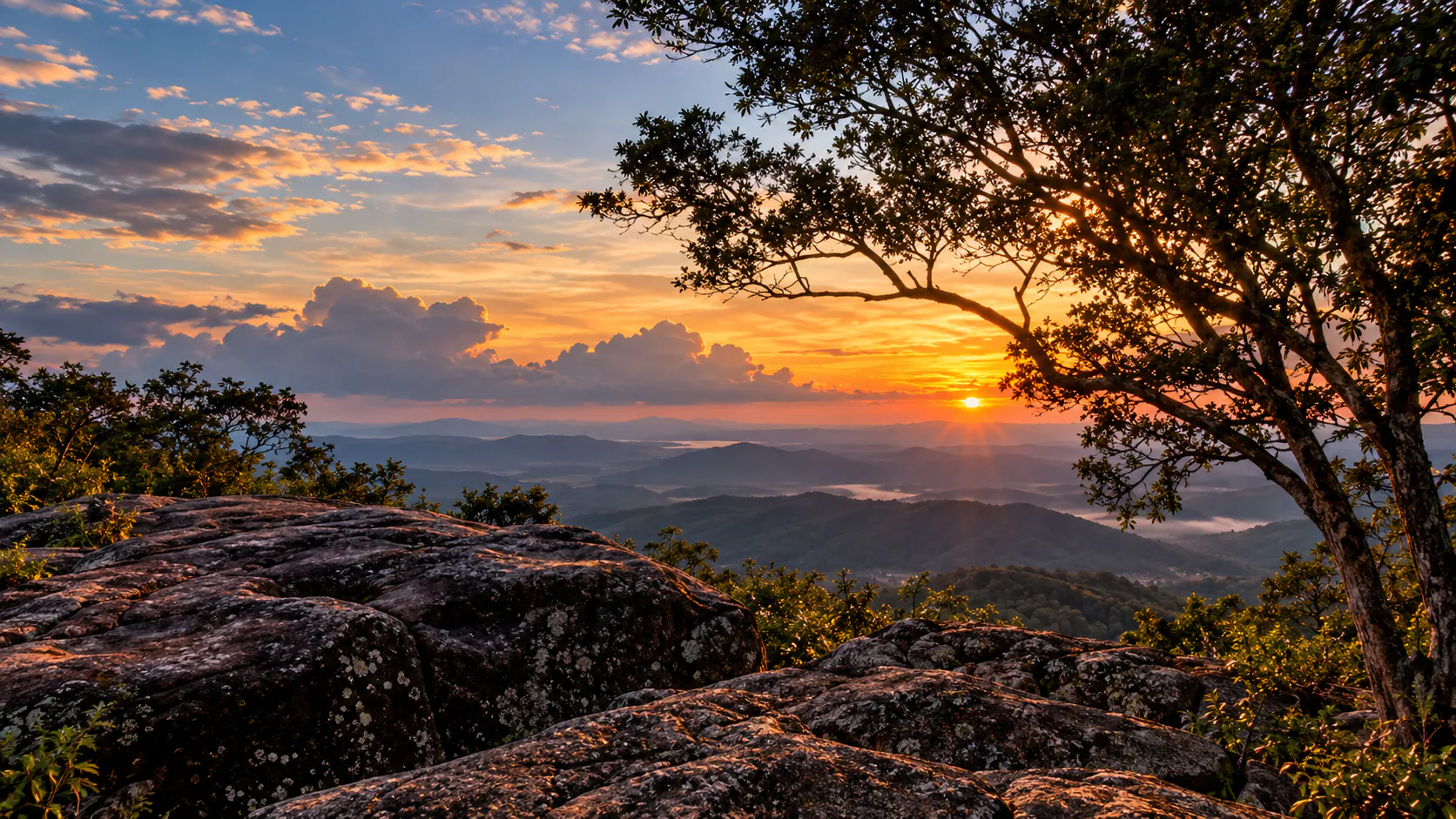
At about 846 metres, this is the highest point associated with the Phang Hoei range within the park. The escarpment drops away dramatically — views across distant mountains and lower plains.
Geographically, the Phang Hoei area marks a transition between the Khorat Plateau and central Thailand. The viewpoint is more than a panorama: it is a place where Thailand’s geography becomes visible.
Pha Ko Rak Nature Trail
Trails around Pha Ko Rak let you meet vegetation, seasonal flowers, highland air and forest more closely than a single viewpoint stop. In the rainy season, green cover, flowers and occasional mist make the walk especially atmospheric — the landscape encountered gradually on foot.
Waterfalls
Pa Hin Ngam is not primarily a waterfall park, but several falls belong to the wider landscape — strongest in the wet season.
Thep Phana
Namtok Thep Phana lies east of the headquarters area. Water from the Phang Hoei mountains descends in several levels — often described as three principal drops, with a final section of about six metres.
Thep Prathan
Namtok Thep Prathan is less about a tall curtain of water and more about broad rock surfaces and low cascades that swell after rain — a complement to flowers and geology on a wet-season visit.
Forests & Wildflowers
Main vegetation types include dry dipterocarp, dry evergreen and mixed deciduous forest. Dry dipterocarp especially shapes the park’s visual character — Dipterocarp and Shorea species, Siamese rosewood, Pterocarpus, Burmese padauk, Hopea and related trees.
Dry months can look open and brown; monsoon greens the grasses and brings Krachiao. Beyond the famous bloom, highland plants such as Dusita and En-nga, orchids and other wildflowers reward a slower eye — between rocks, along forest edges, not only in the main fields.
Wildlife
Park information associates the forest with barking deer, wild boar, wild rabbits, porcupines, pangolins, civets, squirrels, monkeys, small mammals, reptiles and forest birds — with more than 50 bird species documented in the broader park area.
Sightings are never guaranteed. Treat wildlife as an ecological experience, not a checklist. Do not feed or approach animals; keep noise low on forest trails.
Climate & When to Visit
- Hot
- Feb–Apr — warmer and drier; DNP notes an average around 25.9°C for the hot season.
- Rainy
- May–Oct — green recovery; Krachiao typically Jun–Aug.
- Cool
- Nov–Jan — pleasant highland mornings; orchids and cool air without the famous bloom.
- Geology
- Year-round subject to park conditions — Lan Hin Ngam does not depend on flowers.
Outside flower season?
Yes — if you care about geology, rock forms, mountains, forest, photography, hiking and cooler highland air. The park’s deeper character is mountains + sandstone + forest + seasonal ecology, not a single bloom.
How to Experience Pa Hin Ngam
- 1. View
- Start at Pha Sud Phaendin — feel the mountain scale.
- 2. Flowers
- Walk designated Krachiao paths and elevated walkways.
- 3. Rocks
- Spend real time at Lan Hin Ngam — not one photo and leave.
- 4. Beyond
- Lan Hin Nong, Pha Ko Rak, seasonal waterfalls when access allows.
Panorama → flowers → geology.
A One-Day Itinerary
- Early morning
- Arrive early. Pha Sud Phaendin for panorama, mist and soft light.
- Morning
- Krachiao fields — nature trail and elevated walkway; unhurried photography in season.
- Late morning
- Lan Hin Ngam — study individual formations and textures.
- Afternoon
- Lan Hin Nong, Pha Ko Rak, Thep Phana or Thep Prathan — by season, access and water.
Photography Guide
Wide
Pha Sud Phaendin — ridgelines, mist, sunrise and early atmosphere.
Medium
Krachiao fields — flower-and-mountain compositions, trails, green forest behind.
Detail
Lan Hin Ngam — rock texture, erosion patterns, small plants, abstract forms.
Best light
Early morning. After rain: wet vegetation, mist and diffused light.
What to Bring
- Comfortable walking shoes, light rain jacket, waterproof bag for electronics
- Drinking water, sun and insect protection, small towel, extra socks
- Camera or smartphone; cash for incidental expenses; reusable bottle
- Photographers: wide-angle for landscapes, standard for flowers, telephoto for distance; lens cloth for mist and rain
Responsible Travel
Enjoy the landscape without becoming part of the damage.
- Stay on designated paths — especially in Krachiao season
- Do not step into flower beds or collect flowers, plants or rocks
- Do not feed wildlife; keep noise low
- Take rubbish out with you
Entrance Fees & Hours
Tourism information for the 2026 Krachiao season lists daily opening approximately 06:00–18:00.
Thai visitors
Adult 40 THB · Child 20 THB
Foreign visitors
Adult 200 THB · Child 100 THB
Camping, restaurants and toilets are available subject to current arrangements. Fees, hours, shuttle use and temporary closures can change — verify with the park before travel.
Getting There
Pa Hin Ngam is in Thep Sathit District, Chaiyaphum. From Bangkok, a common approach runs via the Saraburi–Nakhon Ratchasima corridor toward Chaiyaphum and Thep Sathit.
Government tourism information describes a route using:
Highway 1 → Highway 201 → Highway 205 → Highway 2354
then continuing into the mountainous approach around Thep Sathit. Check current navigation and seasonal road conditions before departure.
Where to Stay
Choose park accommodation and camping (subject to DNP booking and operating conditions) for an immersive highland night — or base near Thep Sathit and nearby communities for comfort while exploring the area.
Pa Hin Ngam & Chaiyaphum
Pa Hin Ngam helped make Chaiyaphum synonymous with the Siamese tulip season. The Northeast is often imagined as a dry plateau. At the right elevation and season, this landscape becomes green, misty, cool, floral, mountainous and unexpectedly dramatic.
What Makes It Different?
- Flowers
- Seasonal Siamese tulips create a spectacular rainy-season scene.
- Geology
- Natural sandstone forms give the park a rare visual identity.
- Mountains
- Phang Hoei elevation, forest and expansive viewpoints.
- Ecology
- Dry dipterocarp and mixed forests support plants and wildlife.
- Seasonality
- The park changes substantially between dry and rainy months.
Not only a flower destination — a landscape to explore.
Frequently Asked Questions
- Where is Pa Hin Ngam National Park?
- Thep Sathit District, Chaiyaphum Province, northeastern Thailand.
- What is it famous for?
- Siamese tulip fields, Lan Hin Ngam sandstone formations, and Pha Sud Phaendin viewpoint.
- When do the Siamese tulips bloom?
- Generally June–August in the rainy season; density varies with rainfall.
- Best time to see the flowers?
- Early morning — cooler air, soft light, possible mist.
- Can visitors walk into the Krachiao fields?
- No — stay on designated paths and photography areas to protect the plants.
- What is Lan Hin Ngam?
- A natural sandstone landscape of unusual formations shaped by weathering and erosion.
- How high is Pha Sud Phaendin?
- Approximately 846 metres above sea level.
- Worth visiting outside flower season?
- Yes — for geology, forests, viewpoints, hiking and highland photography.
- Does it have waterfalls?
- Yes — including Thep Phana and Thep Prathan; flow is strongly seasonal.
- Good for photography?
- Yes — panoramas, flower fields, sandstone detail, forest and morning mist.
- How long should I spend?
- A day trip works; allow a full day if you want multiple attractions without rushing.
Essential Information
- Park
- Pa Hin Ngam National Park · อุทยานแห่งชาติป่าหินงาม
- Province / district
- Chaiyaphum · Thep Sathit
- Mountain range
- Phang Hoei Range
- Area
- Approximately 99.9 km²
- Highest point
- Approximately 846 m (Pha Sud Phaendin)
- Main attractions
- Lan Hin Ngam · Dok Krachiao fields · Pha Sud Phaendin · Lan Hin Nong · Pha Ko Rak · Thep Phana · Thep Prathan
- Best flower season
- June–August
- Best time of day
- Early morning
- Typical opening
- 06:00–18:00 (subject to current conditions)
More Isaan Nature
- Nam Nao National Park
- Highland forest and mountain landscapes on the Phetchabun–Chaiyaphum corridor.
- Sai Thong National Park
- Another Chaiyaphum nature destination for waterfalls and highland scenery.
- Phu Laenkha National Park
- Chaiyaphum mountain forest and viewpoints near the provincial heartland.
- All Nature & Parks
- Browse ThailandLover’s national park guides across the country.
Location
Find Pa Hin Ngam
Thep Sathit District, Chaiyaphum Province, Thailand