



National Park · Phetchabun
Tat Mok National Park
อุทยานแห่งชาติตาดหมอก
A Mountain Forest, Misty Waterfalls & Quiet Wilderness in Phetchabun
Mueang Phetchabun · Northern Thailand
East of Phetchabun city, mountain forest feeds misty waterfalls, stream trails and quieter camping nights — a wilderness landscape rather than a crowded viewpoint circuit.
A Quieter Side of Phetchabun
There are places in Phetchabun that are famous for mountain views, cool weather and crowded viewpoints.
Tat Mok National Park (อุทยานแห่งชาติตาดหมอก) offers a different experience.
Located approximately 37 kilometres east of Phetchabun city, Tat Mok protects a large forested mountain landscape of approximately 290 square kilometres, or 181,250 rai. Its forests form an important watershed for the Pa Sak and Chi river systems and provide an ecological link between several major protected forests in the region.
The park is best known for Tat Mok Waterfall, a dramatic single-drop waterfall reached by a forest-and-stream trail, and Song Nang Waterfall, a multi-tiered cascade system.
But the real character of Tat Mok lies beyond the waterfalls: mountain forests, streams, viewpoints over Phetchabun, camping areas and a quieter sense of wilderness.
Tat Mok National Park at a Glance
- ~290 km²
- Park area — approximately 181,250 rai.
- 1998
- Established 30 October as Thailand’s 87th national park.
- ~37 km
- East of Phetchabun city via the Na Pa / Chalerm Lap route.
- 2 waterfalls
- Tat Mok’s single drop and Song Nang’s multi-tier system.
- Watershed
- Feeds the Pa Sak and Chi river systems.
- Thai Name
- อุทยานแห่งชาติตาดหมอก
- Province
- Phetchabun
- District
- Mueang Phetchabun
- Distance from Phetchabun City
- Approx. 37 km
- Area
- Approx. 290 sq km / 181,250 rai
- Established
- 30 October 1998
- National Park Number
- 87th national park of Thailand
- Main Landscape
- Mountain forest, streams, waterfalls
- Signature Waterfall
- Tat Mok Waterfall
- Other Major Waterfall
- Song Nang Waterfall
- Main Outdoor Activities
- Hiking, nature study, camping, photography, stargazing
- Main Access Area
- Na Pa / Chalerm Lap route
- Management
- Department of National Parks, Wildlife and Plant Conservation
The park was officially established by Royal Decree on 30 October 1998, covering the Tabo and Huai Yai forest areas in Mueang Phetchabun District.
Why Visit Tat Mok?
Tat Mok is particularly suited to travellers who prefer forest landscapes over commercial attractions.
Its appeal comes from the combination of:
- Mountain scenery
- Mature forest
- Large waterfalls
- Stream crossings and forest trails
- Phetchabun valley viewpoints
- Camping
- Stargazing
- Bird and nature observation
- Relatively close proximity to Phetchabun city
The park also functions as an important ecological buffer between larger protected forest areas, giving it significance beyond tourism. TAT describes Tat Mok as a major forest and watershed area connected with Nam Nao National Park, Phu Khiao Wildlife Sanctuary and Tabo–Huai Yai Wildlife Sanctuary.
The Landscape
Mountain ranges, forested valleys, living watershed
Tat Mok National Park is dominated by complex mountain ranges and forested valleys.
The landscape is not a flat recreational park. The roads gradually move into mountainous terrain, while streams descend through forested valleys toward the surrounding lowlands.
This topography explains the park’s defining features. Rain falling on the mountain forests becomes part of the watershed system, feeding streams and eventually contributing to the Pa Sak and Chi river basins.
The waterfalls are not isolated attractions. They are visible expressions of the park’s larger mountain-water system.
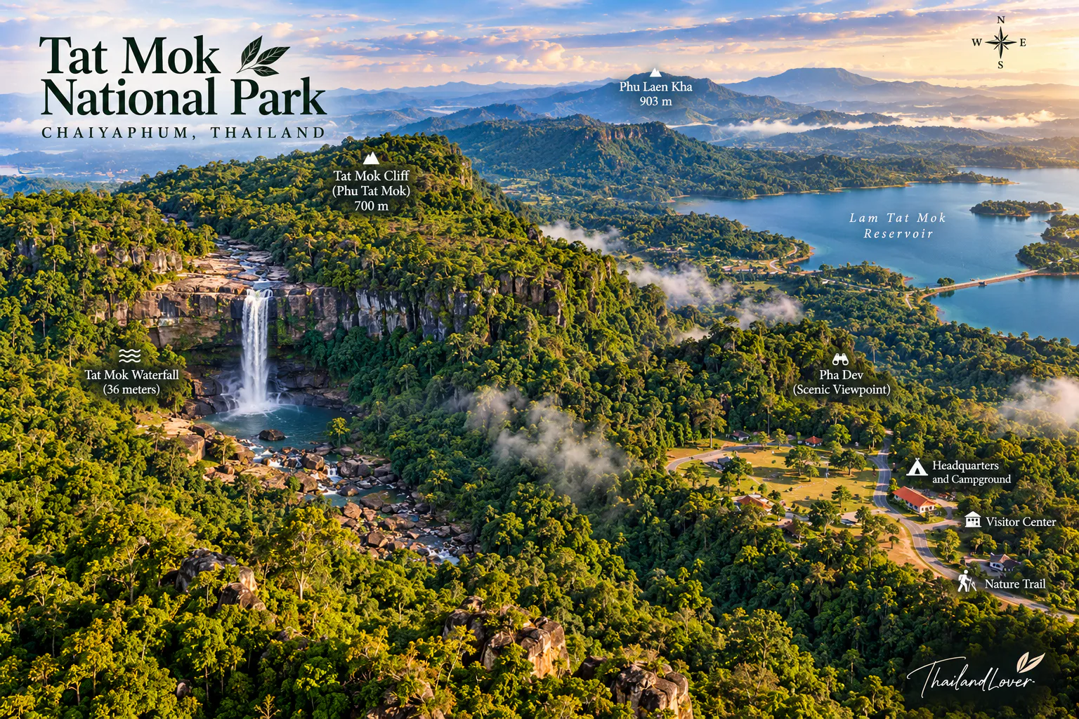
Tat Mok Waterfall
The signature landscape of the park
Tat Mok Waterfall (น้ำตกตาดหมอก) is the park’s defining natural attraction.
The waterfall originates from the Tat Mok mountain area and drops in a dramatic single cascade from a high cliff.
Current information published by the Department of National Parks describes the waterfall as approximately 320 metres high. Water falling from the cliff breaks into spray below, creating a mist-like atmosphere that gives the waterfall — and ultimately the park — its name.
This figure is important because some older tourism materials give a substantially different figure of around 750 metres.
Reaching Tat Mok Waterfall
The waterfall is not a roadside attraction.
According to the DNP’s current access information, visitors travel along the route from Ban Chaliang Lap toward Tat Mok, reaching a parking area before continuing approximately 2 kilometres on foot along the stream to the Tat Mok and Song Nang waterfalls.
More recent DNP information describes the Tat Mok–Song Nang nature trail as involving approximately 2 kilometres of walking along the stream, including a steeper section before reaching Tat Mok Waterfall.
Expect a genuine forest walk rather than a paved promenade.
Depending on water levels and trail conditions, sections can involve:
- Uneven ground
- Rocks
- Stream crossings
- Slippery surfaces
- Short steep sections
Good footwear is essential.
Song Nang Waterfall
น้ำตกสองนาง · a multi-tier cascade system
If Tat Mok is the dramatic single cascade, Song Nang Waterfall provides a completely different experience.
Song Nang is a 12-tier waterfall system. The individual tiers vary considerably in height, with published geological and tourism information recording falls ranging from approximately 5 to 100 metres.
The waterfall is located along the same general route as Tat Mok Waterfall, with a branch leading toward Song Nang before reaching Tat Mok.
Visitors do not necessarily need to climb through all 12 levels. For most travellers, experiencing the accessible section near the main stream already provides a strong impression of the waterfall system.
Those wishing to explore the upper levels should be prepared for a substantially more demanding walk and should follow current instructions from park officials.
Tat Mok–Song Nang Nature Trail
This is one of the most rewarding experiences in the park.
The trail follows the relationship between:
Mountain → Forest → Stream → Waterfall
Rather than simply walking toward a scenic endpoint, visitors move through a functioning watershed landscape.
Along the route, the environment changes subtly:
- Dense forest
- Streamside vegetation
- Ferns
- Moss
- Large trees
- Rocky streambeds
- Small cascades
- Steeper mountain sections
The trail is especially atmospheric during periods of high humidity, when the forest becomes intensely green and water flows more strongly.
The Km 3 Viewpoint
Not every memorable experience in Tat Mok requires a long hike.
A viewpoint around kilometre 3 provides views toward Phetchabun city and the surrounding lowlands.
It is particularly useful for visitors who want to experience the landscape without committing to the waterfall trail. Late afternoon is a good time for photography, especially when the light falls across the valley.
The viewpoint also helps explain Tat Mok geographically. From above, it becomes easier to understand the transition between:
urban Phetchabun → agricultural lowlands → forested mountains.
Lan Chom Dao
ลานชมดาว · camping under a darker sky
Lan Chom Dao is one of the park’s recognised camping and scenic areas.
The name suggests its role as a place for observing the night sky, and the site is used for camping and evening landscape experiences. The elevated setting can provide broad views over the surrounding landscape, while clear nights can reveal a much darker sky than in the city.
For photographers, the combination of sunset, mountain silhouettes, city lights, night sky and forest creates a different visual identity from the waterfalls.
Current DNP information lists camping facilities within the park, including the Huai Bong camping area, while recent DNP communications also identify Lan Chom Dao as a camping area with restroom facilities.
Huai Bong Service Area
The Huai Bong area provides another camping option within Tat Mok National Park.
The DNP currently lists a camping area at Huai Bong, and recent park information identifies the area as a visitor service and camping zone.
This makes Tat Mok suitable not only for a day trip but also for travellers who want to stay overnight in a forest environment.
Facilities are intentionally simpler than those found in commercial resorts.
Forest Ecosystems
Tat Mok’s greatest ecological asset is its forest.
The park contains a mixture of forest communities associated with its different elevations and moisture conditions:
- Mixed deciduous forest
- Deciduous dipterocarp forest
- Dry evergreen forest
- Hill evergreen forest
The result is a varied landscape with both open woodland and dense, humid forest environments. The forest also plays an essential hydrological role — the streams that feed Tat Mok and Song Nang are part of the wider watershed system that supports the Pa Sak and Chi basins.
Trees & Plant Life
The forest supports a range of native tree species and understory plants. Visitors walking toward the waterfalls may encounter:
- Large mature trees
- Bamboo
- Ferns
- Mosses
- Streamside plants
- Wild grasses
- Forest shrubs
- Epiphytic plants
The exact appearance of the forest changes with season. During the wet season, the understory becomes particularly green and the streams become more active. During the drier months, the forest becomes more open in some areas, allowing sunlight to penetrate deeper into the woodland.
Wildlife
Tat Mok forms part of a much larger protected-forest landscape, so wildlife value is an important part of the park’s identity.
Species reported in the wider ecosystem include mammals such as wild boar, deer, macaques, squirrels and other forest mammals. The surrounding protected forests also support a wide range of bird species.
However, wildlife encounters should never be treated as guaranteed. Tat Mok is a natural ecosystem rather than a wildlife park.
The best way to experience it is to move quietly and observe from a distance. Early morning is generally more productive for birdwatching and wildlife observation than the middle of the day.
A Mountain Forest Between Larger Protected Areas
One of Tat Mok’s less visible but more important characteristics is its position within a larger conservation landscape.
The park is associated with the forest systems around:
- Nam Nao National Park
- Phu Khiao Wildlife Sanctuary
- Tabo–Huai Yai Wildlife Sanctuary
This creates a broader landscape of connected forests rather than an isolated patch of protected land.
For ThailandLover, this is one of the most important facts about Tat Mok. The waterfalls may be the visual headline. The forest is the real story.
The Name “Tat Mok”
The name comes from the park’s signature waterfall.
The waterfall drops from a high rock face, and the falling water breaks into fine spray near its base. From a distance, the spray resembles mist or fog.
- Tat (ตาด)
- A waterfall or high rocky ledge
- Mok (หมอก)
- Mist
The resulting image — water transforming into mist as it falls — is essentially the visual identity of the park.
Best Time to Visit
Tat Mok changes considerably throughout the year.
- Rainy season · May–October
- Forest at its greenest; waterfalls generally stronger and more atmospheric. Also means slippery rocks, higher streams, harder trail conditions and greater caution. Waterfall areas have historically had seasonal closures — check the latest DNP announcement. Avoid a generic “open all year” assumption.
- Cool season · November–February
- Generally more comfortable for hiking and camping. Mornings can be cool, particularly in elevated camping areas.
- Hot season · March–April
- Lower areas can become considerably warmer. Water levels may differ from the rainy season. For waterfall photography, water conditions matter more than simply choosing a calendar month.
How to Get There
From Phetchabun city, travel east toward the park.
The DNP route information directs visitors from the provincial government centre along Provincial Highway 2271 toward Ban Chaliang Lap, approximately 12 kilometres, then toward Ban Nam Ron along Highway 2275 for about 200 metres before turning onto the route toward Tat Mok National Park.
The road from Ban Chaliang Lap toward the park is approximately 19 kilometres, after which visitors continue on foot toward the waterfall area.
The total road-and-trail experience should therefore be planned as a nature excursion rather than a quick roadside stop.
A Practical One-Day Itinerary
- Morning
- Phetchabun City → Tat Mok. Arrive early. Stop at the Km 3 viewpoint if conditions are clear, then continue toward the waterfall area.
- Late morning
- Tat Mok–Song Nang Nature Trail. Walk through forest and along the stream. Observe the vegetation rather than rushing directly to the waterfall.
- Midday
- Tat Mok Waterfall. Spend time at the fall and surrounding forest. Continue toward Song Nang if trail conditions and time permit.
- Afternoon
- Return from the waterfall area.
- Late afternoon
- Lan Chom Dao / viewpoint area. Enjoy the mountain landscape toward sunset. Return to Phetchabun or stay overnight if camping is confirmed.
A Better Two-Day Experience
For travellers who want to slow down, two days works better.
- Day 1
- Phetchabun → Tat Mok · Km 3 viewpoint · park exploration · Lan Chom Dao · sunset · camping
- Day 2
- Early morning forest · Tat Mok–Song Nang trail · Tat Mok Waterfall · Song Nang Waterfall · return to Phetchabun
This allows the park to be experienced as a landscape rather than simply as a waterfall destination.
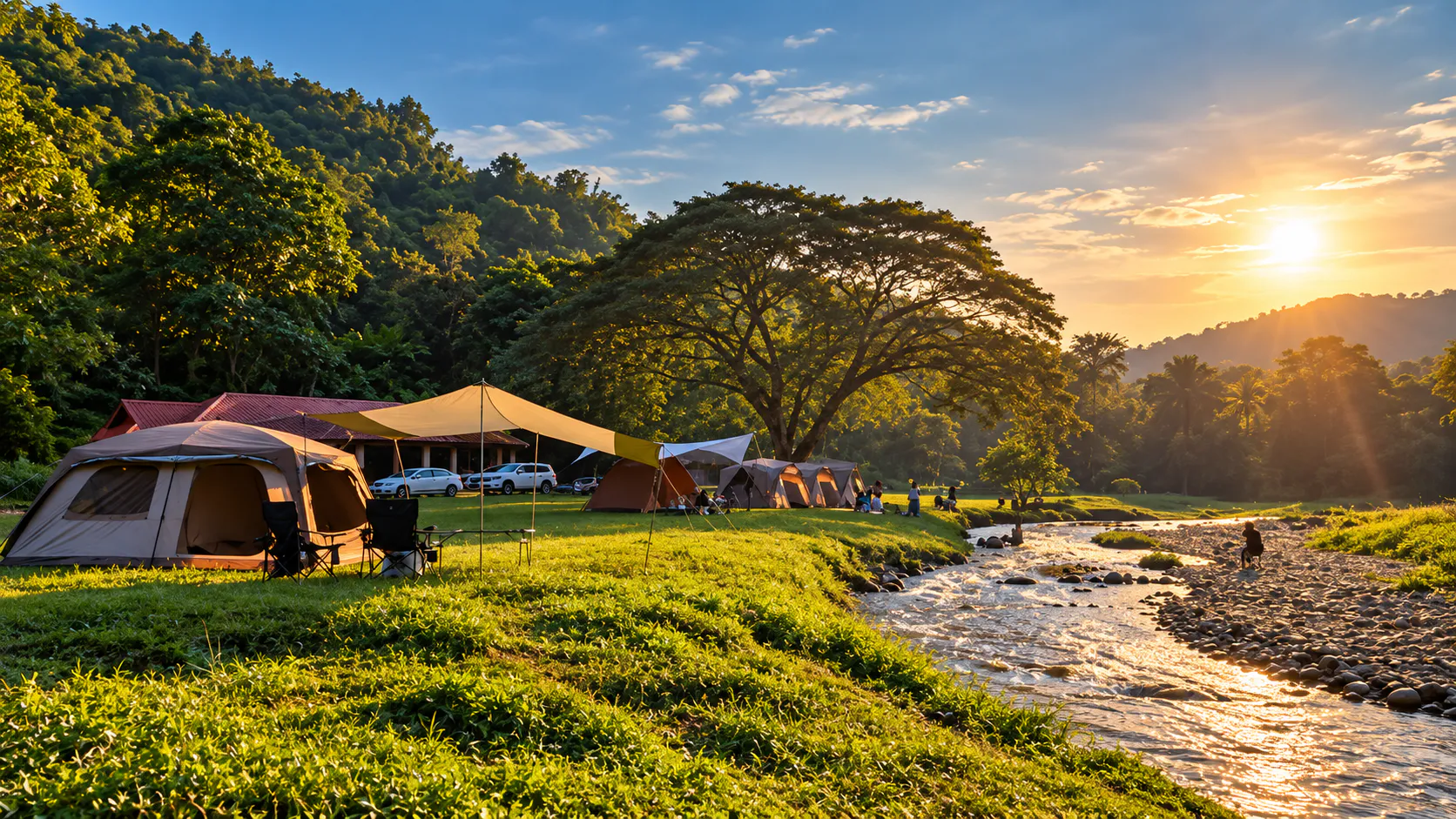
Camping
Tat Mok National Park currently lists camping facilities, including the Huai Bong camping area, while park communications also identify Lan Chom Dao as a camping location.
Camping is particularly attractive here because the park offers both mountain scenery by day and dark-sky conditions by night.
However, availability, access and operating arrangements can change. Visitors should confirm current camping availability with the park before travelling.
- Park contact
- 088 278 7108
What to Bring
For a waterfall and forest trip:
- Hiking shoes with good grip
- Lightweight clothing
- Rain protection
- Extra socks
- Water
- Insect repellent
- Sunscreen
- Waterproof bag
- Small first-aid kit
- Headlamp or flashlight
- Power bank
- Personal medication
- Dry bag for electronics
For camping:
- Warm layer for cool nights
- Sleeping equipment appropriate to the season
- Food and drinking water if required
- Waste bags
Do not assume that every facility or shop will be operating every day.
Safety in the Waterfall Area
Tat Mok is beautiful precisely because it remains relatively natural. That also means visitors need to take responsibility for their own safety.
- Watch the rocks
- Wet rocks can be extremely slippery.
- Respect water levels
- A stream that looks shallow can rise quickly after rain. Do not cross if the current feels strong.
- Stay on the intended route
- Follow park guidance and avoid climbing wet cliff faces or leaving the trail for a “better photo.”
- Mind seasonal closures
- Waterfall areas may close during the wetter months. Confirm current access before you go.
- Supervise children closely
- Stream banks, rocks and spray zones leave little margin for distraction.
- Carry light and water
- The walk is only a few kilometres, but conditions change and shade does not replace hydration.
Essential Information
- Park
- Tat Mok National Park · อุทยานแห่งชาติตาดหมอก
- Province
- Phetchabun, Northern Thailand
- District
- Mueang Phetchabun
- Area
- Approximately 290 km² / 181,250 rai
- Established
- 30 October 1998 (87th national park)
- Signature places
- Tat Mok Waterfall, Song Nang Waterfall, Km 3 viewpoint, Lan Chom Dao, Huai Bong
- Signature experiences
- Forest-stream hike, misty waterfall, valley views, camping, stargazing
- Contact
- 088 278 7108
- Official information
- Department of National Parks, Wildlife and Plant Conservation
Frequently Asked Questions
- What is Tat Mok National Park?
- A mountain-forest national park in Mueang Phetchabun — about 290 km² of watershed forest best known for Tat Mok and Song Nang waterfalls, trails, viewpoints and camping.
- How high is Tat Mok Waterfall?
- Current DNP information describes it as approximately 320 metres. ThailandLover prefers this figure over larger numbers on some older tourism sites.
- How far is it from Phetchabun city?
- About 37 km east. Approach via Ban Chaliang Lap, then walk roughly 2 km along the stream to the waterfall area.
- When is the best time to visit?
- November–February for comfortable hiking and camping. May–October for greener forest and stronger flow — with wetter, more demanding trails and possible seasonal closures.
- Can I camp there?
- Yes — Huai Bong and Lan Chom Dao are listed as camping areas depending on current operations. Confirm before you go: 088 278 7108.
- How long should I spend?
- One full day for the viewpoint and waterfall trail; two days with one overnight for sunset, night sky and an early forest walk.
More of Phetchabun’s Wild Parks
- Nam Nao National Park
- Vast mountain forest on the northern–Isan divide — pine, colour-changing woodland and wildlife corridor.
- Phu Hin Rong Kla National Park
- Highland rock fields, cool air and history on the Phetchabun–Loei–Phitsanulok rim.
- Khao Kho National Park
- Misty ridges and highland scenery — a different, often busier face of Phetchabun.
- Pa Hin Ngam National Park
- Flower fields and rock formations on the Chaiyaphum side of the Phetchabun range.
Location
Find Tat Mok National Park
Mueang Phetchabun, Phetchabun · approx. 37 km east of Phetchabun city via Ban Chaliang Lap