



National Park · Phang Nga
Si Phang-nga National Park
อุทยานแห่งชาติศรีพังงา
A Rainforest Sanctuary of Waterfalls, Wildlife and Southern Thailand’s Wild Interior
Kuraburi · Takua Pa · Southern Thailand
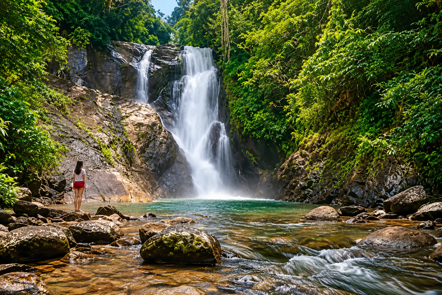
Hidden between the mountains of northern Phang Nga, dense evergreen forest, mountain streams and waterfalls replace the province’s famous islands and sea.
The Rainforest Heart of Phang Nga
Hidden between the mountains of Kuraburi and Takua Pa in Phang Nga Province, Si Phang-nga National Park is one of southern Thailand’s quieter rainforest destinations.
While Phang Nga is internationally known for its dramatic limestone islands and Andaman coastline, Si Phang-nga offers a very different landscape: dense evergreen forest, mountain streams, waterfalls, cliffs and deep inland valleys.
The park covers approximately 246.08 square kilometres (153,800 rai) and forms part of the larger forested landscape connecting southern Thailand’s important protected areas. It was officially established on 16 April 1988 as Thailand’s 56th national park.
This is a place for travellers who want to step away from the beach and experience the rainforest heart of Phang Nga.
At a Glance
- ~246 km²
- Park area — approximately 153,800 rai.
- 1988
- Established 16 April as Thailand’s 56th national park.
- 2 districts
- Kuraburi and Takua Pa, Phang Nga.
- 9 sites
- Principal attractions listed by the Department of National Parks.
- Rainforest
- Evergreen forest, streams, cliffs and waterfalls.
- Official Name
- Si Phang-nga National Park
- Thai Name
- อุทยานแห่งชาติศรีพังงา
- Province
- Phang Nga
- Districts
- Kuraburi and Takua Pa
- Area
- Approximately 246.08 km² / 153,800 rai
- Established
- 16 April 1988
- National Park Number
- 56th national park of Thailand
- Landscape
- Tropical rainforest, mountains, streams, cliffs and waterfalls
- Main Character
- Southern rainforest and freshwater landscapes
- Main Attractions
- Ton Nam Tok Tam Nang, Ton Ton Toei, Wang Pla Pluang, Ton Deng & Ton U, Ton Ton Sai, Suan Mai Waterfall
- Best For
- Waterfalls, rainforest walks, wildlife, nature photography and quiet exploration
The official Department of National Parks database identifies nine principal attractions within the park, including waterfalls, a nature trail, Wang Pla Pluang and the historic Phra Aram Bridge.
Why Visit Si Phang-nga?
Si Phang-nga is not a national park built around one spectacular viewpoint. Its attraction is the forest itself.
The mountains run roughly north–south, parallel to the Andaman coast. Numerous streams originate in the forested ranges before flowing through the park, creating waterfalls, pools and rocky waterways.
For travellers, that creates a very different experience from the coastal side of Phang Nga.
- The coast
- Islands, beaches, limestone cliffs and the sea.
- Si Phang-nga
- Mountains, rainforest, streams, waterfalls and wildlife.
It is particularly appealing if you want the natural side of Phang Nga without the crowds associated with some of the province’s famous coastal attractions.
The Rainforest Landscape
A watershed of streams and cascades
The landscape of Si Phang-nga National Park consists primarily of complex mountain ranges, with the mountains forming a north–south system roughly parallel to the Andaman coastline. The forest is an important watershed.
The Department of National Parks identifies several streams originating in the park:
- Khlong Kurat
- Khlong Tam Nang
- Khlong Phraek Khwa
- Khlong Phraek Sai
- Khlong Bang Daeng
- Khlong Bang Wan
- Khlong Lak Khet
- Khlong Bang Yai
These waterways are responsible for much of the park’s distinctive scenery, particularly its waterfalls and forest streams.
Ton Nam Tok Tam Nang
น้ำตกตำหนัง · the signature waterfall
Ton Nam Tok Tam Nang is the waterfall most closely associated with the establishment and identity of Si Phang-nga National Park.
The area around Tam Nang was the original focus of the proposal to establish a protected area here during the 1980s. Local residents proposed protecting the forest around the waterfall both for conservation and as a natural recreation area. Today, the waterfall forms one of the park’s principal natural attractions.
The surrounding rainforest is as important as the waterfall itself. Tall evergreen trees, dense undergrowth and flowing streams create the characteristic atmosphere of the southern Thai rainforest.
Ton Ton Toei Waterfall
น้ำตกโตนต้นเตย · deeper into the forest
Ton Ton Toei Waterfall is another important waterfall listed by the Department of National Parks. The route toward the waterfall provides a more immersive forest experience than a simple roadside attraction.
The surrounding landscape consists of dense rainforest and flowing streams, making the journey part of the experience. A smaller waterfall known as Ton Ton Toei Noi occurs along the general route before the main waterfall.
Visitor access and trail conditions can vary, so travellers should follow current instructions from park officers.
Ton Ton Sai Waterfall
น้ำตกโตนต้นไทร
Ton Ton Sai Waterfall is another waterfall included in the park’s official list of attractions. Its setting reflects the characteristic landscape of Si Phang-nga: water flowing through a forested mountain environment rather than a large open recreational waterfall.
For nature photographers, the surrounding combination of water, rock, roots and dense vegetation can be more interesting than the waterfall alone.
Ton Deng & Ton U Waterfalls
น้ำตกโตนเด้งและน้ำตกโตนอู · two waterfalls, one forest experience
The park officially lists Ton Deng and Ton U waterfalls among its principal attractions. These waterfalls form part of the network of forest waterways that characterises the park.
The experience here is less about a single monumental cascade and more about seeing how water moves through the southern rainforest landscape. During the wetter months, streams and waterfalls can become considerably more powerful.
Ton Hin Ra & Ton Khing Haeng
น้ำตกโตนหินราและน้ำตกโตนขิงแห้ง
The official park database also identifies Ton Hin Ra Waterfall and Ton Khing Haeng Waterfall. These sites add further variety to the park’s waterfall network.
The names are useful reminders that Si Phang-nga is not a one-waterfall destination. It is a watershed landscape containing multiple streams and cascades distributed through the forest.
Suan Mai Waterfall
น้ำตกสวนใหม่
Suan Mai Waterfall is another natural attraction officially listed by the national park. Like the other waterfalls, its character depends strongly on rainfall and water levels.
The rainy season can produce stronger flows, while conditions during the drier period may be considerably different.
Wang Pla Pluang
วังปลาพลวง · a quiet freshwater landscape
Wang Pla Pluang is officially listed as a scenic natural attraction within Si Phang-nga National Park. Rather than being a dramatic mountain viewpoint, it represents another side of the park’s freshwater environment.
Places like Wang Pla Pluang help illustrate an important characteristic of Si Phang-nga: water is the thread connecting the forest. Streams begin in the mountains, move through the rainforest and create pools, cascades and waterfalls throughout the protected landscape.
Nature Study Trail
Walk slowly. Look closely.
The park also has an officially designated nature study trail. A rainforest trail should not be judged only by distance or by how many attractions can be photographed. The value is in observing the ecosystem itself:
- Tall evergreen trees
- Vines and climbing plants
- Ferns and moss
- Bamboo
- Forest-floor vegetation
- Streams
- Insects and amphibians
- Birdlife
The Department of National Parks describes the forest floor as dense with rattan, vines, herbs, medicinal plants, mosses and ferns, together with several bamboo species.
Forest & Biodiversity
Si Phang-nga is predominantly covered by humid evergreen rainforest. Important tree species recorded by the Department of National Parks include:
- Yang trees
- Takian
- Wild sataw
- Krathon
- Ta Suea
- Siat Cho
- Nakabut
The lower vegetation is particularly dense because of the humid tropical climate. Rattan, vines, herbs, ferns, mosses and bamboo contribute to the layered structure of the forest.
This is one of the reasons the park can feel substantially more humid and enclosed than many northern or northeastern Thai national parks.
Wildlife
Si Phang-nga supports a diverse range of wildlife. The official park information records mammals including:
- Malayan tapir
- Serow
- Asian elephant
- Muntjac
- Sambar deer
- Bear
- Tiger
- Mouse deer
- Gibbon
- Monkeys
- Langurs
- Banteng
The park also supports numerous bird species, including hornbills, junglefowl, barbets, drongos, bulbuls and woodpeckers. Reptiles and amphibians are also present, including turtles, monitor lizards, snakes, frogs and toads.
Part of a Larger Forest Ecosystem
One of Si Phang-nga’s ecological strengths is its connection to the wider forest landscape of southern Thailand. The Department of National Parks notes that the park is adjacent to forest areas associated with the Cheow Lan / Ratchaprapha reservoir landscape in Surat Thani, contributing to a larger connected forest environment.
This larger landscape is important for wildlife movement and biodiversity conservation. It also helps explain why a relatively quiet park in Phang Nga can support a surprisingly broad range of forest wildlife.
Phra Aram Bridge
สะพานพระอร่าม · a historic element inside a natural landscape
Not everything in Si Phang-nga is purely natural. The park’s official attraction list includes Phra Aram Bridge as a historical attraction.
It provides a small but useful reminder that protected landscapes are often connected with the history of people who travelled through, lived around and depended upon these forests. For ThailandLover, it is worth presenting this as part of the park’s human landscape, rather than turning it into a larger historical story than the available evidence supports.
Climate
Si Phang-nga has a humid tropical climate strongly influenced by the southwest and northeast monsoons. Unlike much of inland Thailand, the park receives rainfall for a large part of the year.
The Department of National Parks divides the climate broadly into two seasons:
- Dry / hot season
- January – April
- Rainy season
- May – December
Average temperatures are reported around 26–29°C throughout the year, although conditions can feel cooler or warmer depending on elevation, rainfall and forest conditions.
When to Visit
- January – April · Drier trails
- Generally the easier period for travellers who prefer relatively drier conditions. Waterfalls may have less volume than during the wettest months, but forest trails can be easier to manage.
- May – December · Lush rainforest
- The rainforest becomes particularly lush. Waterfalls and streams can become more impressive after rainfall, but wet trails, slippery rocks and stronger currents require greater caution.
There is no single perfect month for every traveller. Waterfall lovers may prefer wetter conditions. Hikers may prefer more stable weather. Photographers may enjoy the lushness and atmospheric conditions of the rainy season.
Always check current trail and waterfall conditions with the park before entering.
Best Things to Do
- 1. Chase waterfalls
- Explore the park’s network of waterfalls, beginning with Tam Nang and continuing to other designated sites when conditions permit.
- 2. Walk the forest
- Use the designated nature trail to experience the ecosystem at a slower pace.
- 3. Photograph the rainforest
- The combination of giant trees, vines, ferns, rocks and flowing water creates excellent natural compositions.
- 4. Watch for birds
- Bring binoculars if birdwatching interests you. Early morning is generally the most productive time for observing forest birds.
- 5. Listen to the forest
- Si Phang-nga is particularly rewarding when experienced without rushing from attraction to attraction. The sound of flowing water and forest wildlife is part of the destination.
Camping & Accommodation
The Department of National Parks currently lists facilities within Zone 1, the park headquarters area, including:
- Park accommodation
- Meeting facilities
- Camping
- Si Phang-nga Campground
- Three-person tents
- Sleeping bags
- Sleeping mats
- Pillows
Availability can change, so travellers should check the official DNP reservation system before travelling.
For visitors who want a deeper rainforest experience, staying overnight is preferable to treating Si Phang-nga as a quick stop.
Getting There
Si Phang-nga National Park is located in Kuraburi and Takua Pa districts of Phang Nga Province. The park can be incorporated into a southern Phang Nga road trip connecting destinations around Khao Lak → Takua Pa → Si Phang-nga → Kuraburi.
The exact route depends on which park attraction you intend to visit. Because the national park covers a large area and attractions are not all concentrated at one point, travellers should identify their intended destination before setting out.
- By car
- For independent travel, a private car is the most practical option.
- By public transport
- Public transportation can reach the wider districts, but reaching individual waterfalls and forest attractions may require additional local transportation.
Suggested Itinerary
- One day
- Morning: enter the park, visit the main forest area, explore Tam Nang Waterfall and take a nature walk. Afternoon: visit another accessible waterfall or Wang Pla Pluang, and leave before conditions become difficult.
- Two days / one night
- A better option for nature lovers. Day 1: Takua Pa or Khao Lak to Si Phang-nga — Tam Nang, the nature trail, another accessible waterfall, then camp overnight. Day 2: an early morning forest walk, another designated attraction if open, then the surrounding Takua Pa and Kuraburi area.
Always confirm which trails and attractions are currently open before building the itinerary.
What to Bring
For a rainforest visit
- Lightweight breathable clothing
- Comfortable walking shoes
- Rain jacket
- Insect repellent
- Drinking water
- Sun protection
- Small first-aid kit
- Waterproof bag for electronics
- Extra socks
- Binoculars for birdwatching
- Headlamp if staying overnight
During the rainy season, waterproof protection is particularly useful.
Safety in the Rainforest
Si Phang-nga is a genuine forest environment, not a landscaped city park. Take particular care around:
- Wet rocks
- Waterfalls
- Strong currents
- Slippery trails
- Leeches and insects
- Heavy rainfall
- Falling branches
- Wildlife
Responsible Travel
Si Phang-nga protects a valuable rainforest and watershed system. Visitors should:
- Carry rubbish out
- Stay on designated trails
- Never feed wildlife
- Do not collect plants, rocks or animals
- Avoid loud noise
- Do not disturb birds or mammals
- Do not enter restricted areas
- Avoid using soap or chemicals in streams
- Follow fire regulations
- Respect local communities and park staff
The forest is the attraction. The best souvenir is leaving it untouched.
Photography Guide
- Waterfalls
- Use rocks, leaves and trees as foreground elements rather than photographing only the falling water.
- Rainforest
- Look upward. The layered canopy, vines and shafts of light can create stronger photographs than a conventional wide landscape.
- Wildlife
- Use a telephoto lens where possible. Never approach wildlife for a photograph.
- Macro
- The humid forest is excellent for ferns, moss, insects, mushrooms, small amphibians and forest flowers.
Si Phang-nga vs. Phang Nga’s Coastal Parks
Phang Nga Province contains several very different protected landscapes.
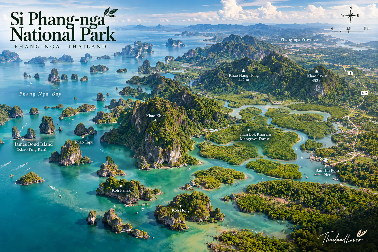
Ao Phang-nga National Park is primarily a coastal and marine environment characterised by limestone islands, mangroves and sea scenery. Si Phang-nga National Park is an inland rainforest landscape characterised by mountains, streams, waterfalls and evergreen forest.
- Sea, islands, limestone
- Choose Ao Phang-nga.
- Rainforest, waterfalls, forest trails
- Choose Si Phang-nga.
Essential Information
- Park
- Si Phang-nga National Park · อุทยานแห่งชาติศรีพังงา
- Province
- Phang Nga
- Districts
- Kuraburi and Takua Pa
- Area
- Approximately 246.08 km²
- Established
- 16 April 1988
- National park
- No. 56 of Thailand
- Landscape
- Tropical evergreen rainforest, mountains, streams and waterfalls
- Address
- Si Phang-nga National Park, Takua Pa District, Phang Nga 82110, Thailand
- Telephone
- 086-952-5246 and 089-473-5007
Principal attractions
- Ton Nam Tok Tam Nang
- Ton Ton Toei Waterfall
- Ton Ton Sai Waterfall
- Ton Deng & Ton U Waterfalls
- Ton Hin Ra & Ton Khing Haeng Waterfalls
- Suan Mai Waterfall
- Wang Pla Pluang
- Nature Study Trail
- Phra Aram Bridge
The attraction list above follows the current official DNP listing.
Before You Go
Park facilities, trails, camping, accommodation, opening conditions and access restrictions can change. For the most current information, check the Department of National Parks reservation and park information system before travelling. The official park page currently lists the park’s accommodation and camping facilities as well as its nine principal attractions.
Frequently Asked Questions
- What is Si Phang-nga National Park?
- An inland rainforest park in Kuraburi and Takua Pa — evergreen forest, streams, cliffs and waterfalls, distinct from Phang Nga’s limestone islands and sea.
- Where is it, and how large is it?
- Kuraburi and Takua Pa, Phang Nga. About 246.08 km², or 153,800 rai. Established 16 April 1988 as Thailand’s 56th national park.
- What are the main attractions?
- Nine official sites: Tam Nang, Ton Ton Toei, Ton Ton Sai, Ton Deng and Ton U, Ton Hin Ra and Ton Khing Haeng, Suan Mai, Wang Pla Pluang, the nature study trail and Phra Aram Bridge.
- When is the best time to visit?
- January–April for easier trails. May–December for stronger waterfalls and a lusher forest, with more caution on wet rock. Temperatures are reported around 26–29°C.
- Can I camp there?
- Yes, in Zone 1 at headquarters — accommodation, the Si Phang-nga Campground, tents and bedding are listed. Confirm availability on the DNP reservation system.
- How do I get there?
- A private car along a Khao Lak → Takua Pa → Si Phang-nga → Kuraburi route is the most practical option. Choose your waterfall before you set out.
- Will I see elephants, tapirs or tigers?
- They are recorded in the ecosystem, not guaranteed on a visit. Large mammals are elusive and should never be approached. Birds, insects and smaller forest animals are the realistic encounters.
More of Phang Nga’s Wild Parks
- Khao Lak–Lam Ru National Park
- Coastal forest, beaches and waterfalls on the Andaman side of Takua Pa.
- Ao Phang Nga National Park
- Limestone islands, mangroves and sea scenery — the coastal counterpart to this rainforest.
- Khao Sok National Park
- The great rainforest and Cheow Lan reservoir landscape next door in Surat Thani.
- Khlong Phanom National Park
- Another southern rainforest of waterfalls and forest streams, inland from the Andaman.
- Mu Ko Similan National Park
- The marine islands offshore from this same stretch of Phang Nga coast.
Location
Find Si Phang-nga National Park
Kuraburi & Takua Pa, Phang Nga 82110 · inland rainforest between Khao Lak and Kuraburi