

National Park · Surat Thani
Khlong Phanom National Park
อุทยานแห่งชาติคลองพนม
Where Limestone Meets Living Rainforest
Surat Thani · Southern Thailand
A hidden mountain landscape of southern Thailand where limestone cliffs rise through ancient rainforest, rivers disappear underground, waterfalls descend through the forest, and one of the world’s most extraordinary flowers emerges from the forest floor.
Beyond the Postcard
Khlong Phanom National Park is one of Southern Thailand’s quieter mountain landscapes — a vast belt of limestone ridges, steep cliffs, caves, waterfalls and dense evergreen rainforest in Phanom District, Surat Thani.
It sits immediately south of the Khao Sok landscape, but it offers a markedly different experience. There is no vast reservoir dominating the scenery here. Instead, the character of Khlong Phanom is defined by limestone mountains rising directly from deep rainforest, underground waterways, hidden caves, waterfalls and rare plants.
And among all of them, one extraordinary flower gives this forest its signature: Rafflesia kerrii — the Rafflesia, or Bua Phut (บัวผุด).
This is a national park for people who want to go beyond the postcard — to walk into the rainforest, enter a cave, follow a stream and discover the landscape at ground level.
Khlong Phanom at a Glance
- Official Name
- Khlong Phanom National Park
- Thai Name
- อุทยานแห่งชาติคลองพนม
- Province
- Surat Thani
- District
- Phanom
- Subdistricts
- Khlong Sok, Phanom, Phlu Thuean
- Area
- 256,500 rai / 410.4 km²
- National Park No.
- 102nd national park of Thailand
- Established
- 17 November 2000
- Landscape
- Limestone mountains, cliffs, caves, rainforest and streams
- Major Watershed
- Khlong Sok–Khlong Saeng–Khlong Phum Duang system
- River Basin
- Tapi River
- Signature Feature
- Limestone mountain landscape
- Signature Plant
- Rafflesia kerrii — Bua Phut
- Major Caves
- Tham Kaeo; Tham Nam Lod Khao Wong
- Major Waterfalls
- Khao Wong Waterfall; Ton Sai Waterfall
- Main Access
- Highway 401
- Headquarters
- Khlong Sok, Phanom, Surat Thani 84250
- Park Telephone
- 0-7791-8559
- Accommodation
- Available
- Camping
- Available
The park’s established area is 256,500 rai, approximately 410.4 km². Older and newer secondary sources occasionally round this to 410 km², which is why both figures appear online. ThailandLover retains the 410.4 km² figure.
The Geography of Khlong Phanom
Khlong Phanom lies in Phanom District, Surat Thani, in the mountainous interior of southern Thailand. The park forms part of the Phuket mountain system, where limestone formations dominate large portions of the landscape. Its terrain is distinctly different from the lowland plains of Surat Thani.
Approximately 80% of the landscape is mountainous, with steep ridges and limestone formations, while flatter areas occur mainly in valleys and intermontane basins. The mountain ridges run through the landscape as a connected series of limestone walls and peaks rather than isolated hills. Some sections form dramatic vertical cliffs, while others disappear beneath dense rainforest.
This geological structure is fundamental. The mountains are not simply scenery. They create caves, underground drainage, waterfalls, cliffs, narrow valleys, streams, forest microclimates and wildlife habitat.
Khlong Phanom is a limestone ecosystem disguised as a rainforest destination.
Limestone: The Architecture of the Park
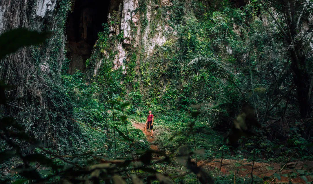
The most immediately recognisable feature of Khlong Phanom is its karst landscape. Limestone is highly susceptible to chemical weathering by rainwater containing dissolved carbon dioxide. Over very long periods, water enters cracks and joints in the rock.
The result is the classic tropical karst landscape: vertical cliffs → caves → underground channels → springs → waterfalls → forest valleys. This is why Khlong Phanom has such a high concentration of caves and dramatic rock formations.
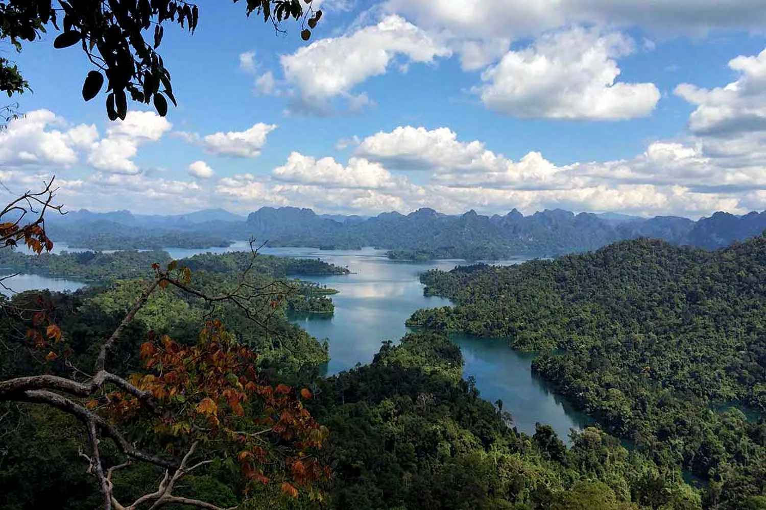
The mountains appear almost architectural — long limestone walls rising above a sea of vegetation. From viewpoints, the landscape often looks like a series of enormous green-and-grey ramparts. This is the visual identity of Khlong Phanom.
A Forest That Feeds a River
Khlong Phanom is also fundamentally a watershed park. Numerous small streams originate in the mountains. These streams flow into the Khlong Sok system, eventually connecting with Khlong Saeng and forming part of the Khlong Phum Duang, which in turn belongs to the Tapi River system — one of the major rivers of southern Thailand and an important river system for Surat Thani.
The ecological importance of Khlong Phanom therefore extends far beyond its park boundary. The forest is effectively a natural water-storage system:
Rain → rainforest → mountain streams → Khlong Sok → Khlong Saeng → Khlong Phum Duang → Tapi River system.

The Rainforest
Khlong Phanom receives abundant rainfall and has a humid tropical climate. The result is an environment dominated by evergreen rainforest, with dense vegetation extending from valley floors up the limestone slopes.
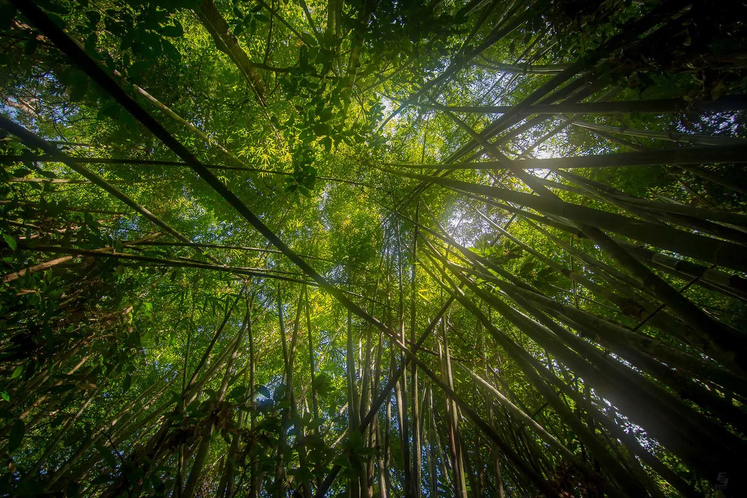
The forest is structurally complex. Large trees form the upper canopy. Below them are palms, bamboo, rattans, ferns, shrubs, vines, epiphytes, mosses, fungi and seedlings. The combination of constant moisture and limestone terrain creates a highly layered forest environment.
The forest can look almost impenetrable in places. That is not a sign of neglect. It is the natural character of a humid southern Thai rainforest.
Trees of Khlong Phanom
Historical botanical inventories associated with Khlong Phanom record a wide variety of valuable and characteristic southern rainforest trees. Reported species include takian (ตะเคียน), yang (ยาง), ta suea (ตาเสือ), hong khai (หงอนไก่), krabak (กระบาก), kraton pa (กระท้อนป่า), chik khao (จิกเขา), khun pa (ขนุนป่า), mamuang pa (มะม่วงป่า), inthanin (อินทนิล), nakbud (นากบุด), champapa (จำปาป่า) and yom hom (ยมหอม).
The forest floor contains bamboo, rattan, palms, ferns and other moisture-loving plants.
Rare Plants
Khlong Phanom is particularly interesting botanically because historical surveys identified rare species within the park. Among those reported are Takian Chan Ta Maeo — a rare tree associated with the southern rainforest — and Yuan Lae, another uncommon species for which Khlong Phanom has been identified as part of its distribution range.
These records matter because the park is not simply preserving generic “jungle.” It protects a specific southern rainforest flora with species distributions that can be geographically restricted.
The Giant Bamboo of Khlong Phanom
One of the more unusual botanical stories associated with Khlong Phanom is Phai Chiang Run (ไผ่เฉียงรุน). Historical surveys described it as an exceptionally large bamboo, with circumference approximately 60–80 cm, culms approximately 30–40 metres long, growing in groups of about 20–30 culms per clump rather than mixed randomly with other bamboo. Historical observations recorded a population around Khao Phru Ching.
The species became notable because of its extraordinary size. ThailandLover describes it as one of the remarkable giant bamboos recorded in the Khlong Phanom forest — rather than repeating the older claim that it is categorically “the largest bamboo in Thailand,” because that superlative depends on the measurement and source used.
Wildlife
The combination of extensive rainforest, limestone cliffs and waterways provides habitat for a wide range of wildlife. Historical park sources report species including Asian elephant, sambar deer, wild boar, serow, Malayan tapir, bears, tigers, gibbons, macaques, langurs, barking deer, mouse deer, squirrels, civets, numerous bird species, reptiles and amphibians.
These records demonstrate the biological richness of the forest. A historical wildlife inventory is not the same thing as a guarantee of present-day sightings. Visitors should not travel to Khlong Phanom expecting to see elephants, tapirs, bears or large cats. Most large mammals are elusive and avoid people.
Khlong Phanom is wildlife habitat — not a wildlife viewing zoo. The greatest wildlife experience may simply be walking through a forest where the animals remain unseen.
Tham Kaeo
ถ้ำแก้ว · The Cave of Glittering Stone
Tham Kaeo is one of Khlong Phanom’s signature attractions. The cave lies approximately 2 kilometres from park headquarters. Visitors must walk along a steep mountain route — approximately 919 metres, taking around 30 minutes under the traditional park description.
Inside, the cave consists of several chambers decorated with stalactites, stalagmites, flowstone, mineral surfaces and unusual rock formations. The cave’s name comes from the glittering appearance of mineral surfaces that can catch light like glass. Several chambers have been named according to the shapes of their formations.
- Glittering Chamber
- Known for sparkling mineral surfaces.
- Hermit Chamber
- Named because one formation resembles a ฤๅษี, or traditional hermit figure.
- Seahorse Chamber
- Named after formations resembling groups of seahorses.
The cave is not simply a hole in the mountain. It is a natural gallery created by water slowly dissolving and redepositing limestone over geological time.
Tham Nam Lod Khao Wong
ถ้ำน้ำลอดเขาวง · The Cave Where the River Passes Through the Mountain
If Tham Kaeo is about cave formations, Tham Nam Lod Khao Wong is about the relationship between cave and water. The cave is approximately 5 kilometres from park headquarters. Inside, water flows through the cave system year-round.
Visitors traditionally spend approximately 45 minutes traversing the cave. It contains stalactites and stalagmites, while the watercourse creates a distinctly different atmosphere from Tham Kaeo. On the opposite side of the cave is a site associated with a former communist insurgent camp, adding a layer of modern political history to the landscape.
Khao Wong Waterfall
น้ำตกเขาวง · The Waterfall Behind the Cave
Approximately 2 kilometres from Tham Nam Lod Khao Wong is Khao Wong Waterfall. The waterfall consists of approximately eight levels, descending from the limestone mountain toward Khlong Phanom.
Its relationship with the cave is particularly interesting: mountain → waterfall → stream → cave → river. Rather than treating the waterfall and cave as separate attractions, they should be understood as parts of one hydrological system. That is the geological story of Khlong Phanom in miniature.
Ton Sai Waterfall
น้ำตกโตนไทร · The Waterfall Beneath the Figs
Ton Sai Waterfall consists of approximately 12 levels. The surrounding forest is especially dense, with large fig trees spreading their branches around the waterfall. The area supports forest vegetation and birdlife, giving the waterfall a more intimate character than the dramatic limestone scenery seen from the park’s viewpoints.
Ton Sai is accessed from Ban Saphan Nak, approximately 3.5 kilometres from the village, followed by a forest walk of around two hours under the traditional route description. This is therefore not the kind of waterfall to treat as a casual roadside stop. It is a forest trekking experience.
Pha Dong Rak
ผาดงรัก · The Limestone Wall
One of Khlong Phanom’s defining viewpoints is Pha Dong Rak. The attraction is less about a single object and more about the landscape. From elevated terrain, visitors can see the distinctive limestone mountain chains extending across the park.
This is where the geography becomes easiest to understand: long limestone ridges + deep green rainforest + vertical cliffs + valleys below. The viewpoint provides the kind of wide landscape view that contrasts beautifully with the enclosed feeling of the caves and rainforest trails.
The Department of National Parks has previously highlighted a new 180-degree viewpoint area at Khlong Phanom as part of its visitor development.
Rafflesia — Bua Phut
บัวผุด · The Flower That Has No Root, Stem or Leaves
This is arguably Khlong Phanom’s most extraordinary botanical attraction. Rafflesia kerrii is commonly known in Thailand as Bua Phut (บัวผุด). It is not an ordinary flowering plant. It is an obligate parasite.
For most of its life cycle, the plant exists inside the tissues of its host vine. It does not develop normal leaves, stems, roots or chlorophyll-based photosynthetic structures. What visitors see is essentially the reproductive structure — the enormous flower — emerging from the forest floor.
The flower produces a strong odour resembling decaying meat, which helps attract insects involved in pollination. This is one reason Rafflesia is biologically extraordinary: it has effectively abandoned the conventional plant strategy of growing leaves and producing its own energy through photosynthesis.
How large is Bua Phut?
A mature Rafflesia flower can become enormous. Sources associated with Thailand’s national-park authorities report flowers reaching approximately 80 centimetres to more than 1 metre across, depending on the individual. The flower is brownish-red and develops directly from the host vine. It is one of the largest individual flowers in the world.
The plant is also extremely fragile. Visitors should never touch, step over, pick or disturb the flower.
When does Bua Phut bloom?
Historical and tourism information for Khlong Phanom places the flowering season broadly between November and April/May, with timing depending on rainfall, soil moisture and local conditions. This is not a fixed annual event. A particular trip does not guarantee a flower.
The Department of National Parks has specifically promoted the Ban Saphan Nak Rafflesia Nature Trail, and in its 2024 seasonal announcement the trail was scheduled to open from 1 November to 30 April.
Never promise that you will see Rafflesia. The flowering season generally falls in the cool-to-hot season, but blooming depends on natural conditions and should be confirmed with the park before travelling.
Ban Saphan Nak Rafflesia Trail
The Ban Saphan Nak Rafflesia Trail is one of the park’s most distinctive nature experiences. Unlike a conventional attraction where a flower is placed beside a road for easy viewing, visitors enter the forest to search for a naturally occurring plant.
The experience is therefore forest walk + ecological interpretation + the possibility of finding Rafflesia. DNP has repeatedly highlighted the trail as one of Khlong Phanom’s seasonal attractions.
A Park with a Hidden History
Khlong Phanom is not only a geological and biological landscape. Its caves and remote mountain valleys also carry traces of Thailand’s political history. The area around Tham Nam Lod Khao Wong contains a former communist insurgent camp.
This reflects a wider historical reality of southern Thailand during the period when the Communist Party of Thailand (CPT) operated in remote forest and mountain areas. The important distinction is that this was not simply a “war cave” attraction. The forest provided concealment, water, food, difficult terrain, natural defensive positions and access to remote communities.
In Khlong Phanom, the same landscape that makes the area ecologically valuable also made it strategically useful during periods of political conflict.
The Human Landscape
Khlong Phanom is not an isolated wilderness without surrounding communities. The park landscape intersects with settlements including Khlong Sok, Phanom, Phlu Thuean, Ban Saphan Nak and Ban Tham Phueng.
The relationship between the forest and surrounding communities is important for both conservation and tourism. Visitors can therefore experience Khlong Phanom not merely as a national park but as part of a wider forest-community landscape.
Khlong Phanom and Khao Sok
This distinction is particularly important. Khao Sok National Park and Khlong Phanom are neighbouring protected landscapes. They share southern rainforest, limestone karst, high rainfall, caves, waterfalls and wildlife habitat. They should not be presented as the same destination.
- Khao Sok
- Best known for Ratchaprapha Reservoir, limestone towers above water, Cheow Lan Lake, floating raft houses, boat journeys and major tourism infrastructure.
- Khlong Phanom
- Best known for rainforest, limestone ridges, caves, waterfalls, Rafflesia, hiking and quieter nature experiences.
Khao Sok is the landscape seen from the water. Khlong Phanom is the landscape discovered on foot.
Climate and When to Visit
Khlong Phanom has a humid tropical climate influenced by the surrounding mountains and monsoon systems. Rainfall occurs through much of the year. The traditional park description divides the climate broadly into a rainy season (May–December) and a hot / relatively drier season (January–April). The heaviest rainfall historically occurs around August–October. Exact timing varies from year to year because the region is influenced by both the southwest and northeast monsoon systems.
Rain creates stronger waterfalls, fuller streams, lush vegetation, muddy trails, slippery limestone and higher flash-flood risk. “Rainy season” is therefore not automatically “bad season.” It depends on the experience you want.
- November–April · Rafflesia
- The traditional flowering window for Bua Phut, although actual blooming varies. DNP has historically opened the Ban Saphan Nak trail during this period.
- November–February · Hiking
- Temperatures are generally more comfortable than the hotter months. Forest trails remain lush.
- May–October · Water
- Rainfall strengthens waterfalls, streams and forest vegetation — but trails can become significantly more difficult.
The Park’s Waterfalls
| Waterfall | Character |
|---|---|
| Khao Wong Waterfall | Approximately 8 levels; connected to the Khao Wong cave/stream system |
| Ton Sai Waterfall | Approximately 12 levels; dense forest and large fig trees |
| Other seasonal cascades | Found throughout the park’s stream systems |
Khlong Phanom’s waterfalls are not isolated attractions. They are products of the same limestone hydrological system that creates the caves and streams.
Adventure Level
Khlong Phanom should not be classified as a purely easy sightseeing park. There are three very different levels of experience. Conditions can become significantly more difficult after rain.
- Level 1 — Easy nature visit
- Park headquarters, viewpoints, forest scenery and basic visitor facilities.
- Level 2 — Moderate nature trail
- Tham Kaeo, the Rafflesia trail and short forest walks.
- Level 3 — Adventure / forest trek
- Tham Nam Lod Khao Wong, Khao Wong, Ton Sai Waterfall and remote trails.
Who Should Visit Khlong Phanom?
- Nature travellers
- Excellent. The park is about ecosystems rather than entertainment.
- Photographers
- Excellent — especially for limestone cliffs, rainforest, waterfalls, cave formations, Rafflesia and mist.
- Hikers
- Very good. Routes should be selected according to current park conditions.
- Families
- The headquarters area can work well. Long cave and waterfall routes are more demanding.
- Wildlife enthusiasts
- Excellent habitat — but sightings are not guaranteed.
- Luxury travellers
- Not as a standalone luxury destination. It works extremely well as a nature experience added to a higher-end Khao Sok / Surat Thani itinerary.
Practical Information
- Location
- Khlong Sok Subdistrict, Phanom District, Surat Thani 84250
- Main Road
- Highway 401 — Surat Thani–Takua Pa. Traditional access places headquarters around Km 90.
- Telephone
- 0-7791-8559
- Accommodation
- Available
- Camping
- Available
- Welfare facilities
- Available in the park visitor area
Entrance fees
Khlong Phanom is classified by the Department of National Parks in Group 1 under the national park entrance-fee system. The published rates are:
| Visitor | Fee |
|---|---|
| Thai adult | 20 THB |
| Thai child | 10 THB |
| Foreign adult | 100 THB |
| Foreign child | 50 THB |
These are the national-park entrance rates published by DNP; vehicle fees, accommodation and other services are separate. Fees and visitor rules can change — check before you go rather than treating them as permanently fixed.
Seasonal Closures and Trail Access
This is particularly important for Khlong Phanom. Different attractions can have different opening periods. DNP has previously published seasonal opening arrangements for the Ban Saphan Nak Rafflesia Trail from 1 November to 30 April, and has also stated that protected areas may close trails when weather conditions create safety risks.
Never assume every trail in Khlong Phanom is open year-round. For caves, waterfalls and remote trails, confirm conditions directly with the park before departure.
Responsible Travel
Khlong Phanom is particularly sensitive because several of its attractions are biological or geological formations that take extremely long periods to develop.
Protect the Rafflesia
- Never touch, pick or step on the flower
- Do not photograph by physically disturbing the plant
- Do not remove surrounding vegetation
Protect the caves
- Never break stalactites
- Do not touch fragile formations unnecessarily
- Do not scratch cave walls or remove rocks
A formation that took thousands or millions of years to develop can be destroyed in seconds.
Protect the forest
- Carry rubbish out
- Do not feed wildlife
- Do not collect plants
- Do not make loud noises
- Stay on designated trails
- Follow ranger instructions
- Do not enter closed areas
Why Khlong Phanom Matters
Khlong Phanom protects an unusual combination of natural systems.
- Geology
- Ancient limestone formations create cliffs and caves.
- Hydrology
- Rainwater becomes streams and underground waterways.
- Forest
- Evergreen rainforest covers the mountain landscape.
- Biodiversity
- The forest supports mammals, birds, reptiles, amphibians and rare plants.
- Botany
- Rafflesia and other rare species make the park particularly important for botanical conservation.
- Human history
- Caves and remote valleys also preserve traces of Thailand’s political history.
Together, these make Khlong Phanom much more than a waterfall park.
Khlong Phanom in One Landscape
Imagine standing beneath a limestone cliff. Above you: dense rainforest. Inside the mountain: a cave with water flowing through it. Below: a stream descending toward a waterfall. Somewhere in the forest: a Rafflesia flower opens for only a short time. And beyond the forest: the water continues toward the Tapi River system.
That is Khlong Phanom.
Frequently Asked Questions
- What is Khlong Phanom National Park?
- Thailand’s 102nd national park, established on 17 November 2000. It covers 256,500 rai / 410.4 km² in Phanom District, Surat Thani, and protects limestone mountains, rainforest, caves, waterfalls and Rafflesia kerrii (Bua Phut).
- Where is it?
- Phanom District, Surat Thani. Headquarters is in Khlong Sok, reached from Highway 401 (Surat Thani–Takua Pa), traditionally around Km 90.
- How is it different from Khao Sok?
- Neighbouring limestone rainforests, but Khao Sok is known for Cheow Lan Lake and boat journeys. Khlong Phanom is discovered on foot — caves, waterfalls, Rafflesia and quieter trails, without a vast reservoir dominating the scenery.
- When can I see Rafflesia?
- Broadly November–April/May, depending on rainfall and moisture. A trip does not guarantee a flower. Confirm the Ban Saphan Nak trail with the park before travelling.
- What are the entrance fees?
- DNP Group 1: Thai adult 20 THB, Thai child 10 THB, foreign adult 100 THB, foreign child 50 THB. Vehicle fees and other services are separate. Check before you go.
- Is camping available?
- Yes. Park accommodation and camping are available. Confirm with the park on 0-7791-8559.
Explore Nearby Forests
- Khao Sok National Park
- Khlong Phanom’s famous neighbour — Cheow Lan Lake, limestone towers above water, and the landscape seen from the boat.
- Tai Rom Yen National Park
- Another Surat Thani mountain forest — cooler ridges and a quieter southern-interior itinerary.
- Kaeng Krung National Park
- Rainforest and watershed country in Surat Thani, inland from the limestone belt.
- Si Phang-nga National Park
- A neighbouring Phang Nga forest on the western side of the same mountain country.
- Khao Luang National Park
- Nakhon Si Thammarat’s high rainforest — useful if you continue east across the peninsula.
- Nature & Parks
- More mountains, forests and protected landscapes across ThailandLover’s collection.
Location
Find Khlong Phanom National Park
Khlong Sok, Phanom, Surat Thani · Highway 401