

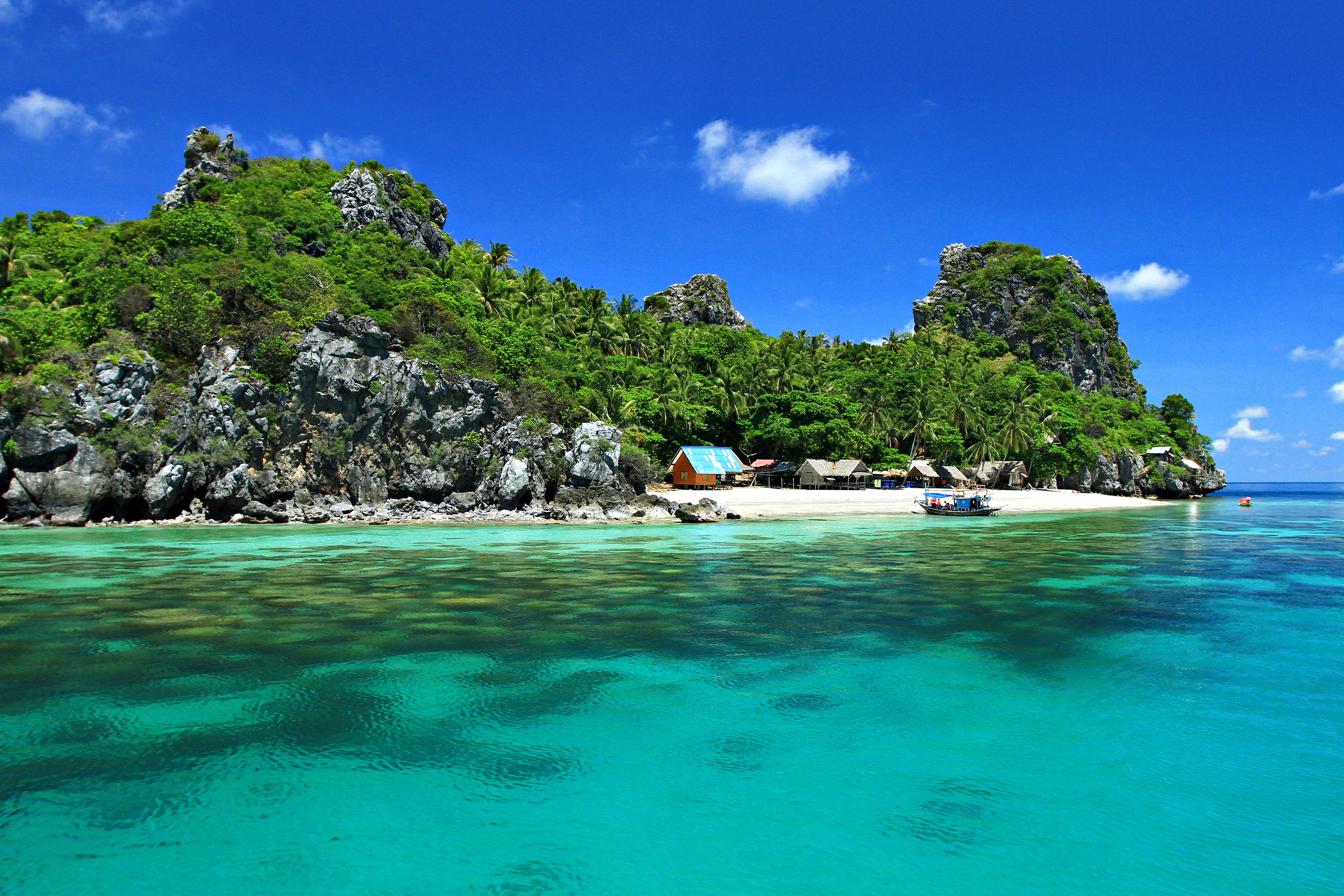
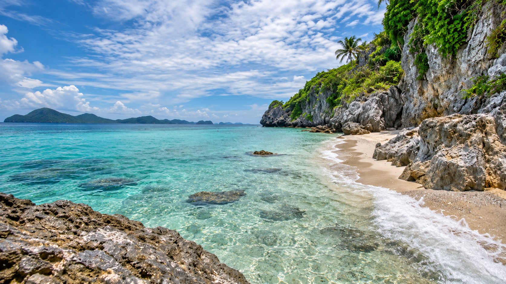
Marine National Park · Chumphon
Mu Ko Chumphon National Park
อุทยานแห่งชาติหมู่เกาะชุมพร
Thailand’s Hidden Gulf Coast
Chumphon · Southern Thailand · Gulf of Thailand
Mangrove forest, quiet bays, more than forty islands and a reef world that still feels local. Chumphon’s sea is not the first name travellers reach for — and that is part of its charm.
A Coast Worth Seeing as One Landscape
Chumphon’s sea is rarely the first name international travellers reach for when they talk about Thai islands. That may be one of its strengths.
On the eastern shore of Southern Thailand, the protected landscape is not only beaches and pretty islets. It is a connected ecosystem: mangrove, coastline, bay, island, mountain, sand and the world beneath the water.
That landscape is Mu Ko Chumphon National Park — อุทยานแห่งชาติหมู่เกาะชุมพร.
The marine national park stretches along the Gulf of Thailand for about 317 square kilometres, or 198,125 rai. Roughly 80.5 percent is water. The land holds mangrove forest, islands, hills and other coastal habitat.
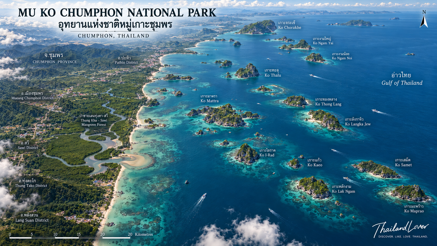
The park crosses several districts of Chumphon, from Ko Chorakhe in Pathio in the north, through Mueang Chumphon, Sawi and Thung Tako, down to Thong Krok Bay in Lang Suan in the south.
This is not one island. It is not only a boat pier for a snorkel stop. It is Chumphon’s marine landscape, seen as a system.
Quick Facts
- Official Name
- Mu Ko Chumphon National Park
- Thai Name
- อุทยานแห่งชาติหมู่เกาะชุมพร
- Province
- Chumphon
- Region
- Southern Thailand / Gulf of Thailand
- Area
- About 317 km² / 198,125 rai
- Water Area
- About 165,696 rai · 80.5%
- Land Area
- About 32,156 rai
- Mangrove
- About 17,375 rai
- Island Land
- About 3,219 rai
- Hills & Other Land
- About 11,562 rai
- Established
- 24 February 1999
- Former Working Name
- Hat Sai Ri National Park, during the survey period
- Islands
- More than 40
- Landscape
- Mangrove, coast, beaches, islands, hills, bays, coral reefs
- Key Islands
- Ko Ngam Yai, Ko Ngam Noi, Ko Mattra, Ko Langka Jew, Ko Thong Lang, Ko Lawa
- Main Office
- Hat Sai Ri, Mueang Chumphon
Why Mu Ko Chumphon?
ทำไมหมู่เกาะชุมพรจึงน่าสนใจ
What sets the park apart from many famous Thai seas is how many landscapes sit in the same protected area.
You can start a day walking a mangrove creek, leave the Gulf shoreline by boat, pass rock islands and small cays, snorkel a reef, and end on a quiet beach.
The park holds mangrove forest, hills, islands, caves, beaches, bays and open sea. Underwater, coral communities and reef life give the place a second geography.
That mix suits travellers who want rest beside the water, and travellers who come for diving, nature, photography, birds, mangroves or local history.
The Landscape
ภูมิประเทศที่ไม่ได้มีแค่ทะเล
Mu Ko Chumphon is a large coastal and marine landscape. Of about 317 square kilometres, the sea accounts for roughly 165,696 rai, or 80.5 percent. Land is about 32,156 rai: mangrove around 17,375 rai, island land around 3,219 rai, and hills and other terrain around 11,562 rai.
Those pieces form one sequence:
Land → Mangrove → Coast → Island → Coral Reef → Open Sea
That is why the park is more interesting as nature than as “pretty sea.”
More Than 40 Islands
หมู่เกาะกว่า 40 แห่ง
One of the park’s signatures is the number of islands. Government and park sources describe about 40 islands and more. They are not all the same: small cays, rock islands, beach islands and reef islands sit in the same waters.
Names travellers and nature records meet most often include:
- Ko Ngam Yai — เกาะง่ามใหญ่
- Ko Ngam Noi — เกาะง่ามน้อย
- Ko Lak Ngam — เกาะหลักง่าม
- Ko Thalu — เกาะทะลุ
- Ko Mattra / Ko Matra — เกาะมาตรา, also เกาะมัตรา
- Ko Langka Jew — เกาะลังกาจิว / เกาะรังกาจิว
- Ko Thong Lang — เกาะทองหลาง
- Ko Maprao — เกาะมะพร้าว
- Ko Lawa — เกาะละวะ
- Ko Kula — เกาะกุลา
- Ko Chorakhe — เกาะจระเข้
Not every island is a tourist landing. Access depends on park management, weather, season and conservation rules.
Ko Ngam Yai & Ko Ngam Noi
เกาะง่ามใหญ่และเกาะง่ามน้อย · Underwater landscape
If the conversation turns to Chumphon’s underwater world, Ko Ngam Yai and Ko Ngam Noi sit near the centre of it. The pair is known for diving. Island form and reef together create habitat for a wide range of marine life.
Thai national-park writing describes the Ngam islands as a noted dive area, with underwater character that includes passages and sea caves in some places.
For divers, this is one of the places that shows Chumphon’s character. It is not only the colour of the water. It is the landscape beneath the surface.
Ko Mattra
เกาะมาตรา · Beach, rock and shallow reef
Ko Mattra — also found in local records as Ko Matra / Ko Tang Kuai (เกาะตังกวย) — is one of the better-known islands in the group. It has beaches, rock and shallow coral.
A local geography database of Prince of Songkla University describes an island about 2.8 kilometres long and 550 metres wide, with a hill of about 133 metres above mean sea level. Reefs surround the island. Wildlife associated with it includes the chicken crab and giant clams.
It remains a principal marine-activity island of the park, especially for snorkelling. Thai PBS reporting, quoting park staff, has highlighted Ko Mattra for giant clams, white sand, rock and shallow reef.
Ko Langka Jew
เกาะลังกาจิว · A historic island in the Gulf of Thailand
If one island in the group should be seen as more than “beautiful sea,” it is Ko Langka Jew. Government sources spell the name as both Langka Jew and Rangaka Jew (รังกาจิว).
The island is tied to the history of edible bird’s-nest collection, and to visits by King Chulalongkorn (Rama V). Thai PBS reporting notes that the king came here three times to observe nest collection.
The important evidence is the royal monogram “จปร.” with Rattanakosin Era years cut into stone at the entrance to the swallow cave: R.S. 108, 117 and 124, corresponding to B.E. 2432, 2441 and 2448 (1889, 1898 and 1905).
You are not only looking at the sea. You are standing on a coastal story from the Fifth Reign.
Department of National Parks material published in 2025 describes a beach of about 100 metres, white sand and clear water, with beach time and snorkelling still possible. ThailandLover presents the island as a historic island in the Gulf of Thailand, not merely a pretty cay.
Ko Thong Lang and Ko Lawa
Ko Thong Lang
เกาะทองหลาง · Reef island
Ko Thong Lang belongs to the same island system and is one of the reef and marine-life sites recorded in park resource material. The name often appears with Ko Mattra, Ko Langka Jew, Ko Lawa and other islands when people talk about Chumphon’s underwater world.
Ko Lawa
เกาะละวะ · Marine life and coral reefs
Ko Lawa is a small, hilly island with reef around it. Local records describe some reef as being in very good condition, with staghorn, table, boulder and cauliflower corals among the forms found, plus other marine life. It is one of the park’s stronger places to talk about marine life and coral reefs.
The Mangrove Forest
ป่าชายเลนอ่าวทุ่งคา–สวี
A common misunderstanding is that Mu Ko Chumphon is only sea. In fact, mangrove forest is a core part of the park.
Around Thung Kha–Sawi Bay, creeks and mangrove connect to the coast. Near park headquarters there is a visitor centre and a nature trail of wooden walkways and a suspension bridge into the mangrove. Visitors can walk, or explore by boat or kayak when services and conditions allow.
Mangrove → Estuary → Coast → Sea
That sequence is one of the experiences that separates this park from a typical island day trip.
Beaches, Bays and a Coastal View
The park is not islands alone. It also covers a long stretch of mainland coast. Bays and beaches include:
- Thung Makham Noi Bay — อ่าวทุ่งมะขามน้อย
- Thung Makham Yai Bay — อ่าวทุ่งมะขามใหญ่
- Thong Tom Yai Bay
- Thong Tom Noi Bay
- Arunothai Beach — หาดอรุโณทัย
- Thong Krok Bay
- Sairee Beach / Hat Sai Ri — หาดทรายรี
Government material describes long beaches with different coastal characters, from sand to more distinctive bays.
Hat Arunothai
หาดอรุโณทัย · Thung Tako
Hat Arunothai lies in Thung Tako District and is one of the important mainland beaches inside the park. Provincial tourism information describes a beach of about six kilometres. The atmosphere is unlike a crowded island destination. This is still coastal Thailand on the Gulf.
Hat Sai Ri
หาดทรายรี · Sea, history and local culture
Hat Sai Ri matters for both travel and Chumphon history. It sits near the shrine of Prince Chumphon (Krom Luang Chumphon Khet Udomsak) and the historic ship HTMS Chumphon, as well as the Khao Chao Mueang viewpoint. The beach is rest — and also the meeting of sea, history and coastal culture.
Khao Chao Mueang Viewpoint
จุดชมวิวเขาเจ้าเมือง
From Khao Chao Mueang you can see the coastline and the islands of Chumphon’s sea. The view helps the geography make sense. “Mu Ko Chumphon” is not a scatter of separate pretty islands. It is one coastal landscape.
Underwater Chumphon
โลกใต้ทะเลของหมู่เกาะชุมพร
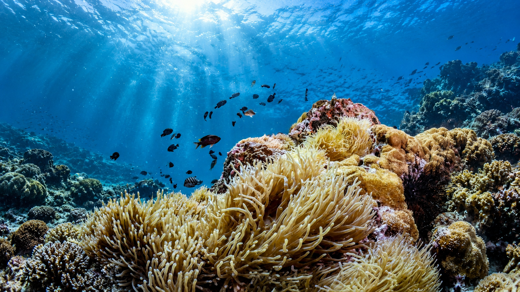
A large part of the park’s strength sits below the surface. Shallow reefs and dive sites around the islands hold a wide range of life. Park material records:
- Hard corals, soft corals and black corals
- Sea anemones, sponges and sea squirts
- Clownfish, butterflyfish, damselfish and other reef fish
- Many molluscs, including giant clams
- Other marine animals of the reef and coast
Larger animals are also reported in Chumphon’s sea — dolphins, whales, whale sharks, manta rays and sea turtles. Sightings depend on season, sea conditions and the animals themselves. They should not be sold as a guarantee on every trip.
Marine Life, Chicken Crabs and Giant Clams
What is interesting here is continuity. Mangrove is a coastal engine. Reef is habitat. Islands are shelter and feeding ground. Open sea links the coast to a wider marine system. Conservation is not only keeping a beach pretty. It is protecting the ecosystem as a whole.
The Chicken Crab
ปูไก่ · Ko Mattra
Ko Mattra is known for the chicken crab, a crab with a striking way of living. Marine and coastal resource material for Chumphon notes the island as a place where the species is found, and that these crabs like to climb trees. The story keeps the park from collapsing into “clear water plus white sand.” It is also biodiversity.
Giant Clams
หอยมือเสือ
Ko Mattra is also known for giant clams. Park staff quoted by Thai PBS have described it as a place where they are found in notable numbers within Chumphon. For a visitor they may be one more reef animal. For conservation they are part of the reef’s living structure.
From Hat Sai Ri to Mu Ko Chumphon
The park began as a survey toward a national park under the working name Hat Sai Ri National Park.
In B.E. 2532 (1989) the Royal Forest Department surveyed further, with a temporary office at the Khao Chao Mueang viewpoint terrace. In B.E. 2540 (1997) that office moved to the mouth of Khlong Tha Chorakhe.
On 24 February 1999 (B.E. 2542) a royal decree designated the mangrove forests of Thung Kha Bay, Sawi Bay and the islands of Chumphon as a national park, under the official name Mu Ko Chumphon National Park. The decree was published in the Royal Gazette, volume 116, part 9 Kor, on the same date.
A Park Across Five Districts
The boundary follows Chumphon’s coast through:
- Pathio — ปะทิว
- Mueang Chumphon — เมืองชุมพร
- Sawi — สวี
- Thung Tako — ทุ่งตะโก
- Lang Suan — หลังสวน
Character changes along that line. The north has islands and shore. The middle holds important island groups and Thung Kha Bay. The south continues as coast and islands toward Thong Krok Bay. This is not a one-size-fits-all destination.
What to Do
Experiences at Mu Ko Chumphon
- 01 — Island hopping
- Boat among islands that do not look alike: sand, rock, reef and quieter landings, subject to park rules.
- 02 — Snorkelling
- Shallow reefs around Ko Mattra, Ko Thong Lang, Ko Langka Jew, Ko Lawa and neighbouring waters.
- 03 — Diving
- The Ngam islands and other sites for experienced divers: reef, cave, rock and marine life.
- 04 — Mangrove walk
- The nature trail near headquarters, with wooden walkways and a suspension bridge into Thung Kha–Sawi mangrove.
- 05 — Kayaking
- Creeks and mangrove give a different view from open Gulf water, when boats or kayaks are available.
- 06 — Beach time
- Quieter Gulf beaches and bays, without the density of some famous island destinations.
- 07 — Nature photography
- Landscape, seascape, marine life, mangrove, wildlife, sunrise and coastal culture.
- 08 — History and culture
- Ko Langka Jew for bird’s-nest history and Rama V; Hat Sai Ri for Chumphon’s coastal memory.
The Chumphon Character
Mu Ko Chumphon does not compete with Phuket or Samui by being larger. It does not need to be the most luxurious sea.
Natural. Coastal. Local. Understated.
The sea is still sea. The islands are still islands. The mangrove is still mangrove. Travel between mainland and islands still feels like going out into a real place.
For travellers who want Thailand beyond the postcard circuit, this coast belongs on the map.
When to Go
Gulf travel depends on season, wind, swell, rain and park announcements. Plan from current information issued by Mu Ko Chumphon National Park and related agencies — especially weather, sea state, opening and closing of sites, boat routes, diving, overnight stays and conservation rules.
Do not plan from a single old travel article.
Getting There
Park headquarters sits at Pak Khlong Tha Chorakhe, Ban Phong Phrang, Hat Sai Ri Subdistrict, Mueang Chumphon.
From Chumphon town, the Chumphon–Pak Nam road leads toward the park. Thai government information puts the headquarters about 23 kilometres from town.
Boat piers for different islands may not be the same as headquarters, and they vary by programme and operator. “Going to Mu Ko Chumphon National Park” does not mean everyone starts from one point and reaches every island from there. Plan by the island route you actually want.
Before You Go
- Respect the marine environment
- Do not stand on or touch coral. Do not collect shells, marine animals or other wildlife. Do not feed marine life. Avoid products and behaviour that damage reef.
- Weather matters
- The sea is not a road. A clear sky on the coast does not guarantee the same conditions around the islands. Follow staff and the sea on the day you travel.
- Not every island is a tourist island
- Many islands does not mean every island can be landed. Some places are habitat, some are restricted. Park rules come first.
Frequently Asked Questions
- What is Mu Ko Chumphon National Park?
- A protected coastal and marine landscape in Chumphon Province, Southern Thailand, including mangrove forests, coastline, beaches, islands, mountains and marine ecosystems.
- How many islands are in the park?
- Government tourism sources commonly describe more than 40 islands. Chumphon Province as a whole has 54 islands according to the Department of Marine and Coastal Resources — a different dataset from the park boundary.
- What are the most famous islands?
- Ko Ngam Yai, Ko Ngam Noi, Ko Mattra, Ko Langka Jew, Ko Thong Lang, Ko Maprao, Ko Lawa and Ko Kula are among the better-known names.
- Is it good for snorkelling?
- Yes. Coral reef around several islands makes snorkelling one of the principal marine activities here.
- Is it good for diving?
- Yes. Ko Ngam Yai, Ko Ngam Noi and other sites are known for reefs, underwater rock and marine life.
- What is special about Ko Langka Jew?
- It combines nature with history: edible bird’s nests, and inscriptions tied to King Chulalongkorn’s visits.
- What is Ko Mattra famous for?
- Beaches, rocky shoreline, coral reefs, chicken crabs and giant clams.
- Can visitors explore the mangrove forest?
- Yes. Headquarters has a nature study route with wooden and suspension bridges. Boat or kayak exploration depends on services and conditions.
- Is the park only about islands?
- No. It protects mangrove, mainland coast, bays, beaches, hills, islands and marine ecosystems together.
- Where is the park?
- Along the Chumphon coast across Pathio, Mueang Chumphon, Sawi, Thung Tako and Lang Suan. The main office is at Hat Sai Ri, Mueang Chumphon.
Related Destinations
- Mu Ko Ang Thong National Park
- Another Gulf marine park — limestone islands and Thale Nai, west of Koh Samui.
- Hat Khanom–Mu Ko Thale Tai
- A neighbouring Gulf seascape further south, with a different island character.
- Kaeng Krung National Park
- Inland rainforest and rapids in neighbouring Surat Thani — the forest side of the same southern belt.
- Lam Nam Kra Buri National Park
- West across the peninsula toward Ranong: river, waterfall and Andaman-facing forest.
- Khao Sok National Park
- Southern Thailand’s great inland limestone rainforest, a different world from this Gulf coast.
Location
Find Mu Ko Chumphon National Park
Pak Khlong Tha Chorakhe, Hat Sai Ri, Mueang Chumphon, Chumphon