

National Park · Ranong
Lam Nam Kra Buri National Park
อุทยานแห่งชาติลำน้ำกระบุรี
Where the River Becomes the Border
Kra Buri River · Thailand–Myanmar · Andaman Coast
A ThailandLover guide to a quietly remarkable landscape of tropical rainforest, mangrove forests, river islands and the Kra Buri River — a natural frontier between Thailand and Myanmar.
Where the River Becomes the Landscape
There are places in Thailand where a river is simply part of the landscape. And then there are places where the river becomes the landscape itself.
In far southern Ranong, the Kra Buri River forms a dramatic natural frontier between Thailand and Myanmar. Along its banks, mangrove forests spread through tidal waterways, small forested islands sit within the river, and dense tropical forest rises inland toward the mountains.
This is Lam Nam Kra Buri National Park. Rather than being defined by one spectacular summit or one famous beach, the park is a landscape of river, mangrove, rainforest, islands and border country. Its character changes as you move through it.
- Punyaban Waterfall
- Lush rainforest and flowing water — the easiest way into the park.
- Laem Set Kuat
- The landscape opens toward the river, its islands and the Myanmar side of the frontier.
- The river itself
- Mangrove forests create a tidal ecosystem where land and water continuously meet.
- Inland forest
- Part of the ecological network of Ranong’s western mountains.
This is a quieter side of Thailand. Not a destination built around spectacle. A destination built around landscape.
At a Glance
- Official Name
- Lam Nam Kra Buri National Park
- Thai Name
- อุทยานแห่งชาติลำน้ำกระบุรี
- Province
- Ranong
- Districts
- Mueang Ranong · Kra Buri · La-un
- Region
- Southern Thailand / Andaman Coast
- Landscape
- River, mangrove forest, rainforest, islands, hills and coastal wetland
- Signature River
- Kra Buri River
- International Boundary
- Thailand–Myanmar
- Park Area
- Approximately 160 km² in the established park area
- Water Area
- Approximately 61 km²
- Land Area
- Approximately 99 km²
- Major Waterfall
- Punyaban Waterfall
- Major Viewpoint
- Khao Hin Chang / Laem Set Kuat area
- Major Ecosystem
- Mangrove forest and tropical rainforest
- River Islands
- Ko Siat · Ko Khwang · Ko Yao · Ko Chon · Ko Pling · Ko Nok Plao
- Best Known For
- Kra Buri River, mangroves, border landscapes, river islands and Punyaban Waterfall
- Travel Style
- Nature · Ecotourism · Photography · River Landscape · Slow Travel
The established park area is approximately 160 km², consisting of roughly 99 km² of land and 61 km² of water. Older official tourism material describes the park as extending along the Kra Buri River and incorporating mangrove forests, river islands and reserved-forest landscapes.
This figure should not be confused with the much larger 122,046-hectare Ramsar wetland that encompasses the wider Kaper Estuary–Laem Son Marine National Park–Kra Buri Estuary wetland complex. The Ramsar site covers a broader ecological landscape, not simply Lam Nam Kra Buri National Park.
The First Impression
Lam Nam Kra Buri is best understood through a simple idea: water defines the park.
The Kra Buri River is not merely a river running beside the national park. It is one of the central geographical features of the park. Its channels separate and reconnect. Mangrove islands sit within the river. Tidal water moves through forests. And across the river lies Myanmar.
The result is a landscape that feels simultaneously wild, tropical, maritime and continental. You can stand on the Thai side and look across a river that forms an international boundary. That alone makes the experience unusual.
The Kra Buri River
A river with an international horizon
The Kra Buri River is the defining geographical feature of Lam Nam Kra Buri National Park. For much of its lower course, the river forms part of the boundary between Thailand and Myanmar.
The opposite riverbank is not simply another section of forest. It is another country. The river therefore becomes both a natural ecosystem and a geographical frontier.
From viewpoints along the Thai side, visitors can see the river channels, forested islands, mangroves and landscapes on the Myanmar side. This is one of the strongest visual identities of the park.
Mangrove Country
Where forest and tide meet
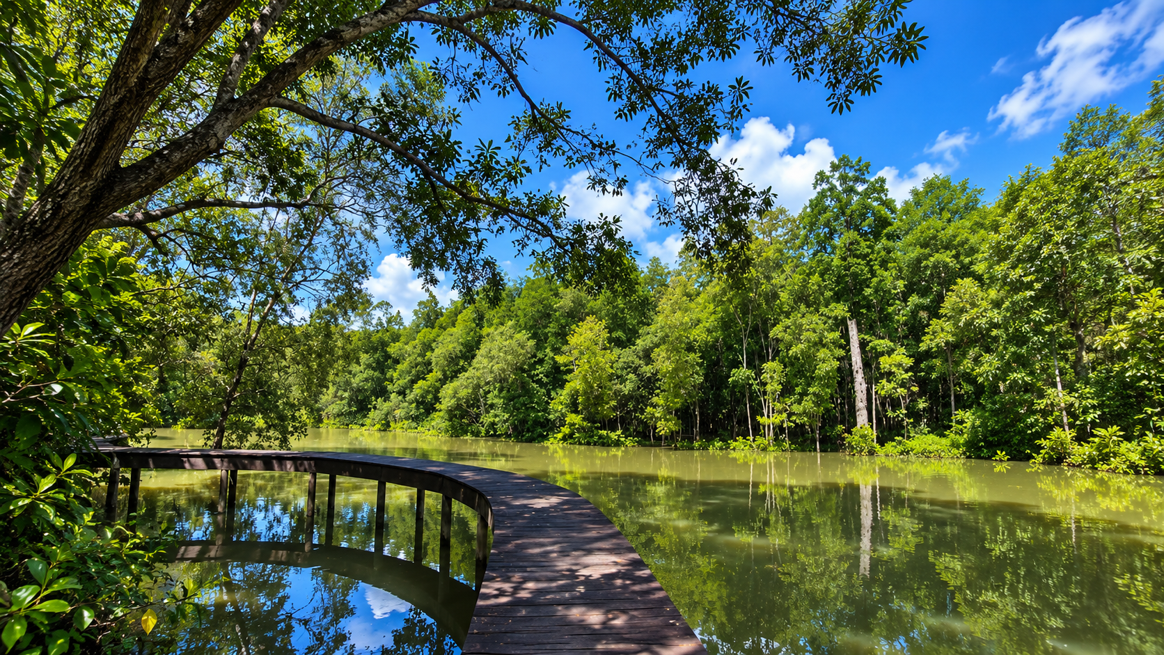
The mangrove forests of Lam Nam Kra Buri are among the most important features of the park. Mangroves occupy the intertidal landscape where freshwater and seawater interact. Their roots create a complex three-dimensional environment above and below the water.
Among the mangrove vegetation recorded in the wider park landscape are species such as:
- Rhizophora mucronata and Rhizophora apiculata
- Ceriops tagal
- Xylocarpus moluccensis and Xylocarpus granatum
- Bruguiera, Avicennia and Sonneratia
The exact composition varies according to salinity, tidal influence, sediment and local hydrology. This is not simply a forest growing beside water. It is a forest adapted to living in water.
Why the Mangroves Matter
Mangrove ecosystems perform several functions at once. They stabilise coastal sediments, reduce shoreline erosion, provide nursery habitat for aquatic animals, support fish and crustacean communities, feed birds, store carbon, and connect terrestrial and marine ecosystems.
In Ranong, the mangrove landscape is particularly significant. The wider Kaper Estuary–Laem Son Marine National Park–Kra Buri Estuary wetland was designated a Ramsar Site in 2002. The Ramsar site covers 122,046 hectares and includes a very large proportion of Ranong’s mangrove ecosystems. Ramsar describes these mangroves as the largest remaining concentration in Thailand and among the most extensive mangrove systems in the Indo-Pacific region.
Again, this is the wider wetland complex, not the area of Lam Nam Kra Buri National Park itself. That distinction is important.
The River Islands
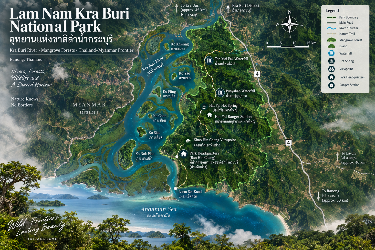
One of the most distinctive elements of the Kra Buri River landscape is the group of small islands located within the river. Traditional park descriptions identify six principal islands:
- Ko Siat
- Ko Khwang
- Ko Yao
- Ko Chon
- Ko Pling
- Ko Nok Plao
These islands are associated with mangrove vegetation and form part of the river’s complex wetland environment. Older park information describes them as largely uninhabited natural islands with well-developed mangrove vegetation.
They matter not because they function like conventional tourist islands, but because they show how the river itself creates habitat.
Ko Khwang
Ko Khwang is better understood as part of the river’s ecological mosaic than as a conventional island destination. From a boat, the relationship between island, mangrove and tidal channel becomes much clearer. The landscape is less about a beach and more about waterways, forest, tide and wildlife.
Ko Yao
Ko Yao contributes to the sequence of forested islands within the Kra Buri River. Its importance is primarily ecological and geographical. The islands break the river into a network of channels, creating different conditions for mangrove growth and aquatic life.
Ko Pling, Ko Chon, Ko Siat & Ko Nok Plao
Together with Ko Khwang and Ko Yao, these islands form the island landscape traditionally associated with the park’s section of the Kra Buri River. They should not be confused with Thailand’s better-known offshore island destinations. There are no expectations of resort beaches or conventional island tourism here. Their value lies in their natural riverine character.
Laem Set Kuat
Where the river opens up
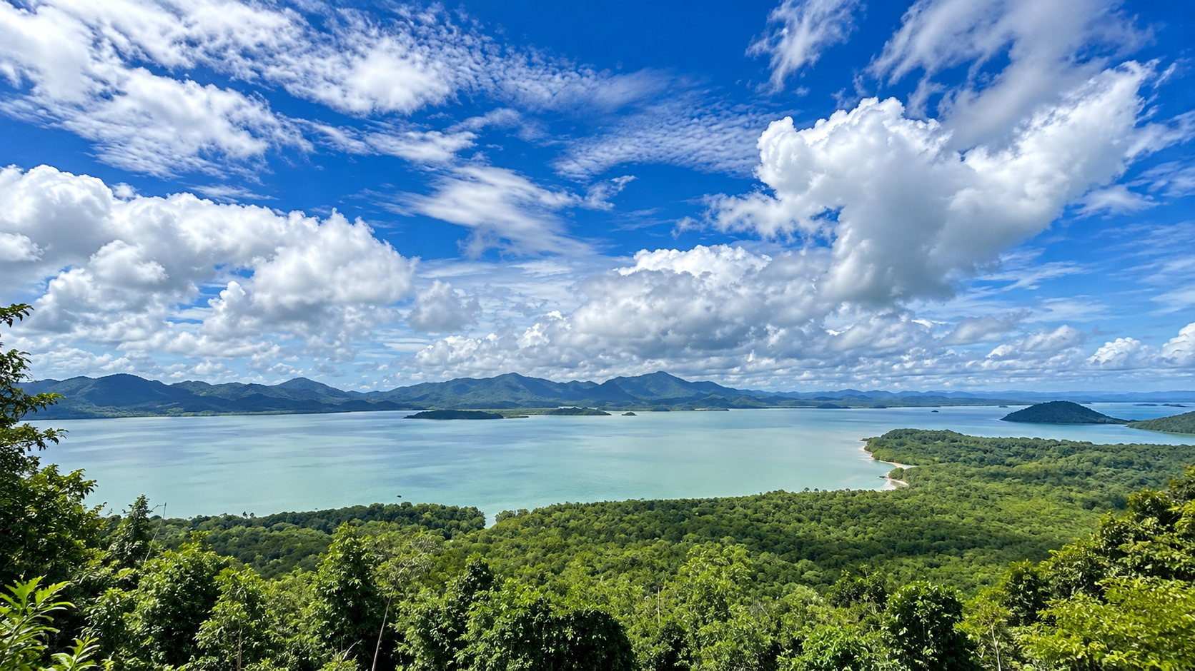
One of the most visually interesting areas of the park is Laem Set Kuat. The headland extends toward the Kra Buri River and is surrounded by mangrove ecosystems. The landscape is particularly valuable from a viewpoint perspective because the river, islands and Myanmar side of the border come together in a single panorama.
The older park description identifies the Laem Set Kuat peninsula as an area of healthy mangrove forest covering approximately 3.2 km² and extending into the Kra Buri River.
Thailand on one side. Myanmar on the other. A river between them.
Khao Hin Chang Viewpoint
The border landscape from above
The Khao Hin Chang viewpoint provides one of the clearest perspectives on the geography of Lam Nam Kra Buri. From the elevated landscape, visitors can look across:
- The Kra Buri River and its forested islands
- Mangrove forests and forested hills
- Myanmar’s riverbank
This is not a conventional mountain viewpoint where the objective is simply elevation. The attraction is geographical perspective. The higher you stand, the more clearly the river system becomes visible.
Punyaban Waterfall
The park’s most accessible natural attraction
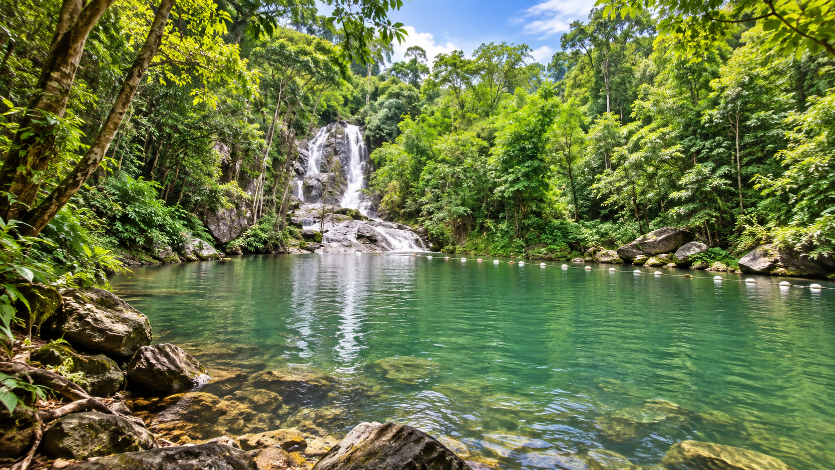
If the Kra Buri River represents the park’s large-scale landscape, Punyaban Waterfall provides its easiest introduction. The waterfall is located beside Highway 4 (Phetkasem Road) and is only about 3 kilometres from the park headquarters. The Tourism Authority of Thailand’s tourism directory identifies it as a year-round waterfall.
This makes Punyaban very different from some of the more remote attractions in western Thailand. You do not need a long expedition simply to experience the forest. The road brings you close to the waterfall.
The three-level waterfall
- Level 1 — Punyaban Waterfall
- The main and most accessible section.
- Level 2 — Ton Mai Phai Waterfall
- A higher section associated with bamboo vegetation.
- Level 3 — Ton Ton Fern Waterfall
- The upper section associated with the forest environment.
The waterfall system is fed by streams from the surrounding forest and ultimately drains toward the local stream system. Tourism information describes Punyaban as having water throughout the year, although flow volume naturally changes with rainfall and seasonal conditions.
Not just a waterfall
The most interesting thing about Punyaban is its context. The waterfall is surrounded by rainforest. You can hear flowing water. The vegetation becomes denser. The temperature feels different from the exposed highway. And the transition happens quickly.
This makes Punyaban an excellent first encounter with Lam Nam Kra Buri. It requires far less commitment than the park’s more remote nature experiences.
The Forest Behind the River
While the Kra Buri River receives much of the visual attention, Lam Nam Kra Buri National Park also protects inland forest. The park’s land component includes forest reserves such as:
- Khlong Set Kuat and Khao Hin Chang
- Khao Sam Laem
- La-un and Ratchakrut
- Khlong Lam Liang–La-un
These areas create a transition from lowland and river ecosystems into more terrestrial tropical forest. The park should not be imagined as a narrow strip of mangrove along a river. It is a connected landscape of forest, streams, mangroves, river and estuary.
Tropical rainforest
The inland forest contains tropical rainforest environments, particularly around the more elevated and wetter forest reserves. High rainfall is one of the defining environmental characteristics of Ranong. The result is a landscape where vegetation can remain intensely green for much of the year.
For photographers, the visual language is very different from dry-season forests elsewhere in Thailand. Here, moisture is part of the identity. Expect dense foliage, moss, ferns, vines, streamside vegetation, large-leaved tropical plants and a humid forest atmosphere.
A distinctive tree
Older park descriptions identify a distinctive tree locally known as Khun Mai, described as having a large straight trunk and fruits resembling cashew nuts. It is associated particularly with areas around Punyaban Waterfall and the La-un / Ratchakrut forest landscape.
Because common names can vary regionally, this guide does not assign an English or scientific species name. Not over-translating a local ecological fact is more accurate than guessing.
Wildlife
Lam Nam Kra Buri’s greatest ecological value comes from the interaction between multiple habitats: tropical forest, mangrove forest, river systems, tidal habitats, islands and wetlands. That diversity supports a broad range of wildlife. The attraction is the ecosystem itself — not a promised sighting of any particular animal.
Birds
Mangroves and riverbanks provide feeding and roosting habitat for numerous bird species. Birdwatchers should look for kingfishers, herons, egrets, shore-associated birds, forest birds and raptors. The exact species encountered will depend on season, tide, habitat and location.
Fish and aquatic life
The mangrove ecosystem is closely connected to aquatic biodiversity. Young fish and other aquatic organisms can use mangrove channels as nursery habitat before moving into larger river and coastal systems. The wider Ranong mangrove wetland is recognised for its diverse fish communities. Ramsar documentation notes more than 82 fish species recorded in the Ranong mangroves.
That figure refers to the wider Ramsar mangrove landscape, not a species count for Lam Nam Kra Buri National Park alone.
Mud, roots and small creatures
One of the easiest mistakes visitors make in a mangrove is looking only at the trees. Look down. Mangrove mudflats contain a surprisingly active world of crabs, molluscs, small fish, juvenile aquatic animals, invertebrates, mudskippers and other intertidal species. The roots themselves create habitat. Every exposed root, tidal pool and mud surface can become a miniature ecosystem.
Monkeys and mangrove wildlife
Mangrove environments in Ranong can support primates and other wildlife associated with river forests. Wildlife viewing here should be treated as observation rather than a guaranteed encounter.
The Importance of the Tides
The Kra Buri River is strongly influenced by tidal movement. This changes the landscape. At one time, channels may appear full. Later, mudflats and exposed roots become visible. The colour and reflection of the river can change with weather and light. For photography, the same viewpoint can look completely different at different times of day.
Best time to experience the river
- Early morning
- Cooler air, softer light and active birdlife.
- Late afternoon
- Warm light across the river and forest.
- Sunset
- Particularly attractive from viewpoints facing the river. River, islands, mangroves and Myanmar create an unusually strong sunset landscape.
The Border Is Part of the Experience
Lam Nam Kra Buri is one of the places where geography is unusually visible. The border is not an abstract line printed on a map. It is physically represented by the river. Stand on the Thai side and look across. The opposite bank is Myanmar.
This gives the destination a geographic character that few national parks in Thailand can replicate. It is also why the river landscape should be approached with respect. Visitors should remain within designated Thai territory and follow all instructions from park and local authorities.
Beyond the Park Boundary
One of the most important things about Lam Nam Kra Buri is that its ecological significance does not stop at the national park boundary. The wider Ranong coastal landscape includes mangrove forests, estuaries, mudflats, river systems, coastal forests, seagrass areas, coral ecosystems and protected forests.
The Kaper Estuary–Laem Son Marine National Park–Kra Buri Estuary Ramsar Site brings many of these ecosystems together under one internationally recognised wetland designation. The Ramsar site was designated on 14 August 2002 and covers 122,046 hectares. Its significance comes from the scale and ecological continuity of Ranong’s coastal wetlands.
Do not confuse the Ramsar site with the national park
This is an easy source of misinformation, so it deserves its own comparison.
- Lam Nam Kra Buri National Park
- Approximately 160 km² — about 99 km² of land and 61 km² of water.
- Ramsar Site 1183
- Approximately 1,220.46 km² / 122,046 ha, covering the Kaper Estuary, Laem Son Marine National Park and the Kra Buri Estuary.
Lam Nam Kra Buri National Park is part of a much larger internationally significant wetland landscape, but the two areas are not the same thing.
Conservation in Motion
The landscape around Lam Nam Kra Buri is still evolving from a conservation-management perspective. In January 2024, the Department of National Parks announced a public participation process concerning a proposed expansion of Lam Nam Kra Buri National Park.
The proposed additions covered 14 plots totaling 13,770.64 rai, in areas including:
- Khlong Lam Liang–La-un
- Khlong Set Kuat–Khao Hin Chang–Khao Sam Laem
- La-un–Ratchakrut
The areas were identified as important forest landscapes and wildlife habitat connecting several protected areas. This is a proposed expansion — an area under consideration — not part of the current established park area.
The larger forest connection
The proposed expansion areas are particularly interesting because they sit within a broader forest network. The Department of National Parks described them as a connection between:
- Lam Nam Kra Buri National Park
- Namtok Ngao National Park
- Thung Raya–Na Sak Wildlife Sanctuary
The department highlighted their importance as wildlife movement and feeding areas and noted the presence of valuable forest resources and species such as Rafflesia and other notable plants. The park should be viewed as part of a larger conservation landscape rather than as an isolated tourist attraction.
What Can You Actually Do Here?
Lam Nam Kra Buri is best suited to slow nature experiences.
- 1. Walk in the mangroves
- A nature trail lets you see the structure of mangrove forest from close range — roots, mudflats, crabs, birds, tidal channels and mangrove seedlings.
- 2. Visit Punyaban Waterfall
- The easiest major nature attraction. Excellent for families, short stops, photography, forest atmosphere and cooling down beside the stream.
- 3. Visit a viewpoint
- Khao Hin Chang and the Laem Set Kuat area offer a different perspective. Here the attraction is not a waterfall. It is the geography of the border river.
- 4. Photograph the river
- Especially compelling at sunrise, late afternoon, sunset, low tide and in misty weather.
- 5. Go birdwatching
- Mangroves and river margins create excellent habitat. Bring binoculars. Move slowly. Listen before looking.
- 6. Study the sequence
- A single area can demonstrate freshwater influence, tidal forest, mangrove, river and estuary. That ecological sequence is the real attraction.
Is It Suitable for Families?
Yes — if the itinerary is designed around the accessible areas. Punyaban Waterfall is significantly easier to experience than remote forest routes. Mangrove nature-study areas can also work well for families interested in short walks and wildlife observation.
Visitors should still distinguish between easy nature sightseeing and remote forest exploration. They are not the same experience.
Is It Suitable for Photographers?
Very much so. Lam Nam Kra Buri has several photographic subjects that are difficult to reproduce elsewhere.
- Landscape
- Forest, river, islands and Myanmar in one frame.
- Mangrove
- Roots, reflections, mudflats and tidal channels.
- Waterfall
- Punyaban’s rainforest environment, close to the highway and a world away from it.
- Atmosphere
- Ranong’s humid climate often produces mist, cloud and dramatic light.
- Border geography
- Few Thai national parks provide such an obvious international frontier within the landscape itself.
The best photography concept
Instead of photographing the park as a collection of attractions, photograph it as a continuous landscape. Start with forest. Move toward mangrove. Then river. Then islands. And finally Myanmar across the water.
That sequence tells the story of Lam Nam Kra Buri much better than a gallery of disconnected waterfalls and viewpoints.
Responsible Travel
The park’s most fragile resource is not one particular attraction. It is the ecosystem.
- In the mangrove, stay on designated paths.
- Along the river, do not leave plastic or fishing-related waste.
- Around wildlife, do not feed animals.
- At waterfalls, avoid entering the water during dangerous flow conditions.
- In forest areas, do not collect plants, shells, animals or other natural materials.
- On viewpoints, stay within designated areas.
- Along the border, follow all official instructions and remain within authorised areas.
Why a mangrove is not an ordinary forest
A mangrove can look deceptively simple. Beneath the canopy is a highly productive ecological system. The roots trap sediment. The mud supports invertebrates. The channels provide aquatic habitat. The forest protects shorelines. The leaves contribute organic material to the food web. Fish move through the system. Birds feed above it. Crabs move beneath it. The entire system is connected to the river and coastal waters.
Walking through a mangrove is not simply a forest walk. It is entering a tidal ecosystem.
When to Visit
Ranong is one of Thailand’s wettest provinces. That fact should shape expectations. The landscape is exceptionally green partly because of its rainfall.
- December – February
- Generally comfortable for outdoor exploration, with lower rainfall than the wettest months. Good for river viewpoints, photography, nature walks and road trips.
- March – April
- Warmer, but still attractive for forest and river landscapes.
- May – October
- Rain becomes a major environmental factor. The forest is intensely green, but heavy rain can affect trails, waterfalls, river conditions, access and safety.
- November
- A transition period. Conditions can vary considerably.
Seasonal access
National park attractions can have seasonal closures. Historical national-park closure schedules have included the Punyaban Waterfall nature trail from 1 October to 30 November. Seasonal management can change, so that window should not be treated as a permanent rule.
How to Get There
The most practical access is by road on Highway 4 / Phetkasem Road. The Department of National Parks places the headquarters at 130 Moo 3, Pak Nam, Mueang Ranong, about 18 kilometres from Ranong town: turn off at kilometre 595 and continue about 1 kilometre. Punyaban Waterfall is one of the easiest entry points because it sits directly beside the highway, approximately 3 kilometres from headquarters.
- From Ranong city
- Travel north on Highway 4 toward Kra Buri. Punyaban is the simplest first stop, right beside the road.
- From Chumphon
- Travel south along Highway 4 toward Ranong. Punyaban is encountered before central Ranong — a natural pause on the road trip Chumphon → Punyaban → Lam Nam Kra Buri → Ranong.
- A nature day from Ranong
- Ranong → Punyaban Waterfall → Lam Nam Kra Buri → Khao Hin Chang / Laem Set Kuat → return to Ranong. Check access to each place before departure. Individual routes can have different operating conditions.
A Slow-Travel Destination
This is not a park that needs to be rushed. A common mistake is to arrive, photograph the waterfall and leave. That captures only one layer. A better experience is to spend time understanding how the landscape changes.
- Morning
- Forest.
- Midday
- Mangrove.
- Afternoon
- River.
- Sunset
- The Thailand–Myanmar frontier.
The destination becomes much more interesting when experienced as a sequence rather than as a checklist.
The border-river sunset
Few experiences express Lam Nam Kra Buri better than standing above the river in the late afternoon. The light begins to soften. The mangroves become silhouettes. The river reflects the sky. The islands become dark shapes. Across the water, Myanmar forms the opposite horizon. There is no artificial attraction required. The geography does the work.
What Makes Lam Nam Kra Buri Special?
It is not Thailand’s largest national park. It is not Thailand’s highest mountain destination. It is not a famous island resort. Its strength lies elsewhere.
- It has a river that is also an international frontier.
- It has mangroves connected to a major wetland system.
- It has forested islands inside the river.
- It has tropical rainforest inland.
- It has a highly accessible rainforest waterfall.
- It has viewpoints where several geographical systems become visible at once.
And most importantly: the park still feels like a landscape rather than a tourist product.
ThailandLover Experience Guide
- River landscape
- Photographers and nature lovers.
- Mangrove ecology
- Nature lovers and families on short walks.
- Border views
- Photographers and anyone curious about geography.
- Punyaban Waterfall
- Families and road trips. Easy, green, and right beside Highway 4.
- Wildlife observation
- Birdwatchers. Encounters are never guaranteed.
- Adventure
- Outdoor travellers. This is landscape, not adrenaline.
- Accessibility
- General travellers, if the day stays with the accessible places.
- Off the beaten path
- Independent travellers looking past conventional attractions.
- Photography
- Landscape photographers. Shoot the sequence, not a checklist.
- Slow travel
- The park’s real pace.
Who Should Visit?
Lam Nam Kra Buri is a strong match for:
- Nature lovers and landscape photographers
- Birdwatchers and ecotourists
- Road-trip travellers
- Families looking for accessible nature
- Travellers interested in Thailand’s geography, and in the Thai–Myanmar frontier
- Independent travellers looking beyond conventional attractions
Who may want something else?
Lam Nam Kra Buri may not be the strongest choice for travellers specifically seeking large beaches, coral-island holidays, luxury resorts, high-adrenaline adventure, major nightlife, large tourist attractions or extensive developed facilities. For those experiences, other destinations in southern Thailand will be more appropriate.
Lam Nam Kra Buri’s strength is nature and geography.
Essential Information
- Destination
- Lam Nam Kra Buri National Park · อุทยานแห่งชาติลำน้ำกระบุรี
- Province
- Ranong · Mueang Ranong, Kra Buri and La-un
- Headquarters
- 130 Moo 3, Pak Nam, Mueang Ranong 85000 · about 18 km north of Ranong town, Highway 4 km 595
- Established Park Area
- Approximately 160 km² · about 99 km² land and 61 km² water
- Signature Landscape
- Kra Buri River · Thailand–Myanmar frontier
- Major Ecosystems
- Mangrove forest · tropical rainforest · river · wetland · islands
- Main Waterfall
- Punyaban Waterfall · beside Highway 4, about 3 km from headquarters
- Main Viewpoint
- Khao Hin Chang / Laem Set Kuat area
- Principal River Islands
- Ko Siat · Ko Khwang · Ko Yao · Ko Chon · Ko Pling · Ko Nok Plao
- Wider Wetland Context
- Kaper Estuary–Laem Son Marine National Park–Kra Buri Estuary Ramsar Site · 122,046 ha · designated 14 August 2002
- Important
- The Ramsar area is the wider wetland complex. It is not the area of Lam Nam Kra Buri National Park.
Before You Go
Check current park opening status, seasonal trail closures, waterfall conditions, weather, rainfall, river conditions, current access to viewpoints, and any local safety restrictions. Conditions in southern Thailand can change quickly during periods of heavy rain.
For the most current information, contact the national park directly before travelling. The Department of National Parks lists the park at 130 Moo 3, Pak Nam, Mueang Ranong, and publishes the telephone number 077 989 817.
ThailandLover Destination Verdict
- Landscape
- River, islands, forest and an international horizon.
- Nature
- A connected landscape, not a single attraction.
- Mangrove ecology
- A tidal forest, not a walk in ordinary woodland.
- Photography
- Light, tide and the border do the work.
- Wildlife
- Birds, crabs, mudskippers — observation, not a guarantee.
- Waterfalls
- Punyaban is accessible rainforest, not a remote expedition.
- Adventure
- Quiet geography rather than high-adrenaline travel.
- Accessibility
- Highway-side waterfall plus viewpoint country.
- Families
- Yes, if the day stays with the easy places.
- Slow travel
- The park rewards a sequence, not a checklist.
- Off the beaten path
- Understated, and better for it.
- Geographical interest
- Few Thai parks make an international frontier this visible.
Best for nature, river landscapes, mangroves, photography, birdwatching, ecotourism, road trips, slow travel and geography.
Where Thailand meets Myanmar across a river.
Frequently Asked Questions
- What is Lam Nam Kra Buri National Park?
- A Ranong landscape of river, mangrove, rainforest, islands and border country. The established park covers about 160 km² — roughly 99 km² of land and 61 km² of water. It is defined by the Kra Buri River, not by a single summit or beach.
- Does the park border Myanmar?
- Yes. For much of its lower course the Kra Buri River is the Thailand–Myanmar boundary. From the Thai side you can see channels, islands, mangroves and the opposite bank. Stay in designated Thai territory and follow official instructions.
- Is the Ramsar wetland the same as the park?
- No. The park is about 160 km². Ramsar Site 1183 covers 122,046 hectares — the Kaper Estuary, Laem Son Marine National Park and the Kra Buri Estuary together. The park sits inside that wider wetland. They are not the same area.
- What is Punyaban Waterfall?
- A year-round, three-level rainforest fall beside Highway 4, about 3 kilometres from headquarters. The main fall is Punyaban; higher sections are Ton Mai Phai and Ton Ton Fern. Flow changes with the rain.
- When should I go?
- December to February is generally the most comfortable. May to October is very green and very wet, and rain can close trails or change river conditions. For the river itself, early morning, late afternoon and sunset are often the strongest light.
- How do I get there?
- By road on Highway 4. Headquarters is about 18 kilometres north of Ranong town, turning off at kilometre 595. Punyaban sits beside the highway. From Chumphon, you reach the waterfall before central Ranong.
- Is it suitable for families?
- Yes, if the day is built around Punyaban and short mangrove walks. Remote forest routes are a different, harder experience.
More of Ranong’s Andaman Edge
- Laem Son National Park
- Coast, islands and the Andaman marine landscape — a different Ranong story from this river frontier, and part of the same wider Ramsar wetland.
- Namtok Ngao National Park
- Inland forest connected, in proposed expansion areas, to Lam Nam Kra Buri’s western mountain network.
- Mu Ko Ranong National Park
- Ranong’s offshore Andaman islands — a useful contrast with the forested islands inside the Kra Buri River.
- Nature & Parks
- More protected landscapes across ThailandLover’s collection.
Location
Find Lam Nam Kra Buri National Park
130 Moo 3, Pak Nam, Mueang Ranong · Highway 4 km 595 · about 18 km north of Ranong