

National Park · Kamphaeng Phet & Tak
Khlong Wang Chao National Park
อุทยานแห่งชาติคลองวังเจ้า
Where Mountains, Forests and Waterways Meet
Kamphaeng Phet & Tak · Western Thailand
A vast western forest of the Thanon Thong Chai Range — waterfalls, streams, caves and high ridges rising to Khao Yen at 1,898 metres.
A Wild Corner of Western Thailand
There are places in Thailand that are famous because everyone knows them. And then there are places like Khlong Wang Chao National Park — vast, mountainous and remarkably rich in forest and waterways, yet far less familiar to international travellers.
Stretching across Kamphaeng Phet and Tak, Khlong Wang Chao protects a large section of the Thanon Thong Chai mountain system. Its landscape rises from forested valleys and waterways to high mountain ridges, including Khao Yen, the highest point in the park at approximately 1,898 metres above sea level.
The park is known for waterfalls, mountain streams, caves, natural hot-water features and extensive forest habitat. But its real character lies in the landscape between these individual attractions: a large, interconnected forest ecosystem where mountains feed rivers, rivers shape valleys, and different forest types create habitat for a remarkable variety of wildlife.
This is not a national park designed around one spectacular viewpoint. It is a place to understand Thailand’s western mountain landscape as a whole.
Khlong Wang Chao at a Glance
- Official Name
- Khlong Wang Chao National Park
- Thai Name
- อุทยานแห่งชาติคลองวังเจ้า
- Provinces
- Kamphaeng Phet and Tak
- Established
- 29 August 1990
- National Park Number
- 63rd national park of Thailand
- Area
- Approximately 466,875 rai / 747 km²
- Highest Point
- Khao Yen — approximately 1,898 m
- Mountain System
- Thanon Thong Chai Range
- River System
- Ping River Basin
- Major Watersheds
- Khlong Wang Chao and Khlong Suan Mak
- Landscape
- Mountain ranges, valleys, forests, streams and waterfalls
- Headquarters
- 446 Moo 22, Ko Samphi, Kosamphi Nakhon, Kamphaeng Phet 62000
At roughly 747 square kilometres, the park is considerably larger than many travellers might expect from a destination that remains relatively quiet on the international tourism map.
The Thanon Thong Chai Landscape
Khlong Wang Chao lies in the transition between the western mountain region and the edge of Thailand’s central plain. The park’s mountains generally run from north to south and form part of the Thanon Thong Chai Range. Between the mountain systems are lower areas and small basin-like plains, while the western part of the park rises into considerably higher terrain.
Elevations range from roughly 200 metres to 1,898 metres above sea level, with Khao Yen forming the highest summit. Important mountain areas include Khao Yen, Khao Son, Khao Tao Dam, Khao Khanun, Khao Kha Laeng, Khao E-Lo-Ko, Khao Wang Chao, Khao Pang Yai, Doi Luak and Khao Wung Ka Sang.
Together, these mountains create a complex landscape of ridges, valleys and headwater streams. This is one reason Khlong Wang Chao feels different from a conventional waterfall destination. The waterfalls are only one expression of a much larger mountain ecosystem.

Two Important Watersheds
Water is one of the defining features of Khlong Wang Chao. The park forms part of the Ping River Basin and contains two principal watershed systems.
- Khlong Wang Chao watershed
- Includes waterways such as Khlong Mae Ya Ma, Khlong Wang Chao, Khlong Khun Mak and Khlong Khayaeng.
- Khlong Suan Mak watershed
- A broader network including Khlong Phrai, Khlong Wung Ka Sang, Khlong Phlu, Khlong I Mi, Khlong Som O, Khlong Pang Yai, Khlong Suan Mak, Khlong Tao Dam, Khlong Phu Yai Lao, Khlong Nai Pu, Khlong Kha Khaeng, Khlong Champa, Khlong Tano and Khlong Pang Khop.
These streams and tributaries connect the high mountain forests with lower valleys and form an important part of the park’s ecological structure. For travellers, this translates into something very visible: waterfalls, forest streams, pools and river landscapes appearing throughout the terrain.
Five Forest Worlds
One of the park’s greatest assets is not a single attraction but its diversity of forest ecosystems.
- Mixed deciduous forest
- The dominant forest type, covering approximately 65% of the park, broadly between 200 and 1,000 metres. Important trees include teak, Burma padauk, Afzelia, Lagerstroemia and other deciduous species, together with bamboo. Habitat and refuge for gaur, muntjac, sambar deer, fishing cats, wild boar and a variety of rodents and birds.
- Hill evergreen forest
- Above approximately 1,000 metres, particularly along the higher western ranges. The vegetation becomes denser and the atmosphere changes. Ferns, palms, rattans and other understory plants thrive beneath oaks and other montane species. Used by larger mammals such as gaur, together with smaller mammals and mountain birds.
- Dry evergreen forest
- Mainly around valleys and central mountain areas at approximately 400–1,000 metres. Forest cover, streams and valley habitat make these areas particularly important for wildlife, including gaur, sambar deer, mouse deer, leopard cats, marbled cats and several large forest birds.
- Dry dipterocarp forest
- Occurs in patches on hills and lower ridges, particularly in the eastern and northern parts of the park. More open than evergreen forest. Associated wildlife includes wild boar, muntjac, monitor lizards and Asian leaf turtles.
- Pine forest
- Patches along ridges and higher elevations, approximately 900–1,200 metres. Siamese pine (Pinus kesiya) gives these areas a noticeably different landscape. Wildlife recorded here includes serow, wild boar, macaques, civets and porcupines.
Wildlife
Khlong Wang Chao’s ecological importance becomes especially apparent when looking beyond its waterfalls. The park provides habitat for a broad range of mammals, birds, reptiles, amphibians and freshwater species.
- Mammals
- Gaur, sambar deer, muntjac, wild boar, fishing cat, leopard cat, marbled cat, mouse deer, serow, flying squirrels, civets, porcupines and various rodents.
- Birds
- Great hornbills, wreathed hornbills, woodpeckers, kingfishers, minivets, treecreepers and other forest and stream-associated birds.
- Amphibians and reptiles
- A variety of frogs, toads and other amphibians along the waterways, together with monitor lizards and turtles.
- Freshwater life
- Mahseer-related fish, stream barbs, catfish and other aquatic species in streams and waterways.
For wildlife enthusiasts, this is important context: Khlong Wang Chao is not simply a collection of scenic waterfalls. The waterfalls and streams exist within a functioning forest ecosystem.
The Waterfalls
Waterfalls are among the park’s most recognizable attractions, but they differ greatly in accessibility and character.
- Khlong Wang Chao Waterfall
- One of the most accessible waterfalls associated with headquarters. A single-tier cascade approximately 20 metres high, with a rocky resting area and a natural pool suitable for water activities when conditions permit. About 1.5 kilometres from headquarters — among the more approachable places for visitors who do not want a remote trek.
- Khlong Samo Kruai Waterfall
- A three-tier waterfall about 800 metres from headquarters. The first drop is approximately 40 metres. The surrounding rock and forest create a more enclosed atmosphere than the broader landscapes around some of the park’s larger falls.
- Kratae Tai Mai Waterfall
- A smaller waterfall approximately 1.7 kilometres from headquarters, with a natural pool and a broad rocky resting area. The name refers to the abundance of the fern known as kratae tai mai. It shares an access route with Khlong Samo Kruai.
- Tao Dam Waterfall
- One of Khlong Wang Chao’s signature destinations for travellers looking for something more adventurous. Large and remote, approximately 34 kilometres from headquarters, with drops of more than 200 metres. Access is considerably more difficult and requires appropriate transportation and preparation. The final approach includes a short walk from the vehicle area. The journey is part of the experience.
- Khlong Pong Waterfall
- Another remote multi-tier waterfall reached through a more demanding route, with an overnight stay traditionally required. It belongs on the adventure / trekking side of the park rather than a casual sightseeing itinerary.
Khao Yen — The Roof of the Park
If the waterfalls represent the water of Khlong Wang Chao, Khao Yen represents its mountains. At approximately 1,898 metres above sea level, it is the highest point within the national park. It forms part of the high western mountain landscape and is one of the defining geographical features of the protected area.
The mountain’s elevation creates a markedly cooler environment than the lower valleys. Mist, cloud and changing mountain weather can become part of the experience, particularly during the cooler and wetter seasons.
Access to high-elevation areas should not be treated like an ordinary sightseeing stop. Hiking routes, permissions, seasonal access and safety requirements can change. Confirm current conditions with the park before planning an ascent.
Tham Thep Phanom and Pak Khlong Nakhiri
Khlong Wang Chao is not only a destination for waterfalls. Tham Thep Phanom (Thep Phanom Cave) is a limestone cave environment featuring stalactites and stalagmites. The cave also provides habitat for bats and forms part of the park’s broader karst and forest landscape. Follow park guidance and avoid disturbing wildlife or cave formations.
Pak Khlong Nakhiri is a natural rapids area where Khlong Nakhiri meets Khlong Wang Chao. It represents another side of the park’s character: not a mountain summit or waterfall, but the meeting of waterways within the forest. For travellers interested in the park’s geography, places like this show how the watershed works at ground level.
The park also contains areas described as natural gas seep or hot-water features, including areas associated with wildlife habitat. These locations are part of the park’s geological and ecological landscape rather than conventional tourist attractions. Never approach, enter or interact with unusual geological or thermal features without following official park instructions.
The People Around the Forest
Khlong Wang Chao is also connected with communities living around the forest landscape. The wider area includes Karen communities whose traditional ways of life have long been associated with the surrounding mountain and forest environment. Local tourism information identifies villages in the park’s surrounding landscape where traditional lifestyles can still be encountered.
For ThailandLover, this human dimension matters. The park is not simply an isolated wilderness separated from everything around it. It is part of a larger cultural landscape where forests, waterways, villages and livelihoods have existed alongside one another for generations.
When to Visit
Khlong Wang Chao experiences a tropical monsoon climate. The southwest monsoon from approximately mid-May to mid-October brings higher humidity, cloud cover and heavier rainfall. The northeast monsoon from approximately mid-October to mid-February generally brings cooler and clearer conditions.
Recorded average annual rainfall is approximately 1,318 millimetres. Average temperatures are around 26°C annually, with January lows reported around 14°C and April highs around 36°C.
- November–February
- Generally the most comfortable period for exploring the lower-elevation park landscape — cooler temperatures and often drier conditions.
- Waterfall season
- The rainy season can bring stronger flows and more dramatic waterfalls, but it can also make trails, roads and remote access routes more difficult.
- Mountain trekking
- Higher elevations can be significantly cooler and weather can change quickly. Anyone planning an overnight or high-altitude trek should check current park conditions before departure.
How to Experience It
Khlong Wang Chao works best when you choose your experience according to your level of adventure.
- A relaxed nature day
- Stay closer to park headquarters and explore the accessible waterfalls and forest environment.
- Waterfall explorers
- Build the trip around Khlong Wang Chao Waterfall and Khlong Samo Kruai, then consider the more remote Tao Dam Waterfall if conditions and transportation allow.
- Serious hikers
- Khao Yen and the park’s remote waterfall routes offer a substantially more demanding experience and require advance preparation.
- Nature enthusiasts
- Spend time observing the transition between different forest types rather than rushing from one attraction to another.
- Photographers
- Mountain ridges, mist, waterfalls, forest textures and changing light give Khlong Wang Chao considerable potential for landscape photography.
Getting There
The park can be reached from the Kamphaeng Phet–Tak corridor. Official regional information describes routes from the main highway toward the park headquarters, including access through the Wang Chao / Nong Dan area. The headquarters can be reached by road, with paved access described for the main approach.
Reaching the park headquarters and reaching the remote attractions inside the park are two very different things. Some waterfalls and mountain areas are accessible by ordinary vehicles; remote destinations such as Tao Dam and higher mountain routes can require specialised vehicles, trekking and advance coordination. Do not assume that every attraction shown on a map is accessible by normal road.
Don’t Miss
- Khlong Wang Chao Waterfall
- Khlong Samo Kruai Waterfall
- Kratae Tai Mai Waterfall
- Tao Dam Waterfall
- Khao Yen
- Tham Thep Phanom
- Pak Khlong Nakhiri
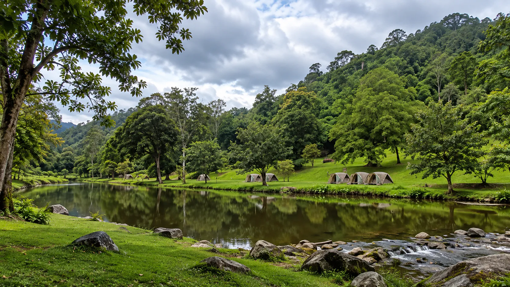
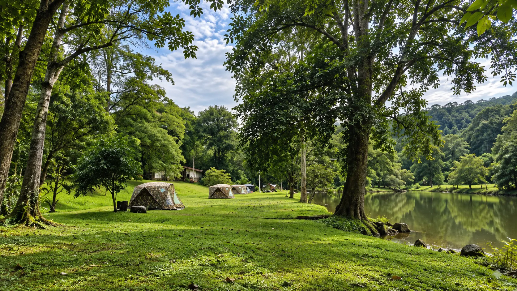
- Camping beside the forest waterways
Best for: waterfalls · forests · mountain landscapes · trekking · caves · streams · wildlife · camping · photography.
Frequently Asked Questions
- What is Khlong Wang Chao National Park?
- Thailand’s 63rd national park, established on 29 August 1990. Approximately 466,875 rai / 747 km² across Kamphaeng Phet and Tak. Highest point: Khao Yen at about 1,898 metres.
- Where is the headquarters?
- 446 Moo 22, Ko Samphi Subdistrict, Kosamphi Nakhon District, Kamphaeng Phet 62000.
- When is the best time to visit?
- November to February for cooler, drier lower-elevation exploration. The rainy season can bring stronger waterfalls but more difficult remote access.
- Which waterfalls are easiest?
- Khlong Wang Chao Waterfall (about 1.5 km from HQ) and Khlong Samo Kruai (about 800 metres). Tao Dam is about 34 km away and requires preparation.
- Can I climb Khao Yen?
- It is the park’s highest mountain, but access is not an ordinary sightseeing stop. Confirm hiking routes, permissions and seasonal conditions with the park first.
Nearby Destinations
- Khlong Lan National Park
- The better-known Kamphaeng Phet waterfall park — a useful neighbour on the same western-forest corridor.
- Mae Wong National Park
- Mountain forest and wildlife habitat connecting Kamphaeng Phet with the western highlands.
- Taksin Maharaj National Park
- Forest and highland landscape in Tak, on the western side of the same mountain country.
- Khuean Srinagarindra National Park
- A vast western forest of limestone mountains, waterfalls and reservoir further south in Kanchanaburi.
Location
Find Khlong Wang Chao National Park
446 Moo 22, Ko Samphi, Kosamphi Nakhon, Kamphaeng Phet 62000