

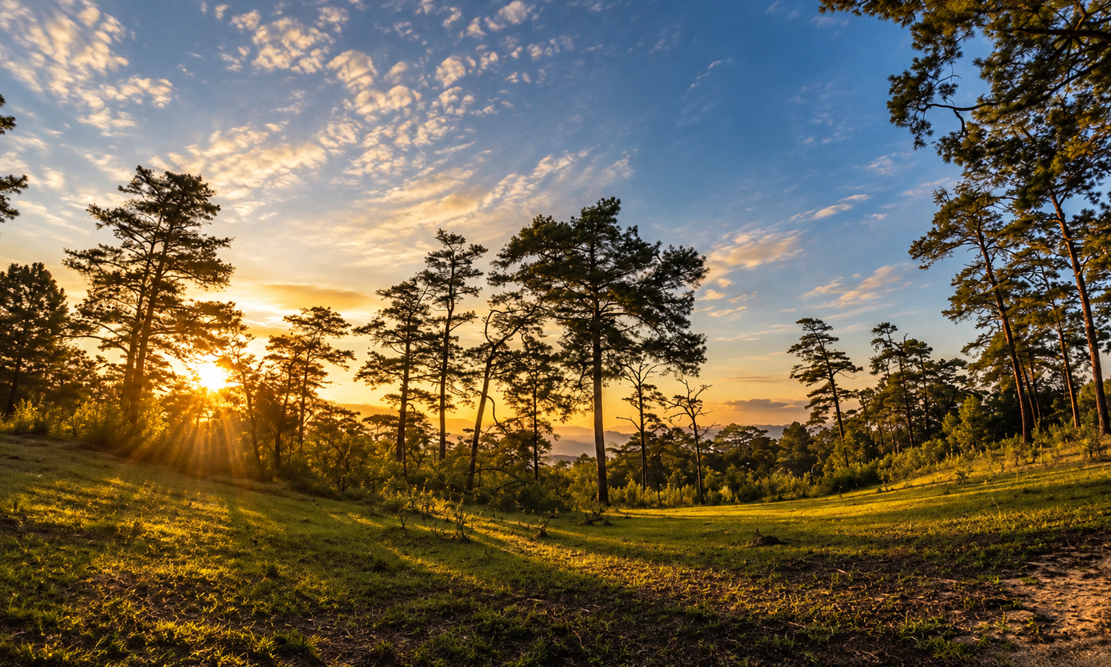
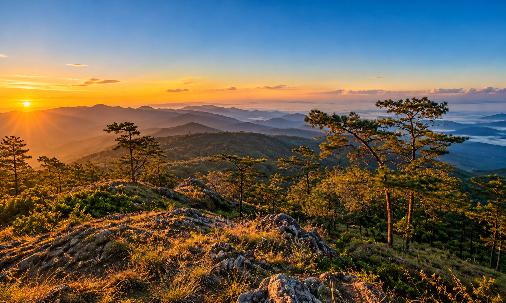
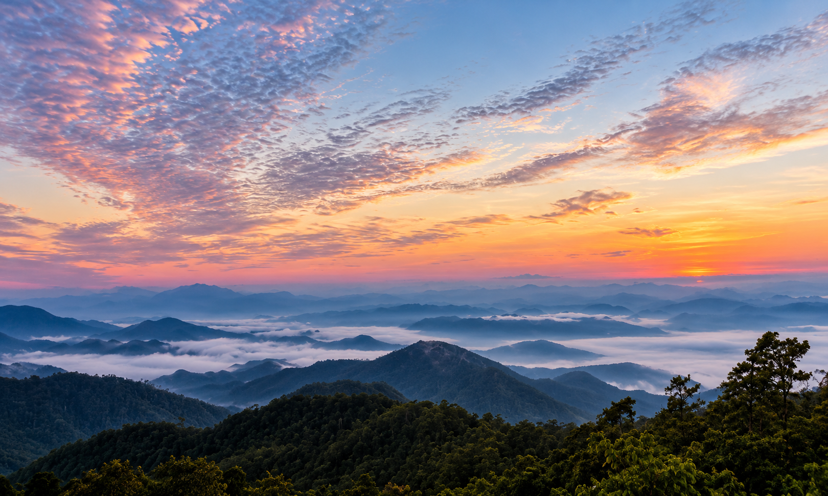
Park Preparation Area · Chiang Mai & Chiang Rai
Doi Wiang Pha National Park
อุทยานแห่งชาติดอยเวียงผา
The Quiet Mountain of Northern Thailand
Chiang Mai & Chiang Rai · Northern Thailand
Doi Wiang Pha National Park is a rugged forested mountain of high ridges, waterfalls, mist and wildlife — still less polished, less crowded and less commercially developed than many of Thailand’s better-known highland destinations.
The Quiet Mountain of Northern Thailand
There are mountains in Northern Thailand that are famous long before you arrive.
And then there are mountains that reveal themselves slowly.
Doi Wiang Pha National Park belongs to the second kind.
Rising deep within the mountain landscape of northern Chiang Mai and extending toward Chiang Rai, Doi Wiang Pha is a rugged forested mountain country of high ridges, waterfalls, mist, wildlife and remarkably quiet landscapes.
Its highest summit, Doi Wiang Pha, rises to approximately 1,834 metres above sea level.
The mountain is not yet one of Thailand’s formally established national parks. As of 2026, it remains an area prepared for designation as a national park under the Department of National Parks, Wildlife and Plant Conservation.
And perhaps that is part of its character.
Doi Wiang Pha still feels less polished, less crowded and less commercially developed than many of Thailand’s better-known mountain destinations.
For travellers who want to see another side of Northern Thailand — beyond the famous names — this is a mountain worth knowing.
Doi Wiang Pha National Park at a Glance
- English Name
- Doi Wiang Pha National Park
- Thai Name
- อุทยานแห่งชาติดอยเวียงผา
- Current Status
- National Park Preparation Area
- Region
- Northern Thailand
- Provinces
- Chiang Mai & Chiang Rai
- Highest Peak
- Doi Wiang Pha
- Highest Elevation
- Approximately 1,834 m
- Landscape
- Mountain ranges, forest, valleys, waterfalls
- Major Forest Types
- Hill evergreen, mixed deciduous, dry evergreen, deciduous dipterocarp, pine
- Best Known For
- Doi Wiang Pha summit, mountain views, waterfalls, forests, mist and biodiversity
- Best Season
- Cool season, generally November–February
- Best For
- Hiking, nature, photography, birdwatching and quiet mountain travel
First, Know the Status
Not Yet a Fully Established National Park
This distinction matters.
Although commonly referred to as Doi Wiang Pha National Park, the area is still officially treated by the Department of National Parks as an area prepared for establishment as a national park.
The Department began the process of defining the proposed Doi Wiang Pha National Park area and opened the proposal for public comment in 2022.
The proposal covered approximately 214,603.49 rai, equivalent to about 343.37 square kilometres.
The proposed area extends across forest areas in northern Chiang Mai and into Chiang Rai.
As of 2026, official Department of National Parks documents continue to classify Doi Wiang Pha as a national park preparation area.
Where Is Doi Wiang Pha National Park?
Doi Wiang Pha lies in the mountainous northern part of Thailand.
The landscape is associated primarily with Chai Prakan, Fang, Phrao and Mae Ai in Chiang Mai Province, together with areas in Mae Suai District, Chiang Rai Province.
The park’s administrative and conservation landscape therefore extends beyond the typical image of a single mountain destination.
It is part of a much larger northern mountain ecosystem.
The Mountain
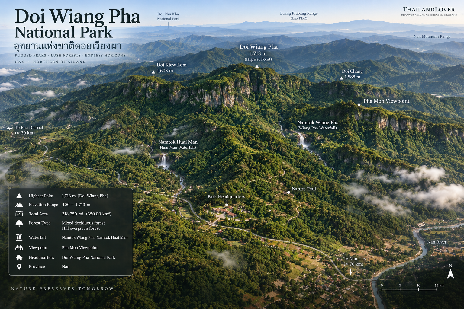
Doi Wiang Pha — 1,834 Metres
The defining feature of the area is the mountain from which it takes its name.
Doi Wiang Pha reaches approximately 1,834 metres above sea level.
At this elevation, the mountain enters a distinctly cooler highland environment. The summit landscape is very different from the agricultural lowlands below.
The higher you climb, the more the forest dominates. Clouds gather along ridges. Morning mist fills valleys. Trees become smaller and more adapted to the cooler mountain climate.
And on clear days, the surrounding mountain ranges unfold in layers toward the horizon.
This is the landscape that defines Doi Wiang Pha.
A Mountain of Forests
Doi Wiang Pha is not covered by a single type of forest. Its elevation, slope orientation, moisture and geology create several forest environments.
This diversity is one of the area’s most important ecological characteristics.
Hill Evergreen Forest
The Upper Mountain
At higher elevations, the landscape becomes increasingly dominated by montane or hill evergreen forest. The atmosphere changes noticeably. The forest becomes cooler, darker, more humid, mossy and rich in ferns and epiphytes.
Moss and lichens can cover rocks and tree trunks. Ferns occupy damp ground. Orchids and other epiphytes can be found in suitable habitats.
During the cool season, the upper mountain can feel almost completely detached from the warmer lowlands.
Mixed Deciduous Forest
Lower and Middle Elevations
These forests change considerably throughout the year. During the dry season, many trees shed their leaves. The forest becomes more open and sunlight reaches the ground. During the rainy season, the same landscape can become dramatically greener.
This seasonal transformation is one of the reasons Northern Thailand’s mountain forests are particularly interesting for photographers.
Dry Evergreen Forest
Moister valleys and areas around streams can support dry evergreen forest. These areas remain greener during the dry season than surrounding deciduous woodland. They also provide important habitat for wildlife.
Streams, shade and vegetation combine to create small ecological corridors through the mountain.
Deciduous Dipterocarp Forest
Some lower and drier parts of the landscape are characterised by deciduous dipterocarp forest. These forests are structurally different from the dense upper mountain forest. The canopy is more open. The ground receives more sunlight. And the forest can become particularly dry during the hot season.
Pine Forest
Pine can also be found within the wider mountain landscape. The presence of pine adds another visual layer to the forest and is characteristic of some northern Thai highland environments.
Flowers of the High Mountain
One of Doi Wiang Pha’s most attractive seasonal features is its high-elevation flowering vegetation. During the cool season, the upper mountain can become particularly beautiful.
Rhododendrons
The mountain is known for กุหลาบพันปี, or rhododendrons. During the flowering season, these highland plants can add vivid colour to an otherwise green mountain landscape. White rhododendron varieties are also reported in the area.
Cool air + mist + evergreen forest + rhododendron flowers
One of the most distinctive seasonal experiences of Doi Wiang Pha.
Doi Wiang Pha Waterfalls
Water is one of the defining elements of Doi Wiang Pha. Several waterfalls are associated with the area. Some are easily accessible. Others require more effort and remain relatively undeveloped.
Huai Sai Khao Waterfall
Namtok Huai Sai Khao · The Most Accessible
Huai Sai Khao Waterfall is the most accessible waterfall associated with the park preparation area. It is located approximately 300 metres from the park office area.
The waterfall has around three levels and forms pools along the stream. During periods of adequate water flow, some pools can be suitable for visitors to cool off.
The character of the waterfall changes strongly with the season. During the dry season, water flow can become very low. After the rains, the waterfall becomes considerably more active. The surrounding humidity also encourages moss growth on rocks and along the stream corridor.
For visitors who do not want a strenuous hike, Huai Sai Khao is one of the easiest ways to experience the forest.
Doi Wiang Pha Waterfall
Namtok Doi Wiang Pha
Older park information describes it as a medium-sized waterfall approximately 8 kilometres from the park office, with a drop of around 18 metres.
Its upper watershed is associated with the mountain environment around Doi Wiang Pha. Access is more demanding than Huai Sai Khao, and conditions may vary according to trail development and weather.
Mae Fang Luang Waterfall
Namtok Mae Fang Luang
Older park references describe it as a medium waterfall with a drop of approximately 10 metres. Like many natural features within Doi Wiang Pha, the experience depends heavily on season and water conditions.
Other Waterfalls
Additional waterfalls and streams have been identified within the wider area, including Huai Hok Waterfall, Pa So Waterfall and Huai Man Waterfall. Some of these areas remain relatively undeveloped from a tourism perspective.
This is important. Doi Wiang Pha should not be approached as a destination where every waterfall is a polished sightseeing attraction.
Some are wilderness features first and tourist destinations second.
Doi Wiang Pha Viewpoint
The Mountain Above the Clouds
The viewpoint on Doi Wiang Pha is one of the major reasons hikers make the journey upward. The attraction is not simply the summit. It is the landscape surrounding the summit.
From higher elevations, the mountain terrain unfolds in successive layers:
forest → ridge → valley → distant mountain → horizon
On mornings with favourable weather, mist may collect in the valleys below. The effect can be spectacular. Instead of seeing a single landmark, you see an entire northern mountain system.
Sunrise
For photographers and hikers, sunrise is one of the strongest reasons to stay overnight or begin the ascent early. The first light can illuminate the surrounding ridges while lower valleys remain covered by mist.
The mountain changes colour continuously during the first hour after sunrise. Blue-grey shadows gradually give way to warmer tones.
This is when Doi Wiang Pha feels most atmospheric.
Sunset
Sunset can also be beautiful, particularly when the sky remains clear after the rainy season. However, visitors should consider the return journey carefully.
Mountain trails become significantly more difficult to navigate after dark. Anyone planning a sunset hike should follow current park instructions and avoid descending without proper preparation.
Wildlife
Doi Wiang Pha supports a diverse mountain ecosystem. The fauna includes a mixture of small mammals, medium-sized mammals, birds, reptiles and amphibians.
Reported mammals include common muntjac, wild boar, serow, porcupine, Siamese hare, palm civet, squirrels and various small forest mammals.
Larger or more elusive species may be present in the broader ecosystem, but visitors should never interpret a species list as a guarantee of sightings.
This is a wild landscape. Wildlife determines when and where it appears.
Serow
One of the most interesting mammals associated with the mountain environment is the serow. Serows are mountain-dwelling ungulates adapted to steep terrain. They are generally shy and difficult to observe.
Their presence is ecologically significant because it reflects the continuing value of the mountain forest as wildlife habitat. Seeing one should be considered a rare privilege, not an expected attraction.
Wild Boar
Wild boar are among the more widespread medium-sized mammals found in northern forest ecosystems. They play an important role in the forest by disturbing soil while foraging and moving seeds through the landscape.
Visitors should never approach or feed them.
Birds
Doi Wiang Pha is also an interesting destination for birdwatching. Reported birdlife includes species such as White-rumped Shama, barbets, woodpeckers, sunbirds, minivets, kingfishers, hawks and other raptors, Red Junglefowl and various forest passerines.
The combination of different forest types and elevations creates opportunities for observing different bird communities. The cool season can be particularly rewarding for birdwatchers.
The Sound of the Forest
One of the most underrated attractions of Doi Wiang Pha is not something that appears on a map. It is sound.
Far from busy urban areas, the upper mountain can become remarkably quiet. Instead of traffic, visitors may hear birds, flowing water, insects, wind moving through trees and occasional distant calls from wildlife.
For ThailandLover, this is part of the destination.
Doi Wiang Pha is not only somewhere to look at. It is somewhere to listen.
Hiking Doi Wiang Pha National Park
The Summit Is the Main Adventure
The journey to the upper mountain is considerably more demanding than visiting the waterfall near the park office. A summit journey should be treated as a genuine mountain hike.
Expect steep sections, uneven ground, changing weather, slippery surfaces during wet periods, limited mobile connectivity in some areas, early starts and significant elevation gain.
The exact opening status and permitted route should always be checked with the park preparation unit before departure.
How Difficult Is It?
- Easy — Huai Sai Khao Waterfall
- Suitable for visitors looking for a short nature experience.
- Moderate — Lower forest trails
- Selected viewpoints and forest walks without committing to the full summit.
- Challenging — Doi Wiang Pha summit
- Requires preparation, appropriate footwear, sufficient water and awareness of mountain conditions.
When to Visit Doi Wiang Pha
- November–February · Cool Season
- Generally the strongest period for the upper mountain. Expect cooler temperatures, clearer mountain atmosphere on good-weather days, morning mist, flowering highland plants and better hiking conditions. This is also the season most associated with the mountain’s rhododendron experience.
- March–April · Hot & Dry Season
- Lower areas can become hot. Forest conditions can become considerably drier. The northern burning season may also affect visibility and air quality. This is not necessarily the best period for long-distance mountain photography.
- May–October · Green Season
- The rainy season transforms the landscape. The forest becomes greener, streams become stronger and waterfalls become more impressive. But trails can become muddy, slippery, difficult or temporarily inaccessible. Heavy rain can also create flash-flood and landslide risks. Always follow official closures and local instructions.
Come in the cool season for the mountain, flowers and mist; come in the green season for forests and waterfalls.
Getting to Doi Wiang Pha from Chiang Mai
The main access is from the Chiang Mai side. From Chiang Mai, travellers generally follow Highway 107 toward Chai Prakan/Fang.
Around the Mae Khilai Fang / kilometre 125 area, the route turns toward the mountain and continues approximately 12 kilometres toward the Doi Wiang Pha park office area.
The final approach is considerably more rural than the main highway. Private transportation is the most practical option. There is no reason to expect the same transport convenience found at major tourist attractions around Chiang Mai city.
From Chiang Mai
Doi Wiang Pha is best treated as a destination requiring a full travel plan rather than a quick city excursion. A practical strategy is:
Chiang Mai → Chai Prakan → Doi Wiang Pha
The mountain can also be incorporated into a longer Northern Thailand road trip connecting the Chiang Mai–Fang–Tha Ton–Chiang Rai region.
What to Bring
For a short nature visit
- Comfortable walking shoes
- Water
- Sun protection
- Insect repellent
- Light jacket
- Rain protection
- Camera
For the summit
- Proper hiking shoes
- Plenty of drinking water
- Rain jacket
- Warm clothing
- Headlamp
- First-aid supplies
- Offline map
- Fully charged phone
- Power bank
- Food / snacks
- Emergency contact information
During the cool season, do not assume that Northern Thailand means warm weather. At 1,800+ metres, conditions can be surprisingly cold.
Camping & Overnight Stay
Doi Wiang Pha has historically provided basic accommodation and camping-related facilities around the park office area.
However, because this is still a park preparation area, facilities and permitted overnight arrangements should not be assumed to operate exactly like those of a fully established national park.
Before travelling, confirm:
- Whether camping is currently permitted
- Whether tents are available
- Whether summit overnight stays are permitted
- Whether accommodation is open
- Whether the summit trail is open
- Whether a guide or ranger arrangement is required
The mountain should be treated as a managed conservation landscape rather than an unrestricted hiking area.
Responsible Travel
Doi Wiang Pha is valuable precisely because it still retains a strong sense of wilderness. That makes responsible travel essential.
- Take only photographs
- Leave only footprints
- Never feed wildlife
- Never collect flowers or plants
- Do not remove rocks or natural objects
- Carry rubbish back out
- Keep noise low
- Stay on designated routes
- Respect local communities
- Follow all temporary closures
Do not treat a protected forest as a playground.
Fire & Smoke Season
Northern Thailand faces a recurring dry-season challenge involving forest fires and agricultural burning. Doi Wiang Pha is not exempt.
During periods of severe fire danger, authorities may restrict access to parts of the forest. Smoke can also dramatically reduce visibility.
For travellers planning a mountain photography trip, this means that the calendar alone is not enough. A clear-weather forecast and current air-quality conditions matter.
Why Doi Wiang Pha Is Special
Doi Wiang Pha does not compete with Thailand’s famous national parks by offering the biggest waterfall, the most developed infrastructure or the easiest access.
Its strength is different.
It offers scale. Silence. Elevation. Forest. Mist. Wildlife. And the feeling of discovering somewhere that has not yet been overwhelmed by tourism.
Doi Wiang Pha vs. More Famous Northern Mountains
- Crowds
- Still well off the mainstream Chiang Mai circuit.
- Infrastructure
- Treat facilities as a preparation-area operation, not a finished national-park complex.
- Wilderness Feeling
- The mountain still feels wild rather than staged.
- Forest
- Several forest types across elevation, moisture and slope.
- Mountain Views
- Layered ridges, valleys and long-distance horizons.
- Waterfalls
- From an easy office-side cascade to wilderness streams.
- Wildlife
- A living mountain ecosystem — sightings never guaranteed.
- Photography
- Mist, pine, sunrise, forest texture and seasonal flowers.
- Hiking
- Short nature walks and a genuine summit route.
- Accessibility
- A planned northern journey, not a quick city excursion.
- Commercial Tourism
- No grand tourist complexes competing for attention.
- Sense of Discovery
- A mountain that still feels like a find.
Who Should Visit?
- Nature Lovers
- For travellers who prefer forests, mountains and natural landscapes to built attractions.
- Hikers
- Especially those who enjoy quieter mountain routes.
- Photographers
- The combination of mist, ridges, forest and seasonal flowers creates excellent landscape photography conditions.
- Birdwatchers
- Different elevations and forest types create opportunities for observing northern forest birds.
- Slow Travellers
- Doi Wiang Pha rewards travellers who are willing to move slowly.
- Adventure Travellers
- The mountain offers a more genuine wilderness experience than many heavily developed destinations.
Who May Not Enjoy It?
Doi Wiang Pha may not be ideal for travellers looking for luxury facilities, easy sightseeing, large restaurants, extensive visitor infrastructure, guaranteed viewpoints, short drives between attractions or predictable weather.
This is not a polished theme-park version of nature.
That is exactly why it is interesting.
Essential Facts
- English Name
- Doi Wiang Pha National Park
- Thai Name
- อุทยานแห่งชาติดอยเวียงผา
- Current Status
- National Park Preparation Area
- Region
- Northern Thailand
- Provinces
- Chiang Mai & Chiang Rai
- Highest Summit
- Doi Wiang Pha
- Elevation
- Approximately 1,834 metres
- Proposed Designation Area
- Approximately 214,603.49 rai / 343.37 km²
- Main Access
- Highway 107 → Chai Prakan → Doi Wiang Pha
- Main Attractions
- Doi Wiang Pha summit, Doi Wiang Pha viewpoint, Huai Sai Khao Waterfall, Doi Wiang Pha Waterfall, Mae Fang Luang Waterfall
- Best Season
- November–February
- Best Experiences
- Hiking, photography, birdwatching, forest exploration and mountain scenery
One-Day ThailandLover Concept
- 06:00
- Leave Chiang Mai.
- 08:30
- Arrive in the Chai Prakan area.
- 09:00
- Continue toward Doi Wiang Pha.
- 09:30
- Huai Sai Khao Waterfall — the easiest way into the forest.
- 10:30
- Forest exploration around the park office landscape.
- 12:00
- Lunch and rest.
- 13:00
- Prepare for the upper mountain route according to current park arrangements.
- Afternoon
- Doi Wiang Pha viewpoint / summit route, then mountain scenery and photography into late afternoon.
- Evening
- Return to the lower area, or overnight according to current park arrangements.
For serious hikers: plan the summit as a dedicated mountain trip rather than trying to combine it with too many attractions.
Frequently Asked Questions
- What is Doi Wiang Pha National Park?
- Doi Wiang Pha National Park, or อุทยานแห่งชาติดอยเวียงผา, is a quiet mountain landscape in Chiang Mai and Chiang Rai. It is known for the 1,834-metre summit, hill evergreen forest, waterfalls, mist and wildlife — and is still a national park preparation area rather than a park formally established by Royal Gazette.
- Is Doi Wiang Pha a fully established national park?
- Not yet. As of 2026, it remains a national park preparation area under the Department of National Parks, rather than a park formally established by Royal Gazette.
- Where is Doi Wiang Pha National Park?
- In mountainous northern Thailand, associated with Chai Prakan, Fang, Phrao and Mae Ai in Chiang Mai, together with Mae Suai District in Chiang Rai. The usual approach is Highway 107 toward Chai Prakan, then about 12 kilometres to the park office.
- How high is Doi Wiang Pha?
- The summit of Doi Wiang Pha rises to approximately 1,834 metres above sea level.
- When is the best time to visit Doi Wiang Pha?
- November to February is generally strongest for the mountain, mist, hiking and highland flowers. The green season is better for forests and waterfalls.
- What waterfalls can you visit at Doi Wiang Pha?
- Huai Sai Khao Waterfall is the most accessible, about 300 metres from the park office. Doi Wiang Pha Waterfall is further into the mountain. Mae Fang Luang, Huai Hok, Pa So and Huai Man are also associated with the wider area.
- How difficult is hiking Doi Wiang Pha?
- Huai Sai Khao is an easy short walk. Lower forest trails are moderate. The summit and viewpoint are a genuine mountain hike. Confirm the current route before departure.
- How do I get to Doi Wiang Pha from Chiang Mai?
- Follow Highway 107 toward Chai Prakan and Fang. Around the Mae Khilai Fang / kilometre 125 area, turn toward the mountain and continue about 12 kilometres to the park office. Private transport is the most practical option.
- Can you camp at Doi Wiang Pha National Park?
- Basic camping and accommodation have historically been available around the park office, but rules can change. Confirm camping, tents, summit overnight stays and trail openings before you travel.
Related Destinations
- Doi Pha Hom Pok National Park
- Thailand’s second-highest mountain — summit trekking, Kiew Lom and Fang Hot Springs, further north along the same Chiang Mai highland corridor.
- Doi Inthanon National Park
- Thailand’s highest mountain — cloud forest, waterfalls and highland trails in Chiang Mai.
- Doi Suthep–Pui National Park
- The mountain behind Chiang Mai — temple, forest, waterfalls and an easy introduction to northern highland landscapes.
- Northern Thailand national parks
- More mountains, forests and protected landscapes across ThailandLover’s Nature & Parks collection.
Location
Find Doi Wiang Pha National Park
Si Dong Yen, Chai Prakan, Chiang Mai · Mae Suai, Chiang Rai