


National Park · Nan
Doi Phu Kha National Park
อุทยานแห่งชาติดอยภูคา
Where Nan’s High Mountains Protect One of Thailand’s Rarest Forests
Pua · Nan · Northern Thailand
A vast highland wilderness of cloud-covered ridges, rare flora, headwater streams, waterfalls and caves — one of the places where Nan feels most genuinely wild.
Where Nan’s High Mountains Protect One of Thailand’s Rarest Forests
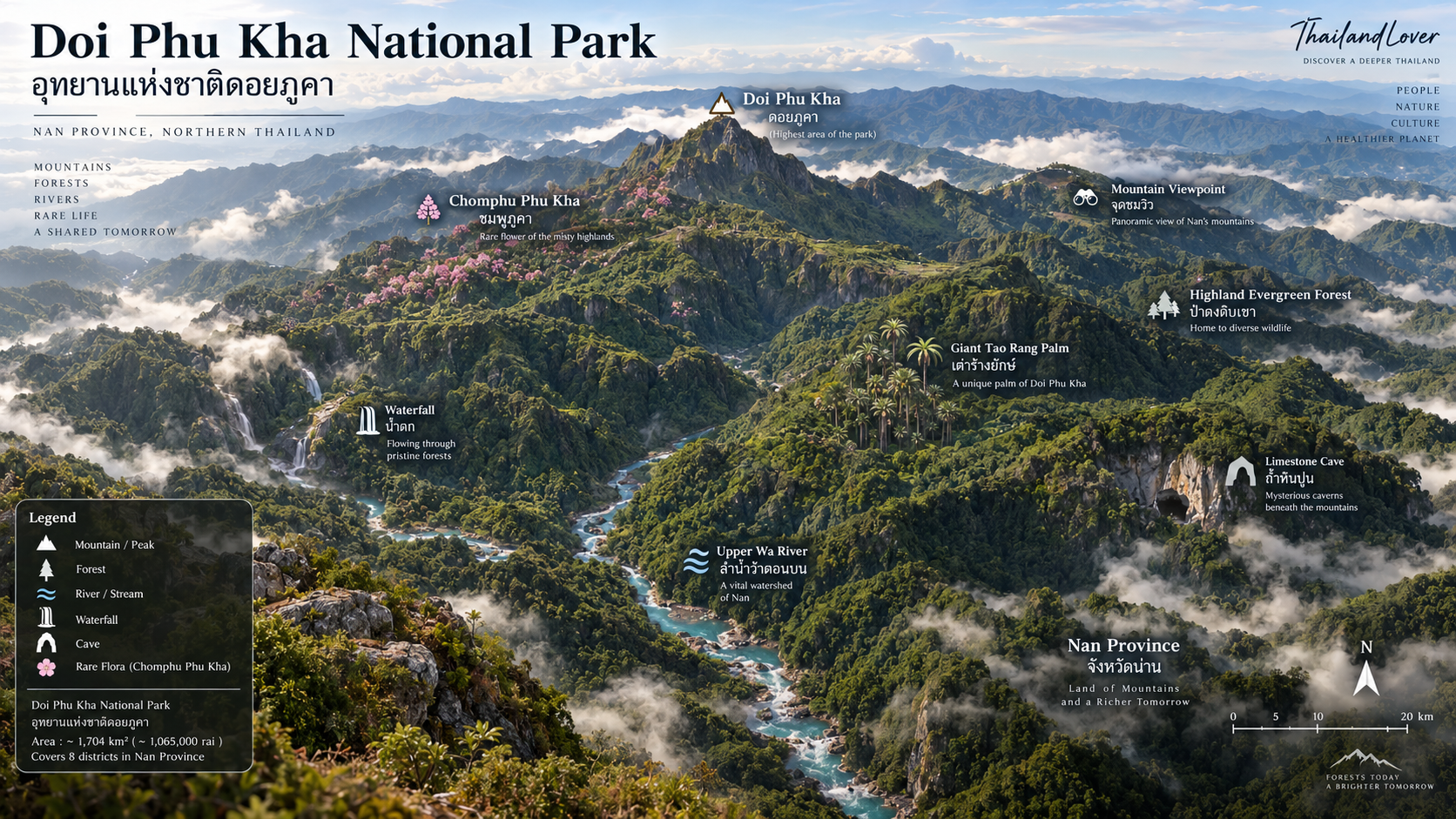
Doi Phu Kha National Park (อุทยานแห่งชาติดอยภูคา) is a vast highland wilderness in Nan Province, Northern Thailand — a protected mountain landscape of cloud-covered ridges, evergreen forest, headwater streams, waterfalls, caves and rare plants found almost nowhere else in the country. Covering approximately 1,704 square kilometres across eight districts, it is one of Nan’s great conservation landscapes rather than a single viewpoint destination.
There are mountains in Thailand that people visit for the view.
And then there are mountains that make you understand why an entire landscape needs to be protected.
Doi Phu Kha National Park is the latter.
Stretching across the high country of Nan, this is one of northern Thailand’s great wilderness areas — a highland world of ridges, deep forest, waterfalls, caves and plants that give the mountain its conservation importance.
Its most famous botanical treasure is the Chomphu Phu Kha, a rare flowering tree whose discovery in Nan transformed how the mountain is understood. Nearby, the enormous Giant Tao Rang Palm adds another layer to the park’s botanical character.
But Doi Phu Kha is more than a place to come and see a famous flower. It is a landscape. A watershed. A mountain ecosystem.
And one of the places where Nan feels most genuinely wild.
What is Doi Phu Kha National Park?
Doi Phu Kha National Park is a protected highland forest and watershed landscape in Nan Province, Northern Thailand, known for rare flora, mountain scenery, caves, waterfalls and trekking.
Where is Doi Phu Kha National Park?
It is in Nan Province in Northern Thailand, covering parts of eight districts: Pua, Chiang Klang, Thung Chang, Mae Charim, Tha Wang Pha, Santisuk, Bo Kluea and Chaloem Phra Kiat.
Why is Doi Phu Kha National Park famous?
The park is best known for its mountain landscape, extensive protected forest and rare plants — particularly the Chomphu Phu Kha and Giant Tao Rang Palm.
- Highland evergreen forest and headwater streams feeding the Nan River system
- Chomphu Phu Kha flowering, generally around February to March
- Giant Tao Rang Palm on steep mountain slopes
- Viewpoints, waterfalls, limestone caves and longer trekking routes such as Doi Phu Wae
When is the best time to visit Doi Phu Kha?
November to January is generally the most comfortable period for hiking and clear mountain views. February to March is the main Chomphu Phu Kha flowering season. May to October brings greener forest, stronger waterfalls and more mist, with wetter roads and trails.
Doi Phu Kha National Park at a Glance
- Official Name
- Doi Phu Kha National Park
- Thai Name
- อุทยานแห่งชาติดอยภูคา
- Province
- Nan
- Region
- Northern Thailand
- Area
- Approximately 1,704 km² / 1,065,000 rai
- National Park No.
- 94
- Established
- 17 June 1999
- Districts
- Pua, Chiang Klang, Thung Chang, Mae Charim, Tha Wang Pha, Santisuk, Bo Kluea and Chaloem Phra Kiat
- Landscape
- High mountain ranges, valleys, forests, cliffs, caves and streams
- Highest Mountain
- Doi Phu Kha
- Signature Flora
- Chomphu Phu Kha · Giant Tao Rang Palm
- Best Known For
- Rare flora, mountain scenery, forests, waterfalls and trekking
Doi Phu Kha covers approximately 1,704 square kilometres, extending across eight districts of Nan. It was officially designated Thailand’s 94th national park in 1999, according to the Department of National Parks, Wildlife and Plant Conservation.
Why Doi Phu Kha Matters
Doi Phu Kha is not simply another mountain destination in Northern Thailand.
The park occupies a vast section of the Luang Prabang mountain range and the eastern Phi Pan Nam mountain system, forming an important forest and watershed landscape in Nan.
Much of the park functions as headwater forest, helping feed streams and rivers that eventually form part of the Nan River system.
This gives the landscape an importance that goes far beyond tourism.
The forest protects water. The mountains protect biodiversity. And the altitude creates habitats where plants found nowhere else in Thailand can survive.
This combination is what makes Doi Phu Kha one of Nan’s most significant natural landscapes.
The Landscape
Doi Phu Kha is a highland environment rather than a single scenic viewpoint.
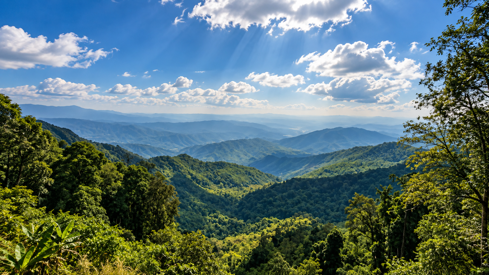
Mountain ridges rise and fold into one another across a huge area, creating a landscape of steep slopes, narrow valleys, forested peaks and headwater streams.
The further you move away from the developed areas, the more the landscape changes from a conventional sightseeing destination into a true mountain wilderness.
Clouds frequently gather around the higher ridges, particularly during the rainy and cooler seasons.
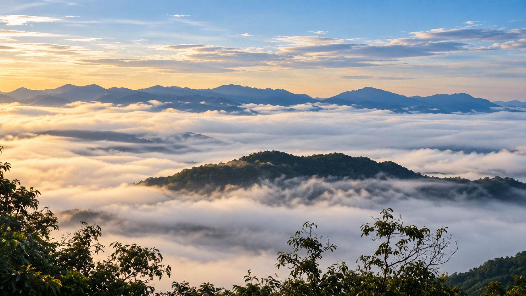
In the early morning, valleys can disappear beneath layers of mist. By midday, the mountains may emerge again, revealing ridge after ridge stretching across Nan.
This constantly changing relationship between mountain, cloud and forest is one of Doi Phu Kha’s strongest visual characteristics.
The Forest
The forest is the real attraction.
Doi Phu Kha protects a mosaic of highland and mountain forest habitats, including areas of montane evergreen forest and other forest types associated with elevation and local conditions.
The higher forests are particularly important because they support rare plants adapted to cooler, wetter mountain environments.
The park has become particularly famous among botanists and nature enthusiasts because several rare and remarkable species occur here.
- Chomphu Phu Kha
- Giant Tao Rang Palm
- Kra Thon Phra Ruesi
- Phu Kha Maple
- Rare orchids and other highland plants
The Department of National Parks describes Doi Phu Kha as an important concentration of rare and threatened flora.
Chomphu Phu Kha
The Flower That Became a Symbol of Nan
If there is one plant that has come to define Doi Phu Kha, it is Chomphu Phu Kha.
Its scientific name is Bretschneidera sinensis Hemsl.
The tree is rare and highly significant from a conservation perspective. It was rediscovered in Thailand in 1989 during botanical surveys by forest botanist Dr. Thawatchai Santisuk. At the time, the species was already considered extremely rare.
The tree can grow to considerable height and is associated with the cool, moist mountain forests of Doi Phu Kha. Its most recognizable feature is its delicate clusters of pink flowers.
The flowering season is generally associated with February to March, when the flowers create one of the park’s most distinctive seasonal spectacles.
For ThailandLover, however, the Chomphu Phu Kha is interesting for more than photography.
It represents something deeper:
The discovery of a species can change the way an entire mountain is understood.
Doi Phu Kha is not simply a beautiful place where a rare flower happens to grow. The flower is evidence of the ecological uniqueness of the mountain.
The Giant Tao Rang Palm
A Prehistoric-Looking Giant of the Highland Forest
Another extraordinary plant associated with Doi Phu Kha is the Giant Tao Rang Palm.
This enormous palm is adapted to steep mountain slopes and high-elevation evergreen forest. Some mature specimens can reach extraordinary proportions, with huge pinnate leaves that give the plant an almost prehistoric appearance.
The species is considered rare and threatened, and Doi Phu Kha is one of its most important known habitats. It is particularly associated with elevations around 1,500–1,700 metres in the mountain forest.
This is one of those details that makes Doi Phu Kha different from a conventional mountain destination.
You are not simply walking through “green forest”.
You are entering a botanical landscape containing living species with extremely unusual ecological histories.
A Living Botanical Landscape
Doi Phu Kha has become important to botanists because of its concentration of rare plants.
- Chomphu Phu Kha
- A rare flowering tree and the botanical symbol most closely associated with the park.
- Giant Tao Rang Palm
- A large and unusual highland palm found in steep evergreen forest.
- Kra Thon Phra Ruesi
- A root-parasitic plant associated with forest habitats.
- Phu Kha Maple
- A distinctive maple species associated with the highlands.
- Orchids and ferns
- The cool, humid mountain environment provides suitable habitat for a wide variety of orchids, ferns, mosses and other moisture-loving plants.
This botanical diversity is one of the reasons Doi Phu Kha should be viewed as a conservation landscape first and a sightseeing destination second.
Mountains, Clouds & Long-Distance Views
The higher elevations of Doi Phu Kha provide some of Nan’s most dramatic mountain scenery.
Unlike isolated peaks, the landscape here is dominated by interconnected ridges. From elevated viewpoints, the mountains appear to roll endlessly toward the horizon.
During the cooler season, early mornings can bring:
- Sea-of-cloud conditions
- Mist-filled valleys
- Layered mountain silhouettes
- Exceptionally clear skies
- Dramatic sunrise light
The experience is less about one iconic viewpoint and more about watching an entire mountain system slowly reveal itself.
Doi Phu Wae
A Mountain for the Serious Hiker
Within the broader Doi Phu Kha landscape, Doi Phu Wae represents a more adventurous side of Nan.
The mountain landscape is characterized by steep terrain, grass-covered ridges and exposed rocky areas.
The route is not designed as a casual walk. Long-distance trekking in this area can require preparation, local coordination and, depending on the route and current park regulations, assistance from park personnel.
For experienced hikers, however, this is where Doi Phu Kha becomes particularly rewarding.
The reward is not simply reaching a summit.
It is moving through a remote highland landscape where the scale of the forest becomes much more apparent.
Waterfalls
Doi Phu Kha contains numerous waterfalls and mountain streams.
Among the waterfalls and water features associated with the park are:
- Phu Fa Waterfall
- Mae Charim Waterfall
- Ton Tong Waterfall
- Tat Luang Waterfall
- Wang Pian Waterfall
These waterfalls vary considerably in accessibility, scale and seasonal water flow. Some are best appreciated during the wetter months, while others become destinations for forest walks and nature exploration.
The important point is that waterfalls here are not isolated attractions. They are part of the same mountain watershed system that defines the park.
Caves & Karst Landscapes
Doi Phu Kha is also a significant cave landscape. Formations throughout the park reflect the geological diversity of Nan’s mountains and provide habitats for bats, insects and other cave-adapted organisms.
Pha Daeng Cave
Pha Daeng Cave, located in the Ban Mani Phruek area of Thung Chang District, is described by the Department of National Parks as one of the most beautiful and longest caves in Doi Phu Kha National Park.
Inside are stalactites, stalagmites, underground water, streams and a waterfall.
The cave demonstrates another side of Doi Phu Kha: the landscape continues beneath the forest surface.
The mountain is not only a system of peaks and valleys. It is also a world of limestone chambers and underground water.
For visitors, caves offer an experience completely different from the open mountain viewpoints. The forest is bright, expansive and atmospheric. The cave environment is dark, enclosed and geological.
Together, they reveal two very different faces of the same landscape.
The Ancient Sea Beneath Nan
One of the most fascinating geological stories associated with the Doi Phu Kha region is that parts of Northern Thailand were once connected to ancient marine environments.
Evidence of ancient marine life has been found in the wider Nan mountain region, including fossil shell deposits dating back roughly 200 million years.
The discovery of ancient marine fossils in the Doi Phu Kha region provides a remarkable reminder that the mountains visible today were formed through geological processes operating over immense periods of time.
This makes the landscape particularly interesting from a geological perspective.
The mountains are not simply “old”.
They are the visible result of a much older geological story.
Wildlife
A large protected forest such as Doi Phu Kha provides habitat for a wide variety of wildlife.
The park’s mountain forests support mammals, birds, reptiles, amphibians and insects, although many species are rarely seen by ordinary visitors.
The most valuable wildlife experience here is therefore not necessarily seeing a large animal. It is entering a functioning forest ecosystem.
Look carefully and you may notice:
- Forest birds moving through the canopy
- Butterflies along forest edges
- Insects on flowering plants
- Frogs and amphibians near streams
- Signs of larger mammals
- Birds of prey above mountain ridges
For wildlife enthusiasts, patience is more valuable than speed.
Birdwatching
Doi Phu Kha’s elevation gradient and diverse forest habitats make it particularly interesting for birdwatchers.
The combination of evergreen forest, mountain ridges, streams, forest edges, flowering plants and different elevations creates a variety of bird habitats.
Early morning is generally the best period for serious observation. The forest is cooler, quieter and more active before the heat of the day develops.
Bring binoculars rather than expecting wildlife to come close.
This is a forest, not a zoo.
Nature Trails & Hiking
Doi Phu Kha offers both easier nature walks near the headquarters and more demanding mountain trekking deeper in the park.
The Doi Phu Kha Nature Trail
Near the park headquarters is a nature-study route associated with the park’s botanical attractions.
One documented route is approximately 3.5 kilometres and passes through recovering forest before entering older, denser mountain forest.
Along the route, visitors can experience changing forest structure and see important plants including Chomphu Phu Kha and Giant Tao Rang Palm.
The route is particularly valuable because it demonstrates ecological succession — how forest can recover after disturbance and gradually develop into more mature forest communities.
For ThailandLover, this is one of the experiences worth emphasizing.
It is not simply a “trek”.
It is a walk through the ecological story of the mountain.
Longer Doi Phu Kha hiking and trekking routes, including Doi Phu Wae, require more preparation and are a different experience from this shorter nature trail.
What Doi Phu Kha Feels Like
Doi Phu Kha has a very different personality from Thailand’s more famous mountain destinations.
It is not as heavily commercialized as some of the country’s best-known national parks. It does not depend on a single viewpoint. And it does not reveal everything immediately.
Its character develops slowly.
First comes the road climbing into the mountains. Then the temperature changes. Then the forest becomes denser. Clouds begin to move across the ridges. The sound of traffic disappears.
Eventually, the landscape becomes less about “seeing an attraction” and more about being inside a mountain ecosystem.
That is the essence of Doi Phu Kha.
Best Time to Visit
November to January is generally the most comfortable period for hiking and clear mountain views. February to March is the main season for Chomphu Phu Kha flowers. May to October brings greener forest, stronger waterfalls and more mist, with wetter mountain roads and trails. Seasonal conditions can vary, so current park information is worth checking before travel — see also ThailandLover’s guide to when to go.
November – January
Cool Mountain Season
This is one of the most comfortable periods for exploring the higher elevations.
Expect cooler mornings, clear mountain views and a good atmosphere for hiking and camping. Early mornings can be particularly atmospheric when mist settles over the valleys.
February – March
Chomphu Phu Kha Season
This is the signature botanical season. The rare Chomphu Phu Kha begins flowering, generally around February–March.
If the purpose of the trip is specifically to see the flower, timing matters. Flowering intensity and exact timing can vary with weather and local conditions, so visitors should check current information with the park before travelling.
May – October
Green Mountain Season
The rainy season transforms the landscape. Forests become intensely green. Streams and waterfalls are generally more active. Clouds and mist become a major part of the scenery.
For photographers and nature lovers, this can be one of the most beautiful times to experience the park. However, mountain roads and trails can become wet and slippery.
Who Should Visit Doi Phu Kha?
- Nature lovers
- For people who want forests rather than entertainment.
- Photographers
- Especially those interested in mist, mountain landscapes, botanical details and atmospheric forest scenes.
- Hikers
- Particularly those looking for longer and more demanding mountain experiences.
- Birdwatchers
- The variety of elevations and forest habitats creates good potential for bird observation.
- Botanical enthusiasts
- Doi Phu Kha is one of Thailand’s most interesting destinations for rare mountain flora.
- Slow travellers
- The park works particularly well for travellers who prefer to spend time in one landscape rather than rush between attractions.
Who might not enjoy it?
Doi Phu Kha is probably not the ideal choice if your priority is nightlife, shopping, highly developed tourist infrastructure, short photo stops, large entertainment attractions or guaranteed wildlife sightings.
The park rewards curiosity, patience and preparation.
How to Get There
The most practical approach for most independent travellers is to travel through Pua District.
From Nan town, the route generally follows the Nan–Pua corridor before continuing toward the Doi Phu Kha mountain area. The park headquarters is in the Pua side of the mountain landscape.
A commonly cited route is approximately 60 km from Nan to Pua, followed by approximately 25 km toward Doi Phu Kha National Park.
Driving yourself or using a rental car provides considerably more flexibility because the park covers a very large area and attractions are spread across different parts of the mountain system. For broader trip logistics, see ThailandLover’s notes on getting around Thailand.
Where to Stay
The national park provides accommodation and camping facilities around the headquarters area.
Accommodation availability, reservation arrangements, trail access and seasonal services can change. Travellers should therefore confirm current conditions directly with the park before departure rather than relying on old opening hours or accommodation information.
The Department of National Parks currently lists park accommodation facilities, including cabins within the headquarters zone. The Tourism Authority of Thailand also maintains a destination listing for the park.
A Better Way to Experience Doi Phu Kha
Don’t try to “complete” Doi Phu Kha in one rushed day. The park is too large and geographically diverse for that.
A better approach is to divide the experience into three layers.
- Layer 01 — The Mountain
- Drive into the highlands. Stop at viewpoints. Watch the clouds. Understand the scale of the landscape.
- Layer 02 — The Forest
- Walk a nature trail. Look for rare plants. Listen for birds. Study the structure of the forest.
- Layer 03 — The Wilderness
- If properly prepared, venture deeper into trekking routes, caves or remote mountain areas with appropriate local guidance. This is where Doi Phu Kha changes from a sightseeing destination into an adventure landscape.
Responsible Travel
Doi Phu Kha is an important conservation area. Visitors should treat the forest accordingly.
Do
- Stay on designated trails
- Carry out all rubbish
- Keep noise low
- Use established camping areas
- Respect wildlife
- Follow park instructions
- Use local guides where required
- Photograph rare plants without touching or damaging them
Don’t
- Pick flowers or plants
- Collect seeds or natural objects
- Feed wildlife
- Enter restricted areas
- Leave food waste behind
- Use loud music in forest areas
- Assume every trail is safe simply because it appears accessible
A rare plant may look like an ordinary plant to someone who does not know what it is. Leave it where it belongs.
Doi Phu Kha & Nan
One of the reasons Doi Phu Kha works so well as part of a Nan journey is that the park connects naturally with the character of the province.
Nan is not a destination that needs to be experienced at high speed.
A typical journey can combine:
Nan City → Pua → Doi Phu Kha → Bo Kluea → mountain villages → return to Nan
This creates a journey through several different expressions of Northern Thailand: historic Lanna culture, Tai Lue communities, mountain agriculture, highland forests, salt-making traditions, coffee and tea landscapes, national parks and remote mountain roads.
Doi Phu Kha is therefore not simply a stop. It can become the natural backbone of a Northern Nan road trip, especially when paired with neighbouring parks such as Si Nan National Park, Mae Charim National Park and Khun Nan National Park.
Essential Information
- Official Name
- Doi Phu Kha National Park
- Province
- Nan, Thailand
- Area
- Approximately 1,704 km² / 1.065 million rai
- National Park
- No. 94
- Established
- 17 June 1999
- Districts
- Pua · Chiang Klang · Thung Chang · Mae Charim · Tha Wang Pha · Santisuk · Bo Kluea · Chaloem Phra Kiat
- Signature features
- Doi Phu Kha · Chomphu Phu Kha · Giant Tao Rang Palm · highland evergreen forest · mountain viewpoints · waterfalls · limestone caves · headwater streams · Doi Phu Wae
- Ideal duration
- 1–2 days for a basic visit; 2–4 days for hiking and slower exploration
Frequently Asked Questions
- Where is Doi Phu Kha National Park?
- Doi Phu Kha National Park is in Nan Province in Northern Thailand, covering parts of eight districts across the province: Pua, Chiang Klang, Thung Chang, Mae Charim, Tha Wang Pha, Santisuk, Bo Kluea and Chaloem Phra Kiat.
- Why is Doi Phu Kha National Park famous?
- It is best known for its mountain landscape, extensive protected forest and rare plants — particularly the Chomphu Phu Kha and Giant Tao Rang Palm.
- When can I see Chomphu Phu Kha flowers?
- The main flowering period is generally February to March, although actual flowering can vary according to local weather conditions.
- Is Doi Phu Kha good for hiking?
- Yes. The park contains nature trails and more demanding mountain trekking routes. Some remote routes require advance preparation and local or park guidance.
- Can I stay overnight?
- Yes. The park has accommodation and camping facilities, although availability and conditions should be confirmed with the park before travelling.
- Is Doi Phu Kha suitable for families?
- The developed headquarters area and easier nature experiences can work for families. More demanding trekking routes are better suited to visitors who are physically prepared for mountain terrain.
- Is Doi Phu Kha worth visiting during the rainy season?
- Yes, if you enjoy lush forests, waterfalls, mist and dramatic mountain atmosphere. However, wet-weather travel requires greater care on mountain roads and trails.
- How long should I spend at Doi Phu Kha?
- For a basic experience, allow 1–2 days. For hiking, botanical exploration and a slower mountain journey, 2–4 days is more appropriate.
- What should I bring?
- Comfortable hiking shoes, light rain protection, warm layers for high elevations, drinking water, insect protection, binoculars, camera, power bank, a small first-aid kit and a reusable water bottle. For overnight trekking, follow the equipment requirements provided by the park or local guide.
Related Destinations
- Si Nan National Park
- Another Nan mountain and forest landscape for travellers continuing through the province.
- Mae Charim National Park
- A Nan park associated with the Mae Charim landscape and the wider river-and-forest country east of Nan town.
- Khun Nan National Park
- A neighbouring Nan highland park for a slower northern mountain itinerary.
- Doi Pha Hom Pok National Park
- Thailand’s second-highest mountain — summit trekking, Kiew Lom camping and Fang Hot Springs in Chiang Mai.
- Doi Luang National Park
- A vast mountain wilderness across Chiang Rai, Phayao and Lampang — limestone waterfalls and forested ridges.
- Doi Pha Klong National Park
- A compact stone landscape in Phrae — Coral Rock Mountain, Erawan Cave and the Yom River.
- Northern Thailand national parks
- More mountains, forests and protected landscapes across ThailandLover’s Nature & Parks collection.
Location
Find Doi Phu Kha National Park
Pua, Nan, Northern Thailand