

National Park · Chiang Mai
Pha Daeng National Park
อุทยานแห่งชาติผาแดง
Where Northern Thailand's Mountains Begin to Feel Wild
Chiang Dao · Wiang Haeng · Chai Prakan, Northern Chiang Mai
Come for the waterfall. Stay for the forest. Wake up above the clouds. Listen to the river — and take a moment to understand where the water begins.
A Living Mountain System
Far in the mountains of northern Chiang Mai, Pha Daeng National Park protects a vast landscape of limestone mountains, highland forests, caves, waterfalls, hot springs, headwaters and wildlife.
Located across Chiang Dao, Wiang Haeng and Chai Prakan districts, the park occupies approximately 1,123 square kilometres (702,085 rai) of mountainous terrain. The forests help protect the headwaters of the Ping and Mae Taeng river systems, while the mountains provide habitat for a remarkable variety of wildlife, birds, insects and plants.
The park is also closely connected ecologically with the Chiang Dao Wildlife Sanctuary, creating a much larger highland forest landscape in northern Thailand.
For travelers, Pha Daeng offers something different from the better-known mountain destinations around Chiang Mai. There is no need for crowds, elaborate attractions or artificial experiences.
Instead, there are mountains. Forest. Water. Stone. Mist. And the quiet feeling of being close to the northern wilderness.
Pha Daeng National Park at a Glance
- 1,123 km²
- Approximately 702,085 rai of mountainous northern Chiang Mai forest.
- 1,794 m
- Doi Puk Phakka — the park's highest point above sea level.
- 400–1,800 m
- Elevation range that shapes climate, forest and wildlife habitat.
- Water story
- Waterfalls, hot springs, caves and Ping–Mae Taeng headwaters.
- Official name
- Pha Daeng National Park
- Thai name
- อุทยานแห่งชาติผาแดง
- Former name
- Chiang Dao National Park
- Province
- Chiang Mai
- Districts
- Chiang Dao, Wiang Haeng and Chai Prakan
- Park headquarters
- Mueang Na Subdistrict, Chiang Dao District
- Approximate area
- 1,123 km² · 702,085 rai
- Highest point
- Doi Puk Phakka · approx. 1,794 m
- Landscape
- Mountain ranges, limestone terrain, caves, forests, streams and waterfalls
- Main forest types
- Dry evergreen, hill evergreen, pine, mixed deciduous and dry dipterocarp
- Signature experiences
- Waterfalls, hot springs, mountain landscapes, caves, birdwatching, wildlife and highland nature
- Major attractions
- Sri Sangwan Waterfall · Pong Ang Hot Springs · Doi Kham Fa · Khun Nam Ru · forest trails
- Contact
- Pha Daeng National Park, Mueang Na, Chiang Dao, Chiang Mai 50170
The Department of National Parks describes the park as a complex mountainous landscape ranging from approximately 400 to 1,800 metres above sea level, with Doi Puk Phakka reaching approximately 1,794 metres.
Where Is Pha Daeng National Park?
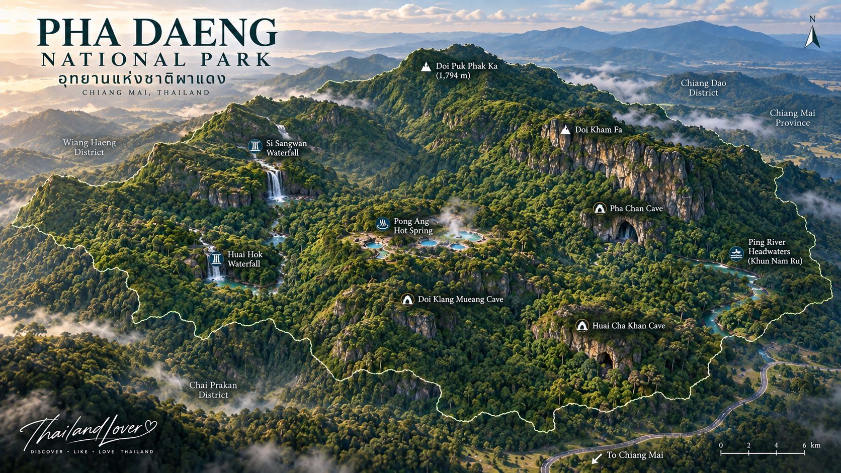
Pha Daeng National Park is located in northern Chiang Mai Province, north of the main Chiang Mai urban area. The park extends across three districts:
- Chiang Dao
- Wiang Haeng
- Chai Prakan
The park headquarters and principal visitor facilities are located in Mueang Na Subdistrict, Chiang Dao District. Its northern and western mountain landscapes lie close to the international border with Myanmar.
This location places Pha Daeng within one of northern Thailand's most important highland forest regions.
Pha Daeng and Chiang Dao
The name Chiang Dao is strongly associated with the spectacular limestone mountain of Doi Chiang Dao. Travelers should understand an important distinction.
Pha Daeng National Park is not the same protected area as Chiang Dao Wildlife Sanctuary.
Doi Chiang Dao itself is associated with the Chiang Dao Wildlife Sanctuary, while Pha Daeng National Park protects a much broader mountainous landscape surrounding the region. The two areas are ecologically connected, and official descriptions note that Pha Daeng forms part of the same broader forest landscape as the Chiang Dao protected area.
A visit to Pha Daeng does not automatically mean you are visiting the summit of Doi Chiang Dao.
From Chiang Dao National Park to Pha Daeng
Pha Daeng National Park was formerly known as Chiang Dao National Park. The protected area was officially established in 2000, and historical references identify it as Thailand's 99th national park. The name was subsequently changed to Pha Daeng National Park.
The current name reflects the Pha Daeng mountain landscape rather than suggesting that the park is synonymous with Doi Chiang Dao. That is why older travel guides may still refer to Chiang Dao National Park, while current official information uses Pha Daeng National Park.
A Mountain Landscape Between Forest and Border
Pha Daeng is characterized by complicated mountain terrain. The park's eastern section contains extensive layered and limestone mountain formations, while the western side contains larger forest-covered mountains.
Important peaks and mountain areas named by the Department of National Parks include Doi Tham Klaep, Doi Hua Tho, Doi Khun Huai Sai, Doi Pha Daeng, Doi Tham Ngop, Doi Dan Fak, Doi Kamphra, Doi Puk Phakka, Doi Lek Chi, Doi San Kiw Khom Phra, Doi Kiw Hlom, Doi Thuai and Doi Yang Klo.
The central portion of the park contains lower valleys and mountain basins, including areas around Doi Tham Yung and Doi Khun Pao. This varied topography helps explain the park's unusually diverse habitats.
Elevation
Terrain ranges from approximately 400 metres → 1,800 metres above sea level, with Doi Puk Phakka reaching approximately 1,794 metres.
Elevation affects temperature, rainfall, vegetation, cloud formation, wildlife habitat, seasonal flowering and forest structure. For travelers, that means two places within the same national park can feel completely different — a low-elevation waterfall can be warm and humid; a high mountain campsite can be cold and misty.
That vertical range is one of Pha Daeng's defining characteristics.
The Forests of Pha Daeng
The park protects several forest types that create a mosaic of habitats across the mountains.
- Dry evergreen
- Dense evergreen vegetation in areas with suitable moisture and elevation.
- Hill evergreen
- Higher elevations — cooler, wetter mountain environments.
- Pine forest
- Mountain pine landscapes in parts of the highland environment.
- Mixed deciduous
- Forest that changes dramatically with the seasons.
- Dry dipterocarp
- More open forest adapted to seasonal dryness.
A Forest of Water
One of Pha Daeng's most important functions is not immediately visible from a viewpoint. The mountains are a major watershed. The forests protect headwaters associated with the Ping River and Mae Taeng River systems.
Rain falls on the mountains. The forest captures water. Streams form. Water moves through valleys. And these waterways eventually become part of much larger river systems supporting ecosystems and communities downstream.
The conservation value of Pha Daeng is much greater than its tourism attractions alone.
Khun Nam Ru — a sacred headwater landscape
One of the most interesting experiences in Pha Daeng is the journey toward Khun Nam Ru, an important headwater area. From the national park headquarters, the route requires approximately two hours of walking according to local tourism information.
Khun Nam Ru is characterized by a small stream emerging from the mountain. For local communities, the headwater has cultural significance — traditional ceremonies associated with the beginning of the agricultural season have been held in the area, including rituals connected with forest conservation.
Nature + water + community + culture.
Why headwaters matter
A spring or small mountain stream can appear insignificant. Ecologically, it can be the beginning of an entire river system. Forests surrounding headwaters help hold soil in place, slow water movement, maintain moisture, reduce erosion, support aquatic ecosystems and supply downstream waterways.
Sri Sangwan Waterfall
A limestone cascade in the forest
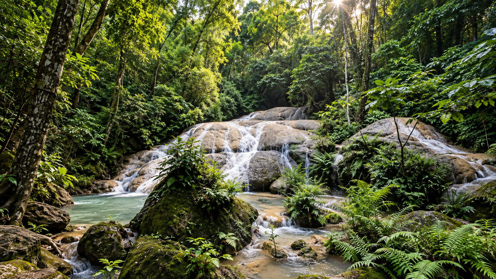
Sri Sangwan Waterfall is one of the most accessible and recognizable attractions in Pha Daeng National Park — a limestone waterfall with water flowing over a series of natural limestone surfaces. The main waterfall is approximately 20 metres high, according to official tourism information. The setting is shaded by forest, making the area particularly pleasant for visitors looking for a cool natural environment. It is especially attractive during periods of stronger rainfall.
The layers of Sri Sangwan
Tourism information describes the waterfall as a series of approximately four limestone levels, with individual sections given poetic Thai names:
- 1 · Khanueang Ha
- First limestone step in the cascade sequence.
- 2 · Chong Thara
- A middle layer where water continues across the stone.
- 3 · Ngam Nathi
- Another poetic step in the limestone series.
- 4 · Sri Sangwan
- The signature level that gives the waterfall its name.
Rather than a single vertical drop, water moves across multiple limestone steps — a softer, more natural landscape than a single plunging waterfall.
Water and geology
Limestone is soluble rock. Over long periods, flowing water can gradually dissolve and reshape surfaces into cascades, pools, small channels, cavities and limestone shelves. The waterfall is therefore not simply a place where water falls — it is a visible example of the interaction between water and geology.
Pong Ang Hot Springs
Hot water from beneath the forest
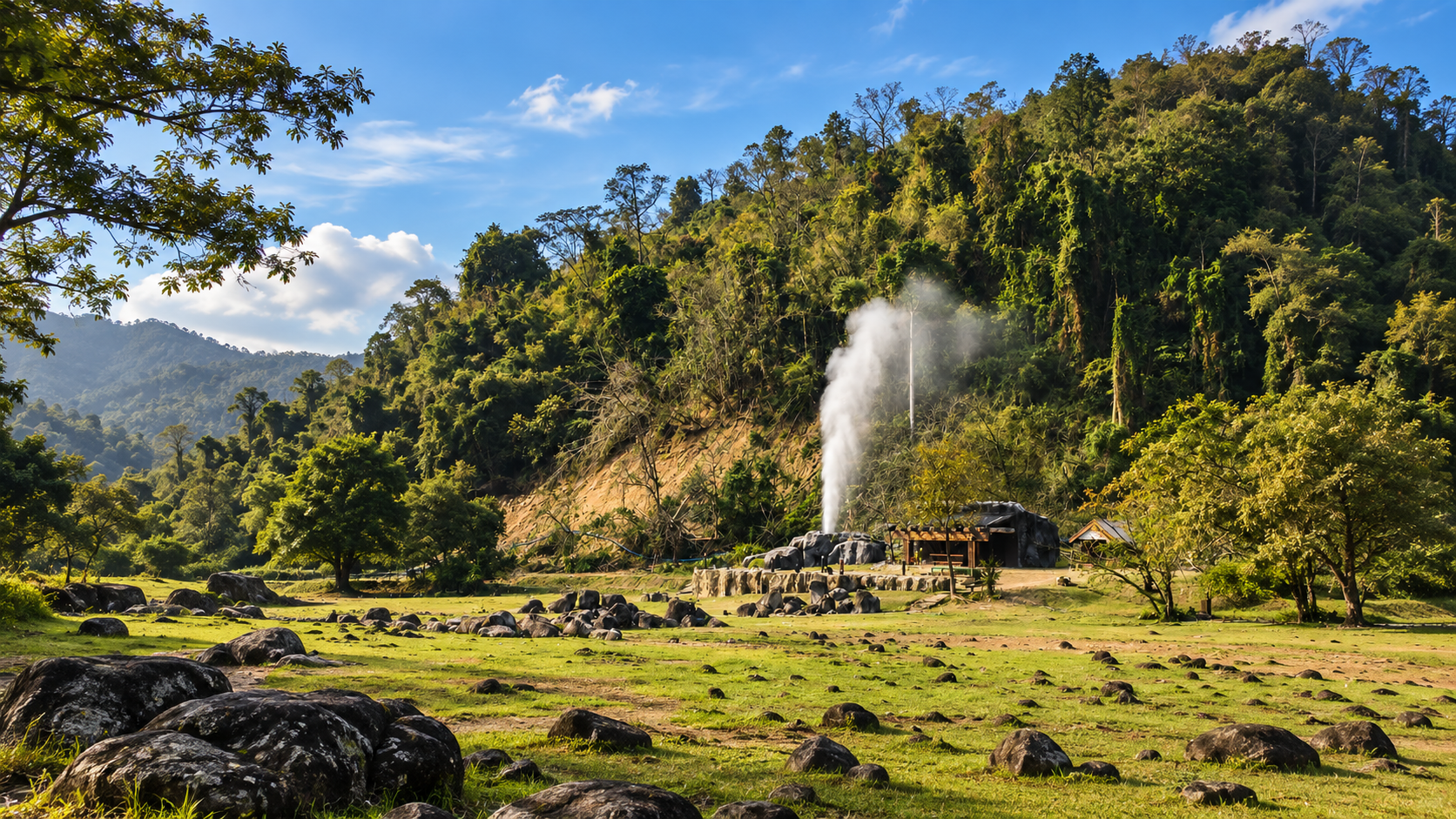
Pong Ang Hot Springs is one of Pha Daeng's most distinctive natural attractions. The site contains two small natural hot-water pools where geothermal water emerges from underground. Official information describes the water temperature at approximately 70–80°C. The hot water flows continuously and joins into a small stream. The park has developed portions of the stream into natural-style soaking pools where visitors can enjoy the hot mineral water at a much safer temperature than the source itself.
What makes Pong Ang interesting?
The experience is not simply “taking a hot bath.” Water circulates beneath the ground. Heat from deeper geological layers raises the temperature. The heated water rises toward the surface. Gases and steam may escape. And the result is a natural hot spring emerging in the middle of a forest environment.
Geology + water + forest + relaxation.
Official information describes the springs as two small pools approximately 4–5 metres wide, associated with gases, sulfur and visible steam. Water flows throughout the year. During cooler weather, steam rising through the forest can create a distinctly northern Thailand experience.
Huai Hok Waterfall
Huai Hok Waterfall is a more remote natural attraction — a single-drop waterfall approximately 20 metres high. Unlike Sri Sangwan, it lies deeper inside the forest. Official tourism information indicates that reaching it requires approximately eight hours of walking from the park headquarters.
This is not a casual sightseeing stop. It is an experience for visitors with appropriate fitness, equipment and preparation — and access should always be confirmed with park staff before attempting the route.
Doi Kham Fa
A highland viewpoint above the forest
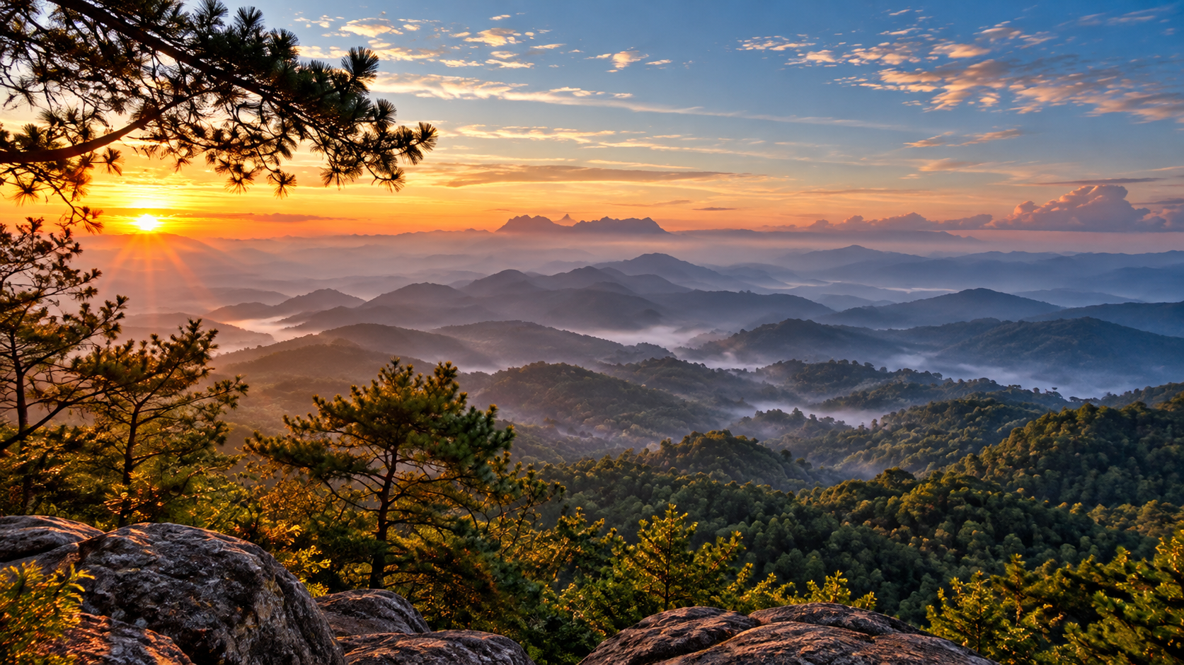
Doi Kham Fa is one of Pha Daeng's most scenic highland destinations — known for mountain panoramas, sea-of-mist conditions, sunrise, winter atmosphere, highland forest and seasonal flowering. The area has camping facilities managed by the national park, although access and seasonal operation can change.
Sea of mist
During cool and humid mornings, clouds and mist can accumulate over valleys below the mountain. From an elevated viewpoint, the landscape may appear as a white sea of cloud surrounded by mountain ridges. The exact conditions depend on temperature, humidity, rainfall, wind and cloud formation.
Winter at elevation
Temperatures at elevation can be considerably lower than in Chiang Mai's lowlands. Morning conditions can include mist, frost-like condensation, cool wind, clear skies and golden sunrise light. Visitors camping at elevation should prepare for genuinely cold conditions rather than assuming northern Thailand will always be warm.
Wildflowers and seasonal color
Pha Daeng is not primarily a flower park. However, its highland forests support seasonal flowering plants. One of the more recognizable seasonal experiences is the flowering of wild Himalayan cherry, known in Thailand as Nang Phaya Sua Krong. When flowering occurs, sections of the highland landscape can acquire pink tones. Timing varies according to elevation and weather.
Wildlife of Pha Daeng
Pha Daeng's ecological importance is closely related to its extensive forest and connection with the wider Chiang Dao protected landscape. Animals recorded in descriptions of the park include serow, muntjac, red junglefowl and other forest birds, gaur, banteng, various mammals, butterflies, forest insects, resident birds and migratory birds.
The serow
Serows are adapted to steep terrain and rocky landscapes. They are elusive and generally difficult to observe. Their presence is more important as a conservation indicator than as a guaranteed wildlife attraction. If you see one, consider yourself exceptionally fortunate.
Gaur and banteng
The wider protected forest landscape supports large wild bovids such as gaur and banteng. These animals require extensive forest habitat and access to food and water. Visitors should never attempt to approach or follow large mammals.
Birds
The combination of evergreen forest, pine forest, deciduous forest, mountain streams, open forest edges and high-elevation habitats creates opportunities for birdwatching. Species reported from the park and surrounding forest landscape include grey treepies, blue-throated barbets, large minivets, black-crested bulbuls, other resident forest birds and migratory birds.
Butterflies and forest insects
Butterflies become particularly noticeable around streams, damp ground, forest clearings, flowering plants and mineral-rich areas. For macro photographers, Pha Daeng can be rewarding even when large animals remain hidden.
Caves of Pha Daeng
The park contains numerous caves associated with its limestone geology. Among the caves and karst features listed in official tourism information are Pha Chan Cave, Doi Klang Mueang Cave, Huai Cha Khaen Cave and other cave systems.
Some areas may have limited access or require specialist equipment and local guidance. Visitors should never enter restricted caves independently.
Pha Chan Cave
Cave environments are highly sensitive. They may contain bats, cave insects, geological formations, underground water and narrow passages. A cave that looks empty to visitors may contain a functioning ecosystem — always follow local access rules and conservation guidance.
Doi Klang Mueang Cave
Rainwater gradually penetrates cracks in limestone. Over long periods, underground channels develop — some become caves, others underground streams. The visible cave is only one part of a much larger geological process.
Other natural attractions
- Thung Kaeo Waterfall
- Huai Hok Waterfall
- Ob Ping
- Pha Chan Cave · Huai Cha Khaen Cave · Doi Klang Mueang Cave
Accessibility and condition vary. Not every attraction is designed for casual visitors. Always confirm current access with park staff.
Ob Ping
Ob Ping is associated with the mountainous river and stream landscape. The term “Ob” in northern Thai geographical usage can refer to a narrow gorge or constricted passage shaped by water and rock — revealing the relationship between mountain + river + erosion.
Climate, Seasons & Best Time
- Nov–Feb
- Cool season. Most comfortable for mountain travel — Doi Kham Fa, mist, sunrise, highland flowers and camping.
- Dec–Jan
- Best Doi Kham Fa atmosphere — cool-weather camping, mountain views and seasonal flowers, subject to current access.
- Mar–May
- Hot season. Lower elevations warm up; some waterfalls reduce flow. Check fire-risk closures carefully.
- May–Oct
- Rainy season. Greener forest and stronger waterfalls — trails can be slippery; some remote attractions may close.
Pha Daeng is not the same destination throughout the year. In winter: cool air, mist and mountain flowers. In the hot season: dry forest and clear mountain views. In the rainy season: green forest, powerful waterfalls and streams.
The landscape changes — and that is one of the reasons to return.
A Perfect First Visit
If you are visiting Pha Daeng for the first time, do not attempt to cover the entire park. It is simply too large. Instead, choose an experience.
- Option 1 · Easy nature day
- Sri Sangwan Waterfall → Pong Ang Hot Springs → forest surroundings. Nature without a demanding trek.
- Option 2 · Mountain
- Doi Kham Fa → sunset/sunrise → sea of mist → camping. For altitude and mountain atmosphere.
- Option 3 · Nature & culture
- Khun Nam Ru → forest walk → headwater landscape → community context. Understand the park as a watershed.
- Option 4 · Adventure
- Remote waterfall / cave routes — only after confirming access and conditions with park staff.
One-day itinerary
- Morning
- Start at Sri Sangwan Waterfall — cooler forest and better light for photography.
- Late morning
- Continue to Pong Ang Hot Springs. Observe the source; use only designated bathing areas.
- Lunch
- Eat at an appropriate local facility or prepare food according to park rules.
- Afternoon
- Explore accessible forest areas. Keep the pace slow — Pha Daeng is better as a landscape than a checklist.
- Evening
- If staying overnight and current access permits, head toward highland camping. Prepare for significantly cooler temperatures.
Photography Guide
Waterfalls
Sri Sangwan for long-exposure water, limestone textures, forest framing and cascades.
Hot springs
Pong Ang is atmospheric in cooler weather — look for steam, forest, water and morning light.
Mountains
Doi Kham Fa for mountain layers, sunrise, sea of mist and forest silhouettes.
Macro
Butterflies, insects, moss, ferns, wildflowers and water droplets.
What to Bring
Day visit
- Comfortable walking shoes
- Drinking water · insect repellent
- Sunscreen · hat · rain protection
- Small towel · camera · power bank
Mountain camping
- Warm clothing · cold-weather sleeping bag
- Waterproof outer layer · headlamp
- Extra socks · personal medication
- Food and drinking water as required
For cave or remote trekking: appropriate footwear, helmet where required, headlamp, navigation support, first-aid equipment, and local guide or ranger support where required.
Safety & Responsible Travel
Pha Daeng is a real mountain wilderness. Do not underestimate it.
Safety
- Watch for slippery limestone
- Do not approach wildlife — especially gaur, banteng or other large animals
- Be careful near hot springs (source water ~70–80°C)
- Do not enter restricted caves
- Check weather — heavy rain can rapidly change streams
- Follow ranger instructions
Responsible travel
- Stay on designated trails
- Do not collect plants, rocks or insects
- Do not feed wildlife or leave rubbish
- Do not enter closed areas
- Do not damage limestone or disturb caves and bats
- Use only designated camping areas
- Respect local communities and cultural traditions
Leave the mountain as you found it.
Communities, Conservation & Why It Matters
Headwater areas have cultural significance. Local communities have historically depended on the forest and water systems for agriculture and daily life. Khun Nam Ru, for example, has been associated with community rituals connected with the beginning of the agricultural season and forest conservation.
Protected landscapes are not empty spaces — nature and human communities have interacted here for generations.
In 2025, the Department of National Parks reported satellite-detected forest encroachment in parts of Pha Daeng, particularly in Chiang Dao District — highlighting the importance of protecting the Ping River headwater forests. When you visit, you are entering a protected ecosystem that requires ongoing management and conservation.
- Wildlife habitat
- Forest for mammals, birds, insects and other wildlife.
- Watershed
- Mountains and forests protect important headwaters.
- Geological landscape
- Limestone, caves, waterfalls and hot springs reveal geological processes.
- Cultural landscape
- Headwaters and forests connect with local traditions and communities.
What Makes Pha Daeng Different?
Pha Daeng is not Thailand's most famous national park. That is part of its character. It does not depend on one iconic attraction. Instead, it offers a collection of experiences: waterfalls, hot springs, caves, mountain forests, sea of mist, wildlife, headwaters and highland camping.
Pha Daeng vs. Doi Chiang Dao
Pha Daeng is a national park covering a large mountainous area across three districts. Doi Chiang Dao is a major limestone mountain protected within the Chiang Dao Wildlife Sanctuary. Adjacent and ecologically connected — but not the same protected area.
Pha Daeng vs. Doi Kham Fa
Doi Kham Fa is inside Pha Daeng National Park. It is not a separate national park — it is one of the highland attractions within the larger protected landscape.
Who Pha Daeng Is For
Nature lovers
Forest, mountains, wildlife, waterfalls, quiet destinations, hiking, camping and natural hot springs. Less suited to heavily developed entertainment.
Photographers
Morning mist, limestone waterfalls, steam from hot springs, mountain forests, wildlife, birds, butterflies, highland flowers and caves — strong for environmental storytelling.
Birdwatchers
Different elevations create different habitats. Visit early, move quietly and listen before looking — often the bird is heard before it is seen.
Families & adventure
Sri Sangwan and Pong Ang can be relatively accessible — keep children close and never touch hot spring sources. Remote routes need preparation, weather checks and park confirmation first.
Essential Information
- Official name
- Pha Daeng National Park · อุทยานแห่งชาติผาแดง
- Province
- Chiang Mai
- Districts
- Chiang Dao · Wiang Haeng · Chai Prakan
- Park headquarters
- Mueang Na Subdistrict, Chiang Dao District
- Approximate area
- 1,123 km² / 702,085 rai
- Elevation
- Approximately 400–1,800 metres
- Highest point
- Doi Puk Phakka — approximately 1,794 metres
- Major attractions
- Sri Sangwan Waterfall · Pong Ang Hot Springs · Doi Kham Fa · Khun Nam Ru · Huai Hok · Thung Kaeo · Pha Chan Cave · Doi Klang Mueang Cave · Huai Cha Khaen Cave · Ob Ping
- Main experiences
- Mountain landscapes · waterfalls · hot springs · caves · hiking · birdwatching · wildlife · camping · sea of mist · highland flowers
Frequently Asked Questions
- Where is Pha Daeng National Park?
- Pha Daeng National Park is in northern Chiang Mai Province and covers parts of Chiang Dao, Wiang Haeng and Chai Prakan districts.
- What was Pha Daeng National Park called before?
- The park was formerly known as Chiang Dao National Park.
- Is Pha Daeng the same as Chiang Dao Wildlife Sanctuary?
- No. They are separate protected areas, although their forests are ecologically connected.
- Is Doi Chiang Dao inside Pha Daeng National Park?
- Doi Chiang Dao itself is associated with the Chiang Dao Wildlife Sanctuary, not simply with Pha Daeng National Park.
- What is Pha Daeng famous for?
- Mountain forests, waterfalls, limestone landscapes, caves, Pong Ang Hot Springs, Doi Kham Fa and rich wildlife habitat.
- What is the highest mountain in Pha Daeng?
- Doi Puk Phakka — approximately 1,794 metres above sea level.
- How hot is Pong Ang Hot Springs?
- Natural source water is approximately 70–80°C. Use designated bathing areas only.
- How high is Sri Sangwan Waterfall?
- Approximately 20 metres high, with multiple limestone cascades.
- Can I swim at Sri Sangwan Waterfall?
- Swimming and water access depend on current park rules and conditions. Follow signs and ranger instructions.
- Can I visit Doi Kham Fa all year?
- Not necessarily. Doi Kham Fa and its camping area can have seasonal closures — check the latest park announcement before traveling.
- Can I camp at Pha Daeng?
- Yes — DNP lists facilities in several zones including headquarters, Pong Ang and Doi Kham Fa. Availability is subject to current park conditions.
- Is Pha Daeng suitable for birdwatching?
- Yes. Extensive forest and varied elevations support numerous resident and migratory birds.
- Is Pha Daeng suitable for hiking?
- Yes, but difficulty varies. Some attractions are relatively accessible; remote waterfalls and caves can require long walks and proper preparation.
- When is the best time to visit?
- November–February for cool weather, mist and highland scenery. Rainy season for waterfalls and lush forest — with more difficult access. Always check seasonal closures.
Related Destinations
- Doi Pha Hom Pok National Park
- Northern Chiang Mai highland landscapes and cooler mountain air further north.
- Si Lanna National Park
- Another Chiang Mai nature destination for forests, reservoirs and quieter park time.
- Op Luang National Park
- Chiang Mai gorge, river and rock landscapes southwest of the city.
- All Nature & Parks
- Browse ThailandLover's national park guides across the country.
Location
Find Pha Daeng National Park
Mueang Na, Chiang Dao, Chiang Mai 50170 — park extends across Wiang Haeng and Chai Prakan