

National Park · Si Sa Ket · Ubon Ratchathani
Khao Phra Wihan National Park
อุทยานแห่งชาติเขาพระวิหาร
Where the Forest Meets the Frontier
Si Sa Ket · Ubon Ratchathani · Northeastern Thailand
A dramatic sandstone landscape where ancient Khmer history, dry forest and the Thailand–Cambodia frontier meet above the plains of Southeast Asia.
The Borderland Where Nature Meets History
At the southern edge of Thailand’s Isan Plateau, a long sandstone escarpment rises above the plains. Beyond it lies Cambodia. This is the Phanom Dong Rak Mountain Range — a landscape of red sandstone cliffs, dry forests, ancient water sources and archaeological remains stretching along the Thailand–Cambodia frontier.
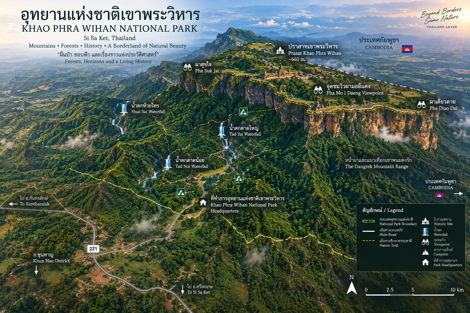
Here, on the Thai side of the mountains, lies Khao Phra Wihan National Park. Covering approximately 81,250 rai, or 130 km², the park extends across Kantharalak District in Si Sa Ket Province and Nam Khun and Nam Yuen districts in Ubon Ratchathani Province. It was officially established on 20 March 1998 as Thailand’s 83rd national park.
Khao Phra Wihan is unlike most national parks. Its significance is not only ecological. It is simultaneously a mountain landscape, a borderland, an archaeological landscape, a cultural heritage zone and one of the most dramatic viewpoints in northeastern Thailand. At its heart is Pha Mo I Daeng — a red sandstone cliff overlooking the Cambodian plains.
Beyond the red sandstone cliffs, nature and history are inseparable — a standout in ThailandLover’s Nature & Parks collection.
At a Glance
- Official Name
- Khao Phra Wihan National Park
- Thai Name
- อุทยานแห่งชาติเขาพระวิหาร
- Region
- Lower Isan, Northeastern Thailand
- Provinces
- Si Sa Ket and Ubon Ratchathani
- Districts
- Kantharalak · Nam Khun · Nam Yuen
- Area
- 81,250 rai / about 130 km²
- National Park
- 83rd national park of Thailand
- Established
- 20 March 1998
- Mountain Range
- Phanom Dong Rak / Dângrêk Mountains
- Typical Elevation
- Approximately 200–500 metres
- Landscape
- Sandstone plateau · cliffs · ridges · dry forest
- Main Forest
- Dry evergreen · mixed deciduous · dry dipterocarp
- Signature Viewpoint
- Pha Mo I Daeng
- Archaeology
- Mo I Daeng bas-reliefs · Twin Stupas · Sra Trao · Don Tuan Sanctuary
- Water
- Khun Si Waterfall · Khun Si Cave · Tat Hai Waterfall · Huai Khon Nun Reservoir
- Dark Sky
- Recognised NARIT dark-sky conservation destination
The Phanom Dong Rak Range
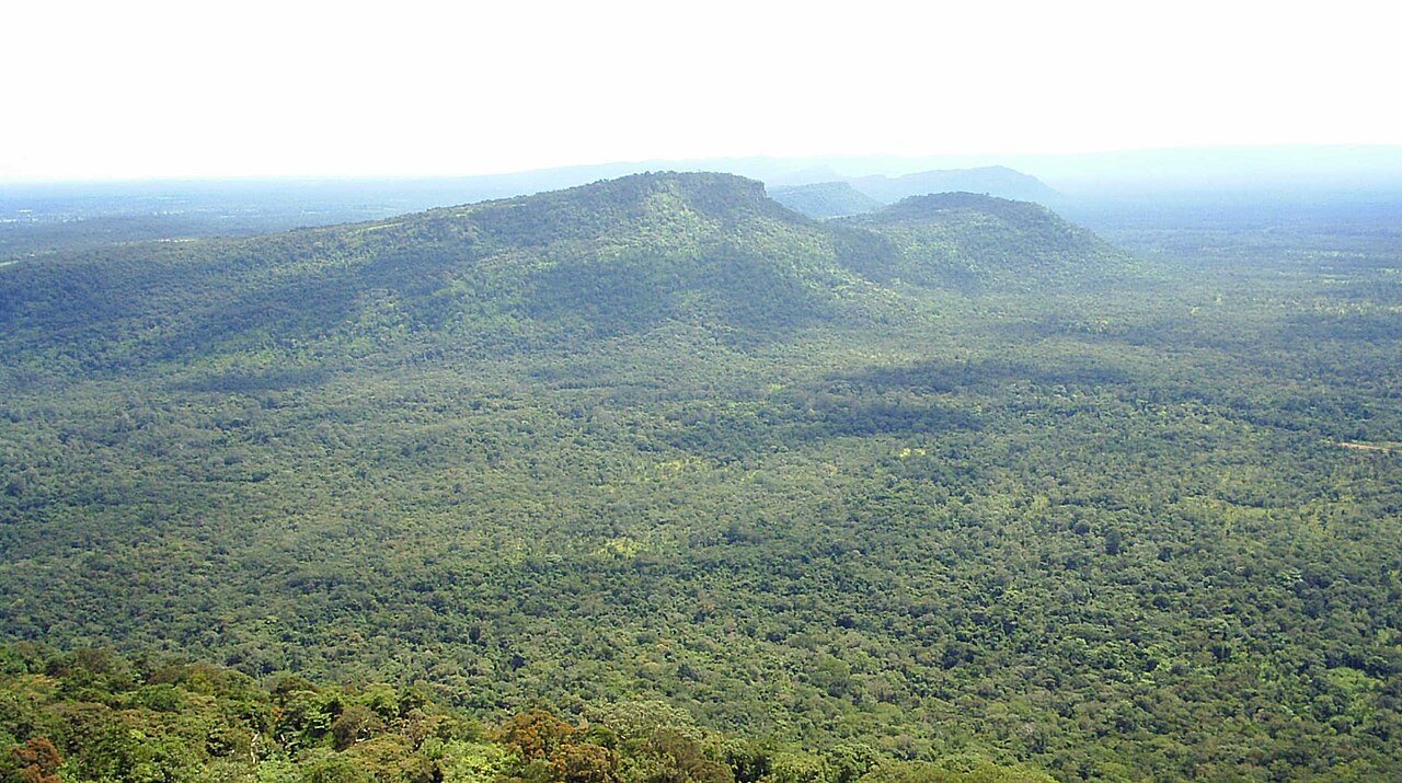
The name Phanom Dong Rak refers to the mountain range forming a natural frontier between northeastern Thailand and Cambodia. Unlike the high, jagged mountains of the North, the landscape here is sandstone plateaus, long escarpments, relatively flat upper surfaces, steep cliff edges, rolling forested hills, exposed rock terraces and dry-season vegetation.
The range forms part of the southern edge of the Khorat Plateau. On the Thai side, the land generally slopes northward toward the Isan plains. On the opposite side, the escarpment descends toward the Cambodian lowlands. That difference in elevation is what gives viewpoints such as Pha Mo I Daeng their extraordinary sense of scale. Elevations across much of the park sit broadly in the 200–500 metre range.
A landscape built over geological time
One of Khao Phra Wihan’s defining features is its sandstone. The Phra Wihan Formation is a recognised geological unit exposed prominently around Pha Mo I Daeng and along the Phanom Dong Rak range. Geological descriptions identify sandstone ranging from white to yellowish-white, together with siltstone, mudstone and conglomeratic layers. These sedimentary rocks were deposited approximately 170–100 million years ago, during the Mesozoic Era.
Over immense periods of erosion, layered sandstone became plateaus, cliffs, ledges, valleys and isolated rock formations. The result looks almost architectural: straight rock faces, horizontal layers, long cliff lines, flat plateaus and deep valleys. It is one of the reasons Khao Phra Wihan feels visually different from many other national parks in Thailand.
Pha Mo I Daeng
ผามออีแดง
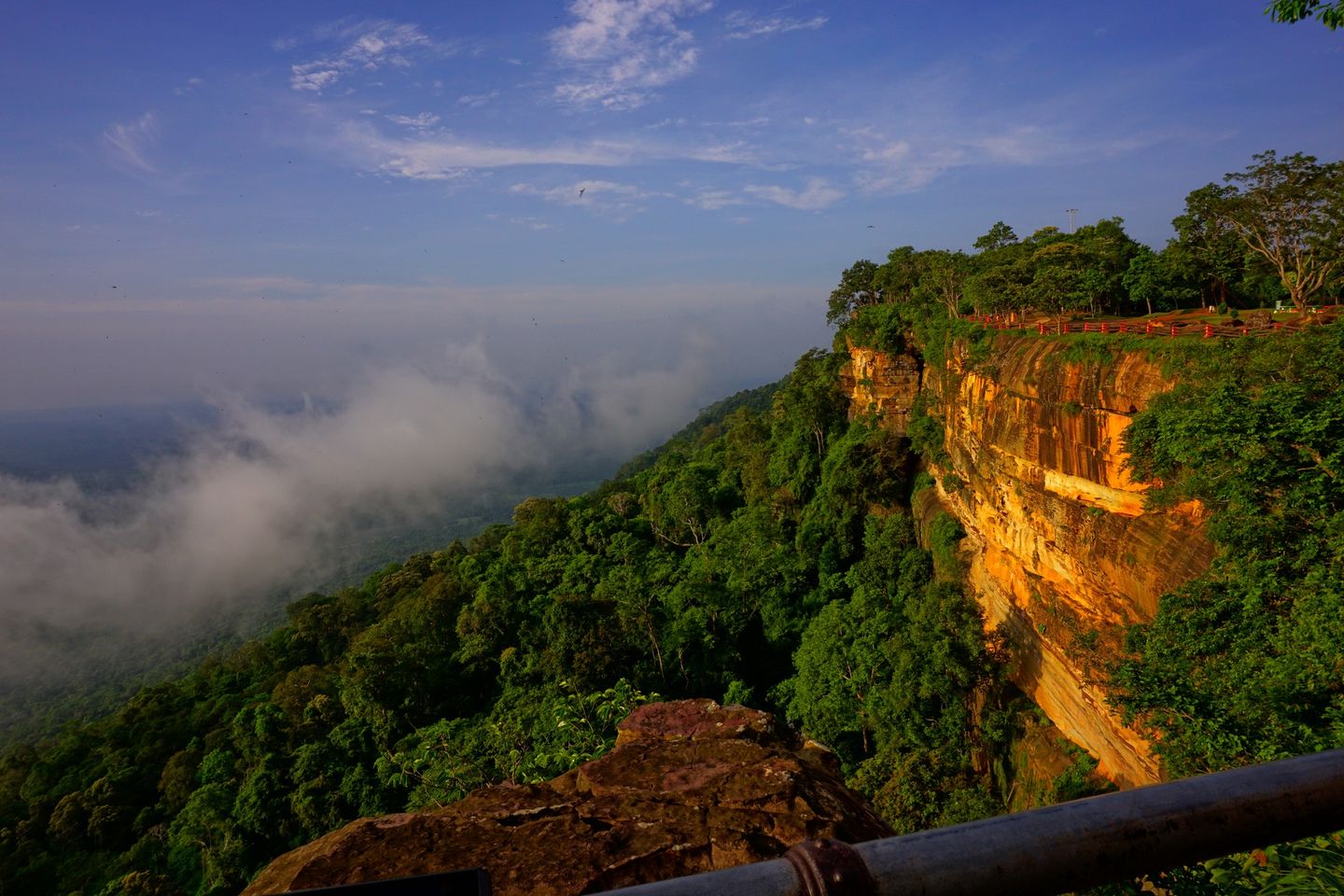
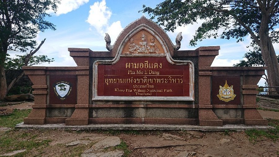
Pha Mo I Daeng is the visual symbol of the park: a long sandstone escarpment along the Thai–Cambodian frontier, extending for approximately 300 metres and creating a broad panoramic viewpoint over the lower landscape on the Cambodian side.
The immediate foreground is Thailand’s forested mountain edge. Beyond the cliff lies the lower terrain of Cambodia. In the distance, layers of forest and mountains stretch toward the horizon. Under suitable conditions, visitors can see the Temple of Preah Vihear / Prasat Preah Vihear from the Thai viewpoint.
You are not simply looking across a valley. You are looking across an international frontier. The Thai plateau stands above the lower Cambodian plain. The Phanom Dong Rak escarpment forms the natural divide. Geography becomes history.
- Sunrise
- The eastern exposure of the escarpment makes early morning particularly atmospheric. Sandstone warms in colour, mist can gather over lower terrain, forest becomes layered in soft tones, and the Cambodian plains gradually emerge from darkness. The scale of the landscape slowly reveals itself.
- Sunset
- Warm light strikes the sandstone and forest. The long cliff edge becomes more pronounced. At certain times of year, visitors may see large numbers of bats emerging from caves beneath the cliff around sunset — recorded by Thailand’s ONEP Natural Environment Division. It is a quieter experience than sunrise: the forest becomes almost black, and the sky takes over.
An Archaeological Landscape
The park is not only a viewpoint. Khmer-period remains are built into the sandstone itself. These sites belong to a historical world that predates the modern international border.
- Mo I Daeng bas-reliefs · ภาพสลักนูนต่ำผามออีแดง
- Beneath the cliff, three approximately life-sized human/divine figures are carved directly into the sandstone. They are generally associated with the Khmer cultural landscape and are believed to be more than a thousand years old. Some Thai cultural sources describe them as possibly a sculptors’ workshop or practice area linked to the greater Preah Vihear architectural complex — an archaeological hypothesis, not an established fact. The simpler point is that ancient Khmer-period rock carvings are incorporated into the natural cliff. The mountain itself became part of the artwork.
- Twin Stupas · สถูปคู่
- West of Pha Mo I Daeng stand two unusual cut-sandstone structures known locally as the Twin Stupas, or Phra That: square lower bodies, rounded upper sections and hollow interiors. They are traditionally associated with the ancient Khmer cultural landscape. Their exact original function is less certain than the modern name suggests. Present them as ancient sandstone archaeological structures traditionally known as the Twin Stupas — not as confidently identified Buddhist stupas.
- Sra Trao · สระตราว
- Also known as Huai Trao: a watercourse and ancient water-management feature around the rocky area beneath Khao Phra Wihan. Water flows through a natural rock shelter and across the sandstone before reaching a lower area. Some interpretations associate the lower basin with an ancient baray or reservoir connected with Khmer-period settlement. The temple landscape was also about water — for people, travellers and agriculture.
- Don Tuan Sanctuary · ปราสาทโดนตวล
- Away from the main cliff, Prasat Don Tuan is generally dated to approximately the 15th–16th Buddhist centuries, in the Khmer architectural period associated with the Angkorian cultural sphere. It sits around Ban Phum Srol in Kantharalak District. Unlike monumental Preah Vihear, Don Tuan is smaller — and that matters. The cultural landscape extended far beyond a single temple, along a corridor of settlements, sacred sites and routes.
Forest, Water and Stone
- Khun Si Waterfall · น้ำตกขุนศรี
- One of the park’s better-known natural attractions, near the route associated with the ascent toward the Preah Vihear area. Three levels descend through forest. At the cliff: sun, sandstone and horizon. At Khun Si: shade, forest and water. Together they reveal the park’s two identities.
- Khun Si Cave · ถ้ำขุนศรี
- A relatively spacious cave near the waterfall, associated with local historical traditions concerning a figure known as Khun Si, said to have supervised stone-cutting during the construction period of the ancient temple landscape. That story belongs to local tradition rather than independently established archaeology. The cave still shows that the mountain contained water, stone, shelters and routes that made the frontier usable for centuries.
- Tat Hai Waterfall · น้ำตกตาดไฮ
- Part of the park’s broader network of streams and seasonal waterfalls. Water moves through rock, moss, forest, stream and valley. Most impressive when water levels are higher.
- Huai Khon Nun Reservoir · เขื่อนห้วยขนุน
- A man-made irrigation reservoir within the wider park landscape, also a scenic and recreational area. Tourism information places it about 25 kilometres from headquarters, associated with a park protection unit. Here the dominant elements are water, forest, rolling hills and open sky — a quieter perspective than the sandstone cliffs.
The sandstone plateau is also a source area for numerous small streams, including Huai Ta Maria, Huai Tani, Huai Ta Ngoet, Huai Tung, Huai Ta Aek and Huai Bon. The park deserves to be understood as an ecosystem, not only a viewpoint.
Dry Forest on the Frontier
Khao Phra Wihan’s forest differs significantly from the humid evergreen forests of southern Thailand. A mosaic of types is why the park changes character through the year.
- Dry evergreen forest
- Found where moisture remains relatively available.
- Mixed deciduous forest
- Trees lose their leaves in the dry season, producing dramatic seasonal change.
- Dry dipterocarp forest
- Adapted to seasonal drought, shallow soils, exposed sandstone, intense sunlight and periodic fire.
In the dry season, leaves fall, grass becomes golden, exposed sandstone becomes more prominent, the sky clearer, and the red-brown tones of the cliffs stronger. Long-distance views improve. The colour palette shifts from deep green to olive, ochre, red sandstone and blue sky.
When the rains arrive, forests become greener, streams stronger, waterfalls more active, moss brighter and mist more likely. The sandstone remains. The history remains. Water brings the landscape alive — and at a smaller scale: leaves, insects, bird calls.
Wildlife, Birds and Dark Skies
The Phanom Dong Rak forest is part of a larger ecological landscape along the Thailand–Cambodia frontier. Wildlife does not recognise political boundaries in the same way people do. Species reported in the park and surrounding forest include wild boar, sambar deer, barking deer, gibbons, civets, squirrels, rabbits, bats, numerous smaller mammals and forest birds.
Birds associated with dry and mixed deciduous forest include Indian roller, drongos, doves, forest passerines and other seasonal woodland species. The open cliff and surrounding forest create different habitats within a relatively compact landscape.
Thailand’s National Astronomical Research Institute (NARIT) has recognised Khao Phra Wihan as a dark-sky conservation destination. Away from major urban centres, the park provides conditions for observing the night sky. After sunset the cliffs become silhouettes, the forest darkens, the horizon disappears, and the sky becomes the dominant landscape. The park is not only a sunrise destination. It is also a night-sky destination — when officially permitted.
The forest does not stop at the border.
The Temple Beyond the Cliff
The most important historical point is that the archaeological landscape predates the modern international border. Khmer cultural networks extended across large parts of mainland Southeast Asia. Architecture, inscriptions, sculpture, roads and water systems were created centuries before today’s borders of Thailand and Cambodia. The mountains were once part of a connected cultural landscape — not a line on a map.
The monument commonly known in Thai as Prasat Khao Phra Wihan is known internationally as the Temple of Preah Vihear. It is located on the Cambodian side of the frontier: a major Khmer architectural complex dedicated to Shiva. UNESCO describes a series of sanctuaries connected by pavements and stairways along an approximately 800-metre axis, with origins reaching back to the 9th century and major development in the first half of the 11th century. It was inscribed on the UNESCO World Heritage List in 2008 under Criterion (i).
The Temple of Preah Vihear is not inside Thailand’s Khao Phra Wihan National Park as Thai territory.
In its 1962 judgment, the International Court of Justice found that the Temple of Preah Vihear was situated in territory under the sovereignty of Cambodia, and that Thailand was required to withdraw military or police forces stationed at the temple or in its vicinity on Cambodian territory. In 2013, the ICJ further interpreted the 1962 judgment as concerning Cambodia’s sovereignty over the whole territory of the promontory of Preah Vihear.
UNESCO identifies the inscribed property as 154.7 hectares, with a 2,642.5-hectare buffer zone, located in Cambodia. World Heritage designation concerns the Temple of Preah Vihear cultural property — not Khao Phra Wihan National Park as a whole.
Pha Mo I Daeng is a Thai viewpoint from which visitors can see the Temple of Preah Vihear and the surrounding Cambodian landscape. It is not “the temple inside the Thai national park.” That distinction is essential.
A Frontier Park — Safety First
Khao Phra Wihan occupies a sensitive border environment. The region has experienced political and military tensions, particularly around the Temple of Preah Vihear. Following the temple’s 2008 World Heritage inscription, armed incidents occurred in the frontier area. The ICJ’s 2013 interpretation case records those incidents and provisional measures concerning a demilitarised zone around the temple.
For travellers, the practical lesson is straightforward: border access is never something to assume. Park opening conditions, trails and viewpoints can change according to security conditions.
In 2025, the park experienced significant security-related disruption. The Department of National Parks reported in December 2025 that parts of the park had suffered substantial damage, including the Pha Mo I Daeng visitor-service area, visitor buildings, toilets, community shops, structures at Noen Nab Dao, roads and other facilities. The DNP also reported that multiple unexploded or uncleared explosive hazards remained in several areas, with security authorities responsible for clearance.
As of September 2026, recent reporting indicated that authorities were preparing a possible limited reopening — initially considering weekend access from 08:30–15:30, with Thai visitors prioritised in the first phase. That report stated this was still only a principle-level decision, not an official reopening announcement, pending approval involving conservation-area administration, security authorities and relevant agencies.
Do not assume fixed opening hours. Do not treat Pha Mo I Daeng as currently open without checking the latest official announcement. Do not enter any area that has not been cleared and officially reopened.
The wider Thai–Cambodian border region contains areas affected by historical military activity and unexploded ordnance. Informal exploration is particularly dangerous. Remain on officially opened routes. Follow park and security personnel. Never leave marked paths. Never touch suspicious objects. Never explore abandoned military structures independently. Never enter closed forest. Never cross border-control lines.
How to Experience Khao Phra Wihan
A casual visitor may think Khao Phra Wihan equals Preah Vihear Temple. That is incomplete. The national park has its own collection of natural and archaeological attractions. The temple is one extraordinary element in a much larger landscape — seen from Thailand, not located inside the park.
- 01 — The viewpoint
- Pha Mo I Daeng: sunrise, panoramic landscape, sandstone cliffs, Cambodian plains, Temple of Preah Vihear views and photography — when officially open.
- 02 — The history
- Mo I Daeng bas-reliefs, Twin Stupas and Sra Trao: archaeology, Khmer history, ancient engineering and cultural landscape.
- 03 — The forest
- Khun Si Waterfall, Khun Si Cave and nature trails: shade, freshwater, hiking, biodiversity and seasonal waterfalls.
- 04 — The wider cultural landscape
- Don Tuan Sanctuary: Khmer archaeology and the network beyond Preah Vihear.
- 05 — The night
- Dark-sky observation and astrophotography when officially permitted.
A Park Made for Layers
Khao Phra Wihan is unusually good for landscape photography because it has multiple visual planes: red sandstone, forest, cliffs and ancient structures in the foreground; the Phanom Dong Rak escarpment, forest valleys and Cambodian plains in the midground; distant mountains, sky, cloud, sunrise or sunset behind.
- Pha Mo I Daeng — wide panoramic landscapes
- Red sandstone — close-up geological textures
- Bas-reliefs — ancient sculpture in natural rock
- Twin Stupas — geometry against forest
- Forest trails — human scale against the mountain
- Sunrise — warm light across the Cambodian plain
- Night sky — when officially permitted
Responsible Travel
This is a borderland. Respect it. The most interesting way to experience Khao Phra Wihan is not as a political destination, nor merely as archaeology or a viewpoint. It is a place where geography explains history: the mountain created the escarpment, the escarpment created the frontier, the frontier shaped movement, movement shaped settlement, settlement produced temples, temples left ruins, and the forest grew around all of it.
Do
- Follow official instructions and stay on authorised routes
- Respect security boundaries and park closures
- Photograph archaeological sites without touching them
- Keep noise low and carry rubbish out
- Respect local communities and sensitive photography locations
- Check current conditions before travelling
Do not
- Cross the international border or enter restricted military areas
- Explore closed trails, caves or forest without permission
- Touch suspicious objects
- Collect archaeological material, stones or artefacts
- Climb or damage ancient structures
- Assume that an old online travel guide reflects current access
Why Khao Phra Wihan Matters
- Geologically
- A dramatic sandstone escarpment within the Phanom Dong Rak range.
- Ecologically
- Dry evergreen, mixed deciduous and dry dipterocarp forest.
- Hydrologically
- Highlands that form the source of multiple streams.
- Archaeologically
- Khmer-period remains and rock carvings on the Thai side of the mountains.
- Culturally
- Part of a wider historical landscape shared across mainland Southeast Asia.
- Geographically
- One of Thailand’s most visually dramatic international border landscapes.
- Astronomically
- A relatively dark environment supporting dark-sky conservation.
Essential Khao Phra Wihan
- Name
- Khao Phra Wihan National Park
- Thai
- อุทยานแห่งชาติเขาพระวิหาร
- Region
- Lower Isan, Northeastern Thailand
- Provinces
- Si Sa Ket and Ubon Ratchathani
- Districts
- Kantharalak · Nam Khun · Nam Yuen
- Area
- 81,250 rai / about 130 km²
- National Park
- Thailand’s 83rd · established 20 March 1998
- Mountain Range
- Phanom Dong Rak / Dângrêk Mountains
- Elevation
- Approximately 200–500 m across much of the park
- Geology
- Sandstone plateau and escarpment
- Forest
- Dry evergreen · mixed deciduous · dry dipterocarp
- Signature Viewpoint
- Pha Mo I Daeng
- Archaeology
- Mo I Daeng bas-reliefs · Twin Stupas · Sra Trao · Don Tuan Sanctuary
- Natural Attractions
- Khun Si Waterfall · Khun Si Cave · Tat Hai Waterfall · Huai Khon Nun Reservoir
- Seen from Thailand
- Temple of Preah Vihear, Cambodia
- UNESCO
- Temple of Preah Vihear — World Heritage Site since 2008 (Cambodia)
- Dark Sky
- NARIT dark-sky conservation destination
- Best For
- Landscape · archaeology · history · nature · photography · stargazing
- Headquarters
- Ban Phum Saron, Sao Thong Chai, Kantharalak, Si Sa Ket 33110
- Access
- Highway 221 · about 98 km south of Si Sa Ket town · confirm current status
Frequently Asked Questions
- What is Khao Phra Wihan National Park?
- Thailand’s 83rd national park, established on 20 March 1998. About 81,250 rai / 130 km² of sandstone plateau, dry forest, waterfalls and Khmer-period archaeology across Kantharalak in Si Sa Ket and Nam Khun and Nam Yuen in Ubon Ratchathani.
- Is the Temple of Preah Vihear inside the Thai national park?
- No. The temple is in Cambodia. Pha Mo I Daeng is a Thai viewpoint from which visitors can see the temple and the Cambodian plains when access is open. UNESCO status applies to the temple property in Cambodia, not to the Thai park as a whole.
- Can I visit Khao Phra Wihan now?
- Do not assume the park is fully open. As of September 2026, access remains subject to security conditions and official reopening announcements. Check with DNP and local authorities before travelling. Do not enter uncleared or restricted border areas.
- What is Pha Mo I Daeng?
- A red sandstone escarpment about 300 metres long along the Thai–Cambodian frontier — the park’s signature viewpoint over forest, the Cambodian plains and, under suitable conditions, the Temple of Preah Vihear.
- What else is there besides the viewpoint?
- Mo I Daeng bas-reliefs, the Twin Stupas, Sra Trao, Don Tuan Sanctuary, Khun Si Waterfall and Cave, Tat Hai Waterfall, Huai Khon Nun Reservoir, dry-forest trails and a recognised dark-sky landscape.
- When is the best time to visit?
- The dry season opens long-distance views and stronger sandstone colour. The rainy season greens the forest and strengthens waterfalls. Confirm current access before planning either season.
- How do I get there?
- Headquarters: Ban Phum Saron, Sao Thong Chai, Kantharalak, Si Sa Ket 33110, along Highway 221 south of Kantharalak — about 98 kilometres south of Si Sa Ket town. Confirm that visitor routes are open before travelling.
- How do I contact the park?
- Published DNP information lists 0 4582 6045 for general enquiries and attraction opening status.
Related Destinations
- Pha Taem National Park
- Another Isan sandstone escarpment — Mekong cliffs, rock art and sunrise over the river in Ubon Ratchathani.
- Kaeng Tana National Park
- Rapids, potholes and forest where the Mun River meets sandstone in Ubon Ratchathani.
- Phu Chong–Na Yoi National Park
- A large forest landscape in southern Ubon Ratchathani, another highland face of Lower Isan.
- Nature & Parks
- More protected landscapes across ThailandLover’s national-park collection.
Location
Find Khao Phra Wihan National Park
Ban Phum Saron, Sao Thong Chai Subdistrict, Kantharalak District, Si Sa Ket 33110