


National Park · Northeastern Thailand
Phu Suan Sai National Park
อุทยานแห่งชาติภูสวนทราย
Misty mountains, deep evergreen forest and a frontier view toward Laos
Na Haeo · Loei · Northeastern Thailand
A quiet borderland of forest ridges, waterfalls, sandstone formations and sweeping views across the Thai–Lao mountains.
A Quieter Side of Loei
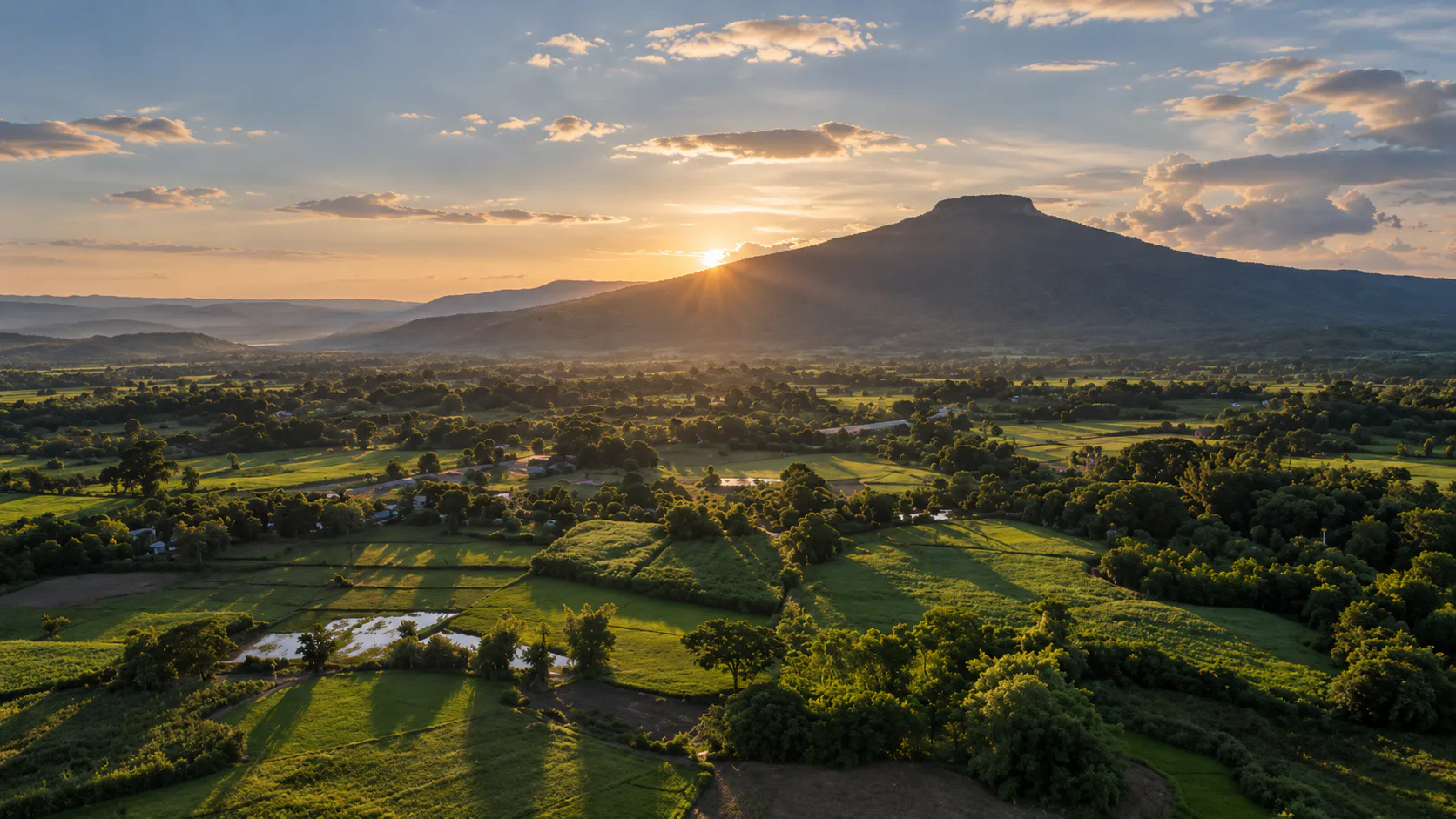
Phu Suan Sai is a mountain landscape made for travellers who prefer exploration over crowds.
Located in Na Haeo District along the mountainous frontier between Thailand and Laos, the park protects approximately 117.16 square kilometres of highland forest, narrow ridges, streams and waterfalls.
The highest point is Phu San Sai, rising to approximately 1,408 metres above sea level. Elevation and moisture create a cooler, greener environment than many of the drier landscapes elsewhere in northeastern Thailand.
Water descends through the forest. Sandstone formations emerge between trees. Viewpoints open toward the borderlands. Old mountain paths hint at the history of this remote frontier.
This is a place to slow down, listen to the forest and look beyond the ridge.
At a Glance
- Official Name
- Phu Suan Sai National Park
- Thai Name
- อุทยานแห่งชาติภูสวนทราย
- Former Name
- Na Haeo National Park
- Location
- Na Haeo District, Loei
- Region
- Northeastern Thailand — Isan
- Area
- Approximately 117.16 km² / 73,225 rai
- Highest Point
- Phu San Sai — approximately 1,408 m
- Elevation Range
- Approximately 600–1,408 m
- Landscape
- Mountain ranges, evergreen forest, waterfalls and sandstone formations
- Border
- Thailand–Laos
- Established
- 23 November 1994
- Status
- Thailand’s 79th national park
- Signature Experiences
- Noen 1408, Noen 1255, Tat Hueang, Khing Waterfall and forest trails
Why Visit Phu Suan Sai?
Phu Suan Sai is not built around one enormous attraction. Its character comes from the entire mountain landscape: steep forested slopes, streams, waterfalls and viewpoints that extend beyond Thailand toward the mountains of Laos.
- Mountain landscapes
- Forest trekking
- Waterfalls
- Sunrise viewpoints
- Quiet destinations
- Nature photography
- Borderland scenery
- Biodiversity
The Mountains of Phu Suan Sai
The park forms part of a complex mountain system along the Thailand–Laos frontier. Elevations range from approximately 600 to 1,408 metres, with slopes varying from gentle inclines to sections exceeding 50 percent.
The western area contains some of the largest and steepest forest, while the eastern terrain becomes somewhat gentler. These mountains are also important watersheds, feeding streams in the Hueang River and Phrae River systems.
A Forest Unlike Much of Isan
Phu Suan Sai is notable for its relatively humid forest. Dry evergreen forest dominates much of the park, mixed with deciduous forest, while the higher elevations support hill evergreen forest.
Elevation and moisture keep the upper forest cool and green even when lower areas of Loei are much warmer. Mosses, ferns, vines and epiphytes add to the humid mountain atmosphere, especially during the rainy season.
Wildlife
The wider forest landscape supports serow, wild dogs, forest mammals, birds of prey, amphibians and reptiles. Sightings are never guaranteed: move quietly, listen for bird calls and watch for tracks. Never feed or approach wild animals.
Waterfalls
- Khing Waterfall
- A shaded, relatively accessible cascade along the Phrae River beside the road between Saeng Pha and Lao Ko. The area also carries royal history: a residence was constructed following a visit by Princess Maha Chakri Sirindhorn on 12 February 1991.
- Chang Tok Waterfall
- About 500 metres farther upstream from Khing Waterfall, where the river enters steeper, more rugged mountain terrain. Flow is strongest after rain.
- Wang Tat Waterfall
- Approximately 1.5 kilometres upstream from Chang Tok. Reaching it feels more like nature exploration than roadside sightseeing; follow current park guidance after heavy rain.
- Tat Hueang Waterfall
- Also called the Thai–Lao Waterfall, this three-tier cascade drops a combined height of around 50 metres on the Hueang River, which forms part of the international boundary. It is traditionally described as flowing year-round, though volume changes with rainfall.
- Pha Khao Waterfall
- Another forest waterfall associated with the Hueang River border, surrounded by dense vegetation and best understood together with Tat Hueang.
Mountain Viewpoints
- Noen 1408 · The Highest Viewpoint
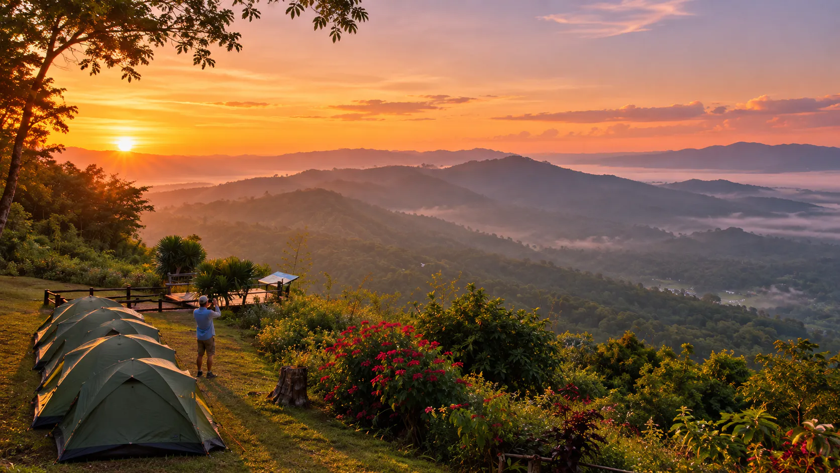
- Named for its elevation of 1,408 metres, the viewpoint on Phu Tin Suan Sai opens east and southeast toward Ban Bo Mueang Noi, Ban Saeng Pha and the wider Na Haeo landscape. Sunrise is the signature experience.
- Noen 1255 · Looking Toward Laos
- At approximately 1,255 metres, this viewpoint looks across Ban Huai Nam Phak. In clear conditions, distant mountain ranges in Laos, including Phu Soi Dao and Phu Wiang, may be visible.
Sunrise at Phu Suan Sai
On favourable mornings, low cloud settles between ridges and the mountains appear in layers. Some mornings are clear; others are dominated by cloud. Neither is a failure — the changing atmosphere is part of the experience.
Sandstone & Local Belief
- Hin Si Thit · Four-Direction Stones
- Four prominent rocks rise from evergreen forest at a site with local cultural significance and a recurring merit-making pilgrimage tradition. It is both a natural formation and a place shaped by local belief.
- Hin Kuai Lo · The Mushroom-Shaped Rock
- At the foot of Phu Tin Suan Sai, a sandstone formation resembles a mushroom bud rising beneath the forest canopy — a small geological detail that rewards slow exploration.
Nature Trails
Park information has described two designated nature routes of approximately 2 kilometres and 5 kilometres. They connect the headquarters area with the surrounding forest and have traditionally been conducted with park staff.
These shorter routes suit visitors who want to experience the forest without committing to a full-day mountain excursion. Confirm current availability before travelling.
The Thai–Lao Border Landscape
Phu Suan Sai is inseparable from its frontier setting. Mountains form a natural boundary, while sections of the Hueang River create the international border itself. From designated viewpoints, the landscape continues visibly into Laos.
History of the National Park
The area was originally established as Na Haeo National Park. A Royal Decree published on 23 November 1994 made it Thailand’s 79th national park, protecting forests around Phu Puey, Phu Khi Thao and Phu Ruea in Na Haeo District.
In 2006, the Department of National Parks changed the name to Phu Suan Sai National Park to better reflect the landscape. Its conservation story is closely connected with watershed protection, a relatively intact border forest, local communities and the strategic geography of Na Haeo.
Best Time to Visit
- Rainy Season · May–October
- The forest is at its greenest and waterfalls are generally strongest. Mist is common, but trails and sandstone can be slippery.
- Cool Season · November–February
- Usually the most comfortable period for hiking and sightseeing. Mornings at higher viewpoints can be cold, with better chances of long-distance views.
- Hot Season · March–April
- Lower elevations become warm, though the highlands remain cooler. Plan outdoor activities for early morning or late afternoon.
- Waterfalls
- Rainy season
- Green Forest
- May–October
- Comfortable Hiking
- November–February
- Sunrise Viewpoints
- Cool-season mornings
- Clear Mountain Views
- Cool and dry season
- Misty Atmosphere
- Rainy and cool seasons
Signature Experiences
- Watch sunrise at Noen 1408
- See the park’s broadest highland panorama as the first light reaches the ridges.
- Look toward Laos from Noen 1255
- Understand how the mountain landscape continues beyond the border.
- Visit Tat Hueang
- Experience a waterfall where the river itself forms part of the Thai–Lao boundary.
- Explore Khing Waterfall
- Combine accessible forest scenery with a small chapter of local royal history.
- Walk a nature trail
- Choose a shorter designated route for a closer look at the humid forest.
- Find Hin Si Thit and Hin Kuai Lo
- Discover local belief, sandstone geology and details hidden beneath the evergreen canopy.
Photography Guide
- Sunrise
- Noen 1408 is the natural choice. Use receding mountain ridges as layers to create depth.
- Border Landscape
- At Noen 1255, a wider lens can connect foreground forest with distant mountains in Laos.
- Waterfalls
- A slower shutter can soften moving water, but stable footing matters more than the photograph.
- Forest Details
- Look closely for moss, ferns, bark, vines and epiphytes in the humid evergreen forest.
- Mist
- A sea of fog is never guaranteed; humidity, temperature, rain and local weather determine each morning’s atmosphere.
How to Get There
Park headquarters is in Na Haeo District, Loei Province. From Loei city, travellers generally head toward Dan Sai and Na Haeo, then continue through the local mountain road network.
A private car or rental vehicle is the most practical option. Public transport serves the wider Na Haeo area, but individual park attractions can be inconvenient to reach without your own transport. Allow extra time for mountain roads and scenic stops.
Where to Stay
The national park provides visitor accommodation and camping facilities, subject to seasonal availability and current management. Hotels and restaurants are also available in Na Haeo and nearby Loei destinations.
Staying in Na Haeo works well for a slower, multi-day exploration of the park and surrounding borderland communities.
Travel Tips
- Bring a light jacket for cool highland mornings
- Wear shoes with grip on wet forest and sandstone
- Carry water where facilities are limited
- Start early and allow safe travel time before sunrise
- Follow all border signs and staff instructions
- Respect sacred and culturally significant formations
- Never pick plants or disturb wildlife
- Expect waterfalls, mist and trails to change with the weather
A Different Kind of Loei Mountain
Travellers often associate Loei with Phu Kradueng and Phu Ruea. Phu Suan Sai offers something different: it is quieter, more forest-focused, more closely connected to the Thai–Lao border and less developed for mass tourism.
Its strongest attraction is not one iconic photograph. It is the feeling of being inside a large, humid mountain forest.
Essential Information
- Park
- Phu Suan Sai National Park — Na Haeo, Loei, Thailand
- Area
- Approximately 117.16 km² / 73,225 rai
- Elevation
- Approximately 600–1,408 m
- Highest Point
- Phu San Sai — 1,408 m
- Established
- 23 November 1994
- National Park
- Thailand’s 79th
- Former Name
- Na Haeo National Park
Frequently Asked Questions
- Where is Phu Suan Sai National Park?
- In Na Haeo District, Loei Province, along Thailand’s mountainous border with Laos.
- What is the best time to visit?
- November–February is generally most comfortable for hiking and clear views. May–October brings greener forest and stronger waterfalls, with wetter and more slippery conditions.
- What are the park’s main attractions?
- Noen 1408, Noen 1255, Tat Hueang Waterfall, Khing Waterfall, Chang Tok, Wang Tat, Pha Khao, Hin Si Thit, Hin Kuai Lo and designated nature trails.
- Can visitors cross into Laos?
- No. Stay in designated visitor areas, follow border signs and park instructions, and never cross markers or enter restricted zones.
Location
Find Phu Suan Sai National Park
Na Haeo · Loei · Northeastern Thailand