

National Park · Trat
Namtok Khlong Kaeo National Park
อุทยานแห่งชาติน้ำตกคลองแก้ว
Where the Eastern Forests Rise Along the Cambodian Frontier
Bo Rai · Bo Phloi · Trat Province
Follow the streams of Trat’s mountain forests to Khlong Kaeo Waterfall, where granite, rainforest and wildlife meet the eastern frontier.
A Forest Watershed on Thailand’s Eastern Frontier
Far from the islands and beaches for which Trat is famous, another Thailand begins inland.
The landscape rises. Roads become narrower. The forest becomes deeper. Streams descend from the mountains.
And along the eastern frontier, the forests of Namtok Khlong Kaeo National Park form one of Trat’s important mainland conservation landscapes.
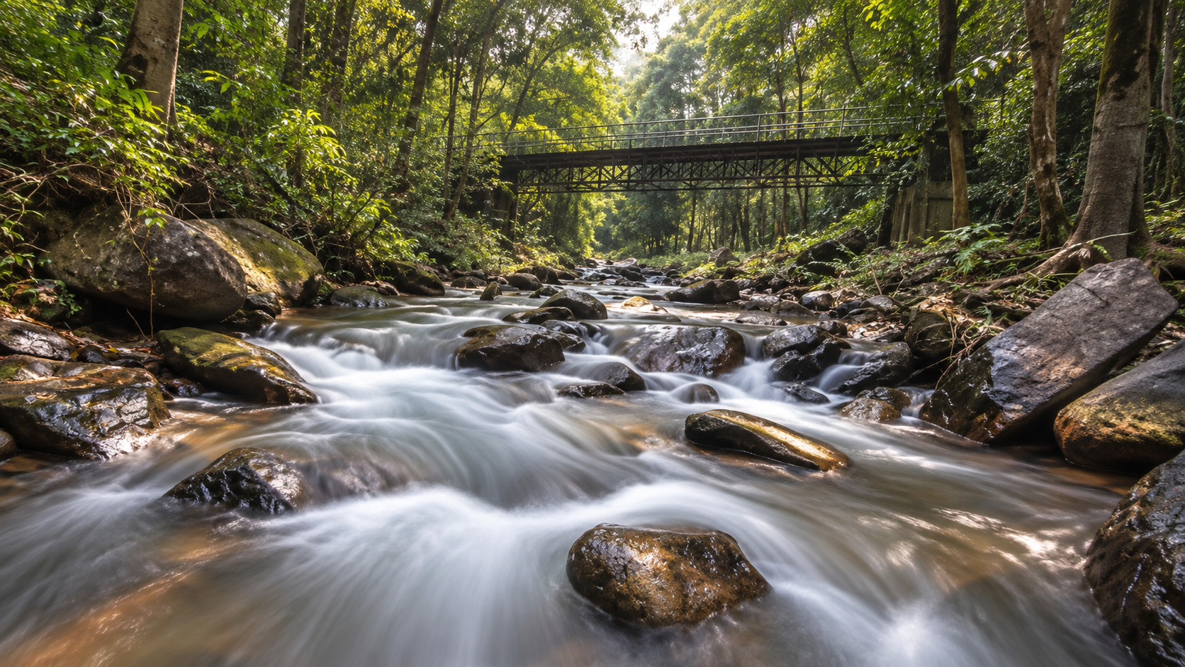
At the centre of the park is Khlong Kaeo Waterfall, a multi-level cascade system flowing over granite rock through moist forest. But the waterfall is only the most visible part of the story.
Behind it lies a much larger watershed landscape of mountains, evergreen forest, streams, wildlife corridors and a natural frontier with Cambodia.
For ThailandLover, Namtok Khlong Kaeo is best understood not simply as a waterfall destination, but as a forest watershed on Thailand’s eastern frontier.
At a Glance
- Official English Name
- Namtok Khlong Kaeo National Park
- Thai Name
- อุทยานแห่งชาติน้ำตกคลองแก้ว
- Province
- Trat
- Main District
- Bo Rai
- Protected Landscape
- Khao Saming Forest Reserve landscape
- Established
- 25 December 2009
- National Park Number
- 121st national park of Thailand
- Gazetted Area
- approximately 123,700 rai / 197.92 km²
- Mountain System
- Eastern mountain ranges / Khao Saming landscape
- Elevation
- approximately 100–836 metres
- Highest Peak
- Khao Ta Bat · approximately 836 m
- Main Attraction
- Khlong Kaeo Waterfall
- Main Water System
- Khlong Kaeo and associated mountain streams
- Signature Viewpoint
- Rock terrace above the fourth major waterfall level
- Forest Character
- Moist evergreen and mixed forest communities
- International Frontier
- Thailand–Cambodia
- Main Visitor Area
- Bo Phloi Subdistrict, Bo Rai District
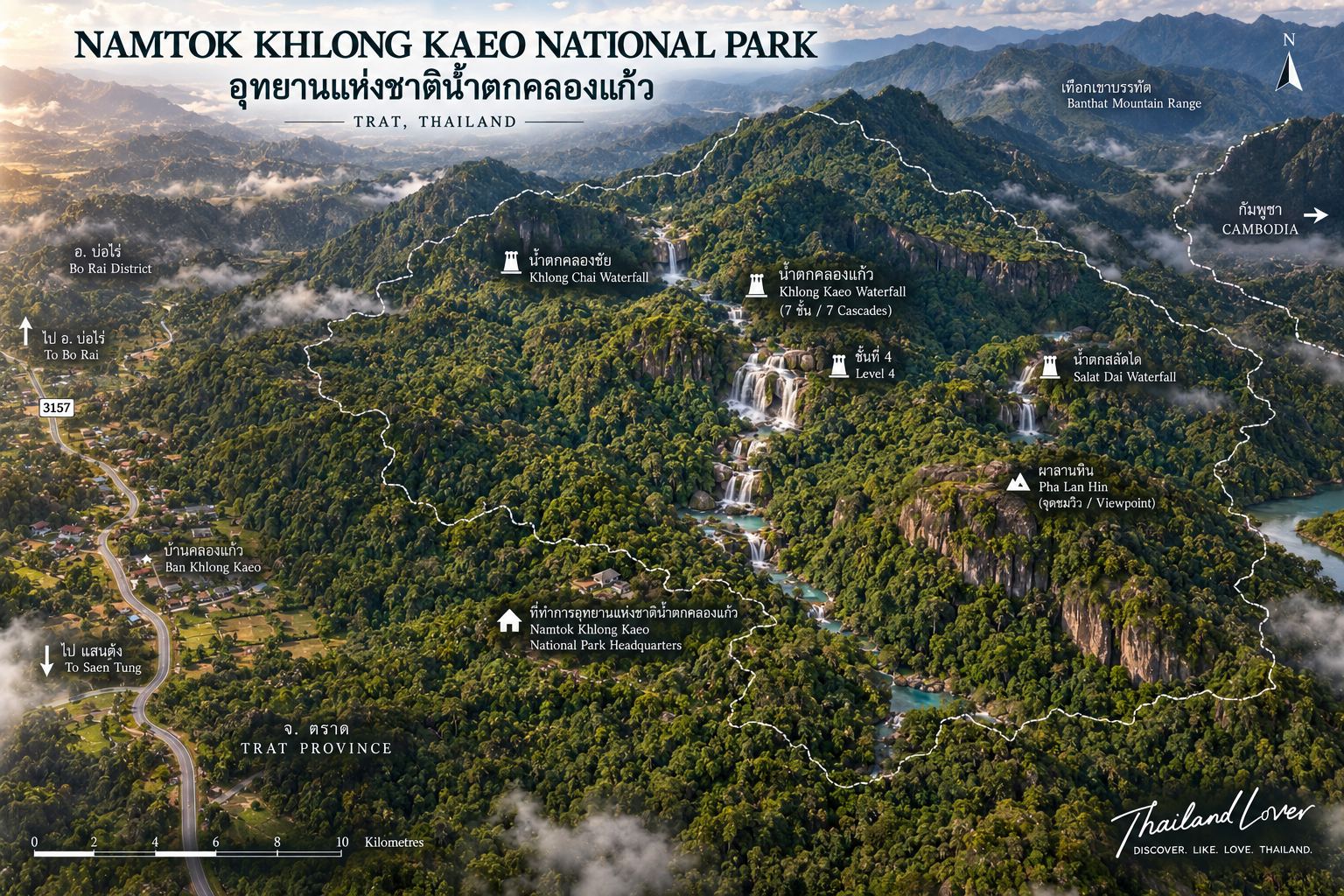
Namtok Khlong Kaeo National Park was formally established on 25 December 2009 as Thailand’s 121st national park. The Royal Decree covers approximately 123,700 rai, or 197.92 square kilometres, in Bo Rai District, Trat Province.
The First Impression
Trat Beyond the Islands
Most international travellers associate Trat with one thing: the islands. Ko Chang. Ko Mak. Ko Kut. The Gulf.
But travel inland and the geography changes completely. The coastal landscape gives way to plantations, agricultural land and increasingly rugged forest terrain. Eventually, the mountains begin.
Namtok Khlong Kaeo lies within this inland landscape of Trat — an important reminder that Trat is not only a gateway to islands. It is also home to substantial mainland forest.
The Eastern Frontier
A Mountain Landscape Beside Cambodia
The park occupies a mountainous landscape close to the Thailand–Cambodia border. The upper ridges form part of the natural geographic frontier between the two countries.
This is not simply a political line drawn across a map. The mountain landscape itself creates the boundary. Forested ridges rise along the frontier. Streams originate in the mountains. Water descends toward the lower country. And wildlife moves through a landscape that does not recognize administrative borders in the same way humans do.
This makes Namtok Khlong Kaeo important as part of the wider eastern forest ecosystem.
The Mountains of Khlong Kaeo
A Forested Mountain System
The park is characterized by a series of relatively compact but rugged mountains. Important named mountains include:
- Khao Kaeo
- Khao Ta Bat
- Khao Ta Chot
- Khao Kamphaeng
The terrain rises from approximately 100 metres to 836 metres above sea level. The highest point is Khao Ta Bat, approximately 836 metres.
These elevations are modest compared with Thailand’s highest northern mountains. But elevation is not the only factor that matters. The eastern frontier receives substantial rainfall, and the combination of mountain terrain and high moisture creates a dense forest environment.
Khao Ta Bat
The Highest Mountain in the Park
At approximately 836 metres, Khao Ta Bat is the highest summit associated with the park. It is important not because it is exceptionally high, but because it represents the upper watershed of the park.
Rainfall collected around the mountain feeds streams that eventually descend into the lower landscape. This relationship explains why the park contains several waterfalls rather than a single isolated cascade.
The mountains are the source. The waterfalls are the visible result.
The Watershed
Where the Water Begins
The park contains numerous streams and small waterways, including:
- Khlong Lek
- Khlong Aeng Puk
- Khlong Kaeo
- Khlong Ta Bat
- Khlong Hin Phloeng
- Khlong Lue
- Khlong Ka Chai
- Khlong Makok
These streams originate within the forested mountain landscape and eventually feed into the Khlong Sato watershed, which carries water toward the lower country and the sea.
The park is not simply protecting waterfalls. It is protecting the forest that creates the waterfalls.
Khlong Kaeo Waterfall
The Signature Landscape
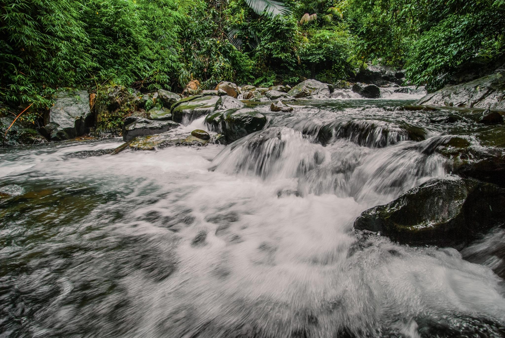
Khlong Kaeo Waterfall is the attraction that gives the national park its name. It is a multi-level waterfall formed where the Khlong Kaeo stream descends across natural granite formations.
Water does not fall from one enormous cliff and disappear. Instead, the stream repeatedly changes elevation — small cascades, rock shelves, pools, sloping channels, larger drops, then more flowing water.
This creates a long, continuous waterfall landscape.
Seven Levels — or Four Major Levels?
Why Different Sources Give Different Numbers
This is one of the places where ThailandLover should be more precise than ordinary travel websites.
Tourism information commonly describes Khlong Kaeo Waterfall as a seven-level waterfall. The official Thailand Tourism Directory and DASTA’s community-based tourism information both use seven levels and identify the fourth level as the major viewpoint.
However, a detailed publication on waterfalls in Thailand’s eastern national parks describes Khlong Kaeo differently. It explains that the waterfall contains many smaller drops but identifies four principal large levels, with smaller cascades in between.
In that technical description, smaller drops are approximately 3–4 metres; major drops exceed 5 metres; and the fourth major level is the most impressive.
The First Levels
The lower sections of Khlong Kaeo Waterfall are the most accessible part of the visitor experience. The trail follows the stream through forest. Water moves over granite surfaces. Small drops appear between larger sections. The forest canopy creates shade. The sound of the stream becomes increasingly dominant as visitors move away from the entrance.
These lower sections are suitable for visitors who want to experience the waterfall without committing to a long ascent.
The Fourth Level
The Great View of Bo Rai
The fourth level is the defining point of the Khlong Kaeo experience. Here, the stream drops from a granite cliff of approximately 30 metres, then continues down a sloping rock section for approximately another 20 metres.
The landscape opens significantly at this point. Above the waterfall is a broad rock terrace. From here, visitors can see across the forested landscape toward Bo Rai District.
This combination makes the fourth level different from the lower cascades. It is simultaneously:
waterfall + granite cliff + forest + panoramic view
The fourth level is therefore the natural visual centre of the park.
The Rock Terrace
A Viewpoint Made by the Landscape
The rock terrace above the fourth major waterfall is often referred to as Lan Hin or Lan Hin Khao in local descriptions. It is not an artificial observation platform. The viewpoint is created by the natural rock landscape.
From the elevated position, the visitor can look beyond the immediate waterfall and see the broader Bo Rai landscape. The waterfall is no longer simply something to look at. The visitor becomes part of the mountain landscape.
Beyond the Fourth Level
The Journey Becomes the Attraction
Most visitors do not continue all the way to the uppermost levels. The complete seven-level route requires considerably more time and physical effort. Tourism information notes that visitors commonly explore only the first four levels, while reaching the upper levels can take most of a day.
- The Short Experience
- Lower waterfall levels + fourth-level viewpoint. Suitable for families, casual visitors, photographers and short visits.
- The Full Experience
- The complete waterfall sequence. Suitable for hikers, nature enthusiasts, visitors with sufficient time, and people comfortable with steep or wet terrain.
Granite and Water
The Geology of the Falls
Khlong Kaeo is particularly associated with granite rock. The waterfall forms where the stream moves across and descends through granite terrain.
Granite produces broad rock surfaces, ledges and channels that can create long sloping cascades rather than only vertical drops. The fourth level demonstrates this especially clearly — water first drops from the main cliff and then continues over a long sloping rock surface.
vertical movement · and · horizontal flow
Khlong Kaeo is not best understood as a single dramatic wall of water. It is a forest waterfall system — something that must be walked through rather than simply viewed.
The Moist Evergreen Forest
Why This Part of Trat Stays Green
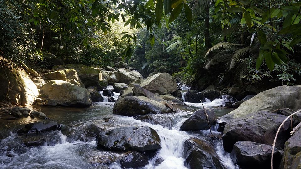
Namtok Khlong Kaeo receives substantial rainfall influenced by the monsoon climate of eastern Thailand. The park’s forest is generally characterized by moist evergreen forest, together with other forest communities.
DNP material describes the area as a highly moist forest landscape and an important watershed. The forest canopy is dense. The understory can be thick. Ferns, vines, mosses and other moisture-loving plants thrive around streams and shaded rock.
The result is an environment noticeably different from the drier deciduous forests found in many parts of inland Thailand.
The Forest Floor
A World at Ground Level
Visitors who focus only on the waterfall can easily miss one of the most interesting parts of Khlong Kaeo. Look down. The forest floor is alive with moss, ferns, leaf litter, fungi, small invertebrates, seedlings, roots and decomposing organic matter.
In wet periods, the forest floor becomes especially active. This is the small-scale ecosystem that supports the larger forest.
Trees of the Moist Forest
Historical national-park reference material records important moist-evergreen forest trees including:
- Hopea ferrea
- Dipterocarpus dyeri
- Anisoptera costata
These are characteristic trees of humid southeastern forests and contribute to the structure of the canopy. The park’s botanical importance extends beyond the waterfall.
The Yellow Chanthaboon Orchid
A Botanical Signature of Eastern Thailand
One of the most distinctive plants associated with the park is the Yellow Chanthaboon Orchid, commonly known in Thai as เหลืองจันทบูร.
It is associated particularly with eastern Thailand and is regarded as one of the region’s notable native orchids. Local government information identifies it as an attractive orchid associated with the eastern part of Thailand and records its presence within Namtok Khlong Kaeo National Park.
For nature photographers, this is an excellent example of why the forest deserves as much attention as the waterfall.
Wildlife
A Forest with Real Wildlife Pressure
The ecological quality of Namtok Khlong Kaeo is reflected in its wildlife. The park is part of a larger forest landscape in which animals can move between forest and surrounding agricultural areas.
The presence of wildlife is not simply an attraction. It also creates management challenges.
Khlong Kaeo is functioning wildlife habitat. The 2026 elephant-monitoring reports are particularly strong evidence of that fact.
Wild Elephants
The Forest Is Not a Zoo
One of the most important current wildlife stories in Khlong Kaeo is the presence of wild Asian elephants.
DNP reports from 2026 document repeated operations to monitor and guide wild elephants away from communities around Bo Rai and return them toward forest areas. In January 2026, authorities recorded multiple elephant appearances involving both solitary elephants and herds. In February 2026, DNP again reported elephant monitoring and operations after sightings near communities.
A Wildlife Corridor
Why the Larger Forest Matters
Animals need more than a waterfall. They need food, water, shelter, breeding areas, migration routes and connected forest.
The mountain landscape of Khlong Kaeo provides these ecological functions. The streams create water sources. The forest creates cover. The mountain ridges provide movement routes.
This is why DNP has emphasized the ecological importance of maintaining and expanding the protected forest around the park.
The Proposed Expansion
A Larger Conservation Landscape
In 2023, DNP opened public consultation regarding a proposed expansion of Namtok Khlong Kaeo National Park. The proposed expansion covered approximately 13,449.70 rai in areas including Khao Pik Ka, Khlong Khwai Tai, Khlong Wang Pho, Khao Et and Thap Ka Dai, within Non Si and Dan Chumphon subdistricts of Bo Rai District.
DNP explained that the area was considered suitable because of steep mountainous terrain, intact moist evergreen forest, wildlife habitat, high biodiversity, watershed importance and plant species of conservation concern.
Other Waterfalls & Landscapes
Khlong Kaeo is not the only natural attraction within the wider park landscape.
Khlong Thai Waterfall
A medium-sized waterfall approximately 20 metres high, with clear water and a moist evergreen forest environment. The route also passes areas where historical gem-mining activity can still be seen — giving Khlong Thai a different character from the main visitor area.
Than Hin Dat Waterfall
A medium-sized waterfall with three levels, associated with a quieter natural environment and particularly suitable for visitors interested in forest scenery. Historical park references describe it as a nature-oriented destination suitable for camping.
Hin Khit Waterfall
Another medium-sized waterfall with three levels. The surrounding forest is particularly interesting during the rainy season. Historical descriptions also note the presence of numerous leeches during wet conditions — a useful practical detail for serious hikers.
Khlong Chai Waterfall
Another stream and waterfall feature represented on park maps. It is less developed for mass tourism than the main Khlong Kaeo waterfall — valuable precisely because it remains relatively quiet.
Salat Dai Waterfall
Associated with the Bo Rai forest landscape and known as a quieter recreation and nature area. Because access conditions can vary, treat it as a separate excursion rather than assuming it is immediately adjacent to the main waterfall.
Pha Lan Hin
A natural rock landscape within the park. Unlike the waterfalls, its attraction comes from exposed rock surfaces and the surrounding forest — another way to experience the rock that controls the movement of water.
The History Beneath the Forest
Bo Rai and the Gem Landscape
Bo Rai is historically associated with gem mining, particularly rubies and other coloured gemstones. This history is important because the landscape around Khlong Kaeo is not untouched wilderness in the absolute sense.
People have used the surrounding land for generations. Old mining traces can still be encountered in some areas — at Khlong Thai Waterfall, historical descriptions specifically note traces of former gem-mining activity along the route.
This creates an interesting contrast: forest conservation above a landscape with a history of resource extraction.
The Rainfall Story
One of Thailand’s Wetter Eastern Landscapes
Namtok Khlong Kaeo lies within eastern Thailand, an area strongly influenced by monsoon systems. The park receives substantial rainfall, contributing to its moist evergreen forest and perennial or near-perennial streams.
- Hot Season
- February–April
- Rainy Season
- May–October
- Cooler Season
- November–January
These should be treated as broad climatic patterns rather than guaranteed weather conditions for a particular visit.
When the Waterfall Is at Its Best
Rain Changes Everything
- After Rain
- The stream becomes stronger; smaller cascades become more visible; granite surfaces become darker; forest vegetation becomes intensely green; the atmosphere becomes cooler and more humid.
- Drier Periods
- Flow can decrease; rock surfaces become more visible; pools may become calmer; walking conditions can be easier.
The most dramatic waterfall photography generally comes after sufficient rainfall — but that is also when trails and rocks can become most slippery. More water does not automatically mean a better time to enter the river.
The Main Visitor Route
From Forest to Viewpoint
The principal Khlong Kaeo route begins near the park headquarters. The historical park guide describes approximately 310 metres of walking from the parking area to the first waterfall section. From there, the route continues upward toward the viewpoint above the fourth major level, approximately 740 metres from the first level.
A concrete walking route has been developed along the principal visitor section, making the lower waterfall experience substantially more accessible than the deeper mountain trails.
How Long Should You Spend?
- Quick Visit
- 1.5–2.5 hours — lower waterfall sections and continue toward the fourth-level viewpoint.
- Half-Day Visit
- 3–5 hours — photography, the forest trail, the fourth-level viewpoint and relaxed exploration.
- Full Waterfall Experience
- Most of the day — continue toward the upper levels. Requires substantially more physical effort and should be attempted only when conditions and park instructions allow.
Who Will Enjoy Khlong Kaeo?
- Nature lovers — the forest is more important than the tourist infrastructure
- Photographers — granite, water and forest provide many compositions
- Hikers — upper waterfall levels and wider forest trails offer a more demanding experience
- Families — the lower visitor area is much more accessible than the upper mountain routes
- Wildlife enthusiasts — the wider forest is genuine habitat, including wild elephants
- Travellers interested in eastern Thailand — a completely different perspective on Trat beyond the islands
Swimming
Khlong Kaeo is associated with natural pools and recreational water use. However, ThailandLover should not present swimming as an unconditional activity. Water conditions change. The park may restrict access to parts of the waterfall depending on rainfall, safety or conservation conditions.
Swim only where park officials currently permit it.
Photography
Shoot the Landscape, Not Just the Cascade
The obvious photograph is the waterfall. The better ThailandLover photograph tells a larger story. Try to include granite terraces, flowing water, forest canopy, mist, people for scale, the fourth-level cliff and the distant Bo Rai landscape.
waterfall below → forest → rock terrace → Bo Rai landscape
At the fourth level, the combination of waterfall and landscape makes it possible to create a much stronger sense of place — forest and people occupying the same landscape.
The Sound of Khlong Kaeo
One of the strongest experiences here is auditory. As you move away from the entrance, the soundscape changes. Road noise decreases. Bird calls become more noticeable. The stream becomes louder. Water hits granite. Small cascades overlap. Leaves move above the trail.
The forest becomes the soundscape — an important part of the destination’s identity.
Why the Forest Is the Real Attraction
The waterfall is spectacular because the forest is healthy enough to supply it. The streams exist because rainfall is captured by the mountains. The forest remains green because water is retained within the landscape. Wildlife remains because the forest provides habitat.
Protect the forest → protect the watershed → protect the waterfall.
Conservation
A Living Protected Area
Namtok Khlong Kaeo is not a static scenic park. It is an actively managed conservation landscape. DNP teams conduct forest patrols, wildlife monitoring, elephant management, protection against illegal hunting and conservation planning.
DNP has specifically reported SMART patrol operations in the park and enforcement against illegal hunting activities — a strong indication that the park’s primary role remains conservation, even though tourism is an important secondary function.
The Elephant Question
Conservation and Communities
Wild elephants create one of the most difficult conservation challenges around Khlong Kaeo. The animals need large forest areas. But communities and agricultural land also surround the forest. When elephants leave protected forest in search of food, they can come into contact with people.
DNP’s 2026 reports show that authorities are actively coordinating with wildlife veterinarians, researchers, local leaders, volunteers and rapid-response teams. The objective is to reduce conflict while returning elephants toward suitable forest habitat.
This is a modern conservation story that belongs in the ThailandLover profile.
The Park’s Earlier History
From Forest Reserve to National Park
The national park was developed from the Khao Saming Forest Reserve, specifically the Khlong Yai–Khao Fai Mai forest landscape. Initial consideration began in the 1990s.
A 1995 local forestry committee recommended consideration of areas including Khao Cha Om, Khao Khlong Puk and Khao Mapring because of the remaining forest condition and wildlife. A formal survey followed. Later surveys expanded the proposed area to include additional mountains and forest blocks.
In 2000, the provincial committee approved the proposal and the National Park Committee agreed that the area could proceed toward national-park establishment. The final legal designation came later.
25 December 2009
The National Park Is Born
On 25 December 2009, a Royal Decree formally designated the forest as Namtok Khlong Kaeo National Park. It became Thailand’s 121st national park.
The legal designation covered approximately 123,700 rai, or 197.92 square kilometres.
A Different Side of Trat
Trat is usually presented through images of turquoise water, beaches, islands, coral, boats and tropical resorts. Namtok Khlong Kaeo tells another story.
deep green · dark granite · silver water · wet leaves · mist · earth
This is inland Trat. And it deserves its own identity.
The ThailandLover Experience
- Arrive Early
- Morning is ideal. The air is cooler, the light is softer, and the stream is easier to hear.
- Follow the Water
- Do not rush directly to the fourth-level viewpoint. The lower cascades explain how the waterfall works — watch the water change direction, look at the granite, notice the smaller drops.
- Reach the Fourth Level
- Pause here. Look back. The view toward Bo Rai gives context to the forest.
- Decide Whether to Continue
- If you have the time, fitness and current permission from park officials, continue upward. If not, the first four sections already provide the core experience.
A Full-Day Version
- Morning
- Khlong Kaeo Waterfall
- Late Morning
- Fourth-level viewpoint
- Lunch / Rest
- Park visitor area
- Afternoon
- Forest exploration or another officially accessible attraction
- Late Afternoon
- Return before conditions become difficult
The upper waterfalls and more remote attractions should be treated as separate excursions rather than trying to cover the entire park in one rushed day.
What to Bring
- Main Waterfall
- Comfortable walking shoes with good grip, drinking water, insect repellent, sun protection, rain protection, waterproof protection for phones and cameras, and a change of clothes if water activities are permitted.
- Deeper Forest Routes
- Proper hiking footwear, sufficient water, food, rain gear, first-aid supplies and any equipment required by park staff.
Responsible Travel
Leave the Forest Intact
- Stay on established trails
- Do not collect plants or orchids
- Do not remove rocks
- Do not feed wildlife
- Never approach wild elephants
- Avoid loud noise
- Take rubbish out where required
- Never leave food waste
- Follow temporary closures
The forest is not a backdrop for recreation. It is the reason the destination exists.
Water & Wildlife Safety
Granite becomes extremely slippery when wet — especially around waterfall edges and sloping rock surfaces. Do not climb directly onto wet waterfall faces simply for photographs. Do not stand beneath unstable rock. Do not enter fast-moving water. Do not cross streams during dangerous conditions.
After heavy rainfall, water levels can rise rapidly. Park staff have the authority to close areas when conditions are unsafe.
When to Visit
- Rainy Season — May to October
- Best for: stronger waterfalls, greener forests, streams, moss, orchids and atmospheric photography. Considerations: slippery rocks, leeches, heavy rain and possible trail closures.
- Cooler Season — November to January
- Best for: hiking, comfortable forest walks, photography and longer outdoor excursions. The forest remains relatively lush because the eastern region retains substantial moisture.
- Hot Season — February to April
- Best for: shorter visits, quieter trails and waterfall recreation when conditions permit. Water volume can vary according to recent rainfall.