

National Park · Phayao
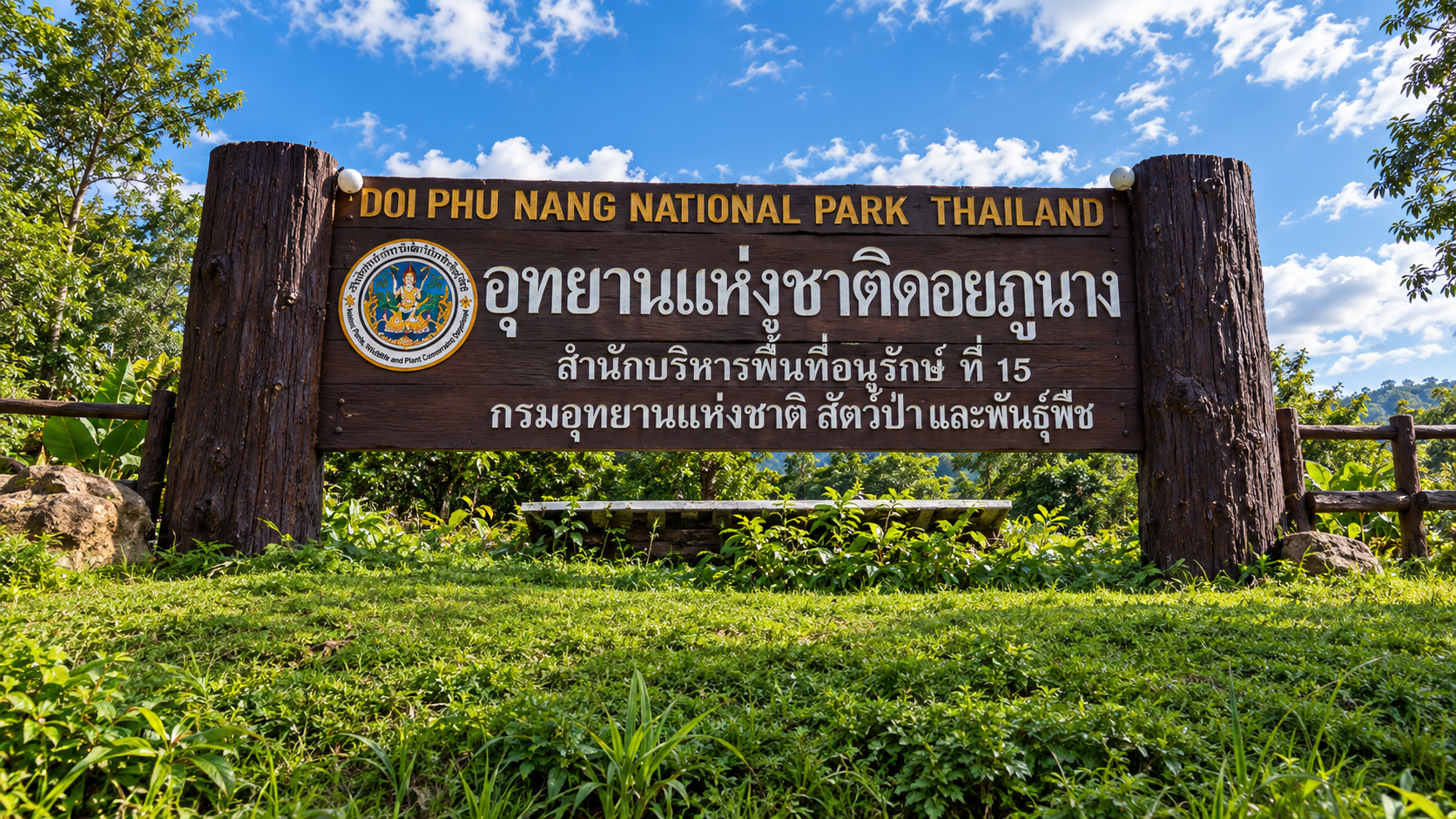
Doi Phu Nang National Park
อุทยานแห่งชาติดอยภูนาง
Where Wild Peafowl Roam Through the Forests of Phayao
Chiang Muan · Phayao · Northern Thailand
A living forest of Green Peafowl, limestone waterfalls, caves and mountain streams — a Phayao landscape that remains considerably quieter than Thailand’s better-known parks.
Where Wild Peafowl Roam Through the Forests of Phayao
Doi Phu Nang National Park (อุทยานแห่งชาติดอยภูนาง) is a forest-and-wildlife landscape in Phayao Province, Northern Thailand — a protected mountain park of dry evergreen, mixed deciduous and dipterocarp forest, limestone waterfalls, caves and wild Indochinese Green Peafowl. Covering approximately 859.88 square kilometres across Dok Khamtai, Pong and Chiang Muan districts, it is defined less by a famous summit than by what still lives inside the forest.
There are mountain landscapes that impress you with their height.
And there are forests that become memorable because of what lives inside them.
Doi Phu Nang is the second kind.
Set among the mountains of Phayao, the park protects a mosaic of ridges, streams and forest types that create habitats for a remarkable variety of wildlife. One animal has made Doi Phu Nang particularly special: the Green Peafowl.
The park is recognized as an important habitat for wild Green Peafowl in Northern Thailand. Then there are the waterfalls, limestone cliffs, caves, mountain streams and quiet forest roads that lead deeper into a landscape considerably less visited than Thailand’s better-known national parks.
Doi Phu Nang is not a destination built around one spectacular summit.
It is a destination built around an entire living forest.
What is Doi Phu Nang National Park?
Doi Phu Nang National Park is a protected forest and mountain landscape in Phayao Province, Northern Thailand, known for wild Indochinese Green Peafowl, limestone waterfalls, caves and mixed forest habitats.
Where is Doi Phu Nang National Park?
It is in Phayao Province in Northern Thailand, covering parts of three districts: Dok Khamtai, Pong and Chiang Muan.
What is Doi Phu Nang famous for?
The park is particularly known for its wild Green Peafowl, forest ecosystems, waterfalls and caves.
- Indochinese Green Peafowl habitat
- Than Sawan, Huai Ton Phueng and Na Bua waterfalls
- Pha Tang Cave and limestone landscapes
- Dry evergreen, mixed deciduous and dry dipterocarp forest
Can I see Green Peafowl at Doi Phu Nang?
The park is an important habitat for wild Green Peafowl, especially around January to March, but sightings are never guaranteed. Wildlife should always be observed from a respectful distance.
When is the best time to visit Doi Phu Nang?
Under normal access conditions, October to January is generally attractive for greener forest and cooler weather. January to March is interesting for Green Peafowl activity. The rainy season can produce stronger waterfalls, but trails may be wetter.
Is Doi Phu Nang National Park open?
Visitor access can change because of conservation measures, wildfire conditions, weather and official park regulations. Check the latest status with the Department of National Parks before travelling.
Doi Phu Nang National Park at a Glance
- Official Name
- Doi Phu Nang National Park
- Thai Name
- อุทยานแห่งชาติดอยภูนาง
- Province
- Phayao
- Region
- Northern Thailand
- Area
- Approximately 859.88 km² / 537,424 rai
- National Park No.
- 127
- Established
- 13 June 2012
- Districts
- Dok Khamtai, Pong, Chiang Muan
- Mountain System
- Phi Pan Nam Range
- Highest Point
- Doi Phu Nang, approximately 1,202 m
- Signature Wildlife
- Indochinese Green Peafowl
- Best Known For
- Than Sawan Waterfall, Huai Ton Phueng Waterfall, Pha Tang Cave, Na Bua Waterfall and forest trails
Doi Phu Nang became Thailand’s 127th national park in 2012 and covers approximately 859.88 square kilometres, or about 537,424 rai, according to the Department of National Parks, Wildlife and Plant Conservation. The protected area extends across Dok Khamtai, Pong and Chiang Muan districts of Phayao.
Why Doi Phu Nang Matters
Doi Phu Nang protects a large section of the Phi Pan Nam mountain system in Phayao — one of Northern Thailand’s quieter forest landscapes. See more national parks in Northern Thailand.
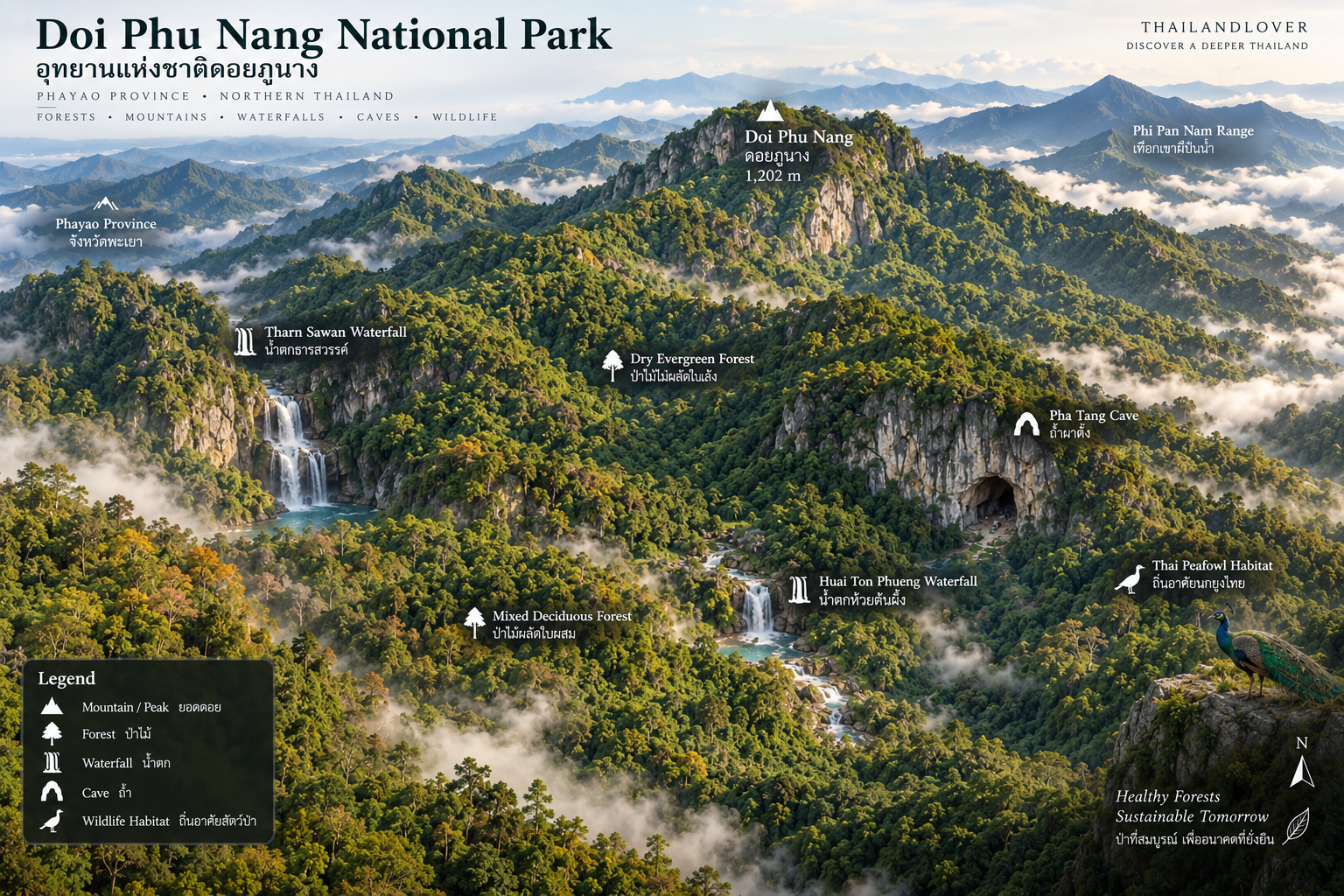
The terrain is predominantly mountainous and forested, with several different forest ecosystems occurring across the landscape:
- Dry evergreen forest
- Mixed deciduous forest
- Dry dipterocarp forest
- Mountain forest
- Stream and watershed habitats
The combination creates ecological niches for a wide variety of wildlife and plants. The park is also connected ecologically with other important protected areas in northern Thailand, forming part of a broader forest landscape around the Mae Yom region.
The significance of Doi Phu Nang therefore extends beyond its official boundaries. It is part of a larger network of northern mountain forests.
The Mountain Landscape
Doi Phu Nang is not dominated by a single dramatic peak. Instead, the landscape consists of interlocking mountain ranges, forested ridges, valleys and limestone formations.
The highest point is Doi Phu Nang itself, rising to approximately 1,202 metres above sea level. At this elevation, the mountain is high enough to create cooler forest conditions without becoming a high-alpine environment.
The result is a distinctly northern Thai mountain landscape: green ridges, dry-season golden forests, limestone cliffs, deep valleys and streams descending through the forest.
The terrain also changes dramatically with the seasons. During the rainy season, the mountains become intensely green and waterfalls gain strength. During the dry season, parts of the deciduous forest become more open, allowing more sunlight to reach the forest floor.
The Forest
A Landscape of Different Forests
One of the most interesting things about Doi Phu Nang is that the forest is not uniform. Different elevations, slopes, moisture levels and soil conditions create different forest communities.
- Dry evergreen forest
- These forests retain relatively dense vegetation throughout the year and are particularly important around streams and areas with greater moisture. They provide shade, food and shelter for wildlife.
- Mixed deciduous forest
- During the dry season, some trees shed their leaves, creating a very different visual landscape from the dense green forest of the rainy months. When the rains return, the forest changes again.
- Dry dipterocarp forest
- These forests are adapted to seasonal dryness and contain characteristic dipterocarp trees. Their more open structure can create grassy clearings and forest edges that are particularly interesting for wildlife observation.
Together, these ecosystems make Doi Phu Nang more than simply a “green mountain”. It is a changing ecological landscape.
The Green Peafowl
Doi Phu Nang’s Most Famous Resident
If one species defines Doi Phu Nang, it is the Indochinese Green Peafowl.
Known in Thailand as นกยูงไทย, the Green Peafowl is considerably different from the more familiar Indian Blue Peafowl commonly associated with gardens, temples and ornamental collections.
The wild birds of Doi Phu Nang belong to the Indochinese population. They are forest birds. They are wary. And seeing one in the wild is a very different experience from seeing a peafowl in captivity.
Doi Phu Nang has long been recognized for its significant wild population of Green Peafowl. Local and conservation sources have described the park as one of the most important remaining habitats for the species in northern Thailand.
The Peacock Season
The breeding season of the Green Peafowl is generally associated with January to March.
During this period, males may become more visible as they display and compete for mates. For wildlife observers, this is one of the most interesting periods of the year.
But wildlife is never guaranteed. A national park is not a wildlife enclosure.
The best approach is to move quietly, avoid disturbing birds and allow the animals to determine the distance between you.
How to Experience the Green Peafowl
If visitor access is officially permitted, the best wildlife observation strategy is simple:
Go early. Stay quiet. Watch the edges of the forest.
Pay attention to forest clearings, open woodland, roads passing through forest, areas near streams, forest edges and early-morning feeding areas.
Avoid loud conversations and sudden movement. And never chase a bird to obtain a photograph.
The photograph is not the objective. The encounter is.
Than Sawan Waterfall
The Emerald Heart of Doi Phu Nang
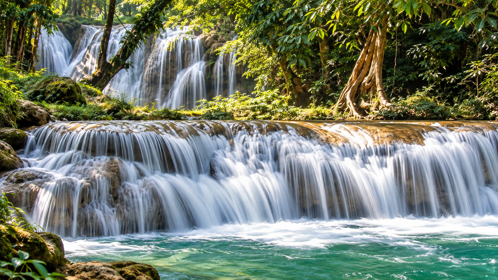
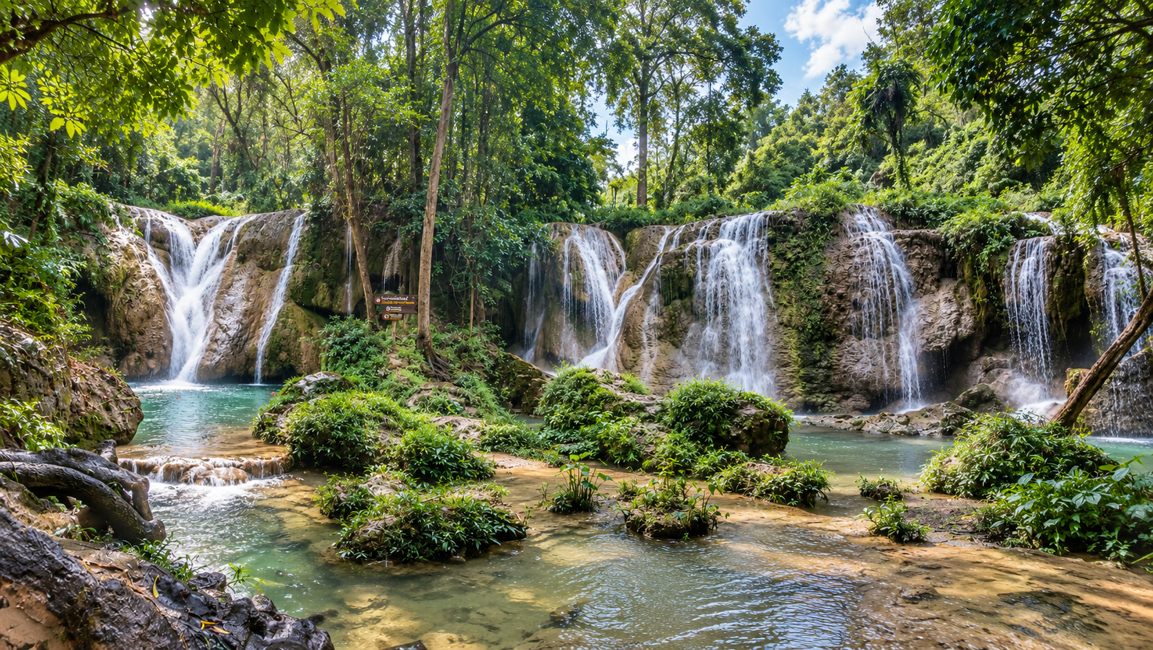
Than Sawan Waterfall is one of the park’s signature attractions.
The waterfall is located close to the park headquarters and is known for its clear, green-toned pool surrounded by forest. Community-based tourism descriptions record it as a medium-sized waterfall approximately 20 metres high and 40 metres wide, while other local descriptions divide the falls into multiple limestone levels.
Water flows from several small streams that converge before descending through the limestone landscape. The result is a waterfall environment that feels unusually lush for a northern Thai forest. The surrounding vegetation provides shade and creates a cool atmosphere even when the surrounding lowlands are hot.
The Than Sawan Nature Trail
Near Than Sawan Waterfall is a nature-study route of approximately 2 kilometres.
The trail allows visitors to experience the forest rather than simply photograph the waterfall. Along the route, the landscape changes between streams, forest vegetation and small natural features. When access is permitted, this is the most practical Doi Phu Nang hiking experience for most visitors.
For ThailandLover, this is an important distinction. The waterfall is the visual attraction. The trail is the ecological experience.
Huai Ton Phueng Waterfall
Huai Ton Phueng Waterfall is another natural highlight of Doi Phu Nang.
The waterfall is located approximately 11 kilometres from the park headquarters and is described as a small limestone waterfall with a high cascade. One local description records a major drop of approximately 80 metres, while access requires a walk of around 1 kilometre from the road.
The approach itself is part of the attraction. Rather than arriving directly at a developed viewpoint, visitors walk through forest toward the sound of water.
This makes the experience quieter and more immersive.
Na Bua Waterfall
Na Bua Waterfall is another limestone waterfall system associated with the park. It consists of multiple levels and is fed by mountain streams.
The waterfall is particularly attractive during periods of stronger water flow. As with many waterfalls in northern Thailand, the visual character changes dramatically between the rainy and dry seasons.
During the rainy season: more water, greener forest, stronger atmosphere.
During the dry season: more exposed rock, calmer pools and a different geological character.
Pha Tang Cave
Beneath the Limestone Mountain
Doi Phu Nang is not only a forest landscape. It is also a geological landscape.
Pha Tang Cave is one of its best-known cave environments. The cave system includes impressive limestone formations, with stalactites and stalagmites formed over long periods of geological time.
The larger cave is reported to extend approximately 800 metres, with additional smaller caves around the Pha Tang area.
Above ground: forest, sunlight, birds and waterfalls. Below ground: darkness, limestone chambers, mineral formations and underground passages.
Pha Tang — A Landscape Shaped by Water
A Landscape Shaped by Water
The cliffs around Pha Tang demonstrate how water has gradually shaped the limestone landscape.
Rainwater enters cracks in the rock. Over geological time, those cracks expand. Water dissolves and reshapes limestone. Caves develop. Streams emerge. And the landscape slowly transforms.
This is why the waterfalls and caves of Doi Phu Nang should not be viewed as separate attractions. They are different expressions of the same geological and hydrological system.
Fang Ta
A Natural Sculpture Garden
Another distinctive landscape within the broader Doi Phu Nang area is Fang Ta.
The landscape has been compared with the famous rock formations of Phae Muang Phi in Phrae. Long-term erosion by water and wind has carved unusual shapes into the terrain.
Instead of a conventional mountain viewpoint, visitors encounter a landscape of natural rock sculptures. The shapes change according to light, weather and perspective.
This is one of the places where Doi Phu Nang becomes particularly interesting for landscape photographers.
Huai Yua Reservoir
The Huai Yua Reservoir offers a completely different perspective on the park landscape. Here, forest and water meet.
The reservoir becomes particularly atmospheric in the cooler season when morning mist can settle over the surrounding landscape. Sunrise is one of the most attractive times to experience the area.
Rather than dramatic mountain peaks, the visual appeal comes from water, forest, mist and morning light.
Kaeng Luang
Kaeng Luang lies farther into the park landscape, in the area above Kaeng Suea Ten.
During the rainy season, higher water levels create opportunities for river-based recreation such as rafting in appropriate conditions. During the dry season, falling water levels expose rocks and create a very different landscape.
This seasonal transformation is typical of northern Thailand’s river systems. The river is never exactly the same landscape twice.
Wildlife Beyond the Peacock
The Green Peafowl may be the park’s most famous species, but it is not the only wildlife found here.
The different forest habitats support birds, reptiles, amphibians, insects, small mammals and forest species associated with seasonal streams.
Species documented in descriptions of the park include animals such as monitor lizards, freshwater turtles, forest birds, Green Peafowl and other small wildlife associated with dry and mixed forests.
The park’s importance is therefore not based on a single species. It is the combination of multiple habitats that makes the landscape ecologically valuable.
Birdwatching
Doi Phu Nang is especially interesting for birdwatchers because of its forest diversity. The Green Peafowl is the obvious headline species. But the broader forest supports many other birds.
A serious birdwatching trip should begin early. Morning is generally when forest activity is highest.
Listen before looking. Birds are often easier to identify by sound than by sight. And in a dense forest, patience can be more important than equipment.
Plant Life
Doi Phu Nang contains a considerable variety of plant communities. Research conducted in the park has documented significant diversity among the ginger family (Zingiberaceae), including 30 species across 7 genera in one survey.
This is particularly interesting because the ginger family includes many plants that are important not only ecologically but also culturally and economically in Southeast Asia.
The forest environment also supports orchids, ferns, vines, bamboo, hardwood species, dipterocarps and streamside vegetation.
The plant story of Doi Phu Nang is therefore much richer than the better-known story of its wildlife.
A Mountain Watershed
Doi Phu Nang also plays an important hydrological role. Streams originating in the forest feed larger waterways in the surrounding landscape, contributing to the wider Mae Yom / Yom River watershed.
This is one of the most important reasons to understand the park as a conservation landscape. The forest does not exist only for recreation. It stores water. It slows runoff. It protects soil. It provides habitat. And it supports communities downstream.
A waterfall is therefore not merely a tourist attraction. It is the visible endpoint of a much larger forest-water system.
Doi Phu Nang & the Mae Yom Landscape
The park forms part of the broader forest landscape around the Mae Yom River.
This region contains a network of forests and protected areas that together form an important ecological corridor in northern Thailand. The wider Doi Phu Nang area is also associated with nearby protected landscapes such as Doi Pha Chang Wildlife Sanctuary, Wiang Lor Wildlife Sanctuary and Mae Yom National Park.
This wider landscape is important because wildlife does not recognize administrative boundaries. A forest corridor is more valuable when animals can move between connected habitats.
Best Time to Visit
Under normal access conditions, October to January is generally the most comfortable period for greener forest and cooler air. January to March is interesting for Green Peafowl activity. The rainy season can produce stronger waterfalls, while the dry season opens the deciduous forest and raises wildfire risk. Seasonal conditions vary — see also ThailandLover’s guide to when to go.
October – January
Green Forest & Cool Air
This period is traditionally considered one of the most attractive times to experience the park. The forest is greener after the rainy season and the weather becomes more comfortable. Morning mist can add another layer to the landscape. This is also a good period for landscape photography.
January – March
Green Peafowl Season
The breeding period of the Green Peafowl generally falls around January to March. For wildlife enthusiasts, this is potentially the most interesting period. However, exact wildlife activity varies naturally. Do not expect guaranteed sightings.
Rainy season
Waterfalls at Their Best
The rainy season brings stronger streams, greener vegetation and more dramatic waterfall conditions. This is arguably the most visually impressive period for the waterfall landscapes. However, wet trails, slippery rocks and flash-flood risks can make some areas unsuitable for visitors. Always follow current park instructions.
Dry season
A Different Forest
The dry season reveals another side of Doi Phu Nang. Deciduous trees lose their leaves. The forest becomes more open. Dry grasses become visible. And wildfire risk increases significantly. The severe fire conditions that led to the 2025 closure demonstrate why dry-season travel in protected forests must be treated seriously.
How Long Should You Spend?
Under normal circumstances, a basic visit could be planned around:
- 1 day
- Waterfall + nearby nature experience + surrounding landscape.
- 2 days
- Waterfalls + nature trail + wildlife observation + slower exploration.
- 3 days or more
- Useful for serious nature enthusiasts who want to explore different sections of the park and surrounding Phayao landscapes.
However, the actual itinerary must always follow current access restrictions and conservation rules.
How to Get There
The park headquarters is located in Ban Mang, Chiang Muan District, Phayao Province.
The park can be approached through the road network connecting Phayao with Chiang Muan and the surrounding districts.
Because the protected area extends across three districts and covers a large mountainous landscape, having private transportation provides considerably more flexibility than relying on public transport.
For remote attractions such as waterfalls and caves, access conditions can vary. Road conditions, trail conditions and official access restrictions should always be checked before travelling. For broader trip logistics, see ThailandLover’s notes on getting around Thailand.
Where to Stay
The park has historically provided accommodation and camping facilities around its headquarters. Official DNP accommodation records list four park houses in the headquarters zone:
- Doi Phu Nang 101 — Chom Doi 1
- Doi Phu Nang 102 — Chom Doi 2
- Doi Phu Nang 103 — Chom Doi 3
- Doi Phu Nang 104 — Chom Kho
The official accommodation schedule lists capacities of approximately 8 people per house, subject to the specific unit.
However, visitor-access status can change. Do not assume that accommodation is currently available. Always verify directly with the park or the Tourism Authority of Thailand listing and DNP before travelling.
Responsible Travel
Doi Phu Nang is a wildlife and forest destination. That changes the rules of the experience.
Do
- Stay on designated routes
- Keep noise low
- Carry your rubbish out
- Respect wildlife
- Keep a safe distance from Green Peafowl
- Follow fire restrictions
- Follow instructions from park officers
- Use established camping areas where permitted
Don’t
- Feed wildlife
- Chase birds
- Collect plants or pick flowers
- Remove rocks or cave formations
- Light fires outside designated areas
- Enter closed forest areas
- Ignore wildfire restrictions
- Enter the park during official closure periods
The most important rule is simple:
If the forest is closed, stay out. A temporary loss of access is preferable to permanent ecological damage.
Doi Phu Nang & Conservation
The 2025 closure illustrates an increasingly important reality for Thailand’s national parks. Protected areas are under pressure from wildfire, agricultural expansion, illegal forest use, climate variability, human disturbance and changing rainfall patterns.
In March 2025, DNP reported 557 hotspots in the Doi Phu Nang area between 1 October 2024 and 25 March 2025, compared with 401 during the corresponding period a year earlier — an increase of 38.9%.
The response was not simply to send firefighters. The park was closed to allow the ecosystem to recover and to reduce human access during a critical period.
This is an important part of the modern story of Doi Phu Nang.
The ThailandLover Experience
If Doi Phu Nang were open for normal tourism, ThailandLover would not recommend treating it as a checklist destination. Instead, experience it through four themes.
- 01 — Wildlife
- Come for the possibility of seeing the Green Peafowl in its natural habitat. Not a staged encounter. Not a captive bird. A wild animal choosing whether to reveal itself.
- 02 — Water
- Follow the journey of mountain water — from forest streams, to waterfalls, to rivers, to the wider Mae Yom watershed.
- 03 — Stone
- Explore the relationship between limestone, caves, cliffs and waterfalls. The geological landscape explains much of the park’s visual character.
- 04 — Forest
- Slow down. Look at the trees. Listen to birds. Notice insects. Watch how the forest changes with elevation and season. This is where Doi Phu Nang becomes more than a tourist attraction.
Who Should Visit Doi Phu Nang?
- Wildlife enthusiasts
- Especially birdwatchers and anyone interested in Green Peafowl conservation.
- Nature photographers
- The combination of waterfalls, forest, mist, limestone and wildlife creates strong photographic opportunities.
- Hikers
- For visitors who enjoy forest trails rather than highly developed tourist attractions.
- Families
- The easier waterfall and nature areas can be suitable when officially open and when current conditions allow.
- Slow travellers
- Doi Phu Nang is better suited to people who enjoy observation and nature than those looking for a packed attraction schedule.
Who Might Not Enjoy It?
Doi Phu Nang is probably not the right destination for travellers looking for nightlife, shopping, large tourist attractions, luxury resort infrastructure, guaranteed wildlife encounters, heavily developed viewpoints or a quick list of photo spots.
Its strength is precisely the absence of those things.
Essential Information
- Official Name
- Doi Phu Nang National Park
- Thai Name
- อุทยานแห่งชาติดอยภูนาง
- Province
- Phayao, Thailand
- Area
- Approximately 859.88 km² / 537,424 rai
- National Park
- No. 127
- Established
- 13 June 2012
- Districts
- Dok Khamtai · Pong · Chiang Muan
- Highest Point
- Doi Phu Nang, approximately 1,202 m
- Signature features
- Indochinese Green Peafowl · Than Sawan Waterfall · Huai Ton Phueng Waterfall · Na Bua Waterfall · Pha Tang Cave · Fang Ta · Huai Yua Reservoir · Kaeng Luang
Frequently Asked Questions
- Where is Doi Phu Nang National Park?
- Doi Phu Nang National Park is in Phayao Province in Northern Thailand, covering parts of Dok Khamtai, Pong and Chiang Muan districts.
- What is Doi Phu Nang famous for?
- The park is particularly known for its wild Indochinese Green Peafowl, forest ecosystems, waterfalls, caves and mountain landscapes.
- Can I see Green Peafowl at Doi Phu Nang?
- The park is an important habitat for wild Green Peafowl, but sightings are never guaranteed. Wildlife should always be observed from a respectful distance.
- When is Green Peafowl breeding season?
- The breeding season is generally associated with January to March.
- What is the most famous waterfall?
- Than Sawan Waterfall is one of the park’s signature attractions and is known for its forest setting and green-toned pools.
- Are there caves in Doi Phu Nang?
- Yes. Pha Tang Cave is one of the best-known cave systems in the park, with stalactites, stalagmites and a larger cave passage reported at approximately 800 metres.
- How large is Doi Phu Nang National Park?
- The officially cited area is approximately 859.88 square kilometres, equivalent to around 537,424 rai.
- What is the highest mountain?
- The park’s namesake, Doi Phu Nang, reaches approximately 1,202 metres above sea level.
- Can I stay overnight?
- The park has historically provided cabins and camping facilities. However, accommodation availability depends on current visitor-access rules and should be confirmed directly with park authorities. Official DNP accommodation records list four cabins at the headquarters.
- Is Doi Phu Nang currently open?
- Visitor access can change because of conservation measures, wildfire conditions, weather and official park regulations. The Department of National Parks announced a closure on 25 March 2025 because of severe wildfire conditions and ecosystem recovery. Check the latest status with DNP before travelling, and do not rely on third-party listings.
- When is the best time to visit?
- Under normal access conditions, October–January is a particularly attractive period for green forests, cooler weather and mist, while January–March is interesting for Green Peafowl activity. The rainy season can produce stronger waterfalls, but access conditions vary.
More National Parks to Explore
- Mae Yom National Park
- A neighbouring forest and river landscape on the Mae Yom watershed — part of the same northern corridor.
- Doi Luang National Park
- A vast mountain wilderness across Chiang Rai, Phayao and Lampang — limestone waterfalls and forested ridges.
- Phu Sang National Park
- Another Phayao landscape of forest, water and quieter northern mountain country.
- Doi Pha Hom Pok National Park
- Thailand’s second-highest mountain — summit trekking, Kiew Lom camping and Fang Hot Springs in Chiang Mai.
- Doi Pha Klong National Park
- A compact stone landscape in Phrae — Coral Rock Mountain, Erawan Cave and the Yom River.
- Doi Phu Kha National Park
- Nan’s highland wilderness — rare Chomphu Phu Kha forest, sea of mist and mountain trekking.
- explore more national parks in Thailand
- More mountains, forests and protected landscapes across ThailandLover’s Nature & Parks collection.
Location
Find Doi Phu Nang National Park
Ban Mang, Chiang Muan, Phayao, Northern Thailand