

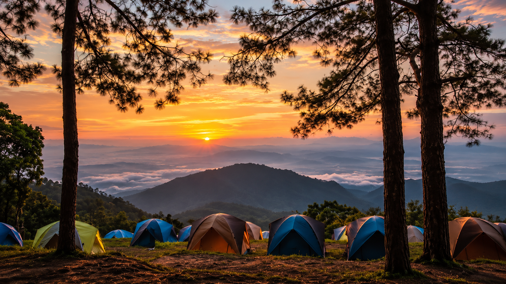
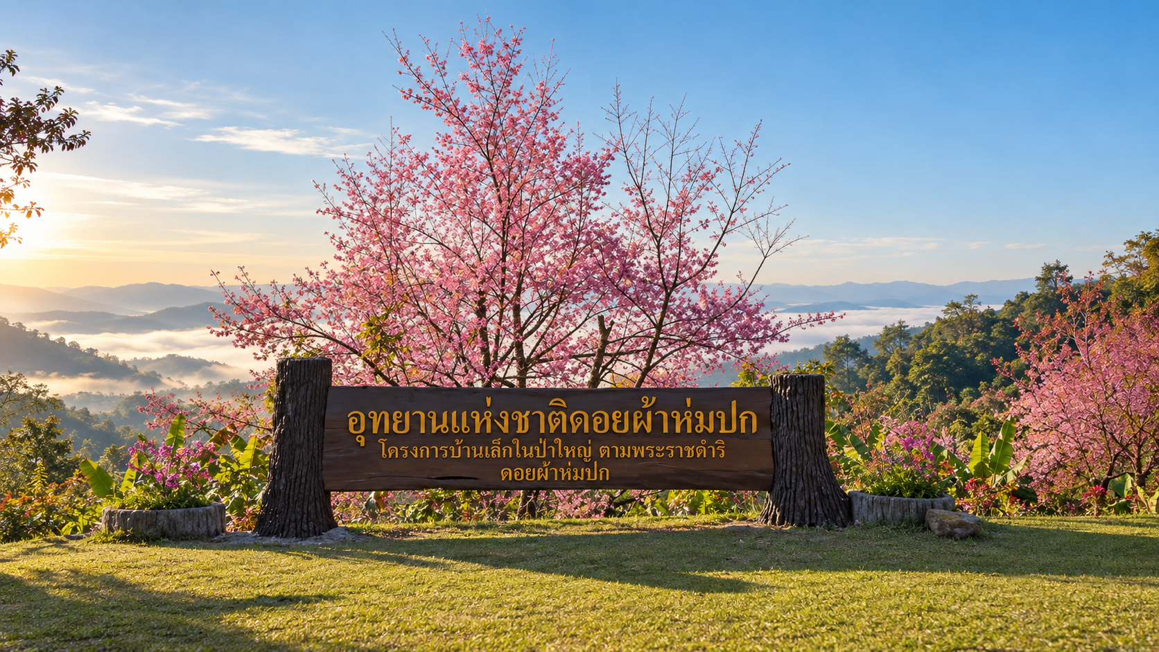
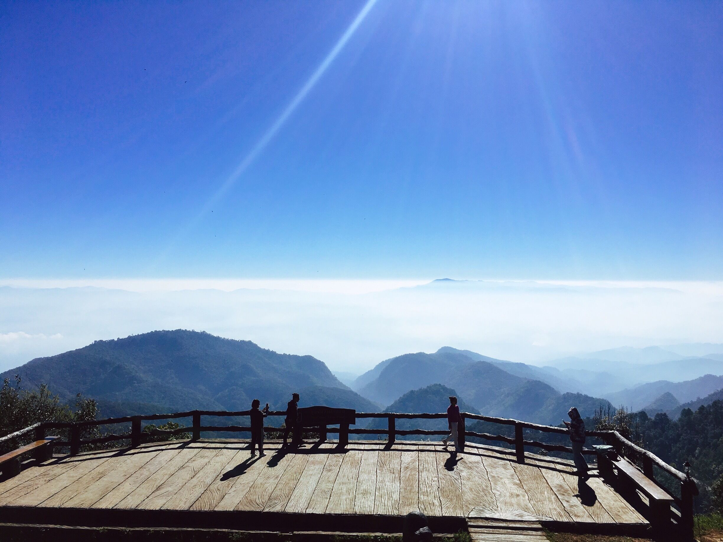
National Park · Chiang Mai
Doi Pha Hom Pok National Park
อุทยานแห่งชาติดอยผ้าห่มปก · อุทยานแห่งชาติดอยฟ้าห่มปก
The High Mountain Wilderness of Northern Thailand
Fang · Mae Ai · Chai Prakan · Chiang Mai
Thailand’s second-highest mountain — a high-altitude wilderness of wind, mist, forest, geothermal springs and rare birds on the northern frontier.
The High Mountain Wilderness of Northern Thailand
At the northern edge of Thailand, where the mountains rise toward the Myanmar border, Doi Pha Hom Pok National Park offers one of the country’s most remarkable high-altitude landscapes.
This is a place of steep mountain ridges, deep forests, geothermal springs, rare orchids, migratory birds and cold, mist-covered summits.
At its heart stands Doi Pha Hom Pok, rising to 2,285 metres above sea level — the second-highest mountain in Thailand, after Doi Inthanon.
But the mountain itself is only part of the story.
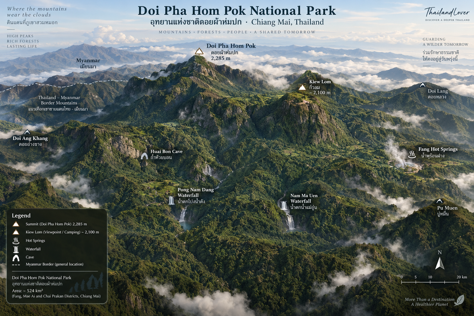
Below the summit, the landscape descends through vast forests toward Fang Valley, where geothermal activity creates the extraordinary Fang Hot Springs. Along the western side, the park reaches toward the Myanmar border, while its forests form important watersheds for the surrounding communities.
For travellers looking beyond Thailand’s most familiar mountain destinations, Doi Pha Hom Pok offers something different:
A high-altitude wilderness where mountains, forests, wildlife and geothermal landscapes exist within one extraordinary protected area.
Doi Pha Hom Pok at a Glance
- English Name
- Doi Pha Hom Pok National Park
- Thai Name
- อุทยานแห่งชาติดอยผ้าห่มปก
- Official Thai naming
- อุทยานแห่งชาติดอยฟ้าห่มปก
- Location
- Chiang Mai Province, Northern Thailand
- Districts
- Fang, Mae Ai & Chai Prakan
- Mountain Range
- Daen Lao Range
- Highest Peak
- Doi Pha Hom Pok — 2,285 metres above sea level
- Rank
- Thailand’s second-highest peak
- Area
- Approximately 327,500 rai / 524 km²
- Established
- 4 September 2000
- National Park
- Thailand’s 97th National Park
- Border
- Myanmar along the western side
- Major Experiences
- Summit trek · Kiew Lom camping · sunrise and sea of mist · Fang Hot Springs · birdwatching · orchids · waterfalls · mountain photography
The park covers approximately 524 square kilometres, or 327,500 rai, across Fang, Mae Ai and Chai Prakan districts of Chiang Mai. It was established as Thailand’s 97th national park on 4 September 2000.
Why Doi Pha Hom Pok Is Special
Thailand has many beautiful mountains.
But Doi Pha Hom Pok is unusual because several major natural environments meet within one park.
At the highest elevations, the landscape becomes a cold, windswept mountain environment.
Lower down, dense forests cover the slopes.
Further toward Fang, underground geothermal activity produces hot springs.
And along the mountain forests, particularly around Doi Lang, the area becomes a remarkable habitat for birds and other wildlife.
It is therefore not simply a mountain destination.
It is a complete highland ecosystem.
The Second-Highest Mountain in Thailand
The defining feature of the park is Doi Pha Hom Pok, which rises to approximately 2,285 metres above sea level.
Only Doi Inthanon, at 2,565 metres, is higher.
This makes Doi Pha Hom Pok one of the most significant mountain destinations in Thailand for travellers interested in altitude, trekking and high-elevation landscapes.
Unlike Doi Inthanon, however, there is no road leading directly to the summit.
The final approach requires a trek.
That difference changes the experience completely.
You do not simply arrive at the top.
You have to walk into the mountain.
A Mountain of Wind, Mist & Granite
The summit of Doi Pha Hom Pok has a distinctive character.
The upper landscape is relatively open and exposed, with shallow soils and granite surfaces. Strong winds and frequent cloud cover contribute to the mountain’s cool, rugged atmosphere.
The summit is often surrounded by mist.
On clear mornings, the landscape opens into layers of distant mountains and valleys.
On cloudy mornings, the experience becomes more intimate.
The mountain disappears into mist.
The forest becomes quieter.
And the trail feels less like a sightseeing route and more like an expedition into the highlands.
The Meaning Behind the Name
The name Pha Hom Pok is commonly associated with the image of a mountain “covered” or “wrapped” by the sky and mist.
It is an appropriate description.
The summit frequently carries clouds and mist, creating the impression that the mountain is naturally wrapped in a blanket.
For ThailandLover, this is one of the most evocative characteristics of the destination:
A mountain that seems to disappear into the clouds.
The Mountain Range
Doi Pha Hom Pok forms part of the Daen Lao mountain range, a major mountain system extending across the northern part of Thailand and into neighbouring Myanmar.
The park’s terrain is highly mountainous, with elevations ranging from approximately 400 metres to 2,285 metres above sea level.
Important mountains in the wider park landscape include:
- Doi Pha Hom Pok
- Doi Pu Muen
- Doi Laem
- Doi Lang
The variation in elevation is one of the reasons the park contains such a diverse range of forest environments.
Three Districts, One Mountain Ecosystem
Doi Pha Hom Pok National Park extends across three districts of Chiang Mai:
- Fang
- The principal gateway to the park and the location of the park headquarters around Fang Hot Springs.
- Mae Ai
- The northern sections of the park extend into Mae Ai, creating a broad mountain landscape toward the northern frontier.
- Chai Prakan
- The southern portion of the park reaches Chai Prakan, connecting the mountain ecosystem with the surrounding highlands.
The western boundary approaches Myanmar, with the park sharing an international frontier landscape extending for approximately 70 kilometres.
The Myanmar Frontier
One of the less obvious characteristics of Doi Pha Hom Pok is its proximity to Myanmar.
The western side of the park follows the mountainous frontier.
This gives the landscape a feeling of remoteness that is unusual for a national park relatively accessible from Chiang Mai.
There are no urban skylines here.
Instead, the landscape is dominated by mountains, forests and long-distance views.
This frontier geography also contributes to the ecological importance of the area.
Doi Pha Hom Pok Summit Trek
The Signature Experience
The summit trek is the defining experience of Doi Pha Hom Pok.
The standard approach begins from Kiew Lom, a high-altitude camping area that serves as the base for the final ascent.
From the campsite, travellers continue on foot toward the summit.
The route is approximately 3.1–3.5 kilometres one way, depending on the route and current trail conditions.
The hike involves a significant climb and should be treated as a genuine mountain trek rather than a casual nature walk.
Kiew Lom
Kiew Lom is more than simply a campsite.
It is the staging point for the summit experience.
At high elevation, the temperature is substantially lower than in Fang Valley, particularly during the cool season.
Many visitors stay overnight at Kiew Lom and begin the summit hike before sunrise.
This strategy makes sense for one important reason:
The mountain is at its most atmospheric in the early morning.
Hiking Before Sunrise
One of the most memorable ways to experience Doi Pha Hom Pok is to begin the final ascent while it is still dark.
The trail becomes a completely different world.
The forest is quiet.
The temperature drops.
The sky slowly changes colour.
And as the trail approaches the upper ridge, the first light begins to illuminate the surrounding mountains.
The final reward is not simply reaching the summit.
It is watching the landscape appear.
Sunrise from Doi Pha Hom Pok
On a clear morning, sunrise from the summit can reveal layers of mountains extending toward the horizon.
When moisture accumulates in the valleys below, the landscape may transform into a sea of mist.
The higher ridges remain visible above the cloud layer.
This is one of the classic mountain scenes of Northern Thailand.
But conditions are never guaranteed.
Cloud, wind and visibility can change quickly at 2,285 metres.
That uncertainty is part of the mountain experience.
Sea of Mist
The sea of mist is most commonly associated with the cooler months, when overnight temperatures and atmospheric conditions favour low cloud and valley mist.
The best opportunities are generally around sunrise.
The visual sequence can be extraordinary:
Dark forest → first light → mountain silhouettes → mist-filled valleys → golden sunrise.
For photographers, this is one of the strongest reasons to camp at Kiew Lom.
Doi Pha Hom Pok Is Not an Easy Viewpoint
This distinction matters.
The summit is not a roadside attraction.
Visitors need to:
- Travel to the high-altitude trailhead
- Prepare for a mountain hike
- Carry sufficient water
- Wear appropriate footwear
- Prepare for cold temperatures
- Use a headlamp for pre-dawn hiking
- Follow current ranger instructions
Fang Hot Springs
A Completely Different Side of the Park
If Doi Pha Hom Pok represents the park’s cold, high-altitude world, Fang Hot Springs represents its geothermal heart.
Located near the park headquarters, the hot springs are one of the most distinctive attractions in the entire national park.
The geothermal area covers approximately 10 rai and contains more than 50 hot springs.
Water temperatures vary significantly, with some sources reaching extremely high temperatures.
The Great Geothermal Geyser
The most dramatic feature is a large hot spring that can send steam and hot water high into the air.
The largest spring has been reported to produce a column reaching approximately 40–50 metres.
The sight is particularly striking in the cool morning air, when steam rises visibly above the forest landscape.
This is not a conventional hot spring resort.
It is a genuine geothermal landscape.
Why Are the Springs So Hot?
The hot springs are produced by geothermal heat beneath the Earth’s surface.
Groundwater passes through heated geological layers before returning toward the surface through fractures and geological structures.
The result is a natural system of hot pools, steam vents and mineral-rich water.
Some pools are extremely hot.
Visitors should never enter or touch undeveloped hot-spring pools unless an area has specifically been designated for bathing.
Boiling Eggs at Fang Hot Springs
One of the traditional visitor experiences is cooking eggs using the natural heat of the hot springs.
The activity demonstrates just how hot the geothermal water can be.
Some pools are hot enough to cook eggs in a relatively short period.
It is a simple activity, but it connects visitors directly with the geological phenomenon beneath their feet.
Forest Walks Around the Hot Springs
The hot-spring area is not only about the geothermal pools.
The surrounding forest provides an opportunity to observe the transition between the developed visitor area and the natural landscape.
Walking trails allow visitors to experience the forest without committing to the demanding summit trek.
This makes Fang Hot Springs a particularly good introduction to Doi Pha Hom Pok for travellers who have limited time.
Doi Lang
One of Northern Thailand’s Birdwatching Destinations
For serious birdwatchers, Doi Lang may be one of the most important places within the wider Doi Pha Hom Pok landscape.
The high-elevation forest and location near the northern frontier create habitat for a remarkable variety of birds.
During winter, migratory species increase the diversity of birdlife.
Reported species include rare and distinctive mountain birds such as:
- Purple Cochoa
- Himalayan Cutia
- Red-tailed Laughingthrush
- Chestnut Thrush
- Other high-altitude and migratory species
The park’s Doi Lang area is therefore particularly attractive to birders looking for species that are difficult to encounter elsewhere in Thailand.
Rare Birds
One of the attractions of Doi Lang is that birdwatching here is not simply about seeing large numbers of common species.
The appeal is the possibility of encountering specialised highland birds.
Winter is particularly interesting because migratory birds arrive from higher latitudes.
For birdwatchers, patience is essential.
The best sightings often come from standing quietly, listening and allowing the forest to reveal itself.
Orchids & Mountain Flora
Doi Pha Hom Pok is also notable for its botanical diversity.
The combination of elevation, cool temperatures, moisture, forest diversity and mountain geology creates suitable habitats for numerous plants and epiphytes.
The park is particularly known for orchids, including rare species.
More than 70 orchid species have been reported in the park’s broader botanical records, alongside rare mountain plants and forest flowers.
A Landscape for Wildflowers
The upper mountain landscape can change dramatically with the seasons.
Small flowers appear among grasses and rocks.
Orchids grow in forest environments.
Moss and ferns thrive in damp areas.
And the high-elevation vegetation becomes increasingly distinct from the forests below.
For macro photographers, these details can be as interesting as the mountain panorama.
Butterflies
The park is also notable for butterfly diversity.
One particularly interesting species associated with the area is the Doi Pha Hom Pok Emerald, reported as a butterfly found in Thailand specifically around this mountain region.
Other mountain butterfly species can also be encountered along forest trails and higher elevations.
This makes the destination particularly appealing to photographers interested in small-scale wildlife rather than only large animals.
Forest Ecosystems
The large elevation range of the park creates several forest environments.
Reported forest types include:
- Dry dipterocarp forest
- Mixed deciduous forest
- Dry evergreen forest
- Pine forest
- Montane / hill evergreen forest
These forest types change according to altitude, rainfall, soil and exposure.
The result is a layered ecosystem extending from warm lowland valleys to cold high mountain ridges.
The Headwaters of Fang
Doi Pha Hom Pok is also important as a watershed.
The mountain forests are the source of several streams and tributaries, including:
- Huai Mae Chai
- Huai Mae Fang
- Huai Mae Sao
- Mae Kum Luang
- Mae Hang
- Mae Laeng
These waterways connect the protected mountain ecosystem with the agricultural and residential landscapes below.
The national park is therefore not simply scenic.
Its forests provide important ecological services to the surrounding region.
Wildlife
The park’s large protected forest supports a wide range of wildlife.
Species recorded or associated with the area include various deer, wild boar, small carnivores, primates, squirrels, civets, birds, reptiles and amphibians.
The park’s most important wildlife experience, however, is not a guarantee of seeing a particular animal.
It is the opportunity to enter a functioning forest ecosystem.
Tracks. Calls. Movement in the canopy. Birds crossing the trail.
These are often the real signs that you are travelling through wildlife habitat.
Wildlife Watching Ethics
- Never approach wildlife for photographs
- Never feed animals
- Never use food to attract birds or mammals
- Avoid loud music and unnecessary noise
- Never leave food waste along the trail
A photograph is not worth changing an animal’s natural behaviour.
Waterfalls
Although the summit and hot springs are the park’s best-known attractions, Doi Pha Hom Pok also contains several waterfalls and forest watercourses.
Pong Nam Dang Waterfall
A forest waterfall surrounded by the mountain landscape.
Tad Luang Waterfall
Another waterfall destination within the park’s extensive forest system.
Nam Ma Uen Waterfall
A quieter natural attraction associated with the park’s mountain streams.
Water flow is naturally seasonal. The rainy season generally provides stronger waterfalls, while dry-season conditions can reduce flow.
Huai Bon Cave
Huai Bon Cave is another natural feature associated with the park.
Unlike the open mountain summit or geothermal springs, the cave introduces visitors to another side of the area’s geology.
The cave landscape is connected to the mountain’s limestone and geological formations.
Cave access should always follow current park guidance because underground environments can become dangerous during rainfall.
Doi Pha Hom Pok in Different Seasons
November – February
The Mountain Season
This is generally the most attractive period for high-altitude trekking.
The weather becomes cool and dry. Morning mist becomes more likely. The summit can be extremely cold.
Winter is also particularly attractive for birdwatching because migratory species arrive.
At the summit, temperatures can approach around 2°C during winter according to local park information.
Best for: summit trekking, sunrise, sea of mist, camping, birdwatching, photography.
March – May
The Hot & Hazy Season
Lower elevations become increasingly hot.
April is generally the hottest period, with local climatic records indicating maximum temperatures around 39°C in the lower areas.
Visibility can also be affected by Northern Thailand’s seasonal haze and wildfire conditions.
Travellers planning mountain photography should check air quality before travelling.
June – October
The Green Season
The monsoon brings rainfall and transforms the forest into a deep green landscape.
Waterfalls become more impressive. Streams become fuller. Moss and forest vegetation become particularly vibrant.
However, wet conditions also make mountain trails more slippery. Heavy rain can affect access and trekking safety.
When Is the Best Time to Visit?
There is no single best season for everyone.
- Best for trekking
- November – February
- Best for sea of mist
- Cool-season mornings
- Best for birdwatching
- Winter
- Best for green forest
- Rainy season
- Best for waterfalls
- Rainy season / immediately after rainfall
- Best for hot springs
- Cool mornings
- Best for landscape photography
- November – February
If the primary goal is the summit, the cool season is the strongest choice.
A Perfect Doi Pha Hom Pok Experience
For travellers with enough time, the ideal experience is not a rushed day trip.
Day 1
Arrive in Fang. Visit Fang Hot Springs. Walk through the geothermal area. Enjoy the surrounding forest. Continue toward the highland camping area according to current park arrangements. Set up camp at Kiew Lom. Watch the mountains change colour toward sunset.
Day 2
Wake before dawn. Prepare for the summit trek. Start the ascent in darkness. Reach the upper ridge around sunrise. Watch the mountains emerge from the mist. Explore the summit. Return to camp. Descend toward the lower park. Finish the journey with a slower afternoon around Fang.
This sequence allows the traveller to experience the park at both extremes:
Geothermal lowland → high-altitude mountain wilderness.
Doi Pha Hom Pok for Photographers
This is a destination where photography can begin before the summit.
- Geothermal photography
- Steam rising from the hot springs can create dramatic images in cool morning light.
- Forest photography
- Look for moss, ferns, orchids, tree textures and light through the canopy.
- Mountain photography
- The upper ridge provides layered mountain compositions.
- Sea of mist
- Use the summit rocks and vegetation as foreground elements.
- Sunrise
- The changing light creates rapidly shifting tones across the mountain layers.
- Wildlife
- Use long lenses and maintain distance.
Doi Pha Hom Pok for Birdwatchers
If birdwatching is the primary purpose of your trip, do not treat Doi Lang as an optional side attraction.
The high-elevation forests and winter migration make the area one of Northern Thailand’s notable birding environments.
Bring binoculars, a telephoto lens, a field guide, neutral clothing and patience.
Early morning is generally the most productive period.
What to Bring for the Summit
Essential
- Hiking shoes
- Warm jacket
- Windproof layer
- Headlamp
- Water
- Snacks
- Personal medication
- Rain protection
- Gloves during cold months
- Phone / camera
- Power bank
Highly recommended
- Trekking poles
- Small backpack
- Dry bag
- Hat
- Sunscreen
- Insect repellent
The summit is exposed and windy. A warm jacket is not optional during the cool season.
Is Doi Pha Hom Pok Suitable for Everyone?
- Yes — for the hot springs
- Fang Hot Springs can be enjoyed without undertaking the summit trek.
- Yes — for casual nature travellers
- There are forest and geothermal experiences that require much less physical effort.
- Yes — for photographers
- The park offers many different photographic environments.
- Yes — for birdwatchers
- Doi Lang is particularly attractive.
- But be prepared if you want the summit
- The summit trek requires reasonable fitness and proper preparation. This is a mountain — not a viewpoint beside a parking lot.
Getting to Doi Pha Hom Pok
The principal gateway is the Fang area of Chiang Mai.
From Chiang Mai city, travellers generally travel north along Highway 107 toward Fang.
The park headquarters and Fang Hot Springs are in the Fang area.
The mountain trekking experience requires continuing into the highland section of the park and following the current access arrangements toward Kiew Lom.
Because mountain roads and access policies can change, travellers should confirm the current route and vehicle arrangements with the park before departure.
From Chiang Mai
The drive from Chiang Mai to Fang is a substantial northern road journey.
Rather than treating Doi Pha Hom Pok as a quick day trip from central Chiang Mai, ThailandLover recommends considering it as part of a Northern Thailand road trip.
Possible combinations include:
Chiang Mai → Fang → Doi Pha Hom Pok → Tha Ton → Chiang Rai
This creates a much richer journey than simply visiting the park and returning immediately.
From Chiang Rai
Doi Pha Hom Pok can also be incorporated into a Northern Thailand itinerary connecting Chiang Rai with Fang.
This is particularly attractive for travellers who want to explore the northern mountains rather than follow a simple city-to-city itinerary.
Fang as Your Base
Fang is the natural gateway to the park.
The town provides access to Doi Pha Hom Pok, Fang Hot Springs, Doi Lang, Tha Ton, northern mountain communities and agricultural landscapes.
For travellers who want to explore the area slowly, staying in Fang rather than rushing through can make the experience considerably better.
Doi Pha Hom Pok & Tha Ton
The nearby Tha Ton area offers an interesting complement to Doi Pha Hom Pok.
Where Doi Pha Hom Pok is defined by mountains and forests, Tha Ton provides a cultural and riverside landscape.
Combining the two creates a more complete northern journey:
Mountains + forest + river + local culture.
Responsible Travel
Doi Pha Hom Pok is a protected mountain ecosystem. Its value is not only recreational.
The forest protects watersheds. The mountains provide habitat for rare plants and animals. The geothermal system is a natural phenomenon. And the frontier landscape forms part of a much larger ecological system.
Visitors should:
- Stay on designated trails
- Follow ranger instructions
- Never feed wildlife
- Never collect flowers or plants
- Never remove rocks
- Never leave rubbish
- Avoid loud noise
- Do not disturb birds
- Do not enter restricted areas
- Do not touch undeveloped hot springs
- Respect seasonal closures
The Importance of the Forest
A destination like Doi Pha Hom Pok can be easy to reduce to a checklist: summit, sunrise, hot springs, photograph, leave.
But the real significance of the park is much larger.
Its forests regulate water. Its mountains support biodiversity. Its highland ecosystems provide habitat for species that cannot survive in the lowlands. Its streams flow toward communities and agricultural land.
The mountain is therefore not simply a tourist attraction.
It is infrastructure for nature.
Doi Pha Hom Pok vs Doi Inthanon, Doi Chiang Dao & Phu Chi Fa
Both Doi Pha Hom Pok and Doi Inthanon National Park are among Thailand’s highest mountains. The experiences are very different.
- Doi Inthanon
- Thailand’s highest mountain. Highly developed tourism infrastructure. Roads reach high elevations. Multiple roadside attractions. Easier access.
- Doi Pha Hom Pok
- Thailand’s second-highest mountain. A more rugged mountain experience. Summit requires trekking. High-altitude camping. Stronger sense of wilderness. Famous hot springs. Exceptional birdwatching.
- Doi Chiang Dao
- Famous for its dramatic limestone massif. Doi Pha Hom Pok offers a different combination: high mountain + forest + geothermal springs + birdwatching + frontier landscape.
- Phu Chi Fa
- Primarily famous for its iconic sunrise viewpoint. Doi Pha Hom Pok is a much larger national park destination — sunrise is only one component.
If Doi Inthanon is the highest mountain experience, Doi Pha Hom Pok is the mountain adventure.
The Character of Doi Pha Hom Pok
Every mountain has its own personality.
Doi Inthanon feels monumental. Doi Chiang Dao feels dramatic. Phu Chi Fa feels iconic.
Doi Pha Hom Pok feels wild and atmospheric.
It is a mountain of wind. A mountain of mist. A mountain of cold mornings. A mountain where the journey matters as much as the summit.
And beneath the mountain is another world entirely:
The steaming geothermal landscape of Fang.
That contrast is what makes Doi Pha Hom Pok exceptional.
Who Should Put Doi Pha Hom Pok on Their Thailand List?
- The Mountain Traveller
- If you want a genuine high-altitude trek rather than a viewpoint accessible by car.
- The Photographer
- If sunrise, mist, mountains and unusual natural details are your idea of a perfect trip.
- The Birder
- If rare and migratory northern birds are high on your list.
- The Nature Traveller
- If you prefer forests and ecosystems over heavily developed attractions.
- The Road-Tripper
- If you want to explore Northern Thailand beyond Chiang Mai and Chiang Rai.
- The Slow Traveller
- If you are willing to spend time allowing the landscape to reveal itself.
Who Might Want to Skip the Summit?
If you dislike cold temperatures, early mornings, hiking, uneven terrain, camping, remote mountain roads or unpredictable weather, you can still visit Doi Pha Hom Pok National Park.
Simply make Fang Hot Springs and the lower forest attractions the focus of your visit.
The park does not require climbing the second-highest mountain in Thailand to be worth visiting.
A Different Kind of Northern Thailand
Northern Thailand is often presented through a familiar collection of images: temples, coffee shops, rice fields, hill tribes, elephants, sunrise viewpoints.
Doi Pha Hom Pok reveals another side.
A colder Thailand. A wilder Thailand. A Thailand of high ridges and cloud forests. A Thailand where the border mountains disappear into mist. And a Thailand where the ground itself can be hot enough to send steam tens of metres into the air.
This is the kind of landscape that rewards curiosity.
There are destinations that you visit because everyone tells you to go. And there are destinations you discover because you wanted to understand Thailand more deeply.
Doi Pha Hom Pok belongs to the second category.
It is a meeting point of mountains, forest, wildlife, geothermal activity, culture and frontier landscape.
The summit gives you the view. The trail gives you the experience. The forest gives you the story. And Fang’s hot springs remind you that the landscape is alive beneath your feet.
Essential Information
- Official Name
- Doi Pha Hom Pok National Park
- Thai
- อุทยานแห่งชาติดอยผ้าห่มปก · also อุทยานแห่งชาติดอยฟ้าห่มปก
- Province
- Chiang Mai
- Districts
- Fang · Mae Ai · Chai Prakan
- Mountain Range
- Daen Lao Range
- Area
- 327,500 rai / approximately 524 km²
- Highest Peak
- Doi Pha Hom Pok — 2,285 metres
- Rank
- 2nd highest mountain in Thailand
- Established
- 4 September 2000
- National Park No.
- 97
- Major Attractions
- Doi Pha Hom Pok · Kiew Lom · Fang Hot Springs · Doi Lang · Pong Nam Dang, Tad Luang & Nam Ma Uen Waterfalls · Huai Bon Cave · sea of mist
- Best Season for Summit
- November–February
- Ideal Duration
- 1–2 days for the core experience; longer for a Fang–Doi Lang journey
Frequently Asked Questions
- Is Doi Pha Hom Pok the second-highest mountain in Thailand?
- Yes. At approximately 2,285 metres above sea level, Doi Pha Hom Pok is Thailand’s second-highest mountain after Doi Inthanon.
- Where is Doi Pha Hom Pok National Park?
- The park is in Chiang Mai Province and covers parts of Fang, Mae Ai and Chai Prakan districts.
- Can you drive to the summit?
- No. The summit experience requires hiking from the high-altitude access area around Kiew Lom.
- How long is the summit hike?
- The final route from Kiew Lom is approximately 3.1–3.5 kilometres one way, depending on the route and current conditions.
- Where do people camp?
- Kiew Lom is the principal high-altitude camping base for the summit experience. Current camping arrangements should be confirmed with the park.
- Can you see the sea of mist?
- Yes, conditions can produce sea-of-mist views, particularly during cool-season mornings. However, mist and visibility depend entirely on weather conditions.
- Is Doi Pha Hom Pok cold?
- Very. Temperatures at the summit can be close to 2°C during the winter period according to local park information. Strong wind can make conditions feel even colder.
- Is Fang Hot Springs inside the national park?
- Yes. Fang Hot Springs is located within Doi Pha Hom Pok National Park near the park headquarters.
- How many hot springs are there?
- The geothermal area contains more than 50 hot springs across approximately 10 rai.
- Is Doi Pha Hom Pok good for birdwatching?
- Yes. Doi Lang and the surrounding high-altitude forests are particularly notable for mountain and migratory birds.
- What is the best time to visit?
- For the summit, sunrise and cold-weather experience, November to February is generally the strongest period. The rainy season can be better for green forests and waterfalls.
Related Destinations
- Doi Inthanon National Park
- Thailand’s highest mountain — cloud forest, waterfalls and highland trails in Chiang Mai.
- Doi Luang National Park
- A three-province mountain wilderness of trekking, waterfalls and forest between Chiang Rai, Phayao and Lampang.
- Doi Pha Klong National Park
- A compact Phrae park of coral-like rock, boulders, caves and the Yom River — geology rather than altitude.
- Phu Chi Fa
- A Chiang Rai sunrise viewpoint known for its iconic sea of mist.
- Northern Thailand national parks
- More mountains, forests and protected landscapes across ThailandLover’s Nature & Parks collection.
Location
Find Doi Pha Hom Pok National Park
Fang, Mae Ai & Chai Prakan, Chiang Mai, Northern Thailand