

National Park · Phrae
Doi Pha Klong National Park
อุทยานแห่งชาติดอยผากลอง
The Hidden Stone Landscape of Phrae
Mueang Phrae · Long · Sung Men · Phrae
A compact northern park where forest, geology, water and local stories meet — boulders, coral-like rock, caves and the Yom River.
The Hidden Stone Landscape of Phrae
Doi Pha Klong National Park is one of Phrae’s most intriguing natural landscapes, where rugged mountains, unusual rock formations, caves, forests and the Yom River come together in Northern Thailand. From the enormous boulders of Suan Hin Maharat to the coral-like formations of Phu Khao Hin Pakarang and the chambers of Erawan Cave, the park offers a different kind of nature experience — one shaped as much by geology as by forest.
There are mountains in Thailand that announce themselves with dramatic peaks.
And then there are mountains that reveal themselves slowly.
Doi Pha Klong belongs to the second kind.
Located in Phrae Province in Northern Thailand, this relatively compact national park is a landscape of rugged mountains, steep cliffs, dry forests, unusual rock formations, caves and streams flowing toward the Yom River.
Its most distinctive character comes from stone.
Massive boulders rise from the forest at Suan Hin Maharat.
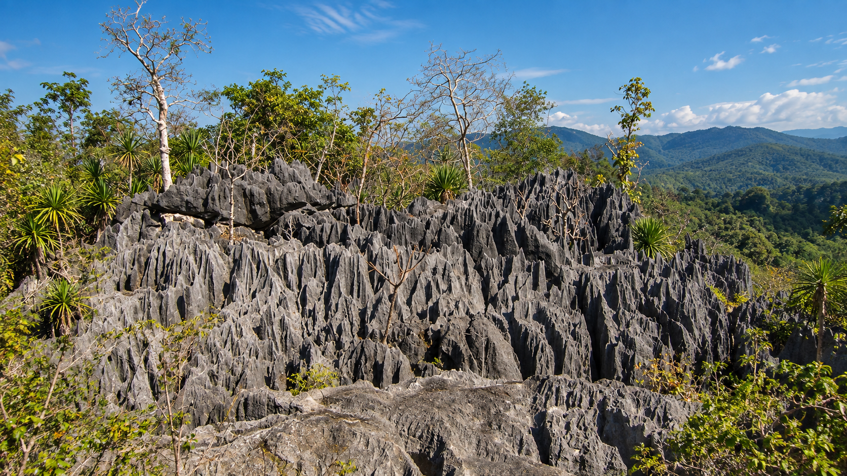
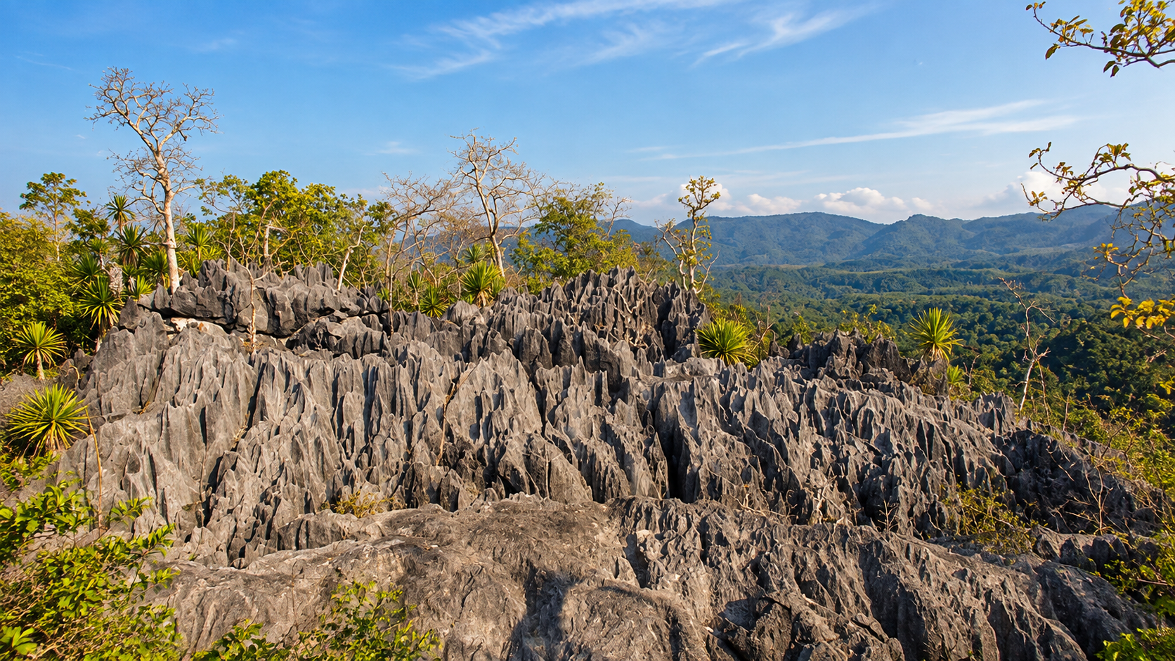
Sharp weathered rock formations create the surreal landscape known as Phu Khao Hin Pakarang — the Coral Rock Mountain.
Deep inside the limestone landscape, Erawan Cave opens into a cavern decorated with stalactites and stalagmites.
And below it all, the Yom River cuts through the landscape at Kaeng Luang.
Doi Pha Klong is therefore not a conventional “mountain viewpoint” destination.
It is a place where forest, geology, water and local stories come together.
For travellers exploring Phrae’s natural landscape beyond its historic teak houses and old-town culture, Doi Pha Klong offers a completely different side of the province:
Wild, geological and surprisingly dramatic.
What is Doi Pha Klong National Park?
Doi Pha Klong National Park is a protected mountain and forest landscape in Phrae Province, Northern Thailand, known particularly for unusual rock formations, caves, the Yom River and mixed deciduous forests.
Where is Doi Pha Klong National Park?
It is located in Phrae Province and extends across parts of Mueang Phrae, Long and Sung Men districts.
What is Doi Pha Klong National Park famous for?
The park is best known for Suan Hin Maharat, Coral Rock Mountain, Erawan Cave and Kaeng Luang.
How long is the Coral Rock trail?
The nature trail is approximately 1,100 metres, although the terrain can be demanding because of uneven and sharp rock surfaces.
When is the best time to visit Doi Pha Klong National Park?
November to February is generally comfortable for hiking and outdoor exploration. The rainy season can provide greener forests and stronger river flow but also makes rocks and trails more slippery.
Doi Pha Klong National Park at a Glance
- English Name
- Doi Pha Klong National Park
- Thai Name
- อุทยานแห่งชาติดอยผากลอง
- Province
- Phrae
- Region
- Northern Thailand
- Districts
- Mueang Phrae, Long, Sung Men
- Area
- Approximately 117,982 rai / 188.77 km²
- Established
- 6 July 2007
- National Park Number
- 107
- Main river
- Yom River
- Signature attractions
- Suan Hin Maharat, Coral Rock Mountain, Erawan Cave, Kaeng Luang
The park was formally established by Royal Decree published in the Royal Gazette on 6 July 2007 and became Thailand’s 107th national park. Its officially recorded area is approximately 117,982 rai.
Where Is Doi Pha Klong National Park?
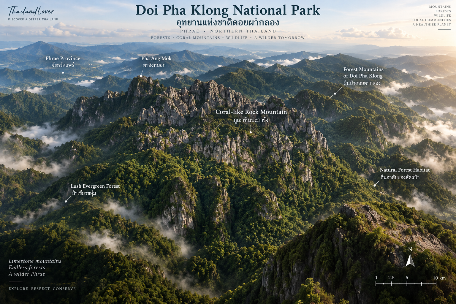
Doi Pha Klong lies in Phrae Province, one of Northern Thailand’s quieter provinces.
The protected landscape extends across parts of:
- Mueang Phrae District
- Long District
- Sung Men District
The park headquarters is located in Tha Pha Mok Subdistrict, Long District, along Highway 1023, the road connecting Phrae with Long. The headquarters is approximately 20 kilometres from Phrae town according to tourism information published for the park.
This makes Doi Pha Klong unusually accessible compared with many mountain national parks.
You can leave Phrae’s historic city centre and, within a relatively short drive, move from teak architecture and old-town streets into a rugged forest landscape.
The Geography of Doi Pha Klong
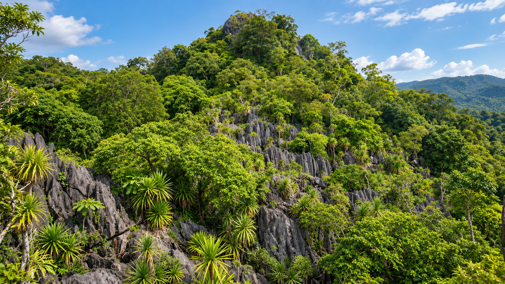
Doi Pha Klong is characterised by a rugged mountain landscape with steep slopes, cliffs, rocky outcrops and areas of relatively open terrain.
The park also functions as an important watershed.
Streams originating in the mountain forests flow downward and eventually contribute to the Yom River system, which also shapes nearby landscapes such as Mae Yom National Park.
Several tributaries associated with the park include:
- Huai Khamin
- Huai Pha Kham
- Huai Bia
- Huai Nam Rin
- Huai Mae Ta
- Huai Mae Sang
This makes the park more than a scenic destination.
The mountain forest is part of a larger water system connecting the uplands with the valleys and communities of Phrae.
A Small Park With a Big Geological Personality
Doi Pha Klong covers less than 200 square kilometres.
Compared with some of Thailand’s enormous national parks, that is relatively compact.
But size is not the defining characteristic here.
The park’s importance comes from the concentration of unusual geological features within a relatively accessible landscape.
Instead of one enormous mountain dominating the horizon, Doi Pha Klong presents a sequence of geological experiences:
Boulders → cliffs → unusual rock formations → caves → river rapids.
That makes the park particularly interesting for travellers who enjoy understanding the landscape rather than simply looking at it.
Suan Hin Maharat
The Stone Garden of Doi Pha Klong
If Doi Pha Klong has one visual signature, it is Suan Hin Maharat.
The name translates roughly as Maharaj Rock Garden.
Large rocks and boulders are scattered through the forest, each with its own strange shape and silhouette.
Some look like animals. Some resemble objects. Others seem almost impossible to balance.
The landscape invites imagination.
But beneath the visual curiosity is a much longer geological story.
These rocks are the product of natural weathering and erosion over geological time, leaving resistant rock masses exposed while surrounding material was gradually removed.
The result is a natural sculpture garden.
No architect designed it. No artist carved it.
Time did.
Suan Hin Maharat is located near the entrance and headquarters area along Highway 1023, making it one of the easiest places within the park to experience.
Why Suan Hin Maharat Is Different
Many Thai national parks have spectacular waterfalls. Some have high peaks. Others have beaches or caves.
Doi Pha Klong’s signature is different.
Here, the rocks themselves are the attraction.
Walking through the forest, visitors encounter enormous stone forms appearing unexpectedly between trees.
The scale is difficult to appreciate from photographs alone.
A person standing beside one of the larger boulders provides a sense of proportion that reveals just how massive these natural formations can be.
Coral Rock Mountain
Phu Khao Hin Pakarang
One of the most unusual landscapes in Doi Pha Klong is known as Phu Khao Hin Pakarang, or Coral Rock Mountain.
The name comes from the appearance of the rock formations.
Weathered stone rises in sharp, irregular ridges and pinnacles, creating a landscape that can resemble an enormous coral reef lifted far above the sea.
It is one of the most distinctive geological scenes in Phrae.
The Coral Rock Nature Trail
The Coral Rock area includes a short nature trail of approximately 1,100 metres.
Although the distance is relatively short, the terrain can be physically demanding.
Some sections pass over sharp and uneven rock surfaces.
This means the trail should not be judged by distance alone.
1.1 kilometres on irregular rock can feel very different from 1.1 kilometres on a paved trail.
Good footwear is essential.
The trail is particularly attractive in the morning, before the sun becomes intense.
Tourism information describes the route as relatively short but strenuous because of the sharp rock terrain.
The Natural Air-Conditioner
One of the more unusual experiences along the Coral Rock route is a natural cooling effect produced by air moving from the cave system.
Moisture and cooler air emerging from the rock formations can create noticeably cooler pockets along the route.
Locally, this has been described as a kind of natural air-conditioning.
It is one of those small experiences that photographs cannot fully communicate.
You have to stand there. Feel the cool air. And realise that the mountain is breathing.
The View from Coral Rock Mountain
As the trail rises, the landscape begins to open.
The unusual rock formations become the foreground.
Beyond them, the forested mountains of Phrae extend toward the horizon.
This creates an interesting contrast:
Ancient exposed stone in the foreground + deep green forest in the distance.
For photographers, this is one of the strongest compositions in the park.
Phu Khao Hin Pakarang
Phu Khao Hin Pakarang is the Thai name for Coral Rock Mountain in Doi Pha Klong National Park.
The landscape is the result of long-term geological processes involving uplift, weathering, erosion and the gradual breakdown of surrounding rock.
Over millions of years, different rates of erosion shaped the exposed rock into the sharp and irregular formations visible today.
The result is not actual coral.
It is a rock landscape whose shape resembles coral.
That distinction is important.
The visual metaphor is “coral”.
The geological process is mountain rock being sculpted by time.
Erawan Cave
Tham Erawan
Across the wider Doi Pha Klong landscape, Erawan Cave is another major attraction.
The cave is located near Kaeng Luang, along the Yom River.
Inside, the cave opens into a relatively large chamber system containing stalactites and stalagmites.
Some formations have been interpreted as resembling the head or trunk of Erawan, the mythical three-headed elephant associated with Hindu and Buddhist traditions.
This resemblance is part of the story behind the cave’s name.
The Story of Erawan Cave
The name “Erawan” comes from the distinctive rock formation inside the cave.
As with many caves in Northern Thailand, geological formations become intertwined with local imagination.
A natural shape becomes a story. A story becomes a name. And eventually, the name becomes part of the identity of the landscape.
This is an important part of travelling through Thailand.
The landscape is rarely only geological.
It is also cultural.
Inside the Cave
Erawan Cave contains:
- Stalactites
- Stalagmites
- Large chambers
- Rock formations
- Narrower passages
- Natural formations associated with local stories
The cave has been described locally as extending approximately 200 metres into the mountain.
Cave conditions can change with rainfall.
Visitors should therefore follow current park instructions and avoid entering restricted cave sections.
Kaeng Luang
Where the Yom River Meets the Rocks
Near Erawan Cave is Kaeng Luang, a rocky section of the Yom River.
The river flows across and around large rock formations, creating rapids and pools.
During the rainy season, increased water volume transforms the character of the river.
Water strikes the rocks with considerably greater force.
The sound arrives before the river comes fully into view.
It is a completely different experience from the quiet forest around Suan Hin Maharat.
Kaeng Luang in the Rainy Season
The Yom River is highly seasonal.
During periods of strong rainfall, the river becomes more powerful and the rapids become more dramatic.
This is when Kaeng Luang is at its most energetic.
But the same conditions that make the river spectacular can also make it dangerous.
Activities involving the river should only be undertaken when officially permitted and under appropriate local supervision.
A River and a Cave in One Landscape
One of the reasons the Erawan–Kaeng Luang area is so interesting is the relationship between water and geology.
The river flows through the landscape. The cave exists within the surrounding rock. The rocks shape the river. And the river continues to shape the rocks.
The visitor is essentially seeing different chapters of the same geological story.
Forests & Biodiversity
The park is predominantly associated with mixed deciduous forest, with areas of dry forest and other vegetation communities occurring according to local conditions.
The forest supports plant species characteristic of Northern Thailand, including:
- Dracaena / Chan Pha
- Ensete superbum / Kluey Pha
- Ground orchids
- Medicinal plants
- Various deciduous forest species
The forest landscape changes significantly between the dry and wet seasons.
During the dry season, deciduous trees can create a more open landscape. During the rainy season, the forest becomes greener and denser.
Chan Pha
Dracaena and the Rocky Forest
One of the plants associated with Doi Pha Klong is Chan Pha, a distinctive plant adapted to rocky and relatively dry environments.
Its architectural form stands out against the surrounding forest.
This is particularly appropriate for Doi Pha Klong because the park’s identity is strongly connected to exposed rock.
Plants such as Chan Pha demonstrate how life adapts to environments that may initially appear harsh.
Ground Orchids
Doi Pha Klong also supports terrestrial orchids.
Unlike the epiphytic orchids commonly seen growing on trees, ground orchids live closer to the forest floor.
They are particularly interesting during the wetter months when forest vegetation becomes more active.
For nature photographers, these small plants are easy to miss if the journey is focused only on large landscapes.
Slow down. Look down. The forest is full of details.
Wildlife
Doi Pha Klong supports a range of wildlife associated with Northern Thailand’s forest ecosystems.
Species reported in park and regional tourism information include:
- Serow
- Bears
- Barking deer
- Wild boar
- Red junglefowl
- Civets
- Various bird species
The park also provides habitat for migratory birds, including minivets reported during the winter period.
Wildlife Is Not Guaranteed
Doi Pha Klong should not be treated as a wildlife-viewing destination where animals appear on demand.
Large mammals are elusive. They may move through the forest without ever being seen.
For responsible travellers, evidence of wildlife can be just as meaningful as a photograph:
- Tracks
- Calls
- Feathers
- Droppings
- Movement in the canopy
The forest is alive even when you cannot see its inhabitants.
Birdwatching
The park’s forest environment provides opportunities for birdwatching, particularly during the cooler months.
Winter can bring migratory birds into Northern Thailand.
Early morning is the most appropriate time for serious observation.
Bring binoculars. Keep your voice low. And allow the forest to reveal itself.
Birdwatching at Doi Pha Klong is less about collecting a checklist and more about understanding the forest as a living ecosystem.
Doi Pha Klong Through the Seasons
November – February
Cool Season
The cooler months are generally the most comfortable for exploring the forest and rock formations.
Morning temperatures are pleasant. The forest is relatively dry. Bird activity can be rewarding.
This is also a strong period for hiking and photography.
March – May
Hot Season
The dry season can make exposed rock areas extremely hot during the middle of the day.
For the Coral Rock trail, early morning is preferable.
Northern Thailand’s seasonal haze can also affect long-distance visibility.
Travellers should check current air-quality conditions before planning outdoor activities.
June – October
Green Season
Rain transforms the landscape.
The forest becomes greener. Streams gain volume. Kaeng Luang becomes more energetic. And the rock formations contrast beautifully against dense vegetation.
However, wet rock can become slippery, particularly around caves and exposed formations.
Good footwear and caution are essential.
When Should You Visit?
There is no single answer.
- Best for comfortable exploration
- November – February
- Best for green forest
- June – October
- Best for stronger river scenery
- Rainy season
- Best for rock photography
- Early morning
- Best for birdwatching
- Cool season
- Best for avoiding intense heat
- November – February
The right season depends on what you want to experience.
Things to Do
- 1. Explore Suan Hin Maharat
- Walk among the giant natural rock formations.
- 2. Hike the Coral Rock Trail
- Experience the park’s most unusual geological landscape.
- 3. Photograph the rock formations
- The combination of rock, forest and morning light is particularly photogenic.
- 4. Visit Erawan Cave
- Explore the cave’s natural chambers and geological formations when access is officially available.
- 5. Experience Kaeng Luang
- See the Yom River moving through the rocky landscape.
- 6. Go birdwatching
- Explore the forest slowly and listen for birds.
- 7. Study the forest
- Look for orchids, Chan Pha, ferns and other forest plants.
- 8. Camp
- Camping areas associated with the park include locations around the park headquarters and Kaeng Luang area, subject to current park management and opening conditions. Current official listings identify Pha Khao Thapawang, Kaeng Luang, and the headquarters area among accommodation/camping zones.
Doi Pha Klong for Photographers
This is a destination where photography is not dependent on a single viewpoint.
- Wide landscape
- Use the rock formations as foreground and the forested mountains as background.
- Geological details
- Shoot the textures, cracks, erosion patterns and mineral surfaces.
- Forest
- Use shafts of light, trunks, leaves and mist.
- Cave
- Focus on texture rather than trying to illuminate the entire cave.
- River
- Kaeng Luang offers opportunities for long-exposure water photography when conditions are safe.
- Wildlife
- Use a long lens and maintain distance.
A Photographer’s Morning
The best approach is simple.
Arrive early.
The light is softer. The rocks are cooler. The shadows are longer. The forest feels quieter. And the contrast between stone and vegetation becomes stronger.
By late morning, the same landscape can feel completely different.
This is particularly important at Coral Rock Mountain, where exposed stone can become hot under direct sunlight.
Doi Pha Klong for Families
Not every experience in the park requires strenuous hiking.
- Easier experience — Suan Hin Maharat
- The rock garden near the entrance provides an accessible introduction to the landscape.
- Moderate experience — Coral Rock Trail
- Suitable for visitors comfortable with uneven terrain and walking on rock.
- More adventurous — cave and river areas
- These require greater attention to current conditions and local guidance.
Families should choose activities according to weather, terrain and children’s physical ability.
Doi Pha Klong for Slow Travellers
Doi Pha Klong works particularly well as part of a slower Phrae itinerary.
Instead of treating the park as a two-hour stop, consider spending a full day exploring the landscape.
- Morning
- Suan Hin Maharat
- Late morning
- Coral Rock Mountain
- Afternoon
- Phrae / Long — or, depending on access and conditions, Kaeng Luang + Erawan Cave
This creates a journey that combines geology, forest, river and local culture.
Doi Pha Klong + Phrae
Doi Pha Klong makes sense as part of a broader Phrae itinerary.
Phrae itself is known for historic teak houses, Lanna culture, traditional architecture, temples, local food, Phae Muang Phi, cave landscapes and national parks.
The Tourism Authority of Thailand specifically includes Doi Pha Klong among the nature destinations around Phrae.
A good ThailandLover itinerary therefore should not isolate the park.
It should connect the city + culture + forest + geology.
Doi Pha Klong + Long
Long is particularly relevant because much of the park’s visitor experience is connected to the Long district.
The journey from Phrae toward Long follows Highway 1023 and passes directly into the mountain landscape.
Long also has its own cultural and historical identity.
For travellers interested in understanding Phrae beyond the provincial capital, this is a worthwhile combination.
Getting There
From Phrae
The main approach from Phrae is via Highway 1023 toward Long.
The park headquarters is approximately 20 kilometres from Phrae town according to tourism information.
The road provides relatively straightforward access to the headquarters and Suan Hin Maharat area.
From Bangkok
For an overland journey:
Bangkok → Phitsanulok → Uttaradit → Phrae
From Phrae, continue toward Long via Highway 1023.
For international travellers, flying to a nearby northern airport and continuing by road may be more convenient depending on the itinerary.
Public Transport
Historical tourism information notes that local blue songthaews operating toward Long can be used from Phrae.
However, public-transport schedules and fares can change.
ThailandLover recommends confirming current local transport information before travelling rather than relying on historical fare information published online.
Where to Stay
- Phrae City
- Best for first-time visitors, restaurants, culture, historic architecture and more accommodation choices.
- Long
- Best for slower exploration, early access to the western/southern sections, and combining the park with Long’s local attractions.
- Inside the park
- Camping and selected accommodation may be available depending on current park operations. Availability, opening periods and booking procedures can change. Always verify directly before travelling.
What to Bring
For a comfortable visit:
- Comfortable walking shoes
- Water
- Hat
- Sunscreen
- Insect repellent
- Light rain jacket
- Small backpack
- Camera
- Power bank
For the Coral Rock trail, proper shoes are particularly important.
Sharp and uneven rock surfaces make sandals or smooth-soled footwear a poor choice.
Safety Around the Rocks, Cave and River
The rocks
The most important rule at Doi Pha Klong is simple:
Do not underestimate the rocks.
They may look stable. But surfaces can be sharp, uneven, slippery, hot, or loose in places.
Avoid climbing formations simply for a photograph. Stay on designated routes. And do not walk on exposed rock during or immediately after heavy rainfall without checking conditions.
The cave
Caves are dynamic environments. Rainfall can rapidly change water conditions. Rock surfaces can be slippery. Some passages may be dark and uneven.
Do not enter restricted areas. Follow ranger instructions. And if cave access is closed, do not attempt to bypass the closure.
Kaeng Luang
The Yom River can change dramatically during the rainy season. Fast-flowing water and slippery rocks can be dangerous.
Never assume that a calm-looking river is safe. Do not enter the water unless the activity is officially permitted and conditions have been assessed.
Responsible Travel
Doi Pha Klong is a protected forest.
The landscape is not a theme park. It is habitat. It is watershed. It is geology. It is part of the living landscape of Phrae.
Visitors should:
- Stay on designated trails
- Carry rubbish out
- Never feed wildlife
- Never collect plants
- Never remove rocks
- Avoid loud noise
- Respect caves
- Respect river safety zones
- Follow temporary closures
- Do not start fires outside permitted areas
Fire & Haze
Northern Thailand experiences a recurring dry-season wildfire and haze problem.
Doi Pha Klong is actively managed as a protected forest area, with fire-control and monitoring operations in the surrounding conservation landscape. The Department of National Parks has documented wildfire prevention and monitoring activities in the park and surrounding communities.
This matters to visitors because:
Beautiful mountain visibility is not guaranteed during the dry season.
Before travelling during the haze period, check current air quality and park announcements.
The Geological Story of Doi Pha Klong
Perhaps the most interesting way to understand Doi Pha Klong is to stop thinking about its attractions individually.
Suan Hin Maharat. Coral Rock Mountain. Erawan Cave. Kaeng Luang.
These are not unrelated attractions.
They are different expressions of the relationship between:
Rock + water + weather + time.
Rock is exposed. Water flows. Rain erodes. Temperature changes surfaces. Vegetation takes root. Caves develop. Rivers cut through valleys. And over enormous spans of time, the landscape becomes what we see today.
That is the real story of Doi Pha Klong.
A Park Built Around Stone
Some national parks are defined by trees. Some by waterfalls. Some by mountains.
Doi Pha Klong is defined by stone.
The stone is everywhere. In the enormous boulders of Suan Hin Maharat. In the sharp formations of Coral Rock Mountain. In the walls and formations of Erawan Cave. In the riverbed at Kaeng Luang.
Stone is the thread connecting the entire destination.
The Human Imagination and Natural Landscape
There is something distinctly Thai about the way people name natural formations.
A rock resembles an elephant. A mountain resembles coral. A strange boulder becomes a character. A cave becomes part of a legend.
These names allow people to remember landscapes. And they create a bridge between geological reality and cultural imagination.
Doi Pha Klong is a good example.
Science explains how the landscape formed. Stories explain how people remember it. Both are part of the destination.
The Character of Doi Pha Klong
Every national park has its own personality.
Doi Inthanon National Park feels monumental. Doi Chiang Dao feels dramatic. Phu Chi Fa feels iconic.
Doi Pha Klong feels curious.
It constantly asks you to look closer. At a strange rock. At a cave entrance. At a plant growing from stone. At water passing through a gorge. At a shape that looks almost impossible.
It is not a park that needs one giant viewpoint.
It rewards exploration.
Doi Pha Klong vs Other Northern Thailand Destinations
Doi Pha Klong is much smaller than many of Northern Thailand’s national parks.
That is not necessarily a disadvantage.
Its attractions are concentrated. The journey is manageable. And the park can be combined naturally with Phrae’s cultural destinations.
- Huge wilderness
- Choose a larger mountain park such as Doi Inthanon National Park or Doi Pha Hom Pok National Park.
- Geology + forest + caves + river + accessibility
- Doi Pha Klong becomes much more interesting.
Who Should Visit Doi Pha Klong?
- The Curious Traveller
- You enjoy places that have a story behind what you see.
- The Photographer
- You want something different from conventional mountain viewpoints.
- The Geology Lover
- You want to see how rock, erosion and water shape landscapes.
- The Nature Traveller
- You prefer forests and unusual natural formations.
- The Phrae Explorer
- You want to see the province beyond its historic town.
- The Slow Traveller
- You prefer discovering a place rather than ticking attractions off a list.
Who Might Not Need to Visit?
If your only goal is a very high mountain summit, a dramatic sea-of-mist viewpoint, luxury tourism, large developed attractions, or easy sightseeing without walking, Doi Pha Klong may not be your first choice.
Its appeal is more subtle.
It is about discovery rather than spectacle.
A Suggested One-Day Doi Pha Klong Route
Morning — Suan Hin Maharat
Start early. Explore the large rock formations while temperatures are comfortable.
Late morning — Coral Rock Mountain
Walk the nature trail. Take your time. Photograph the geological formations.
Lunch
Return toward Long or choose a local food stop.
Afternoon — Kaeng Luang
Continue toward the Yom River. Experience the river landscape.
Late afternoon — Erawan Cave
Visit if the cave is open and current conditions allow.
Evening
Return toward Phrae or stay around Long.
This itinerary works because it follows the landscape:
Stone → mountain → river → cave.
A Better Two-Day Experience
If you have more time:
Day 1
Phrae Old Town → local food → Doi Pha Klong → Suan Hin Maharat → Coral Rock Mountain → stay in Phrae / Long.
Day 2
Kaeng Luang → Erawan Cave → Long cultural landscape → return to Phrae.
This is more consistent with the ThailandLover philosophy:
Do not rush through Thailand.
Beyond the Park
Doi Pha Klong works particularly well as part of a wider Phrae journey.
Nearby experiences can include Phrae Old Town, Khum Wong Buri, Khum Chao Luang, Wat Phra That Cho Hae, Phae Muang Phi, Long cultural attractions, local food and traditional teak architecture.
The Tourism Authority of Thailand highlights Phrae’s combination of cultural heritage and nearby natural attractions, including Doi Pha Klong and Phae Muang Phi.
Why ThailandLover Recommends Doi Pha Klong
There are destinations that are famous because they are spectacular.
And there are destinations that become memorable because they are unusual.
Doi Pha Klong belongs to the second category.
You may not remember the highest mountain. You may not remember the longest trail.
But you are likely to remember:
- The enormous rocks standing in the forest
- The sharp formations that look like coral
- The cool air coming from the cave
- The sound of the Yom River hitting the rocks
Those details give Doi Pha Klong its personality.
Essential Information
- Official Name
- Doi Pha Klong National Park
- Thai
- อุทยานแห่งชาติดอยผากลอง
- Province
- Phrae
- Region
- Northern Thailand
- Districts
- Mueang Phrae · Long · Sung Men
- Area
- 117,982 rai / approximately 188.77 km²
- Established
- 6 July 2007
- National Park No.
- 107
- Main Landscape
- Mountain ranges, cliffs, mixed deciduous forest, rock formations, caves and river valleys
- Main River
- Yom River
- Signature Attractions
- Suan Hin Maharat · Coral Rock Mountain · Erawan Cave · Kaeng Luang · Doi Pha Klong mountain landscape
- Best For
- Nature · geology · photography · short hiking · cave exploration · river landscapes · birdwatching · Phrae road trips
- Ideal Duration
- 1 day; 1–2 days combined with Phrae and Long
Frequently Asked Questions
- What is Doi Pha Klong National Park?
- Doi Pha Klong National Park is a protected mountain and forest landscape in Phrae Province, Northern Thailand, known particularly for unusual rock formations, caves, the Yom River and mixed deciduous forests.
- Where is Doi Pha Klong National Park?
- It is located in Phrae Province and extends across parts of Mueang Phrae, Long and Sung Men districts.
- How large is Doi Pha Klong National Park?
- The officially recorded area is approximately 117,982 rai, equivalent to about 188.77 square kilometres.
- When was Doi Pha Klong National Park established?
- The park was established on 6 July 2007 and became Thailand’s 107th national park.
- What is Doi Pha Klong famous for?
- The park is best known for Suan Hin Maharat, Coral Rock Mountain, Erawan Cave and Kaeng Luang.
- What is Suan Hin Maharat?
- Suan Hin Maharat is a natural rock garden containing large weathered boulders scattered through the forest near the park entrance.
- What is Coral Rock Mountain?
- Coral Rock Mountain, or Phu Khao Hin Pakarang, is an unusual landscape of sharply weathered rock formations that resemble coral.
- How long is the Coral Rock trail?
- The nature trail is approximately 1,100 metres, although the terrain can be demanding because of uneven and sharp rock surfaces.
- What is Erawan Cave?
- Erawan Cave is a natural cave near Kaeng Luang containing stalactites, stalagmites and rock formations associated with the legend behind its name.
- What river flows through Kaeng Luang?
- Kaeng Luang is associated with the Yom River.
- Is Doi Pha Klong good for photography?
- Yes. The unusual rock formations, forest, cave environments and Yom River provide a much more distinctive photographic subject than a conventional mountain viewpoint.
- Can I camp at Doi Pha Klong?
- Camping facilities have been associated with several areas of the park, but availability and opening arrangements can change. Current conditions should be confirmed with the park before travelling.
- What is the best time to visit?
- November to February is generally comfortable for hiking and outdoor exploration. The rainy season can provide greener forests and stronger river flow but also makes rocks and trails more slippery.
Related Destinations
- Mae Yom National Park
- Another Phrae–Lampang landscape along the Yom River system — a natural pairing with Doi Pha Klong.
- Wiang Kosai National Park
- A neighbouring Phrae and Lampang forest park for travellers continuing through the lower north.
- Lam Nam Nan National Park
- A Uttaradit–Phrae reservoir and forest landscape on the road between Phitsanulok and Phrae.
- Doi Khun Tan National Park
- Railway history, pine forest and the Y.1–Y.4 hike between Lamphun and Lampang.
- Doi Pha Hom Pok National Park
- Thailand’s second-highest mountain — a larger wilderness contrast to Doi Pha Klong’s compact stone landscape.
- Doi Phu Kha National Park
- Nan’s highland wilderness — rare Chomphu Phu Kha forest, sea of mist and mountain trekking.
- Northern Thailand national parks
- More mountains, forests and protected landscapes across ThailandLover’s Nature & Parks collection.
Location
Find Doi Pha Klong National Park
Mueang Phrae · Long · Sung Men, Phrae, Northern Thailand