

National Park · Nan · Preparatory Area
Nanthaburi National Park
อุทยานแห่งชาตินันทบุรี
A mountain wilderness of forests, waterfalls, mist and memory in northern Nan
Tha Wang Pha · Mueang Nan · Ban Luang · Nan
On the western ranges of Nan — watershed forests, waterfalls, viewpoints and mountains that once held strategic weight. Today they return as forest, water, mist and quiet.
More Than a Viewpoint
On the western mountain ranges of Nan Province stretches a vast forest across complex high ridges — a watershed landscape and home to rare wildlife.
This is Nanthaburi National Park — or, to match its current legal status, Nanthaburi National Park (Preparatory Area).
The area holds hill evergreen, dry evergreen and mixed deciduous forest, waterfalls, streams, ridgelines and viewpoints above 1,000 metres.
What sets Nanthaburi apart from many mountain stops in Nan is that the landscape is not only beautiful — it carries a memory of place.
Doi Phachi, Doi Pha Chang and Doi Pha Wua were once key strategic ground during past political conflict and fighting. Today those same mountains belong again to forest, water, mist and silence.
Nanthaburi is a place to look at more deeply than the phrase “viewpoint” allows.
Nanthaburi at a Glance
- Name
- อุทยานแห่งชาตินันทบุรี (Nanthaburi National Park)
- English
- Nanthaburi National Park
- Current status
- Preparatory / proposed area — อุทยานแห่งชาตินันทบุรี (เตรียมการ)
- Province
- Nan
- Main districts
- Tha Wang Pha · Mueang Nan · Ban Luang
- Landscape
- Complex high mountains, generally north–south
- Elevation
- Approx. 300–1,656 m (DNP survey, 2022)
- Surveyed area (2022)
- About 262,992 rai / 420.79 km²
- Ecosystems
- Mixed deciduous · dry evergreen · hill evergreen · watershed forest
- Highlights
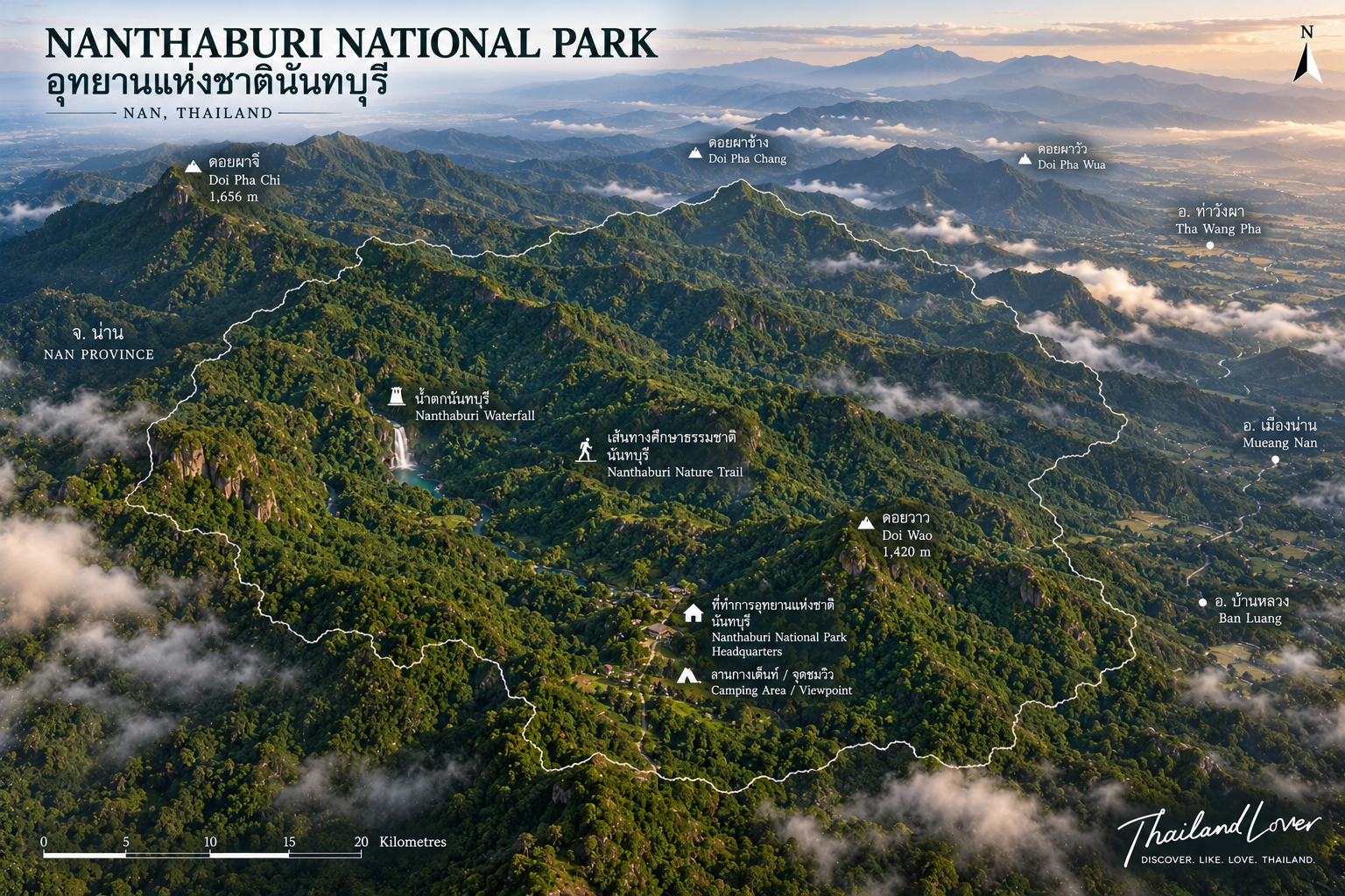
- Doi Phachi · Doi Wao · HQ viewpoints · Nuntaburi Falls 1 & 2 · nature trails
- Recorded wildlife
- Serow · muntjac · leopard cat · many birds
- Stream indicator
- Pulu turtle (เต่าปูลู)
DNP describes the surveyed mountain system as complex highland and an important watershed. Most of the survey area falls in Class 1A watershed quality — a signal of ecological and headwater value, not just scenery.
The Landscape
A Mountain Range at the Heart of Nan
Nanthaburi’s terrain is complex highland. Ridges generally run north–south, with surveyed elevations of about 300–1,656 metres above sea level.
That height and steepness make the area an important watershed forest. Several streams rise here — including Huai Muang, Huai Khun and Huai Si Phan — and water-resource data also links Nanthaburi to multiple river and stream systems across Nan Province.
The Forest
Three Forest Worlds
One of Nanthaburi’s quiet strengths is forest diversity. According to Tourism Authority of Thailand information:
- Mixed deciduous forest — ป่าผสมผลัดใบ
- Dry evergreen forest — ป่าดิบแล้ง
- Hill evergreen forest — ป่าดิบเขา
Notable trees include teak, padauk, Lagerstroemia (tabaek), dipterocarp (yang) and many other species. As elevation changes, so do plant communities and microclimate — climbing higher is not only cooler weather, but a shift in the living forest itself.
This is why Nanthaburi rewards nature study more than mist photography alone.
Water
The Forest That Feeds the Streams
Water is part of Nanthaburi’s identity. Mountain forest feeds headwaters, while streams drop through the canopy and form a series of falls.
One of the most rewarding areas is the Nuntaburi waterfall nature trail — especially Nuntaburi Waterfall 2, a medium-sized cascade of eight tiers, each roughly 3–20 metres high, with year-round flow reported by park authorities.
Interest does not stop at the falls. Stream ecosystems matter here too: the area is known for the Pulu turtle, which the Department of National Parks treats as one indicator of intact forest and clean water.
Wildlife
A Forest That Still Has Predators and Prey
Camera-trap surveys in Nanthaburi have recorded a range of wildlife, including:
- Serow — เลียงผา
- Muntjac — เก้ง
- Leopard cat — แมวดาว
- Birds such as Asian fairy-bluebird, common green magpie, verditer flycatcher, oriental turtle dove and barn owl
Records come from observation, camera traps and wildlife-monitoring tools. Finding these species means more than a colourful list — it shows that the forest still holds ecological structure capable of supporting wildlife at several levels.
The Pulu Turtle
เต่าปูลู — Small Creature, Big Ecological Story
One of Nanthaburi’s most interesting species is the Pulu turtle (Platysternon megacephalum). DNP reports sightings along the Nuntaburi Waterfall 2 nature trail and Khun Nam Wao stream.
- Large head, elongated shell, hooked beak, sharp claws and a long tail
- Cannot fully retract head and limbs into the shell like many other turtles
- Depends on suitable stream habitats — presence reflects stream quality
For visitors: do not hunt for the Pulu turtle to photograph it. Leaving wildlife undisturbed is the best way to keep this story alive.
The Viewpoints
Where the Mountain Opens
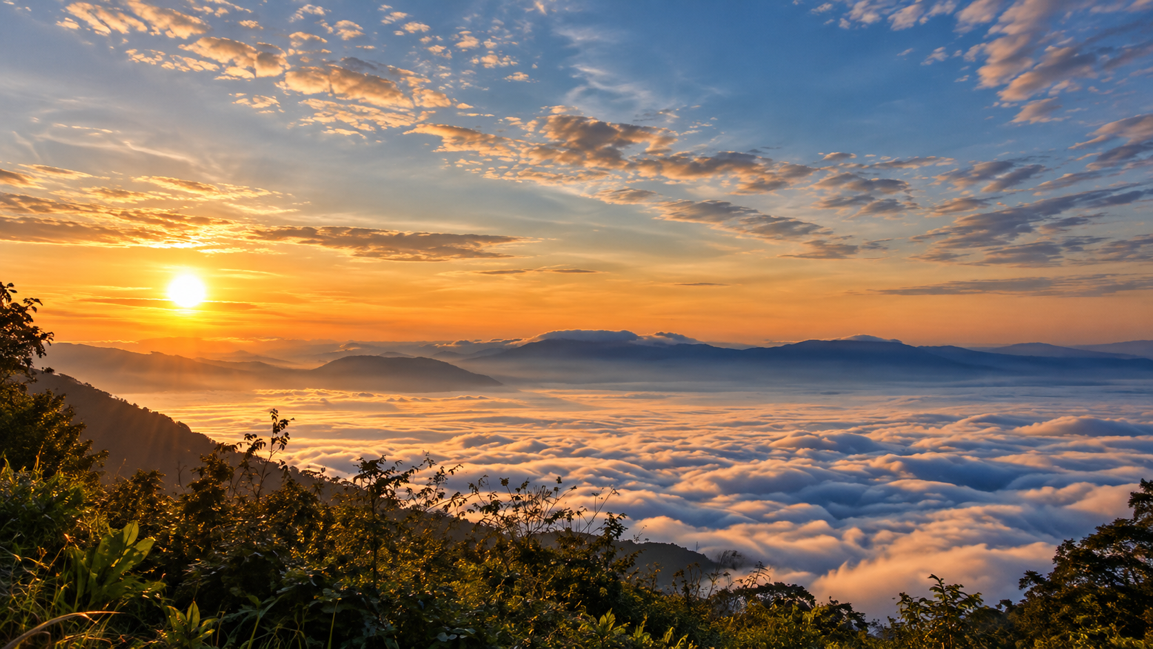
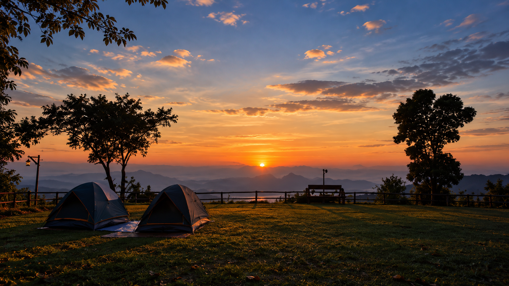
Nanthaburi offers several strong viewpoints, especially around the service area and camping grounds. A single zone can reward sunrise, sunset, sea of mist and night lights — when conditions cooperate.
Eastern viewpoints look toward Tha Wang Pha District and the villages below. At night, community lights create the mood locals often call “stars on the ground”.
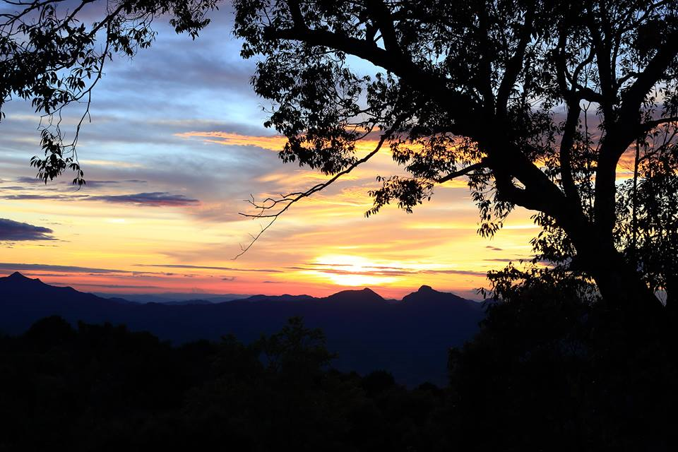
Western views open toward Doi Phachi · Doi Pha Chang · Doi Pha Wua. In late afternoon the sun can drop beautifully along the Pha Chang–Pha Wua ridgeline; on winter mornings, mist may fill the valleys beneath.
Doi Wao
ดอยวาว
Doi Wao is one of the park’s key viewpoints, about 1 kilometre from headquarters according to DNP information. It suits sunrise watching; at night you can see lights from Tha Wang Pha. Camping space near here also supports overnight visitors.
What makes Doi Wao special is not height alone but open terrain — from the ridge you can read the relationship of mountain → valley → village → sky.
Doi Phachi
ดอยผาจิ
Doi Phachi is among the best-known mountains of the Nanthaburi area — forest, waterfalls and rich plant life — with another layer of story beneath the scenery.
It once hosted Communist Party of Thailand positions and was tied to past fighting. This mountain is therefore not only landscape but historical landscape — a place where nature and history share the same ground.
Doi Pha Chang & Doi Pha Wua
Mountains with a Memory
Doi Pha Chang and Doi Pha Wua appear in views from Nanthaburi’s lookouts. In late light they become the backdrop to sunset — and, in another dimension, part of Nan’s historical mountain geography.
Better than “Where should I shoot?” is “What has this mountain already seen?”
The Waterfalls
Nuntaburi Waterfall 1
Nuntaburi Waterfall 1 is a medium cascade of about six tiers, set among ravines, rock shelves and natural overhangs. It sits close to headquarters — tourism sources cite roughly 1 kilometre — and suits a short nature walk.
Nuntaburi Waterfall 2
Nuntaburi Waterfall 2 is one of the area’s strongest nature highlights — eight tiers, each about 3–20 metres high. Ferns, cycads, palms and rattan grow around the stream, and this is also where Pulu turtles have been recorded.
Forest + Water + Wildlife — one of Nanthaburi’s strongest story lines.
Core Area vs Linked Attractions
Wider information on Nanthaburi and surrounding tourism also mentions other nature sites — such as Santisuk Waterfall, Song Khwae Waterfall, Huai Phrik Waterfall, Tat Wao Waterfall, Doi Mok Waterfall and Ban Nam Ki hot springs.
These places differ in location, access and development — do not assume every spot sits near headquarters or is an easy walk.
- Nanthaburi core area
- HQ viewpoints, Doi Wao, Nuntaburi Falls 1 & 2, camping and nature trails near the service area
- Nanthaburi-linked attractions
- Wider-area falls and hot springs that may require separate travel planning
The History
When These Mountains Were a Battlefield
Nanthaburi’s history cannot be separated from its geography. High ridges and dense forest gave this landscape strategic weight — especially around Doi Phachi, Doi Pha Chang and Doi Pha Wua.
These areas once fell under the influence of the Communist Party of Thailand and saw fighting between state forces and CPT positions. What remains today is not only a story in books — it is mountains and routes that were once real operational ground.
Walking Nanthaburi can therefore be read as a historical landscape experience as well as eco-tourism.
The People
Beyond the Forest
Nanthaburi connects to several communities, and Tourism Authority of Thailand materials note links to the Mlabri (also known historically as Phi Tong Luang).
ThailandLover presents this carefully. The Mlabri should not be framed as an “exotic attraction,” but through history, forest relationships and how livelihoods change as the modern world arrives.
Flowers of Winter
นางพญาเสือโคร่ง — Thai Cherry Blossoms
In winter — especially around January — there is a chance to see nang phaya suea khrong blossoms, often nicknamed “Thai sakura.” DNP notes Nanthaburi viewing points for these trees and flowers in January each year.
Typically around January, depending on weather conditions — not a guarantee of peak bloom on a fixed date.
Stargazing
Stars Above, Lights Below
Elevation and distance from dense city glare make night skies clearer than in town. Nanthaburi’s signature mood is different again — stars above, village lights below — the image that earns the nickname “stars on the ground.”
The best window is after sunset, before community lights and moonlight overwhelm the sky. For astrophotography, check the moon phase and weather before you travel.
Best Time to Visit
- Winter — Nov to Feb
- The classic Nanthaburi window: cool air, sunrise, sunset, night sky, possible sea of mist and, in parts of the season, Thai cherry blossoms (nang phaya suea khrong). If you want the postcard mountain mood, start here.
- Rainy season
- Deep green forest and fuller streams — traded for slippery roads, wet trails, thick mist, reduced visibility and flash-flood risk. Check weather and official notices first.
- Dry / haze season
- Some outdoor logistics may feel easier, but northern Thailand can face wildfire smoke and PM2.5. “Cool season” is not always “clear air.” Check air quality before long-distance landscape photography.
What to Do
- 01 — Nature walk
- Walk the Nuntaburi waterfall nature trail — plants, streams and forest structure.
- 02 — Waterfall exploration
- Visit Nuntaburi Falls 1 and especially Falls 2 with its eight tiers.
- 03 — Sunrise
- Climb to Doi Wao or a suitable HQ viewpoint for first light over mountains and villages.
- 04 — Sunset
- Look west to Doi Phachi, Doi Pha Chang and Doi Pha Wua — golden hour opens the landscape best.
- 05 — Sea of mist
- A weather-dependent winter morning experience — never a daily guarantee.
- 06 — Camping
- Service-area camping facilities exist according to DNP information; confirm opening and booking with staff.
- 07 — Stargazing
- Clear nights reward wide views and lower light pollution.
How to Experience Nanthaburi
Don’t Come Only for the Mist
Sea of mist is beautiful — but it should not be the only reason to come. If you have time, split the experience into four movements:
Afternoon forest / waterfall → Golden hour on Phachi–Pha Chang–Pha Wua → Night stars & village lights → Morning sunrise + mist
Done this way, Nanthaburi becomes a full overnight experience rather than a quick photo stop.
Why Nanthaburi Matters
- Forest — multiple forest types by elevation
- Water — headwaters and streams
- Wildlife — serow, muntjac, leopard cat and birds
- Biodiversity — Pulu turtle and stream life
- Landscape — ridges, mist and sky
- History — former strategic mountains
- People — communities linked to the forest
All of this makes Nanthaburi mean more than “a pretty Nan viewpoint.”
Responsible Travel
Protect What You Came To See
Nanthaburi is forest and headwater country. Every visit should leave the lightest possible footprint.
Do
- Stay on marked trails and follow staff guidance
- Pack out all rubbish; camp only in designated areas
- Keep quiet; watch wildlife from a respectful distance
- Use fire carefully; check weather and area notices before travel
Don’t
- Feed wildlife or catch Pulu turtles / other animals
- Collect plants, flowers or natural objects
- Leave rubbish, make loud noise or leave trails without permission
- Approach cliff edges or light fires where not allowed
Visit gently.
Practical Information
Location
The preparatory area covers parts of Tha Wang Pha, Mueang Nan and Ban Luang districts. Headquarters sit in Pha Thong Subdistrict, Tha Wang Pha District, Nan Province.
From Nan City
Provincial tourism information cites roughly 75 kilometres from Nan City to the park area, about 1 hour 20 minutes — depending on route, road conditions and your destination inside the park.
First-time visitors should navigate to Nanthaburi National Park headquarters first, then plan onward to specific viewpoints or trails.
Before You Go
Trail status, camping grounds, accommodation and activities can change with season, weather and park management — especially in the rainy season and wildfire / haze months. Confirm the latest details with staff before you travel.
The Essential Nanthaburi List
- One day
- 01 HQ viewpoint for landscape · 02 Nuntaburi Waterfall 2 for forest and stream · 03 Doi Wao for sunrise
- One night
- 04 Sunset on Phachi–Pha Chang–Pha Wua · 05 Stargazing and village lights · 06 Sunrise + mist
For the Curious Traveler
Look Beyond the Photograph
If you come to Nanthaburi for photographs, pause after the shutter and ask: Where do the headwaters begin? Which way do the streams run? Why does this forest still feel intact? What lives in these waterways? Why does Doi Phachi matter historically? And why was this landscape proposed as a national park?
When those questions start, Nanthaburi shifts from a tourist stop into a landscape with a story.
Final Thought
Some Mountains Are Beautiful. Some Mountains Have Stories.
Nanthaburi is both — mountains, forest, waterfalls, mist and stars — yet what sets it apart is the memory still held in the ridges.
The sounds of fighting are gone. What remains is water in the streams, birds in the canopy, wind on the ridgeline, and the last light of day settling between cliff tops.
Sometimes the best journeys do not take us to the most famous places — they take us to places that help us understand Thailand more deeply.
Nanthaburi is one of those places.
Quick Facts
- Destination
- Nanthaburi National Park
- Thai
- อุทยานแห่งชาตินันทบุรี
- Legal status
- Preparatory / proposed national park
- Province
- Nan
- Districts
- Tha Wang Pha · Mueang Nan · Ban Luang
- Landscape
- High mountain range and watershed forest
- Elevation
- Approx. 300–1,656 m (2022 survey area)
- Key viewpoint
- Doi Wao / viewpoint near the park service area
- Key landscape
- Doi Phachi · Doi Pha Chang · Doi Pha Wua
- Waterfalls
- Nuntaburi 1 & 2 (+ wider-area / seasonal falls)
- Wildlife
- Serow, muntjac, leopard cat and numerous birds recorded
- Notable species
- Pulu turtle
- Winter highlight
- Sea of mist; Thai cherry blossoms depending on conditions
- Night highlight
- Stargazing and “stars on the ground” village lights
Frequently Asked Questions
- Is Nanthaburi an officially established national park?
- Not fully. Use the familiar name Nanthaburi National Park, but understand the factual status as a preparatory / proposed area — อุทยานแห่งชาตินันทบุรี (เตรียมการ) — as still used by DNP as of 2026.
- Where is Nanthaburi National Park?
- In Nan Province, covering parts of Tha Wang Pha, Mueang Nan and Ban Luang. The service area is in Pha Thong Subdistrict, Tha Wang Pha District.
- How large is Nanthaburi?
- A 2022 DNP survey cites about 262,992 rai (420.79 km²). Older project figures of 548,125 rai / 877 km² should not be presented as the current surveyed area without context.
- What are the main attractions?
- HQ viewpoints and Doi Wao; western views to Doi Phachi, Doi Pha Chang and Doi Pha Wua; Nuntaburi Waterfalls 1 and 2; nature trails; winter mist; and night “stars on the ground.”
- When is the best time to visit?
- November to February for cool air, sunrise, sunset, possible mist and, typically around January depending on weather, Thai cherry blossoms.
- How do I get there from Nan City?
- About 75 km / 1 hour 20 minutes toward the Tha Wang Pha side according to provincial tourism information. Navigate to headquarters first, then to specific stops.
- Can I camp?
- Camping is associated with the service and Doi Wao zones. Confirm opening status, facilities and booking with staff before travel.
- Who is it best for?
- Nature lovers, landscape photographers, hikers, campers, stargazers, history-minded travellers and slow travellers — not those seeking large commercial attractions or guaranteed mist.
Location
Find Nanthaburi National Park
Pha Thong, Tha Wang Pha, Nan · Northern Thailand