


Nature & Parks · Narathiwat
Namtok Si Po National Park
น้ำตกซีโป
Seven Cascades in the Rainforest of Southern Thailand
Ra-ngae, Narathiwat · Far South
Hidden among forested mountains, Si Po is a landscape of waterfalls, streams, dense rainforest and granite — an intimate encounter with southern Thailand beyond the beaches.
Where Rainforest Becomes Water
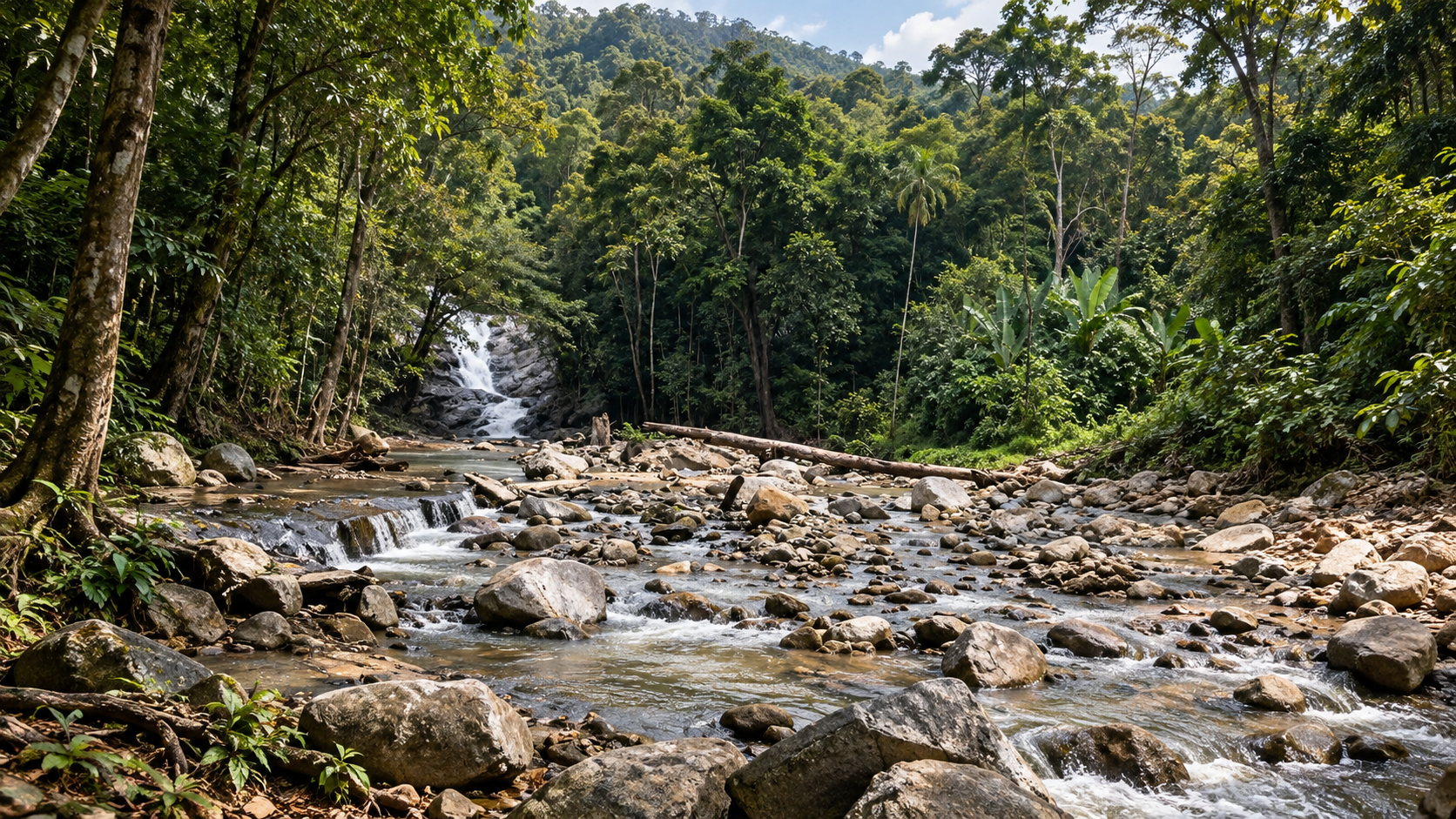
Hidden among the forested mountains of Narathiwat Province in southern Thailand, Namtok Si Po is a landscape of waterfalls, streams, dense rainforest and mountain terrain.
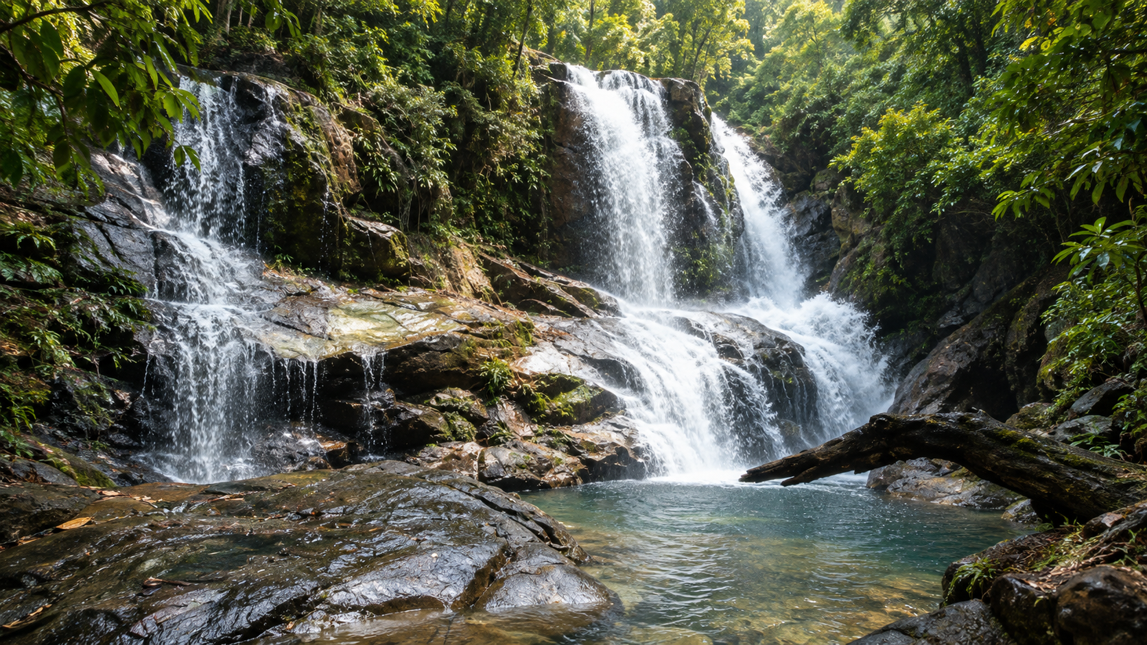
At the centre of the area is Si Po Waterfall, a striking seven-tiered waterfall flowing through a lush forest environment. Water descends across large rock faces and gathers in natural pools surrounded by tropical vegetation.
But the waterfall is only part of the story. The surrounding forest forms an important watershed landscape for southern Thailand. It supports a rich variety of plant species and provides habitat for wildlife including hornbills, wild elephants, Malayan tapirs and other forest species.
For travellers looking beyond Thailand’s better-known beaches and islands, Si Po offers something different: an intimate encounter with the rainforest and mountains of the far south.
The waterfall is simply the most visible expression of a much larger hydrological system.
At a Glance
- Seven tiers
- Si Po Waterfall — broad cascades over granite, not a single narrow drop.
- ~65.7 km²
- Proposed protected area reported by DNP in 2022: about 41,048.80 rai.
- Watershed
- Headwaters linked to the Sai Buri and Bang Nara river systems.
- Wildlife
- Tapir, elephant, black giant tortoise and seven hornbill species reported.
- English name
- Namtok Si Po / Si Po Waterfall
- Thai name
- น้ำตกซีโป
- Proposed national park name
- Namtok Si Po National Park
- Region
- Southern Thailand
- Province
- Narathiwat
- Main area
- Chaloem Subdistrict, Ra-ngae District
- Main attraction
- Si Po Waterfall
- Waterfall structure
- Seven major tiers
- Landscape
- Mountain forest, streams, waterfalls and rainforest
- Protected-area background
- Former Si Po Waterfall Forest Park / proposed national park area
- Approximate proposed area
- 41,048.80 rai / 65.6781 km² (DNP 2022)
- Main forest type
- Moist evergreen forest
- Highest point
- Khao Mae Tae
- Main watershed role
- Headwaters associated with Sai Buri and Bang Nara river systems
- Address
- Moo 3, Chaloem Subdistrict, Ra-ngae District, Narathiwat 96130
The Department of National Parks reported in 2022 that the proposed national park area covered approximately 41,048.80 rai, or 65.6781 square kilometres, and that the department had opened the process for public consultation concerning establishment of Namtok Si Po National Park.
Where Is Namtok Si Po?
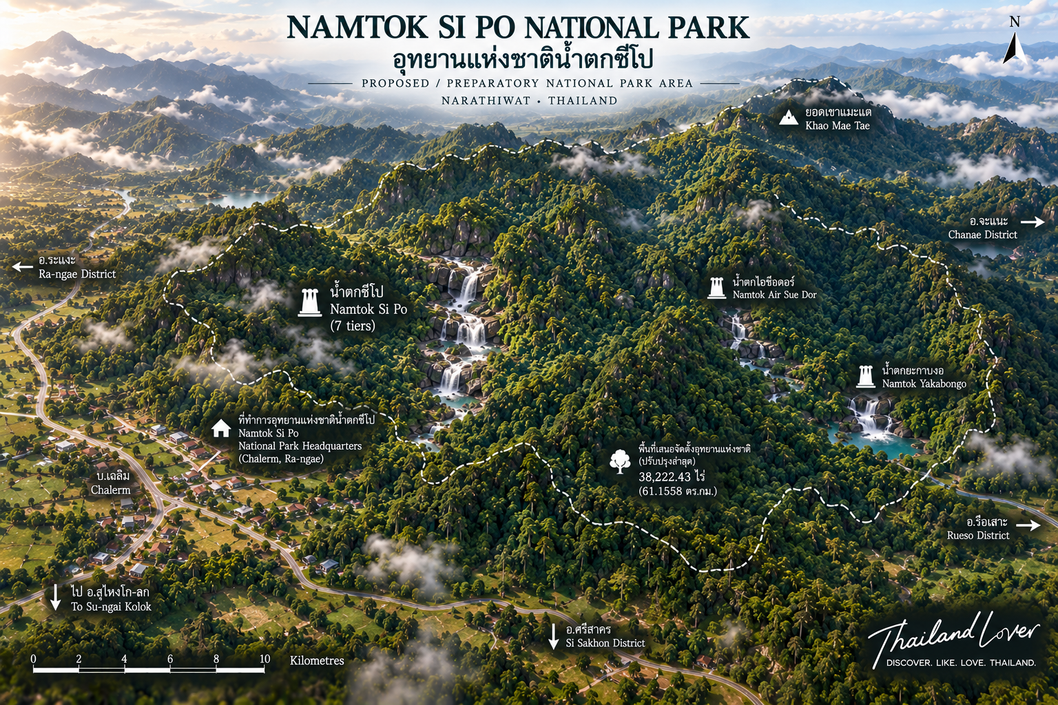
Namtok Si Po is located in Ra-ngae District, Narathiwat Province, in Thailand’s far south. The principal waterfall area is associated with Chaloem Subdistrict, with the visitor area historically located at Moo 3, Ban Si Po.
The landscape extends beyond the waterfall itself into a larger forested mountain area. Historical planning documents for the proposed national park identify areas within:
- Chanae District
- Ra-ngae District
- Rueso District
- Si Sakhon District
The terrain consists largely of interconnected mountain ranges running broadly from north to south.
The Meaning Behind the Name
Why is it called “Si Po”?
The name Si Po has a local Yawi origin. According to the Department of National Parks, the word refers to a local tree known in Thai as matad or san, associated with the species Dillenia indica.
Historically, these trees grew densely along streams around the waterfall. Because the vegetation was such a distinctive feature of the landscape, local people came to call the waterfall Pajo Si Po, meaning the waterfall associated with the Si Po trees.
The name remained with the waterfall and eventually became the name of the proposed protected area.
A waterfall named after a tree — landscape becoming cultural identity.
The Mountain Landscape
Namtok Si Po lies within a rugged mountain landscape rather than a flat lowland environment. The mountains are arranged in a series of ridges and peaks, with steep slopes in many areas.
The highest point identified in descriptions of the proposed national park is Khao Mae Tae.
Rain falling on the forested slopes enters small streams and eventually feeds larger waterways. This makes the forest more than scenery — it is part of the natural infrastructure supporting communities downstream.
A Forest of Water
One of the defining characteristics of Namtok Si Po is its role as a watershed forest. The Department of National Parks describes the area as a headwater landscape associated with tributaries of the Sai Buri River and the Tanyong Mat / Bang Nara river system.
These waterways are important to communities across Thailand’s southern border provinces. The forest therefore performs several functions simultaneously:
Rainfall → Forest → Stream → River → Community
Si Po Waterfall
Seven tiers through the forest
The defining attraction is Si Po Waterfall, a large seven-tiered waterfall. Water moves down a sequence of rock faces and natural pools before continuing downstream.
The lower section is particularly accessible from the former park headquarters area. Historical park documentation describes a walking route of approximately 150 metres from the headquarters to the lower waterfall, with a trail continuing upward toward the higher tiers.
The Seven-Tier Character
Descriptions of Si Po Waterfall identify seven major waterfall levels. Older park documentation also records a series of named pools associated with the waterfall complex, including:
- Tang Phap Pool
- Sia Pool
- Ton Farang Pool
- Nuea Sai Pool
- Rang Nam Pool
- Nam Sat Pool
- Jong Ang Pool
- Kwang Pool
- Noppharat Pool
The presence of several named pools reflects the traditional way visitors experienced the waterfall: not simply as one cascade, but as a sequence of water environments connected along the stream.
The Lower Waterfall & Upper Cascade
The lower section
Historical park documentation describes a large rock-face cascade approximately 40 metres high. The water falls across the broad rock surface before reaching the pool below.
The upper cascade
Other official-linked descriptions give approximately 30 metres for a prominent upper cascade. Surrounded by dense tropical vegetation, it becomes particularly atmospheric after rainfall.
Published height figures differ — ThailandLover avoids treating every waterfall-height number as a definitive measurement. The important visual characteristic is consistent across sources:
Si Po is a broad, multi-tiered waterfall flowing across large rock surfaces rather than a single narrow vertical drop.
White water, dark rock, deep green forest, mist and natural pools create the characteristic visual identity of Si Po.
Swimming
Swimming has historically been possible in pools associated with Si Po Waterfall. However, this should not be interpreted as unrestricted swimming throughout the waterfall.
After heavy rainfall, water levels can rise quickly, currents can become significantly stronger, rocks become slippery, pool conditions can change, and access may be temporarily restricted.
The Geology of Si Po
The waterfall is associated with Budo Granite, a major geological feature of the region. Historical geological documentation identifies the rock around Si Po Waterfall as a form of tourmaline–biotite–muscovite granite, including porphyritic granite characteristics.
The rock is generally described as light grey and displays mineral alignment and structural features associated with geological contacts and faults. The stream has been shaped by the geological structure of the mountain landscape over long periods.
The Rainforest
The proposed protected area contains extensive moist evergreen forest. The upper mountain forest is described as remaining green throughout much of the year because of the humid southern climate.
Trees documented in descriptions of the area include keruing-related forest trees, Hopea species, ironwood-related species, dipterocarp trees and various large evergreen trees. The forest canopy creates a cool, shaded environment around streams and waterfalls.
For visitors, the most immediate impression is simply how green the landscape feels.
A Biodiversity Hotspot in Southern Thailand
The importance of Si Po is not limited to tourism. The surrounding forest provides habitat for a diverse range of wildlife. The Department of National Parks has highlighted the presence or importance of species including:
- Malayan tapir
- Wild elephant
- Black giant tortoise
- Hornbills
- Other forest mammals and birds
Government information has identified seven hornbill species out of the thirteen species recorded in Thailand in the Si Po forest landscape — making the forest particularly valuable from a biodiversity perspective.
Wildlife of the Forest
- Malayan tapir
- One of Southeast Asia’s most recognisable rainforest mammals — elusive and primarily forest-dwelling. Seeing one should be considered rare, not expected.
- Wild elephants
- Their presence indicates the broader ecological importance of connected habitat. Never approach, feed or attempt close-range photography; follow ranger guidance.
- Hornbills
- Seven species reported. Several depend on large mature trees for nesting — early morning is generally best for quiet observation.
- Black giant tortoise
- Another reason to treat Si Po as a protected ecological landscape, not simply a waterfall attraction.
Other wildlife associated with the forest
Historical descriptions have recorded monkeys, langurs, deer, mouse-deer, wild boar, porcupines, slow lorises, civets, giant squirrels, hornbills, drongos, raptors, other forest birds and freshwater organisms.
Species presence can change over time. ThailandLover presents these animals as species associated with the forest ecosystem, not as animals visitors are certain to see.
Climate & When to Visit
The far south of Thailand receives substantial rainfall. Historical descriptions of the Si Po area identify a predominantly humid climate with a long rainy period.
- May – December
- Rainy period. Stronger cascades, intensely green forest — also slippery trails and higher flood risk.
- January – April
- Drier / warmer period. Often easier walking weather; waterfall volume depends on recent rain.
- ~2,500 mm
- Historically reported average annual rainfall, with average temperature around 27°C — useful context, not a year-by-year forecast.
A useful principle: visit after sufficient rainfall, but avoid travelling during dangerous weather conditions. Always check current local conditions before entering the waterfall area.
Beauty of the wet season
Streams become louder, the waterfall expands across the rock, mist hangs in the vegetation — the atmosphere that makes Si Po visually distinctive for photographers.
Seasonal closures
A DNP closure schedule has listed Si Po Waterfall with tourism and overnight stays closed from 1 November through 31 December for the applicable management period. Verify the current year’s announcement before travelling.
Getting There
From Ra-ngae
A commonly documented route begins in Ra-ngae District. From Ra-ngae, travel through the Tanyong Mat area and continue along the local road toward Si Po.
- Travel from Ra-ngae through Tanyong Mat
- Continue approximately 2 kilometres along the Ra-ngae–Sako local road
- Turn toward the Tanoh–Baluka route
- Pass local villages including Balatae, Batu Bue Sa and Pase
- Continue toward Ban Si Po
- Travel approximately 1.5 kilometres farther along the village road to the headquarters area
From there, the lower waterfall has historically been reached on foot in approximately 150 metres.
From Tanyong Mat Railway Station
Older tourism information describes the waterfall as approximately 8 kilometres from Tanyong Mat Railway Station. Treat the distance as historical reference rather than a guaranteed current navigation measurement. Use a current navigation service and verify final road conditions locally.
Facilities & Camping
Historical descriptions identify visitor facilities around the former park headquarters / forest park area, including parking, basic visitor facilities, walking routes, waterfall access, rest areas and basic welfare services.
Facilities should not be treated as permanent. The area’s management status has evolved as the government has considered national park designation. Confirm current facilities before making a dedicated journey.
Why Seasonal Closures Matter
A seasonal closure is not simply a tourism inconvenience. Protected forest areas may need periods of reduced visitation because of heavy rainfall, flooding, trail conditions, visitor safety, forest recovery, wildlife protection and watershed management.
Sometimes the best way to protect the attraction is to temporarily keep people away from it.
Recent academic research specifically examines the impact of flooding on the ecosystem and tourism development of the Si Po Waterfall area — reinforcing that water is both the attraction and one of the area’s primary natural hazards. Heavy rainfall upstream can affect waterfall conditions even when rainfall at the visitor area appears moderate.
Things to Do
- 1 · Waterfall
- Walk from the visitor area toward the lower waterfall and continue along permitted paths toward the higher tiers.
- 2 · Photograph
- Wide landscape frames and close-up water details across the changing shape of the seven tiers.
- 3 · Swim
- Where officially allowed — always check current safety conditions first.
- 4 · Forest walks
- Observe tropical plants, insects and birds. Move quietly and slowly.
- 5 · Birdwatching
- Multiple hornbill species make early morning especially worthwhile.
- 6 · Nature photography
- Water, granite, forest, mist and tropical vegetation in one frame.
A Photographer’s Perspective
Si Po is best photographed as a landscape rather than simply a waterfall. Instead of filling the frame only with falling water, include the surrounding canopy, rock formations, people for scale, pools, forest depth, mist and vegetation.
The resulting photograph tells a larger story — where the waterfall exists, not merely what it looks like.
Responsible Tourism
Tourism here takes place inside a forest and watershed environment. Visitors can help protect the area by following simple principles.
Protect the place
- Carry out all waste
- Never wash with soap or chemicals in streams
- Stay on permitted trails
- Do not carve trees or remove bark
- Leave rocks and plants where they are
- Keep noise low
Wildlife viewing
- Do not feed wildlife
- Do not follow animals
- Do not use loud sounds to attract birds
- Do not approach elephants
- Do not touch wild animals
- Do not remove plants, feathers or natural objects
A photograph is temporary. The forest has to remain intact after the photographer leaves.
What Makes Si Po Special?
There are many waterfalls in Thailand. Si Po is different because the waterfall is inseparable from its forest.
The water comes from the mountain. The mountain is covered in rainforest. The rainforest captures rainfall. The rainfall becomes streams. The streams form the waterfall. The waterfall becomes part of the river system. And the river system supports communities downstream.
The attraction is not just the seven tiers of water — it is the entire ecological chain behind them.
Southern Thailand is often represented by beaches, islands and turquoise seas. Narathiwat tells another story: mountains inland, dense forest, streams cutting through the ranges, and wildlife moving through one of the region’s remaining forest landscapes.
Suggested One-Day Experience
- Morning
- Arrive early. Begin around the visitor / former headquarters area. Walk toward the lower waterfall while the forest is still relatively cool.
- Late morning
- Explore the permitted waterfall route. Photograph tiers and pools. If swimming is currently allowed, use only designated safe areas.
- Afternoon
- Rest in the forest. Observe birds and forest life. Avoid loud activity.
- Before departure
- Take all rubbish with you. Leave before weather deteriorates. In the rainy season, allow extra time for roads and local conditions.
What to Bring & What Not to Do
Bring
- Drinking water
- Comfortable walking shoes
- Quick-drying clothing
- Rain jacket
- Insect repellent & sun protection
- Waterproof phone/camera protection
- Small first-aid kit & dry bag
- Extra clothing if swimming is permitted
Do not
- Enter closed areas
- Swim during dangerous water conditions
- Climb unstable waterfall cliffs
- Walk across slippery rocks unnecessarily
- Feed wildlife or approach elephants
- Disturb hornbills
- Enter forest areas without permission
- Leave rubbish or use soap in streams
Frequently Asked Questions
- Where is Namtok Si Po?
- In Ra-ngae District, Narathiwat Province, southern Thailand, with the main waterfall area associated with Chaloem Subdistrict and Ban Si Po.
- What is Si Po Waterfall famous for?
- Its seven-tier waterfall, forest setting, large granite rock formations and natural pools.
- Why is it called Si Po?
- From a local Yawi term associated with the matad / san tree, historically abundant around the waterfall.
- How many levels does the waterfall have?
- Traditionally described as having seven major tiers.
- Can you swim at Si Po Waterfall?
- Historically possible in some pools — check current access and safety conditions before entering the water.
- What wildlife can be found there?
- Species associated with the forest include Malayan tapir, wild elephant, black giant tortoise and several hornbill species (seven reported by DNP).
- Is Si Po officially a national park?
- DNP conducted public consultation on proposed establishment in 2022. Verify the latest Royal Gazette / DNP legal status before treating it as a legally established national park.
- Can I camp there?
- Camping has been associated historically — confirm current overnight facilities and permissions before travelling.
- When should I visit?
- After sufficient rainfall for stronger cascades, but avoid dangerous weather. Check seasonal closures.
- Is Si Po suitable for international travellers?
- Rewarding for rainforest and wildlife travellers who plan carefully — facilities and access may be more limited than major tourist destinations.
ThailandLover Editorial Story
Where the rainforest becomes water
The journey to Si Po is a journey away from the familiar image of southern Thailand.
There are no beaches here. No long line of resort umbrellas. No horizon of tropical islands.
Instead, there are mountains. Trees. Rain. And water.
Deep inside the forest, rainfall gathers on the slopes of the mountains and begins its journey downhill. The stream meets granite. The granite shapes the water. The water becomes a waterfall.
Seven tiers descend through the forest, each revealing another layer of the landscape. And around it all, the rainforest continues its quiet work.
This is Si Po — a waterfall named after a tree. A forest shaped by water. And one of the lesser-known natural landscapes of southern Thailand.
More Southern Thailand Nature
- Thale Ban National Park
- Lake, rainforest and borderland nature in neighbouring Satun–Songkhla country.
- San Kala Khiri National Park
- Mountain forest landscapes of the far south.
- Namtok Sai Khao National Park
- Another southern waterfall park for travellers exploring the peninsula’s inland side.
- Namtok Si Khit National Park
- Emerald limestone waterfalls and rainforest further north on the peninsula.
- All Nature & Parks
- Browse ThailandLover’s national park guides across the country.
Location
Find Namtok Si Po
Moo 3, Chaloem Subdistrict, Ra-ngae District, Narathiwat 96130 — forest landscape around Ban Si Po