

National Park · Ranong & Chumphon
Namtok Ngao National Park
อุทยานแห่งชาติน้ำตกหงาว
Where Waterfalls, Rainforest & Remarkable Wildlife Meet
Mueang Ranong · Kapoe · Chumphon districts
Most national parks make you work for the first view. Namtok Ngao hands it to you through the car window — and then quietly asks whether you would like to come in and meet the forest that made it.
The Waterfall You See Before You Arrive
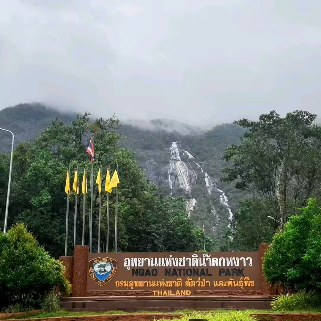
Driving south out of Ranong town on Phetchakasem Road, you look left and there it is: a long white thread of water hanging on a green mountain wall. No hike, no viewpoint fee, no guide. Ngao Waterfall is simply part of the highway scenery, and it is the reason most people first hear the name Namtok Ngao.
That roadside view is honest but incomplete. Behind the waterfall sits one of southern Thailand's most generous stretches of evergreen rainforest — roughly 668 square kilometres spilling across two provinces, climbing the Namsao Range, feeding streams so clean that a crab found nowhere else in the world chose to live in them.
So there are two ways to experience this park. You can stop for twenty minutes, take the photograph and drive on. Or you can stay, walk the short forest path, soak in a hot mineral spring, climb to a ridge viewpoint and start understanding why this particular forest matters.
A waterfall anyone can reach, guarding a forest most people never enter.
At a Glance
- 93rd
- National park of Thailand. Gazetted 2 June 1999.
- 668 km²
- Evergreen rainforest spanning Ranong and Chumphon provinces.
- Ngao Falls
- Signature landmark — visible from Highway 4, about 500 m from the park office.
- Panda Crab
- Phricotelphusa sirindhorn — a rare black-and-white crab discovered here in 1986.
- Official English name
- Namtok Ngao National Park
- Thai name
- อุทยานแห่งชาติน้ำตกหงาว
- Provinces
- Ranong and Chumphon
- Area
- Approximately 668 km² · gazetted 417,500 rai · GIS survey approximately 445,460 rai
- Established
- 2 June 1999
- National park no.
- 93rd national park of Thailand
- Highest notable summit
- Namsao Mountain — approximately 1,089 m
- Watershed
- Namsao Range — a key water source for both provinces
- Landscape
- Tropical evergreen rainforest, steep ridges, streams and waterfalls
- Signature attraction
- Ngao Waterfall — roughly 13 km from Ranong town on Highway 4
- Other highlights
- Phrang Hot Mineral Spring · Khlong Phrao Waterfall · Bang Rin Waterfall · Khuan Khao Klang Viewpoint
- Flagship species
- Panda Crab, Phricotelphusa sirindhorn
- Signature plants
- Daraphilas (Lasianthus ranongensis) · Gomasum orchid (Dendrobium formosum)
- Biggest waterfalls
- Rainy season · easiest travel November–April
Why Visit?
Namtok Ngao is unusually easy to like. It gives you a genuinely impressive waterfall within a few minutes of a main road, then rewards anyone curious enough to go deeper with hot springs, tiered cascades, ridge views and one of the richest rainforests in the Thai south.
It is also one of the few places where the science is part of the scenery. The streams here are so clean and so specific in their conditions that they support species described from this park and almost nowhere else. You are not just looking at pretty water — you are looking at habitat.
- A waterfall visible from the highway and reachable in a 500-metre walk
- Dense tropical evergreen rainforest on the Namsao Range
- A natural hot mineral spring with 17 pools and accessible design
- Multi-tier waterfalls at Khlong Phrao and Bang Rin
- The rare Panda Crab, named for Princess Sirindhorn
- Ranong's provincial flower, the Gomasum orchid, growing wild
- Birdwatching in lowland and foothill rainforest
- A ridge viewpoint over forest, lowland and the Andaman side
- Phukhao Ya, the Grass Hill, almost directly across the road
Geography & Terrain
The park's spine is the Namsao Range, a north–south chain of forested mountains running along the narrow waist of the Thai peninsula. The highest notable point, Namsao Mountain, reaches approximately 1,089 metres — modest by northern Thai standards, but steep, wet and densely forested in a way northern mountains rarely are.
That range is the reason the park exists. It functions as a watershed, catching enormous quantities of monsoon rain and releasing it slowly through streams that supply communities on both the Ranong and Chumphon sides. Every waterfall in the park is essentially this watershed at work, made visible.
The terrain drops quickly from ridge to lowland, which is exactly what produces tall, sudden cascades like Ngao rather than the long gentle rivers of the central plains.
Forest & Rain
Ranong is one of the wettest provinces in Thailand. The monsoon arrives off the Andaman Sea, hits the Namsao Range and unloads. The result is tropical evergreen rainforest in its full expression: multi-layered canopy, buttressed trunks, epiphytes, ferns, mosses, permanent humidity and a soundscape of water and insects.
Unlike the deciduous forests of the north, almost nothing here drops its leaves and waits. The forest simply keeps going, green through the year, which is why even a dry-season visit still feels lush even when the falls are thin.
All that rain also shapes visitor experience. Paths stay damp, rocks stay slippery, leeches and mosquitoes are part of the deal, and cameras fog. Come prepared and the forest is extraordinary. Come in flip-flops and you will remember the wrong things.
Ngao Waterfall
The park's signature landmark
Ngao Waterfall is the rare Thai waterfall that announces itself from the road. Tall and narrow, it drops down a forested cliff face in clear view of Phetchakasem Road (Highway 4), roughly 13 kilometres from Ranong town. Drivers see it without meaning to; that accidental first glimpse is part of its charm.
Up close, the character changes. From the park office it is only about a 500-metre walk to the base — a short, mostly straightforward path through shaded forest, easy enough for families and casual visitors. At the foot of the fall, the scale that looked graceful from the highway becomes physical: spray in the air, cool damp rock, water noise replacing traffic noise.
This combination — near-zero effort, real payoff — is unusual, and it makes Ngao one of the most rewarding quick stops on the entire southern west coast.
Five hundred metres from a car park to the bottom of a mountain's water supply.
When Is Ngao Waterfall Most Impressive?
In the rainy season, without much competition. Fed directly by monsoon rainfall on the Namsao Range, the fall is at its widest, loudest and most photogenic when the mountain is saturated. The spray reaches further, the rock darkens, and the whole cliff feels alive.
From roughly November to April travel is more comfortable and the roads and paths are kinder, but the water volume steadily declines. Late in the dry season the fall can become a slender ribbon — still beautiful against green forest, but no longer thunderous.
The practical answer: decide what you actually want, then check recent rainfall before you travel. A waterfall is a weather report, not a fixed attraction.
The Panda Crab
Phricotelphusa sirindhorn · the park's most famous resident
The most celebrated inhabitant of Namtok Ngao is not a large mammal or a spectacular bird. It is a small freshwater crab, patterned in striking black and white, which earned it the affectionate name Panda Crab.
It was found on 6 December 1986 by Professor Paiboon Naiyanetr in the Ngao stream, and named Phricotelphusa sirindhorn in honour of Princess Maha Chakri Sirindhorn. For a country with thousands of described species, this one carries unusual weight: a tiny crab in a Ranong stream, bearing a royal name, standing in for the value of clean water.
The crab is not decorative — it is diagnostic. It needs cool, clear, well-shaded, well-oxygenated forest streams. Damage the forest and the stream warms, silts and changes, and the crab goes. Its presence is a direct readout of the health of the catchment.
Seeing one
Sightings are a matter of luck, season and patience. The crabs are most active in the wetter months, in shaded stream sections with rocks, leaf litter and running water. Look quietly near stream edges; do not turn over rocks or dig.
The rule
Look, photograph, leave alone. Never handle, relocate, feed or collect a Panda Crab. Do not bait an area to bring them out. If you find one, you have been granted a small privilege — treat it like one.
Daraphilas — the Cute Star Flower
Lasianthus ranongensis · flowering roughly April–June
The park's signature plant find is a modest forest shrub known in Thai as Daraphilas, sometimes translated as the Cute Star Flower. Its scientific name, Lasianthus ranongensis, carries Ranong itself — a reminder of how much of this province's natural history was first documented here.
It flowers approximately April to June, producing small star-shaped blooms in the shaded understorey. You will not see it from the road. It belongs to the category of things you only notice once you are inside the forest, walking slowly, looking down rather than up.
Gomasum — Ranong's Provincial Flower
Ueang Ngern Luang · Dendrobium formosum · flowering roughly October–December
Where Daraphilas is easy to miss, the Gomasum orchid is impossible to ignore. Known in Thai as Ueang Ngern Luang and scientifically as Dendrobium formosum, it produces large, waxy white flowers with a yellow throat — and it is the provincial flower of Ranong.
It flowers roughly October to December, which happens to overlap the tail of the rains: strong waterfalls and orchids in the same trip. For plant-minded travellers, that late-year window is the most rewarding time to be here.
One orchid, two claims: a wild forest epiphyte and a provincial emblem.
Inside the Rainforest
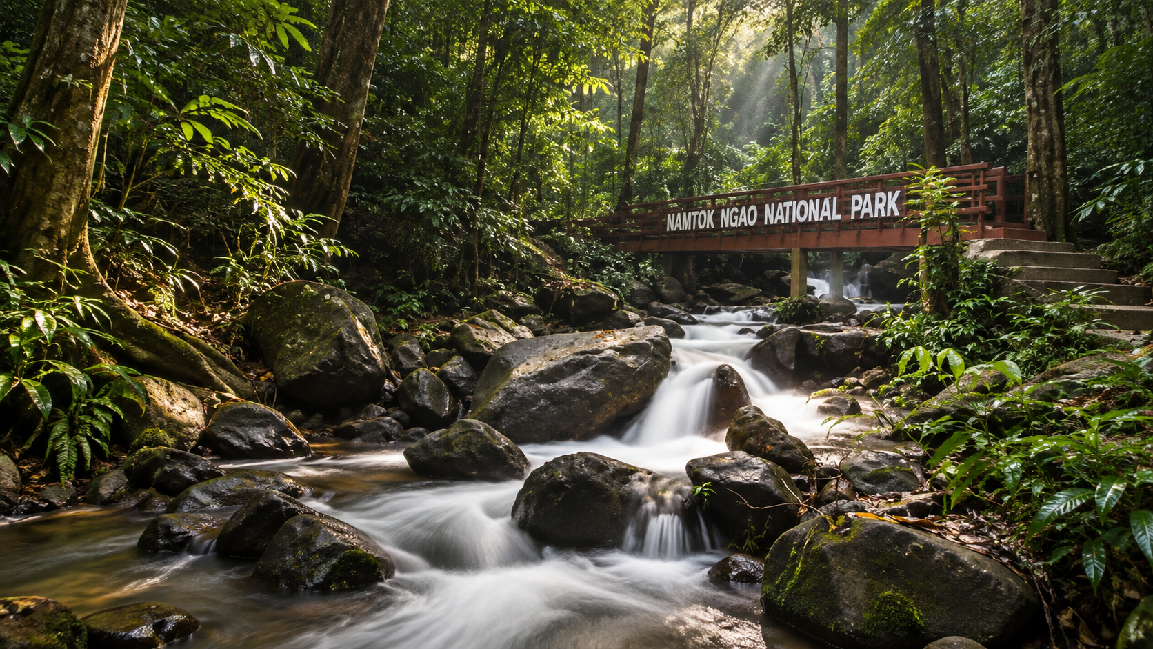
Walking into the forest at Namtok Ngao, the first thing you notice is the light — filtered, green, dim even at midday. The canopy layers overlap so completely that direct sun reaches the floor only in flecks.
Everything is competing for that light. Lianas climb, epiphytes ride on branches, ferns colonise trunks, palms fill gaps, and fungi work the leaf litter. This vertical crowding is what distinguishes a true evergreen rainforest from a merely green forest, and the Ranong side of the peninsula does it as well as anywhere in Thailand.
It is also why the park matters ecologically out of proportion to its fame. Forest of this type has been heavily reduced across the peninsula. What survives inside the boundary is not a remnant garden — it is a functioning system.
Wildlife & Biodiversity
Wet lowland and foothill rainforest supports a dense, well-hidden community of wildlife. Expect to hear far more than you see. Gibbon and macaque calls, squirrels overhead, hornbill wingbeats, frogs after rain, and an enormous cast of insects and stream life form the everyday soundtrack.
Larger mammals exist within the wider forest block but are shy, nocturnal and sensibly avoidant of trails. The realistic wildlife experience here is the small stuff: stream invertebrates, amphibians, reptiles, butterflies, and the Panda Crab if fortune allows.
- Primates — heard more often than seen, especially at dawn
- Squirrels and other small arboreal mammals
- Rainforest birds through the canopy and mid-storey
- Frogs and amphibians, abundant after rain
- Freshwater crabs, including Phricotelphusa sirindhorn
- Butterflies along stream edges and forest gaps
- Wild orchids and understorey flowering plants
Birdwatching
Peninsular rainforest birding is difficult and addictive. The birds are there in quantity, but the canopy is high and dense, so success depends on patience, ears and early starts.
Work the forest edges, the waterfall approach and the stream corridors in the first two hours after dawn, when activity peaks and light penetrates furthest. Bring binoculars; a telephoto lens without binoculars means you will find far less. Recording calls is often more productive than chasing movement.
Khlong Phrao Waterfall
Five tiers · third tier approximately 40 m
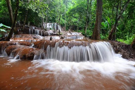
Where Ngao is a single dramatic drop, Khlong Phrao is a sequence. The waterfall descends in five tiers, each with its own pools, rock shelves and character, threaded through rainforest rather than displayed on an open cliff.
The third tier is the headline at approximately 40 metres — the point where the walk stops feeling like a stroll between pretty pools and starts feeling like a waterfall proper.
Khlong Phrao rewards the kind of visitor who prefers exploring to arriving. It is less photographed than Ngao, and correspondingly quieter. Conditions between tiers vary with rainfall, so ask staff about current access before committing to the full sequence.
Bang Rin Waterfall
Also known as the Sixteen-Tier Waterfall
If five tiers sounds generous, Bang Rin raises the count dramatically. Known locally as the Sixteen-Tier Waterfall, it is a long stepped cascade working its way down through forest in a series of modest drops rather than one spectacle.
This is a waterfall with a completely different appeal. There is no single money shot; the pleasure is cumulative — the sound changing as you climb, pools appearing one after another, forest closing around each level. It suits walkers more than photographers.
Access and how far up the sequence is practical will depend on season and trail condition. Check locally.
Phrang Hot Mineral Spring
Natural hot mineral water inside a national park
Ranong is Thailand's hot-spring province, and the park holds one of its best assets: the Phrang Hot Mineral Spring. Geothermally heated groundwater rises here naturally, filtered through the same mountain system that feeds the waterfalls.
What sets Phrang apart from many Thai hot springs is the water itself. It is notably clear, with very little sulphur smell — no eggy haze, no cloudiness. For anyone who has been put off hot springs by the odour, this is a different experience entirely.
Phrang today
A 2026 upgrade repositioned Phrang as a proper wellness destination rather than a rustic bathing stop, with 17 bathing pools at approximately 40–44°C. The range of pool temperatures lets you move gradually from warm to hot instead of committing to one intensity.
Accessibility
The upgrade was built around Universal Design principles, which means the facility is intended to be usable by older visitors, wheelchair users and people with limited mobility — not just the able-bodied. In a national park context that is still uncommon, and genuinely worth noting.
Pairing Phrang with a waterfall morning is one of the most satisfying combinations in Ranong: cold spray first, hot mineral water afterwards.
Cool waterfall, hot spring, same mountain, same morning.
Khuan Khao Klang Viewpoint
Looking out over the Namsao Range
Waterfalls show you the park from below. Khuan Khao Klang shows it from above. This ridge viewpoint opens out over layered forested hills, with the Ranong lowlands and the Andaman side of the peninsula stretching away beyond.
The value of coming up here is perspective. From the highway, Namtok Ngao looks like a waterfall. From the ridge, you see the actual extent of it — continuous forest running across ridgelines toward Chumphon, which is a much more accurate picture of what the park protects.
Mornings often bring mist sitting in the valleys; late afternoon gives the best ridge light. Both are worth the effort.
Two Provinces, One Watershed
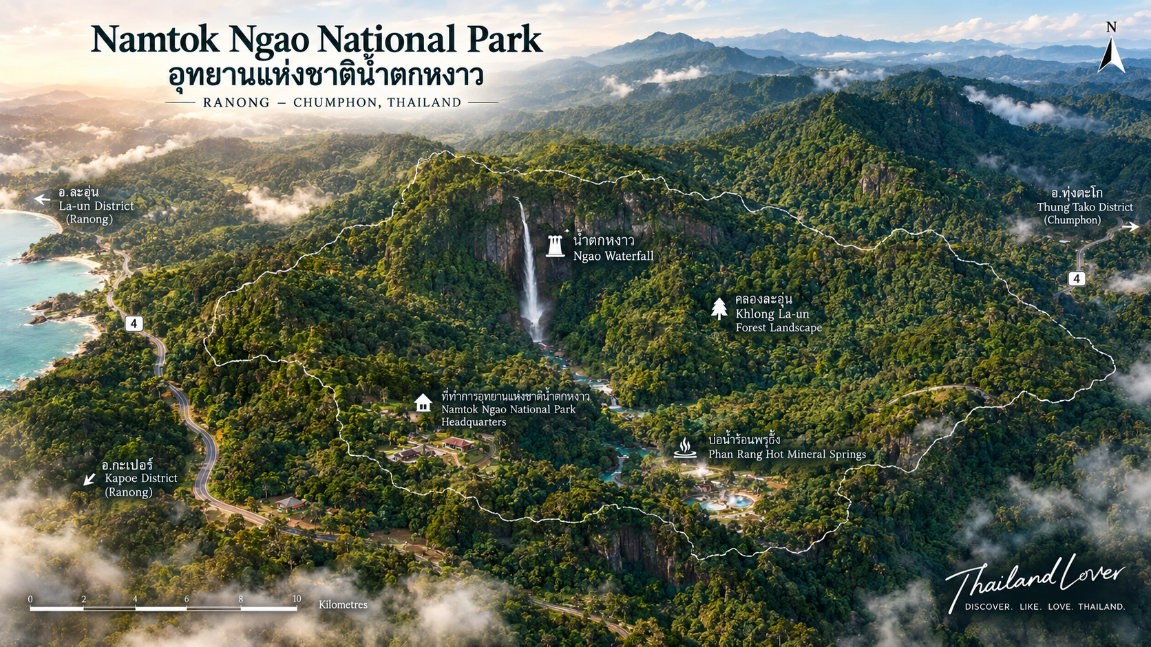
Namtok Ngao is administratively a two-province park, covering land in both Ranong and Chumphon. Ecologically, though, it is a single thing: the forested Namsao Range and the water it produces.
This matters more than a map detail. The Thai peninsula is at its narrowest here, and that slim strip of mountain forest catches rain from the Andaman side and releases it to communities on both flanks. Protecting the park is not primarily about scenery — it is about water security for two provinces.
It is also why the park boundary looks awkward on a map while making perfect sense on the ground. It follows a watershed, not a political line.
History — and Why It's Called Ngao
The park's status grew in stages rather than arriving all at once. The Ngao Waterfall area was first protected as Ngao Forest Park, a smaller and lighter designation reflecting its role as a popular local beauty spot beside the highway.
In 1989 the Khlong Phrao area was brought into the picture, significantly enlarging the protected landscape and shifting the emphasis from a single waterfall to a forest block. The combined area was then renamed Namtok Ngao, keeping the name of the landmark everyone already knew.
Finally, on 2 June 1999, it was gazetted as Thailand's 93rd national park.
The name itself is straightforward: namtok means waterfall, and Ngao is the waterfall and stream at the heart of the original forest park. The park is named after the thing you can see from the road — which is unusually honest naming.
Seasons & Best Time to Visit
There is no single best time here, only trade-offs. Ranong's extreme rainfall is what makes the waterfalls great and the travel awkward, and you cannot have one without the other.
- Rainy season · best waterfalls
- Maximum water volume, greenest rainforest, most active streams and best chance of Panda Crab activity. Expect wet paths, slippery rock, leeches and mosquitoes, and possible access restrictions.
- November – December · the sweet spot
- Falls still carrying good water after the rains, travel becoming easier, and the Gomasum orchid flowering roughly October–December. For many visitors this is the best-balanced window.
- January – April · easiest travel
- More convenient and more predictable for sightseeing, but waterfall flow gets thinner as the dry season progresses. The forest stays evergreen regardless.
- April – June · flowering understorey
- The window for Daraphilas (Lasianthus ranongensis) and a good time for slow forest walking if you care more about plants than volume of water.
Whatever you choose, check recent rainfall before travelling. A fortnight of dry weather can change Ngao Waterfall from spectacular to slender.
Things to Do
- 1 · Walk to Ngao Waterfall
- The essential experience. About 500 metres from the park office, easy enough for most visitors, and far more powerful up close than from the highway.
- 2 · Soak at Phrang Hot Mineral Spring
- Seventeen pools at roughly 40–44°C, clear water with little sulphur smell, and accessible design following the 2026 upgrade.
- 3 · Explore Khlong Phrao's five tiers
- A quieter, more exploratory waterfall; the third tier drops around 40 metres. Ask about current access between tiers.
- 4 · Climb Bang Rin
- The Sixteen-Tier Waterfall — a long stepped cascade that rewards walkers rather than photographers.
- 5 · Take in Khuan Khao Klang Viewpoint
- Ridge views over the Namsao Range and the Ranong lowlands. Mist in the morning, best light late in the day.
- 6 · Look for the Panda Crab
- Quietly, near shaded stream edges, in the wetter months. Photograph and leave alone — never handle or collect.
- 7 · Find the orchids and understorey plants
- Gomasum (Dendrobium formosum) roughly October–December; Daraphilas (Lasianthus ranongensis) roughly April–June.
- 8 · Bird the forest edge at dawn
- Rainforest birding is ear-first work. The first two hours of light around stream corridors are the most productive.
Who Should Visit?
Best for
Waterfall chasers who want a real one without a long hike. Nature lovers drawn to genuine rainforest. Wellness travellers heading for the hot springs. Families who need a short, manageable walk with a big payoff. Birdwatchers and plant people willing to work slowly. Road trippers on Highway 4 looking for the best possible stop between Chumphon and Phuket.
Less suitable for
Travellers who dislike heat, humidity, rain and insects — this is one of the wettest corners of Thailand and it does not pretend otherwise. Visitors expecting a large resort-style attraction complex. Anyone hoping to reliably see big mammals: the forest is rich, but it keeps its larger residents to itself.
Getting There
This is one of the simplest national parks in Thailand to reach. Ngao Waterfall sits beside Phetchakasem Road (Highway 4), approximately 13 kilometres from Ranong town. If you are driving the west-coast route you will pass the waterfall whether you plan to or not — it is visible from the road.
From the turn-off, the park office area is immediate, and the waterfall is a short walk beyond. Ranong town is the obvious base, with the airport, bus terminal and accommodation all within easy reach. Other park highlights — Khlong Phrao, Bang Rin, Phrang and the Khuan Khao Klang ridge — are separate destinations and need their own travel planning.
A one-day route that works
- Morning — Ngao Waterfall, while it is cool and the light is soft in the forest
- Late morning — Phrang Hot Mineral Spring, warm water after cold spray
- Afternoon — Phukhao Ya (Grass Hill), just across the road, best in late light
Practical Advice, Safety & Respect
What to bring
Rain gear in any season — this is Ranong. Proper shoes with grip, not sandals; wet rock and forest paths are slippery. Drinking water, more than you think. Insect protection for mosquitoes and, in the wet months, leeches. A dry bag or plastic sleeve for phone and camera.
Staying safe
Do not climb wet rocks beside waterfalls or swim above a drop. Watch for rising water during heavy rain — streams here respond fast. Stay on marked paths, keep children close near water, and turn back rather than pushing on when a route deteriorates. Do not rely on mobile coverage away from the highway.
Respect the forest
- Take all rubbish out with you, including food scraps
- Do not pick plants, orchids or ferns, or remove rocks and wood
- Never handle, move or collect crabs, frogs or other stream life
- Do not feed wildlife or leave food out
- Keep noise down — most wildlife here is heard before it is seen
- Use soap and detergent nowhere near streams
- Follow park staff instructions on closures and restricted areas
Fees & Accommodation
Standard national park entrance fees apply, with the usual Thai and foreign, adult and child tiers. Camping and park accommodation may be available in designated areas, and Ranong town offers a full range of hotels and guesthouses within a short drive of the waterfall.
Two Personalities
Namtok Ngao is really two parks sharing a name, and understanding that is the key to enjoying it.
The accessible side
Ngao Waterfall, the park office, the 500-metre path, the hot spring, Phukhao Ya across the road. Easy, family-friendly, doable in half a day, visible from the highway. This is the park that welcomes everyone.
The wild side
The Khlong Phrao tiers, Bang Rin's sixteen levels, the Khuan Khao Klang ridge, the forest running across the Namsao Range into Chumphon. Steeper, wetter, less visited, and where the park's actual ecological weight sits.
Scientific importance
That wild side is why the park earns more than a scenic rating. Species described from here — the Panda Crab, Lasianthus ranongensis — mean this forest is a reference point, not just a recreation area. Habitat this specific, in a peninsula this narrow and this developed, does not come back once it is gone.
Essential Information
- Name
- Namtok Ngao National Park
- Thai
- อุทยานแห่งชาติน้ำตกหงาว
- Provinces
- Ranong and Chumphon
- Area
- Approximately 668 km² · gazetted 417,500 rai · GIS approximately 445,460 rai (not interchangeable figures)
- Established
- 2 June 1999
- National park number
- 93
- Main landmark
- Ngao Waterfall — visible from Highway 4, about 13 km from Ranong town
- Walk to the falls
- Approximately 500 m from the park office
- Highest notable summit
- Namsao Mountain — approximately 1,089 m
- Watershed
- Namsao Range, supplying both provinces
- Hot spring
- Phrang Hot Mineral Spring — 17 pools, approximately 40–44°C, Universal Design (2026 upgrade)
- Other waterfalls
- Khlong Phrao (5 tiers, third approximately 40 m) · Bang Rin (Sixteen-Tier)
- Viewpoint
- Khuan Khao Klang
- Flagship species
- Panda Crab — Phricotelphusa sirindhorn, discovered 6 December 1986
- Signature plants
- Daraphilas, Lasianthus ranongensis (April–June) · Gomasum, Dendrobium formosum (October–December)
- Nearby
- Phukhao Ya (Grass Hill), across the road
- Park character
- Tropical evergreen rainforest, waterfalls, streams, hot springs and watershed mountains
Frequently Asked Questions
- Where is Namtok Ngao National Park?
- It covers land in both Ranong and Chumphon provinces in southern Thailand. Ngao Waterfall sits beside Phetchakasem Road (Highway 4) roughly 13 km south of Ranong town — one of the easiest national park waterfalls in the country to reach.
- What is Namtok Ngao National Park famous for?
- Ngao Waterfall, tall enough to be seen from the main highway, and the rare Panda Crab (Phricotelphusa sirindhorn) discovered in the park's Ngao stream in 1986. It also protects rich evergreen rainforest, the Phrang hot mineral spring, Khlong Phrao and Bang Rin waterfalls, and the Namsao Range watershed.
- When was the park established and what number is it?
- Gazetted on 2 June 1999 as Thailand's 93rd national park. The area was earlier managed as Ngao Forest Park before being expanded and upgraded.
- How big is the park?
- Approximately 668 km². The gazetted figure is 417,500 rai; a later GIS survey gives approximately 445,460 rai. These come from different measurement exercises and are not interchangeable.
- How far is the walk to Ngao Waterfall?
- About 500 metres from the park office to the foot of the fall, on a short and mostly easy path. You can see the upper part of the waterfall from Highway 4 before you even turn in.
- What is the Panda Crab and can I see one?
- A small black-and-white freshwater crab, Phricotelphusa sirindhorn, discovered on 6 December 1986 by Professor Paiboon Naiyanetr in the Ngao stream and named in honour of Princess Maha Chakri Sirindhorn. It needs clean, cool, shaded forest streams and is most active in the wetter months. If you find one: look, photograph, leave it alone — never handle, move or collect it.
- What is the Phrang hot mineral spring like?
- A natural hot mineral spring inside the park. After a 2026 upgrade it runs as a wellness destination with Universal Design access and 17 pools at roughly 40–44°C. The water is notably clear with little sulphur smell.
- What is the best time to visit?
- The rainy season gives the biggest waterfalls and greenest forest but wetter, more slippery travel. November to April is more convenient for travel, though the falls run thinner as the dry season goes on. Ranong is one of Thailand's wettest provinces — check recent rainfall before you commit.
- Is there anything else to see nearby?
- Phukhao Ya (the Grass Hill) sits almost directly across the road. A natural day route is Ngao Waterfall in the morning, the Phrang hot spring late morning, and Phukhao Ya in the afternoon.
- Are there entrance fees and can I stay overnight?
- Standard national park entrance fees apply, and camping or park accommodation may be available in designated areas. Rates and regulations change — verify with the Department of National Parks or the park office before travelling.
More Ranong Nature
- Laem Son National Park
- Ranong's long mangrove-and-beach coastline on the Andaman side — the sea counterpart to Ngao's rainforest.
- Mu Ko Ranong National Park
- Islands, mangroves and estuary waters off the Ranong coast.
- Lam Nam Kra Buri National Park
- The Kra Buri river landscape and mangrove systems along the Myanmar border.
- Mu Ko Chumphon National Park
- Across the peninsula on the Gulf side, if your road continues east from the Namsao Range.
- All Nature & Parks
- Browse ThailandLover's national park guides across the country.
Location
Find Namtok Ngao
Beside Phetchakasem Road (Highway 4), about 13 km from Ranong town · Ranong 85000