


National Park · Ranong & Phang Nga
Laem Son National Park
อุทยานแห่งชาติแหลมสน
Where the Forest Meets the Andaman
Upper Andaman Coast · Southern Thailand
A ThailandLover guide to one of the quieter marine parks on Thailand’s upper Andaman coast — long beaches, casuarina forest, mangroves, reefs and a scatter of islands, rather than one famous beach.
Where the Forest Meets the Andaman
Along Thailand’s upper Andaman coast, where long beaches meet coastal forests, mangroves, coral reefs and scattered islands, lies one of the country’s quieter marine national parks.
Laem Son National Park stretches along approximately 60 kilometres of coastline in Ranong and Phang Nga, protecting a landscape far more diverse than its name might suggest. There are beaches lined with natural casuarina. Mangrove forests where freshwater meets the sea. Coral reefs and seagrass beneath the Andaman. And offshore, a chain of islands — including the Kam Islands, Ko Khang Khao and smaller islets.
This is not a destination defined by one famous beach. It is a landscape defined by forest, coast, islands and sea.
And that is what makes Laem Son worth discovering.
Laem Son National Park at a Glance
- Official Name
- Laem Son National Park
- Thai Name
- อุทยานแห่งชาติแหลมสน
- Location
- Ranong and Phang Nga
- Established
- 19 August 1983
- National Park No.
- Thailand’s 46th national park
- Area
- 196,875 rai / approximately 315 km²
- Coastline
- Approximately 60 km
- Coastal Region
- Upper Andaman Sea
- Landscape
- Beaches, beach forest, mangroves, estuaries, islands, coral reefs, seagrass and lowland forest
- Main Island Groups
- Kam Yai and Kam Nui archipelagos
- Other Islands
- Ko Khang Khao and several smaller islands
- Main Visitor Area
- Hat Bang Ben
- Nearest Major City
- Ranong
- Wetland Connection
- Kaper Estuary – Laemson Marine National Park – Kraburi Estuary Ramsar Site
The park was formally established by Royal Decree published in the Royal Gazette on 19 August 1983, covering approximately 315 square kilometres. It became Thailand’s 46th national park.
A National Park Built Around the Sea
Laem Son is different from many of Thailand’s better-known national parks. Its defining geography is not a high mountain range. The park follows the Andaman coastline, extending inland from the sea and taking in offshore islands and marine habitats.
UNESCO’s description of the Andaman Sea natural reserves identifies approximately 60 kilometres of coastline within Laem Son. More than 80% of the park’s area is described as marine or open-sea environment. This is fundamentally a coastal and marine landscape, not a conventional forest park.
The coastline is shaped by a combination of:
- Sandy beaches and coastal forest
- Mangrove forests and tidal channels
- Estuaries and rocky shores
- Coral reefs and seagrass
- Offshore islands
Small streams descend from inland areas toward the Andaman, carrying freshwater and sediment into the coast. Where those waterways meet the sea, mangrove ecosystems develop. Further offshore, shallow marine habitats provide nursery and feeding grounds. The result is a connected system — not a list of unrelated attractions.
Where Is Laem Son National Park?
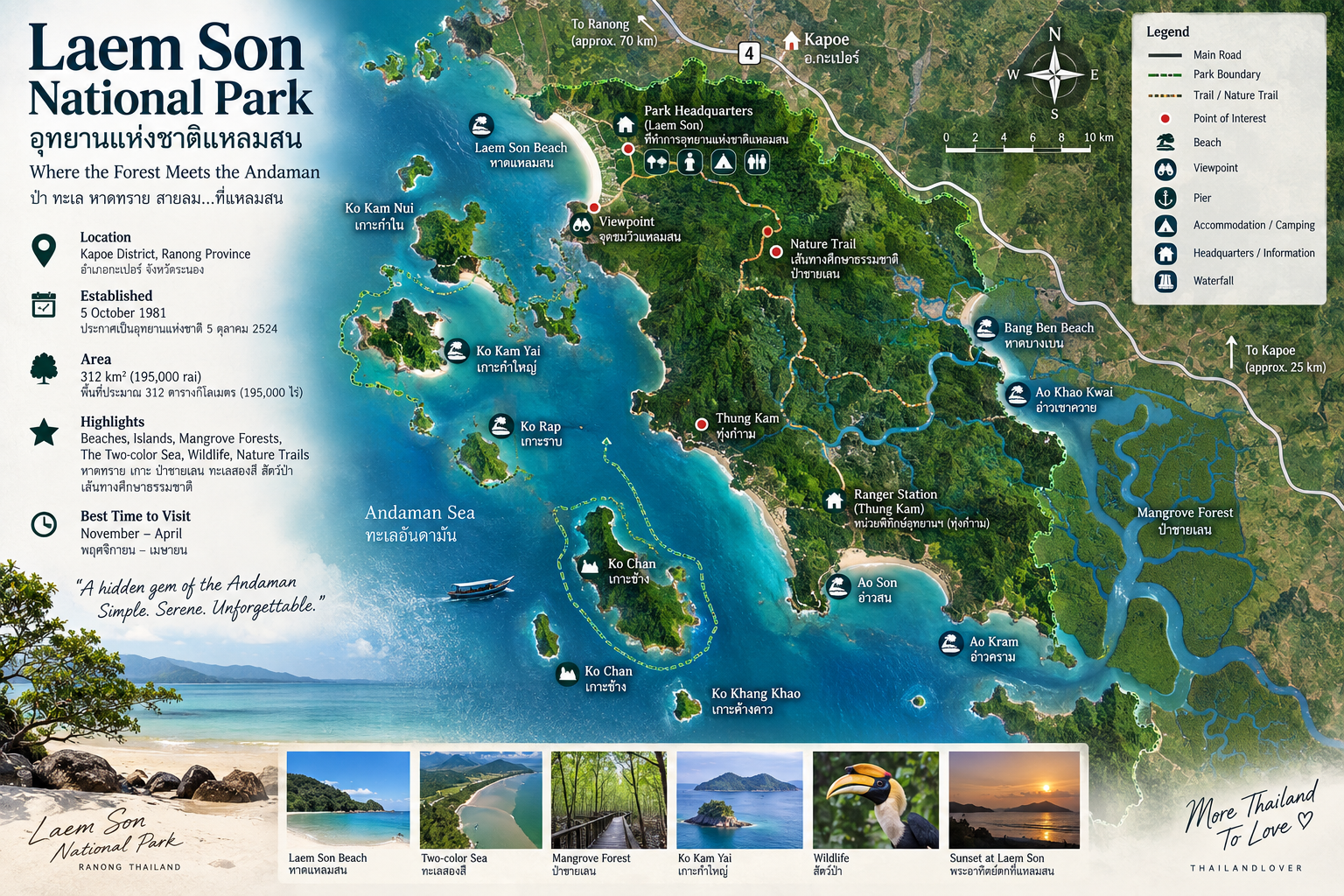
The park extends along the western coast of southern Thailand. Its territory covers coastal areas in Ranong and continues south toward Khura Buri District in Phang Nga. The protected landscape includes areas associated with Mueang Ranong, Kapoe and Suk Samran districts, together with the Khura area in Phang Nga.
The principal visitor area is around Hat Bang Ben, where the national park headquarters and visitor facilities are located. From Ranong, the park is reached by travelling south along the Andaman coastal corridor.
For travellers, Laem Son sits naturally inside a broader Ranong–Kapoe–upper Andaman journey, rather than as a place that always needs a separate long-distance trip of its own.
Why Is It Called “Laem Son”?
The name comes from the landscape itself. Laem Son refers to a cape associated with son — the casuarina trees that grow along the coast. Those trees are one of the park’s visual signatures.
At beaches such as Hat Laem Son and Hat Bang Ben, pale sand, open sea and lines of coastal casuarina create a landscape quite different from the dense tropical rainforest often associated with southern Thailand.
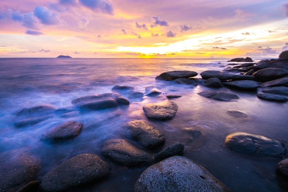
Wind. Sand. Trees. Sea. And a long horizon.
The Coastal Landscape
Laem Son’s geography is closely connected to what geographers describe as a submergent, or drowned, coastline. Rather than one continuous, perfectly straight beach, the shore is irregular — bays, headlands, tidal waterways and offshore islands.
Short streams flow from the inland landscape toward the Andaman. Among the waterways associated with the park are Khlong Khong, Khlong Lat Nod, Khlong Kanut and Khlong Bang Ben. They carry sediment toward the coast and help form estuarine and mangrove environments.
The mangrove forests are not simply trees beside the beach. They are part of a much larger coastal system — the relationship between freshwater and seawater is fundamental to understanding Laem Son.
The Forests of Laem Son
Despite being known primarily as a marine national park, Laem Son contains several distinct coastal forest environments.
Beach forest
Along the beaches, vegetation is adapted to salt spray, wind, intense sunlight and sandy soils. One of the most characteristic species is casuarina (Casuarina equisetifolia). Other coastal plants include species of Barringtonia, Terminalia catappa, Derris, and other beach-adapted trees and shrubs.
Beach forest provides shade, helps stabilise sandy areas and creates habitat for birds and other wildlife. It is also one of the reasons Laem Son’s beaches feel more natural and spacious than heavily developed resort beaches.
Mangrove forest
The mangroves are among the most ecologically important parts of the landscape. Where freshwater streams meet tidal seawater, they form complex intertidal habitat. Recorded mangrove species include:
- Rhizophora mucronata and Rhizophora apiculata
- Bruguiera sexangula, Bruguiera parviflora and Bruguiera cylindrica
- Xylocarpus granatum and Xylocarpus moluccensis
- Other coastal vegetation such as Sonneratia, Avicennia, Ceriops and Acanthus
Mangrove forests provide nursery habitat for young fish, shelter for crustaceans, habitat for molluscs, feeding grounds for birds, sediment trapping and coastal protection during storms. That is one of the most important reasons Laem Son has conservation value far beyond its beaches.
The Islands
Off the coast are groups of islands that form another major part of the park. UNESCO identifies two principal groups — the Kam Yai and Kam Nui archipelagos — together with several additional inshore islands. English spellings of individual island names vary between sources, so this guide uses the names visitors most often meet, with Thai names alongside.
- Ko Kam Yai · เกาะกำใหญ่
- One of the most recognisable islands in the Kam landscape — forested terrain, clear coastal water and sandy beaches. Sheltered bays make it one of the islands most associated with boat trips from the mainland. The real attraction is forest, sand, shallow sea and the smaller islands around it — not “another beautiful island” on its own.
- Ko Kam Nui · เกาะกำนุ้ย
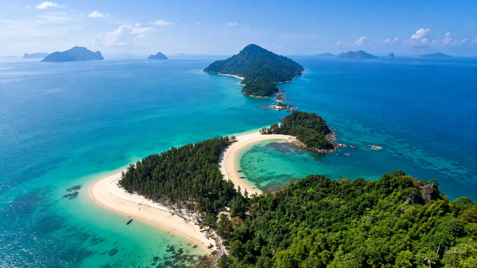
- Also written Ko Kam Noi. A smaller, more compact island close to Ko Kam Yai. From the water the relationship is clear: one island as foreground, another as the horizon, and between them shallow turquoise water, reefs and channels. That scattered-island seascape is one of Laem Son’s most distinctive views.
- Ko Kam Tok · เกาะกำตก
- Also known as Ko Ao Khao Khwai (เกาะอ่าวเขาควาย). A curved bay and sandy beach, associated with a ranger station and park protection unit. The setting feels discovered rather than developed — a very different island experience from the built-up beaches elsewhere on the Andaman.
- Ko Khang Khao · เกาะค้างคาว
- Bat Island. Sandy beaches, rocky coastal areas, and a shoreline of rounded stones that feels distinct from the fine-sand beaches elsewhere. It can be reached by boat from the Bang Ben area. Travel time depends on sea conditions, boat type and the current operating arrangement — this guide does not treat any one duration as guaranteed.
The park’s wetland inventory also identifies additional islands, including Ko Mu, Ko Piak Nam Noi, Ko Piak Nam Yai, Ko Thao, Ko Lan and Ko Khai Yai. Visitor maps of the Kapoe coast also label islands such as Ko Rap and Ko Chan.
The Beaches
- Hat Bang Ben · the gateway
- If Laem Son has a front door, it is this long sandy beach, surrounded by natural casuarina and home to the park headquarters and visitor facilities. The beach is broad and open. It is also the principal departure point for island boats. You arrive by road, the landscape opens, forest gives way to sand, and the Andaman is suddenly in front of you. Provincial tourism descriptions of Hat Laem Son–Bang Ben note the long beach, natural pine and casuarina, and the headquarters, visitor centre, camping and accommodation in this area.
- Hat Laem Son
- A short distance from Bang Ben. Pale sand and natural coastal vegetation, and a useful place for bird observation. Especially attractive at low tide, when the broad intertidal zone becomes visible. Better suited to walking, watching the sea, photography and slowing down than to a packed schedule.
- Hat Praphat · Hat Hin Thung
- Further south, a large beach with natural casuarina forest, associated with the Kam Nui island area. More removed from the headquarters experience. For travellers continuing along the coast, another chance to meet the Andaman shoreline without the concentration of development found at Thailand’s major beach destinations.
The Sea Around Laem Son
The waters around Laem Son are ecologically significant because the habitats are connected. Mangroves nursery young marine organisms. Seagrass supports marine life and helps stabilise sediment. Coral reefs provide shelter and feeding habitat. Estuaries bring nutrients from land to sea. The beach itself joins terrestrial and marine ecosystems.
- Coral reefs and seagrass beds
- Mangrove forests and estuaries
- Sandy beaches and intertidal flats
- Shallow coastal waters
Together they form one of the important ecological networks of Thailand’s upper Andaman coast.
Marine Turtles
The Laem Son coastal ecosystem has also been identified as habitat used by marine turtles. UNESCO’s assessment of the Andaman Sea natural reserves identifies olive ridley turtles (Lepidochelys olivacea) and leatherback turtles (Dermochelys coriacea) as species associated with nesting grounds in the wider Laem Son coastal landscape.
Seeing turtles is not something visitors should expect on demand. The value of Laem Son lies in protecting the habitat that allows these species to keep using the coast.
Birds and Wildlife
Mangrove, beach forest, mudflat, estuary, inland forest and marine habitat create an unusually varied environment. Birdwatching can be particularly rewarding around mangroves, estuaries, mudflats, beach forest, tidal channels and coastal islands. Species recorded in the wider region include waterbirds, shorebirds, kingfishers, raptors and forest birds.
The park’s ecological importance is not limited to large animals. A large part of the biodiversity value is found in the small, often overlooked organisms of the intertidal zone.
The Famous Stone-Tool Monkeys
One of the most fascinating scientific stories associated with the Laem Son islands involves long-tailed macaques. Research has documented wild macaques using stones as tools on islands including Piak Nam Yai. The monkeys use stones to open marine foods such as shellfish — an unusual example of tool use in wild primates.
The story is not simply that there are monkeys on an island. It is that wild macaques have developed and maintained their own tool-using behaviour within this coastal environment. That is considerably more interesting — and it is discovery, not conventional sightseeing.
Mangroves on an International Scale
Laem Son’s importance becomes clearer beyond the park boundary. The area forms part of an internationally recognised wetland complex:
Kaper Estuary – Laemson Marine National Park – Kraburi Estuary
The site was designated under the Ramsar Convention on 14 August 2002 as Ramsar Site No. 1183, covering approximately 122,046 hectares. That is not the same thing as saying the national park itself is 122,046 hectares. The Ramsar designation covers a much larger wetland complex — the Kaper Estuary, Laem Son Marine National Park and the Kraburi Estuary together.
The Ramsar Information Sheet describes the site as containing a major concentration of Ranong’s mangrove forests, together with mudflats, sandy beaches, coral reefs and seagrass. That distinction matters.
Ranong Biosphere Reserve
Laem Son also sits within a larger conservation landscape associated with the Ranong Biosphere Reserve. UNESCO describes the reserve as a continuum of protected habitats from mountain ecosystems down through the coast and into the sea. The wider reserve contains exceptionally important mangrove ecosystems, supports more than 300 recorded fauna species, and has mangrove diversity exceeding 50 species.
Laem Son is not an isolated marine park. It is part of a broader mountain-to-mangrove-to-sea ecosystem.
A Coast Shaped by Tides
One of the most interesting ways to experience Laem Son is to visit at different stages of the tide. At high tide, waterways appear fuller and the sea approaches the mangrove edges. At low tide, mudflats, sandbars and intertidal zones become visible. The changing waterline reveals the structure of the coast.
For photographers, the same place can look completely different. For nature lovers, it also shows why mangroves and tidal flats matter. The landscape is not static.
Laem Son changes throughout the day.
The 2004 Indian Ocean Tsunami
Laem Son was also affected by the 2004 Indian Ocean tsunami. The tsunami caused major damage to infrastructure in the park, including the destruction of the former park headquarters, and physically altered parts of the coastal landscape. One notable example is Ao Khao Khwai, where the coastal configuration changed after the event.
This is part of the modern history of the park. It also demonstrates something fundamental about coastal landscapes: the coastline is not permanent. The same forces that shape beaches, islands, sandbars and estuaries over geological time can sometimes transform them within a single event.
Best Things to Do
Laem Son is best experienced through a combination of land and sea.
- 1. Walk Hat Bang Ben
- Start with the simplest thing. Walk the beach. Follow the casuarina. Watch the tide. Stay for the changing light.
- 2. Visit Hat Laem Son
- A quieter beach a short way along the coast. Long sand and coastal vegetation make it good for photography and bird observation.
- 3. Take a boat to the islands
- The Kam Islands are the park’s signature marine experience. Depending on season and sea conditions, trips may include Ko Khang Khao, Ko Kam Tok, Ko Kam Yai and Ko Kam Nui. Routes and times vary. Do not plan around a fixed travel time.
- 4. Snorkel, where conditions allow
- The coastal waters contain coral reef habitat. Where access is permitted and the sea is suitable, snorkelling offers a glimpse of the underwater ecosystem. Laem Son is not a coral-island resort. Its attraction is the entire coastal ecosystem.
- 5. Watch birds
- Bring binoculars. Mangrove, beach forest, mudflat and estuary are a particularly interesting combination. Early morning and late afternoon are generally the most rewarding times.
- 6. Explore the mangrove landscape
- A completely different visual experience from the open beach. Look for tidal channels, exposed roots, mudflat life, juvenile fish, crabs, molluscs and wading birds. This is where the ecological story becomes visible.
When to Visit
Laem Son is strongly influenced by the southwest monsoon and the seasonal condition of the Andaman Sea. The marine environment is not equally accessible throughout the year. The traditional season for the offshore islands is the drier, calmer months. Many island areas may be subject to seasonal closure or restricted access during the monsoon. Destination information has historically noted island closures from approximately May to October.
Island access is seasonal and may be restricted during the monsoon. Check current national park announcements before planning a boat trip.
Some visitor maps print November to April as the best time. Treat that as a traditional dry-season window, not a guaranteed opening calendar.
- Island hopping
- Generally the drier Andaman season. Calmer seas and better marine visibility make offshore excursions more practical.
- Beaches
- The dry season offers the most predictable beach conditions.
- Photography
- Light around sunrise and sunset can be excellent throughout the year, although cloud and weather vary with the season.
- Mangrove and nature observation
- The coastal ecosystem remains interesting year-round. Access and weather should always be considered.
How to Get There
The principal visitor area is at Hat Bang Ben, where the headquarters and visitor facilities are located. The park lies along the coastal route south from Ranong toward Kapoe and the Phang Nga side of the upper Andaman. From the main highway, the route turns toward the Bang Ben / Laem Son area.
Road conditions and access arrangements can change. Check current navigation and park information rather than relying on old printed distances.
Reaching the park headquarters is not the same as reaching the islands. The islands require a separate boat journey.
Where to Stay
The main park area around Bang Ben has historically provided national park accommodation, camping, visitor facilities, food services and access to boat trips. Availability varies with season, maintenance and park operating conditions. Treat accommodation as park facilities subject to current availability — not a promise of a specific room type or service. Confirm with the park before you travel.
What Kind of Traveller Is Laem Son For?
- The nature lover
- If you prefer forests, beaches, mangroves and wildlife to large resorts, Laem Son fits naturally.
- The slow traveller
- This is not a place that rewards rushing. Its best experiences are often simple: walking, watching, listening and exploring.
- The photographer
- Casuarina forest, white sand, turquoise water, mangroves and offshore islands offer excellent visual variety — and the tide can change the picture entirely.
- The birdwatcher
- Mangroves, mudflats and beach forest create diverse bird habitat.
- The island explorer
- The Kam island group offers a more remote island experience than many of Thailand’s highly developed beach destinations.
- The curious traveller
- Perhaps most importantly, Laem Son rewards people who want to understand how Thailand’s coast actually works.
What Laem Son Is Not
Laem Son should not be presented as a luxury island resort, a party destination, a mass-tourism beach, a guaranteed year-round island-hopping circuit, or a place where every island is accessible every day.
Its strength is almost the opposite. It is a protected landscape where access, weather and nature still determine the experience.
Responsible Travel
Laem Son is an ecologically sensitive coastal environment. Visitors should:
- Take all rubbish back
- Never collect shells, coral or marine life
- Avoid standing on coral, and use reef-safe behaviour when snorkelling
- Never feed wildlife, and keep noise low around animals
- Stay on designated trails where they exist, and follow ranger instructions
- Avoid damaging mangrove vegetation
- Never disturb turtle nesting areas
- Respect seasonal closures, and avoid single-use plastic where possible
Leave the coast looking as though you were never there.
Laem Son and Thailand’s More Famous Islands
Thailand has no shortage of famous island destinations — Phi Phi, Similan, Surin, and the beaches of Phuket. Laem Son occupies a different position. It is less about dramatic limestone cliffs or luxury resorts. It is more about the relationship between coast, mangrove, beach forest, islands, reef and estuary.
For travellers who have already seen Thailand’s famous beaches and want a quieter ecological side of the Andaman, Laem Son offers a different kind of experience.
Essential Information
- Park
- Laem Son National Park · อุทยานแห่งชาติแหลมสน
- Region
- Upper Andaman Coast, Southern Thailand
- Provinces
- Ranong and Phang Nga
- Established
- 19 August 1983 · Thailand’s 46th national park
- Area
- 196,875 rai / approximately 315 km²
- Coastline
- Approximately 60 km
- Main Ecosystems
- Beach, beach forest, mangrove, estuary, coral reef, seagrass, coastal and lowland forest, offshore islands
- Main Visitor Area
- Hat Bang Ben
- Key Beaches
- Hat Bang Ben · Hat Laem Son · Hat Praphat / Hat Hin Thung
- Key Islands
- Ko Kam Yai · Ko Kam Nui · Ko Kam Tok / Ko Ao Khao Khwai · Ko Khang Khao · smaller islands and islets
- Marine Wildlife
- Marine turtles and diverse coastal and marine fauna
- International Recognition
- Ramsar Site No. 1183, designated 14 August 2002 — the wider Kaper–Laemson–Kraburi wetland, 122,046 hectares
The Ramsar site’s 122,046-hectare area is not the area of Laem Son National Park. The national park itself is approximately 315 km² / 196,875 rai.
ThailandLover Quick Guide
- Best for
- Nature · beaches · islands · mangroves · birdwatching · snorkelling · photography · slow travel
- Difficulty
- Easy around the main beach and visitor area. Offshore islands need extra transport and depend on weather and seasonal access.
- Ideal stay
- 1 day for the main beach · 2 days for a more relaxed coast-and-island experience
- Don’t miss
- Hat Bang Ben · Hat Laem Son · Kam Islands · Ko Khang Khao · mangrove landscape · sunset along the coast
- Bring
- Sun protection · water · insect repellent · dry bag · snorkelling equipment where appropriate · binoculars · camera
- Remember
- Island access is seasonal. Confirm current conditions, boat services and park regulations before departure.
Frequently Asked Questions
- What is Laem Son National Park?
- Thailand’s 46th national park, established by Royal Decree on 19 August 1983. It covers about 315 km² / 196,875 rai along roughly 60 km of upper Andaman coastline in Ranong and Phang Nga.
- Where is it?
- On the western coast of southern Thailand. The main visitor area and headquarters are at Hat Bang Ben, south of Ranong. The park continues toward Khura Buri in Phang Nga.
- Why is it called Laem Son?
- The name refers to a cape associated with the casuarina trees — son — that line the coast.
- When should I go?
- Island trips are most practical in the drier, calmer months. Access may be restricted during the southwest monsoon. Check current park announcements before booking a boat. Do not treat a printed “November to April” note as a guaranteed opening date.
- Is the Ramsar site the same as the park?
- No. The park is about 315 km². Ramsar Site No. 1183 covers the much larger Kaper–Laemson–Kraburi wetland complex, about 122,046 hectares, designated on 14 August 2002.
- What wildlife might I encounter?
- Olive ridley and leatherback turtles use the wider coastal landscape, though sightings are never guaranteed. The mix of mangrove, mudflat and beach forest is good for birds. Islands including Piak Nam Yai are known for stone-tool-using long-tailed macaques.
Explore the Upper Andaman
- Mu Ko Ranong National Park
- Ranong’s other island park — a different marine landscape on the same upper Andaman coast.
- Lam Nam Kra Buri National Park
- The Kraburi river landscape that shares the wider Ramsar wetland story with Laem Son.
- Mu Ko Ra–Ko Phra Thong National Park
- Continue south into Phang Nga’s quieter island and mangrove coast.
- Si Phang-nga National Park
- Inland forest on the Phang Nga side, if the journey turns from coast to rainforest.
- Ao Phang-nga National Park
- The famous limestone bay further south — a useful contrast with Laem Son’s lower, quieter shoreline.
- Nature & Parks
- More coasts, forests and protected landscapes across ThailandLover’s collection.
Location
Find Laem Son National Park
Hat Bang Ben, Kapoe, Ranong · upper Andaman coast