

National Park · Lampang & Tak
Mae Wa National Park
อุทยานแห่งชาติแม่วะ
Where Forests, Waterfalls and Mountain Ridges Meet
Thoen · Mae Phrik · Ban Tak · Sam Ngao
A quieter mountain park between two provinces. Not one landmark. A landscape of water, pine, cave and ridge.
A Quieter Side of the Northern Mountains
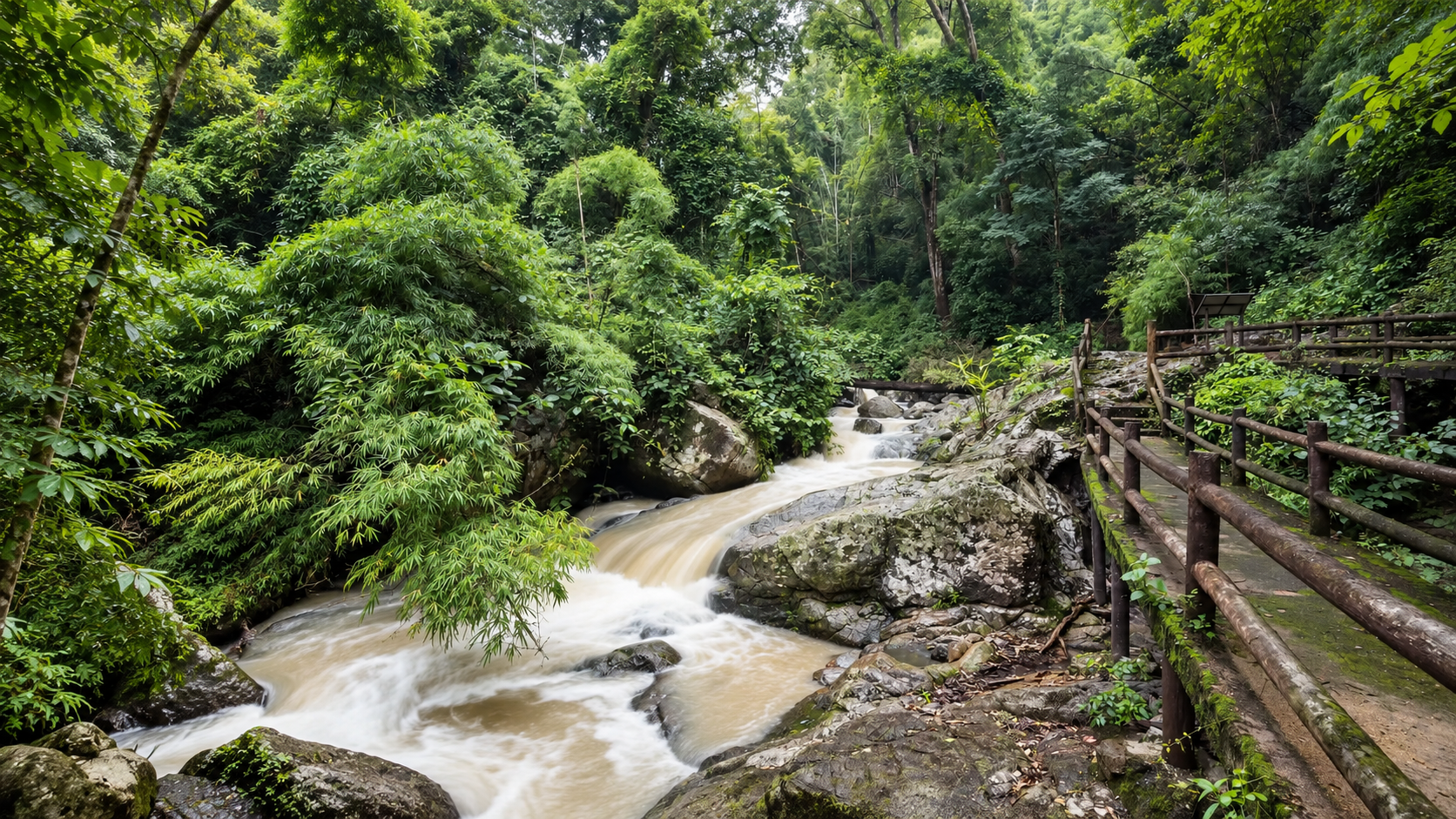
Away from Chiang Mai’s famous peaks, a long forested ridge system stretches across the border between Lampang and Tak. This is Mae Wa. Rugged mountains, dry forest, pine woodland, waterfalls, caves and high viewpoints. It is not defined by one monumental landmark. Its character is the combination.
The recognizable experiences run from the multi-tiered Mae Wa Waterfall to the high viewpoint of Doi Pha Daeng. Caves such as Tham Phra Chedi open a second landscape under the forest. For ThailandLover, Mae Wa is a broad mountain ecosystem linking two provinces — a park for travellers who want to see the forest behind the photograph.
A landscape of transition — between mountain and valley, wet and dry forest, water and rock, Lampang and Tak.
At a Glance
- 98th
- National park of Thailand. Established 17 November 2000. Not a preparatory area.
- 364,173 rai
- About 582.68 km². The safer current figure. Older pages sometimes say 368,125 rai.
- 1,027 m
- Doi Ta Chi, traditionally the highest point. High enough to change the forest. Not a famous summit.
- Check the ridge
- The park can be open while Doi Pha Daeng or a nature trail is seasonally closed.
- Thai name
- อุทยานแห่งชาติแม่วะ
- Provinces
- Lampang and Tak
- Lampang
- Thoen and Mae Phrik
- Tak
- Ban Tak and Sam Ngao
- Landscape
- Mountain ranges, forests, highland plains, waterfalls and caves
- Signature waterfall
- Mae Wa Waterfall · น้ำตกแม่วะ
- Signature viewpoint
- Doi Pha Daeng
- Caves
- Tham Phra Chedi · Nam Pha Pha Ngam Cave
- Forests
- Mixed deciduous, dry dipterocarp, dry evergreen and coniferous
- Best overall
- November–January
Two Provinces, One Mountain System
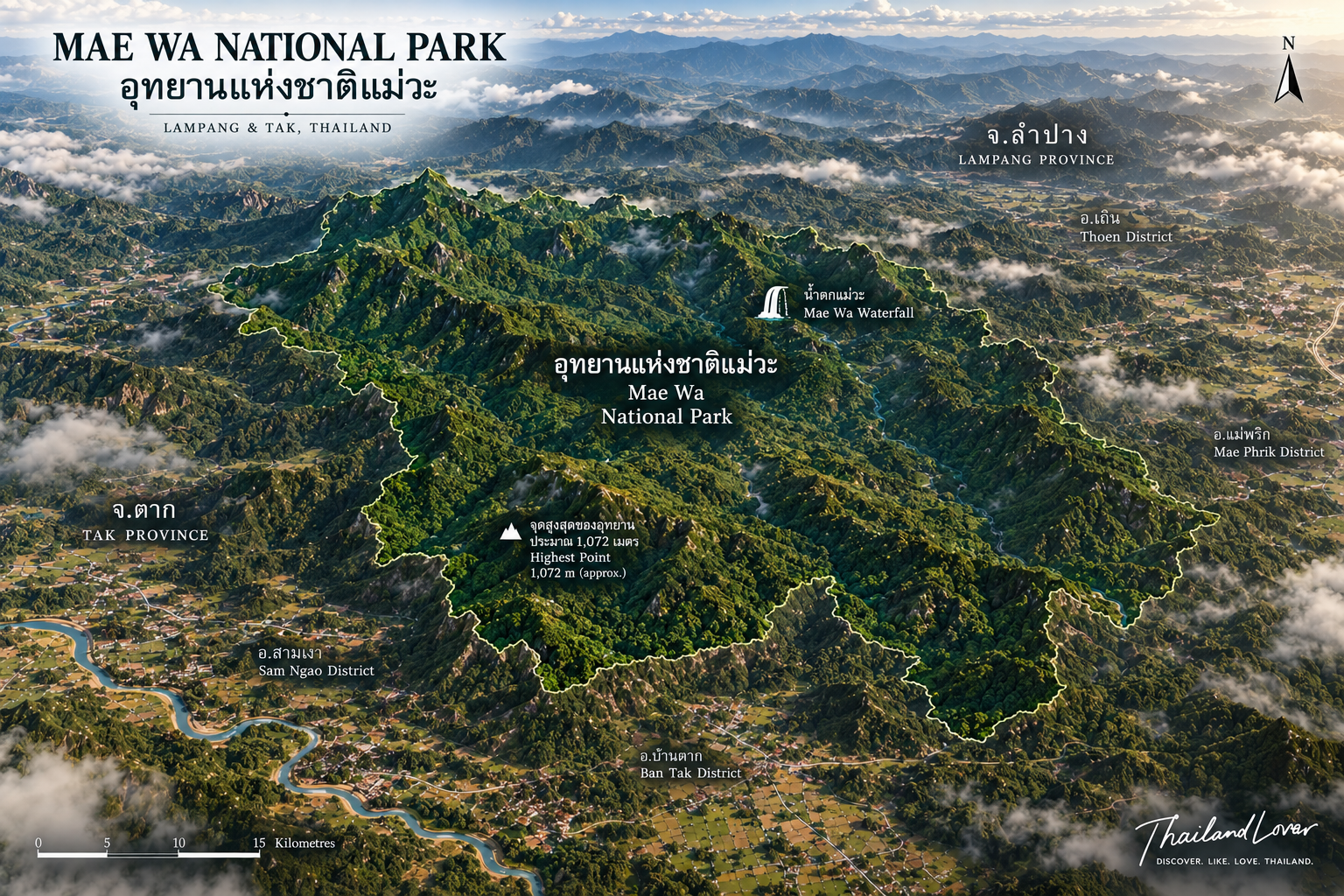
The north of the park is relatively high and rugged. Further south and through the centre, ridges open into broader highland plains and elongated summits. The west holds sandstone formations. Inside one protected area there are steep slopes, ridgelines, forested valleys, open highland, pine, waterfalls, streams, caves, cliffs and viewpoints. Mae Wa rewards visitors who leave the headquarters.
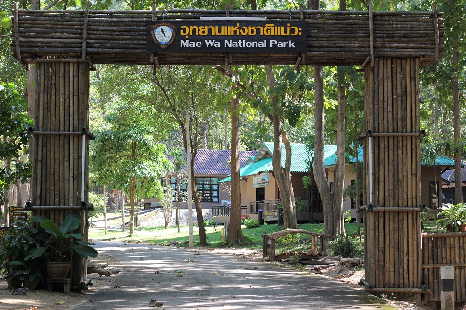
The nearest urban reference in many descriptions is Tak. The main administrative and visitor areas are associated with the Thoen side in Lampang. Mae Phrik is the other Lampang gateway, especially for caves. The southern park continues into Tak, which makes Mae Wa more interesting as part of a Lampang–Tak road trip than as a there-and-back from Chiang Mai.
Thoen is not only a fuel stop. The district has its own historical landscape, and the change from lowland communities into mountain forest is part of the journey. A national park here is not an island. It sits inside a larger human country.
Doi Pha Daeng at First Light
Mountain road · pine · a walk · a view
Doi Ta Chi, at about 1,027 metres, defines the park’s mountainous character more than it competes with Thailand’s highest peaks. The visitor experience most people mean is Doi Pha Daeng: mountain views, sunrise, sunset, a possible sea of mist, pine, and open highland. The Tourism Authority of Thailand has described travel by park vehicle toward Suan Son Lan Chom Dao, then a walk to a viewpoint. It is not “drive to the railing.”
A good morning is headquarters, permitted park transport, the pine garden, the walking route, then the viewpoint before the sun. Historical operating notes have mentioned advance booking and limited departures. Confirm them. They change.
Before sunrise the valleys can stay in shadow. Mist may sit between the ridges. What you see, when the air is clear, is overlapping mountains rather than one famous silhouette. Depth and atmosphere, not a logo peak. Mist is most likely when the night was cool, humidity is high, the valleys still hold moisture, and the morning is calm. A clear forecast does not guarantee it. Treat mist as a bonus.
Pine, and the Forests Around It
- Mixed deciduous
- A northern character forest. Many trees shed in the dry season. The same slope becomes a different picture.
- Dry dipterocarp
- Adapted to seasonal dryness, and vulnerable to wildfire when the north burns.
- Dry evergreen
- More evergreen vegetation despite a pronounced dry season.
- Coniferous
- Pine above lower growth. Blue sky, dry grass and trunks in the cool months. Greener and more humid in the rains.
The pine landscape is one of Mae Wa’s strongest visual signatures, especially around the higher viewpoints. Older Lampang tourism notes singled out August to November for greener forest, stronger falls, wildflowers, mist on the tops and fuller streams. That is a landscape observation. Rain still decides whether the trail is wise.
In the dry season the aesthetic shifts: warm earth, golden grass, pale trunks, blue sky, pine silhouettes. Photographers can use that. Smoke is the cost. Check PM2.5, fire conditions and visibility. A viewpoint is only valuable if you can see it.
Mae Wa Waterfall
น้ำตกแม่วะ · many tiers · not always all of them
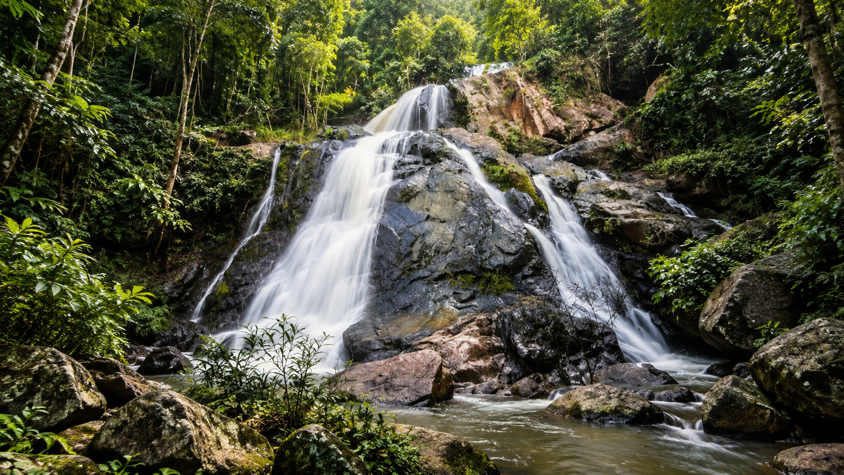
The namesake fall begins in the park’s mountains and descends through a series of cascades, traditionally described as about 12 levels. Streams from the Doi Prae Luang area feed it before the water joins the wider Wang River system. The Wang flows south and eventually meets the Ping. The forest is not only framing a photograph. It is holding part of a river.
The interest is the relationship of forest, rock, flowing water and elevation, not a single biggest drop. In the rains the forest tightens, moss appears, and the water has force. In low rainfall some sections shrink. Waterfall photography here is strongly seasonal.
The Daen Song Tawan Pa Mae Wa Nature Trail is the more immersive forest walk — less “arrive, photograph, leave,” more “walk, observe, understand.” It has also appeared on seasonal-closure lists. Confirm it with the viewpoint, not instead of the viewpoint.
Under the Forest
- Tham Phra Chedi · ถ้ำพระเจดีย์
- A natural formation resembling a pagoda — the Cave of the Pagoda. It is geology, not a constructed chedi: limestone, mineral, water and time. A completely different hour from the open ridge.
- Nam Pha Pha Ngam · ถ้ำน้ำผาผางาม
- A large cave on the Mae Phrik side, with stalactites, stalagmites, chambers and limestone formations. Evidence that Mae Wa is also a cave landscape, which the geology of the Mae Phrik–Thoen country helps explain: sedimentary, volcanic and granitic ground, cliffs, falls and ridges shaped over timescales longer than a visit.
Caves ask for a different mindset. Rainwater enters. Rock becomes glass-smooth. Some passages are unsuitable for inexperienced visitors. Follow current park instructions. Do not enter a closed cave. Do not touch formations you do not need to touch. Do not remove rock. A formation can take thousands or millions of years. A hand takes a second.
What the Forest Holds
Historical reports from the park include sambar, barking deer, wild boar, gaur, civets, Siamese hare, Asian black bear, forest birds, reptiles, amphibians and insects. Older descriptions also mention larger carnivores, including tiger, from the broader forest. Those lists are habitat history, not a promise that a visitor will meet the animal. The useful line is simpler: Mae Wa remains a significant forest. Watch as an ecological experience, not a checklist.
One smaller story is easy to miss. Older provincial tourism information identified the flying lizard — กิ้งก่าบิน — as a species that could still be found here. It does not fly like a bird. Skin membranes let it glide from tree to tree. Birds of deciduous woodland, pine, evergreen, forest edge and stream corridors are more likely to announce themselves by sound, early, if you walk quietly.
In wetter months the understory can fill with herbs, flowers, orchids, ferns and moss. In the cool dry season the woodland opens. That seasonal change is part of the appeal.
When to Go
- November – January · best overall
- Cooler air, comfortable walking, clearer ridges, pleasant camping, attractive pine, sunrise and sunset. ThailandLover rating: excellent.
- August – October · green and wet
- Lush forest, stronger falls, mist, wildflowers. Trails and roads get harder. The most photogenic water, and the season to be conservative about hiking.
- February – March · check the closure
- Some highland attractions have entered seasonal closure in this window. Do not assume Doi Pha Daeng is available because the park gate is open.
- March – May · dry, hot, often hazy
- The weakest bet for long mountain photographs if smoke is severe. Still interesting if you want dry-forest colour and you have checked the air.
Sunrise is the stronger hour: cool air, possible mist, valley shadow, soft light. Sunset works from exposed viewpoints. The return on a remote mountain road after dark is the risk. Drive it only if you already know it.
A Park That Rewards 5:30 a.m.
Camping is one of the better ways to be here: cooler air, forest sound, sunrise, the chance of early mist. The main visitor area has had camping facilities. Do not assume every service runs all year. Arrive before dark. Secure food. Skip the loud music. Wake before the sun. The difference between 11:00 a.m. and 5:30 a.m. can be the whole visit.
A suggested two-day shape: Thoen or Lampang into the park, the waterfall and a forest walk, then camp. Next morning, Doi Pha Daeng if it is open, sunrise, then a cave or another attraction if current conditions allow, and on toward Tak or back to Lampang. That gives you both the forest and the mountain. A few hours at the waterfall alone is one component.
Families
The visitor area, camping ground, short walks and accessible waterfall sections. Slippery caves and steep ridges need a separate decision, especially with young children.
Hikers and couples
Uneven mountain ground: forest trails, waterfall walks, viewpoint hikes, ridges, caves. A short wet trail can be harder than a longer dry one. The quiet version — camp, stars, sunrise, mist — suits people who do not need a commercial mountain.
A Proposed Expansion Is Not the Park
In November 2023 the Department of National Parks announced public participation on a proposed expansion of Mae Wa. The survey covered areas in Thoen (Mae Wa, Thoen Buri, Lom Raet, Mae Pa, Mae Mok, Wiang Mok), Mae Phrik (Phra Bat Wang Tuang) and Ban Tak (Mae Salit, Wang Chan), including community-related parcels totalling several thousand rai.
That was a legal and participatory process. It does not mean those additional areas automatically became the national park. Existing boundary and proposed expansion are different maps. ThailandLover keeps them apart.
What the Quiet Asks of You
- Stay on trails. Mountain soil erodes quickly.
- Do not collect plants, orchids or wildflowers.
- Do not touch cave formations. Do not feed wildlife.
- Carry rubbish out, especially on remote trails.
- Never create an uncontrolled fire.
- Keep voices down. Sound travels in mountain forest.
Do not expect a luxury resort, a theme park, a guaranteed sea of mist, guaranteed wildlife, every waterfall level open, or every attraction available every day. The relative quiet is the appeal.
ThailandLover Signature Experiences
- 01 · Walk the waterfall
- As far as the current trail allows. The tiers change with the rains.
- 02 · Sleep in the forest
- Then be awake before the sun.
- 03 · Go up to Doi Pha Daeng
- Park transport, pine, a walk, a view — if the seasonal closure is not in force.
- 04 · Enter Tham Phra Chedi
- A pagoda the mountain made. Follow the rules underground.
- 05 · Listen before you look
- Birds, and perhaps a gliding lizard, announce a forest that is more than a viewpoint.
- 06 · Continue toward Tak
- The park is a landscape between provinces, not a dead-end from one town.
ThailandLover Editorial Verdict
- Mountain landscape
- Ridges and highland plains, not one famous peak.
- Forest diversity
- Deciduous, dipterocarp, evergreen and pine in one park.
- Waterfalls
- Multi-tier, seasonal, and not always fully open.
- Caves
- A second landscape under the forest.
- Viewpoints
- Doi Pha Daeng, when it is open and the air is clear.
- Wildlife potential
- Real habitat. Not a viewing guarantee.
- Photography
- Pine, water, mist, dry forest, cave light.
- Camping
- The way to earn the morning.
- Accessibility
- Reachable from Thoen. The ridge is another question.
- Infrastructure
- Enough for a nature stay. Not a resort.
- Quiet
- Low-density compared with the famous peaks. Keep it so.
- Overall
- Stronger than its tourist profile suggests.
Best for: nature travellers, landscape photographers, hikers, campers, road trippers, waterfall lovers, cave explorers, and people who prefer quieter national parks.
Less suitable for: luxury accommodation, attractions beside the main road, travellers who dislike walking, or anyone expecting a guaranteed waterfall or sea of mist.
Frequently Asked Questions
- Is Mae Wa officially a national park?
- Yes. It was established on 17 November 2000 and is generally identified as Thailand’s 98th national park. It is not a proposed or preparatory park.
- How large is it, and where is it?
- About 364,173 rai / 582.68 km². Older secondary sources sometimes say about 368,125 rai. Use the first figure unless a newer boundary instrument says otherwise. The park covers Thoen and Mae Phrik in Lampang, and Ban Tak and Sam Ngao in Tak.
- Can I see all 12 levels of the waterfall?
- The fall is traditionally described as about 12 natural tiers. Access has been limited to particular levels during repairs. Confirm what is open. Do not treat “12” as a current visitor promise.
- Is Doi Pha Daeng always open?
- No. It and the Daen Song Tawan nature trail have been on seasonal-closure schedules, including a previous 1 February – 31 March listing. The park itself may remain open. Check the current DNP/TAT schedule, and book park transport if that is still how the upper area is reached.
- When should I go?
- November to January is the strongest general window. August to November is often the greenest and the best for water, subject to trails. March to May can be hazy. Always check fire, air quality and road conditions.
More of Lampang and Tak
- Doi Soi Malai National Park
- Another mountain landscape in this quieter stretch of the north.
- Lan Sang National Park
- Waterfall country in Tak, if the road continues south.
- Doi Luang National Park
- Further north, if the journey turns back toward Chiang Rai and Phayao.
- Chae Son National Park
- Forest and hot springs in Lampang, a different temperature of the same province.
Location
Find Mae Wa
Thoen, Lampang · the park continues into Mae Phrik, Ban Tak and Sam Ngao