

National Park · Phayao & Chiang Rai
Mae Puem National Park
อุทยานแห่งชาติแม่ปืม
Where Forest, Water and Northern Skies Meet
Chiang Rai · Phayao · Mae Puem Reservoir
A quiet northern landscape of forests, a reservoir, lower mountains and winter birds. It does not demand attention. It rewards it.
Don’t Come Looking for a Landmark
Some places in the north are defined by a dramatic peak, a waterfall, or a famous viewpoint. Mae Puem is quieter. Its beauty is the relationship between forest and water.
Mountain forest surrounds Mae Puem Reservoir. Streams come down from the hills. Dry dipterocarp woodland changes colour with the season. In the cooler months, birds gather over the water. Early in the morning, mist can sit on the reservoir while the ridges emerge.
This is a place for slowing down: a walk in the forest, birds, a night beside the water, and a less commercial side of Northern Thailand.
Mae Puem is quiet by nature. That is exactly why it is worth discovering.
At a Glance
- 25 Dec 2009
- Thailand’s 120th national park.
- 219,266 rai
- About 350.83 km². Use this figure, not older planning numbers.
- ~5,000 rai
- Mae Puem Reservoir — the heart of a visit.
- Jan – Mar
- The season most associated with migratory waterbirds.
- Official name
- Mae Puem National Park
- Thai name
- อุทยานแห่งชาติแม่ปืม
- Provinces
- Chiang Rai and Phayao
- Main office
- Phayao side · Ban Pa Tung, Mae Chai District, beside the reservoir
- Gazetted area
- Approximately 219,266 rai / 350.8252 km²
- Established
- 25 December 2009 · 120th national park
- Main reservoir
- Mae Puem Reservoir · about 5,000 rai
- Forest types
- Dry evergreen, mixed deciduous, dry dipterocarp and pine
- Water systems
- Mae Kaeo River and the Mae Puem stream system
- Signature
- Reservoir, forest, birdwatching, camping and nature walks
- Best general season
- November–February
Two Landscapes, One Watershed
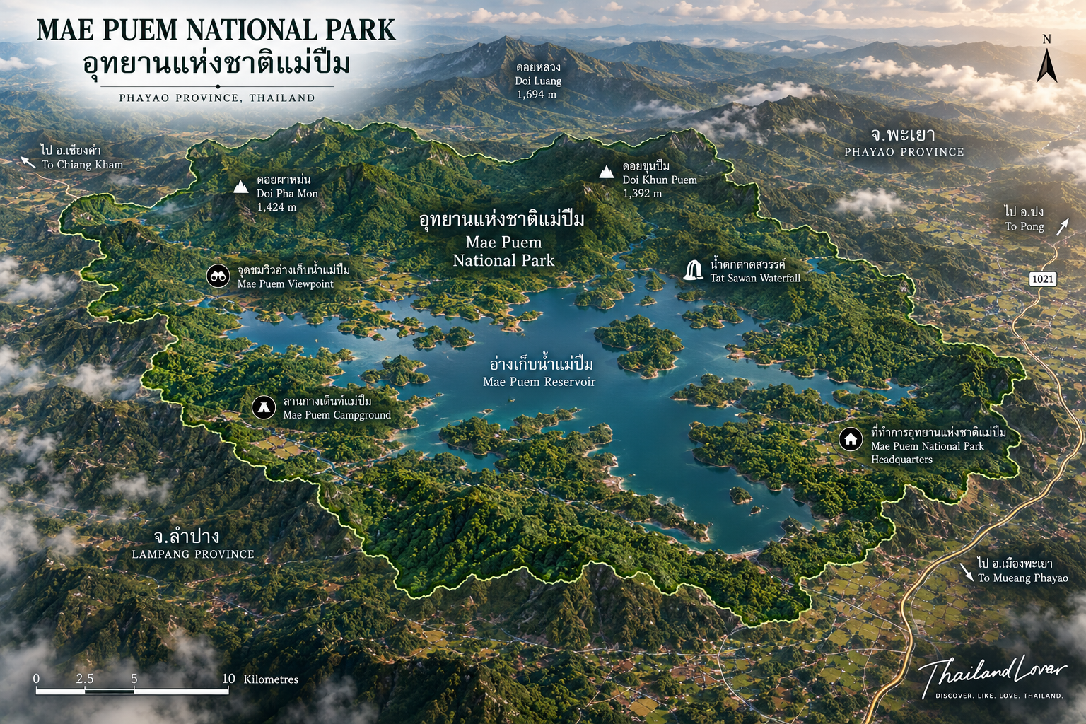
Mae Puem is not one simple mountain block. Protected forest sits around Mae Puem, Mae Phung, Doi Pui, Huai Mae Kaeo, Huai Mae Puem and the surrounding watersheds — two major areas with different characters.
- The Doi Pui area
- The northern section is predominantly steep mountain, with relatively little flat land. Elevations run from about 403 to 936 metres. It is an important source of the Mae Kaeo River.
- The Mae Puem area
- Also mountain country, broadly north to south, from about 403 to 978 metres. This is the source of the Mae Puem stream system, which feeds the reservoir.
Together they are a protected watershed: mountain, forest, stream, reservoir, wetland, wildlife. That chain is the thing to understand. Mae Puem does not have the high-elevation profile of Doi Inthanon or Doi Chiang Dao. The ridges still matter, because they hold the water.
From Forest Reserve to National Park
The area was investigated for national-park status in the 1990s. In 1994 the Royal Forest Department ordered further surveys. In March–May 2001, forest-engineering officials surveyed the boundary and arrived at about 350.8252 km², or 219,266 rai. A Royal Decree completed the process. Mae Puem was declared on 25 December 2009 and became Thailand’s 120th national park.
That date matters. Some older pages still carry preliminary figures from before the final gazette, including a historical tourism figure of about 222,500 rai. Those numbers come from different stages of planning. ThailandLover uses one figure:
Mae Puem National Park covers approximately 219,266 rai (350.83 km²).
Four Forests, and the Trees That Shape Them
- 01 · Dry evergreen
- Where moisture lasts longer. Greener for more of the year.
- 02 · Mixed deciduous
- Strongly seasonal. Leaves fall in the dry months and return with the rain.
- 03 · Dry dipterocarp
- The characteristic northern forest. In the dry season grasses turn gold and the canopy opens.
- 04 · Pine
- Higher, cooler stands that change the look of the ridges.
Trees recorded in the park include teak, Burma padauk, Xylia xylocarpa, Afzelia xylocarpa, Siamese rosewood, dipterocarps, two-needled pine, and species of the beech and oak family. They are not a species list for its own sake. They decide whether the forest reads as lush or as open gold.
Thailand is not endlessly green. The north has seasons. Mae Puem shows that clearly: a dry-season palette of brown and amber, then a rainy-season return of leaf, grass and active streams. For photographers, that transformation is one of the park’s real strengths.
Mae Puem Reservoir
About 5,000 rai · water, forest, mountains, sky
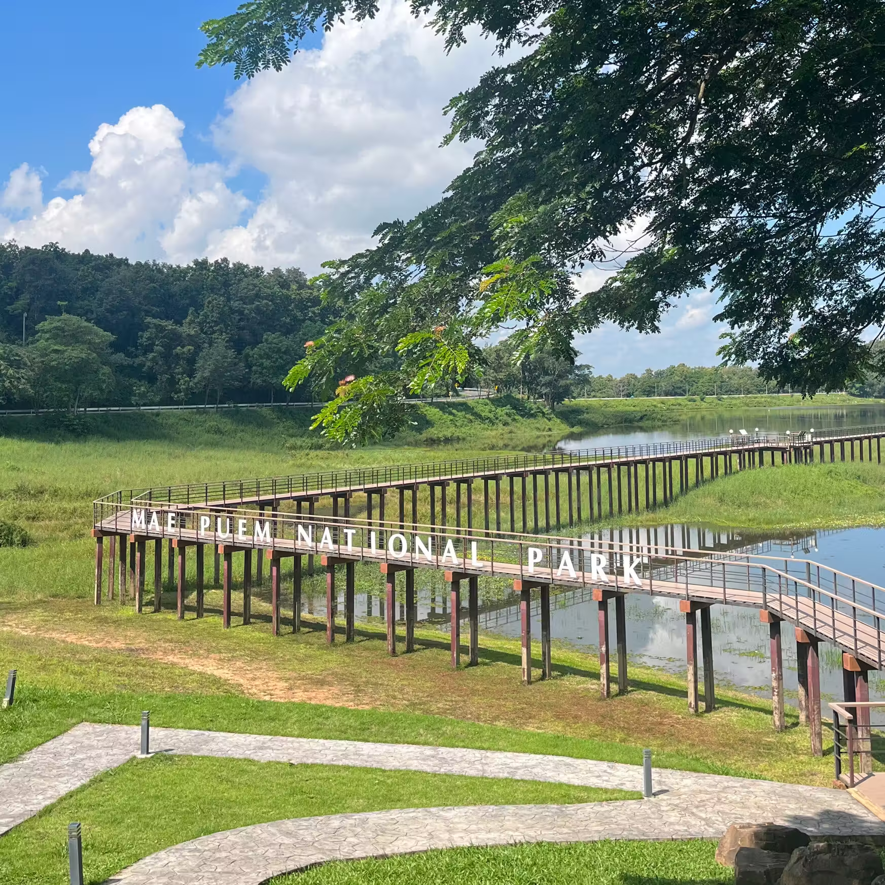
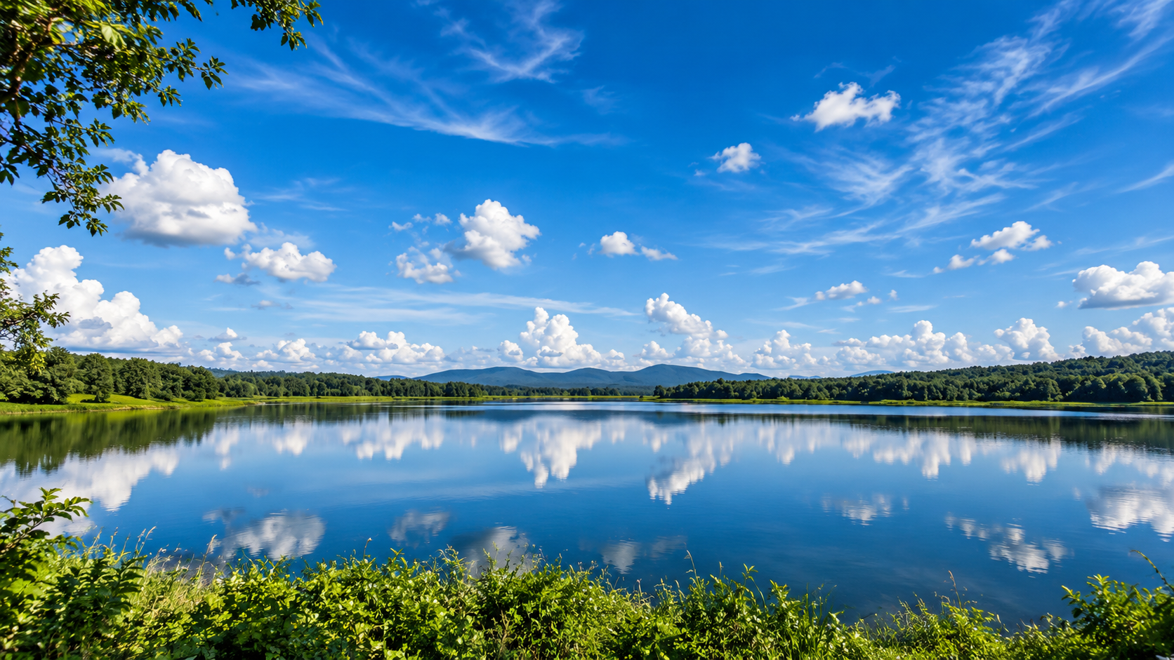
If one place defines a visit, it is the reservoir. It stores water. For visitors it also opens a visual space between the forests and the hills. Morning mist, sunset across an open horizon, and a night away from city light are the usual rewards.
It does not feel like an urban lake. Buildings do not dominate the shore. The composition is water, forest, mountains and sky — understated, atmospheric, not spectacular in the way a giant peak is spectacular.
The reservoir should not be separated from the forest. The Mae Puem stream’s watershed is the surrounding mountains. Without that watershed there is no reservoir landscape, and without a healthy forest the long-term stability of the water is harder to protect. The Mae Kaeo River, born in the forested mountains and associated in its upper reaches with rock and flowing water, makes the same point at a different scale: rainfall, forest, stream, river, community. Protecting the trees protects water beyond the park line.
Two lesser water landscapes, Huai Phaya Kao Reservoir and Huai Luang Reservoir, belong to the same water story. They are quieter than the main reservoir, and not every named feature is a developed attraction. Check access locally. Do not build a day around visiting every name on a list.
Winter Birds
According to tourism information from the Tourism Authority of Thailand’s Chiang Rai office, significant numbers of teal and other waterbirds come to the reservoir from about January to March. The experience can be as simple as quiet water, morning light, distant mountains, and birds moving across it.
The forests hold more than migrants. Government tourism information has reported more than 40 bird species, including lesser whistling duck and other local waterfowl, common kingfisher, greater coucal, racket-tailed drongo, Oriental magpie-robin and other insectivores, doves, forest raptors, and woodpeckers. The reservoir draws waterbirds. The forest draws insectivores and woodland species. Open ground gives raptors a hunting space. That is a compact set of habitats in one trip.
For people combining birdwatching, camping and landscape photography, January to March is one of the more interesting windows. Exact numbers and species change from year to year. Do not play repeated calls, and do not crowd nesting birds. The best wildlife photograph is the one that does not disturb the animal.
Doi Ngam, the Trail & Phra Bat Tak Pha
- Doi Ngam viewpoint
- A named scenic area whose appeal is the surrounding mountain country, not a single rock formation. Morning can be atmospheric. ThailandLover describes it as a mountain viewpoint over northern forest — not as a guaranteed sunrise, sunset or year-round panorama.
- Nature study trail · about 875 m
- A short walk associated with the reservoir area, useful if you want the ecology without a long trek: forest structure, seasonal plants, trees, small wildlife, bird habitat, and the watershed relationship. One of the better introductions to why Mae Puem is more than a lake.
- Phra Bat Tak Pha
- A cultural and religious site associated with the area: a large rock surface traditionally linked to the drying of monastic robes, a Buddha-footprint representation, and a sacred water source. Present it as local religious heritage, not as a photo curiosity.
Wildlife — Look, Don’t Chase
Government and provincial information has recorded barking deer, wild boar, mouse deer, squirrels, civets, porcupines, wild cats and other small mammals. Larger wildlife has been reported in the wider forest. Sightings are uncommon and never guaranteed. The useful sentence is not “you will see wild boar here.” It is that the forest provides habitat for those animals, and a quiet visitor has a better chance of noticing movement, tracks and calls than someone moving quickly and loudly.
When to Visit
Mae Puem has a tropical monsoon climate. Historical park climate notes give an annual average rainfall of about 1,550 mm. December can become particularly cold, with historical minimums reported around 6–12°C.
- November – February
- Best overall for camping, cool weather, morning atmosphere and being outside. Generally the most comfortable period.
- January – March
- The window most associated with migratory waterbirds. If birds are the reason, this is the one to plan around.
- March – May
- Dry-forest photography. Also the haze season. Check PM2.5, visibility and fire conditions, especially February to April.
- June – October
- Green landscapes and rainy-season atmosphere. Wetter trails, changing water, and possible closures.
What to Do
- Walk the nature trail
- About 875 metres. Slow enough to notice the forest.
- Watch the reservoir at dawn
- Mist, still water and low light — one of the more atmospheric hours.
- Go birdwatching
- Especially January–March, when migratory waterbirds gather.
- Camp by the forest
- Camping and park houses around the headquarters zone. Confirm what is open.
- Photograph the season
- Gold and amber in the dry months. Deep green, cloud and mist in the rains. Winter birds against the water. Early morning and late afternoon beat the middle of the day.
- Visit what is actually open
- Doi Ngam, Phra Bat Tak Pha, and the secondary reservoirs — only if the current notice says so. Spend time on one shore rather than collecting names.
A Day, or a Weekend
Deliberately simple
- Morning
- Arrive early. Walk the shore. Look for waterbirds. Photograph the light.
- Late morning
- The nature trail. Trees and habitats, not a march.
- Afternoon
- Whatever scenic area is open. Stay near the water.
- Late afternoon
- Back to the shore for sunset. Camp, or return to nearby accommodation.
A weekend version is stronger. Day one: Chiang Rai or Phayao, the reservoir, the trail, sunset, camping. Day two: early birds, then Doi Ngam or whatever viewpoint is open, Phra Bat Tak Pha if it is open, and on toward the other city. That treats Mae Puem as a chapter, not a roadside stop between two northern towns.
How to Get There
The main reservoir is relatively easy to reach from the Chiang Rai–Phayao corridor. That is an advantage over remoter mountain parks: forest, water, camping and birds without a major expedition. Remote forest sections still need more preparation.
- From Phayao
- North on Highway 1 toward Chiang Rai. Tourism information puts the headquarters about 23 kilometres from the city. Published park directions describe about 17 kilometres to kilometre marker 754, then a right turn and about 6 kilometres to the office beside the reservoir.
- From Chiang Rai
- South on Highway 1 toward Mae Chai and Phayao, then the same branch to the reservoir. A natural stop on a northern road trip.
The sequence Chiang Rai, Mae Puem, Phayao works because not every stop has to be a major attraction. Mae Puem can be the quieter nature chapter between two cities.
Who It Is For
Birdwatchers, especially in the winter migration. Campers. Photographers of water, mountains, mist, dry forest, birds and seasonal colour. Families around the main reservoir and the short trail — check facilities first. Slow travellers. Weekend escapers between Chiang Rai and Phayao.
It is a weaker choice if you want high mountains, extreme trekking, large waterfalls, luxury resorts, dense tourist infrastructure, or guaranteed wildlife. Mae Puem is about atmosphere, not spectacle. Water matters here, but the strongest water feature is the reservoir and the streams that feed it — not a waterfall destination.
Keep It Quiet
- Keep noise low. Never feed wildlife. Stay on designated trails.
- Do not collect plants or rocks. Take rubbish with you.
- Respect camping rules and fire restrictions.
- Do not disturb birds. Keep a safe distance from wildlife.
- Respect religious sites and local communities.
- Follow seasonal closure notices.
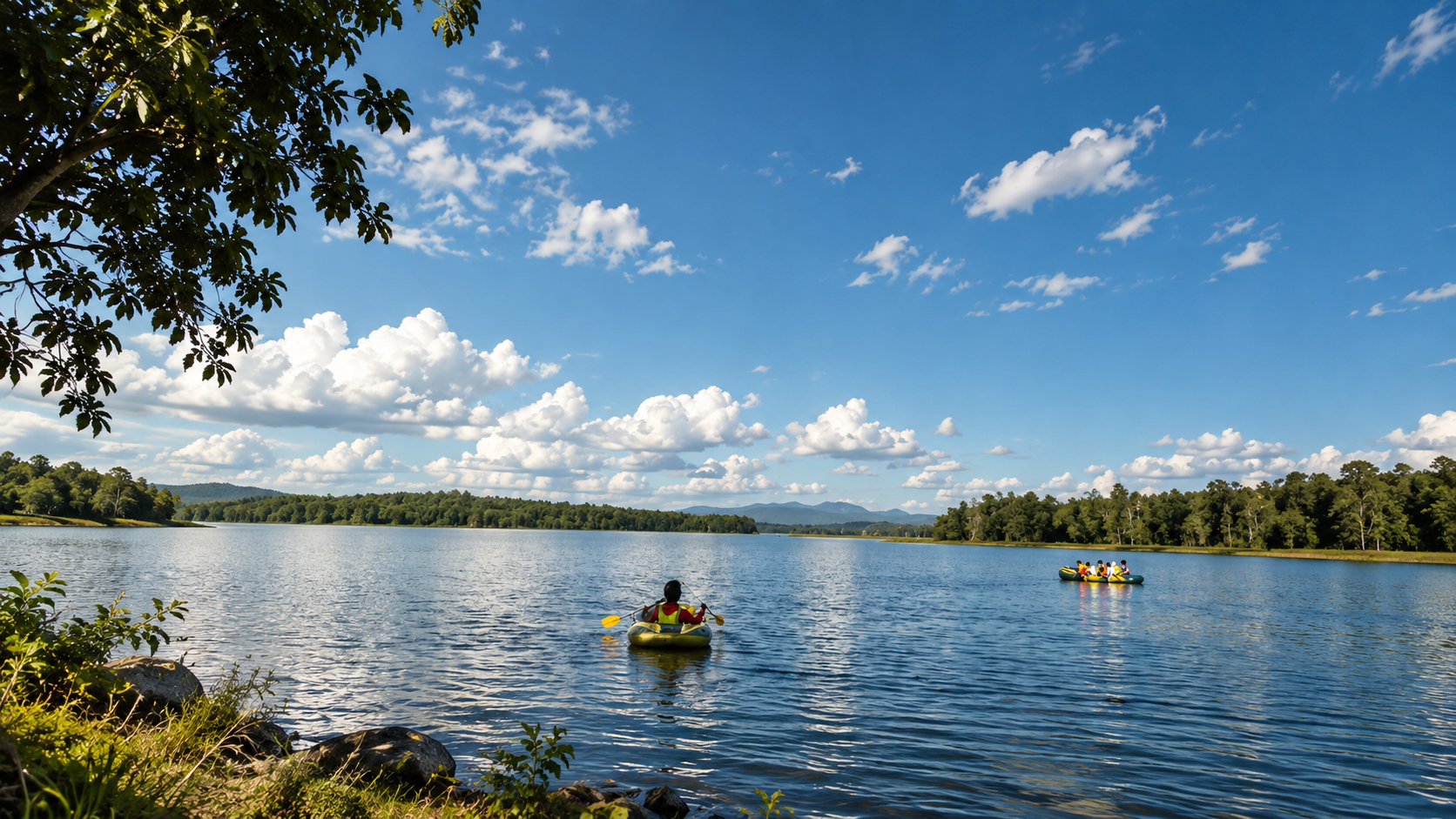
The reservoir is a natural water body, not a swimming pool. Use designated recreation areas, follow park instructions, and wear the right safety kit if you are on a boat. Conditions change quickly in storms. Do not assume every stretch of water is open for swimming.
The dry season also brings a regional reality: wildfire and agricultural burning, with severe haze particularly from about February to April. A clear forecast does not guarantee clear air. Check PM2.5, visibility, fire conditions and park announcements before a trip built around views.
Facilities
Around the main area, facilities have included park accommodation, camping, toilets, visitor facilities, the nature trail and reservoir recreation. Official accommodation records include several park houses in the headquarters zone. Do not assume every listed building is open every day, or in every season.
In 2025 the Department of National Parks reported that Mae Puem was among the parks recognised under the GREEN Health Attraction 2025 programme, which focuses on public sanitation and environmentally minded visitor facilities. That is a sign of ongoing work on facilities and environmental management, not a promise about a specific house being free tonight.
ThailandLover Signature Experiences
- 01 · Wake up beside the reservoir
- The simplest hour may be the one you remember.
- 02 · Watch migratory birds
- January to March. Give the water time.
- 03 · Walk dry dipterocarp forest
- One of the characteristic ecosystems of the north.
- 04 · Catch the morning mist
- Arrive early. The mountain decides.
- 05 · Follow the nature trail
- About 875 metres into the ecology, not just the view.
- 06 · See both seasons
- Gold and open in the dry months. Green and alive in the rains.
- 07 · Camp under the northern sky
- Stay close to the forest instead of rushing back to the city.
ThailandLover Quick Verdict
- Natural beauty
- Atmospheric rather than spectacular.
- Reservoir landscape
- The visual heart of the park.
- Forest diversity
- Four forest types in a modest area.
- Birdwatching
- Especially January–March.
- Wildlife
- Habitat. Not a guarantee.
- Mountain views
- Ridges and watersheds, not a famous summit.
- Hiking
- A short trail, and remoter forest if you prepare.
- Waterfalls
- Not the reason to come.
- Camping
- Strong, when the season allows.
- Photography
- Water, mist, dry forest, birds, seasonal colour.
- Family friendliness
- The reservoir and the short trail, with a check on facilities.
- Accessibility
- Practical from the Chiang Rai–Phayao road.
- Facilities
- Real visitor infrastructure. Confirm the night you want.
- Adventure
- Gentle by northern-park standards.
- Slow travel
- The pace that suits it.
- Mass tourism
- Quiet. Worth keeping that way.
Best for: birdwatchers, photographers, campers, families, nature lovers and slow travellers.
Not primarily for: high-altitude trekking, dramatic waterfalls, or extreme adventure.
Frequently Asked Questions
- Where is Mae Puem — Phayao or Chiang Rai?
- Both. Protected forest lies in both provinces. The principal visitor area and headquarters are on the Phayao side, beside the reservoir, at Ban Pa Tung, Mae Chai District. That is why some sites list it under Phayao and others associate it with Chiang Rai.
- How large is it, and when was it established?
- About 219,266 rai, or 350.8252 km². Officially established on 25 December 2009 as Thailand’s 120th national park. Do not mix this with older planning figures of about 222,500 rai.
- What is it known for?
- Mae Puem Reservoir, migratory waterbirds, northern forest, dry dipterocarp woodland, camping, a nature trail, Doi Ngam, and a quiet mountain landscape.
- Can I see migratory birds? Is it good for birdwatching?
- Yes. Teal and other waterbirds have historically gathered from about January to March. More than 40 bird species have been reported in general park information. Numbers vary by year. The reservoir, open ground and forest are different habitats in one visit.
- What is the best time to visit?
- November–February for comfort. January–March for birds. March–April for the dry forest at its most distinctive, with haze possible. The rains for green landscapes. Always check access and closure announcements.
- Can I camp? Is it suitable for families?
- Yes to camping and park houses, subject to season and current rules. Families often do well around the reservoir and the short trail. Check facilities and activity limits before you travel.
- Is it a difficult trek? Does it have waterfalls?
- Not primarily. It is better known for reservoir, forest, birds and camping than for demanding mountain walking. Some remote forest needs more preparation. Water matters, but Mae Puem is not a waterfall destination. The reservoir is the main water feature.
- Can I swim in the reservoir?
- Do not assume every part is open for swimming. Follow current rules and use only designated areas where swimming is permitted.
- Can I visit in the rainy season? Is there a viewpoint? What is the nature trail?
- Yes, with more difficult conditions. Some attractions and accommodation have been listed as closed from 1 July to 30 September in annual schedules — check the current notice. Doi Ngam is a named viewpoint; visibility and access depend on weather and park conditions. The nature trail is a study route of about 875 metres.
More of This Northern Corner
- Doi Luang National Park
- A neighbouring northern mountain forest, if the road continues through Phayao and Chiang Rai.
- Phu Sang National Park
- Another Phayao landscape of water and forest, quieter than the city circuit.
- Doi Phu Nang National Park
- Cliffs and northern forest if the journey turns toward Phayao’s mountain country.
Location
Find Mae Puem National Park
Ban Pa Tung, Mae Chai, Phayao 56130 · Highway 1, about 23 km north of Phayao city