


Preparatory Area · Mae Hong Son
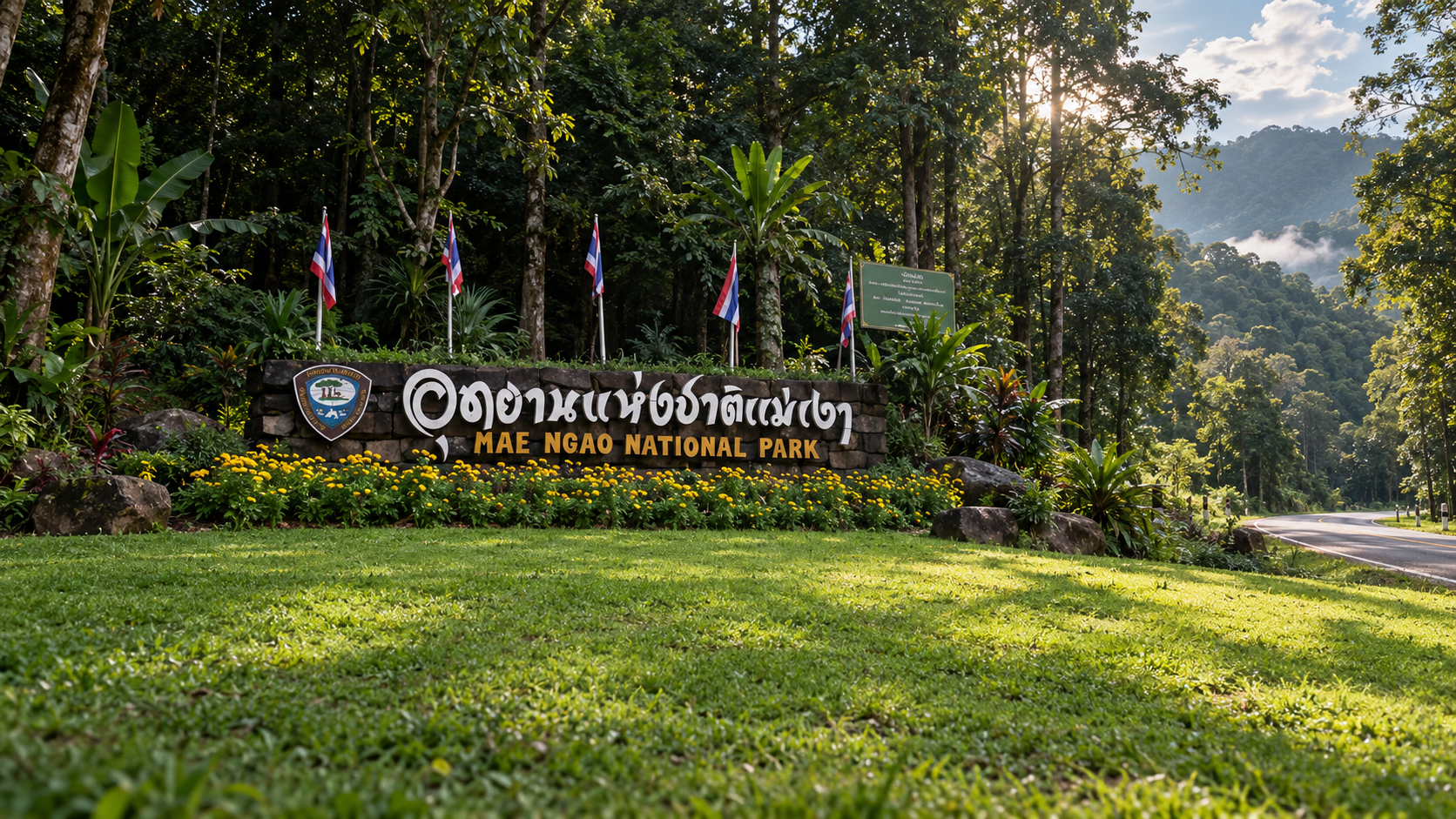
Mae Ngao National Park
อุทยานแห่งชาติแม่เงา (เตรียมการ)
Where the River Reflects the Forest
Sop Moei · Mae Hong Son · Tak · toward Chiang Mai
Not a checklist. A mountain landscape that still lets the forest tell its own story — if you are willing to travel slowly.
A Forest That Speaks for Itself
Some places in Thailand do not pull you in with a famous name. There is no main road to every corner, and not much in the way of comfort. What they offer instead is rarer: the feeling that a stretch of forest has been left to tell its own story.
Mae Ngao National Park (Preparatory Area) — อุทยานแห่งชาติแม่เงา (เตรียมการ) — is one of those places. A western-north mountain landscape linking Mae Hong Son, Tak and the country toward Chiang Mai: valleys, natural forest, rivers, waterfalls, caves, and communities whose lives are still close to the trees.
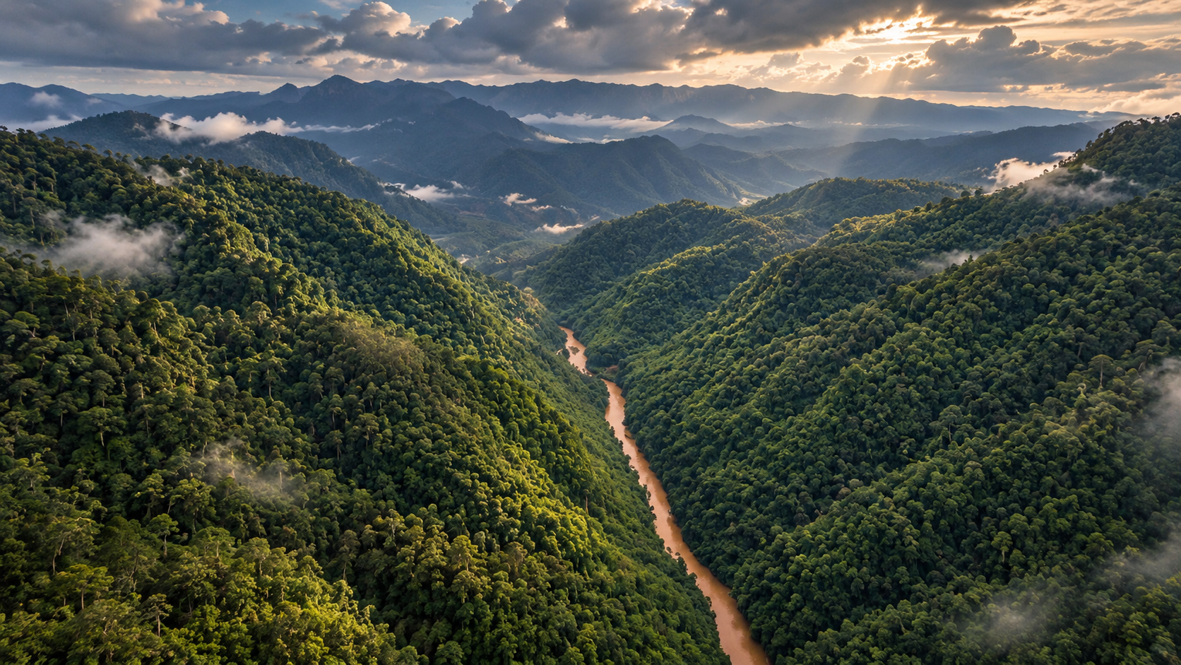
The heart of it is the Mae Ngao River. In the right light the water is clear enough to hold a reflection. That is where the name comes from — Mae Ngao, the river of shadows.
This is not a destination for people who want to check every box. It is for people who want to walk into a landscape that is still mostly itself.
At a Glance
- Preparatory
- Not yet a fully gazetted national park. Keep that word in the name until an official announcement.
- ~42 km
- Of the Mae Ngao River inside the area, about 10–20 metres wide.
- Highway 105
- The practical road, between Mae Sot and Mae Sariang.
- Remote
- Quiet, natural, and built for people who do not need a schedule.
- Thai name
- อุทยานแห่งชาติแม่เงา (เตรียมการ)
- English name
- Mae Ngao National Park (Preparatory Area)
- Region
- Northern Thailand
- Main province
- Mae Hong Son
- Related landscape
- Mae Hong Son, Tak, and the adjoining country toward Chiang Mai
- Main district
- Sop Moei, Mae Hong Son
- Headquarters
- Ban Mae Ngao, Mae Suat Subdistrict, Sop Moei. Some official English pages spell the subdistrict Mae Suan.
- Main river
- Mae Ngao River · แม่น้ำเงา
- Landscape
- Mountain ranges, valleys, forests, streams and waterfalls
- Current status
- National park preparatory area
- Signature
- The river, forest, waterfalls, viewpoints and trekking
- Character
- Remote, natural, quiet, adventure-oriented
Why Mae Ngao Matters
Mae Ngao is not interesting only because it has a pretty mountain or a pretty river. What holds it together is the relationship between mountain, forest and water.
The terrain is a complicated highland, a headwater for several streams. The Mae Ngao is the important river through the area. The Mae Yuam is the other major system of this western Mae Hong Son country.
The forest is not one forest. Hill evergreen, dry evergreen, pine, mixed deciduous and dry dipterocarp stand in the same landscape, shifting with height and moisture. For a traveller that means there is no single “Mae Ngao view”.
You can move through river, riverside forest, waterfall, mountain, a sea of mist, and a walking trail without leaving the same country. The landscape is the experience — not one named stop inside it.
The River That Gives Mae Ngao Its Name
แม่น้ำเงา
If one thing stands for Mae Ngao, it is the river. Tourism information for the area describes about 42 kilometres of the Mae Ngao inside the preparatory landscape, roughly 10–20 metres wide, bending through rapids and river islands before it joins the Mae Yuam system.
The name is tied to the clarity of the water. In the right conditions you can see the forest and the sky held on the surface. That is the picture to keep: green forest, mountains stacked in the distance, and a clear river reflecting both.
The river also belongs to the villages. In some seasons boats are still how people move between settlements. A bamboo-raft journey is not only an activity. It is a way of seeing a landscape, and a way of life, that grew up with the water.
Green forest. Mountains behind it. A river clear enough to hold both.
The Two-Coloured River
แม่น้ำสองสี · where the Ngao meets the Yuam
One of the more striking pictures is the meeting of the Mae Ngao and the Mae Yuam. The two waters can look different where they join, which is why the place is known as the two-coloured river.
That does not mean the rivers have fixed, permanent colours. Sediment, volume, season and weather all change the look. Read it as the meeting of two rivers, not as a colour that stays the same all year.
Forests of Mae Ngao
Several forests in one mountain country
Height does the work. Area information describes hill evergreen, dry evergreen, pine forest, mixed deciduous forest and dry dipterocarp forest. The river valley does not feel like the high country. The high country is where walking and morning mist make sense.
- Hill evergreen
- Dry evergreen
- Pine forest
- Mixed deciduous
- Dry dipterocarp
For anyone who loves landscape more than landmarks, that variety is the point. You are not visiting one attraction. You are moving through a whole piece of country.
Mountains & High Country
Published tourism figures for the older survey of the area name several peaks. Treat the numbers as approximate. They are not a claim that any of these is the highest mountain in Thailand, or in the province.
- Doi Pui Luang · ดอยปุยหลวง
- About 1,498 m
- Doi Soe Ter Lu · ดอยเซอเทอลู่
- About 1,622 m
- Doi Kui Luang · ดอยคุยหลวง
- Above about 1,678 m
Doi Pui Luang
ดอยปุยหลวง · about 1,500 m
For walkers, Doi Pui Luang is one of the more serious reasons to come. From around 1,500 metres the ridges stack into the distance, and on a clear cool morning there can be a sea of mist. The point is not only the summit. It is the walk itself — from lower forest into high country.
This is Mae Ngao in the version you have to earn.
Doi Pui Ko
ดอยพุ่ยโค · a Sop Moei viewpoint
Doi Pui Ko has drawn attention as a viewpoint in Sop Moei. The Department of National Parks has published a trip account describing about 15 kilometres off the main road, with a walk for the last stretch. The draw is layered mountains and, when the weather agrees, morning mist.
Published heights for Doi Pui Ko do not agree with each other. ThailandLover does not lock a number into this page until it can be checked against geospatial data or the local office.
Waterfalls
Several falls are scattered through the mountains. Names in area information include:
- O Lo Kro · น้ำตกโอโละโกร
- Mae Wa Luang · น้ำตกแม่วะหลวง
- Mae Chae · น้ำตกแม่แจ
- Mae Lo O / Mae La O · น้ำตกแม่ลออ / แม่ละออ
- Burana Prapha · น้ำตกบูรณประภา
- Tat Lom / Tat Khom · น้ำตกตาดลม / ตาดคม
- Mae Ngao Waterfall · น้ำตกแม่เงา
Some names are spelled differently across databases. Confirm the official name with local staff before building a URL or structured-data entry around a single spelling.
O Lo Kro Waterfall
น้ำตกโอโละโกร · a cliff of about 150 m, and a walk to match
O Lo Kro is one of the stronger waterfalls in the area, falling from the O Lo Kro stream on the southeastern side. Published figures give the cliff about 150 metres. The important fact is the approach: this is not a waterfall you drive up to. Route surveys describe a walk through rough forest.
It is a place for experienced walkers, not a casual stop. Coordinate with staff and a local guide every time. Do not turn an old walking-time into a fixed itinerary. The trail changes.
Caves
ถ้ำแม่อมกิ · and the country under the mountain
One name that appears in tourism information is Mae Om Ki Cave. Inside are the usual limestone forms — stalactites, stalagmites — and a stream through the cave. Northern mountain caves are not photo sets. Water level, weather, and what local staff say that day matter more than the picture you saw online.
Bamboo Rafting & the River Journey
Travelling on the water is one of the more particular Mae Ngao experiences. The river runs through forest and villages, so a bamboo raft is a way of meeting the country at water level: riverside forest, cliffs, rapids, islands, villages, and people whose lives are tied to the current.
The right time depends on water level and weather. Do not treat one month as a rule.
River Communities
Mae Ngao is not an empty forest. Communities have lived with these woods and this river for a long time, including Karen / Pgaz K'Nyau communities in the landscape. The river has been transport as well as scenery.
A good account of Mae Ngao should not stop at “beautiful forest, clear water, beautiful mountains.” The nature you are walking into is lived in, and looked after, by people who are already there.
A Landscape Shared with Communities
The preparatory status has a context that should not be skipped. Drawing the boundary has involved farmland, community forest and cultural land. The National Human Rights Commission of Thailand has noted that boundaries were reviewed with local people, that the preparatory area and its extent were reduced, and that public hearings were held in 2023 (B.E. 2566).
ThailandLover’s reading is therefore balanced: conservation, and the rights and livelihoods of the people who live here. This is not an empty wilderness, and it is not a landscape without limits on how it can be used.
When to Visit
- November – February
- Cool season. The better window for walking, mountains and morning mist on the high ground, especially when the sky opens.
- March – May
- Hot, and often hazy. Northern Thailand can be affected by forest fire and smoke. Check air quality and local announcements before you leave.
- June – October
- Green, and wet. Forest deepens, streams rise, and many falls look stronger. Roads and trails get slippery, and river levels can change quickly.
How to Get There
The practical road is Highway 105.
- From Mae Sot
- North on Highway 105 toward Mae Sariang. At Ban Mae Ngao, a side road leads to the area office. Department of National Parks information describes about 190 kilometres from Mae Sot to the Ban Mae Ngao junction, then about 4 kilometres of concrete road to the office.
- From Mae Sariang
- South on Highway 105 toward Mae Sot. Published figures put Ban Mae Ngao about 40 kilometres from the Mae Sariang area, then about 4 kilometres in.
- By songthaew
- An orange songthaew runs between Mae Sariang and Mae Sot and passes the Ban Mae Ngao junction, according to Department of National Parks information. Timetables change. Check before you travel.
What to Expect
Mae Ngao is not a mainstream national park. There is no road to every viewpoint, no row of cafés, and no full set of facilities at every stop. Many places are reached on foot. Some need a guide. Some take days. Some exist only in certain seasons.
It suits people who want nature, trekking, camping, a river journey, waterfalls, mountain views, local culture, slow travel, and a route that is still off the main circuit. It does not suit a few-hour photo stop.
Things to Do
- 01 · Follow the Mae Ngao River
- Spend time on the bank. Learn the shape of the watershed before you try to collect sights.
- 02 · Bamboo rafting
- When the water and the operating route allow it — not as a year-round promise.
- 03 · Trek the mountains
- Doi Pui Luang, and other routes that are actually open. Ask first.
- 04 · Watch the morning mist
- On the high ground, on the mornings the weather chooses to open.
- 05 · Walk to a waterfall
- O Lo Kro and the other falls, for people who like forest more than railings.
- 06 · Notice the villages
- The river landscape includes people. That relationship is part of the place.
- 07 · Camp under the forest
- Possible where camping is open. Confirm the site and the rules before you travel.
Who Mae Ngao Is For
- Nature lovers
- People who want mountains, forest and a river, not a programme.
- Trekkers
- People who will accept some inconvenience in a remote place.
- Photographers
- Mountains, water, mist, and a landscape that changes with the hour.
- Slow travellers
- People who do not need several highlights in one day.
- Adventure travellers
- People ready for a landscape that has not been built for mass tourism.
Who Should Think Twice
Mae Ngao is a poor fit if you want a resort, many restaurants, easy travel in every season, a car to every sight, a fixed timetable, or a phone signal the whole way.
If what you want is space, silence, mountains and rivers, it belongs on the list.
Travel Responsibly
This is both an ecosystem and a lived landscape.
- Take rubbish out.
- Do not collect plants or animals.
- Keep noise down — for wildlife and for villages.
- Do not damage water sources.
- Do not light fires where they are not allowed.
- Do not leave the permitted route.
- Follow the area’s rules.
- Respect community life and cultural places.
- Use a local guide where the route requires one.
- Check closure notices before you travel.
A good journey does not leave only photographs. It leaves the place the same — or better — than it was.
Practical Information
Facilities are limited, access is seasonal, and several sites need a guide. Confirm what is open before you commit to a date. Entrance charges for a preparatory area should be checked with the office — ThailandLover does not publish a fee here that the current official schedule has not clearly fixed for this landscape.
ThailandLover Rating
An editorial reading of the experience, not an official score. Mae Ngao scores for atmosphere and remoteness, not for convenience.
- Natural beauty
- River, forest and a mountain country that still feels like country.
- River experience
- The reason the place has its name.
- Trekking
- Real walks. Not a nature boardwalk.
- Waterfalls
- O Lo Kro is serious. Access is the point, and the constraint.
- Slow travel
- The pace the landscape asks for.
- Accessibility
- Highway 105 gets you close. After that, the country decides.
- Facilities
- Not the reason to come. Confirm what is actually open.
- Mass tourism
- Mercifully low. Keep it that way.
Best for: nature, trekking, river journeys, photography and slow travel.
Less suitable for: a short check-in, resort comfort, or a timetable that cannot bend.
Essential Facts
- Status
- Preparatory area · อุทยานแห่งชาติแม่เงา (เตรียมการ)
- Main district
- Sop Moei, Mae Hong Son
- Related landscape
- Mae Hong Son, Tak, toward Chiang Mai
- River
- About 42 km inside the area · 10–20 m wide · joins the Mae Yuam
- Peaks, approximate
- Doi Pui Luang ~1,498 m · Doi Soe Ter Lu ~1,622 m · Doi Kui Luang above ~1,678 m
- Viewpoint without a locked height
- Doi Pui Ko — about 15 km off the main road, then a walk
- Notable waterfall
- O Lo Kro, cliff about 150 m, on foot through rough forest
- Road
- Highway 105 · ~190 km from Mae Sot · ~40 km from Mae Sariang · ~4 km in
- Best general season
- November–February
- Check before summer travel
- Closure notices have included 1 June–30 September
Frequently Asked Questions
- Is Mae Ngao an official national park?
- Not yet in the fully gazetted sense. The accurate name is Mae Ngao National Park (Preparatory Area) — อุทยานแห่งชาติแม่เงา (เตรียมการ). Keep that wording until an official establishment announcement.
- Where is it?
- Sop Moei, Mae Hong Son, with the office at Ban Mae Ngao, Mae Suat Subdistrict. The landscape also relates to Tak and the country toward Chiang Mai. Highway 105 is the practical road.
- Why is it called Mae Ngao?
- The name belongs to the river, said to be clear enough to hold a reflection. About 42 kilometres of it lie in the area, roughly 10–20 metres wide, before it joins the Mae Yuam.
- What is the two-coloured river?
- The meeting of the Mae Ngao and the Mae Yuam, where the waters can look different. Colour depends on sediment, season and weather. It is not a permanent paint-box effect.
- Can I drive to O Lo Kro Waterfall?
- No. Published route notes describe a walk through rough forest to a cliff of about 150 metres. It is for experienced walkers, with staff and a local guide. Do not use an old walking-time as a fixed plan.
- When should I go?
- November to February for walking, mountains and mist. March to May can be hot and smoky. June to October is greener and wetter. Closure notices have included 1 June–30 September — check the year you travel.
- How do I get there without a car?
- An orange songthaew between Mae Sariang and Mae Sot passes the Ban Mae Ngao junction, according to Department of National Parks information. Confirm the current run. From the junction it is about 4 kilometres to the office.
More of the Western North
- Mae Sariang National Park
- Another preparatory mountain landscape, above the town to the north of here.
- Salawin National Park
- The Salawin river country of Mae Hong Son — a different water, the same western forests.
- Mae Moei National Park
- Sea of mist and Mae U-Su Cave, farther south on the Highway 105 mountain road.
- Op Luang National Park
- Canyon and river forest between Chiang Mai and Mae Sariang, if the journey starts from the east.
Location
Find Mae Ngao
Ban Mae Ngao, Sop Moei, Mae Hong Son 58110 · Highway 105, about 4 km in from the junction