

National Park · Krabi
Khao Phanom Bencha National Park
อุทยานแห่งชาติเขาพนมเบญจา
The Mountain Behind the Postcard
Krabi · Southern Thailand
Discover Krabi beyond the beaches — a rainforest world of waterfalls, caves, mist-covered mountains and wildlife rising to 1,397 metres above sea level.
The Mountain Heart of Krabi
Krabi is internationally known for limestone cliffs, turquoise seas, islands and beaches. Behind that famous coastal landscape is another Krabi: a world of deep rainforest, high mountains, mist, waterfalls, caves and wildlife. This ThailandLover guide is about that inland dimension — Khao Phanom Bencha National Park.
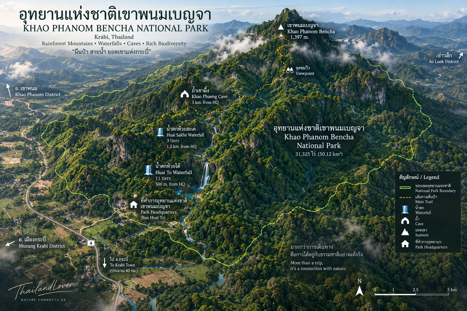
Located north of Krabi Town, the park protects approximately 31,325 rai, or 50.12 square kilometres, across parts of Mueang Krabi, Ao Luek and Khao Phanom districts. It was officially declared a national park on 9 July 1981, becoming Thailand’s 29th national park. The Royal Decree was published in the Royal Gazette, Volume 98, Part 112.
At the centre of the landscape is Khao Phanom Bencha, rising to approximately 1,397 metres — the highest mountain in Krabi Province according to long-established provincial and national-park references.
This is not the Krabi of island-hopping. It is the Krabi of mountains and rainforests — a standout in ThailandLover’s Nature & Parks collection.
At a Glance
- Official Name
- Khao Phanom Bencha National Park
- Thai Name
- อุทยานแห่งชาติเขาพนมเบญจา
- Province
- Krabi, Southern Thailand
- Districts
- Mueang Krabi · Ao Luek · Khao Phanom
- Area
- 31,325 rai / 50.12 km²
- Highest Peak
- Khao Phanom Bencha · approximately 1,397 metres
- National Park
- 29th national park of Thailand
- Established
- 9 July 1981
- Landscape
- Mountain rainforest · waterfalls · streams · caves · cliffs
- Main Forest
- Moist evergreen / rainforest
- Signature Waterfall
- Huai To Waterfall
- Other Waterfall
- Huai Sakhe Waterfall
- Major Cave
- Khao Phueng Cave
- Signature Experience
- Long-distance trekking toward Khao Phanom Bencha
- Best For
- Nature · trekking · waterfalls · birdwatching · forest photography
Khao Phanom Bencha — 1,397 Metres
The name of the national park comes from its dominant mountain. Rising approximately 1,397 metres, Khao Phanom Bencha belongs to a larger north–south mountain system, with complex ridges and steep slopes covered by forest.
From a distance, the mountain appears as a massive green wall behind Krabi’s lowlands. Closer in, the landscape changes completely. Roads become smaller. The forest becomes denser. Streams appear. Waterfalls emerge from the slopes. Mist gathers around the higher ridges. And the famous limestone scenery of coastal Krabi gives way to a much more terrestrial landscape.
The Other Krabi
Krabi is often marketed through its marine landscapes: Ao Nang, Railay, Phi Phi, the Hong Islands, tropical beaches. The province also contains a substantial mountain and forest environment. Khao Phanom Bencha represents that inland dimension.
It is a protected terrestrial national park, rather than a marine park, and its landscape is dominated by mountains, forest, streams and waterfalls. For travellers who want to understand Krabi beyond the postcard image, this distinction matters.
The sea is only half the story.
A Forest Built by Rain
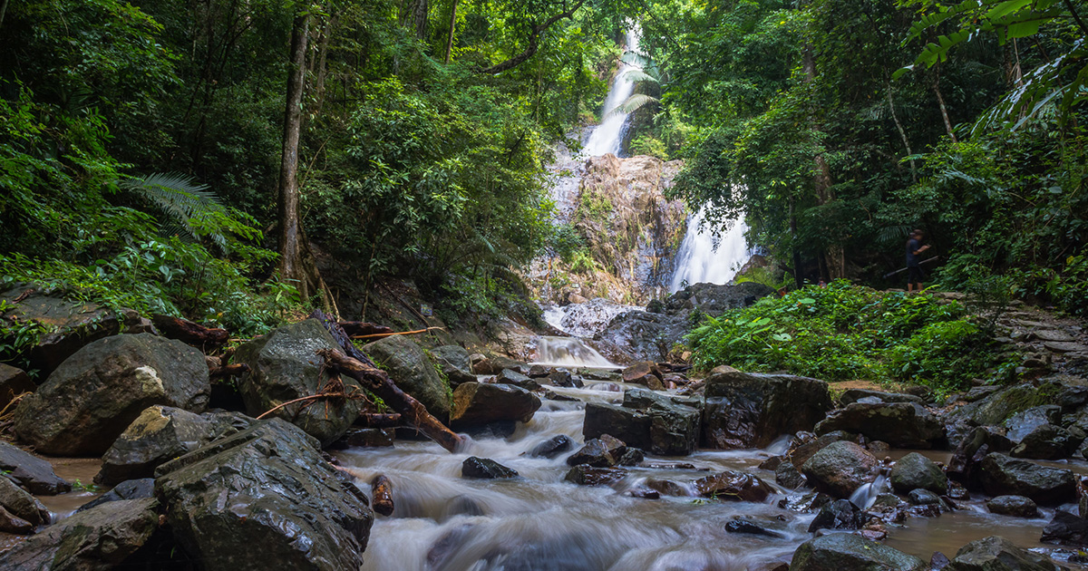
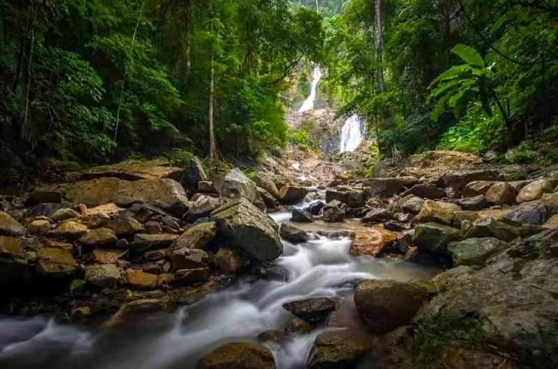
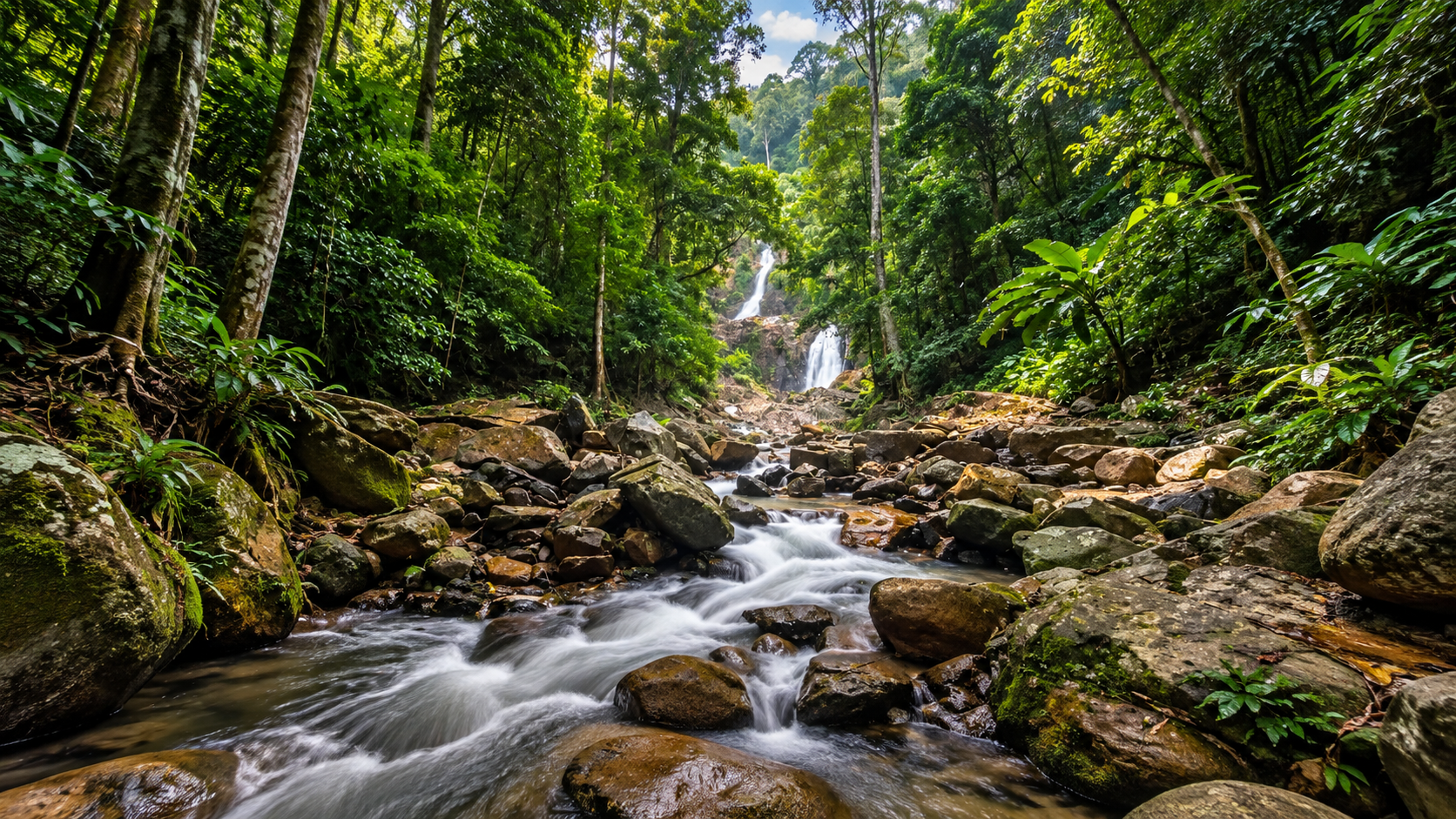
Khao Phanom Bencha receives the humid tropical conditions that allow rainforest to thrive: dense evergreen forest, tall canopy trees, vines and climbers, ferns, moss, orchids and epiphytes, bamboo, mountain streams and steep forested slopes. The higher the trail climbs, the more pronounced the mountain environment becomes.
Moisture is part of the forest’s identity. Rain falls on the mountain. The forest absorbs and slows the water. Streams gather in the valleys. Eventually the water becomes the waterfalls for which the park is known.
The mountain forest also functions as an important watershed. One of the clearest examples is Huai To Waterfall. Its water originates in the Khao Phanom Bencha mountain system before descending through a series of waterfall tiers and eventually contributing to the wider drainage of Krabi. Historical park descriptions identify the Huai To stream as flowing onward toward Khlong Krabi Yai.
Forest → rainfall → streams → waterfalls → rivers → communities.
Huai To Waterfall
น้ำตกห้วยโต้
If Khao Phanom Bencha has one signature attraction, it is Huai To Waterfall. Located only around 500 metres from the park headquarters according to park and local-government descriptions, it is one of the park’s most accessible major natural attractions.
The waterfall descends through a series of rock terraces surrounded by rainforest. Published descriptions identify 11 levels, although older tourism descriptions sometimes group the major sections differently. Some of the individual drops are reported to reach approximately 70–80 metres. The result is not a single curtain of water. It is a long sequence of waterfalls, pools, rock terraces and forest.
The levels of Huai To
Historical descriptions give names to several of the waterfall sections, including Wang Sam Hap, Wang Chong Loi, Wang Doi Prong, Wang Thep Da and Wang Ton Phriu. Some sources list additional intermediate sections, which explains why the number of named levels and the total number of tiers can differ.
Huai To is a multi-tier waterfall system with numerous pools and drops rather than one single waterfall.
Clear, cold and forest-fed
The water comes directly from the mountain forest. After rainfall, the waterfall can become dramatically more powerful: streams swell, cascades become louder, spray increases and the surrounding forest becomes intensely green. Those same conditions can become hazardous. A mountain waterfall that looks calm at one moment can become dangerous after heavy rain. Swimming should only take place where the park has specifically permitted it and where conditions are considered safe.
Huai Sakhe Waterfall
น้ำตกห้วยสะเค
Another important attraction near headquarters is Huai Sakhe Waterfall, approximately 1.2 kilometres from the park office according to park-related tourism information. It descends over a series of rock levels, with descriptions commonly identifying three main tiers.
Compared with Huai To, Huai Sakhe offers a quieter forest-water experience. The trail itself is part of the attraction. The closer you get, the more the sounds of roads and buildings disappear. What replaces them is water, birds, insects and forest.
Khao Phueng Cave
ถ้ำเขาผึ้ง
Khao Phueng Cave gives the park a different dimension. Rather than being simply a forest-and-waterfall destination, Khao Phanom Bencha also contains underground environments. The Khao Phueng area is described as containing five caves in the same general area, with stalactites and stalagmites forming a variety of natural shapes.
Inside, visitors may encounter stalactites, stalagmites, curtains and flowstone, chambers, unusual mineral formations and dark underground passages. The caves demonstrate the interaction between water and rock over geological time. Above ground, water creates waterfalls. Below ground, the same force slowly creates caves and mineral formations.
Where water meets rock
The broader Khao Phanom area includes granite intrusions, with geological reports identifying Cretaceous granite around Khao Phanom Bencha, intruding older sedimentary rocks. That complexity contributes to steep mountain ridges, exposed rock, stream valleys, cliffs, caves, waterfalls and deeply dissected slopes. The park is interesting not only as a biological landscape, but as a place where geology can be read directly from the terrain.
Wildlife & Birdlife
Khao Phanom Bencha has long been recognised for its wildlife. Large mammals are generally elusive and tend to avoid people. Wildlife lists compiled for tourism purposes do not mean visitors should expect to encounter these animals.
- Malayan tapir · สมเสร็จ
- One of the most significant mammals associated with the forest. A large, forest-dependent herbivore and an indicator of relatively intact habitat.
- Sumatran serow · เลียงผา
- A mountain ungulate adapted to rugged terrain — particularly appropriate to the steep environment of Khao Phanom Bencha.
- Asian black bear / sun bear
- Thai tourism descriptions have historically listed bears among the wildlife of the park. Treat these as habitat associations, not guaranteed sightings.
- Fishing cat · เสือปลา
- Included in historical descriptions of wildlife associated with the park, reflecting the importance of wetland and stream environments within the broader forest ecosystem.
Birdlife is one of the park’s strongest biodiversity features. Tourism and educational references report more than 218 bird species, including eagles, hornbills, woodpeckers, forest passerines and other tropical forest birds. Mature forest, elevation, streams and dense understory create a particularly interesting habitat.
The larger animals receive the headlines. Look closely and the forest floor becomes a miniature world of mushrooms, fungi, moss, ferns, insects, butterflies, spiders, amphibians, small reptiles, seedlings and fallen leaves decomposing into soil. These organisms form the ecological machinery that keeps the forest functioning.
Listen before you look. A rainforest often reveals its wildlife through sound before sight.
The Journey to 1,397 Metres
Reaching the summit of Khao Phanom Bencha is a completely different experience from visiting Huai To Waterfall. This is long-distance mountain trekking. Historical descriptions identify two principal approaches.
- Route 01 — Huai To to the summit
- The traditional route begins near headquarters and follows the waterfall and forest system deeper into the mountains. Historical accounts describe multiple overnight camps, including areas around Khao Luk Chang, Khuan Nam Khang and the base of Khao Phanom Bencha. Older descriptions give an itinerary of approximately 4 days / 3 nights.
- Route 02 — Bang Saran Base
- Another historic approach begins from the Bang Saran operational base, allowing trekkers to enter the mountain system from another direction. Historical accounts describe an approximately 3-day / 2-night itinerary.
These historical route descriptions should not be treated as current operating instructions. Mountain routes, permits, camping locations and seasonal access can change. Anyone planning a summit expedition should obtain current permission and route information directly from park officials before departure.
Along the way the landscape changes repeatedly: lowland rainforest, mountain streams, waterfalls, rock shelters, steeper ridges, dense montane forest, mist, high-elevation vegetation, then the summit. Historical descriptions mention forests, wildlife, caves, rock shelters, waterfalls, streams, mist and viewpoints toward Krabi.
When the mountain disappears
One of the most beautiful characteristics of Khao Phanom Bencha is its mist. Moisture rises from the forest. Clouds collect around the mountain. The ridges disappear, then reappear, then disappear again. From an elevated trail, the experience can be almost surreal. The same landscape that appears solid and imposing from Krabi Town becomes fluid and atmospheric from the mountain.
On exceptionally clear days, higher viewpoints can reveal the lowlands around Krabi: forest-covered mountain in the foreground against the urban landscape beyond. From the beach, Krabi looks like a coastal destination. From Khao Phanom Bencha, it becomes a mountain province connected to the sea.
Climate & When to Go
Khao Phanom Bencha experiences the humid tropical climate characteristic of southern Thailand. Rain is an integral part of the landscape — which is precisely why the park has permanent or semi-permanent streams, waterfalls, dense rainforest, moss, ferns, high humidity and mist.
The weather can change rapidly with elevation. Conditions on the summit may be dramatically cooler and wetter than in Krabi Town. For trekking, weather should be treated as a serious planning factor rather than an afterthought.
The forest is at its most dramatic when water is abundant: fuller waterfalls, louder streams, intensely green leaves, more mist. Heavy rain also increases the risks of slippery trails, strong currents, rock falls, flash floods and difficult stream crossings. The most beautiful conditions and the most challenging conditions can occur at the same time.
Conservation, Responsible Travel & Safety
Khao Phanom Bencha was protected because a survey of the forest identified steep mountains, waterfalls, cliffs and caves worthy of permanent protection. Today that conservation role is even more important. Krabi continues to develop rapidly as an international tourism destination. The park preserves a fundamentally different environment from the developed coast.
The best way to experience it is to treat it as a living ecosystem. Come as a visitor. Leave as if you were never there.
Do
- Stay on designated trails and follow ranger instructions
- Check current conditions before trekking and use authorised guides where required
- Carry sufficient drinking water, rain protection and proper trekking shoes
- Take rubbish out of the park
- Keep noise low and observe wildlife from a distance
- Respect seasonal closures
- Photograph plants and animals rather than collecting them
Do not
- Feed wildlife or touch wild animals
- Collect orchids or other plants
- Remove rocks or cave formations
- Leave food waste, plastic or other rubbish
- Enter closed areas, or caves without appropriate guidance
- Swim during dangerous water conditions
- Play loud music
The accessibility of Huai To Waterfall should not create the impression that the entire park is easy. Visiting the waterfall and trekking to the summit are different undertakings. The summit environment involves steep terrain, long distances, slippery surfaces, heavy rain, stream crossings, limited infrastructure, changing weather, potential wildlife encounters and physical exhaustion. Obtain current information from the park and follow its permit, guide and camping requirements.
How to Get There
Headquarters: 170 Moo 4, Thap Prik Subdistrict, Mueang Krabi District, Krabi 81000. The park is approximately 20 kilometres from Krabi Town, depending on the route and starting point. Historical transport information places the headquarters around 20 kilometres from the Talat Kao junction.
- From Krabi Town
- A commonly described approach is Krabi Town → Talat Kao area → route toward Ban Huai To → Khao Phanom Bencha National Park. The road journey is relatively straightforward compared with the mountain routes inside the park.
- Park headquarters
- The practical gateway to Huai To Waterfall, Huai Sakhe Waterfall, forest trails, camping facilities when operating, trekking information and summit-route arrangements. Start here before moving deeper into the forest.
Khao Phanom Bencha is close enough to Krabi Town to be experienced as a day trip, but the environment feels dramatically different: urban, warm, lowland river tourism on one side; mountain, cooler rainforest, waterfall and wilderness on the other.
Two Faces of Krabi — and of the South
Khao Phanom Bencha and coastal Krabi are not competing experiences. They complete each other.
Khao Phanom Bencha · Coastal Krabi
- Mountains
- Islands
- Rainforest
- Beaches
- Waterfalls
- Sea
- Mist
- Sun
- Trekking
- Boat trips
- Caves
- Coral and marine life
- Forest wildlife
- Marine wildlife
- Freshwater
- Saltwater
- Forest silence
- Coastal tourism
Both Khao Phanom Bencha and Khao Nan are important rainforest parks in Southern Thailand, but they offer different experiences. Khao Phanom Bencha is much smaller geographically, yet its terrain rises dramatically from the surrounding lowlands.
- Khao Phanom Bencha
- Krabi · 50.12 km² · highest about 1,397 m · established 1981 · compact, steep mountain forest · Huai To Waterfall · relatively close to Krabi Town
- Khao Nan
- Nakhon Si Thammarat · about 409.79 km² · highest about 1,438 m · established 2009 · large wilderness landscape · high mountains, caves and waterfalls · more dispersed access
Why Visit Khao Phanom Bencha
A weak description of this park would be “a national park with waterfalls near Krabi.” That misses the point. The beaches are the face of the province. The islands are its international image. Khao Phanom Bencha is part of its ecological foundation: rain falls on these mountains, the forest holds the water, the waterfalls carry it downhill, the streams feed the lowlands, and the landscape eventually connects with the sea.
- Come for the waterfalls
- Huai To is one of Krabi’s most impressive inland waterfall systems.
- Stay for the forest
- The rainforest is the real attraction.
- Go higher for the mountain
- Khao Phanom Bencha reaches approximately 1,397 metres.
- Go deeper for the caves
- Khao Phueng reveals the underground side of the park.
- Listen for the wildlife
- More than 218 bird species have been reported.
- Trek for the view
- Higher trails reveal another perspective of Krabi.
- Return for the silence
- The most memorable part may be what you don’t see.
Essential Khao Phanom Bencha
- Name
- Khao Phanom Bencha National Park
- Thai
- อุทยานแห่งชาติเขาพนมเบญจา
- Province
- Krabi
- Districts
- Mueang Krabi · Ao Luek · Khao Phanom
- Area
- 31,325 rai / 50.12 km²
- Highest Point
- Khao Phanom Bencha · approximately 1,397 metres
- National Park
- Thailand’s 29th · established 9 July 1981
- Landscape
- Mountain rainforest · streams · waterfalls · caves · cliffs
- Main Waterfall
- Huai To Waterfall
- Other Waterfall
- Huai Sakhe Waterfall
- Cave
- Khao Phueng Cave
- Wildlife
- Malayan tapir · serow · bear species reported · fishing cat · numerous forest species
- Birdlife
- More than 218 species reported
- Main Activities
- Nature walks · waterfall visits · birdwatching · photography · trekking · cave exploration
- Signature Experience
- Trekking toward the summit of Khao Phanom Bencha
- Travel Character
- Nature · adventure · wilderness · slow travel
- Headquarters
- 170 Moo 4, Thap Prik, Mueang Krabi, Krabi 81000
- Access
- About 20 km from Krabi Town · Talat Kao · Ban Huai To
Frequently Asked Questions
- What is Khao Phanom Bencha National Park?
- Thailand’s 29th national park, declared on 9 July 1981. About 31,325 rai / 50.12 km² of mountain rainforest, waterfalls, caves and wildlife habitat across Mueang Krabi, Ao Luek and Khao Phanom.
- Is Khao Phanom Bencha the highest mountain in Krabi?
- Yes, according to long-established provincial and national-park references. The peak rises to approximately 1,397 metres above sea level.
- How far is Huai To Waterfall from headquarters?
- Park and local-government descriptions place Huai To around 500 metres from headquarters. Huai Sakhe Waterfall is about 1.2 kilometres away.
- Can I climb Khao Phanom Bencha as a day trip?
- Treat the summit as a serious multi-day mountain trek. Historical accounts describe about 4 days / 3 nights from Huai To, or about 3 days / 2 nights from Bang Saran. Confirm current permits with the park. Huai To Waterfall is the easier introduction.
- How do I get there from Krabi Town?
- Headquarters: 170 Moo 4, Thap Prik, Mueang Krabi, Krabi 81000 — about 20 kilometres from Krabi Town via Talat Kao and Ban Huai To.
- When is the best time to visit?
- The forest is most dramatic after rain, but heavy rain increases trail and flood risk. Confirm current conditions with the park before trekking.
- What wildlife lives in the park?
- Historical descriptions associate Malayan tapir, serow, bear species and fishing cat with the landscape. More than 218 bird species have been reported. Large mammals are elusive.
- How is it different from coastal Krabi?
- Coastal Krabi is islands, beaches and boat trips. Khao Phanom Bencha is a terrestrial mountain rainforest of waterfalls, caves, mist and trekking — close enough to Krabi Town for a day visit, but a completely different environment.
- How do I contact the park?
- Published DNP information lists 0 7585 5216. Headquarters: 170 Moo 4, Thap Prik, Mueang Krabi, Krabi 81000.
Related Destinations
- Hat Noppharat Thara–Mu Ko Phi Phi National Park
- The coastal Krabi that most visitors know — beaches, islands and the Andaman Sea.
- Than Bok Khorani National Park
- Emerald pools, limestone and forest in Krabi — another inland face of the province.
- Ao Phang Nga National Park
- Karst islands and mangrove seascapes just west of Krabi, a marine counterpart to this mountain park.
- Khao Nan National Park
- A larger southern rainforest wilderness in Nakhon Si Thammarat, rising to about 1,438 metres.
- Nature & Parks
- More protected landscapes across ThailandLover’s national-park collection.
Location
Find Khao Phanom Bencha National Park
170 Moo 4, Thap Prik Subdistrict, Mueang Krabi District, Krabi 81000