

National Park · Surat Thani
Kaeng Krung National Park
อุทยานแห่งชาติแก่งกรุง
Deep Forests. Wild Rivers. Southern Thailand at Its Most Untamed.
Surat Thani · Southern Thailand
A rainforest and river wilderness of tropical evergreen forest, mountain streams, waterfalls, hot springs and the powerful current of Khlong Yan — quieter, less commercial, and named after a rapid.
The Forest Is the Destination
Hidden in the forested mountains of Surat Thani, Kaeng Krung National Park is one of Southern Thailand’s quieter national parks — a landscape of tropical evergreen forest, mountain streams, waterfalls, hot springs and powerful river rapids.
Unlike Thailand’s better-known national parks, Kaeng Krung is not defined by a single iconic viewpoint or postcard attraction.
Its character is different.
Here, the forest is the destination.
The rivers are part of the journey.
And the landscape reveals itself gradually — through trails, waterfalls, forest streams, mountain viewpoints and the powerful current of Khlong Yan.
For travellers looking beyond Thailand’s familiar tourist circuit, Kaeng Krung offers a glimpse into a much less commercialised side of the country’s southern wilderness.
Kaeng Krung at a Glance
- Official Name
- Kaeng Krung National Park
- Thai Name
- อุทยานแห่งชาติแก่งกรุง
- Province
- Surat Thani, Southern Thailand
- Districts
- Tha Chana, Chaiya, Tha Chang and Vibhavadi
- Established
- 4 December 1991
- National Park
- 69th national park of Thailand
- Area
- Approximately 541 km² / 338,125 rai
- Landscape
- Mountain ranges, tropical evergreen forest, rivers, waterfalls and hot springs
- Highest Elevation
- Approximately 849 metres above sea level
- Major Watershed
- Khlong Yan and associated headwaters
- Signature Landscape
- Kaeng Krung rapids on Khlong Yan
- Main Viewpoint
- Pha Hanuman, approximately 620 metres
- Headquarters
- Takuk Nuea, Vibhavadi District
What Makes Kaeng Krung Different?
Kaeng Krung is not a park designed around mass tourism.
It is a large forest landscape in which rivers, mountains and evergreen forest remain the dominant elements.
The park stretches across a complex mountainous terrain and protects important watersheds feeding rivers in southern Thailand.
Its name comes from Kaeng Krung, a large rapid in the Khlong Yan river. The rapids became sufficiently well known that the name was eventually adopted for the entire national park.
This gives Kaeng Krung an unusual identity among Thailand’s national parks.
It is named not after a mountain, waterfall or island, but after a river rapid.
A National Park Built Around Water
Water is fundamental to Kaeng Krung. The park’s mountains function as an important watershed, feeding streams and rivers that flow toward surrounding communities and larger river systems.
Khlong Yan
คลองยัน · The River That Defines the Park
Khlong Yan is one of the park’s defining natural features. The river passes through dense tropical forest, with rocky sections, islands and rapids creating a changing landscape along the watercourse.
The most famous section is the large Kaeng Krung / Chiao Krung rapid, which gives the park its name. Khlong Yan is also associated with whitewater rafting when conditions allow.
Khlong Sa
คลองสา
Khlong Sa is another important watercourse associated with the northern part of the park. It also provides opportunities for river-based recreation, particularly rafting in suitable conditions.
The northern drainage system is associated with the Khlong Sa watershed and the Lang Suan river system — reinforcing the park’s role as a watershed forest rather than merely a recreational destination.
Watershed Importance
The forest of Kaeng Krung plays a wider ecological role than simply providing scenery. It is part of the headwater landscape associated with rivers serving Surat Thani and neighbouring areas.
This is one reason why the preservation of the forest is important even when visitors never see the deeper sections of the watershed.
The Landscape
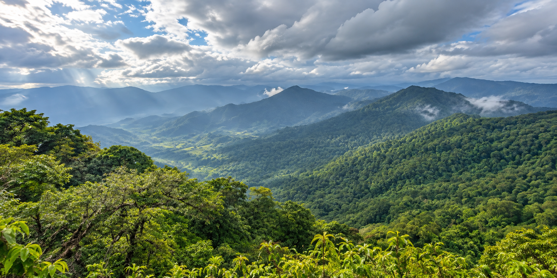
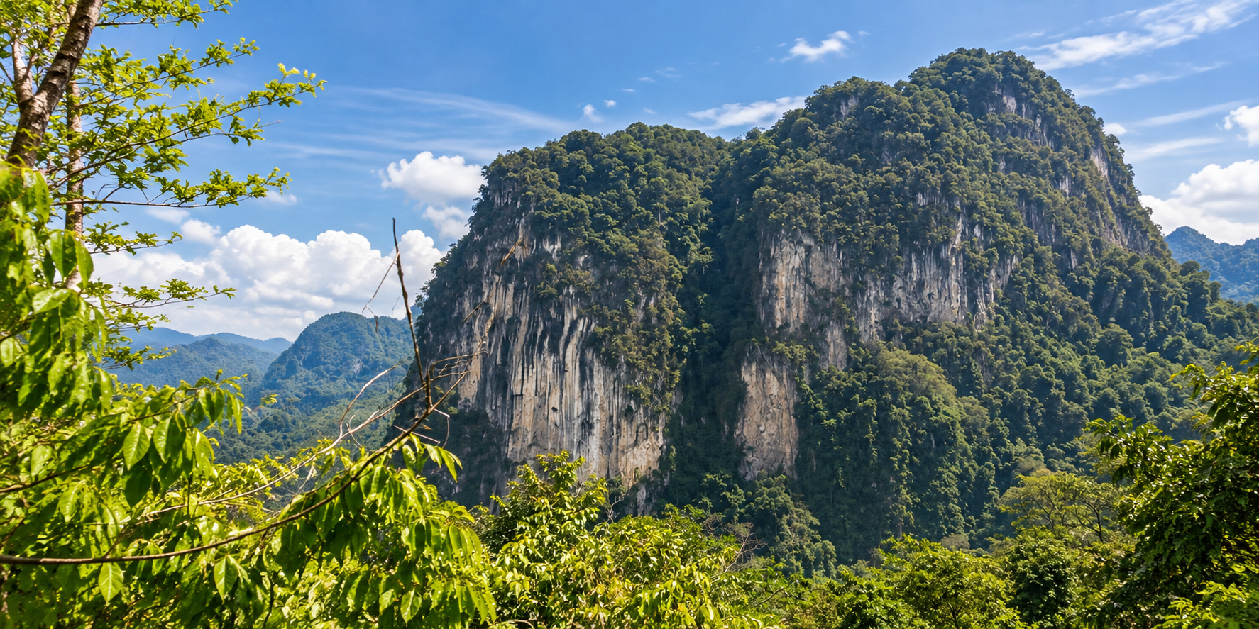
Kaeng Krung sits within a mountainous landscape characterised by forested ridges, valleys and streams. The terrain is not uniformly high. Instead, the park is a succession of hills, ridges, valleys and river corridors.
The highest point is reported at approximately 849 metres above sea level. This elevation is modest compared with Thailand’s highest northern mountains, but the combination of steep terrain, dense forest and high rainfall creates a distinctly southern tropical environment.
The park’s forest survey found that tropical evergreen forest is the dominant forest type, accounting for approximately 92.65% of the surveyed park area.
This is fundamentally a rainforest landscape, rather than a dry-season mountain landscape.
Tropical Evergreen Forest
The forest of Kaeng Krung is particularly important because of its relatively continuous tropical evergreen character. Historical forest-resource surveys documented a wide variety of tree species and forest plants.
Among the economically or ecologically notable tree species recorded in the park are Hopea, Dipterocarpus, Parashorea, Hydnocarpus, Aglaia, Diospyros and Baccaurea. The survey also recorded species such as หลุมพอ, ตะเคียน and จำปา, characteristic of the rich southern forest environment.
The important point for visitors is not simply the number of tree species. It is the structure of the forest itself.
Dense canopy. Moist understory. Streams running through shaded valleys. Moss and moisture around rocks. And a forest floor that changes dramatically with rainfall.
This is why Kaeng Krung feels substantially more like a wilderness landscape than a conventional sightseeing park.
Wildlife
Kaeng Krung is recognised as an important forest habitat with a diversity of wildlife and birds. The park’s historical descriptions consistently emphasise the abundance of wildlife and bird species within its forest.
However, visitors should understand an important distinction:
Wildlife presence does not mean wildlife sightings are guaranteed.
The deeper forest is habitat, not a wildlife exhibition. Animal traces may sometimes be found around rivers, forest trails and mineral-rich areas, but many animals are active primarily during dawn, dusk or at night.
For responsible wildlife observation
- Never approach wild animals
- Never feed wildlife
- Do not make loud noises near forest habitat
- Avoid leaving food waste
- Do not attempt to lure animals for photographs
- Stay on designated routes when required
- Follow instructions from park rangers
At Kaeng Krung, the experience is often about understanding that wildlife is present even when you do not see it.
Pha Hanuman
ผาหนุมาน · Approximately 620 metres
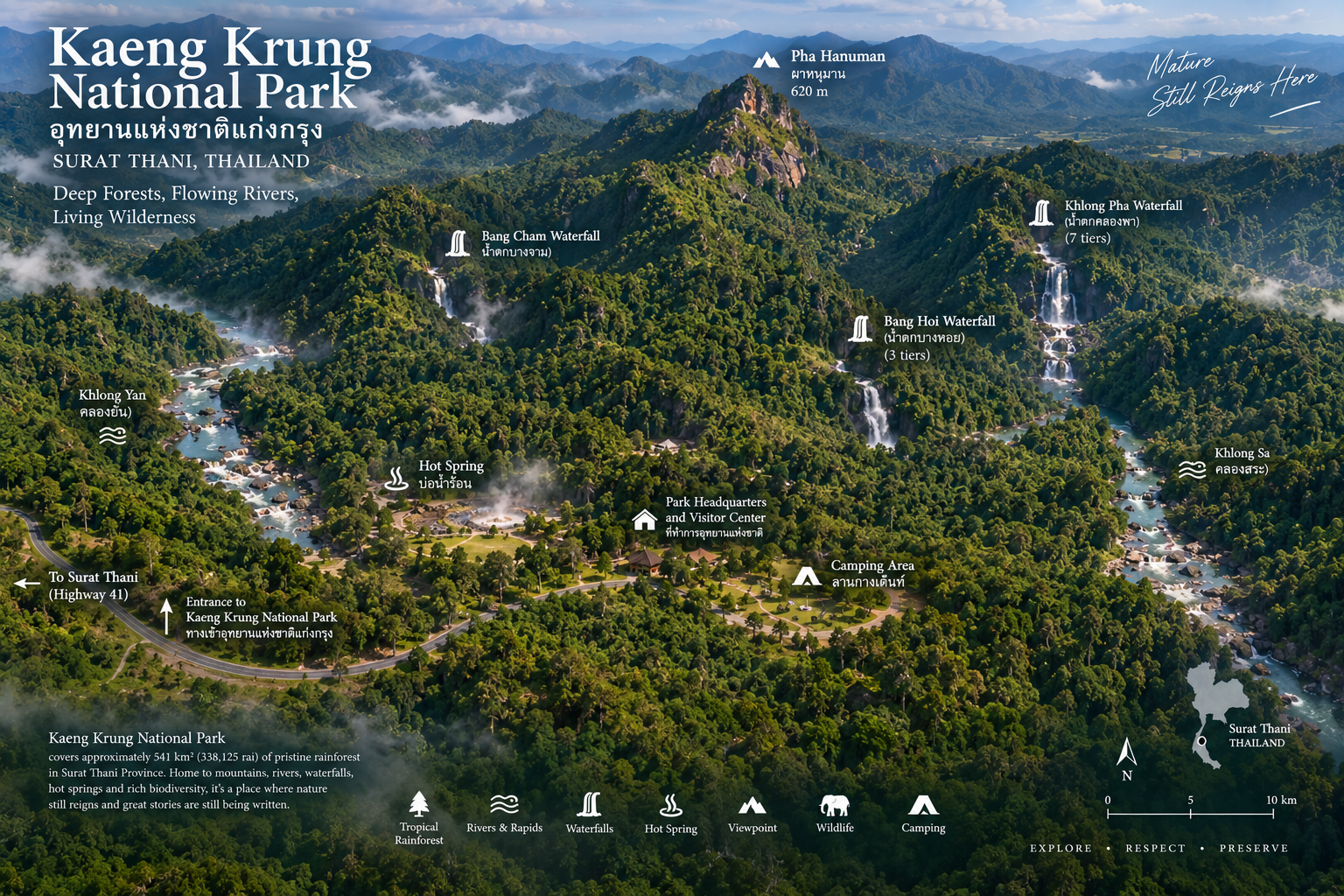
One of the park’s principal viewpoints is Pha Hanuman, located on the summit area of Bang Cham. The viewpoint is approximately 620 metres above sea level.
The route to the viewpoint functions as a nature trail and is approximately 3 kilometres from the park headquarters.
Pha Hanuman is less about a built-up observation platform and more about experiencing the elevated forest landscape. From higher ground, the surrounding forest and mountain terrain become easier to understand as a continuous landscape rather than a collection of separate attractions.
Why visit Pha Hanuman?
- Mountain scenery
- Layered ridges and forested valleys rather than a single postcard frame.
- Forest atmosphere
- A nature-trail walk through tropical evergreen cover.
- A quieter viewpoint
- An alternative to crowded mountain destinations.
Waterfalls of Kaeng Krung
The park’s waterfalls are closely connected to the surrounding rainforest. They are not dramatic open landscapes in the style of Thailand’s most famous cascades — they are forest water, moving through rock, shade and seasonal rain.
Bang Hoi Waterfall
น้ำตกบางหอย · Three tiers
Bang Hoi Waterfall is a three-tier waterfall located in the Bang Hoi area of Tha Chang District. It is described as having water throughout the year.
Its character is more closely connected to the surrounding rainforest than to the dramatic open landscapes associated with some of Thailand’s larger waterfalls. The surrounding vegetation and flowing water are part of the experience.
Bang Cham Waterfall
น้ำตกบางจำ · Takuk Nuea
Bang Cham Waterfall is located in the Takuk Nuea area. It is described as a medium-sized waterfall whose flow becomes stronger during the rainy season.
During wetter periods, streams and waterfalls throughout Kaeng Krung can become considerably more powerful. That also means visitors should treat river crossings, slippery rocks and waterfalls with caution after heavy rain.
Khlong Pha Waterfall
น้ำตกคลองพา · Seven tiers
Khlong Pha Waterfall is one of the more distinctive waterfall systems in the park. It consists of seven tiers and is described as having substantial water for much of the year.
The multiple levels make it more than a single-drop waterfall. The attraction is the progression of water through the forest landscape. For photographers, the combination of rock, flowing water and dense tropical vegetation can be more interesting than a single large waterfall.
The Hot Spring
บ่อน้ำร้อน · Takuk Nuea
Kaeng Krung also contains a natural hot-spring area in Takuk Nuea. The surrounding mineral-spring area is described as covering approximately 2 rai.
One of its unusual ecological characteristics is that wildlife may visit the area to obtain minerals from the surrounding mineral-rich ground. This makes the hot spring interesting not only as a recreational feature but also as part of the forest ecosystem.
It should be understood as a natural feature rather than a developed resort-style hot spring.
Khlong Yan
The River That Defines the Park
If there is one natural feature that best represents Kaeng Krung, it is Khlong Yan. The river flows through forested terrain and contains numerous rapids and rocky sections.
Among them is the famous Kaeng Krung / Chiao Krung, the large rapid from which the national park takes its name. The principal rapid is reported to contain a rocky section approximately 400 metres long, with numerous smaller rapids along the rafting route.
This is the point where Kaeng Krung becomes more than a forest park. It becomes a river wilderness.
Whitewater Rafting on Khlong Yan
Rafting is one of Kaeng Krung’s signature activities. The park and tourism information describe rafting routes along Khlong Yan through forested river corridors.
One documented route begins around Hat Pak Chun, near the park’s Khlong Yan protection unit, and continues approximately 8 kilometres to the park’s river landing area. The published route description gives an estimated rafting time of approximately 2 hours, depending on conditions.
The route contains numerous rapids, with Kaeng Krung / Chiao Krung being one of the most prominent sections. The park has used two-person kayaks for this activity, with visitors able either to paddle themselves or have assistance from park personnel, according to published tourism information.
The More Remote Side of Khlong Yan
One of the reasons Kaeng Krung remains relatively wild is that some river access points are not convenient.
The published rafting information describes the route from Hat Pak Chun as being approximately 8 kilometres from the park headquarters. The access road is described as rough and requiring a four-wheel-drive vehicle, with no mobile-phone signal in parts of the area.
Kaeng Krung should not be marketed as a simple roadside attraction. Some experiences require preparation.
The Story Behind the National Park
Kaeng Krung’s history is closely connected with the recognition of the ecological importance of the forest.
During the late 1980s, government agencies investigated the forest around Tha Chana and surrounding reserved-forest areas in connection with proposals for a multipurpose dam. The surveys revealed a landscape with rich tropical evergreen forest, valuable tree species, abundant wildlife and important headwaters.
Rather than being treated simply as potential reservoir land, the ecological value of the forest became a major reason for protecting the area.
The area was subsequently designated as Kaeng Krung National Park on 4 December 1991, under Royal Decree published in the Royal Gazette, becoming Thailand’s 69th national park.
Why is it called “Kaeng Krung”?
The name is derived from a major rapid in Khlong Yan. The rapid is known as Kaeng Krung, or Chiao Krung. The name became widely recognised in the area and was subsequently adopted as the name of the national park.
The name describes a physical feature of the landscape rather than a person or historical figure.
The Four Districts of the Park
Kaeng Krung is unusual in its geographic extent because the protected area reaches across four districts of Surat Thani Province.
- Tha Chana District
- The northern and western parts of the park include forest areas associated with Khlong Pha and surrounding mountain terrain.
- Chaiya District
- The park extends into forest areas of Chaiya, connecting the protected landscape with the broader forest system of northern Surat Thani.
- Tha Chang District
- Bang Hoi Waterfall and parts of the park’s forest landscape are associated with this district.
- Vibhavadi District
- The park headquarters is located here, and this is the main administrative and visitor-access area.
Forest Conservation
The forest-resource survey of Kaeng Krung provides an unusually useful picture of the park. Approximately 92.65% of the surveyed area was classified as tropical evergreen forest.
Other categories included naturally regenerating forest, old clearings and natural water resources. The survey’s overall calculations were based on the park’s official boundary area of 541 square kilometres / 338,125 rai.
This helps explain why Kaeng Krung remains visually dominated by forest. It is not simply a park with patches of forest surrounding tourist attractions.
The forest is the principal land cover.
Mineral resources
Historical descriptions of Kaeng Krung also note the presence of tin in the area. Tin mining was historically important in parts of southern Thailand, and the geological history of the region is connected with these mineral resources.
The modern identity of Kaeng Krung, however, is primarily that of a protected forest and watershed.
A Quiet National Park
Kaeng Krung is one of the national parks that can easily be overlooked by travellers who follow Thailand’s conventional tourism routes.
It does not have the international profile of Khao Sok, Doi Inthanon, Erawan, Khao Yai, Phi Phi or Doi Suthep–Pui.
And that is precisely what makes it interesting.
There is less emphasis on iconic photography. Less concentration of large tourist groups. Less commercialisation. More forest. More river. More space.
For ThailandLover, this makes Kaeng Krung particularly valuable as a destination for travellers who want to discover a side of Thailand that is not already heavily packaged for international tourism.
Who Should Visit Kaeng Krung?
- Nature travellers
- People who enjoy forests, rivers, waterfalls and natural landscapes.
- Adventure travellers
- Especially those interested in rafting and river-based activities.
- Photographers
- Tropical forest, flowing water, mountain terrain and changing weather create strong photographic opportunities.
- Birdwatchers and wildlife enthusiasts
- The park provides forest habitat for numerous bird and wildlife species, although sightings are never guaranteed.
- Slow travellers
- Travellers who prefer spending time in one natural landscape rather than checking off multiple attractions.
- Experienced outdoor travellers
- Visitors comfortable with less-developed infrastructure and variable road and weather conditions.
Who may not enjoy it?
Kaeng Krung may not be the ideal choice for travellers looking for luxury accommodation, extensive restaurants and cafés, large visitor centres, highly developed attractions, easy roadside viewpoints, predictable wildlife encounters or a resort-style nature experience.
This is not a weakness. It is part of the park’s identity.
Accommodation
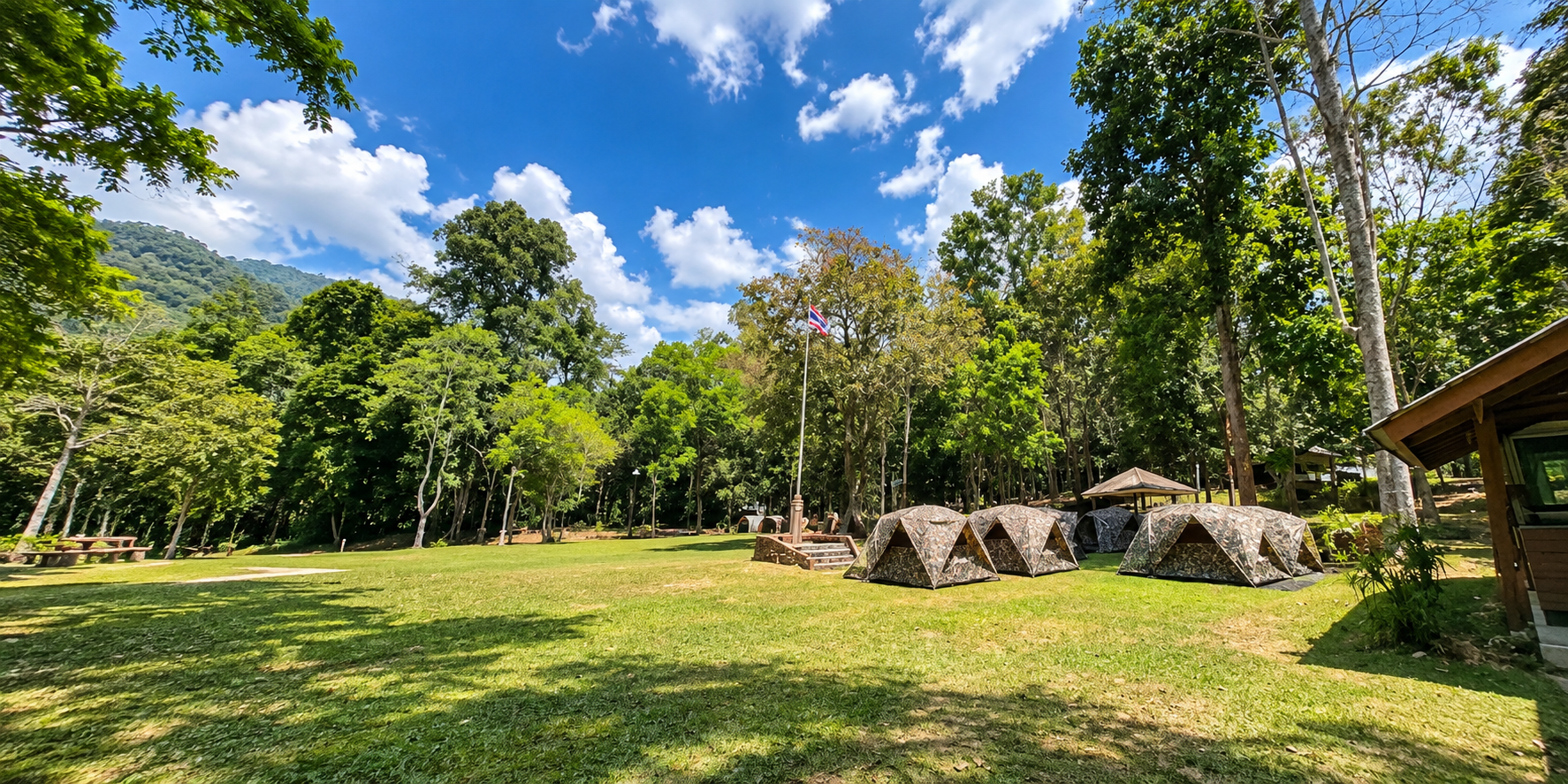
The park has historically provided park accommodation and camping areas. The main visitor facilities are associated with the park headquarters.
Because availability and operating conditions can change, accommodation should be confirmed with the park before arrival. Travellers planning to stay overnight should also check whether accommodation is open, whether camping is permitted during the intended dates, weather conditions, seasonal closures, road conditions and river activity status.
Entrance Fees
Kaeng Krung is classified under National Park Group 1 in the national park entrance-fee schedule. The published DNP schedule specifies:
- Thai adult
- 20 THB
- Thai child
- 10 THB
- Foreign adult
- 100 THB
- Foreign child
- 50 THB
Additional fees may apply to accommodation, camping, activities or other services. Because fees and operating conditions can change, visitors should verify the latest information before travelling.
How to Get There
The main access to Kaeng Krung National Park is through Highway 41.
Highway 41 → Highway 4262 → Takuk Nuea → Kaeng Krung National Park
The DASTA route description directs travellers from Highway 41 toward Khuan Ra intersection, then along Highway 4262 toward Vibhavadi, followed by the turn toward the park.
TAT describes the park headquarters as approximately 72 kilometres from Surat Thani city, although actual travel time depends heavily on the starting point, road conditions and the final approach into the park.
Getting around the park
Visitors should distinguish between the park headquarters area and the more remote forest and river areas. The headquarters is comparatively accessible. Some attractions and activity areas require hiking, forest roads, high-clearance vehicles, four-wheel-drive vehicles, local or park staff assistance, or river transport and rafting arrangements.
The remote Khlong Yan rafting access is a good example. It should not be approached as an ordinary passenger-car sightseeing stop.
When to Visit
Kaeng Krung is located in southern Thailand, where rainfall strongly influences the landscape.
- Rainy season
- Waterfalls more powerful, streams fuller, forest greener, rivers more dynamic and rafting more interesting — but roads can be slippery, trails muddy, rocks dangerous and some activities temporarily unavailable.
- Drier periods
- Easier access to certain outdoor areas, but waterfalls and rivers can have lower flow.
The best time therefore depends on the purpose of the trip.
- For waterfalls and lush forest: wetter periods can be visually impressive
- For easier outdoor movement: drier conditions may be more comfortable
- For rafting: river conditions and official safety assessment matter more than a simple calendar date
Seasonal Closure — Important
Published sources do not currently provide one universally consistent permanent closure date for every attraction.
DASTA’s current destination information states that tourism and overnight stays are closed from 1–15 October. TAT’s published 2024 seasonal-closure schedule listed Kaeng Krung’s tourism sites and accommodation as closed from 1 October–15 December.
Safety in Kaeng Krung
Kaeng Krung is a genuine forest and river environment. Visitors should not underestimate it simply because the park is relatively unknown.
- River safety
- Never enter a river or rapid after heavy rain without official confirmation. Water levels in tropical mountain catchments can change rapidly.
- Hiking safety
- Wear proper footwear. Forest trails may become slippery, especially after rainfall.
- Wildlife
- Do not approach or feed animals. Never leave food unattended in camping areas.
- Weather
- Southern Thailand can receive intense rainfall. Check the weather before entering remote areas.
- Communications
- Some remote sections may have limited or no mobile-phone coverage. The published Khlong Yan rafting information specifically notes the absence of mobile signal in the remote access area.
- Vehicles
- Some remote access roads can be rough and may require four-wheel drive. Do not assume that a normal rental car can reach every attraction.
Kaeng Krung as a Wildlife Landscape
The most important way to understand Kaeng Krung is not as a collection of attractions. Think of it as a connected ecosystem.
Mountain ridges collect rainfall. Rain becomes streams. Streams become rivers. Rivers create waterfalls and rapids. The forest protects the watershed. The forest provides habitat. And wildlife moves through this landscape largely independently of human visitors.
That relationship is what makes the park valuable.
What to Look For
A good visit to Kaeng Krung is not necessarily about seeing the most things. Instead, pay attention to:
- The forest canopy
- Look upward. The density of the evergreen canopy is one of the defining visual characteristics of the park.
- The river
- Watch how the water changes from calm sections to rapids.
- Forest-edge wildlife signs
- Tracks, calls and movement may reveal animals that remain invisible.
- Waterfall ecology
- Look beyond the falling water to the plants, rocks and small streams around it.
- Mountain weather
- Mist, cloud and rain can transform the appearance of the landscape within minutes.
Photography Guide
Kaeng Krung is particularly suitable for naturalistic photography. Rather than photographing it as a conventional tourist attraction, photograph it as a living landscape.
Best subjects
- Khlong Yan and the Kaeng Krung rapids
- Forest canopy and rainforest trails
- Waterfalls and river rocks
- Pha Hanuman
- Mist, cloud and forest textures
- Wildlife traces
- Wide-angle
- Forest valleys, rivers and mountain scenery.
- Telephoto
- Birds, distant wildlife and forest details.
- Macro
- Moss, fungi, insects, leaves and small forest organisms.
Responsible Travel
Kaeng Krung is exactly the kind of destination where responsible travel matters.
- Leave no litter
- Do not collect plants, rocks or wildlife
- Do not feed animals
- Keep noise low
- Use designated camping areas
- Follow ranger instructions
- Avoid entering closed areas
- Do not enter dangerous rivers or waterfalls during unsuitable conditions
- Take photographs without disturbing wildlife
The objective is not simply to visit Kaeng Krung. It is to leave the forest essentially unchanged.
Kaeng Krung and the Future of Conservation
The protected area is not static. In 2024, the Department of National Parks opened a public-participation process concerning the proposed addition of three areas totalling approximately 1,583.27 rai to the Kaeng Krung National Park system.
The areas identified were Thap Saming forest, Rai Yao forest and Khlong Sai forest.
This demonstrates that management of the park continues to evolve. National parks are not frozen historical boundaries. Their management, boundaries, visitor facilities and conservation priorities can change over time.
The Kaeng Krung Experience
- Morning
- Start around the park headquarters and explore the surrounding forest environment. If conditions permit, continue toward a viewpoint or nature trail.
- Midday
- Explore a waterfall or forest stream. Allow time rather than trying to rush through several attractions.
- Afternoon
- If an official rafting activity is operating, Khlong Yan can become the centrepiece of the experience. Otherwise, spend the afternoon exploring the forest and river landscape.
- Evening
- Return to the accommodation or campsite. The atmosphere changes dramatically after sunset. This is a forest environment, not a nightlife destination.
A Different Side of Surat Thani
Most international visitors know Surat Thani as the gateway to Koh Samui, Koh Phangan and Koh Tao — or as the gateway to Khao Sok National Park.
Kaeng Krung reveals another side of the province. A side defined by mountains, rainforest, rivers, waterfalls, wildlife, watersheds and local landscapes.
It is therefore particularly relevant to travellers who want to go beyond the conventional island-and-beach itinerary.
Before You Go
Check the following directly with the park. This is particularly important for Kaeng Krung because conditions in a tropical mountain and river environment can change quickly.
- Current opening status
- Seasonal closures
- Accommodation and camping availability
- Waterfall access
- Rafting operation and river safety conditions
- Road conditions and vehicle requirements
- Current entrance and activity fees
Essential Information
- English Name
- Kaeng Krung National Park
- Thai Name
- อุทยานแห่งชาติแก่งกรุง
- Province
- Surat Thani
- Region
- Southern Thailand
- Area
- 541 sq km / 338,125 rai
- Established
- 4 December 1991
- National Park No.
- 69
- Highest Elevation
- Approximately 849 m
- Main Viewpoint
- Pha Hanuman — approximately 620 m
- Major River
- Khlong Yan
- Other River
- Khlong Sa
- Major Attraction
- Kaeng Krung / Chiao Krung rapids
- Waterfalls
- Bang Hoi, Bang Cham, Khlong Pha
- Hot Spring
- Takuk Nuea area
- Accommodation
- Park accommodation and camping facilities
- Main Access
- Highway 41 → Highway 4262 → Takuk Nuea
Frequently Asked Questions
- What is Kaeng Krung National Park?
- Kaeng Krung National Park, or อุทยานแห่งชาติแก่งกรุง, is Thailand’s 69th national park, established on 4 December 1991 in Surat Thani. It covers about 541 km² of tropical evergreen forest, rivers, waterfalls and hot springs, and takes its name from a major rapid on Khlong Yan.
- Where is Kaeng Krung National Park?
- The park covers parts of four districts in Surat Thani: Tha Chana, Chaiya, Tha Chang and Vibhavadi. Headquarters are in Takuk Nuea, Vibhavadi District. The main approach is Highway 41 to Highway 4262 toward Takuk Nuea.
- Why is it called Kaeng Krung?
- The name comes from Kaeng Krung, also known as Chiao Krung, a large rapid on Khlong Yan. The rapid became well known locally and was later adopted as the name of the entire national park.
- Can you go whitewater rafting at Kaeng Krung?
- Rafting on Khlong Yan is one of the park’s signature activities when river and safety conditions allow. A documented route runs about 8 kilometres from Hat Pak Chun, taking around two hours. Confirm operation with the park before travelling.
- What waterfalls can you visit?
- Bang Hoi is a three-tier waterfall in Tha Chang District. Bang Cham is a medium waterfall in Takuk Nuea that strengthens in the rainy season. Khlong Pha is a seven-tier waterfall with substantial water for much of the year.
- What is the entrance fee?
- Kaeng Krung is listed under National Park Group 1. Published DNP rates are 20 THB for Thai adults, 10 THB for Thai children, 100 THB for foreign adults and 50 THB for foreign children. Extra fees may apply, and official fees can change.
- How do I get there?
- The usual route is Highway 41 to Highway 4262 toward Vibhavadi and Takuk Nuea. TAT describes the headquarters as about 72 kilometres from Surat Thani city. Some remote river access points require a four-wheel-drive vehicle.
- When is the best time to visit?
- Wetter periods can make waterfalls, forest and rivers more impressive. Drier periods can be easier for walking. Rafting depends on river conditions more than a calendar date. Seasonal closures can apply — check with the park before an overnight stay or river activity.
- Can you stay overnight?
- The park has historically provided accommodation and camping around headquarters. Availability, weather, seasonal closures and road conditions can change, so confirm directly with the park before arrival.
Related Destinations
- Khao Sok National Park
- Surat Thani’s best-known wilderness — limestone mountains, rainforest and a vast reservoir landscape.
- Khlong Phanom National Park
- Another forested mountain landscape in Surat Thani, quieter than the island-and-beach circuit.
- Tai Rom Yen National Park
- Highland forest and waterfalls in the mountains of southern Thailand.
- Nature & Parks
- More protected landscapes across ThailandLover’s national-park collection.
Location
Find Kaeng Krung National Park
Takuk Nuea, Vibhavadi, Surat Thani 84370