

National Park · Lamphun
Mae Ping National Park
อุทยานแห่งชาติแม่ปิง
The River, the Forest, and the Quiet North
Lamphun · Chiang Mai · Tak
Not one viewpoint. A long northern landscape where the Ping River, dry forest, limestone and the reservoir exist side by side.
A Park Built Around a River
Some national parks in Thailand are famous for a single viewpoint. Mae Ping is different. Its character is not one attraction. It is a whole landscape: a long stretch of the Ping River, forested mountains, limestone cliffs, waterfalls, natural grassland, caves, and the wide water of the Bhumibol Dam reservoir.
Here the journey is part of the destination. A road disappears into dry dipterocarp forest. A grassland opens between the trees. A limestone waterfall drops into an emerald pool. A boat moves between cliffs rising from the reservoir. And high above the river, Pha Daeng Luang opens onto mountains and water toward the horizon.
You do not come to Mae Ping simply to see a waterfall. You come to understand a landscape.
At a Glance
- 13 July 1981
- Thailand’s 32nd national park.
- ~1,003.75 km²
- Current gazetted area — about 627,346 rai.
- ~140 km
- Of the Ping River inside the park.
- ~1,334 m
- Doi Huai Lao, the highest recorded peak.
- Official name
- Mae Ping National Park
- Thai name
- อุทยานแห่งชาติแม่ปิง
- Provinces
- Lamphun, Chiang Mai and Tak
- Main district
- Li, Lamphun
- Headquarters
- 81 Moo 6, Mae Lan Subdistrict, Li, Lamphun 51110
- Established
- 13 July 1981
- Park number
- 32nd national park of Thailand
- Gazetted area
- Approximately 627,346 rai / 1,003.75 km²
- Main river
- Ping River · about 140 km within the park
- Highest peak
- Doi Huai Lao, approximately 1,334 m
- Signature places
- Pha Daeng Luang · Kaeng Ko · Ko Luang · Thung Kik · Yang Wee Cave
- Best known for
- The relationship between forest, limestone and the Bhumibol reservoir
The original designation covered about 626,875 rai. A later boundary adjustment added about 471 rai along Provincial Highway 1087, which is how the current gazetted figure reaches approximately 627,346 rai, or 1,003.7536 km².
Where Is Mae Ping?
Chiang Mai lies to the north, Lamphun through the centre and east, Tak toward the south and southwest. The headquarters is in Mae Lan Subdistrict, Li District, Lamphun, in a long mountain landscape tied to the Ping and the northern arm of the Bhumibol reservoir.
That is why Mae Ping does not feel like a conventional forest park. The combination is mountains, forest, river and reservoir — a visual character of its own among northern parks.
The Ping River
About 140 kilometres of the Ping and its surrounding country lie inside the park, a natural corridor through the mountains. Along it: forested hills, limestone cliffs, rocky islands and rapids, caves, banks, tributaries, and reservoir water.
The river is not scenery added to a forest. It is the backbone. The park’s name says so. From the water the scale becomes obvious — cliffs rising from the surface, forest coming down to the bank, valleys disappearing between the hills.
The Mountains
Long, complicated ranges run generally north to south. Much of the park sits around 400–800 metres. The highest recorded point is Doi Huai Lao, about 1,334 metres. These ridges are watersheds. Streams including Huai Mae Hat, Huai Mae Ko, Huai Pong Ka, Huai Muang, Huai Khun Men and Huai Krai join the Ping system.
The result is ridges and small watersheds, not one plateau. A short journey can move from dry forest and open grassland to a river valley, limestone, and reservoir cliffs.
The Forests
Mae Ping is particularly a dry-forest park of the north: dry dipterocarp, mixed deciduous, pine on higher ground, riverside vegetation, and plants associated with limestone. In the dry season many trees drop their leaves. The forest can turn open and gold rather than deep green. That seasonal change is one reason photographers and naturalists keep coming back.
Thung Kik
Open grassland inside dry forest
Thung Kik is one of the more distinctive landscapes in the park — a broad natural grassland ringed by dry dipterocarp and mixed deciduous forest, important for wildlife and birds. Species reported around it include barking deer, wild rabbits, junglefowl, woodpeckers and other forest birds. It is an established birdwatching ground. The park has even maintained water for birds in the dry season, when natural water in dry dipterocarp forest can run short. Birds recorded nearby include several woodpeckers, Black-winged Kite-related raptors, and other forest species.
Toward the end of the cool season and into the hot season — roughly March to May — wildflowers can cover the grass. Thung Kik is not “a camping field.” It is a seasonal ecosystem.
- Cool season
- Comfortable camping and wildlife observation
- Late dry season
- Flowers, open country and birdwatching
- Rainy season
- Greener vegetation, a different forest mood
Pha Daeng Luang
The signature viewpoint · about 1,000 m · not a roadside stop
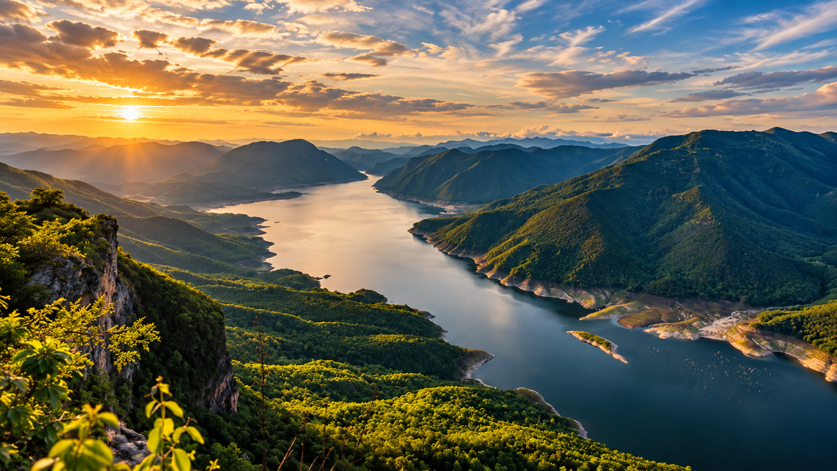
If one viewpoint carries Mae Ping’s visual identity, it is Pha Daeng Luang. It sits at about 1,000 metres and looks down on the Ping and the surrounding mountains. In suitable weather, morning mist settles into layers: mountain, mist, river, reservoir. The cliff’s reddish-orange rock is part of the name.
Historical visitor notes describe a rough approach — a four-wheel-drive track, then a walk — with advance coordination, a local guide and park support. The viewpoint has also operated under seasonal and visitor-number limits, because the terrain is difficult and the ledge is small.
The attraction is the journey as much as the cliff. The road gets remoter. The forest gets quieter. The vehicle gives way to a walk. Then the country opens, and the Ping is a thin ribbon through an enormous mountain landscape. That sense of scale is the point.
Kaeng Ko
Where the Ping became a lake
Kaeng Ko now reads as a wide body of water among mountains and limestone. It is part of the reservoir created by Bhumibol Dam. Before the dam, this was where Huai Mae Ko met the Ping. Rising water turned valleys and channels into an inland landscape of water and forested mountains: national-park forest, river, reservoir and limestone in one view.
A boat shows what the road cannot: cliffs, forested slopes, caves, small islands, channels, and places associated with the landscape that went under the water. The waterway connects, visually and geographically, with Bhumibol Dam and the Doi Tao side of the Ping system. The park has also offered floating accommodation and riverside camping at Kaeng Ko. Confirm what is actually operating before you travel.
Phra That Kaeng Soi
A historic landmark on the river
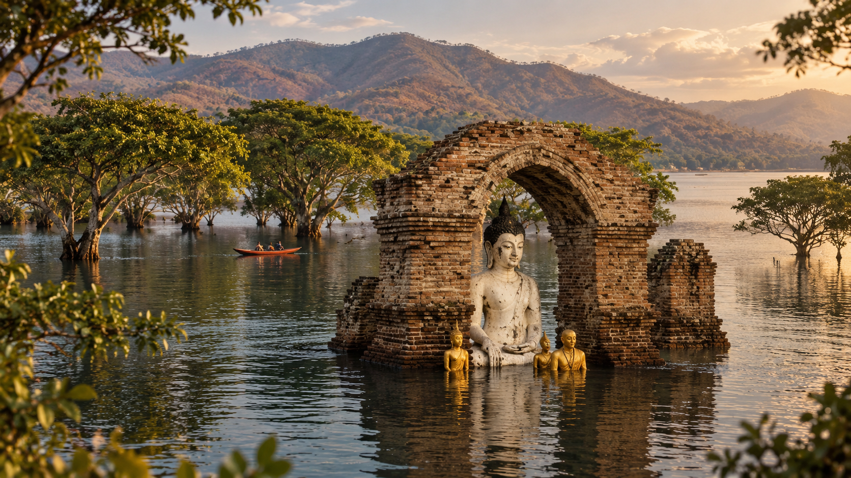
The reservoir carries a layer of northern history. Some places along the Ping corridor were changed when Bhumibol’s water rose. A boat through Kaeng Ko can be more than a scenic trip: the present reservoir sits over an older river and cultural landscape.
Phra That Kaeng Soi is one of the culturally significant places on that journey, traditionally associated with a history of more than a thousand years. Unlike a temple in a town, it is a historic site met inside a remote natural landscape — religious heritage, river, mountain and reservoir together. It is a reminder that this country was not empty wilderness before modern infrastructure changed the river. People, belief and transport had already been tied to the Ping for centuries.
Yang Wee Cave
Limestone under the forest
Yang Wee Cave is a large limestone cave: stalactites, stalagmites, chambers, and the underground features that come with karst. Around it, dry dipterocarp and naturally occurring pine give the forest a different character from the river. Historically, going in has required a flashlight and a guide. Cave conditions change with rain, water, darkness and rock. Follow current instructions. Do not enter independently.
Nearby, the area historically known as Pa Phra Bat Yang Wee combines dry forest, pine and rock — pine, dry forest, limestone and mountain, one of the less obvious ecological notes of Mae Ping. The park is not one ecosystem.
Ko Luang Waterfall
A multi-tiered limestone fall, commonly described as seven levels
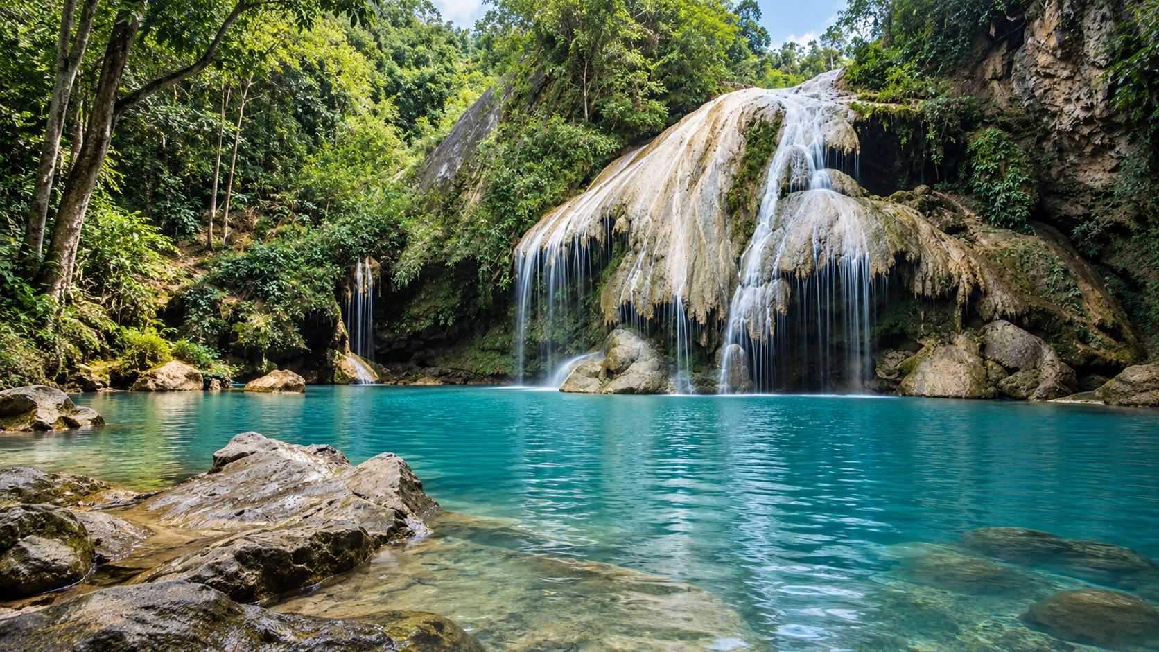
Ko Luang is formed by water moving through the Mae Ko stream system, dropping through limestone tiers into pools. Government tourism material describes seven major levels. Older local counts sometimes differ, because cascades get classified differently. For accuracy, ThailandLover keeps it as a multi-tiered limestone waterfall, commonly described as seven levels — not a false-precision inventory of every rock step.
The pools are famous for colour. Under the right conditions they can look emerald, then turquoise, then brownish when sediment is high. Season, flow, sediment and weather decide it. Dry and cool months can be exceptionally clear. Rainy-season runoff can dull the colour. Never present the colour as permanent.
The geology is the larger story. Water moving through limestone slowly dissolves rock and builds caverns, stalactites, stalagmites, cliffs, pools and travertine-like forms. Ko Luang belongs to the same karst family as the caves elsewhere in the park.
Smaller falls exist, including references to Ko Noi, a multi-tiered fall with green pools and, in some local notes, camping and viewpoints nearby. Access and facilities change. Treat smaller falls as secondary. The editorial spine of the park remains Ko Luang, Kaeng Ko, Thung Kik, Pha Daeng Luang and Yang Wee Cave.
Wildlife & Birds
Dry dipterocarp, mixed deciduous forest, river, grassland, limestone and mountain forest give the park a range of habitats. Species associated with the landscape include barking deer, wild rabbits, junglefowl, woodpeckers, birds of prey, rock-dwelling mammals and other forest wildlife. A sighting is an encounter, not a guarantee.
One of the more distinctive birds tied to Mae Ping is the White-bellied Woodpecker (Dryocopus javensis) — large, black and white, with a powerful bill, associated with mature forest and large trees. The park has highlighted it in its own conservation and birdwatching notes, and it has been described as the symbolic bird of the park.
In July 2026, the park reported observations of the White-rumped Falcon (Polihierax insignis), an uncommon raptor of relatively intact dry dipterocarp and mixed deciduous forest. The park described its continued presence as an ecological indicator. That is one reason Mae Ping should not be marketed only as a waterfall-and-camping stop.
The Human Landscape
Do not describe Mae Ping as untouched wilderness without history. The Ping has long been a corridor for transport and culture. Communities, temples, fields and traditional routes existed around the river before the reservoir changed parts of it. Bhumibol Dam added another layer: valleys became reservoir arms, some historical landscapes went under the water, and new tourism landscapes appeared around it. That tension — natural country and human intervention — is one of the strongest stories ThailandLover can tell here.
From the water, the southern park can look almost like a lake: blue water, forested ridges, limestone cliffs, open sky. A river journey, when boats are running, is perhaps the most honest way to understand why the park carries the name Mae Ping. The landscape passes slowly. Cliffs, slopes, caves, rapids, islands, historic sites, remote forest and reservoir scenery unfold as one corridor rather than a list of stops.
Camping, Houses & the Night Sky
Official accommodation records include facilities in several zones: the headquarters, Kaeng Ko, Thung Kik and Ko Luang — houses and camping areas. Current availability should be checked through the Department of National Parks before travel.
- Thung Kik
- Open grassland and wildlife observation
- Kaeng Ko
- Reservoir scenery, and floating stays when they are operating
- Ko Luang
- Waterfall and forest
Away from settlements and artificial light, the night can be remarkably dark. There is no observatory. There is a tent, a dark forest, a quiet night, and the stars over the northern mountains — a low-impact experience that needs no extra infrastructure.
When to Visit
- November – February
- Cool season. The most comfortable period outdoors: cooler mornings, pleasant days, better camping and hiking, possible morning mist, and kinder conditions on the river and reservoir. For Pha Daeng Luang, this is when sunrise, mist and mountain visibility can combine — if the viewpoint is open.
- March – May
- Hot season, and the dry-forest season. Golden-brown forest, wildflowers around Thung Kik, and good birdwatching. Afternoons can be extremely hot in exposed places. Smoke and haze can affect the north. Check air quality.
- June – October
- Rainy season. Greener, and often stronger streams and falls. Roads can be slippery, trails difficult, water levels higher, caves unsafe, and some sites restricted. Rain also changes Ko Luang. Beautiful, and less predictable.
- Pha Daeng Luang sunrise
- Cool season, subject to opening
- Camping
- November–February
- Thung Kik flowers
- Approximately March–May
- Birdwatching
- Year-round, with seasonal variation
- Ko Luang
- Depends on rainfall and water clarity
- Boat journey
- Depends on water level and current operations
- Hiking
- Cool season is generally kinder
- Stargazing
- Dry, clear nights
- Forest photography
- Dry season for gold; rains for green
How to Get There
- From Chiang Mai
- South toward Doi Tao, then on toward the Mae Ping country. The park’s northern landscape connects with Doi Tao District.
- From Lamphun
- Toward Li District. The headquarters is in Mae Lan. Road access ties into the regional network, including Highway 106 and Highway 1087. Published directions put the office between kilometre markers 20 and 21 on Highway 1087.
- From Tak
- Through the Sam Ngao / Bhumibol Dam side — the useful approach if you are combining the park with the dam and the reservoir.
Mae Ping is large. Approximate historical distances from the headquarters include Thung Kik around 15 km, Kaeng Ko around 24 km, and Ko Luang around 22–26 km depending on the reference point. Pha Daeng Luang is considerably farther and needs special access. Treat these as route distances, not exact current measurements. Roads change.
What to Expect
Not a one-day checklist.
The mistake is entrance, waterfall, viewpoint, exit. The park is too large. Choose an experience instead.
- The nature weekend
- Thung Kik, camping, birdwatching, stargazing
- The river escape
- Kaeng Ko, a boat, the reservoir, floating accommodation if it is open
- The waterfall journey
- Ko Luang, limestone, forest, camping
- The mountain experience
- Pha Daeng Luang — sunrise, mist, a panorama, if access is granted
- The deep-nature route
- Yang Wee Cave, forest, a walk, camping
Who It Is For — and Who May Not Enjoy It
Mae Ping suits nature lovers, photographers of landscape, river, wildlife, birds, forest texture, sunrise, mist and night sky, birdwatchers, campers, adventure travellers who will accept rough roads and advance coordination, and slow travellers.
It is a weaker fit if you want luxury resorts, restaurants everywhere, short walks, paved access to every site, guaranteed wildlife, a dense cluster of attractions, or a highly predictable itinerary. The appeal comes partly from the park being large, quiet and spatially dispersed.
Travel Responsibly & Stay Safe
Mae Ping is a conservation landscape first. Stay on designated routes. Do not collect plants, rocks or anything else. Never feed wildlife. Keep noise low. Carry rubbish out where required. Avoid single-use plastic where you can. Follow fire rules. Do not enter caves without authorisation or a guide where one is required. Follow seasonal closures. Keep wildlife-watching distances. Respect communities and park officers.
Do not chase wildlife for a photograph.
- Water. Depth and current on the reservoir and river can change. Follow boat operators and park staff.
- Waterfalls. Rocks are extremely slippery. Calm-looking water can hide current and submerged rock.
- Caves. Never enter alone. Levels rise quickly after rain.
- Mountains. Remote routes may have little phone signal. Carry water, navigation, a headlamp, a basic kit, proper shoes, rain protection, and a warm layer in the cool season.
Fees, Stay & a 2026 Update
The Department of National Parks lists Mae Ping in Group 1 for entrance fees in the current official schedule.
- Thai visitors
- Adult 20 THB · child 10 THB
- Foreign visitors
- Adult 100 THB · child 50 THB
Vehicles, accommodation, camping and boats may be charged separately. Accommodation records include park houses in the main zone, at Kaeng Ko and at Ko Luang. Check the official reservation system — inventory and prices change.
ThailandLover Signature Experiences
- 01 · Watch the Ping from Pha Daeng Luang
- Stand above the river and watch it disappear between the mountains — if access is open.
- 02 · Slow down at Kaeng Ko
- Take a boat through the reservoir and let the cliffs tell the story.
- 03 · Find the pools of Ko Luang
- See how limestone, water and geology make one of the north’s more distinctive falls. Colour is seasonal.
- 04 · Camp at Thung Kik
- A night in open grassland surrounded by dry forest.
- 05 · Look for the woodpeckers
- The dry forest is a better birding ground than the visitor numbers suggest.
- 06 · Explore Yang Wee
- The limestone world under the forest, with proper guidance.
- 07 · Stay after sunset
- The park’s remoteness is clearest when the artificial lights go out.
ThailandLover Quick Verdict
- Natural beauty
- A landscape shaped by water, not a single postcard.
- Landscape diversity
- Dry forest, limestone, grassland, river and reservoir.
- River experience
- The geographical backbone of the park.
- Waterfalls
- Ko Luang, with colour that changes through the year.
- Mountain views
- Pha Daeng Luang — earned, not casual.
- Birdwatching
- Dry forest, Thung Kik, and a symbolic woodpecker.
- Wildlife
- Habitat first. Sightings are not a promise.
- Caves
- Yang Wee, with a guide and current permission.
- Camping
- Several zones, several atmospheres.
- Stargazing
- When the night is dry and clear.
- Accessibility
- The headquarters is reachable. The highlights are not five minutes apart.
- Facilities
- Park houses and camping. Confirm first.
- Family convenience
- Some easy areas work. Remote routes do not.
- Adventure
- Rough roads, walks, guides, advance calls.
- Slow travel
- The pace the park rewards.
- Mass tourism
- Dispersed, and better kept that way.
Best for: nature lovers, photographers, birdwatchers, campers, hikers, adventure travellers and slow travellers.
Less suitable for: a highly commercial destination, luxury facilities, or a short sightseeing circuit.
Frequently Asked Questions
- Is Mae Ping National Park in Lamphun?
- Yes. The headquarters is in Mae Lan Subdistrict, Li District, Lamphun. The park extends across Lamphun, Chiang Mai and Tak.
- When was it established?
- 13 July 1981. It became Thailand’s 32nd national park.
- How large is it?
- About 627,346 rai, or 1,003.75 km². A proposed expansion of about 50,969.37 rai was under public consultation from 19 August to 18 September 2026 and should not yet be added to the legal area.
- What is it famous for?
- The Ping River landscape, Kaeng Ko, Ko Luang Waterfall, Thung Kik and Pha Daeng Luang — and for dry-forest birds.
- Is Pha Daeng Luang easy?
- No. It is a remote viewpoint needing advance coordination and, depending on current rules, controlled access, suitable transport and a walk.
- Can I camp, or stay on a floating house?
- Camping exists in several zones, including Thung Kik and Kaeng Ko. Floating accommodation has been associated particularly with Kaeng Ko. Confirm what is operating before you plan an overnight stay.
- Is Ko Luang open all year, and what colour is it?
- Appearance changes with rainfall. Access can change with weather and park rules. The pools can look emerald or blue-green in good conditions, and duller when sediment is high. The colour is not fixed.
- Is it good for birdwatching?
- Yes. Dry dipterocarp and mixed deciduous forest support a serious bird community. Thung Kik is particularly associated with birdwatching, including large woodpeckers. In July 2026 the park also reported the White-rumped Falcon.
- When is Thung Kik at its best?
- March to May if you want seasonal wildflowers. November to February if you want cooler camping.
- Can I explore Yang Wee Cave alone?
- Do not assume independent exploration is allowed. Historically, access has required a flashlight and a guide. Follow current instructions. Cave conditions change with rain.
- Is it suitable for families, or first-time hikers?
- Some accessible areas can work for families. Remote viewpoints, caves, long walks and rough roads suit people comfortable outdoors. Short nature walks may be manageable. For remote routes, a local guide and coordination with the park are strongly recommended.
More of the Ping Country
- Doi Inthanon National Park
- The high mountain of the same northern ranges — a different scale, if the journey continues toward Chiang Mai.
- Op Luang National Park
- Canyon and river forest on the road between Chiang Mai and the west.
- Si Lanna National Park
- Another northern park where water and forest share the landscape.
Location
Find Mae Ping National Park
81 Moo 6, Mae Lan, Li, Lamphun 51110 · Highway 106 to Li, then Highway 1087