


National Park · Ratchaburi
Chaloem Phrakiat Thai Prachan National Park
อุทยานแห่งชาติเฉลิมพระเกียรติไทยประจัน
Where the Western Forest Begins
Ratchaburi · Western Thailand
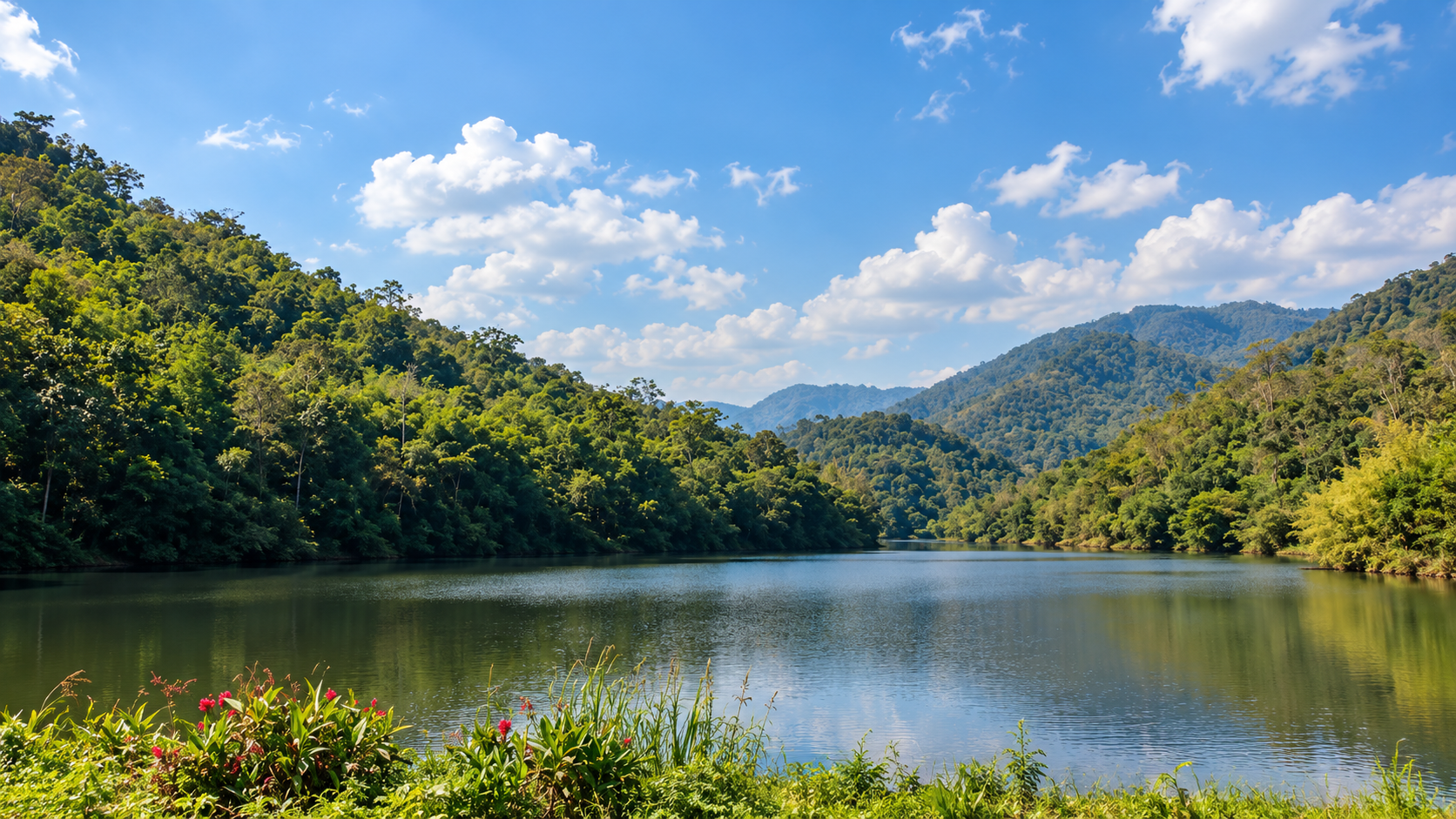
Mountain forests protect important watersheds. Water descends through rocky ravines and waterfalls. Warm mineral water rises from beneath the earth. Reservoirs sit quietly between forested hills — a landscape shaped by conservation, not only by tourism.
Basic Information
- Name
- Chaloem Phrakiat Thai Prachan National Park
- Thai Name
- อุทยานแห่งชาติเฉลิมพระเกียรติไทยประจัน
- Province
- Ratchaburi
- Districts
- Pak Tho · Suan Phueng · Ban Kha
- Region
- Western Thailand
- Established
- 24 January 2012
- National Park Number
- 124th national park of Thailand
- Area
- Approximately 205,463.89 rai / 328.74 km²
- Elevation
- Approximately 200–806 metres above sea level
- Landscape
- Tenasserim mountain range · Forested valleys · Streams · Waterfalls · Reservoirs
- Major Watersheds
- Thai Prachan / Phachi and connected western watershed systems
- Management
- Department of National Parks, Wildlife and Plant Conservation (DNP)
- Main Character
- Western mountain forest · Waterfalls · Hot springs · Reservoirs · Nature trails · Forest conservation history
The Western Forest Few Travellers Know
Far from Thailand’s famous beaches and crowded mountain destinations, western Ratchaburi opens into a quieter landscape of ridges, forests, streams and deep valleys.
Chaloem Phrakiat Thai Prachan National Park occupies a mountainous landscape in western Ratchaburi, close to the Thai–Myanmar frontier.
The park covers approximately 205,463.89 rai, or about 328.74 square kilometres, across parts of Pak Tho, Suan Phueng and Ban Kha districts.
Its terrain belongs to the Tenasserim mountain system and is characterized by rugged ridges, forested valleys and streams.
The park is also part of the broader Kaeng Krachan Forest Complex, one of mainland Southeast Asia’s important remaining forest landscapes — and one of the standout destinations in ThailandLover’s Nature & Parks collection.
It is a watershed landscape.
It is a wildlife habitat.
And it is part of the ecological continuity of western Thailand.
But Thai Prachan is more than a natural landscape. Its story is also about the restoration of a forest once shaped by conflict, and a long-term effort to create a place where forests, wildlife and local communities can coexist.
Why Visit Thai Prachan?
A Different Side of Ratchaburi
Chaloem Phrakiat Thai Prachan is not designed around one spectacular viewpoint. Its appeal comes from the relationship between several landscapes.
- 01 — Mountain Forest
- Large areas remain covered by natural forest across steep mountain terrain.
- 02 — Waterfalls
- Streams descend through rocky valleys to create waterfalls and smaller cascades.
- 03 — Hot Springs
- Pong Krating Hot Spring provides a geothermal element within the wider forest landscape.
- 04 — Reservoirs
- Several reservoirs create open water landscapes surrounded by hills and forest.
- 05 — Streams & Ravines
- The park contains numerous streams, rocky channels and natural gorges.
- 06 — Nature Trails
- Some areas are suitable for walking and environmental interpretation, while deeper routes require greater preparation.
- 07 — Conservation History
- The park represents a long-term effort to restore and protect western forest following a period of conflict and forest degradation.
Where Mountains Become Watersheds
The park lies within the western mountain country of Ratchaburi.
The terrain is not dominated by a single high summit. Instead, it consists of overlapping ridges, valleys and drainage systems.
Elevation ranges from roughly 200 metres to about 806 metres above sea level.
This relatively large vertical range creates different forest environments and microclimates across the park.
- Higher Ridges
- Cooler and more exposed.
- Valleys
- Retain moisture.
- Streams
- Collect water from the forest and carry it toward surrounding river systems.
The landscape therefore functions as both habitat and infrastructure for nature.
The Tenasserim Range
A Mountain System Along Thailand’s Western Edge
Thai Prachan forms part of the Tenasserim mountain landscape extending along western Thailand and the Myanmar border.
These mountains are more than a geographical boundary. They form one of the great ecological corridors of mainland Southeast Asia.
Forest blocks across western Thailand provide habitat and movement routes for numerous species.
Thai Prachan is one component of this larger system.
A Mosaic of Western Thailand’s Forests
The park contains several forest communities.
Documented habitat types include mixed deciduous forest, moist evergreen forest, dry evergreen forest, dry dipterocarp forest, secondary forest, agricultural areas, rivers and reservoirs.
This forest mosaic is one of the park’s ecological strengths.
Different elevations, slopes and moisture conditions create different habitats.
A forested valley beside a stream can look completely different from a dry ridge exposed to the sun.
A Park Built Around Water
Water is one of the defining elements of Thai Prachan.
Streams originate in the mountains. Rain is captured by the forest. Water moves through rocky channels. Small tributaries combine into larger streams. Reservoirs store water. And the surrounding forest protects the entire system.
This makes Thai Prachan particularly important as a watershed landscape.
The park is not simply a place where visitors come to see waterfalls.
It is part of the system that creates them.
Thai Prachan Waterfall
Water Through the Western Forest
Thai Prachan Waterfall is one of the park’s signature natural attractions.
The waterfall is formed by mountain water descending through a rocky forest environment.
Unlike highly developed waterfalls designed around easy roadside access, Thai Prachan represents the more adventurous side of the park.
Some routes require walking through forest and along streams. The landscape becomes increasingly wild as you move away from the main service area.
For visitors, the waterfall is best understood as part of the larger watershed rather than as an isolated attraction.
Pong Krating Hot Spring
Heat Beneath the Forest
Pong Krating Hot Spring is one of the most distinctive attractions associated with the Thai Prachan landscape.
Located in Ban Bueng, Ban Kha District, the hot spring adds a geothermal dimension to an otherwise strongly forest-and-water destination.
The hot spring is associated with warm mineral water emerging naturally from the ground.
The surrounding environment is quieter and more rural than Thailand’s major commercial hot-spring destinations.
This is not a luxury spa.
It is a natural hot-spring landscape integrated into the western countryside.
The Hot Spring Experience
Slow Down
The appeal of Pong Krating is simplicity.
Forest. Warm water. Open sky. Mountain air.
The experience works best as part of a wider journey through western Ratchaburi rather than as a standalone attraction.
ThailandLover recommends treating the hot spring as a pause between forest exploration and the next destination.
Reservoirs of Thai Prachan
Water Between the Mountains
Several reservoirs are associated with the Thai Prachan landscape:
- Ban Thai Prachan Reservoir
- Ban Tak Daet Reservoir
- Ban Wang Pla Chon Reservoir
- Ban Huai Sala Reservoir
The reservoirs create open-water landscapes inside a predominantly mountainous environment.
Early morning is particularly atmospheric. Low mist can settle over the water. The surrounding ridges become reflected in the reservoir. And the forest appears to rise directly from the water.
Ban Thai Prachan Reservoir
The Landscape at the Heart of the Park
Ban Thai Prachan Reservoir is closely associated with the park headquarters and the history of the Thai Prachan conservation project.
The reservoir provides both practical water storage and a scenic open landscape surrounded by forest.
It is also an important part of the park’s story because the area became associated with royal conservation initiatives and the transformation of a formerly conflict-affected landscape.
From Conflict to Forest
The Conservation Story
Thai Prachan has a history unlike many Thai national parks.
During the period of armed conflict in Thailand, parts of this western mountain landscape were associated with the Communist insurgency. The area became a strategic zone of conflict between government forces and communist insurgents.
The resulting instability affected both people and forests.
A major turning point came with the establishment of the Thai Prachan Royal Park project, created in connection with the fifth-cycle birthday anniversary of Her Majesty Queen Sirikit in 1992.
The project’s objective was closely connected with forest restoration and conservation. The area was subsequently developed into a protected landscape.
The Department of National Parks formally established Chaloem Phrakiat Thai Prachan National Park by administrative order in 2003, followed by official designation in the Royal Gazette on 24 January 2012.
This history gives the park a different identity from many national parks established primarily for scenic tourism.
Thai Prachan was also conceived as a landscape of restoration.
Life Inside the Western Forest
The forest landscape supports a range of wildlife typical of western Thailand.
Species documented in the wider forest environment include sambar deer, muntjac, wild boar, macaques, langurs, hornbills, various reptiles, amphibians, forest birds and freshwater species.
However, wildlife sightings are never guaranteed.
ThailandLover recommends treating wildlife as an ecological experience rather than a checklist.
The most valuable encounter may be hearing a hornbill before seeing it.
Or discovering tracks beside a stream.
Or realizing that the forest is moving around you even when you cannot see the animals.
Hornbills
A Sign of Forest Quality
Hornbills are among the most charismatic birds associated with western Thailand’s mature forests.
Their presence is particularly significant because many hornbill species depend on large forest areas and suitable nesting trees.
For birdwatchers, the early morning forest is the best time to listen.
Look upward. Listen for wingbeats. And allow the forest to reveal itself.
The Kaeng Krachan Forest Complex
A Much Bigger Story
Thai Prachan does not exist in ecological isolation.
It forms part of the broader Kaeng Krachan Forest Complex, which includes:
- Kaeng Krachan National Park
- Kui Buri National Park
- Chaloem Phrakiat Thai Prachan National Park
- Phachi River Wildlife Sanctuary
The complex extends across western Thailand through Ratchaburi, Phetchaburi and Prachuap Khiri Khan.
Together, these protected areas form one of Thailand’s most important continuous forest landscapes.
Thai Prachan may be relatively little known internationally.
Its forest is not.
It belongs to one of the country’s most important ecological systems.
Rock, Ridge and Ravine
The landscape is composed of sedimentary geological formations including conglomerate, limestone, shale and sandstone.
These geological structures contribute to the park’s rugged terrain and influence stream channels, waterfalls, caves, ravines, mountain slopes and soil drainage.
This is why the park feels so different from the flat agricultural landscapes of central Ratchaburi.
Streams & Ravines
The Hidden Architecture of Thai Prachan
The park contains numerous natural channels and rocky ravines.
Traditional local descriptions include formations such as Trok Than Hin, Trok Saew Sawan, Trok Bang Phrai and Trok Leela.
These are not necessarily conventional tourist attractions with developed facilities.
They are part of the park’s natural landscape and are best experienced with people familiar with the terrain.
Nature Trails
Walk the Watershed
Nature trails within the park provide opportunities to observe forest succession, native trees, streams, rocks, wildlife signs, water systems and seasonal changes.
The experience is less about reaching a dramatic viewpoint and more about understanding how the forest works.
This is particularly appropriate for travellers who enjoy slow nature travel.
Best Time to Visit
- November – February
- Best overall period. Cooler weather, comfortable outdoor conditions, clearer mountain views — excellent for camping and nature exploration.
- June – October
- Green season. The forest becomes intensely green; streams and waterfalls become more dramatic. Rain can affect trails and remote access — always check conditions before entering deeper forest areas.
- March – May
- Hot + fire-risk period. Temperatures can become high; haze and wildfire conditions may affect visibility. Park access can be restricted during serious fire events. Check current DNP announcements before travelling.
The Forest After Rain
The rainy season transforms the park. Streams become fuller. Waterfalls become more powerful. Moss and ferns brighten the rocks. The forest canopy becomes intensely green.
But rainfall also creates practical problems. Trails can become slippery. Streams can rise quickly. Remote routes may close. Road conditions can deteriorate.
The green season is beautiful, but it requires flexibility.
Dry Season
The dry season generally offers easier road and trail conditions.
However, western Thailand can experience intense heat and wildfire risk toward the late dry season. Forest fire prevention is a major conservation priority.
The DNP has specifically highlighted Thai Prachan’s importance as a watershed and ecotourism landscape while emphasizing community participation in wildfire prevention.
Visitors should respect all fire restrictions.
Community & Conservation
People Are Part of the Landscape
The park covers areas around local communities rather than existing as an isolated wilderness.
Villages, reservoirs, agriculture and forest boundaries interact with one another.
This makes conservation more complicated. It also makes the park more interesting.
The goal is not simply to keep people out.
The long-term challenge is to protect forests while allowing surrounding communities to live sustainably.
A ThailandLover Day in Thai Prachan
- Morning
- Arrive early. Walk around the park headquarters and reservoir landscape. Watch the morning light move across the forest.
- Late Morning
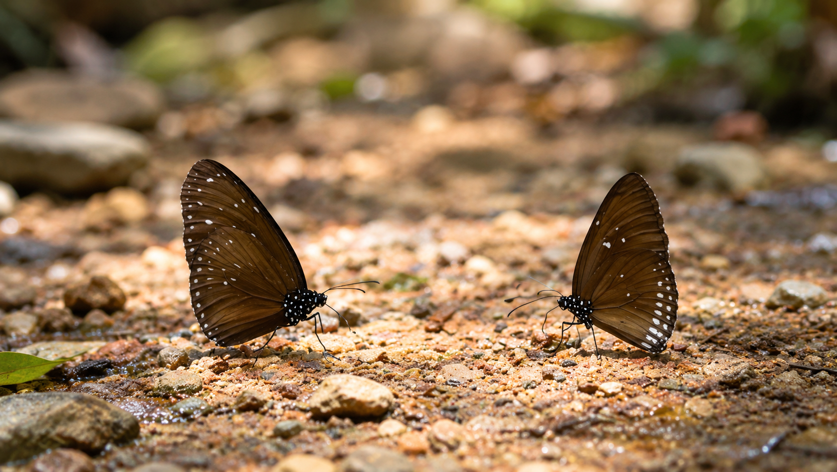
- Follow an accessible nature trail. Look for birds, butterflies and signs of wildlife.
- Afternoon
- Explore the waterfall or stream landscape according to current access conditions.
- Late Afternoon
- Relax around the reservoir. The light becomes warmer. The mountains begin to turn blue.
- Evening
- If staying overnight, return to the campsite before dark. Do not explore remote forest routes after sunset without appropriate authorization.
Camping
Sleep Beside the Western Forest
The park provides camping facilities in its service area.
Camping is the better option for travellers who want to experience the landscape beyond a short daytime visit.
At night, the forest changes character. The temperature falls. Insects become active. The reservoir becomes dark and reflective. And the absence of city light becomes part of the experience.
Camping availability and facilities can change, so confirm current conditions with the park before travelling.
Accommodation
Simple, Not Resort-Style
The park has provided basic accommodation facilities within the service area.
These are intended for nature travel rather than luxury accommodation.
Expect simple rooms, basic facilities, natural surroundings and limited inventory.
For more accommodation choices, travellers can stay in nearby Ratchaburi or Suan Phueng and visit the park as part of a wider itinerary.
The Visual Language of Thai Prachan
Thai Prachan is not primarily a postcard destination. Its strongest images come from atmosphere.
- 01 — Reservoir + Mountains
- Shoot early morning. Keep the foreground simple. Let the mountain layers create depth.
- 02 — Forest Road
- Use the road as a leading line through the forest.
- 03 — Waterfall
- Photograph the surrounding rocks and vegetation rather than filling the frame only with falling water.
- 04 — Hot Spring
- Use steam and natural vegetation to create atmosphere.
- 05 — Wildlife Signs
- Tracks, feathers, nests and movement can tell the story without photographing the animal itself.
- 06 — Sunset Over the Reservoir
- Warm light across the water can create the park’s most cinematic image.
Opening Hours
Published local tourism information lists the park as generally open 08:00–18:00 daily.
However, individual trails, waterfalls, remote areas and overnight facilities may have separate restrictions.
Opening hours should therefore be treated as general visitor information rather than a guarantee that every attraction is accessible throughout the day.
Entrance Fees
Published visitor information currently lists approximately:
- Thai Visitors
- Adult 20 THB
- Foreign Visitors
- Adult 100 THB
Additional vehicle or service fees may apply. Fees can change, so confirm the latest DNP rate before travelling.
How to Get There
From Bangkok
Chaloem Phrakiat Thai Prachan is approximately 160 km west of Bangkok by road, depending on the route.
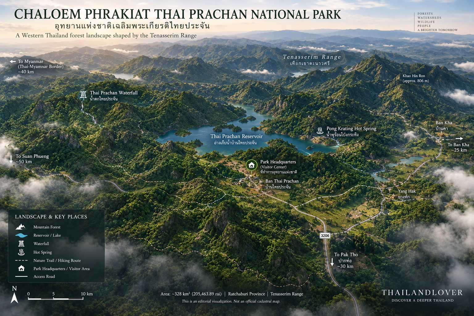
Bangkok → Phetchaburi / Ratchaburi → Pak Tho → Highway 3206 → Thai Prachan
From the main road, visitors continue toward Ban Thai Prachan and the park headquarters.
From Ratchaburi City
From Ratchaburi, travel toward Pak Tho and continue along Highway 3206.
The final approach becomes increasingly rural. Mountain scenery gradually replaces the agricultural landscape.
From Suan Phueng
Thai Prachan can be combined with a wider western Ratchaburi itinerary.
Suan Phueng → Thai Prachan → Ban Kha → Ratchaburi
Road conditions and attraction access vary by season.
Road Conditions
The Last Part of the Journey Matters
The park is not a city attraction. Some routes become narrow and rural.
Remote attractions may require high-clearance vehicles, 4WD vehicles, experienced drivers, local guides or walking.
Do not assume that every attraction shown on an old map is currently accessible by ordinary passenger car.
Safety
- Water
- Streams and waterfalls can rise rapidly after heavy rainfall. Never cross a strong current.
- Rocks
- Wet rocks can be extremely slippery. Wear proper footwear.
- Hot Springs
- Use only designated bathing areas. Do not enter natural geothermal pools unless specifically permitted.
- Wildfire
- Never light a fire outside designated areas. Follow all seasonal fire restrictions.
- Remote Forest
- Do not enter remote trails alone. Ask park staff about trail status, required guides, current wildlife conditions, water levels, weather and overnight rules.
Responsible Travel
Protect the Forest
Thai Prachan’s most valuable asset is not the waterfall. It is the forest that creates the waterfall.
- Carry out all waste
- Avoid single-use plastic where possible
- Never feed wildlife
- Never collect plants or rocks
- Stay on designated trails
- Respect closed areas
- Avoid loud noise
- Never disturb wildlife
- Follow fire regulations
- Use designated camping areas
- Respect nearby communities
Who Is Thai Prachan For?
Perfect for
- Nature Travellers
- Who prefer forests over commercial attractions.
- Photographers
- Who like mountain layers, water and atmosphere.
- Birdwatchers
- Who enjoy mature western forests.
- Campers
- Who want a quiet night away from cities.
- Adventure Travellers
- Who are comfortable with rougher roads and longer trails.
- Slow Travellers
- Who want to understand the landscape rather than collect attractions.
Who May Want Something Else?
If you want luxury resorts, easy roadside attractions, large commercial facilities, guaranteed wildlife sightings or highly developed viewpoints, Thai Prachan may not be the right destination.
Its strength is precisely the opposite.
It is quieter. Rougher. Less polished.
And more connected to the forest.
Nearby Destinations
- Suan Phueng
- A popular western Ratchaburi destination known for mountain scenery, resorts, farms and cafés.
- Ban Kha
- The district surrounding the Pong Krating hot-spring landscape.
- Pong Krating
- A rural hot-spring destination connected to the Thai Prachan landscape.
- Kaeng Krachan Forest Complex
- The larger protected-forest system of western Thailand, including Kaeng Krachan National Park.
- Phachi River Wildlife Sanctuary
- A neighboring protected landscape important to the wider western forest ecosystem.
One Forest, Many Protected Areas
Thailand’s western forest cannot be understood through individual park boundaries alone.
The landscape connects. Forests extend across administrative borders. Wildlife moves between protected areas. Water flows downstream. Mountain ranges continue.
Thai Prachan is one piece of a much larger ecological puzzle.
That is why its conservation importance is greater than its international tourism profile suggests.
Quick Facts
- Name
- Chaloem Phrakiat Thai Prachan National Park
- Thai
- อุทยานแห่งชาติเฉลิมพระเกียรติไทยประจัน
- Province
- Ratchaburi
- Districts
- Pak Tho, Suan Phueng and Ban Kha
- Region
- Western Thailand
- Official Designation
- 24 January 2012
- National Park Number
- 124
- Area
- 205,463.89 rai · approximately 328.74 km²
- Elevation
- Approximately 200–806 m
- Landscape
- Tenasserim mountain system
- Main Attractions
- Thai Prachan Waterfall · Pong Krating Hot Spring · Thai Prachan Reservoir · Other reservoirs · Forest streams · Rock ravines · Nature-study routes
- Main Ecological Importance
- Watershed protection · Forest conservation · Wildlife habitat · Connection with the Kaeng Krachan Forest Complex
- General Visitor Hours
- 08:00–18:00, subject to current park conditions
- Published Entrance Fee
- Thai adult 20 THB · Foreign adult 100 THB
Location
Find Chaloem Phrakiat Thai Prachan National Park
Pak Tho · Suan Phueng · Ban Kha, Ratchaburi, Western Thailand