

National Park · Yala
Bang Lang National Park
Where the Rainforest Meets the Reservoir
Yala · Southern Thailand
Deep in southern Thailand, Bang Lang National Park is a world of rainforest-covered mountains, waterfalls, rivers and the vast waters of Bang Lang Reservoir.
This is Yala at its wildest — a landscape shaped not by beaches, but by forest, water and mountains, where the Pattani River begins its journey, hornbills move through the canopy, and some of Thailand’s most elusive wildlife still survives in the deep southern forests.
Basic Information
- Name
- Bang Lang National Park
- Thai Name
- อุทยานแห่งชาติบางลาง
- Province
- Yala
- Districts
- Bannang Sata · Than To · Betong
- Region
- Southern Thailand
- Landscape
- Tropical Rainforest · Mountains · Reservoir · Rivers · Waterfalls
- Area
- Approximately 163,125 rai · ≈ 261 km²
- Established
- 24 February 1999
- Main Natural Features
- Bang Lang Reservoir · Than To Waterfall · La-ong Rung Waterfall · Halasa Waterfall · Hala-Bala Forest
- Signature Experience
- Rainforest · Reservoir · Waterfalls · Wildlife · Birdwatching
- Best For
- Nature · Adventure · Photography · Wildlife · Slow Travel
Into the Forests of Southern Thailand
Far from Thailand’s better-known beach destinations, the mountains of Yala hold a different kind of beauty.
Bang Lang National Park stretches across the districts of Bannang Sata, Than To and Betong, covering approximately 163,125 rai of mountainous tropical forest. It was officially established as a national park on 24 February 1999.
The park protects a landscape of dense evergreen forest, rivers, waterfalls and mountain valleys.
Its forests are particularly important because they form part of the watershed system of several major waterways, including the Pattani River, Sai Buri River, Khlong To Mo, Khlong Hala and Khlong Ban Chet.
At the heart of the landscape lies Bang Lang Reservoir, created by the construction of Bang Lang Dam.
The result is a destination where:
Mountain → Rainforest → River → Reservoir → Waterfall
all become part of the same story.
Why Visit
Why Bang Lang?
- Deep Southern Rainforest
- Bang Lang is dominated by humid tropical forest and rugged mountain terrain.
- Bang Lang Reservoir
- The enormous reservoir creates a landscape of forested islands, mountain silhouettes and quiet waterways.
- Waterfalls
- The park and surrounding protected landscape contain several impressive waterfalls, including the famous nine-tiered Than To Waterfall.
- Wildlife
- The wider forest landscape supports rare and elusive species, including evidence of tiger and sun bear activity in areas being considered for inclusion in the park.
- Hornbills
- The forests are associated with a remarkable diversity of birds, including several species of hornbill.
- Hala-Bala Landscape
- Bang Lang sits within a broader network of exceptionally important southern rainforest landscapes connected with the Hala-Bala region.
A Forest Shaped by Water
Bang Lang is not a conventional mountain national park.
Its defining feature is the relationship between the forest and the reservoir.
The mountains descend toward waterways. The rivers collect into the reservoir. The reservoir reaches deep into valleys. And dense forest remains visible around the water.
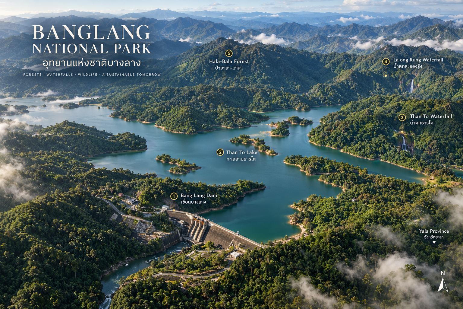
From above, the landscape resembles a giant green-and-blue mosaic.
- Forest
- Dense tropical rainforest covers the surrounding mountains.
- Water
- The reservoir extends through former river valleys.
- Mountains
- Ridges rise continuously around the water.
- Waterfalls
- Streams descend from the forest into the valleys below.
This creates one of Yala’s most distinctive landscapes.
The Water at the Heart of Yala
Bang Lang Reservoir
Bang Lang Dam is one of the most important pieces of infrastructure in southern Thailand.
Construction began in July 1976 and was completed in June 1981. The dam was officially opened on 27 September 1981.
Today, the reservoir serves multiple purposes:
- Hydroelectric power generation
- Water management
- Irrigation
- Flood mitigation
- Freshwater fisheries
- Tourism
The dam has a contracted generating capacity of 84 MW. Its reservoir has a capacity of approximately 1.42 billion cubic metres.
But for travelers, the numbers tell only part of the story.
The visual experience is more memorable:
Green mountains rising from still water.
The Reservoir from Above
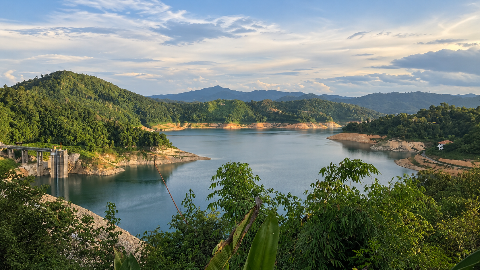
Bang Lang Reservoir becomes particularly impressive from elevated viewpoints.
The water winds between forest-covered mountains, creating a landscape that can look almost like an inland archipelago.
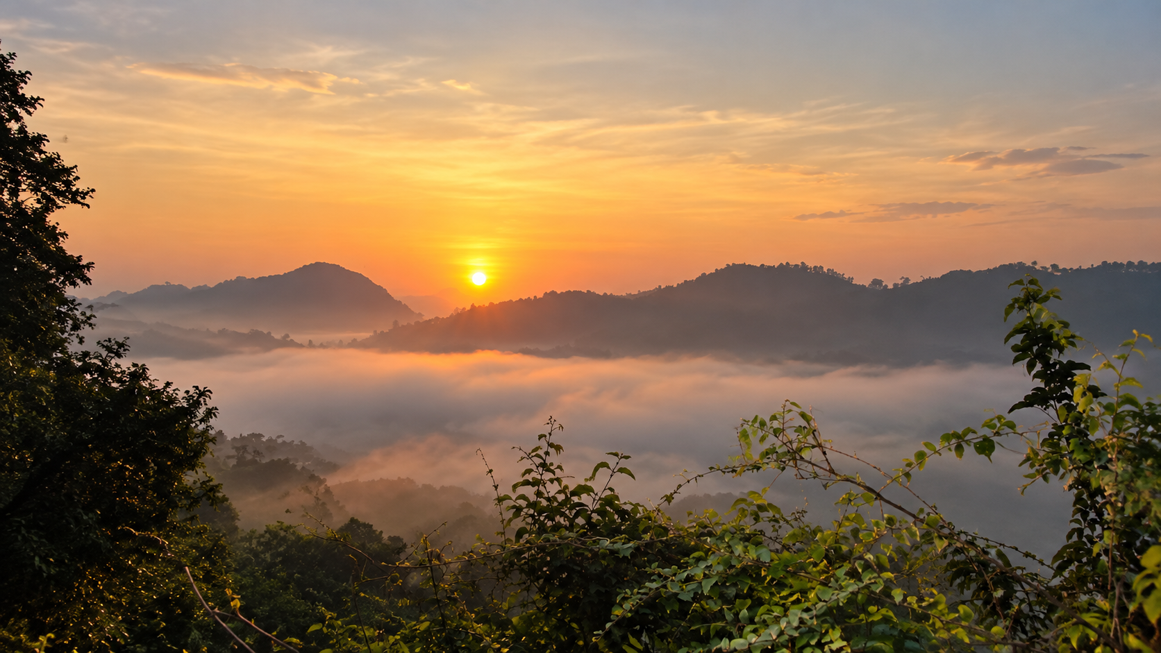
Small islands and peninsulas appear throughout the reservoir. Mist often hangs over the surrounding mountains in the early morning.
For ThailandLover, this is one of the strongest visual identities of Bang Lang.
Nine Levels of Forest
Than To Waterfall
Than To Waterfall is one of the best-known natural attractions associated with Bang Lang National Park.
The waterfall descends through nine levels, with individual cascades surrounded by dense forest.
The route from the first level toward the upper levels is approximately 500 metres, creating a relatively accessible way to experience the rainforest landscape.
The sound changes as you move through the forest. First comes the river. Then the first cascade. Then another. And another. Until the waterfall becomes part of the entire forest atmosphere.
Walk With the Water
The waterfall is not simply a viewpoint. It is an experience of moving through the rainforest.
The trail follows the stream and connects the different levels of the waterfall. Some sections are shaded by dense vegetation. The higher you walk, the more secluded the landscape becomes.
Best experience: Visit in the morning. Walk slowly. Listen to the water. Look into the forest canopy. And watch for birds.
The Rainbow Falls
La-ong Rung Waterfall
La-ong Rung Waterfall is famous for the fine spray created as water falls from the upper cascade.
When sunlight passes through the spray, a rainbow can appear. This is the origin of its name:
La-ong Rung — “Rainbow Mist.”
The waterfall has three levels, and the uppermost cascade is more than 10 metres high. From the first level, visitors can follow the stream and rocky terrain for approximately 200 metres toward the upper sections.
The best time to see the rainbow effect is generally during the morning when sunlight reaches the spray at the right angle.
Into the Rainforest
Halasa Waterfall
Halasa Waterfall is another waterfall within the Bang Lang landscape.
The falls are approximately 100 metres high, and access involves a nature trail through humid rainforest.
The trail is approximately 3 kilometres and is generally considered manageable for visitors with basic hiking ability, although local guidance is recommended.
This is not a quick roadside attraction.
It is better understood as a forest experience.
One Forest, Many Stories
Hala-Bala Forest
Bang Lang sits within the broader ecological landscape of southern Thailand’s deep rainforest.
The nearby Hala-Bala Wildlife Sanctuary is a separate protected area and should not be presented as being entirely inside Bang Lang National Park.
However, the landscapes are ecologically connected and share the broader character of the southern rainforest. Hala-Bala is particularly famous for its biodiversity and hornbill populations.
Where the Forest Still Breathes
Bang Lang’s importance is not limited to scenery. Its forests provide habitat for a remarkable range of wildlife.
Historical sources have recorded species including:
- Malayan tapir
- Wild boar
- Gaur
- Porcupine
- Macaques
- Langurs
- Gibbons
- Numerous forest birds
- Hornbills
Older tourism references also list highly threatened species such as rhinoceros, although these should not be presented as currently confirmed resident wildlife without current survey evidence.
More recent monitoring provides stronger evidence of the forest’s continuing ecological importance.
In July 2025, Department of National Parks patrol teams recorded evidence of both tiger and sun bear in a forest area being considered for incorporation into Bang Lang National Park.
That is significant. It suggests that parts of this southern forest remain sufficiently intact to support large and elusive carnivores.
Birds of the Rainforest Canopy
Hornbills
Hornbills are among the most charismatic birds associated with southern Thailand’s rainforests.
The Bang Lang landscape has been documented as habitat for several hornbill species, including:
- Great Hornbill
- Wreathed Hornbill
- Rhinoceros Hornbill
and other forest birds.
For birdwatchers, the forest canopy can be as interesting as the waterfalls.
Listen before you look.
Sometimes the first sign of a hornbill is not its appearance. It is the sound of wings moving through the canopy.
One of Yala’s Green Strongholds
The Bang Lang forest is predominantly humid evergreen forest, with extremely high biological productivity.
The forest performs several critical functions:
- Watershed Protection
- It protects the headwaters and streams feeding major rivers.
- Wildlife Habitat
- Large continuous forest provides habitat for species that require extensive ranges.
- Biodiversity
- Multiple forest layers create habitats for plants, insects, birds, mammals and reptiles.
- Climate Regulation
- Dense tropical forests store carbon and regulate local water cycles.
- Soil Protection
- Vegetation stabilizes steep mountain slopes and reduces erosion.
This is why Bang Lang is important beyond tourism.
Water Begins Here
Bang Lang’s forest is closely associated with the headwaters of several important waterways, including:
- Pattani River
- Sai Buri River
- Khlong To Mo
- Khlong Hala
- Khlong Ban Chet
The forest therefore functions as a natural water tower for the surrounding region.
This is one of the most important stories to tell:
The waterfalls are not isolated attractions.
They are part of a much larger water system.
A Forest Shaped by History
Bang Lang’s forests remained relatively inaccessible for long periods because parts of the region were historically associated with armed movements and conflict.
The difficult terrain and limited accessibility also helped preserve sections of the forest from extensive development.
Today, the same landscape is increasingly valued for conservation, watershed protection, biodiversity research, nature tourism and local livelihoods.
This history should be understood carefully. It is part of why the forest survived, but the modern identity of Bang Lang should ultimately be about nature and conservation.
Life Around the Water
The creation of Bang Lang Reservoir transformed the landscape and created new economic opportunities around freshwater fishing, boat transportation, local tourism, floating accommodation and recreation.
Visitors can experience the reservoir from boats and rafts, particularly around the Bang Lang Dam area.
The lake is especially atmospheric in the early morning, when mist may settle across the water and mountain ridges.
What to Experience
- Reservoir Cruise
- Travel by boat across Bang Lang Reservoir and explore the forest-covered landscape from the water.
- Waterfall Walk
- Follow the trail at Than To Waterfall and experience the nine cascading levels.
- Forest Trekking
- Explore rainforest trails with appropriate local guidance.
- Birdwatching
- Look and listen for hornbills and other forest species.
- Landscape Photography
- Capture the relationship between mountains, forest, water and mist.
- Slow Travel
- Stay overnight around the reservoir and experience the landscape after the day-trippers leave.
Photographing Bang Lang
- Dawn
- Mist over the reservoir.
- Morning
- Soft light through rainforest canopy.
- Midday
- Deep greens and dramatic contrast around waterfalls.
- Afternoon
- Long shadows across the mountain ridges.
- Blue Hour
- The reservoir becomes a dark mirror beneath the surrounding forest.
When to Go
Bang Lang has a tropical rainforest climate and receives substantial rainfall.
For waterfall walks and outdoor exploration, weather conditions matter significantly.
Official tourism information identifies October–March as a particularly suitable period for visiting La-ong Rung Waterfall, with cooler weather and opportunities to see mist.
However, heavy rainfall can also create dangerous conditions around waterfalls.
Important: Never enter waterfall pools during or immediately after heavy rain. Flash floods can develop rapidly in mountainous rainforest environments.
Visitor Information
Bang Lang National Park does not have a single universal operating schedule that applies to every attraction. Different facilities may have different access conditions.
Some tourism listings report approximately 06:00–18:00 daily, but this should be treated as indicative rather than a guaranteed park-wide schedule. Opening and closure conditions can vary by attraction, weather, season and park regulations.
Seasonal Closures
Current TAT national-park guidance has listed Than To Waterfall and La-ong Rung Waterfall with seasonal closure information, historically including 1 November–15 December; La-ong Rung has also had additional closure periods depending on conditions.
Opening hours and attraction access vary seasonally. Check current park conditions before visiting.
How to Reach Bang Lang
The park headquarters is located around Than To Waterfall in Tham Thalu Subdistrict, Bannang Sata District, along Highway 410, the Yala–Betong route. Historical tourism information places the headquarters around kilometre 56.
From Yala
Follow Highway 410 toward Betong. The journey takes you from the more urban environment around Yala into increasingly mountainous terrain.
From Betong
Travel north along Highway 410 toward Than To and Bannang Sata. The route itself becomes part of the experience as the landscape changes from town and agricultural areas into forested mountain terrain.
The Scenic Route
The road between Yala and Betong is one of the most interesting overland routes in this part of Thailand.
As you move south:
Town → Plantation → Mountain → Rainforest
The landscape becomes progressively greener and more dramatic.
Allow extra time. The destination is not only the attraction at the end of the road.
The journey through southern Yala is part of Bang Lang’s story.
Before You Go
Bring
- Drinking water
- Insect repellent
- Comfortable walking shoes
- Lightweight rain jacket
- Dry bag
- Sun protection
- Waterproof phone protection
- Binoculars for birdwatching
For Waterfall Trails
Wear shoes with good grip.
During Rainy Weather
Avoid entering waterfalls, crossing fast-flowing streams, hiking without local guidance, or approaching unstable cliffs.
Mountain weather can change quickly.
Leave the Forest Wild
Bang Lang is valuable precisely because parts of it remain relatively wild.
- Take all waste out
- Never feed wildlife
- Avoid loud music
- Stay on designated trails
- Do not collect plants, rocks or wildlife
- Do not disturb birds or animals
- Follow ranger instructions
- Respect local communities
If you see wildlife: observe. Don’t approach.
Who Is Bang Lang For?
- Nature Lovers
- One of Yala’s strongest destinations for experiencing genuine rainforest.
- Landscape Photographers
- Reservoir + mountains + mist creates exceptional visual variety.
- Wildlife Enthusiasts
- The wider forest landscape supports significant biodiversity.
- Birdwatchers
- Hornbill habitat makes the area particularly interesting.
- Adventure Travelers
- Waterfalls, forest trails and reservoir exploration provide active experiences.
- Beach Travelers
- Bang Lang is not a beach destination. Come here for forest and mountains, not the sea.
Continue Exploring Yala
- Betong
- A distinctive southern Thai town surrounded by mountains and famous for its food, hot springs and Chinese-Thai heritage.
- Aiyerweng Sea of Mist
- One of southern Thailand’s best-known mountain viewpoints, famous for sunrise above layers of mist.
- Hala-Bala Wildlife Sanctuary
- One of the most important rainforest landscapes in the deep south.
- Piyamit Tunnel
- A historical underground tunnel system associated with the region’s past.
- Than To
- A quieter district and useful gateway to the waterfalls and forest landscapes around Bang Lang.
The Perfect Southern Forest Route
For ThailandLover, Bang Lang works particularly well as part of a larger itinerary:
Yala → Bang Lang → Betong
Day 1
Yala → Bang Lang Reservoir → Than To Waterfall → Forest exploration
Day 2
Bang Lang → Aiyerweng → Sea of Mist → Betong
This creates a journey through one of Southern Thailand’s most distinctive landscapes.
Quick Facts
- Province
- Yala
- Districts
- Bannang Sata · Than To · Betong
- Region
- Southern Thailand
- Established
- 24 February 1999
- Area
- 163,125 rai · ≈ 261 km²
- Landscape
- Rainforest · Mountains · Reservoir · Rivers · Waterfalls
- Signature Landmark
- Bang Lang Reservoir
- Waterfalls
- Than To · La-ong Rung · Halasa
- Wildlife
- Hornbills · Gibbons · Tapirs · Gaur · Other rainforest species
- Conservation Highlight
- Tiger & sun bear evidence in expansion-area forest
- Best Experience
- Reservoir Cruise · Waterfall Walk · Forest Trek · Birdwatching
- Best Season
- October–March is particularly suitable for waterfall/mist experiences, subject to weather
- General Access
- Attraction-specific conditions vary — check current park updates
Location
Find Bang Lang National Park
Tham Thalu, Bannang Sata, Yala · Highway 410 (Yala–Betong)